Background
If you find this free trail guide useful, please provide payment by picking up at least one piece of litter on your hike. Cha-ching! Thanks for being awesome! (And here’s a quick primer on Leave No Trace, too, to help us keep the trails nice and fresh for each other.)
Background you can feel free to skip: The crazy natural beauty at Minnewaska State Park Preserve is probably the worst-kept secret in the Hudson Valley. On a nice summer afternoon, you’re probably more likely to find solitude at Wal-Mart. But man, what a place. Minnewaska draws crowds for a reason.
A trip to Minnewaska could be a leisurely stroll around the lake, or a day-long extravaganza with multiple vistas and mileage reaching double digits, whichever you prefer. The very nice New York State Minnewaska homepage features tons of great information to help you plan your day here, including a jam-packed trail map (the same one they’ll hand you when you pay at the guard shack on your way in). The New York-New Jersey Trail Conference map for this area is much easier to read, but you’d have to be willing to shell out some cash for it.
The hike I’m suggesting here is a 6.4-mile loop, which breaks my keep-it-under-5-miles rule, but the trails here are, for the most part, pretty easy carriage roads, and there aren’t any insane climbs. There’s also an easy way to knock a couple miles off the hike, if you want to shorten it up a bit (though you’d miss out on an awesome overlook.)
There’s enough to see here that you could come every weekend for the summer and check out something new each time. And if you’re game for sharing your time outdoors with crowds of other granola munchers, you’ll have a hard time finding a more perfect spot than Minnewaska.
Trail Guide
Bonus unsolicited advice: Don't depend on having cell service in the woods - it can be spotty out there! Download this trail guide to your phone before you head out. (It's easy to do on iPhone and Android.) May your connection to nature be strong, even when your connection to the internet is weak.
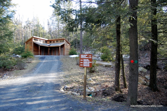
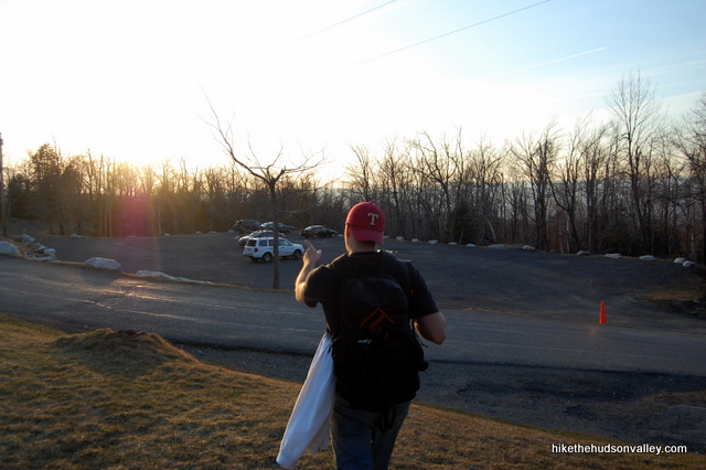
1. From the Lake Awosting parking area inside the preserve (see “Directions to the trailhead” below), walk back down the entrance road, toward the guard shack where you just deposited $8.
2. Once at the guard shack, check out the information on the kiosk to your right, then turn right to head into the park on the main road.
3. In a very short distance, you’ll cross the Peters Kill stream. Directly afterwards, turn left onto the red-blazed Awosting Falls Trail. The stream burbles and drops off to your left on its way to the falls.
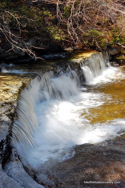
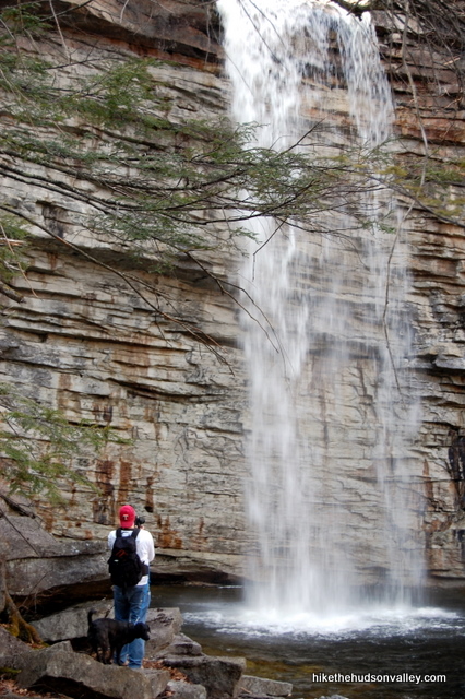
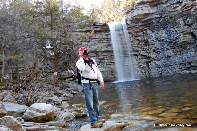
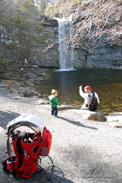
4. Continue down the Awosting Falls Trail as it meanders downhill all the way to an open viewing area of the falls. Awosting Falls drops 60 feet into a clear, wide pool with plenty of vantage points all around. Park yourself on some rocks and enjoy the show.
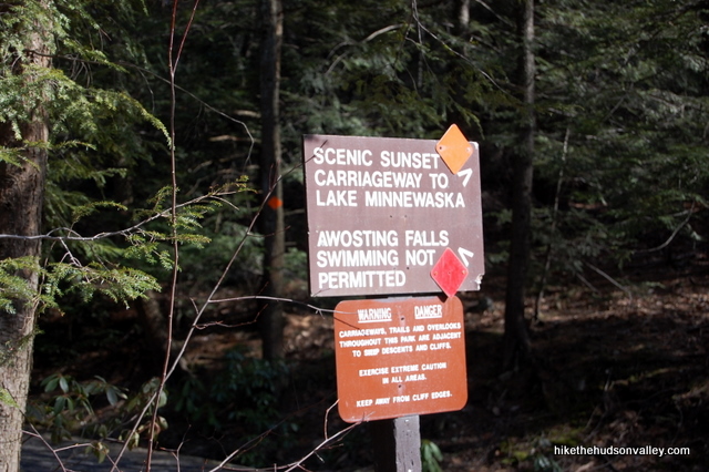
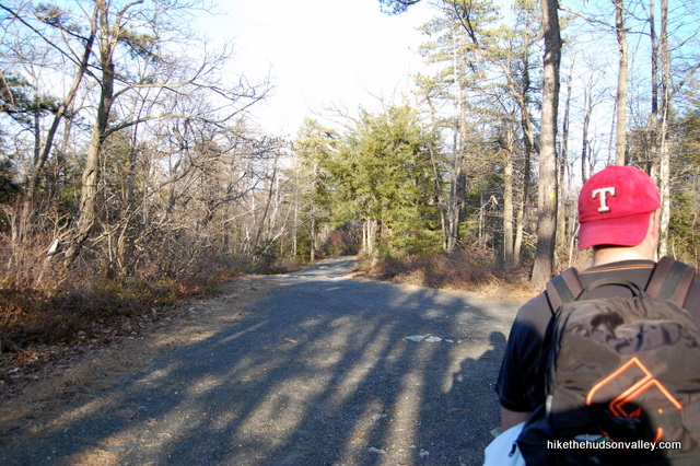
5. When you’ve appropriately soaked it all in, head back up the way you came, to the start of the Awosting Falls Trail. Take a sharp left (U-turn, really) onto the orange-blazed Sunset Carriageway and keep climbing. (Note: You could go back to your car and drive up to the next parking lot to avoid this section of the hike, but we’re here to hike, right? Besides, you’d miss out on a couple of nice views if you did that. I just don’t want you to be mad at me when you see the parking lot at the top of the hill.)
6. Enjoy the views as the gentle switchbacks of the Orange Trail take you up toward Lake Minnewaska. From the bottom of the Orange Trail to the first lake vista is about 20 minutes, with stops for pictures.
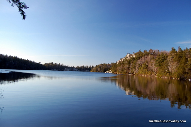
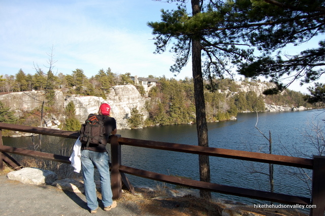
7. Stay on the Orange Trail until it ends just past the upper parking lots. Make sure you don’t wander into the parking lots and get lost, as my friends did when following this trail guide — the lots should stay on your left as you continue up the trail. Continue up the trail to the fence that offers a great overlook of Lake Minnewaska (the upper parking lot is now directly behind you), with the white cliffs rising up on the left and the visitor’s center neatly camouflaged on top. See it?
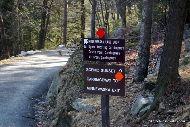
8. After taking in the view for a moment, turn to your right, heading back the way you came for just a few steps. Turn left on the red-blazed trail marked “Minnewaska Lake Loop.” (Our next destination is Kempton Ledge on the Castle Point Carriageway.)
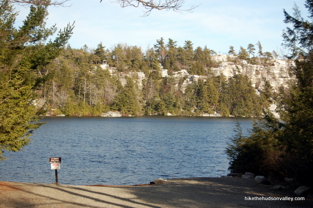
9. Follow the Red Trail down past the swimming beach. Not a bad place to take a dip, if it’s open and you’re so inclined. You’ll also stroll past a bathroom facility, which you’re welcome to take advantage of. We’ll wait. Otherwise, just keep hanging in there on the Red Trail.
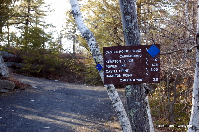
10. About five minutes after the bathroom facility, take a right turn onto the blue-blazed Castle Point Carriageway. The sign lets you know that Kempton Ledge is just an easy mile away.
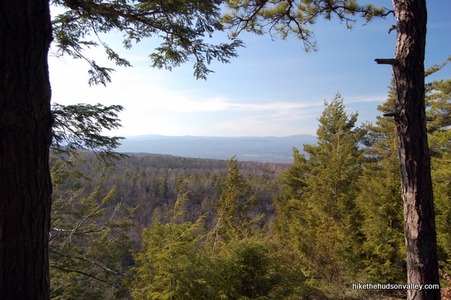
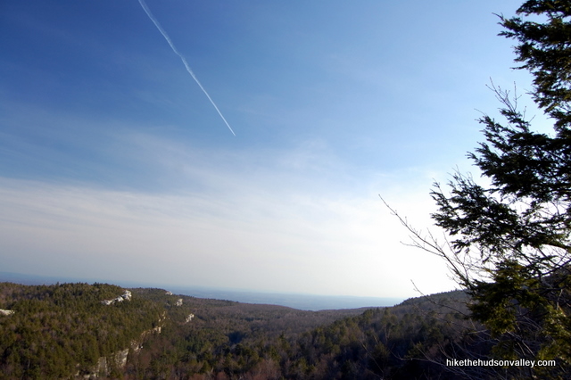
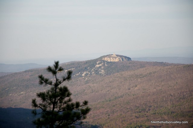
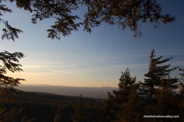
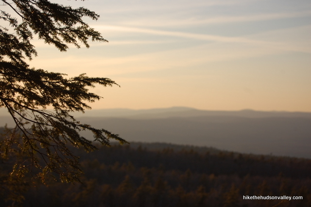
11. Enjoy the views of the Catskills off to your right as you gently ascend toward Kempton Ledge.
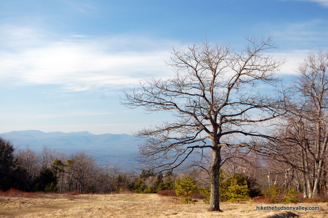
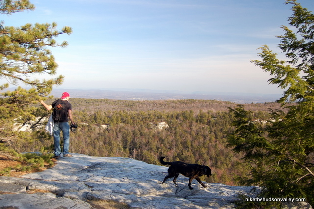
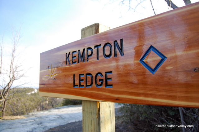
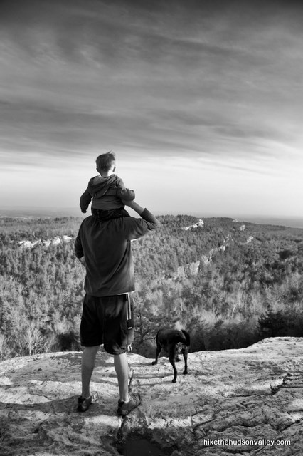
12. After about twenty minutes on the Blue Trail, you’ll arrive at Kempton Ledge, which is very well-marked, on your left. (Update July 12, 2014: Per Jules’ comment below – and since confirmed – it’s not so well-marked anymore, which is a real shame. That was one beautiful sign. The ledge, though, will still be easy to find – it’s that big, gorgeous, ledge-like ledge on your left.) Take some time to enjoy the gigantic view, clear across the Gunks to the Hudson Highlands.
13. After you’ve sufficiently marinated your eyeballs in that view, head back the way you came on the Blue Trail.
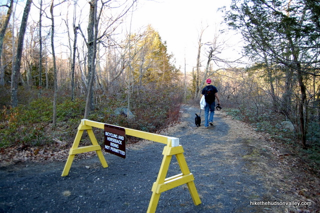
14. About five minutes after leaving Kempton Ledge, you’ll take your first right turn onto the intermittently yellow-blazed Millbrook Mtn Carriageway, which was marked during our visit in spring 2011 with a big ol’ sawhorse. (Jules of the Comments reports that the sawhorse is still there as of July 2014. Giddyup! And Siena reports that it’s now gone. Whoa.) Whether you see a yellow blaze or not, just take your first right turn.
15. A couple of other trails will merge into the Millbrook Mtn. Carriageway, but just keep heading straight, or as straight as possible.
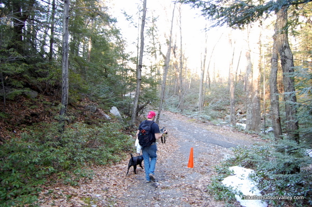
16. About ten minutes after getting on the Millbrook Mtn. Carriageway, it dead-ends into the red-blazed Minnewaska Lake Loop. Take a right to head down to the water’s edge.
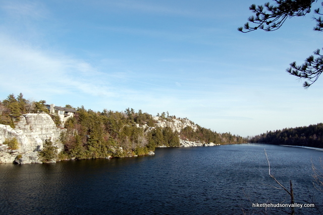
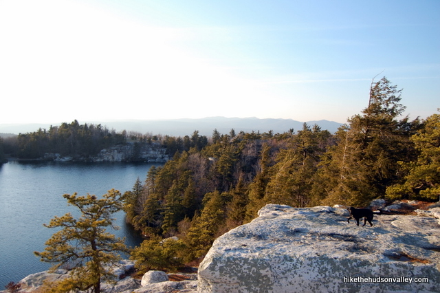
17. The Red Trail takes you right down to the water, where you get some great views back across the lake.
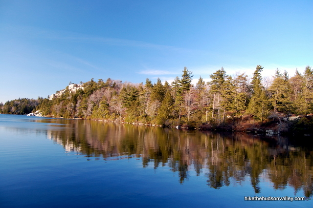
18. As you continue around the lake, the Red Trail gains altitude to start bringing you up on top of those beautiful white cliffs. Along the way, you’ll find another viewpoint off to your right, where you can step out onto the rocks and see clear across to the Skytop Tower at Mohonk Mountain House.
19. Just after that viewpoint, take a left at the fork to keep climbing and heading toward the cliffs.
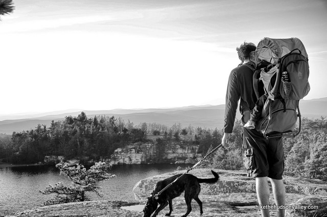
20. A wide picnic area opens up in front of you. Head across the lawn, towards the lake, leaving the Red Trail behind. You’ll pop out onto the cliffs, where you’ll have an awesome view of the lake below and the Catskills beyond.
21. Keep heading around the lake. The trails up here become a bit of a tangled mess. Just keep sticking as close as you can to the lake, keeping it on your left and following the trails as they head around it. When you see some friendly red blazes again, hop back on the Red Trail and continue following it to the tip of the lake.
22. The Red Trail brings you to some (very scenic!) porto-potties straight ahead, with some private property off to your sharp left. Take the middle road, just to the left of the porto-potties.
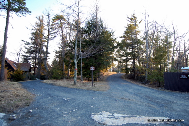
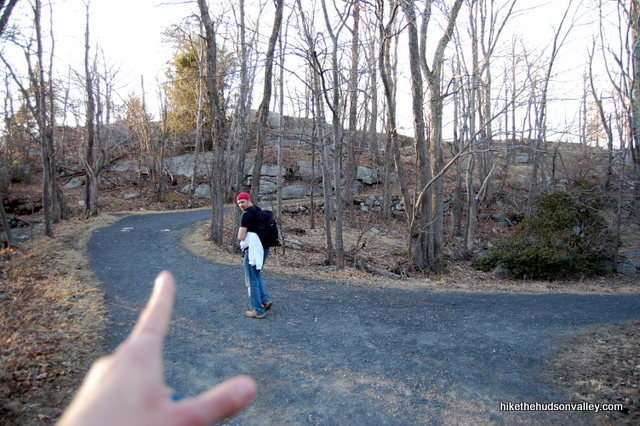
23. You’ll see the parking lots off to your right, where the lazy people parked. Head down the hill to the lower parking lot. In the back-left corner of the lower lot, you’ll see our old pal the Orange Trail (Sunset Carriageway). Take a right onto the Orange Trail to head back down the hill, towards your car.
24. Take one last look at the views as you head downhill.
25. Boom! The Orange Trail pops you back out near the guard shack. Remember this place? Take a left at the shack to return to the Lake Awosting parking area.
26. When you get home, see if there’s anybody there who’s willing to give you a foot massage. You’ve earned one.
Directions
Directions to the trailhead: From New Paltz, head west on Route 299. Follow 299 until it dead ends into Rt. 44/55, where you’ll make a right turn. Follow 44/55 past the hairpin turn under the Shawangunk cliffs and past the Trapps parking area on your right. Continue another 3 miles past the Trapps parking area to find the well-marked entrance to Minnewaska State Park Preserve on your left. Stop at the guard shack, pay the fee, then make an immediate right turn to make the short drive over to the Lake Awosting parking area, where you’ll leave your car.
You can also get directions by checking out the Minnewaska State Park Preserve entry on the HiketheHudsonValley.com Google map.
Sorta nearby address for your GPS: The New York State Parks page gives the address for Minnewaska as:
5281 Route 44-55
Kerhonkson, NY 12446
Google Maps chokes on that address, though. If your GPS doesn’t like it, either, you could try the intersection of 44/55 and Jenny Lane in Kerhonkson, NY, which is about a mile west of the Minnewaska entrance on 44/55. (My old-ish Garmin Nuvi lets me put in an intersection as a destination, so hopefully yours does, too.)
GPS coordinates of parking area: 41.73469, -74.24402 (Clicking will open in Google Maps or the Apple Maps app, depending on your browser/device.)
**UPDATE/WARNING for 2019** Here’s an official warning from the Parks Service on the multiple construction projects underway at Minnewaska this year:
|
|
|
Resources & Interactives
Super-cool Google Earth flyover of hike route:
Google Terrain Map of hike route:
Related resources: If you’re looking for actual facts and/or useful information, visit these excellent resources:
- The New York State Parks page for Minnewaska
- The official Minnewaska trail map
- The surprisingly informational Minnewaska Wikipedia page
- More Minnewaska hikes from the New York-New Jersey Trail Conference
- More nice pictures and trail descriptions on this CNY Hiking page
- A nice write-up with more trail descriptions on this HV/Net page
Want to support trails in the Hudson Valley? Here’s one great way: Visit the New York-New Jersey Trail Conference homepage and click on Volunteer, Donate, or Shop! (Then you can volunteer, donate, or shop, depending on your mood.)
Considering it is mostly carriage roads, is this route feasible with a hefty jogging stroller? We want to bring our toddler who is too big for a backpack but too little to do the whole loop on foot! Thanks in advance.
Yes Becca, a stroller should be fine on all of the carriage roads as they are hard packed gravel.
Thank you – excellent job with the trail guide ! We went yesterday and I can report there were plenty of parking spaces when arriving at 10:30am on a Friday but all lots were full by the time we left at 2:30pm. Most people were annoyingly not wearing masks or at least plopping them on their faces when walking past, so be prepared to keep your social distance if you come while this pandemic is still raging. I would echo comments left by others on this post on a few tricky spots. Avoid turning right on the first fork after the beach on the Lake Minnewaska Loop when trying to find the Castle Point Carriageway… if you take that first right, it quickly turns into an overgrown grass trail and you’ll notice no blue markers. When we did find Castle Point Carriageway, we also mistakenly walked another 15-20 minutes past Kempton Ledge to an even more astounding vantage point and nice place to get scorched by the sun. Take care when taking the Millbrook Mountain Carriageway from there back to the LM Loop… just keep hanging to the left, including when you see the Hamilton Point Carriageway sign, in order to get to the LM Loop… as the colored markers are curiously missing in all directions when you get to that intersection of the three roads.
This is one of my favorite hikes in NY. Amazing views and that lake from the top of the cliff is all you need to smile. I made a video of my last trip. https://youtu.be/HqLlAUrfacA
Hi, FYI the COVID guidance at the top of this page is incorrect according to the official park homepage. States there that parking has been limited by 50% in order to prevent overcrowding and it posts an update when the lot is full for the day: https://parks.ny.gov/parks/minnewaska/details.aspx
I can’t see the covid guidance but I do know that Minnewaska is open and updates their page when the lots are full. It’s a very popular site, so if you really want to get in, go early. That’s when it is best anyway. Also very nice in the rain if you have the right gear
Thanks for the additional details, Alex! I will post another update soon with a run-down of the most current information I can find for all of the various parks around here. I note in the April 4 COVID-19 warning above that there are additional parking restrictions at many parks, including Minnewaska. Is that incorrect? I think it jibes with what you’ve posted here. In any event, I’ll do my best to keep the site updated with the latest – thanks for your help in keeping it current!
We went to Stony Kills Falls yesterday and park was definitely open. Hike was great! We didn’t go to main lot, but their page still says they are capped at 50% capacity. No notices posted that they were full this week, I imagine a nice weekend day might be different.
Hi,
Does anyone know where I can get gpx file tracks so I can guide my family and I around Minnewaska??? I haven’t been there in years and would like to stay on course with the help of directions via my smartphone. THANK ALL for help and HAPPY TRAILS!
Richbikerun1
Hi, Rich! Two great options for using your phone to navigate the hikes on this site can be found on the Hiking Tips page, under #11 and #12. (You can use the Google Terrain Map above by tapping the [ ] icon in the top-right corner, which will show where you are vs. my GPS track. You can also use the Avenza app to show your location against the official New York-New Jersey Trail Conference maps, which is the more industrial-strength solution.) Hope that helps, and happy adventuring to you and your family!
I took a simple route but found the Alltrails app helpful.
Hiked this (or our version of it) yesterday (Sept 2019) and really enjoyed it. Thanks very much for this guide, super helpful. When we got to the parking lot, it was full and we were directed to the one at Peters Kill entrance. I wanted to share this here for others who might end up having to start there. If you park at the Peters Kill entrance, there is a short path (white blazes) that starts on the other side of the road on which you just traveled, pretty much across from the park ticket booth. It connects to the carriageway marked with red blazes. You turn right and keep going on the carriageway until you start seeing the river bed on your right. Follow along the river/creek, keeping it to your right, and you make it to Awosting Falls. There was not much water when we went but it was still very pretty and worth doing. After the falls, you can continue on to the other carriageway (orange blazes) which has more of an incline, and it takes you up over the lake to that spot with the gorgeous views. Just remember you need to do a hairpin turn to the left to go up over the lake, at first it feels like you’re going back the way you came but just do it. There’s more inclines and steeper paths on this part of the trail but it’s all on a well kept path, you are not climbing over rocks or anything, very doable for most skill and fitness levels. After stopping for views and pictures, you can then go down the path to the lake loop, stop by the small beach, and/or continue going around the lake. Then we basically retraced our steps back to the parking lot but if we had more time we would have explored to see if there’s another way to close the loop and end up where we left the car. I hope this is helpful to someone.
Secil, judging by the thumbs on your comment, it’s been helpful to several people! Thanks so much for taking the time to share this information here for the folks who find themselves parking at the Peters Kill entrance. Much appreciated!
Pingback: Minnewaska State Park Preserve - NY Foodie Family
Hiked 9/21/18- It was chilly but still very crowded, especially around the lower waterfall and the upper lake. We walked right past Kempton Ledge not realizing it was the “money shot” and kept walking another 20 minutes or so. Once you pass under the power lines, go another five minutes for a even more beautiful flat granite ledge- with a nice boulder perfect to sit and eat lunch on.
If you do want to stop at Kempton Ledge, it’s just a few minutes past the Hamilton Point Carriage Road trail marker.
Also, they’re doing construction around the “lower” upper parking lots, so you can currently not walk through to the Orange blaze trail. Instead, keep walking along the lake until you come back to the first great lake view and then turn right and head up the orange trail back to the Lake Awosting parking area.
Great hike! We loved it!
Went there today, I had this page bookmarked but ended up doing my own thing, did the LA Trail (Forgot what color) from the parking lot, ended up detouring to the red trail and finally orange trail, was a wonderful day, must’ve did 10 miles in total.
It is appalling Minnewaska park caretakers are not attending to maintaining the chemistry of the public restroom the odors are an atrocity.
http://www.kdheks.gov/nps/lepp/ChVIIIWaterConservingFinal.pdf
Great site but too many choices! I have two days to hike ….looking for two day hikes fairly close to each other….not afraid of elevation and about 6-8 miles….photography spots a must. Any suggestions? We are from San Francisco and also looking for recommendations on places (small towns etc) to stay….we will by flying out of Stewart Airport on our third day….thanks! BTW we’ll be there end of August
Hello, I saw your comment when reviewing this hike. I have two recommendations for you. The first is to stay in or around New Paltz, NY and hike in or around the Shawangunk Mountains. The hike around Gertrude’s Nose has incredible views, and another good one is Bonticou Crag. If you want to go a little farther north, and get more of a “feel” of the lower hudson valley, my second recommendation is to go to the Catskills. The town if Woodstock, NY is absolutely adorable and there are some really neat mountains pretty nearby. Slide Mountain and Wittenberg Mountain are good options
I agree 100% – in new paltz there is a trail called “the Lemon Squeeze”
I was just in Woodstock last weekend and was ABSOLUTELY AMAZING , where we went was kid friendly and they swam and slid down the cascading waters
Would you mind sharing the name of the kid friendly trails please?
Just following up on Dilara’s comment below. The sign is indeed for the Hamilton Point Carriage Road. You’ll take that short road to Hamilton Point Carriage Road. Once you dead-end onto HP, you’ll need to make a left. HP will dead-end onto Millbrook Mountain Carriage Road. You’ll need to make a left there as well. A few minutes on that and you’ll hit the Lake Minnewaska Loop.
Just did this hike yesterday (Sept 22 2016 Autumnal Equinox).
I wanted to say thank you thank you thank you for your amazing guide! I printed it it out and followed it to the letter and this was one of the most beautiful hikes I’ve been on! I LOVED IT!
I am relatively new to hiking and suffering from some foot & shoulder issues, and this was really amazing for me. It was just strenuous enough for someone not in great shape like me.
I love hikes near any kind of water, and this had a waterfall and a gorgeous lake, beautiful rocks to sit on and just watch the water.
I went here with my friend and as we neared Kempton Ledge (which, yes, is still not marked) we saw about 4 hawks take off of a tree just above our heads. We ran into a biker who had just seen a friendly but huge black bear sunning itself on a rock (this was near the middle of #14 above). For me it’s an additional source of joy that no hunting, fishing or “harassment of wildlife” (as the sign at the entrance says) is allowed. No sounds of gunshots!
Additional note: if this helps any of the other hikers out, there is a sign for #14 now (where you wrote “About five minutes after leaving Kempton Ledge, you’ll take your first right turn onto the intermittently yellow-blazed Millbrook Mtn Carriageway… Whether you see a yellow blaze or not, just take your first right turn.” The sign there now reads: “Hamilton Carriage Road” I tried to post a pic of the sign below, but it wouldn’t upload…. will try again in another post.
Thank you again – will be doing this hike again very soon.
Love the scenery here just from the pictures. Was wondering how far of a hike are the awosting falls from the parking lot . And if you can provide the address to the nearest parking lot next to the awosting falls
Hike/stroll from the 1st parking lot after you pay is 10 minutes tops. Its a flat walk on pavement. Just make sure once you get there, you go down the dirt trail to the real falls as seen in the pictures. Some people turned back after seeing the smaller falls.
I dont have the address, but google maps pointed me in the right direction when i typed in the falls.
Thank you for the write up. My family and I followed it and was able to skip “cheat” part of the hike and drove up the mountain. Tough to walk so much with a toddler on your back. If you can, please add more pictures of each focus point so it makes it easier for us to find.
Thanks again!
Haven’t done the hike yet, but I just called the park and was told that the Castle Point Carriageway is open! I’ll confirm if I do it tomorrow.
As of today, everything on this hike is open! Castle Point Carriageway and all.
Other updates: That Kempton Ledge sign is definitely gone. It’s pretty clear what/wherethe ledge is, but there’s no sign.
On the way back down from there, there’s no longer a sawhorse across that road, though there’s a sign that says, “To Hamilton Carriageway” or something similar.
Also, on the way out to Kempton Ledge, those views referenced in #11 are on the left, not the right. 🙂
It’s also more ore of a hilly walk, but that was perfect for such a hot day, and going back to the swimming beach at the end was ideal!
Thank you so much for these updates, Siena! Really glad to hear that those formerly closed trails are now reopened. I’ve updated the trail guide in a couple of spots above, linking down to your comment. Very much appreciated! (I’m also very nearly 100% certain that the image in Step 11 is indeed on the right side of the trail, though there are also nice views to the left — if someone can prove me wrong, I will apologize and/or eat a hiking shoe. In the meantime, I’ve left that description unchanged.)
Thanks for this guide. Love these things! Just wanted to let you know the “Fly over” you have linked is showing California. 😉
Thanks, Maria! I had to remove those flyovers because mapmyhikes.com, which used to support them, just decided one day to stop supporting them, thereby breaking about fifty links on this site (not really breaking them, I guess, but making them all point to the Golden Gate Bridge for some reason). I miss those things. Sigh.
Hello! I went on this wonderful adventure today and enjoyed every moment. I did want to give you the heads up that the Castle Point Carriageway is closed for most of 2015 due to construction. Instead, I went up the Millbrook Mountain Carriageway and then looped back to Lake Minnewaska on the Millbrook Mountain Mountain Path. I then was able to complete the Lake Minnewaska loop after returning to the Red Loop Trail. The mountain pass is extremely fun, but it is definitely challenging. There were detour signs for the Castle Point Carriageway via the Hamilton Point Carriageway but I decided to follow my own path. All in all, a great day!
I can confirm that the Castle Point carriage way is still closed as of yesterday!
Thank you both for the information! I finally put an update at the beginning of the trail guide to alert people about the closure – sorry I didn’t get it out there when you first posted your comment, Krista! (And thanks for the nudge, Gabrielle!) Much appreciated – hope that helps other people to avoid having their hike interrupted unexpectedly.
Luckily Minnewaska has lots of other great hikes right there! We did Millbrook Mountain instead 🙂
Hi,
We went on this hike today, and wanted to give you an update on the previous detour in Step 14:
The good news is that the Millbrook Carriage Road is no longer under construction, although it still has the “big ‘ol sawhorse” as in your picture above from 2011. Therefore, the original directions are valid again. Note, however, there is a closure on the Hamilton Point trail, and even though it does NOT impact this hike, there are enough warning signs about it that it kinda makes you worry that it does.
One other note: I did not see the Kempton Ledge sign (step 12) so it may not be there anymore, but the ledge is pretty easy to spot… just look for a rock ledge/outcropping on your left.
The hike was incredibly awesome, and the park has to be one of the most beautiful places I’ve ever been. I can’t wait to go back and explore some of the other areas of the preserve. Thank you so much for the recommendation and for the great instructions…
Jules, thank you so much for this incredibly helpful feedback! I’ve just updated the trail guide in a few places based on your input. Really appreciate it, and so glad you had a great day out there!
Hi,
We did (part of) this hike yesterday, and it was beautiful! We went on a Thursday on purpose, to avoid big crowds, but it was still a bit busy in the afternoon. We ended up adding about 3.5 miles to the hike via various paths, taking us to a bit more quiet areas of the park with some beautiful views, would love to share that if you wish.
I do want to point out, the yellow path (Millbrook Carriage Road) at point 14 of your description has been closed as per August 2013, because of repairs to the Hamilton Point carriageway. The only option now is, after enjoying the views of the Kempton Ledge, to completely walk down the blue path (Castle Point Carriageway) again, until you meet the red one (Minnewaska Lake Loop) where you turned off before at point 10, turn right there and and just follow that along the lake and you’ll pick up your description again at point 16.
Thanks so much for the helpful information, Fabian! I’ll update the trail guide at point 14 with a pointer down to your directions. Much appreciated! And I’d absolutely be game for hearing recommendations on other nice spots to visit in the park. Thanks!
You are very welcome with respect to the updated directions, glad to help others also enjoy this great hike.
For our additional miles added to the hike, it is easiest to explain using the official trail map by NY State Parks (http://www.nysparks.com/parks/attachments/MinnewaskaParkMap.pdf): after coming back from the blue CP to the red LM trail (around step 14 above), we followed LM along the like until we met with MC (yellow trail). We followed MC around the mountain, with some great views on the right side. At the end of MC, yet another point with amazing views to the southeast (perfect spot for a long break with some food and drinks!), we took the footpath MM (red trail) back towards LM and picked up the route above at step 17/18. Point to note: MM is a footpath, not a wide carriageroad, and had some parts that were steep and harder to walk over. However, a lot more quiet than the rest of the park!