Background
If you find this free trail guide useful, please provide payment by picking up at least one piece of litter on your hike. Cha-ching! Thanks for being awesome! (And here’s a quick primer on Leave No Trace, too, to help us keep the trails nice and fresh for each other.)
**UPDATE May 2019 — PLEASE READ!!!** Many thanks to the helpful commenters below, who alerted us to the (permanent?) trail closure that makes the loop hike documented on this page no longer accessible. You can still follow this hike up to Step 16 or so (right up until the cabin), then you’d need to retrace your steps back to your car. If anyone has any other helpful details they can share, please share them in the comments! For now, I hope this trail guide will still be useful as an up-and-back guide to the summit of Alander.
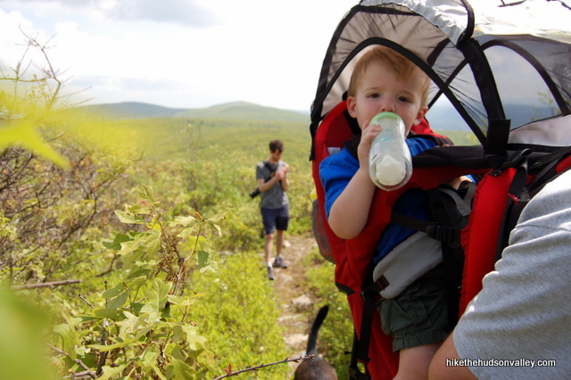
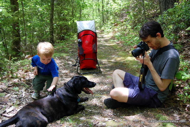
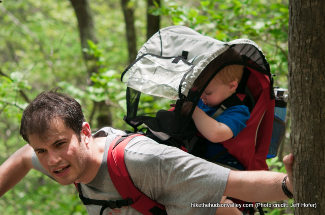
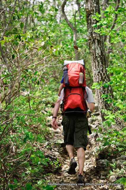
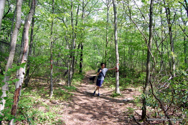
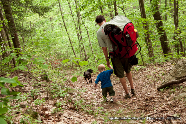
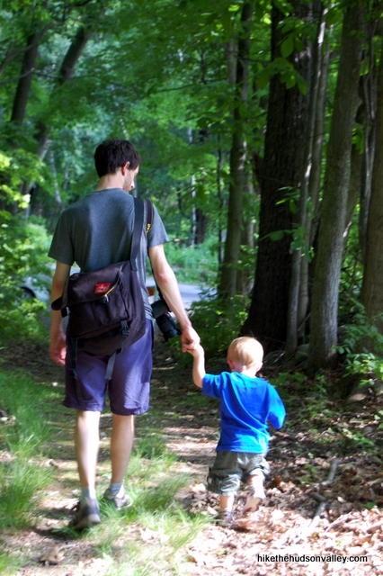
Background you can feel free to skip: There are several good ways to get to the top of Alander Mountain, but there aren’t any easy ones. Of the two ways I’ve tried, the first is the longest hike (8 miles) I’ve ever done with a baby on my back, and the other is the steepest (1,822 feet in ascent in 5.4 miles). I’ll write up the steeper, shorter version here, but if you’d like to try the longer, gentler climb (the trailhead for this one is 700 feet higher), check out the write-up for Alander Mountain II. My son Evan approved of them both, and hopefully he’ll still like this hike when he has to do some of the walking himself.
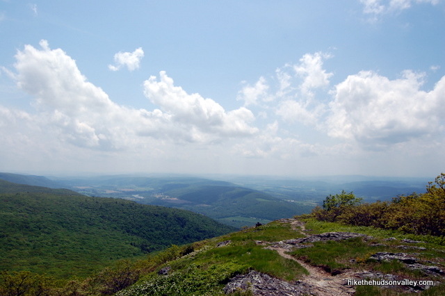
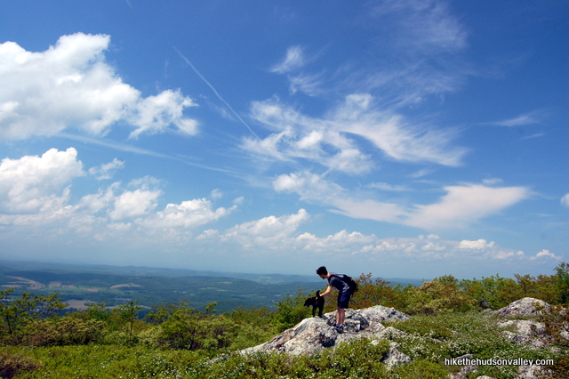
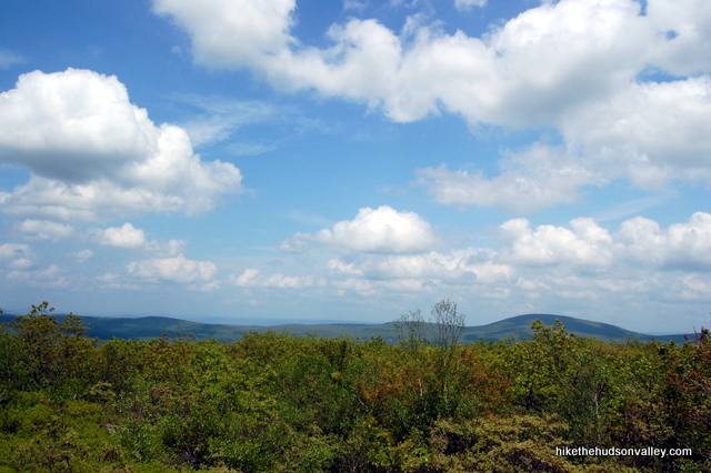
The summit of Alander Mountain is unique for this area in that there’s no one place you can point to and say, “This is the best spot to take in the view.” The grass, rocks and low bushes along the trail at the summit allow you to stop wherever you’d like, grab a seat and create your own personal money spot.
For all the beauty you’ll find here, you won’t be bothered by crowds, unless perhaps you’re competing for a spot in the cabin near the summit. Actually, that’s been empty both times I’ve been up here, so maybe crowds aren’t an issue there, either.
On the sunny spring day when I was here last, there were a few people lazing about near the summit, but not nearly as many as there should have been. This is a gorgeous hike that should be high on your to-do list if you’re willing to burn a few (thousand) calories to earn some awesome views.
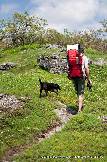
One more minor detail: If I was hoping to come across an eastern timber rattlesnake in its natural environment, this is the hike I would pick. I haven’t seen one here in my visits, but I am apparently in the minority. They are very common in the Taconic Range, and at Mt. Alander in particular. Step carefully out there!
**UPDATE February 24, 2014** The Massachusetts Dept of Conservation and Recreation has a very nice (revamped, I’m almost 100% sure) Mt. Washington State Forest homepage, complete with a contact number and with a very nice PDF trail map of the other Mt. Alander hike (the majority of the hike outlined below isn’t shown on that map, but it’s still a nice resource to have). Thanks, MassParks!
Trail Guide
Bonus unsolicited advice: Don't depend on having cell service in the woods - it can be spotty out there! Download this trail guide to your phone before you head out. (It's easy to do on iPhone and Android.) May your connection to nature be strong, even when your connection to the internet is weak.
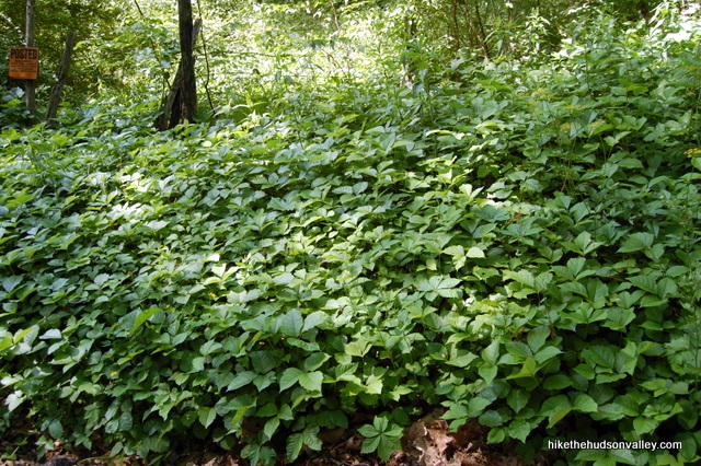
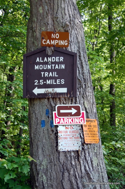
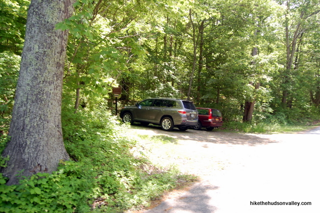
1. From the parking area, head downhill along the road for a couple hundred yards, back to the trailhead on your right. Careful on the side of the road – if I’m not mistaken, that is one of the biggest fields of poison ivy I’ve ever seen (this is the only spot I noticed any poison ivy along the hike).
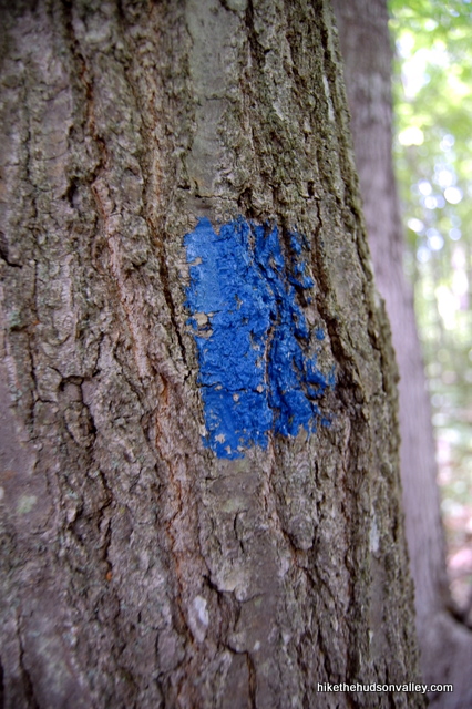
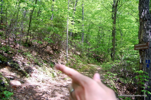
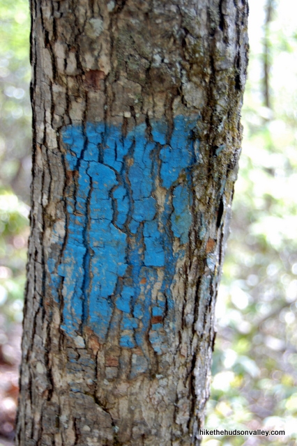
2. From the trailhead, which is clearly marked with several signs on a tree facing the road, hop on the blue-blazed Alander Brook Trail. Only 2.5 miles from here to the junction with Alander Mountain Trail at the summit? Piece of cake! Strenuous, strenuous cake.
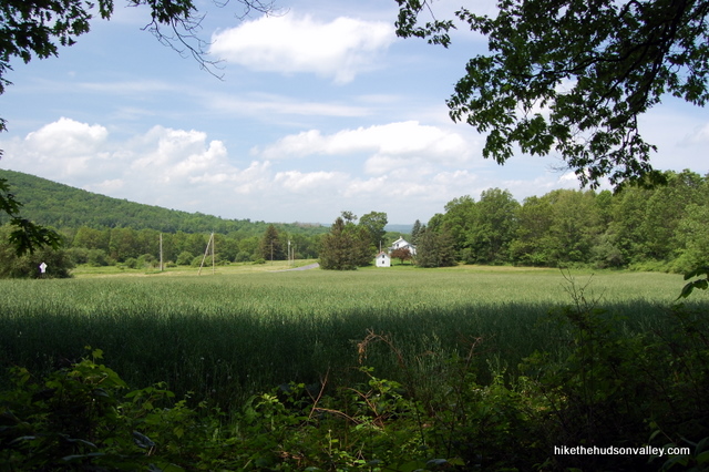
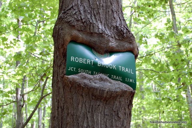
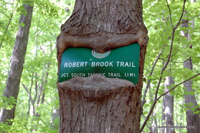
3. For the first mile or so, the trail is pretty flat. Enjoy it while you can. In just a couple of minutes, after taking in the nice view across the field to your left, you’ll come to the junction with the Robert Brook Trail, which is marked by a tree that is eating the sign.
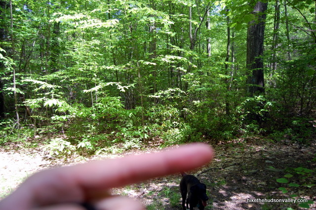
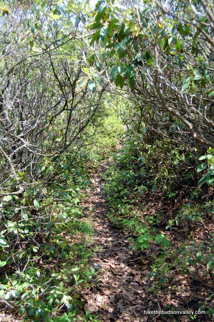
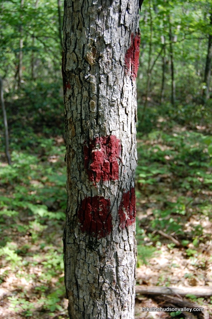
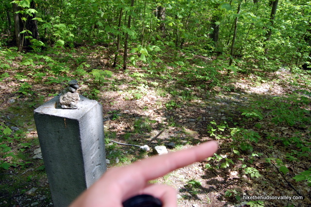
4. Turn left here to stay on the Alander Brook Trail. This is the beginning of the loop – you’ll come back down via the Robert Brook Trail later, when you’re much more tired and sweaty.4. In 10-15 minutes, you’ll cross over a culvert (which is what you call those big honking metal pipes, according to the Internet) that directs Alander Brook under the trail. Directly after this culvert, make a hard right to stay on the Blue Trail. If you went straight/left here, which looks logical, you’d end up on a Spur Trail to Nowhere, so try not to do that. (The picture on the left was taken after I’d already crossed the culvert, so that’s the view looking back.)
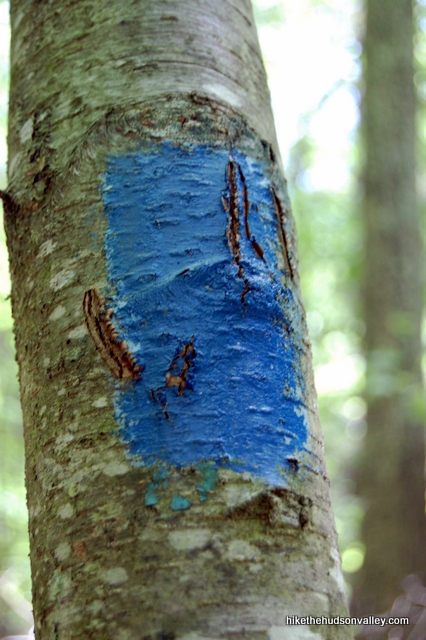
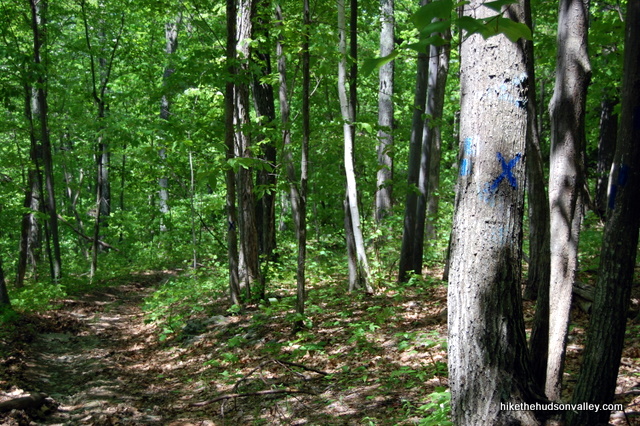
5. Keep following those blue blazes. You might notice another trail joining from the left, with a big blue X on the tree to tell you not to go that way. Take that X’s advice and keep heading straight/uphill on the Blue Trail. **UPDATE 11/6/2016** One friendly hiker reported getting tripped up here. Make sure you stay to the RIGHT to continue on the Blue Trail, and do not get lured to your left onto the X-marked Trail to Nowhere Good.
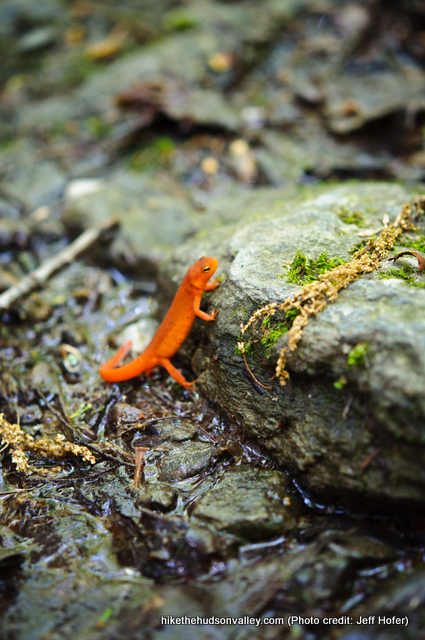
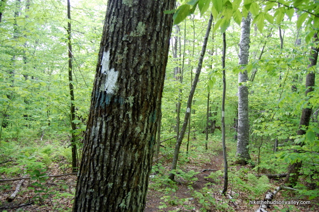
6. Shortly after the culvert, the trail reminds you that you are, indeed, climbing a mountain. The next junction to look for is with the white-blazed South Taconic Trail.It took us 30 minutes to get to that junction from the culvert, including stops to take pictures of salamanders.
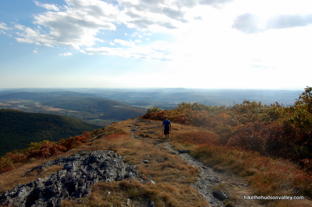
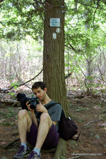
7. When you arrive at the South Taconic Trail, which joins you from the left (careful you don’t stroll past it!), you’ll have climbed about 700 feet from the parking area. You might want to take a breather at this junction, because the South Taconic Trail isn’t going to take it any easier on you.After you’ve caught your breath, take a left to head uphill on the South Taconic Trail. You’ll take a few steps up the bank, then curve right with the trail at the tree with the “South Taconic Trail” sign on it.
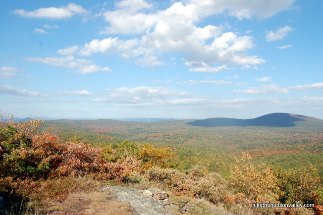
8. You have about 500 vertical feet to climb until you’ll pop out into some awesome views. Just keep trudging up the South Taconic Trail and all your hard work will be rewarded soon. From the Alander Brook/South Taconic trail junction, it took me about 25 minutes to get to the views, slogging slowly along, wondering how my two-year-old could possibly weigh 300 pounds.
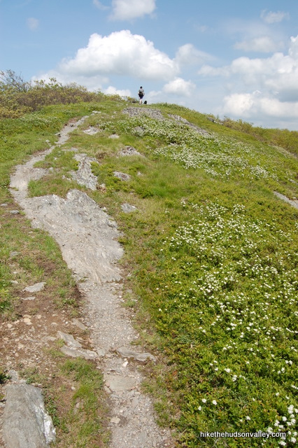
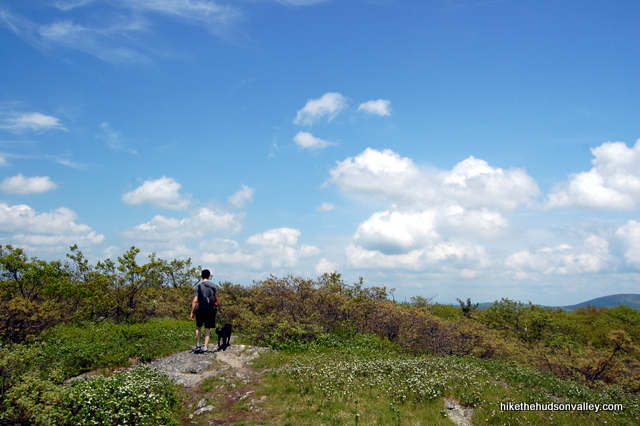
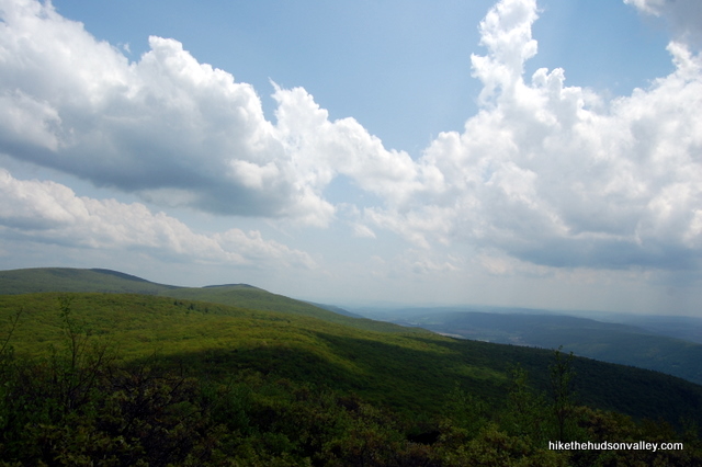
9. And all of a sudden, there they are. Those views.
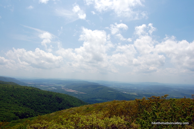
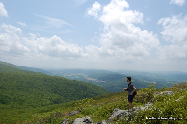
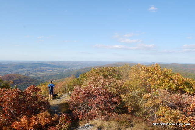
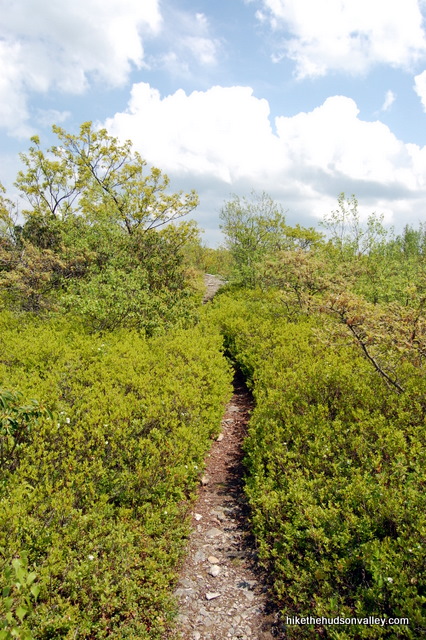
10. Keep making your way up the trail, stopping often to look at the view behind you. There’s no one place along this several-hundred-yard length of trail that is the “best” place to take in the view. If you see a spot that looks good for a picnic or break, by all means, plunk down and gaze into the distance for a while.
11. On your left, after some more steep climbing, you might notice a sign that tells you you’ve come .8 miles (that’s all?) from the Alander Brook Trail. Only 1,000 more feet to go until the next trail junction.
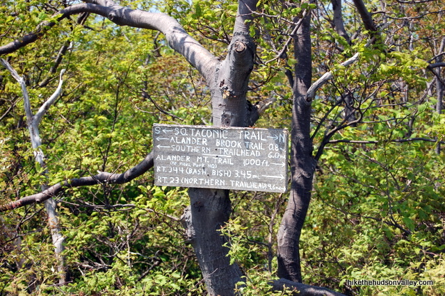
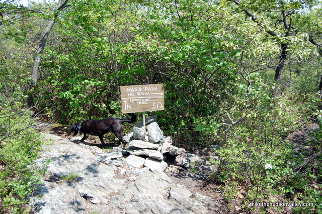
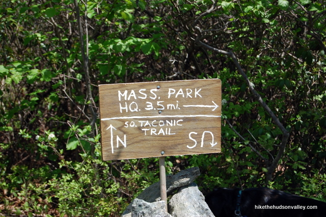
12. Keep climbing, and the trail levels out a bit. The best views on the mountain are behind you, but there are still more to come. You’ll head back into some trees and bushes to arrive at a trail junction, with a sign sticking out of a small rock cairn. (UPDATE September 2016: Per Sandy’s helpful comment below, the sign pictured here is in seriously sorry shape now, and likely won’t be much help to you. The directions below are still valid. so hopefully this won’t slow you down too much! Just visualize an awesome, helpful sign in that cairn and you’ll be all set. Thanks for the heads-up, Sandy!)
13. Optional step: Turn left to head north on the South Taconic Trail and see some different views. This will add about 20 minutes of hiking to your day, and it will be up-and-back, returning you to this spot. If you want to see them, turn left and head through the thick underbrush for a few hundred yards, stopping when you get to a small, rocky and grassy clearing. The views here aren’t earth-shattering compared to what you’ve just seen, but they’d be a destination on any other mountain. After you’ve taken them in, return to the junction with the sign sticking out of the rock cairn.
If you’re running low on energy, you shouldn’t feel like you’re missing out on too much if you skip this step. I skipped it the last time I was here. The 5.4-mile length for this hike does NOT include this optional step.
14. From the junction with the rock cairn, facing the sign as if you’ve just arrived from Step 12 above (whether you did the optional step or not), turn right to head toward the “MASS. PARK HQ”. Goodbye for now, South Taconic Trail! See you again soon.
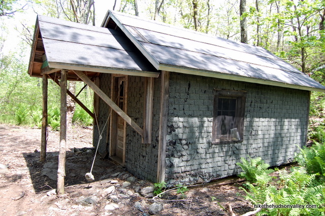
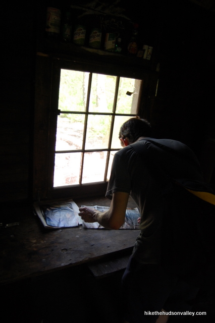
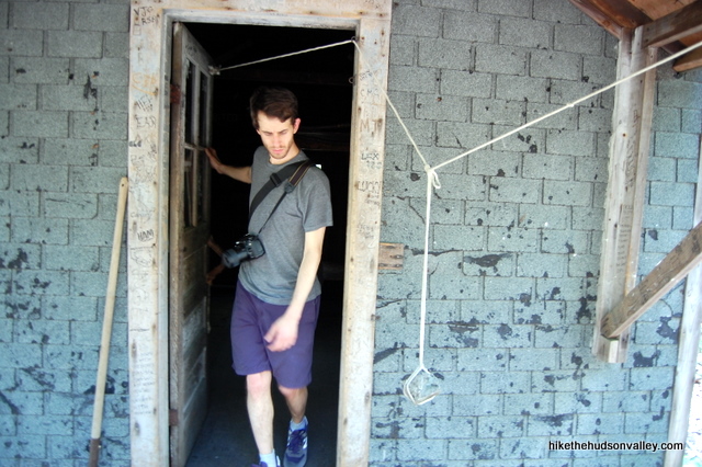
15. In just a moment, you’ll see a cabin through the trees. Head down the bank to pay it a visit. From what I can tell, this place is first-come, first-served, and free. Since there’s no camping allowed up here otherwise, the wooden bunks in this cabin look like the only option for sleeping on Alander Mountain.
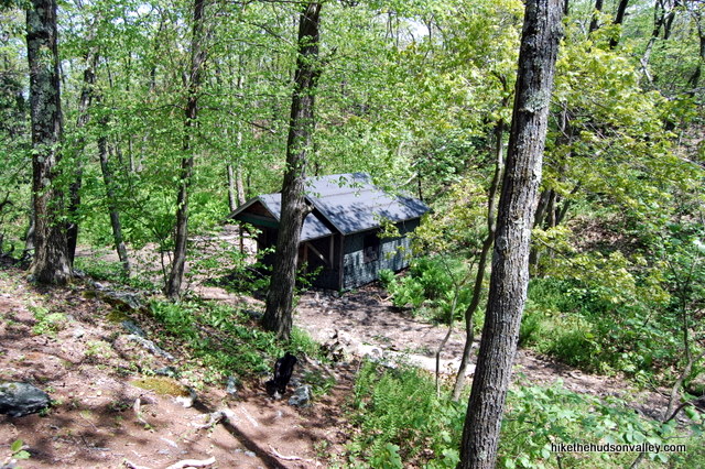
16. From the front door of the cabin, look back uphill, the way you just came down. Straight ahead, you’ll see a sign directing you to the right for the Alander Mt. Trail, Alander Mt. Summit and South Taconic Trail. You could retrace your steps to return to your car back this way if you’d like, but I like a good loop, and the way we’ll take down also has some nice views (it’s about the same distance either way).
**UPDATE August 2019** As mentioned above, the loop documented below is no longer a viable option — the connector trail that made the loop possible is now officially closed. (Even when it was open, it could be a fairly dicey proposition to navigate the loop.) Please respect the rules and the super-cool people who determined that closing the loop was necessary. Time to retrace your steps back to your car! The good news: You get to go past the best views on Alander Mountain one more time on your way back down. Enjoy!
Walk up to that sign and turn left, into the Great Unknown. Or at least the Great Unmentioned on That Sign, since it doesn’t say what happens when you go left.
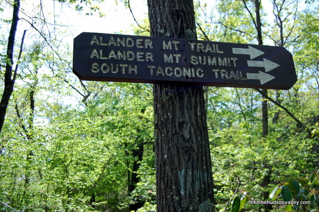
**UPDATE June 2016**A friend of mine got lost at this spot, so I’d like to make sure we’re absolutely crystal clear on the directions here. Face the front door of the cabin. Now turn RIGHT, and head back the way you came, very briefly. In just a moment, you should the see sign pictured just above, with three arrows pointing right. At this sign, turn LEFT. (If you were to make a left turn while facing the front door of the cabin, you’d end up descending Mt. Alander on the wrong side, coming, several miles later, to the Mt. Washington St. Forest HQ in Massachusetts, which is what my friend did. Her group found a nice hiker to drive them back to their car at the other trailhead, a twenty-minute drive, which was very fortunate and cool of that hiker. But let’s do our best to have you avoid hitchhiking today, shall we?)
17. “Dude, seriously?” you might be asking yourself right about now, as the single-track, blue-blazed trail makes its way through a dense mountain laurel thicket. I promise, the going gets much easier in just a few minutes. You’re now on the Alander Loop Trail, preparing to make a well-deserved descent.
18. About five minutes after turning onto the Alander Loop Trail, you’ll come to a small clearing with limited views. If you haven’t already stopped for lunch or a snack, this is probably your best bet for the rest of the hike, even though you can’t see the views when you’re sitting.
19. Keep heading down the blue-blazed Alander Loop Trail. Just when you thought you were done with views for the day, you get some more.
20. You’ll keep losing altitude for a solid half-hour after that small clearing with limited views, then the Alander Loop Trail dead-ends into the white-blazed South Taconic Trail. Turn left to go gently uphill along the South Taconic Trail. Does the South Taconic Trail ever go downhill?**UPDATE November 2017**As reported by several alert hikers in the comments below, you may see a “TRAIL CLOSED” sign at this junction, referring to the Alander Loop Trail trail that you’ve just traversed. There is no corresponding sign at the top of the trail to actually, you know, close the trail. Not sure why this sign is here, but until someone tells me that this trail is no longer passable from the top, I guess we’ll all just keep pretending that the “TRAIL CLOSED” sign doesn’t exist. Carry on, then!
**UPDATE May 2019** Okay, someone told me that the trail is no longer accessible from the top. Sigh. I’ve added a warning at the top of this page accordingly, so hopefully you aren’t finding this out just now.
21. The trickiest junction of the entire hike is coming up in about 10-15 minutes. It’s a right turn onto the red-blazed Robert Brook Trail. Keep a sharp eye out for it – if you weren’t paying attention, it’d be easy to stroll right past it. If you looking for it, though, you shouldn’t have a problem – there are plenty of blazes.**UPDATE November 2017**According to Rebecca’s helpful comment below, this junction now has some fresh signage. Cool! Thanks, whoever did that! (And thank you, Rebecca!)
When you see those dark red blazes, turn right onto the Robert Brook Trail. If you miss the turn, enjoy the summit of Brace Mountain in about two miles or so! No, but seriously, don’t miss the turn.
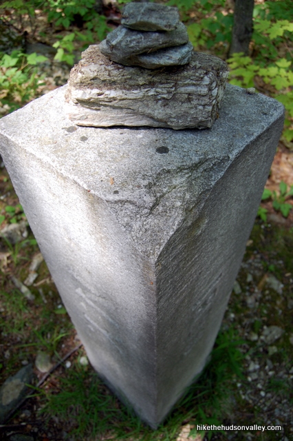
22. Thankfully, you’re headed downhill again. About five minutes after you turn onto the Robert Brook Trail, you’ll pass a concrete NY/MA state line marker.
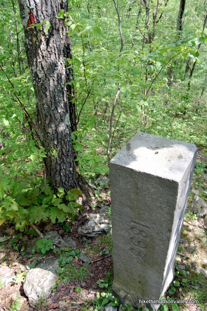
23. In another five minutes, you’ll pass another one, for some reason. We like our state borders clearly marked, indeed we do. Directly after that second marker, be sure to take a right to stay on the Robert Brook Trail. I’m not sure where that trail coming in from the left goes, but it’s definitely not to your car.
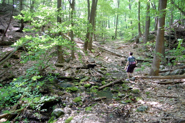
24. Keep steadily descending, giving away all that altitude you worked so hard to earn. It took us 40 minutes from the start of the Robert Brook Trail to reach the eponymous Robert Brook. Once you cross that brook, you’re very close to the finish line.
25. Less than ten minutes after crossing the stream (probably much less – my son wanted out of the bag, so he walked the rest of the way to the car from here, throwing off my time estimates a bit), you’ll arrive back at the junction with the sign-eating tree. Hooray!
26. Take a left to head back down the short trail to the road.
27. At the road, go left to return to your car. Watch for traffic! And wait to collapse until you’re past all the poison ivy. Phew! You made it. I hope you have something delicious for dinner tonight. Those calories aren’t going to replace themselves.
Directions
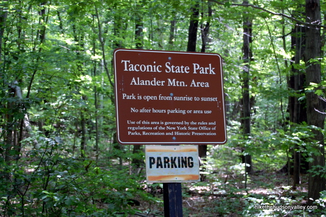
Directions to the trailhead:From Millerton, head north on Route 22. After about 8.5 miles, turn right onto Under Mountain Road, just after Old New York 22 comes in from the right (for the second time). Cross over railroad tracks. About a mile after the turn off of 22, you’ll see the trailhead markings on a tree to your left. (It says “No Parking” here, but I saw two different cars parked here on my trip. In any event, there’s only room for one car, and a nice, officially approved pull-off is just up the road.) Keep going a few hundred yards past the trailhead, around a corner to find some nice parking spots on the left, directly across the street from a house. Park the car and let the adventure begin.
You can also get directions by checking out the Alander Mountain (Under Mountain Road trailhead) entry on the HiketheHudsonValley.com Google map.
Sorta nearby address for your GPS: The intersection of Rt. 22 and Under Mountain Road in Ancram, NY is one mile from the trailhead. Just head east on Under Mountain Road from that intersection and you’ll be there in a moment. (My old-ish Garmin Nuvi lets me put in an intersection as a destination, so hopefully yours does, too.)
GPS coordinates of parking area: 42.06534, -73.51535 (clicking will open in Google Maps or the Apple Maps app, depending on your broswer/device)
Resources & Interactives
Super-cool Google Earth flyover of hike route:
Google Terrain Map of hike route:
Related resources: If you’re looking for actual facts and/or useful information, visit these resources:
- The official Mt. Washington State Forest homepage
- An excellent alternate hike write-up from BerkshireHiking.com
- General information at the Alander Mountain Wikipedia page
- A nice Alander hiking diary with pictures at AndyArthur.org
- Plenty of nice pictures, including some winter shots, at taconichiking.com
- A gentler, longer route up the mountain at Hike the Hudson Valley’s Alander Mountain II page
More Alander Mountain pictures from the hike’s Picasa album (with a special thanks to my buddy Jeff Hofer for providing some of these photos):
In case you lose connectivity out there: Save as PDF
Want to support trails in the Hudson Valley? Here’s one great way: Visit the New York-New Jersey Trail Conference homepage and click on Volunteer, Donate, or Shop! (Then you can volunteer, donate, or shop, depending on your mood.)
plenty of rattlesnakes on these trails
Another excellent walk-through! Thank you so much for your helpful directions, this hike was incredibly beautiful. (:
Pingback: 20 Breathtaking Fall Hikes in the Hudson Valley
I did this hike this past weekend and it was an awesome hike, but the Alander Loop Trail detailed in step 16 now has a trail closed sign at both ends. We didn’t wanna be those people to disregard some nice new signs, so we just made the hike a there and back. Still a solid hike this way, but heads up I don’t think it can be done as a loop anymore 🙁
Katie, thank you so much for the update! So sorry to hear that the trail appears to be actually, officially closed now. I’ve added a warning to the top of this page. Really appreciate you helping other hikers not to run into the same nasty surprise — THANK YOU!!!
Confused about this talk of the blue trail (Alander Brook Trail) being closed. Took this trail just a few weeks ago. It’s steep but seemed fairly well marked. And I saw no snakes.
Hi!
Thanks for your detailed hiking directions. I’m planning to hike this trail soon, and I’m glad I read the updates before attempting it. I see the blue trail is now CLOSED (on the ascent or descent?), which is a bit concerning for me because I’m not an experienced hiker and looking to do this trail which I’ve read is moderate level. If I am planning to park near the Mountain Washington state forest side near the Bish Bash falls, would I still follow the Alander Mountain blue and white trails to the summit? I would prefer to take the more gentler trail, but I also see that it’s an 8 mile loop compared to the shorter, more harder route at 5.4 miles. Just wondering if this is because that depends on the location where I start the hike. Any tips would be appreciated, thanks!
Your trail guide and extensive commentary was really useful and much appreciated. Thank you! I took a group on this loop today (September 1), and was rewarded with the privilege of seeing SEVEN timber rattlesnakes all in one place! It was really something! They were congregated in a very small clearing perhaps a half mile down the trail from the summit, if you’re going clockwise. I kept my eyes on the snakes as the others in the group blazed a short detour behind me and back onto the trail a few yards ahead of the snakes.
As a side note, I’ve often read that people turn back on the trail when a rattlesnake is present and I wonder if they think these creatures have hidden legs and will suddenly leap up and bite them in the face. You’re in no real danger around a venomous snake unless you antagonize it, or accidentally step too closely. Just walk behind it, and continue on your way, just as the snake is doing.
Jeff, that picture is INSANE! My goodness. Thanks so much for sharing it here. Wow.
I’m also curious for an update on the trail conditions up that way. Did you follow the route outlined above? Have any issues at the section where the trail is apparently closed or closing or no longer maintained? I’m in a quandary about what to do with this trail guide, and any current information you can provide is much appreciated. Thank you!
Hi Mike! I did follow the trail just as you outlined, which happens to correspond exactly with AllTrails’ GPS route, so I used that as backup. Your instructions are spot on, but now the sign in the cairn in Step 13 is nothing more than a laughable fragment of particle board held onto a stick by a single screw. One person in my group looked at it and said, “What’s that supposed to be?” and I said it once was a useful sign telling us where the hell to go from here, but now we’re on our own!
The trail just beyond the cabin (which appeared to be actively-used on our visit) is really overgrown, to the point where you have to continually look down to find your way through the vegetation. There were segments so overgrown, that if you you looked for a moment, the trail ostensibly vanished. If I had not established an early rapport with those in my group, they would have thought I was leading them to the slaughter!
The blue trail is definitely NOT closed, although a sign (which only faces hikers at the beginning of the ascent approaching counter-clockwise) indicates it is. We stopped here wondering why on earth the trail we just came down would ever be closed to hiking. It just didn’t make any sense.
Not too far beyond the cabin, and along this overgrown path, is where I discovered the rattlesnakes. Seeing those seven sssnakes together was really spectacular, one of the most fascinating experiences of my life, and probably won’t happen again. I messaged an older friend who has hiked the valley extensively for decades and he replied that he’s never seen more than 3 rattlesnakes together at once. You were right when you said this was the hike to pick to see an eastern timber rattlesnake! Hope you get to see seven yourself.
That spot with the snakes is a very important birthing spot. Sharing the gps with the world goes against all conservation practices and they are state-listed. Please remove that for the sake of the snakes.
John, I posted that almost a year ago and you’re the first person to even reply, so thank you. It’s highly unlikely that busloads of hikers are going to head up the grueling trail to Alander Mountain in the remote hope of seeing a cluster of poisonous snakes. I provided the GPS coordinates primarily to warn hikers to keep alert, and keep away, from that part of the trail. I’m certainly not going to remove the coordinates. None of the seven snakes were alarmed by my hiking group’s presence so I seriously doubt they gathered at the end of the day and agreed to stop reproducing. Come to think of it, moving to a new location off the trail might even do them much good.
Hiking trails are created so people can enjoy nature. All of it. Why would you want to diminish that?
After receiving more feedback that this loop was officially closed after the cabin (Step 16 above), I updated the trail guide back in May to advise people to turn around at the cabin to retrace their steps back down the South Taconic Trail. Based on these comments today, I added another warning on Step 16 itself, to make sure everyone knows that the trail is indeed officially closed. (It was a near-bushwhack even when it was open, it must be very hard to follow now.) Hopefully that will cut down on anyone attempting to venture beyond the cabin, and will help to leave this area for the rattlesnakes (which is, I assume, why the trail was closed in the first place). Hope this helps — and thank you to everyone for helping to keep this trail guide as current, accurate, and responsible as possible.
Jeff,
I know the spirit in which you left your original comments, and appreciate you taking the time to share your story (and that amazing photo) to help other hikers. I hope you’ll continue sharing on this site. Yesterday, a herpetologist from the Massachusetts Division of Fisheries & Wildlife reached out to me, explaining the importance of this area, and the troubled history of people illegally collecting, killing, and harassing the snakes. He asked if we could please take down those coordinates, with the understanding that both you and I would be hesitant to do so (you because you’re trying to help your fellow hikers, and me because I don’t want to mess with other people’s comments).
While I do hate to alter comments from users, under the circumstances, it does feel like the right thing to do. I’ve removed the sentence with the coordinates. I would never have anticipated their posting here to be an issue, but this has been an educational experience for me, and I appreciate the sensitivity with which my newfound herpetologist friend approached the conversation here.
Hope that all sounds copasetic to you, and hope to see you around this site (and perhaps even on the trails) sometime soon!
All the best,
Mike
There is a better way to get to Alander Mountain without absolutely killing yourself. Not that it’s easy, but it is better. The only twist is that it requires two cars. Leave one at the NY trailhead to the Alander Brook Trail on Undermountain Road. Then take the other car and drive up Rt. 22 until the turnoff toward Bash Bish Falls. That road will take you up into Mt. Washington State Forest on the MA side. Park the second car at Mt. Washington HQ and take the Alander Mountain Trail, passing by some nice streams and going uphill, but gradually. Eventually you arrive at a cabin. From that point take the South Taconic Trail for a short while until you reach Alander Mountain Summit. Enjoy the views, then continue downhill on the South Taconic Trail until you reach the Alander Brook Trail. Follow that back to Under Mountain Road and walk the short distance back to the parking area. Then drive back to Washington HQ and get your second car. I did it this way last weekend, and though it was strenuous it was not an absolute killer. Also had time to visit Bash Bish Falls afterward.
Saw this beauty on South Taconic Trail just north of Alander summit a few weeks ago!
I’m going to echo the previous statements – the blue trail is CLOSED and it is listed on the NYNJTC map as “unmaintained”. I actually couldn’t get to the true summit or the cabin because there were 3 timber rattlesnakes blocking the trail between the southern summit along the NY/MA line and the main summit. Got within 10 feet and the biggest one started rattling, so I went no further. Wasn’t about to fight a 3-4 foot long snake that could kill me. It was okay, though, because there was a great view at the south summit.
I saw quite a bit of other wildlife, too. Several toads, many birds (some quite large), and what I think was a porcupine climbing a tree near the South Taconic/Robert Brook junction.
They keep getting bigger and fatter every year this decade. It’s getting to the point where I’d rather deal with the icy death cookies of the South Taconic Trail in winter than hike the corridor from Brace up to Alander and over to Bear north to Race in the summer. Those timber rattlesnakes are beautiful but one encounter was enough to scare (scar?) me for life.
Thought you’d be interested to see how this tree/sign relationship has progressed 🙂
Oops heres the image. Compare with the one above
Jonny, thanks so much for trying to upload that image – I’m curious to see it! If you could send it to me at [email protected], I should be able to post it here.
And here’s the pic – thanks for sending it, Jonny!
I’m not going to say anything new as everyone else has said it already, but
I wish I had read your site before going today … we traverse the non-labeled at the top CLOSED trail and it was downright bad; don’t know how many times my son got hit in the face after I pushed thru a downed tree or thicket … seriously in need of being closed and signage at the top. We were nearing the bottom and I said to my son jokingly “I bet that sign says Trail Closed” … AND IT DID!!! I said to my son that if I wasn’t so sore I would hike back up and put up a sign.
That said … the sign in the cairn is just a stick and a well something that use to be a sign now but is long gone. And the cabin is …. horrible smelling; I would never stay that … ranky.
Otherwise the views are incredible … nice hike.
I will state for the record (6/4/2018) I just got off the phone with Mt. Washington State Forest … and the person I spoke with actually didn’t know that the trail was closed at the bottom. He is going to go check it out; so the maybe the trail should be open … and the closed sign was put in by mistake … OR make the trail should be closed and there is no sign at the top saying closed … UNKNOWN at this time.
Rick,
Thanks so much for the update! I’d love to know the official position on the trail here, and will need to figure out a workaround if the trail is actually closed and returning to nature (that’s really a shame). For now, I’ll update the trail guide above with a warning. Please keep us in the loop if you find out anything else!
Great trip report! I hiked this today it looks like a lot of new signage has been done! The right turn onto Robert Brook trail is now clearly marked and there are trail markers along the trail.
As mentioned above once you turn left at the three way junction (after visiting the cabin) and follow the blue blazed trail until you reach the South Taconic trail, there is a trail closed sign at the end. However, going in the same direction as you describe you don’t see it until you have already done the trail. As there is no trail closed sign on the other end.
Thank you for another great report!
Rebecca, thanks so much for the helpful information! I’ve put new **UPDATES** on Step 20 and 21 above, based on your input. Much appreciated!
Did this hike today. As usual your directions were spot on! Views were incredible. I reached the Robert Brook trail junction with time and energy to spare, so I continued on South Taconic trail to Brace Mountain summit then over to Mount Frissell for summit and Connecticut high point before heading back to complete loop. This more than doubled the mileage for hike, but since the majority of climbing was in first two miles it didn’t seem too bad!
Thanks for this site! Since I found it two years ago I have discovered so many great trails to explore – all within a two hour drive from my home!
Wow, Jeannine — that’s some impressive extra credit you racked up there, hitting Brace Mountain, too! You’re tough! Thanks for the validation of the directions, and glad you had a great day out there.
If you were to do this hike in reverse (counter clockwise): I noticed that there’s a sign on the southern end of the blue, Alander Loop, trail where it ‘dead ends’ in step 20, saying that the trail is closed and advising to ascend Alander Mtn using the South Taconic Trail. No explanation as to why. Sorry, I didn’t think to snap a photo.
I don’t know if there’s a similar sign up at the northern end of the trail.
I noticed that too. Did the hike today and it was awesome! I saw that sign on the way down, but there was not one at the top. I used NYNJTC map 107 and it helped, particularly around the cabin junction. Great time but this was definitely a challenging hike for me. Quite steep up and down, but Ioved it. Would be amazing in the fall.
I did this hike in reverse today, and saw this trail closed sign on what I think is the loop trail? So I took the left fork instead of the right, and it brought me down to where the red trail meets the white. I believe this is just the taconic trail that i was on? and the “closed” portion is the blue blazed allander loop trail?
Would it be possible to update the map to show this detour portion?
Hello there, all! I’m not quite sure what to do here in terms of an update — it sounds like there’s only a consideration to be made with the “Trail Closed” sign if you do this hike in reverse from what I’ve documented above, and I’m not 100% clear on where the sign is located or why it’s there. Jeannine just validated the above trail guide about a week ago, so I’m confident that people could follow the instructions as they are without any issues. Any other thoughts on how the trail guide above should be updated, if at all?
The “Trail Closed” sign is at 42.07898, -73.50505. The closed trail goes north to the cabin junction from the South Taconic Trail and is shown as an unmaintained trail (dotted line) on NYNJTC map #107. Again, I took this trail from the other direction (due south from the cabin junction) and did not notice a closed sign at the top.
Thank you, Kelly! I’ve just added a new update to Step 20 above – hopefully, that will help clarify the situation for people who stumble upon that sign. Really appreciate your pictures and updates!
Great TR! I’m hoping to head out there next weekend (April 29th). I’m actually hoping to come across some rattlers to photograph; has anyone come across them this early in the season? Just for fun, I’ve included a photo of a copperhead I took last week in Connecticut.
Hi Brendan! I heard from a friend who saw a rattler at Minnewaska about a week ago, so they are apparently out and about in the area. (The snake didn’t even rattle as he gently nudged it off the trail with a long stick – he took a video of the proceedings, and the snake seemed awfully mellow about the whole thing.) I’ve never seen a copperhead before, and hope to keep that streak going. Thanks for the nice pic – hope you had plenty of zoom on that lens, and I hope any rattlers you find have pleasant dispositions!
Hi–I just got back from trying this hike, and had some difficulty at Step 5. We came to a junction with the blue X on the tree, looked at your directions which said to keep going straight, and continued straight on a trail that was a bit overgrown. We hiked for quite a long time, unable to find the South Taconic Trail turnoff. After awhile, fearful we had screwed up, we headed back the way we had come. At the junction where the tree with the X is, I tried the other trail (which would have been a right turn at the junction not “straight”), and eventually saw a blue blaze on a tree. Eureka! By now it was getting too late to continue, but I assume this is the correct way? I would suggest changing the directions to indicate that you bear right at the intersection with the Blue X. We have enjoyed using your maps and love the photos. Keep it up!
Cathy, I’m so sorry to hear this. Looking back over the directions above, I’m pretty sure things went off the rails on Step 4. Here’s what the trail guide says: “Directly after this culvert, make a hard right to stay on the Blue Trail. If you went straight/left here, which looks logical, you’d end up on a Spur Trail to Nowhere, so try not to do that.”
If you thought you were on Step 5 at that point, you would have been looking at these instructions: “You might notice another trail joining from the left, with a big blue X on the tree to tell you not to go that way. Take that X’s advice and keep heading straight/uphill on the Blue Trail.”
It sounds to me like you probably ended up on the Spur Trail to Nowhere mentioned in Step 4. Does that sound like the right prognosis? Is there anything I could change in the text that would have helped to avoid this problem? Hope you have a better run at it next time, and I hope we can help others to avoid the same fate!
Hi Mike–Actually I did make the hard right to stay on the blue trail after the culvert. There was a sort of big climb after that and then I arrived at the intersection With the X on the tree.mentioned. At that point, we would have to turn right again to stay on the blue trail (left would turn us toward the tree with the X). This is where we goofed…your directions said keep “straight/uphill” so we went straight. I think the directions would be correct if you said, at the junction, bear right uphill on the blue trail. I plan to try the hike again, so will take some photos to clear up what I mean. Thanks for your response.
This is very helpful, Cathy – thank you! I just updated Step 5 above with a warning to make sure nobody else hits this same problem. Let me know if that doesn’t do the trick!
How come the red dots on the map don’t say which junction it is? It’s completely unclear which way you ascended and descended. The map I’m looking at from the Mt Washington SF government site does not even show an “Alander loop trail”… this is utter #$%^
Pleasure to meet you, na! When I first created this site, the Everytrail.com maps that I’d create from my GPS data would include waypoint labels and animations of the hike route. For some reason, Everytrail made changes that removed the animations and stripped out the waypoint labels (hence the red pins with no text). I agree that it’s less than ideal. For this hike, I just scrapped the Everytrail link and created a new Google map that includes the waypoint labels — try clicking the link in the “GPS Goodies” section above and see if you don’t find it more useful now.
Sounds like you’d also benefit from purchasing the official map set for this area: http://www.nynjtc.org/product/south-taconic-trails
You can also read the (perhaps too copious) text above to figure out which way I tackled this hike.
Hope this all helps you to have a nice adventure out there. Thanks for stopping by!
Thank you, lol. I became frustrated trying to puzzle together the way went through reading your account and going back and forth with the red dots. Perhaps my reading comprehension is not what it once was, but I was almost sure that you took the other way up and the left turn near the ny/mass border was where you picked up the STC in step 7. But then I realized the steps didn’t in anyway correspond to the red dots and I had no idea of which way you went up. In any event great site and interesting accounts.
By the way, I know you know this but you were in the heart of timber rattler territory with dens close by when you sat on that rock on the loop trail for a break. But I’m sure you kept a close eye on the kid, what an experience he’s lucky to have had at such a young age.
I have one last question, in your opinion which of these mountains has the best views? I have time to hike maybe two this fall (I don’t live close by) I know this is relative but as far as views would you choose: Alander, Brace, Race, Bear, Frissell, or Everett? I’m leaning toward Alander and Race, and Bear my third option if I have the time. Are Braces best views toward the Catskills rather than the rest of the Taconics? Maybe Bear should replace Race? What say you my Toddler toting, unafraid of sitting next to rattlesnakes for a break, South Taconic Mountain expert?
Thanks for the nice follow-up, Unavailable! I just added a timber rattler warning to my two Alander trail guides, just to make sure everyone knows to step carefully out there. As for ranking the views in the Taconics, I would recommend Brace (via the South Taconic Trail – listed as Brace Mountain II on this site), then Alander (via either route), then Race (which I did last year and will write up one of these days – beautiful hike, but the view isn’t as good as Brace or Alander). I haven’t done Bear or Everett, and Frissell doesn’t have much of a view. Hope that helps!
Thank you that definitely helps with my decision, I have a hard time with those.
Did this hike about a week ago–as you put it so succinctly–great views, steep climb! I just want to point out that the sign mentioned in Steps 12-14 (the sign sticking out of the rock cairn) is in bad shape. When we got there it was in pieces; only 1 piece that was barely hanging on was still attached & it was hanging at an angle with arrows in the wrong direction. It was impossible to use that sign as it was for directions. You wisely tell folks to go right to continue the loop when they get to that junction. I would just reiterate it here–don’t worry about what the sign says, or which way it appears to be pointing–just go right at that junction. Btw, met some NYNJ Trail Conference folks on the way down & told them about the sign. They said they were aware but with so many signs to maintain, don’t know when they’ll get to it. (The pic I posted of the sign is after I picked up a fallen piece & kind of leaned it next to the attached piece)
Thank you, Sandy! I’ve just updated the trail guide at Step 12 with a link down to your comment. Very much appreciated!
This is so awesome! I wish I had seen this before doing this hike yesterday. I took the alander trail, went past the south taconic, into the white traill, then switched to blue trail. We reached at the cabin, and continued upwards to the summit. The summit was a big tease as there was a breathtaking view after every big ascent we took however it was not the top so we kept going up and up forever. But got to say, the almost 360 degree view at the summit was worth every bit. On our way back, we had a visitor, a black timber rattle snake (around 1.5 feet) right on the middle of the trail path. It was quite an experience. I definitely plan on going back, to try a different trail to the mount. Your record of the trails are amazing , it will definitely help me when I go back. Thank you !!! 🙂
Just want to say thank you. I followed this post to a “T” today. I didn’t miss a single turn. Loved the pictures and landmarks! You doing this with a kid made it feel super attainable. Took me 3 hours to do the loop. Stopped at the cabin to have lunch. Great day man. Thanks for helping me have the confidence in the trails. Met 2 Rattlesnakes today on the trails, super cool.
Just a quick thank – you . Your instructions were very helpful.
I did this hike yesterday, altho in the opposite direction.I got quite confused near the cabin by the sign pointing to the summit. This is contradictory to the summit location on my NYNJ trail map, hence the confusion. I needed my compass to figure out which direction to continue (south). Perhaps I’m getting a little senile, at age 63 w 50 years hiking experience. Anyhoo… a wonderful hike thanks for posting it on your GREAT website.
This nyebone poster is my hiking buddy, except when he sneaks up Alander Mountain without me, and he’s always quite confused. I’m 73 with 60 years hiking experience, so I say tolerate him but pay attention to me.
I did this hike today (1/12/2017) and checked out the cabin.
The directions could perhaps be improved by emphasizing the distractor and the up (to go down).
1) Walk to the sign (your back is to the cabin).
2) Ignore the well-defined distractor path straight ahead (south) not mentioned in the directions) and ignore the three right-pointing arrows on the sign.
3) Take the blue path to the left up (southeast) which later curves southwest down.
Note that the first blue mark is barely visible from the sign.
Today it was raining, misty, windy (noisy!), dark, late afternoon, and I was so lonely.
At this point, after spending fifteen minutes over-analyzing the options,
I slipped on my crampons and flew up, followed by down, the icy but correct trail.
All joking aside, I used the NYNJTC map and its contour lines, my compass, my crampons,
and I kept checking my compass because I knew a mistake could still happen.
The cabin itself is great and worth a visit (it has a fairly-new blue tarpaulin over the middle part of the roof) but some of its denizens should never have been born.
I swept the main part (it has a broom) but it’s still a mess (the Problem of the Commons).
The bunk platforms are all clean.
I hope I don’t have one of those horrible nightmares tonight in which nasty dogs attack and swallow poor innocent rattle snakes (and nyebones) in filthy cabins.
Great hike. Thanks.
John, you seriously need to listen to my advice about posting after/while you’re imbibing
Thanks for the great guide. I plan on trying this weekend. Is it possible to take the blue trail all the way up? I’m a bit confused by the directions, why do you not turn towards the arrow pointing to the summit?
Hope you have a great trip, Ricky! You COULD finagle a trip to the top using only the Blue Trail, but that would be a different hike than the one outlined above, and I’ve never tried it before. If you’re referring to Step 16 above, you turn away from the summit because, at that point, you’ve already visited the summit, so you turn left there to continue along the loop.
I hope this is helpful! Let me know if I didn’t answer your question.
Pardon meh, but is there directions to the trailhead parking on this page?
delete delete found them sorry on the other page Alander II the directions were at the top
oh no they weren’t they were at the bottom. haha good stuff, I should start smoking weed again it makes me more perceptive.
Thanks for the detailed directions on your hike reviews, extremely helpful.
Hiked Alander Mountain this weekend, a few things I noticed.
At the point with the two way fork in the road that either leads you towards the cabin area or brings you straight north of the mountain we encountered a timber rattlesnake, or what I believe is a timber rattlesnake.
Also, the sign area that leads you to the cabin gets turned around easily, and we completely miscalculated and headed north instead of towards the cabin. We should have realized after we didnt see the cabin to turn back but we went about 2 miles back down the mountain in the opposite direction before we decided to totally do a 180.
It poured out so I guess he was sun bathing, he wasn’t aggressive or anything but god was he big! and he was also blocking our path, we ended up having to cut through the brush to get around him.
Thanks for the heads-up! Seems like this area, including Brace Mountain, is not in any danger of running out of rattlesnakes anytime soon. In my experience, bumping into a rattlesnake is one of those things that’s very cool in retrospect. Glad you didn’t get any better acquainted with him than you did.
For the sign issue, please let me know if an update to the guide above could be helpful to help others avoid the same fate. Thanks for taking time to drop a comment, MBow!
It shouldn’t be a major problem for anyone as long they know how to tell North/South/East/West
We were just so confused when we looked at the sign and south was north and north was south.
We should have just listened to instinct really but we followed the sign and later realized it was totally turned around.
But yea, the rattlesnake was beautiful for sure. Definitely a bit alarming but a fun time, I want to go back and try and get Brace Mountain done by the end of the fall.
Thanks so much for the detailed guide! Without you I would of been very lost. 🙂
Mike,
Hi, first off – thanks for all of the work that you have done on all of the trails. I have hiked more than five this summer and fall – all of your trail advise has been very helpful. I am thinking of hiking Alander Mt. this weekend and would like your opinion on the possible conditions. Do you know if anyone has tried this late in the year. Any advise would be appreciated. thanks, Jim
Hi Jim,
Glad to hear the site has been useful for you! I’ve never tried it this late in the year, and especially after the snowfall we got last night, along with fallen leaves, I’d expect the trail conditions to be pretty dicey and more difficult to follow. If you have experience with this kind of thing, it’d be beautiful up there, but my blanket recommendation would be that it might be better to wait until spring, or at least until we have a good long dry/warm(ish) stretch. Good luck if you give it a go!
Mike,
Thanks for information. I think I might try Brace Mt. I am hopeful that you did not get that much snow ‘up north’ – I live in Westchester – and that today’s temps melt what ever you did get. I don’t plan on pushing it if the conditions look that bad. I just need to get out and have done all of the difficult hikes nearer to me. I will let you if I make it and what the conditions were like.
Thanks again for your hard work on this website. I love it and have recommended to many friends.
Jim
Hey Mike,
Great directions…Ive hiked a lot of areas in the US and this was a very rewarding hike. We decided to do this hike instead of Monument Mountain and I think it was the right choice. I do have to mention we (my girlfriend and I) saw a fairly large (3ft. or so) timber rattlesnake at the top. I am originally from Texas so I found it humorous to run into a rattlesnake in New England but my Berkshire native girlfriend didn’t find it as funny. All in all a beautiful hike with better than expected views at the top. Definitely compares favorably to Mount Greylock from that standpoint. I recommend this relatively short but somewhat strenuous day hike for anyone with some spare time in the area (whether a tourist or resident).
Thanks, Clayton! I ran into a rattler on nearby Brace Mountain, and I don’t recall finding the humor in the whole thing until way, way later. They’re apparently all over the place in the Taconics. Step carefully out there, everyone!
I couldn’t believe how much it will cost for the large doses of anti-venom for the timber rattler bite, considering that you need ~20-40 times the dosage amount for other rattlers.
Does anyone have any personal recommendations for a good snake bite kit? I like to hear from people who have actually had to use them, kind of hard to find those types of reviews, which I guess is good in a sense.
Hi Mike,
We hiked the trail yesterday, it was a great. Your overview was great and helped us along the way and I’m not sure what we would have done without it. There where a number if other people on the trail that were using it as well. I have a couple of comments for anyone who is planning to hike this…to Mike’s point you are going to get your heart rate up fast and it will not drop until you get to the summit. Also, when you heading down and looking for the Robert Brook trail, the red markers have faded, so you really have to pay attention. As a side note this trail is not hiked by the masses which is great, but the trail is not well maintained and the markers are few and far in between or have faded to the point you can barely make them out.
Chris
Not sure why I didn’t reply to this comment long ago, but thanks so much for the kind words and useful info, Chris! Very much appreciated.
Hi Mike,
I’m with a university outdoors club and we want to do some hiking in the area this Saturday, March 1st. Do you know if there is too much snow? Are trails open and would crampons be necessary? Thanks!
Hi Kelsey! Your comment prompted me to update this page with a link to the Mt. Washington State Forest HQ homepage – the old page had become a broken link that I’d deleted. I’ve never done this hike in the winter, and am not sure of the trail conditions at the moment, but would venture a guess that they are fairly gnarly. Even in warm weather, this is a tough hike. Please give the park HQ a call and see what advice they have for you there – the number given on their homepage is (413) 528-0330.
Hope that helps – have a great trip, and take lots of pictures!
My friend and I decided to take a hike up there yesterday around 3:15. Not really paying attention to the time or thinking about what time the sun would be setting. Thanks to your very detailed descriptions and spot on times we were able to navigate our way down after the sun had set. Thank you for providing beautiful pictures and a thorough description of what to look for! The hike kicked our butts but was so worth it! Thanks again!
So glad you made it down safely! Hope you have many more great adventures out there, perhaps with slightly less excitement.
Hi we just hiked the trail today. Your website helped tremendously thank you. We got down following the loop, not sure exactly how but we did. Along the way down we encountered a 3ft timber rattler. Very cool well at least i thought so. I have a question though. At the top we came across a military ammo box. My son and daughter were very intrigued by it. There was definitely something inside of it but we chose not to open it. Just curious if you know anything about it. It was pretty much out in the open. Thanks Paul
Hi Paul,
I’ve been up Alander three times and never come across a rattler there (though I did recently have a close encounter on its neighbor, Brace Mountain) — I will step more carefully from here on out! As for the ammo box, I strongly suspect that you happened across a geocaching cache (http://www.geocaching.com/). I saw a very similar-sounding ammo box at Fahnestock Park just this week (which reminded me to come back and finally reply to your comment – sorry it took me so long!). My little cousins found one on a hike up in Maine, and there was a logbook and some trinkets inside — as I understand it, the idea is generally to sign in, take a trinket and leave a trinket for the next person who comes along. There are websites that give the GPS coordinates of geocaching boxes hidden all over the place. Fun idea for a treasure hunt.
Hope this is helpful — thanks for taking the time to comment!
Mike
Mike:
Thanks for all of the great information. I have one question though regarding the elevation gain. The NY/NJ Trail Conference Map I have from REI shows the beginning of the Alander Brook trail at about 800ft and the summit of Alander at 2250 for a net gain of about 1450′. You list 1822′ in your description…does the trail climb and dip and climb again to gain that extra 400? I am taking a group of scouts and want to be sure I understand the elevation/distance ratio.
Thanks,
Jessica
Hi Jessica! That’s a good question. I got that number (1,822′) from my hiking GPS, which records all the ups and downs during the hike. If you click the first link in the “GPS goodies” section at the top of this page — the one that says “Google Terrain map” — you’ll see an overlay of the elevation profile for this hike, including the little upward jog between mile 3 and 4 that should account for a good percentage of that extra 400 ft (if you’re using a mobile device to click that link, you won’t see the elevation profile – it needs to be a regular laptop/desktop browser).
Hope that helps, and I hope you and the scouts have a great trip!
Do you have an address for the parking area at the start of the trail?
Hi Kelly,
Just the intersection I gave in the “Sorta nearby address for your GPS” section above, which should work for putting into Google Maps or a GPS device, and will get you really close – the “Directions to the trailhead” section gives more details, too. (There’s a house right across the street, but it seems weird for me to post private addresses to this site, so I generally don’t do it.)
Hope that helps! Let me know if you still can’t find it. Have fun out there if you check this one out!
Mike
On step four, it says that if you go straight, it’s a dead end. Tonight we accidentally missed the turn off and went straight. That way, albeit probably longer, is a gentle carriage way esque trail right to the top of the Alander Trail. Basically, the blue trail is shorter, but if you want to save your knees a bit for the descent, you can head straight and end up there anyway. Either way the hike was amazing, and your trail guide, a usual, was helpful in negotiating it.
Thanks, Kimberly! That’s good to know – never tried that way. And thanks for the kind words. Very much appreciated. Glad you had a good day out there!