Background
If you find this free trail guide useful, please provide payment by picking up at least one piece of litter on your hike. Cha-ching! Thanks for being awesome! (And here’s a quick primer on Leave No Trace, too, to help us keep the trails nice and fresh for each other.)
**UPDATE posted August 2022** The stairs to the falls have been barricaded to keep people out of the water at Bash Bish Falls. You can find more details in this Berkshire Eagle article: State blocks swimming access at Bash Bish Falls in Mt Washington. According to Dave’s comment below, the barricades may be removed after Columbus Day. (My guess is that the barricades will appear whenever the weather is warm enough for swimming, since people seem to have a hard time obeying the “No Swimming” signs here. But that’s just a guess.) The hiking trails and parking lots are still open, you just can’t get quite as close to the falls anymore. A minor bummer, but not a showstopper. Happy Bash Bishing, everyone!
Background you can feel free to skip: “Dude, you’re supposed to be at the Bash Bish parking lot. Where are you?” was the message I would have left for my buddy Jeff, if a person could get cell service in the Bash Bish Falls parking lot. Instead, my lifeless phone just stared back at me, unable to help.
Jeff was coming from Massachusetts, I was coming from New York, and we were going to meet at Bash Bish Falls on the state line before tackling nearby Mt. Alander later in the day.
As it turned out, Bash Bish has two parking lots, one in Massachusetts and one in New York, separated by about a mile. If you plan to meet someone at Bash Bish Falls, you’d do well to choose which state you’re going to meet in.
From the New York parking lot, the walk is an easy, flatter 1.5-mile roundtrip stroll. The walk from the Massachusetts parking lot is much shorter and steeper, and it’s the one I’ll write up below.
After 30 minutes of waiting in the New York lot, I drove up the road to find the Massachusetts lot with Jeff patiently waiting in it. We both enjoyed the hike from that spot, so it’s the one I’m recommending here, plus it has an extra little view that the New York lot doesn’t have.
If you’d prefer to do a flatter, slightly longer stroll (1.5 miles instead of 1.0, roundtrip), all you really need is the trailhead for the New York lot (which you can find using the Bash Bish Falls (NY trailhead) entry on the HiketheHudsonValley.com Google map), and it’s a piece of cake from there. There’s a wide trail with a huge informational display and map kiosk marking the trailhead. This trail also meanders along Bash Bish Creek, which makes for a pleasant little hike.
If you’d like to descend and then climb back up a hill on your way to the falls, see the write-up below for the walk from the MA trailhead. If you’d prefer a shorter creekside amble, fire up the journey from the NY trailhead. Either way, you’ll be glad you paid Bash Bish Falls a visit.
Trail Guide
Bonus unsolicited advice: Don't depend on having cell service in the woods - it can be spotty out there! Download this trail guide to your phone before you head out. (It's easy to do on iPhone and Android.) May your connection to nature be strong, even when your connection to the internet is weak.
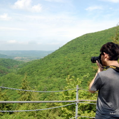
1. From the Massachusetts parking lot, head to the back-left corner of the lot, where you’ll see a small sign directing you uphill to a SCENIC VIEW. Hop on that trail, which will cost you perhaps 10-minutes for the roundtrip if you severely dilly dally.
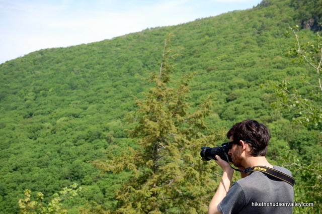
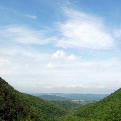
2. Guide wires keep you from tumbling off the edge of the trail. Just head uphill for a couple of minutes and you’ll get to the end of the trail, corralled on all sides by the guide wires. You’re now looking straight down Bash Bish Gorge. Nice spot.
3. After taking in the view, head back down to the parking lot.
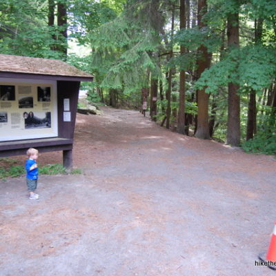
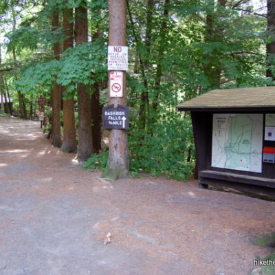
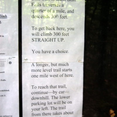
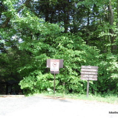
4. With your back to the trail you just came down (you’re now facing the road), turn left and go to the far end of the parking lot to begin your descent to the falls. Some signs and a kiosk mark the entrance, along with a warning that if you’re looking for a flat stroll, you should drive down to the NY trailhead. Since you’re hard core, you’ll just walk right past it.
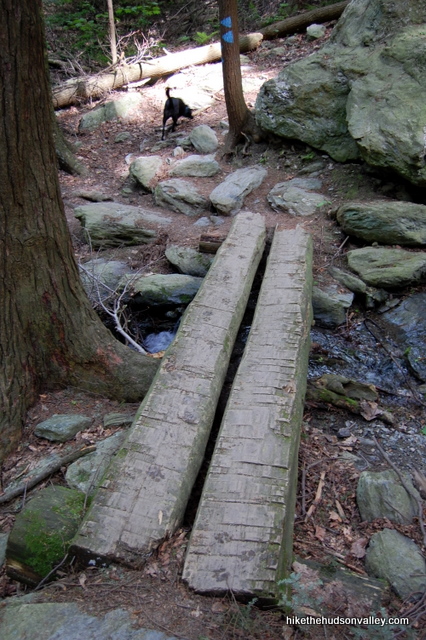
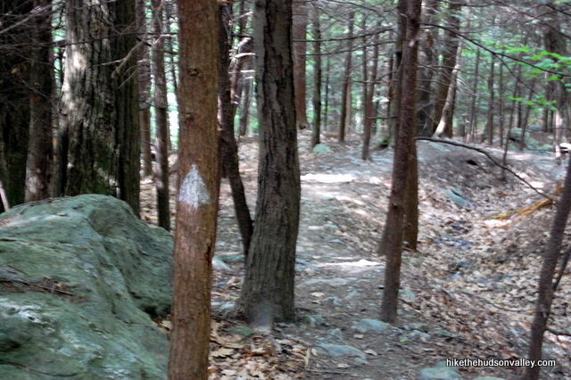
5. Follow the blue blazes downhill, over a cool little bridge that spans a burbling creek.
** UPDATE November 5, 2014 ** According to Jocelyn’s very helpful comment, the trail has been re-routed here since my last visit, and you simply follow the blue blazes all the way down to the falls, without visiting the little footbridge or trail junction pictured below. Sounds like a more straightforward journey now — you can skip to Step 7 below, since Steps 5 and 6 are now obsolete. Thank you, Jocelyn!
6. Less than ten minutes into the hike, you come to a junction with the White Trail heading downhill to your left. With no signage indicating which way to the falls, we guessed that we should stay on the Blue Trail (as did some other hikers there that day), and we were all wrong. Turn left! The White Trail is your friend. Your friend that will bring you to the falls in about five more minutes.
(A sign pointing the way to the falls – which I’m guessing 95% of people at this junction are looking for – might be a nice addition here. That way, morons like me who didn’t read the map at the kiosk won’t get lost.)
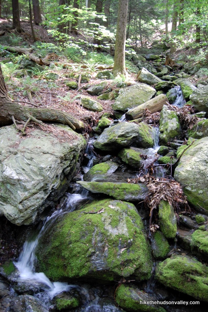
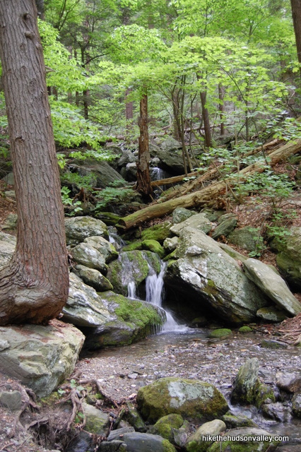
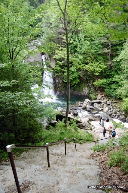
7. Pass some more burbles as the sound of the falls becomes louder. In a few minutes, you’ll arrive at the top of a big staircase that leads down to the falls.
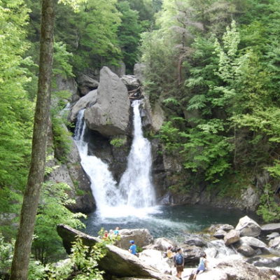
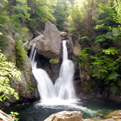
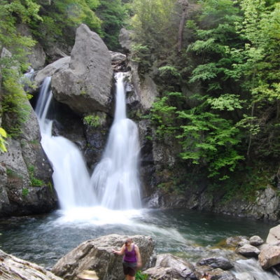
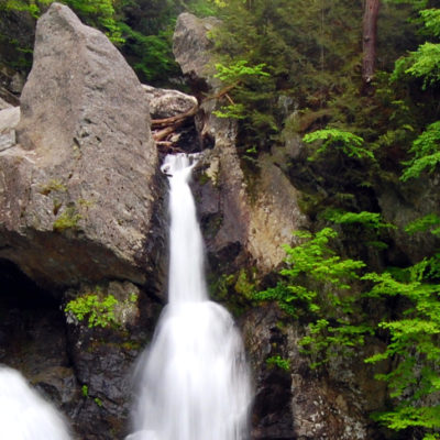
8. Boom. There they are, tumbling past that big rhinoceros rock and falling 60 feet into the crystal pool below.
You probably won’t be alone at this viewing spot, but who cares? A destination like this deserves to draw a crowd.
9. When you’re done lazing about on the rocks and soaking in the view and the mist, retrace your steps to return to your car, taking the White Trail to a right turn on the Blue Trail all the way up, climbing just over 300 vertical feet. Man, was it this steep on the way down?
Directions
Directions to the trailhead: From Millerton, NY, head north on Route 22 for 12 miles. Turn right onto NY 344 (one of several roads also marked as “Old Rt. 22”), and follow signs to stay on 344, which becomes Falls Road as you get close to Massachusetts. In about a mile, you’ll see the Taconic State Park on your right, which is the NY trailhead for Bash Bish Falls (there are often orange cones on the center line here). Continue about one more mile as the road twists and climbs up to the MA trailhead, which is clearly marked on your right after a sharp right curve.
You can also get directions by checking out the Bash Bish Falls (MA trailhead) entry on the HiketheHudsonValley.com Google map. (An easier hike can also be done from the NY trailhead.)
Sorta nearby address for your GPS: The Copake Falls Post Office is about two miles from the MA trailhead, and a mile from the NY trailhead. Its address is:
109 State Route 344
Copake Falls, NY
Just keep heading east on 344 and you’ll be there in a couple minutes.
GPS coordinates of MA parking area: 42.115, -73.49157 (Clicking will open in Google Maps or the Apple Maps app, depending on your browser/device.)
GPS coordinates of NY parking area: 42.11711, -73.50776 (Clicking will open in Google Maps or the Apple Maps app, depending on your browser/device.)
Resources & Interactives
Super-cool (and somewhat wriggly) Google Earth flyover of hike route:
(Also somewhat wriggly) Google Terrain Map of hike route:
Related resources: If you’re looking for actual facts and/or useful information, visit these resources:
- The MassParks Bash Bish Falls page
- The NYS Parks Taconic State Park page
- Some informative Yelp reviews on Bash Bish Falls
- A nice About.com article on the falls
- The brief Bash Bish Wikipedia entry
- Some nice autumn pics on this site
- Another nice shot on flickr
Want to support trails in the Hudson Valley? Here’s one great way: Visit the New York-New Jersey Trail Conference homepage and click on Volunteer, Donate, or Shop! (Then you can volunteer, donate, or shop, depending on your mood.)

Waterfall access has become a thing of privilege for a select few. Almost every waterfall and swimming hole in NY State has been shut down, privatized or blocked off from gaining access. Too many garbage people ruining it for local communities who have been using these places for generations. It’s a real shame, local residents are the ones who are punished. Can thank all the day trippers and low class folks for leaving their trash and treating these places like a cesspool.
I agree with you about the garbage, Perhaps some extra cans would help.
I have been going to Bash Bish since 1976. It is a pleasant, family friendly hike. One year I even did it on crutches. It is disappointing when access to the falls is denied, but the view from the top of the stairs is worth the trip. Camping, picnicking, hiking at Rudd Pond or Copake falls is fun too. The nearby town of Millerton has changed so much over the decades but is still worth a visit. There is a rail trail starting in Millerton that has many wildflowers and cool rocks. There is always a silver lining.
Ive been coming to the falls for over 50 years. First with my parents and now with my family. The situation in 2021 was a disgrace. It looks like you can only visit the base of Bash Bish after Columbus Day. Still a nice hike but something had to be done.
Recent pic, as others have commented, nice having it private.
Thanks for the nice pic and the update, Dave! I hadn’t heard that info about Columbus Day – thank you for sharing. I’ve added a link to your comment in a new update at the top of this trail guide. Very much appreciated!
Came here over the weekend 6/26/21 and yes the falls are barricaded with rangers so no one is allowed anywhere close to the falls. Also I hiked from the NYS parking lot side and rangers were telling people to stay on the trails. I saw rangers kicking people out of the streams as well. I saw some people managed to dip in the stream, but the rangers will find you eventually and ask you to leave the water.
We overheard the rangers saying that Bash Bish will be barricaded until they can fix it up so that it won’t be trashed like last year by people.
Thank goodness the rangers and police are taking control. This is a lovely area but it is not a trash dump nor a place for doing whatever you want. There are rules that help to keep it safe and pristine for all but particularly nature. People travel from many places and have no respect. They change diapers and just throw them in the stream. They bring food and leave all their trash behind. It’s mind boggling that people have no respect and clue on packing out their junk. They take over every square inch and spend the day. This is a short hike in and out area. You don’t hang and swim and litter and carry on in a disrespectful way. Horrendous! I hope things improve and not just here. People need to be more thoughtful.
The changes are permanent due to people leaving there trash and human waste. I live locally, it was in the paper. Last year was the nail in the coffin, ruined it for everybody, thank you very much outsiders.
Don’t paint with such a broad brush. I’ve hiked to Bash Bish many times over the past 47 years and never left so much as a match stick behind. I live 1 1/2 hours away. Remember , “outsiders” bring their money to the surrounding towns. Shame on you. You don’t own the state parks.
UPDATE: June 2021 the Massachusetts parking lot is closed so you have to use the NYS lot. The stone stairs down to the falls are barricade as well with park rangers stationed there, so you can’t swim but you can put your feet in close to the beginning of the NYS trail head. That was still very refreshing on a hot June day. I imagine this is because people were breaking the the rules that this became a safety issue. It does make for make nicer picture without all the people there.
Thank you so much for this update, Marjorie! I’ve added a “SUPER IMPORTANT FIVE-ALARM ATOMIC-WEDGIE UPDATE” to the top of the Background section above, with a link down to your comment. Really appreciate your help to keep this trail guide as accurate as possible!
I’ve seen recent pictures and updates that the MA trailhead is open again, and that the barricades have been removed. I’ll follow suit and remove the warning above. Hooray!
If you hike from the MA side with your less ‘hikey’ friends/family, whatever you do…DON’T point out that you could have hiked in on a flat road from the NY side.
One of my favorite places to visit plus its a easy hike. https://youtu.be/Yy55liBcs7I
Really nice video, Eddie! Good reminders on being conscientious while you’re out there, too. Thanks for sharing!
How long does this hike take from start to finish on the NY Trail head and on the MA Trail head?
You can do the round trip in about 30 minutes from the NY trail head, but you’ll want to spend some time at the falls. From the MA trail head, it should take about 10 minutes down and 20-30 back up, depending on your level of fitness. From the MA trail head, it is a rather steep stairway down to the bottom of the falls.
Thanks for the GPS location info on this post. I don’t think we would have found the NY trail today without it! The trail on the NY side is a beautiful walk on a well-maintained wide trail. It’s a steady incline, not steep, but certainly a slight uphill all the way. The stream is on your right all along the trail up to the falls. The falls are beautiful and well worth the walk. So glad we went!
BTW, I saw earlier posts saying this trail is wheelchair accessible. Don’t know how. There’s rocks and lots of uneven terrain. I would not attempt to push a wheelchair up that path.
Please PLEASE if you go here obey ALL SIGNS. A local man died here recently because he disobeyed the signs. Now because of his death people are claiming Bash Bish is unsafe. It is not unsafe if you’re obedient and use your noggin. Do not swim, do not climb into areas closed to the public. Be smart, and stay safe.
Bash Bish can be rather unsafe, like many waterfalls there is significant risk, even in the non-restricted sections.
I’d have to disagree. I don’t recall of a death here ever, whereas there have been numerous deaths at Kaaterskill. The only time I’ve ever seen anyone slip was in the winter when the steps were icy. I have seen sheer stupidity of people swimming, and people climbing onto high rocks they shouldn’t be on and jumping, but I’ve never seen anything else that would put anyone in danger. Just because it’s a waterfall doesn’t automatically make it unsafe. Rules exist for a reason.
Check your sources, there have been many deaths here over the years. Kaaterskill is also dangerous I agree. Perhaps it would all depend on our definition of unsafe, as there are quite a few rocks and cliffs here to fall from, beyond the falls themselves. Hiking is risky, life is risky, accidents happen, awareness reduces the risk.
Perhaps it’s because none of them were blasted over the media like this one was and that’s exactly why people don’t know that. Awareness and common sense go a long way to keep people safe while hiking but sadly common sense is like deodorant and those who need it the most don’t use it.
There have been several deaths at this falls. Each I know of were because of “human judgment “ or lack there of.
My girlfriend and I went to check out Bash Bish Falls recently. It was awesome! The water was raging and the scenery was beautiful. We made a video in an attempt to convey how great this place is:
https://www.youtube.com/watch?v=87Wvqv6regc
I’m thinking of take a group of people to do this hike on a Friday in October. Is parking on the Mass side going to be an issue if there are 10-15 cars?
I am preparing for my first trip to The Berkshires in September 2016. I will be staying for an entire week. I can’t wait to visit the Bash Bish Falls. Your postings and replies are very helpful. I usually climb Camel Back Mountain in Arizona, but wanted to do something different. I am excited!
Ive been going here since I was a child. to me and many locals, its very special to us for its sheer beauty and majestic presence.
Most of the time I swim in the lower pool, below the main pool, the water is always cold and invigorating. I would suggest to many people not familiar with cliff diving to avoid this waterfall, as it is rather dangerous, the main pool having rocks below the surface, many have been killed or injured here.
Lately Ive visited on weekends and was absolutely appalled by the garbage strewn across the parking lots and grounds. eventually this may lead to shutting down the grounds for us all,depending on the action of the state.
I find it very depressing to witness these sacred falls being treated like a state funded playground, please have respect for this land.
Thank you for posting this. It’s a fond childhood memory for me.. So sad to hear about the trash. No respect. We must preserve our beautiful earth.
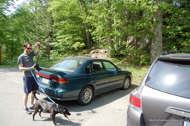
Would like to take my dog on this hike. Are they permitted on the grounds – on leash of course.
yes they are, on a leash.
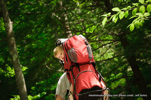
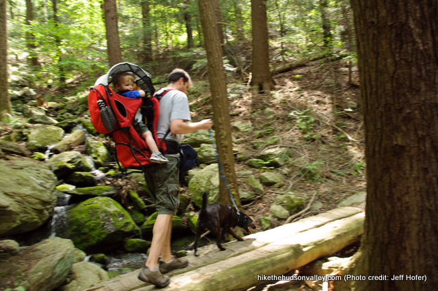
Thanks for sharing!! we’re planning to do the hike with our 1 year old (with a hiking baby carrier). I saw your picture and it looks doable. what trail should we take? can we manage to do the steeper one? We are in good shape but don’t want to take risks… TIA!
The lower trail is wheelchair accessible. It is not paved but flat with just a few places that are a little rough. The upper trail down to the falls involves a steep stairway that is roughly the equivalent of a three story building. It also involves clambering over some rocky places.
Thank you for the info. We will stick with the lower trail.
I agree with Chuck — no need to tackle the steeper one if you’re at all worried. Both trails go to the same beautiful destination, so enjoy the stroll from the NY side and save up your energy for chasing your 1-year-old around when you get home 🙂
Is the NY trail relatively flat and WheelChair friendly?
I believe it was fairly flat from the NY trailhead to the overlook where you could see the falls. Then there were stairs down lower. I don’t remember how wheelchair friendly the trail was, whether it was paved or rocky.
can’t you go up and around the falls ?
Perfect instructions as usual. Thank you for doing this!!!
Thank you!!
Is swimming allowed/possible here?
The area is posted No Swimming, which is universally ignored. There is a large pool at the base of the falls which on a warm summer day, has a lot of people in it. Others walk a short ways down the brook and swim in the pools below. Did not see any attempt to enforce the rule.
During the summer, the no swimming rule IS enforced by park rangers and police. Typically only on weekends though.
Hi! Thanks for this write up. I have a 3 year old and he often walks the shorter hikes or does a combo of walking and on my back. Was this a relatively safe hike for little ones?
Yes, it was. My little one stayed on my back for the entire trek, but he could have handled most of it just fine. If you wanted to play it safe and give your three-year-old more of a chance to roam, the New York trailhead would probably be a better bet. Hope that helps!
Great. Thank you!
Great directions! I visited on 18 Oct 2014 and went from the MA side. I would not have noticed the overlook if you hadn’t mentioned it. The fall colors were in full swing and amazing. At first I thought I was out of luck because there was a sign part way up that said the trail was closed. I followed the guide wires to the right and got to see that beautiful gorge!
I think they may have changed the trail a bit leading from the MA parking lot to the falls. I didn’t see any white blazes or a wooden bridge. The whole trail down to where it meets up with the NY trail is blue blazed. Once you get to where the two trails meet up (you can see the falls from there) you can see what might be the remnants of an old trail but it doesn’t lead anywhere. On the way back there is what looks like a street sign post pointing up for the MA lot and to the left for the NY lot. Very easy to find your way!
Jocelyn — thank you so much for the updated info! I just put an update into Step 5 above, linking down to your comment (also put a small update into Step 9). Really appreciate your help to keep this guide current!
Very cool place that I wouldn’t have known existed without this website. I was feeling a little less than hardcore (I worked the night before) so, I took the easy way from the New York parking lot, which is a pleasant walk through the woods right along the creek. There were quite a few other people there when I went and I went mid-day on a Friday so I imagine that’s its pretty packed on a weekend, but totally worth it.
Hi,
I am interested in coming up for a weekend with my family. The group would be six adults and six children. Is there a house or hotel on the property or near by that you would recommend?
I appreciate your help in identifying a place to stay at.
Best,
Tracy
Hi Tracy! Sorry for not getting back to you sooner on this one – I’m afraid I don’t have any recommendations. I’ve just come up here for day hikes, never stayed over. I bet the Parks Service could be of assistance, though – they’re right next to the falls. Contact information here: http://nysparks.com/parks/83/details.aspx
Hope you have a great trip!
Thanks, this is very useful, as I couldn’t find a trail guide at the Bash Bish Falls State Park site.
Planning on doing this hike next week, concerned about hunters. Please advise regarding this matter.
Thanks
I’m by no means an expert on hunting rules and seasons, but this article give some good advice and links for being safe out there: http://www.usatoday.com/story/travel/2013/09/24/hiking-hunting-season-safety-tips/2854437/
Hope you have a great hike!
This is one of the most helpful guides in planning my visit to Bash Bish Falls!
Glad to hear it, Laura – thank you! Hope you had a great visit.