Background
If you find this free trail guide useful, please provide payment by picking up at least one piece of litter on your hike. Cha-ching! Thanks for being awesome! (And here’s a quick primer on Leave No Trace, too, to help us keep the trails nice and fresh for each other.)
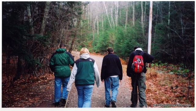
Background you can feel free to skip: “Hey, I just put you in the banner graphic for the Overlook Mountain hike,” I told my friend Johnny (far right in the image above) on the phone last night.
“Oh, that place was cool,” he said. It had been a decade since he’d been there, but he remembered it right away. A day spent at Overlook Mountain (and in nearby Woodstock) is a day you won’t soon forget.
This is especially true if you take a few minutes to hop across the street from the trailhead to visit the Buddhist temple, which looks like it was ripped off a Tibetan mountainside and plunked down here in Woodstock. There’s a gift shop there, so you don’t need to feel like you’re intruding. You can find more information on the temple’s homepage.

The last time I was there (several years ago), a very nice man poured us tea and chatted us up for a while. I’ve always found this to be a very friendly place, and they’ve always been inviting to me and my friends, even when we’re grubby from hiking Overlook.
But back to the hike itself: I’ve been tossing and turning at night about giving Overlook Mountain the full 5-camera scenery rating. Does the view on top knock both socks off (which would make it 4.5 cameras), or does it literally make love to your eyeballs, qualifying it for the full 5-camera score?
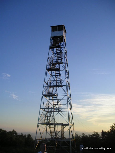
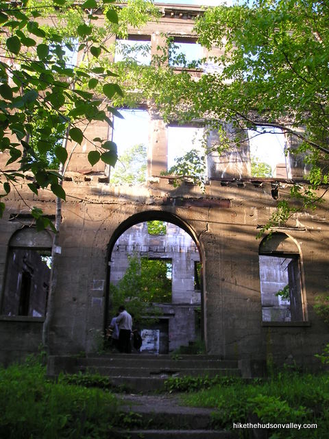
By any measure, the Hudson Valley views from the cliffs on Overlook are incredible, and the fire tower and old hotel ruins on top are icing on an already awesome cake.
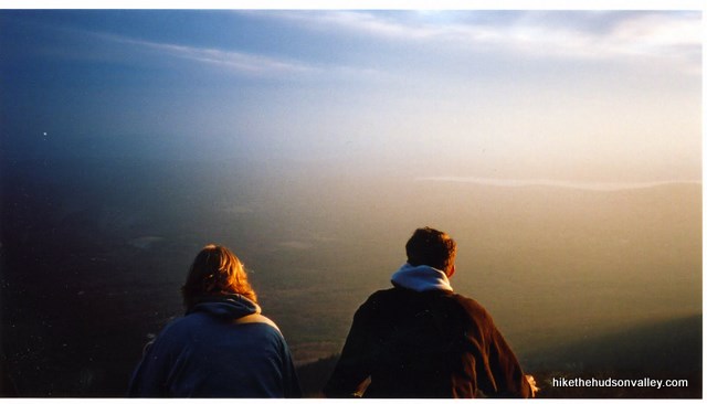
My only hesitation is the trail itself, which is kind of a drag. It’s an old gravel road (with power lines overhead) that you just slog straight up the whole way. It’s fine, really, but not as nice as a well-worn trail through the woods. If you complained about the gravel road up Overlook Mountain, you most definitely wouldn’t be the first.
Still, the top of Overlook is such a festival of awesomeness that I’m going ahead and giving it the 5-camera rating it deserves. Anyone who complains about the road up the mountain (which is pretty much everyone) should immediately stop whining when they arrive at their destination.
Combine a hike up Overlook Mountain with a visit to the temple and some grub at one of Woodstock’s unique eateries, and you’ll have put together a very nice day for yourself. Hopefully, one you’ll still remember fondly a decade later.
**Update 8/28/14** As Ashley reminds us in the comments, this trail runs right through rattlesnake habitat. I’ve climbed this mountain maybe a dozen times and never seen one here, but they’re apparently quite common – be sure to watch where you’re stepping! We want this hike to be memorable for the right reasons.
**Update 9/24/16** I just received this Facebook message today from a local hiker: “Beautiful view but no parking and Woodstock is writing tickets for $150 for illegal parking. Parking lot holds 15 cars and the other 30 cars got tickets as they rotate thru every 3 hours.” If you can hit this hike at an off time (weekdays or very early on the weekends), sounds like you’ll be much better off. This is a very popular spot, as well it should be.
**Update 7/2/18** Well, this should help with the parking situation: New trails, parking area open on Overlook Mountain in Woodstock. Great news!
Trail Guide
Bonus unsolicited advice: Don't depend on having cell service in the woods - it can be spotty out there! Download this trail guide to your phone before you head out. (It's easy to do on iPhone and Android.) May your connection to nature be strong, even when your connection to the internet is weak.
1. From the parking area, sign in at the kiosk and head up the road/trail.
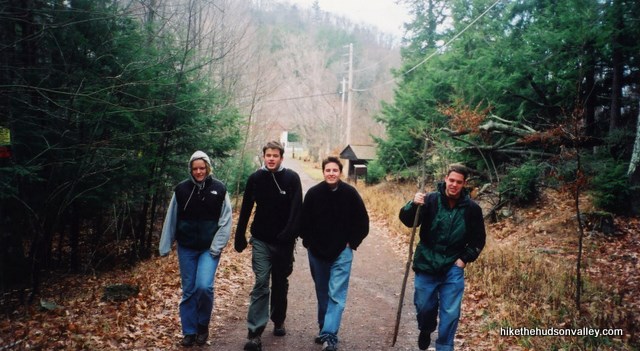
2. Keep walking up the road.
3. That thing you were doing in Step 2? Keep doing that.
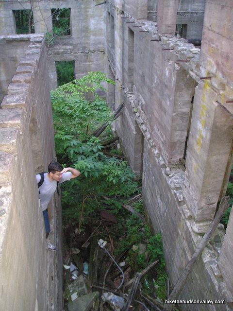
4. Finally, just when you start wondering why you couldn’t just drive up this road like a sane person, you’ll come around a bend to see the shell of the old hotel looming in front of you. The last time I was here, they’d recently put up some signs telling people to stay out of the ruins. I don’t want to be responsible for a chunk of concrete falling on anyone’s head, so please abide by any signage you see. Still, this is quite a place to behold. If I was a ghost, this is probably where I’d live. You know, if I existed.
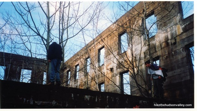
5. Once you get done checking out the hotel, keep heading up the trail. Shortly, you’ll come to a well-marked fork in the trail. Go right to keep heading towards the Overlook summit. I always think of the hotel as the top, but there’s still a little way to go before you reach the fire tower.
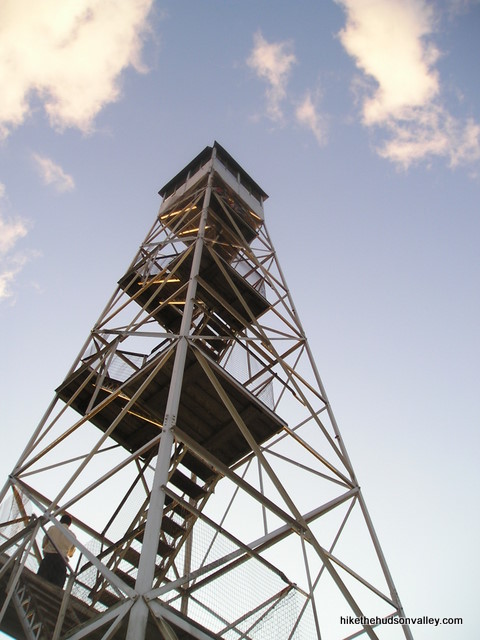
6. And suddenly, off to your left, there it is: the big ol’ fire tower. I usually like to save a climb up the fire tower for last. If you can’t stand it (or if you arrived at a moment when you could actually have it to yourself), go ahead and give it a climb. For everyone else, though, let’s keep heading to the cliff overlook first.
7. You’ll see a small ranger station just past the fire tower (there are some nice museum exhibits in that building, if it’s open when you show up). To the right of this station, follow the trail a short distance back to the cliffs of Overlook Mountain. It’s sad to think that some people come all this way to miss this little trail back to the cliffs, which are really the main event. At the cliffs, have a nice long sit and enjoy the view (and be extremely careful – there’s a considerable drop here).
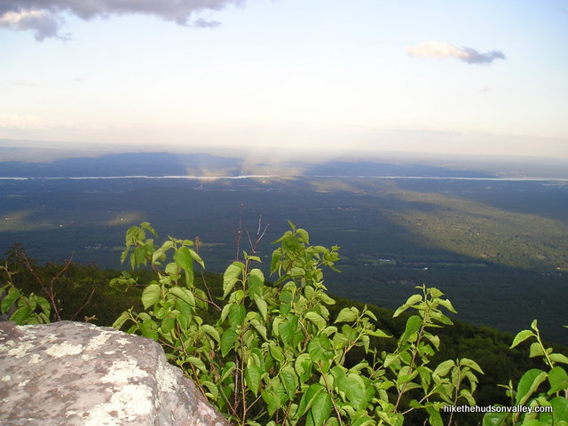
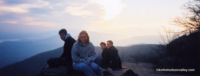
In the rock, you’ll see some etchings from hikers past, back when they knew how to do graffiti right. See if you can find any carvings more than 100 years old.
8. Once you’re done at the cliffs (and hopefully you had time to stay for a while), head back to the fire tower. If you haven’t already, give it a climb and enjoy the awesome views.
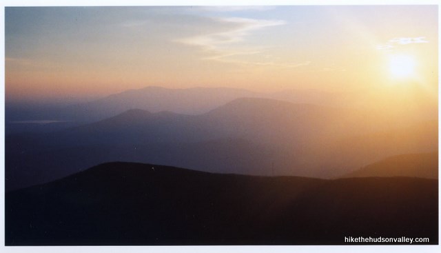
9. When you’ve sufficiently explored the tower, the hotel and the cliff views, head back down the way you came. That was a 5-camera hike after all, wasn’t it?
Directions
Directions to the trailhead: From the village of Woodstock,head north on County Route 33 (Rock City Road). This turn is smack in the center of town, and it’s a right turn if you’re coming into Woodstock from the east on Rt 212. Stay straight on this road through the intersection with Glasco Turnpike (really, this is a turnpike? I think some folks in Jersey might disagree). You’re now on Meads Mountain Road, on which you’ll stay straight as it climbs and winds its way up the base of Overlook Mountain (cheerfully doing much of the work for you). When you see the huge Buddhist temple on your left (about 2.5 miles after the village of Woodstock), look for the trailhead parking area on your right.
You can also get directions by checking out the Overlook Mountain entry on the HiketheHudsonValley.com Google map.
Address for your GPS: The Karma Triyana Dharmachakra temple is directly across the street from the Overlook trailhead. Its address is:
335 Meads Mountain Road
Woodstock, NY 12498
GPS coordinates of trailhead: 42.07106, -74.12255 (Clicking will open in Google Maps or the Apple Maps app, depending on your browser/device.)
Resources & Interactives
Related resources: If you’re looking for actual facts and/or useful information, check out these excellent resources:
- Yelp reviews on the hike
- Another Overlook hike write-up on LocalHikes.org
- HudsonValleyRuins.org’s write-up on the Overlook Hotel
- If you’re interested in getting a bite to eat afterwards, here’s an official Woodstock restaurants page
- A very helpful Kingston Freeman article on the new (as of 2018) trails and overflow parking area: New trails, parking area open on Overlook Mountain in Woodstock
More Overlook Mountain pictures from the hike’s Picasa album (with a special thanks to my buddy Jered Earl “Chunks” Widmer for providing many of these photos, including the banner image on this page):
Was this trail guide useful to you? Please leave a comment!
Want to support trails in the Hudson Valley? Here’s one great way: Visit the New York-New Jersey Trail Conference homepage and click on Volunteer, Donate, or Shop! (Then you can volunteer, donate, or shop, depending on your mood.)

I just did this hike on Easter Sunday and it was amazing! So similar to Mt. Beacon, in the steepness and also that there’s a fire tower and an abandoned building at the top. Don’t forget there’s a little Orthodox chapel right next to the monastery.
This is such a useful website, thank you.
Thanks so much for the tip and the kind words, Lila! Very much appreciated.
I love your site! We travelled to the Catskills area this past weekend and did this trail with our 3 year old twins in tow.
Now, hiking with whiny toddlers is no joke, and they were in the carrier some of the time, but they really liked the old hotel and the fire tower, which they climbed all by themselves. Unlike me, they seem to have 0 fear of heights at this point, so while they and my husband looked around enthusiastically saying “look at the view” at regular intervals I was sitting on the floor of the fire tower eagle’s nest, with my head between my knees. Still, worth it!
I would say that this hike took a lot of investment up front to get to something interesting and worthwhile – the climb to the hotel is very monotonous. It’s just a path that goes up and up, without any scrambling or climbing, and there aren’t any mid points to stop and see the view. We did the Bear Mountain loop (up through the Major Welch trail to the Perkins Memorial tower, down the Appalachian Trail to the Inn), and that one was harder but had a lot of variety, both in terrain and surroundings.
Love your site, never take it down!
What a nice comment, Helen! Thanks so much for all the nice feedback! Yes, this hike is indeed a slog – that stretch from the parking area to the hotel is probably the least-liked section of trail in the Hudson Valley. But man, what a payoff for enduring that slog! Your toddlers sound very brave, and you sound very brave for these big hikes you’re doing with them. Many more happy adventures to all of you!
Does anyone know if it is possible to hike the trail this coming weekend? Feb 27th, 2021? The weather predicts snow/rain, but it will be our only time in the area and we really want to check it out. Does the trail close? Or will we be able to access it even in inclement weather.
Hi, Sophie! The trail should be open this weekend, even with inclement weather (I would expect an unplowed parking lot to be an issue during or immediately after a storm, but not the trail itself closing). You will most likely need microspikes up there with all the snow/ice we’ve had. Otherwise, I hope you have a wonderful hike and have some good luck with the weather! (There’s a great Facebook group called “Catskill Trail Conditions” where you may find more up-to-the-minute information on this hike or others nearby: https://www.facebook.com/groups/CatskillsTrailConditions/. Good luck out there!
As of today (April 7, 2020) during Covid/Corona, this trail is open!
Hi. In the Directions above you wonder why Glasco Tpke is called a Turnpike. From the end of the 18th c. into the early 20th c. Turnpikes were private corporations who built the roads we now take for granted. They were toll roads that had gatehouses with a wooden barrier that would be lifted & turned to allow passage after one paid their toll. Originating in Britain, Americans soon used the spirit of freedom, business savy and cooperation to build & maintain roads that today we take for granted.
Hi! We’re planning on hiking the trail this weekend 1/19/19. What are the weather updates for this trail? Is it currently snowy and muddy? How long does this trail take? Any advice on what to wear during the winter? And lastly, what’s the best time to arrive?
I went last Sunday, Jan. 13, 2019. It was an icy trail all the way up and I slipped all the way down. When I arrived at 11:00 am at the second, lower parking lot it was 18′ F and went up to 25 when I returned at 2:30 pm. Get there early so you don’t run out of day light and have time for rest periods and sightseeing.
Hi there, we’re planning on going (by bus from NYC) to Woodstock for a few days at beginning of Oct, just wondering if it’s possible to walk from Woodstock to the start of the hike as we’ll not have a car whilst we’re there. Thanks for any advice
Yes….but….it’s a 2 1/2 mile walk up Rock City Rd/Meads Mountain Rd to the trailhead, and then the trail is an additional 2 1/2 miles to the fire tower.
Made it to tower but it is sealed shut at top! Boooooooooooo lol
Ev…stumbled upon a trail..dont recall a gravel lane. We were a group of 5-6 kids so the drizzly rain was ok at rhat age. Do recall snakes .. 1 or 2.. Dont recall climb being steep..the higher we went the foggier
it became…we kept plodding along unphased until the fog disappeared & the sun revealed the “castle”!
After 60+ years everything about that particular experience is clear as day. We went back down the trail
only because the rain became torrential & accompanied by lightning. Would love to ezperience that surreal feeling of rain abruptly stopping, sun bursting ro expose the ruins of a hotel,sadly not a castle.
At 82 years w copd, most of those friends dead, im not likely to repeat it. Thanks for the memories that day brought back..
Just did this hike today! There were 2 Timber Rattlesnakes on the trail. Tough trail with a 5, 8 and 12 year old. They kinda hate me now, but I’m hoping that 20 years from now they will think back to how amazing it was! I would do it again, but I would leave the kids at home.
Hello,
Is there an email associated with this mountain overlook or is this the best way to contact the site manager? I’m interested in having a short sweet wedding ceremony at this site and am curious whether or not this would be possible- either to rent for a few hours, the day, or to do it on a regular day with whomever else is there enjoying the mountain. We are extremely open and flexible and would love to get married here in any capacity if this is at all possible.
Maybe try this…
◦DEC Region 3 New Paltz Office: (845) 256-3000 (M-F 8:30AM – 4:30PM); email: [email protected]
I’m so sorry I missed this comment, Laura! I’m afraid I’m just a dude with a website, and have no authority here (or anywhere else, really). Hope Jeff’s suggestion helped you out when you needed it! And if you’re married now, congratulations! Hope it was (and continues to be) awesome. (And thank you, Jeff!)
Hahaha thanks so much Jeff. Yes! Just married in the Catskills.
Congratulations! So glad to hear you found a way to make it work. Happy adventures to you both!
We camped in the area last summer, but didn’t manage to get any hiking in. This time we did Giant Ledge and this long hard slog up the jeep road to look over the overlook. Since the road is fairly exposed, be prepared for the sun if you go around noon, before or after that…follow the shade. I’d rate this lower than a 7, but maybe just by one. It IS all climb, but none of it is very steep, just steady. My 12 year old son had ankle issues on the way down. Make sure you don’t miss the actual overlook behind the ranger station. It is spectacular. If fire towers are not your thing, you should at least climb a flight or two, that is enough to give you a pretty amazing view. It’s also (to me) less knee-knocking than standing on the edge and worrying that your petrified 8 year old daughter is going to tackle you from behind and send you both to your deaths.
If you happen to be toting your elderly Mother-in-law (or any other non hiker types) the monastery is a good place to dump them for a few hours…I mean…well you know what I mean.
Is there any way to get here taking the metro north?
No.. too far north
No, for one it’s west of the hudson, but other than that the Metro North only goes as far as Poughkeepsie on the Hudson line. You can take an Amtrak to Hudson, NY, or take the Metro North to any stop that might have a car rental office. I know there’s Uber around there but I don’t know how much an Uber from the Poughkeepsie MTN to the trailhead would be.
You can take an Adirondack Trailways Bus into the center of Woodstock, but then need to get (either by cab or on foot) to the top of the road where the trail starts.
Trailways Bus goes from Port Authority or White Plains, with other stops along the ways also.
Has anyone tried climbing in winter with snowshoes/crampons, and skiing down? Trail seems wide enough, possibly steep enough as well. A buddy of mine and I would like to try some downhill skiing through this trail (not xc skiing), although it would probably require some heavy snowfall. Any information would be helpful!
The trail is extremely steep and rocky and has a lot of very sharp turns. May be difficult to ski down, a snowmobile might take it okay as long as the person driving it knows what they’re doing. I just imagine the ski getting caught on a hidden rock right under the snow and causing a terrible accident. That’s if we get a snowy winter, this past year we hardly had any snow at all. But there are random area’s in the trail where you’re basically climbing over boulders so the thought of skiing down seems frightening.
We climbed up this past winter without crampons which was a bad idea. The trail is heavily used even on the coldest of days so the snow became a packed down slide. So difficult going both up and down. We fell on our butts the whole way down and wished we could have brought a sled to get to the bottom.
I was thinking of hiking to the echo lake lean to in early June. How dangerous is the rattle snakes? Has anyone been bitten while hiking the trail recently?
I haven’t been recently, but I have been several years ago. Never saw a rattlesnake. Thought I may have heard a bear while I was sleeping in my tent.. so make sure to hang your food away from the site. An owl came by to make some amazing calls and the echo at the lake is amazing! Enjoy!
Took this hike yesterday since we’re dealing with unseasonably warm weather. I figured it would be a good opportunity to get out and enjoy nature while being a little disappointed that we’re not cold yet (snowboard season…)
The hike is definitely rated properly, 7 out of 10 made a lot of sense. The first two miles are fairly uphill, and will definitely get your blood flowing. It’s a Jeep Trail, so it’s not really that exciting of a hike, but once you hit the abandoned hotel, everything just seems easier since you know you’re close to some amazing views.
I was lucky enough to be following the write up, and took the extra (literally less than tenth of a mile out to the cliff look out point — Wow. What an awesome view. I tend to have these moments where I’m prepping myself for a great view, and then once I get to it and actually see the view, I just start laughing. This hike provided one of those moments. I just sat down on the cliff an laughed to myself thinking about how lucky I am to have found this site, and to have found a new interest in Hiking. — The view was so awesome that I decided to facetime the LADY since she didn’t want to make it out for this hike.
I went back to the Tower and climbed to the top only to be greeted with a chain locked door. While that did suck, the view up there is again — just awesome. How can you not like sweeping views in every direction from the foot of the Catskills?
The hike took around 2 hours total, was definitely a good workout, and had some really great views that I’m happy I was able to take in.
If you’re a person who likes hiking with your dog, and you’re not planning on climbing the tower, this is VERY dog friendly, I must have seen 15+ of them on the way up and down. All sizes too, even a 4lb Yorkie!
Hi! I love this site.
I am thinking about taking this hike in early March. Do you think this hike will be appropriate for that season? (Not that we ever know what the season will be like!)
Thank you!!
Thanks so much, Becky! After this mild winter, you’d probably be A-OK, but here’s the best place for accurate, up-to-date info on Catskill trail conditions: http://www.nynjtc.org/content/catskill-trails-updates
Scroll all the way down that page to see the week-by-week updates. Hope that helps – happy adventuring!
Pingback: Overlook Mountain - ESCAPE BROOKLYN
Thanks for the nice write-up. I haven’t been back on Overlook for quite a few years but have always enjoyed it. It’s been kind of hot down here by the river in Kingston and I’ve been thinking about a hike back up to get cool. You’ve convinced me.
PS. Yes there are a lot of rattlesnakes in the woods there. They stay away from the trails but can be found off-trail and tend to quickly get out of the way as long as you don’t surprise them, so make lots of ‘man sounds’ if you bushwhack. If you do want to see one, The best time I found was early morning on the top near the big rocks near the tower. A few sometimes come out to warm up in the morning sun. They’re pretty docile then because they are cold. Look, but just don’t crowd one.
Thanks for this info, which inspired us to check it out today. It was awesome! We took our two pups off leash and they loved it. Didn’t encounter any snakes, thankfully. Had a snack at Vegeterranean Grill afterwards, also dog friendly.
Went up there earlier today, 04/18/2015. Great weather (lucky) to hike up to the Fire Tower and breath-taking views. It may be a bit strenuous if you are not in good physical shape, but you will love going all the way up. No doubt about it.
need the exact address for GPS
Greetings, Grissel! Check out the “Address for your GPS” section above, and you’ll be rocking and rolling. Have fun out there!
Our family takes several non-hiking trips to Bear Mt. during the year and we always drive to the top. If you’re pressed for time (or physically unable) and need a ‘summit fix’ then this is for you.
Hi Jeff, so are you allowed to drive this carriage trail?
Not to Overlook, no. But you CAN drive to the top of Bear Mt.
http://www.myharriman.com/drive-to-the-top-of-bear-mountain-state-park/
http://nysparks.com/parks/13/details.aspx
Pingback: No turning around | Adventures in a Red Blazer
Pingback: Camping in the Catskills | Ultimate Bridesmaid
Hello!
This is great, thank you! I have a question. My husband and I are headed up there this weekend. I am 8 months pregnant with twins so will not be hiking. Is it possible to drive to the peak and meet him? Or, do you know any other hikes around Woodstock where this is possible?
Thank you!
Bonnie Jeanne
Hi, Bonnie Jeanne! Congratulations on your impending arrival! I’m afraid that’s not possible here, and I don’t know of any place near Woodstock where you can drive to the money spot. If you’re geographically flexible, you can drive or hike to the summit at Bear Mountain State Park (which is why I haven’t included it on this site — I have a hard time getting too psyched to climb a mountain that has minivans at the top). You can find more info on that destination here: http://www.myharriman.com/drive-to-the-top-of-bear-mountain-state-park/ (it’s about 70 mins from Woodstock, though, so I don’t know it that’ll do you any good. The view is awesome, though!) Hope that’s helpful — good luck with all your upcoming adventures.
Are dogs allowed on this hike? Thank you for your work here!
Which direction does the summit facing ? Does it have good views of sunrise / sunset ?
Hi, Dev! The view from the cliff faces pretty much directly east. I have two young kids, so I only see sunrises involuntarily, but if you’re the kind of person who seeks them out, this would be a wonderful spot to do it. You’d also be able to catch the sunset from the fire tower (see the pic in Step 8 above, which was taken from the tower). Hope that helps!
Is this hike toddler(3 year old) friendly ? Need ideas on how to make it happen with my 3 year old.
Mira,
If you’re carrying said toddler, and you’re in very good shape, then you should be all set — there’s not really any tricky terrain to worry about, just a long, uphill (then downhill) slog. Good luck if you give it a go!
the hike was definitely worth the view!
Glad to hear it, Peggy!
This trail runs through a rattlesnake habitat. Several were spotted on my recent visit!
I updated the trail guide with a link down to this comment. Thanks for the heads-up!
Love this hike during any season, must make the trip up to WS again soon