Background
If you find this free trail guide useful, please provide payment by picking up at least one piece of litter on your hike. Cha-ching! Thanks for being awesome! (And here’s a quick primer on Leave No Trace, too, to help us keep the trails nice and fresh for each other.)
**FIVE-ALARM, ATOMIC-WEDGIE TRAIL ALERT!!!** As of this writing in March 2024, the trails outlined in this guide are still closed due to massive storm damage in the summer of 2023. The closure map is posted here. If you hear that they’re open again, please drop a line in the comments and I’ll remove this warning. Thanks! (And special thanks to alert hiker Adil for the heads-up in the comments below.)
Background you can feel free to skip: For years, Bear Mountain State Park was a notable omission on HiketheHudsonValley.com, serving as arguably the most quintessential Hudson Valley hike not yet documented here.

While the views here are undeniably, famously gorgeous, it was hard for me to build up too much steam to write a trail guide for this hike, for this reason: right beside the beautiful view, there’s a big, fat, busy parking lot.
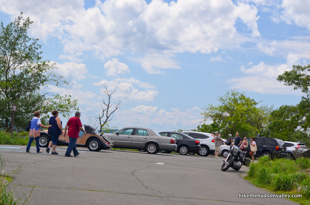
After you’ve spent the afternoon busting your hump to climb a mountain, you know what you don’t want to see at the summit? Minivans. Harley-Davidsons. Flip-flops. Crowds. Vending machines. (Okay, maybe the vending machines are okay.)
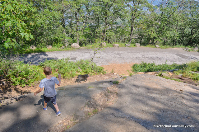
“Look at all the cheaters up here!” my eight-year-old son said, dripping with sweat, as the trail led us into the parking lot. We’d only seen a handful of other hikers on the way up, but the summit was teeming with humanity. And vehicularity.
“Shhhh, buddy, time to stop calling them ‘cheaters’ now,” I whispered.
Sharing the summit at Bear Mountain with your fellow humans is a part of the deal with this place. There WILL be people up there. And really, why shouldn’t there be? What an amazing place. It deserves to draw crowds, and there’s plenty of room on that rocky bluff for everyone. Even the cheaters.
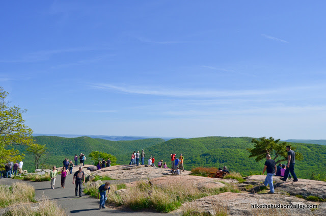
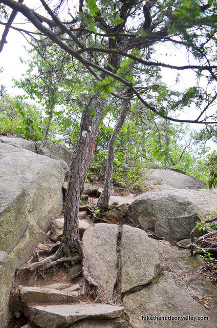
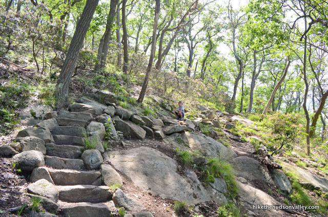
If you skip climbing Bear Mountain just because of the parking lot, you will be doing yourself a terrible disservice. This is a phenomenal hike with fun rock-clambering, multiple wonderful views (some more secluded than others), and some of the most insane trailwork I’ve ever seen.


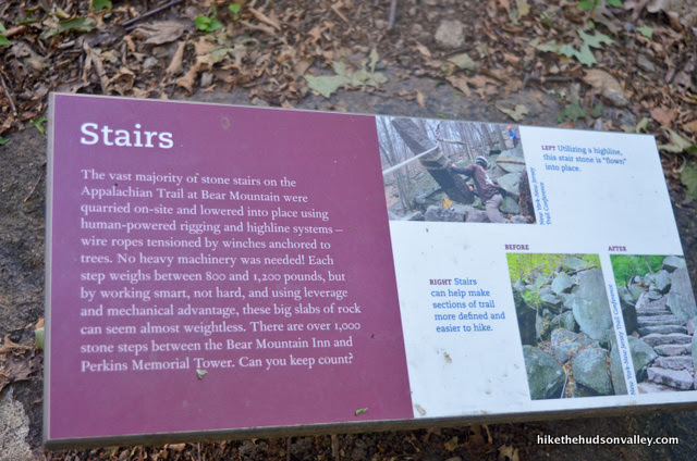
According to signage along the trail, the section of Appalachian Trail that you’ll traverse on your descent features over 1,000 stone steps, each one painstakingly installed without the use of heavy machinery. This trail section is a marvel of ingenuity, engineering, and backbreaking manual labor, and we are all indebted to the people who did this work. (According to this Bear Mountain Trails Project page, it was the always-awesome New York-New Jersey Trail Conference, in cooperation with several other super-cool groups, that made all this awesomeness happen.) To everyone who created this trail, thank you for making the Hudson Valley a better place to live, visit, and explore!
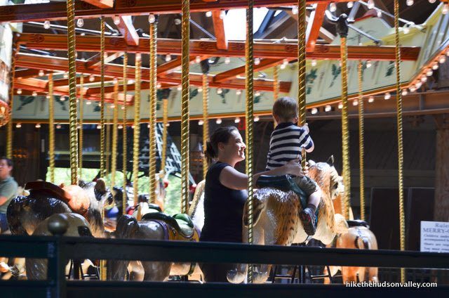
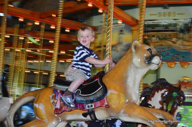
Besides the awesome hiking, this park also offers many other activities. When my family visited Bear Mountain several years ago (we drove to the top that time, because, well, we had little kids and, hey! Stop judging me!), we also visited the Trailside Zoo and the rockin’ carousel.
You could also take a short walk to the Popolopen Creek Suspension Footbridge, or rent boats on Hessian Lake, swim in the pool, go ice skating in the rink (current rates for those activities on the Bear Mountain homepage), or grab some grub at the restaurant or the hiker’s café at the Bear Mountain Inn. Many people just lounge on the lawn and enjoy the views of Anthony’s Nose looming across the river, too.
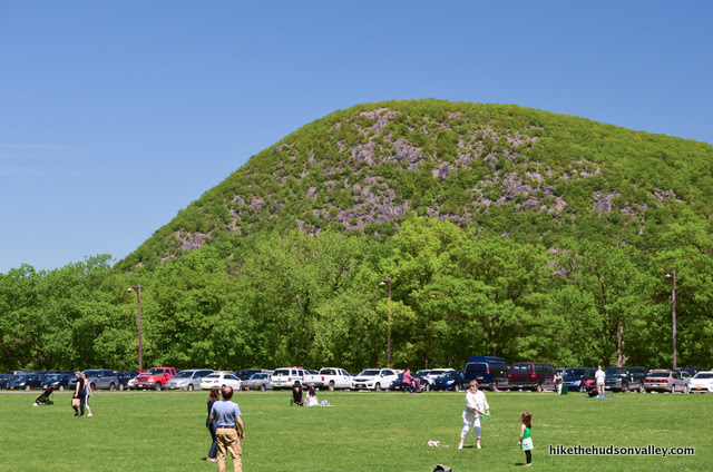
There’s plenty to do here, so whenever you visit, expect to have some company. You may do better to hit this hike on a weekday – the parking lot can fill up on nice weekends. (I drove by Bear Mountain on the Fourth of July, 2017, and it was a madhouse. People were parked illegally all over the place, including the center of the roundabout at the Bear Mountain Bridge, and were being ticketed accordingly. Dudes were dragging coolers across three lanes of traffic. Some families were picnicking in the median! Definitely do NOT try to do this hike on the Fourth of July, unless you enjoy having the worst time of your life.)
The park opens at 8am year-round, so if you’re visiting on a nice weekend, you’d be well-advised to get there as close to 8am as possible.
Once you’re on the trail system, too, you may find some depressing reminders that some people just aren’t as cool as you and me. My pack and pockets were full of other people’s trash by the end of the day, and I only scratched the surface. Humans: So cool sometimes, so not cool sometimes.
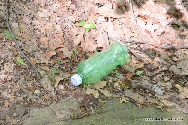
But even with the sea of humanity that you may find elsewhere at Bear Mountain, and the all-too-frequent litter, the trails and scenery here are truly beautiful, are quite secluded in many spots, and should be on every local hiker’s to-do list.

My only regret about hiking Bear Mountain is that I didn’t do it sooner. If you’ve never been, or maybe even if you have, you should put this hike into your rotation. And just think how much gas you’ll save by not just driving to the top!
Trail Guide
Bonus unsolicited advice: Don't depend on having cell service in the woods - it can be spotty out there! Download this trail guide to your phone before you head out. (It's easy to do on iPhone and Android.) May your connection to nature be strong, even when your connection to the internet is weak.
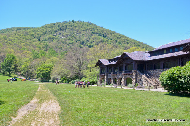
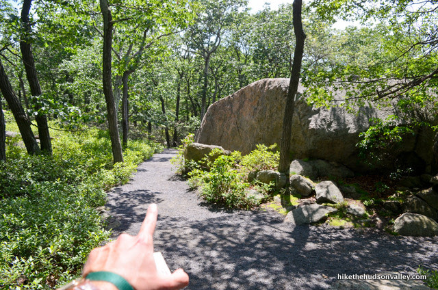
1. From the parking lot (see “Directions to the trailhead below”), cross the field to the left of the Bear Mountain Inn, either by walking across the field itself, or by tromping on the sidewalk that wraps around the inn.
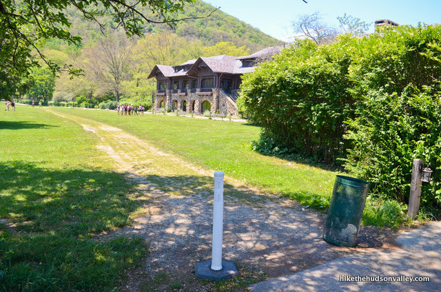
There’s a paved path behind the inn that keeps heading directly away from the parking lot, toward several other paved trails back in the woods. That’s where you want to be.
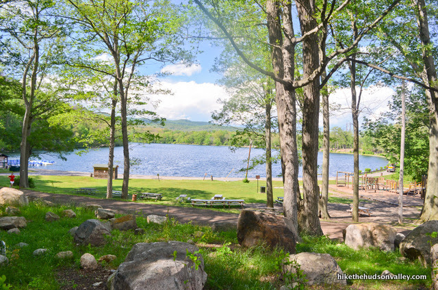
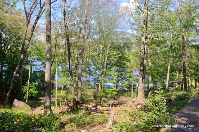
As you venture back there, you’ll see picnic areas and Hessian Lake on your right (don’t turn toward the lake).


On your left, you can see across the field to the awesome carousel building.
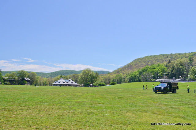
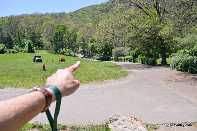
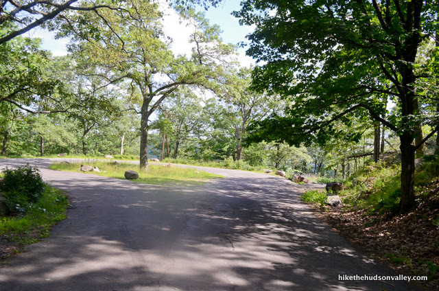
Straight ahead, you’ll see the junction where several trails converge. Hop on up to that junction, assuming you don’t get a better offer to crash a picnic along the way.

2. This junction marks the start (and end) of our loop for the day. We’ll be hopping on the Major Welch Trail to ascend Bear Mountain, and coming back down on the Appalachian Trail.
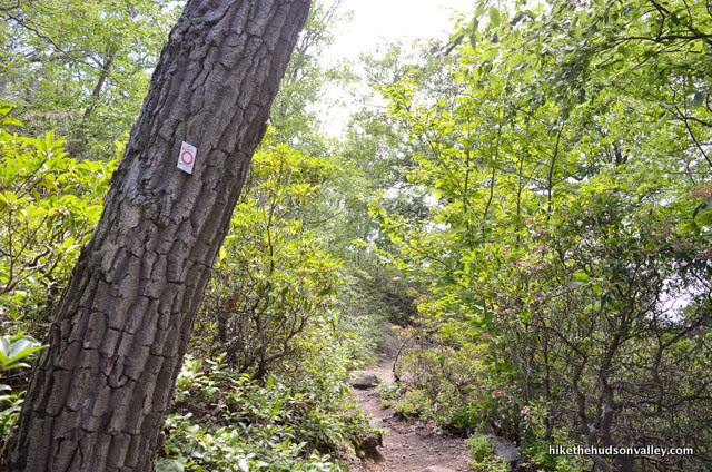
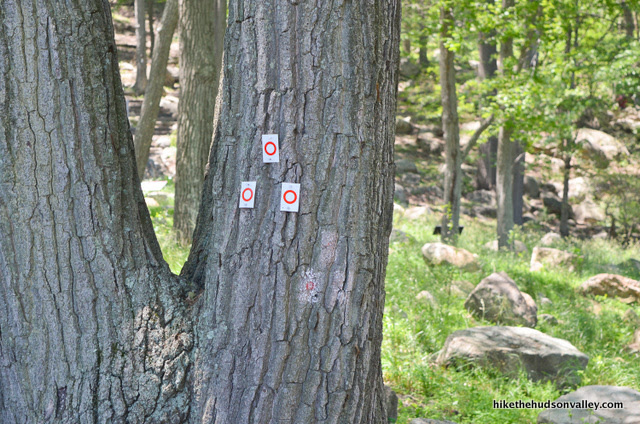
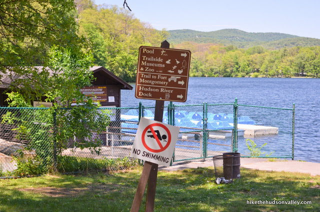
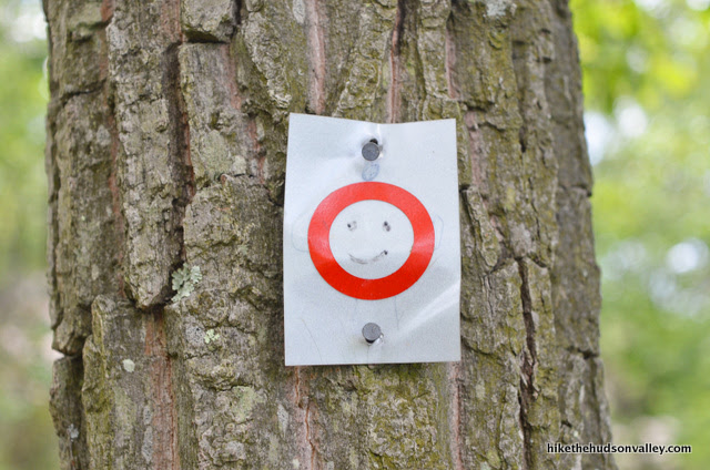
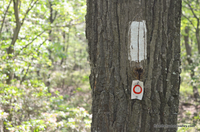
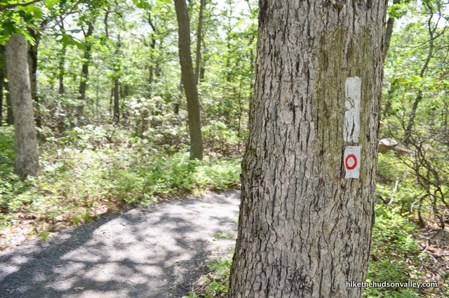
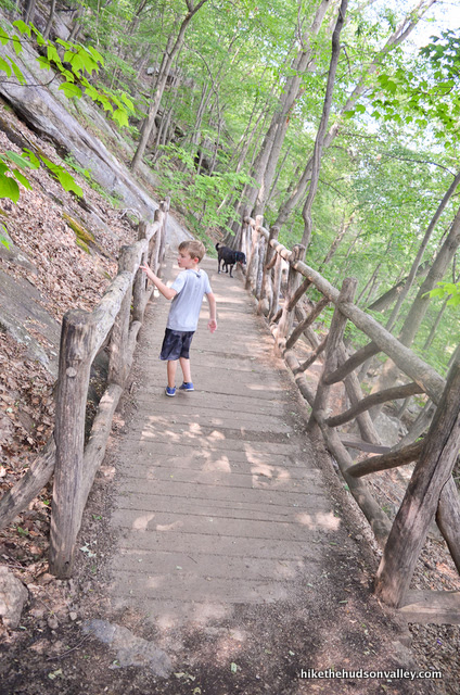
Let’s get started! Take the rightmost option, toward the perimeter of Hessian Lake, to find the three funky red-circle-on-white blazes that you’ll follow on the Major Welch Trail all the way up.
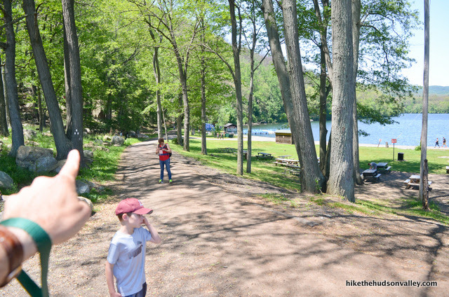
3. Enjoy the views of Hessian Lake as you amble along the paved path to its left. If you’d like to pause this hike to go rent a paddleboat, now’s your chance! We’ll wait here.
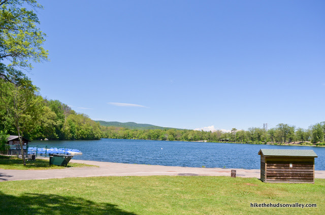
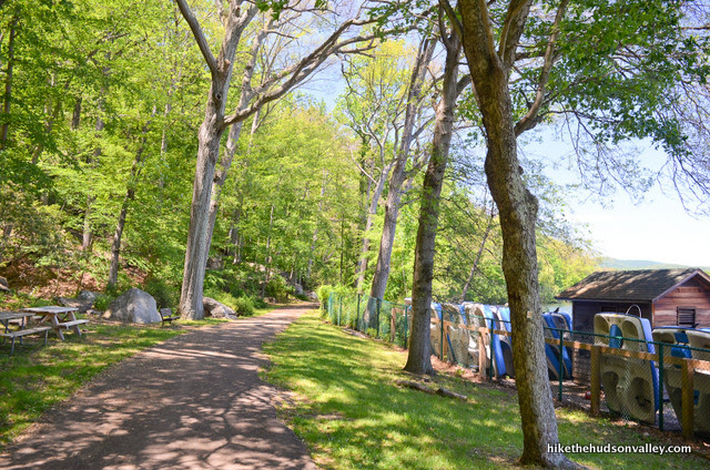
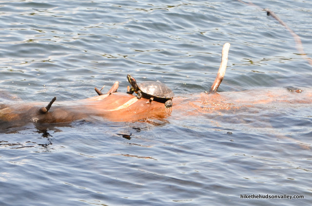
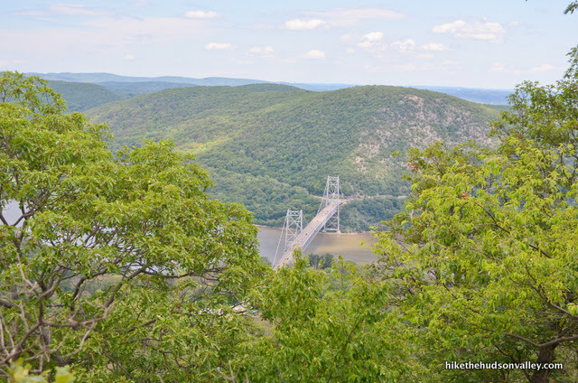
4. You’ll stroll along this relatively flat paved path for just over .5 miles, enjoying views across the lake to Anthony’s Nose and the top of the Bear Mountain Bridge. Wave to any friendly turtles you pass, and enjoy the smooth sailing.
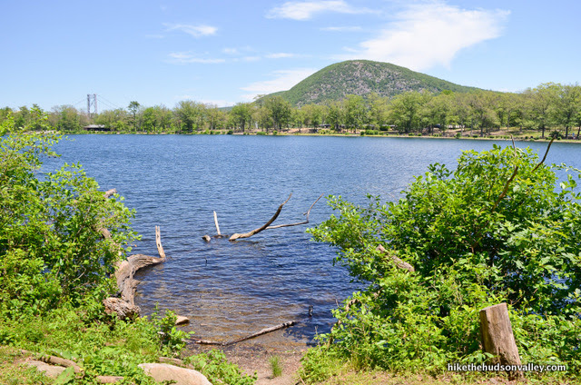
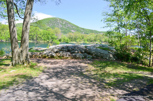
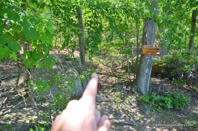
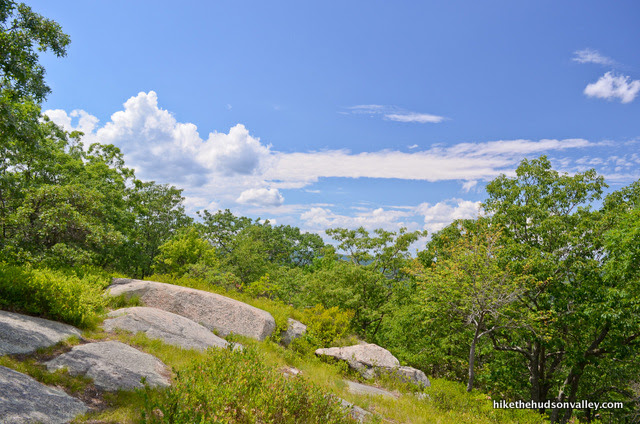
5. As you near the far side of the lake, you’ll find a nice, rocky overlook on your right, where you can hop up and check things out.

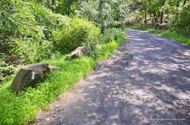
6. Immediately after that overlook, look for the sign on the left side of the trail that marks the end of your paved vacation. Turn left here to head uphill, following the Major Welch Trail – which now becomes an actual trail.
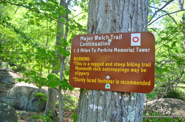
Say goodbye to the easy livin’! Time to go to work. Over the next 1.25 miles, you’ll climb 1,064 feet.
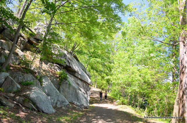
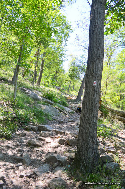
7. The trail immediately becomes steep and rocky.
In about ten minutes, you’ll hop across a (probably seasonal) stream.
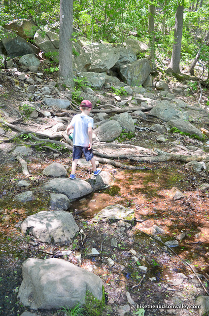
A moment after that, an unmarked trail heads to your left, up to a giant’s hot tub. Don’t go that way.
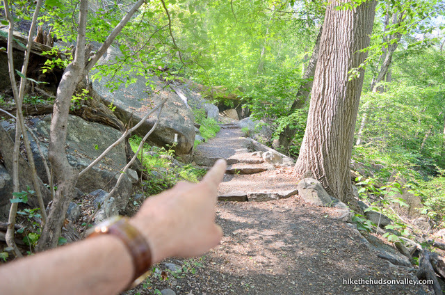
Head right/straight to keep following the Major Welch Trail.
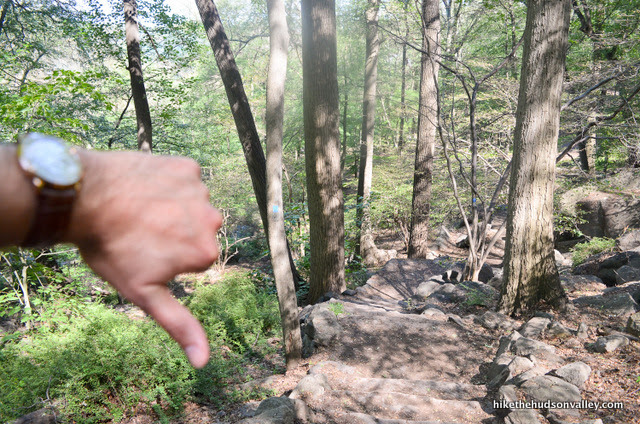
8. Immediately after the giant’s hot tub, the trail splits again, with an unmarked trail heading down and to the right – don’t go that way. Veer left to stay on the Major Welch trail.
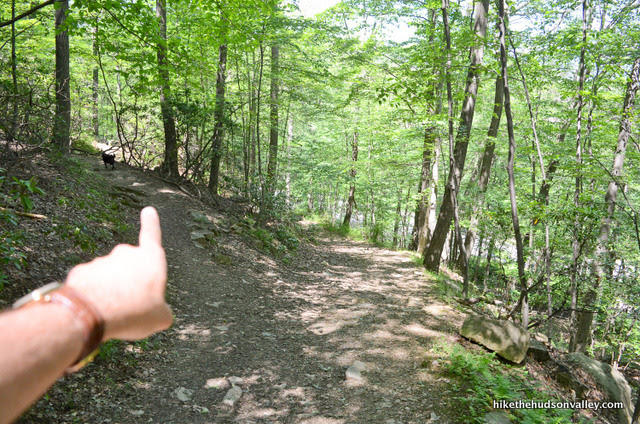
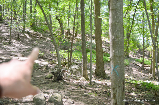
9. Pay close attention in this next section – if you don’t play a game of “Find the Next Trail Marker” the whole way, you could easily wander off-trail. In particular, about five minutes after you veered left to stay on the Major Welch Trail, you’ll come upon a tree with a blue X on it (as of June 2017) – you have to look past that tree, uphill, to find the next Major Welch blaze. Otherwise, you could wander straight here into the wild green yonder.
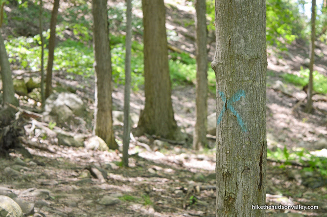
Major Welch is adequately (but not abundantly) marked through this area – look alive out there, and keep watching for those blazes.
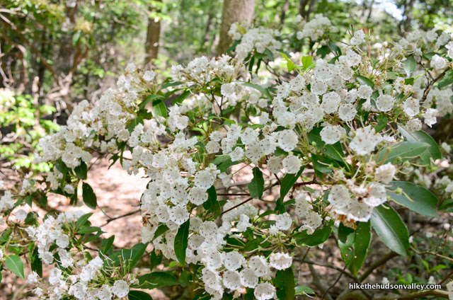
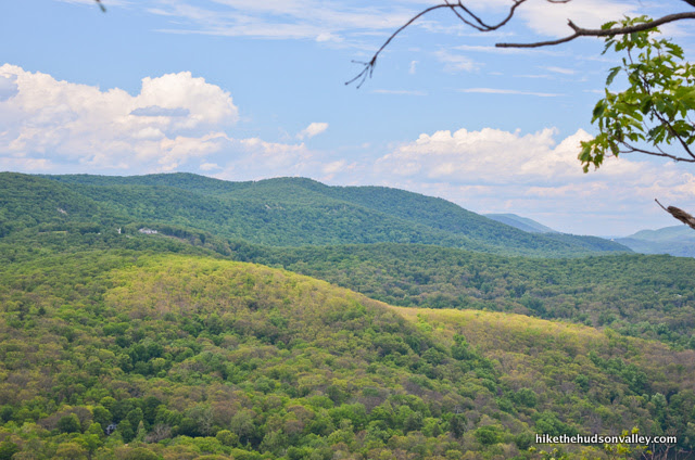
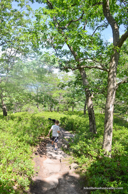
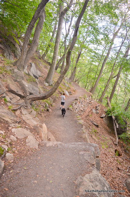
10. As the trail continues ascending, you’ll wander through some mountain laurel thickets that must be amazing at the right time of year. (By June 21 they were already past peak, but not by much.)
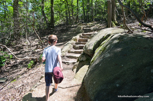
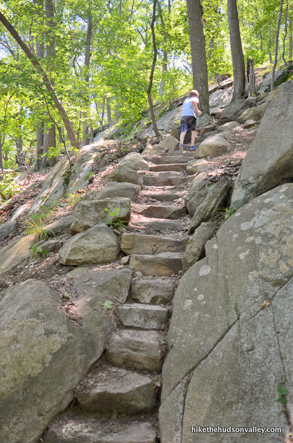
You’ll also see some amazing trail work here. These stone steps must have taken many gallons of elbow grease to build.
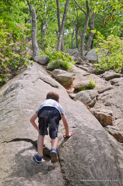
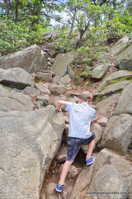
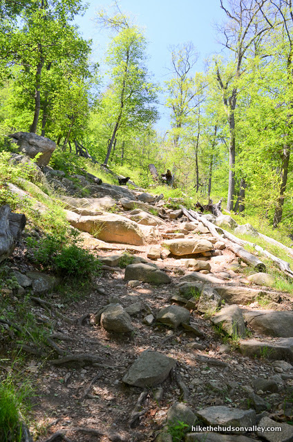
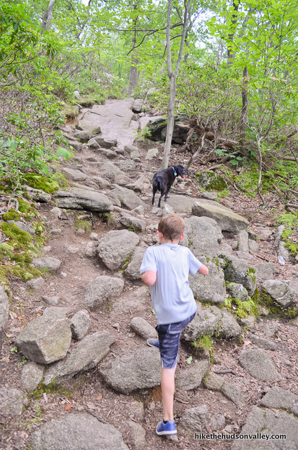
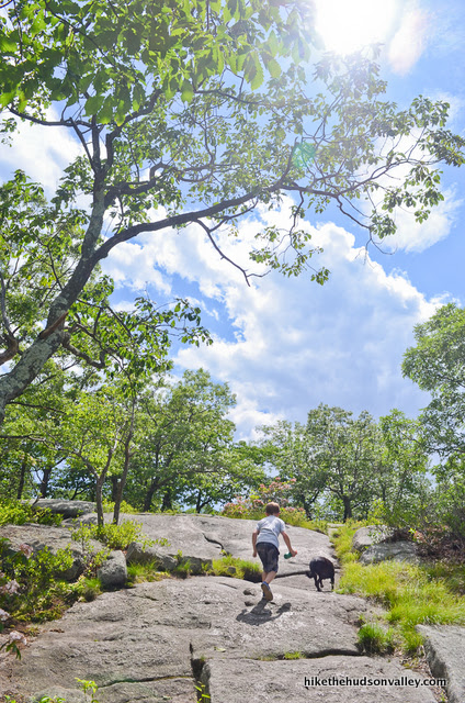
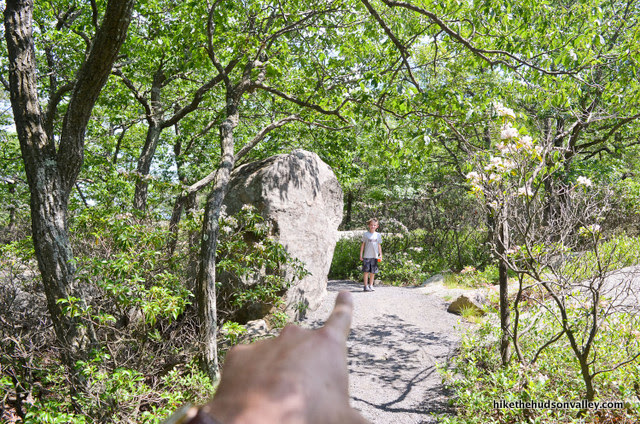
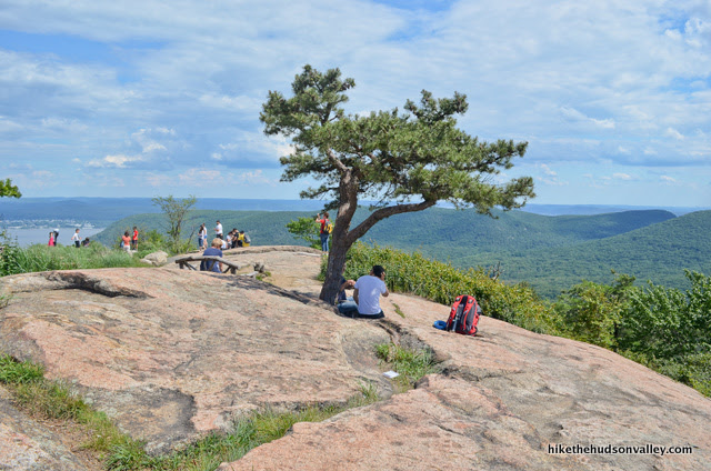
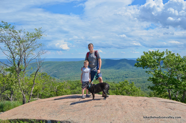
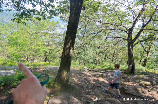
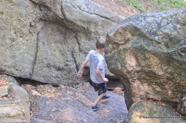
About twenty minutes past the giant’s hot tub, you’ll arrive at my son’s favorite stretch of trail, with several steep, open rock faces to traverse. (I was a little concerned about how my 9.5-year-old pooch would do here, but she clambered right up, no problem. She’s a good girl. Yes she is.)
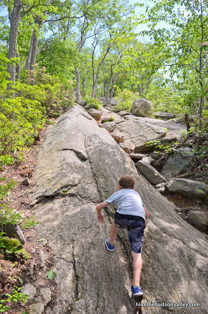
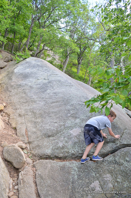
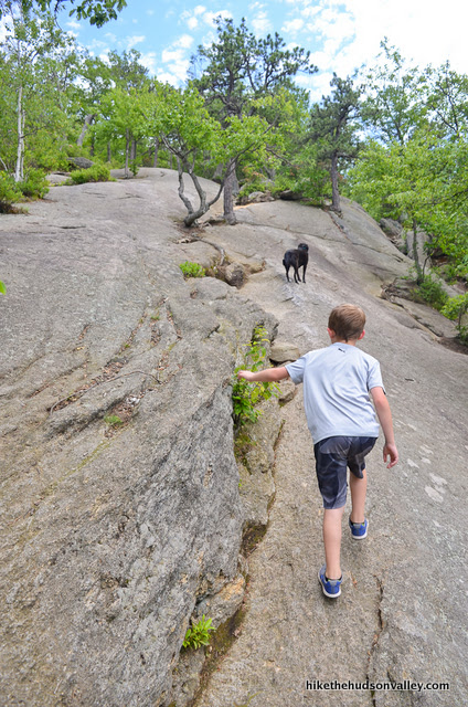
As you’re clambering up those rock faces, don’t forget to peek behind you occasionally. There’s a view back there!
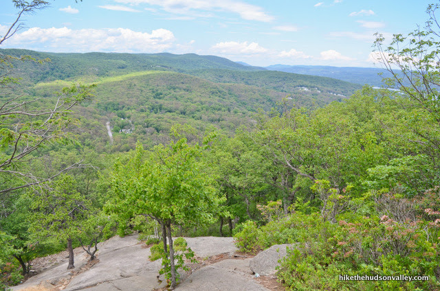
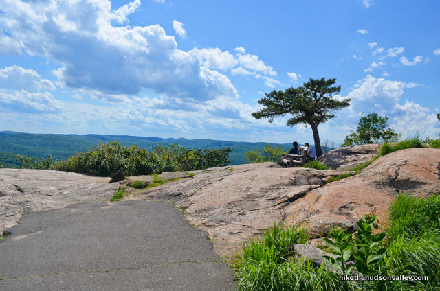
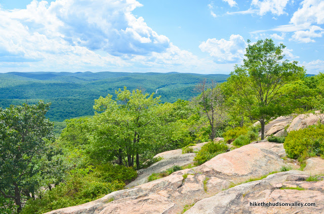
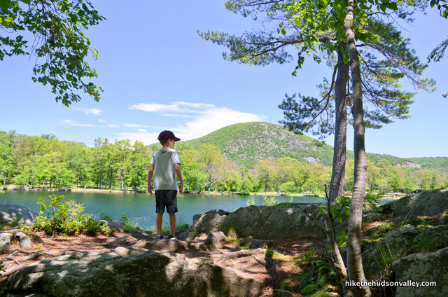
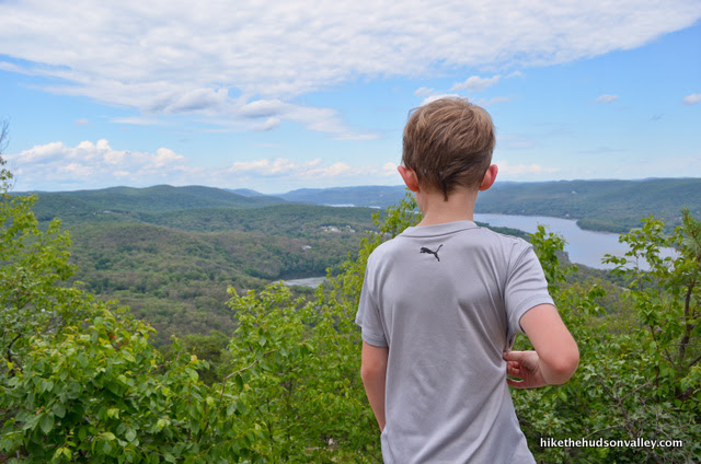
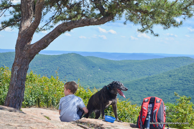
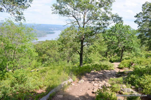
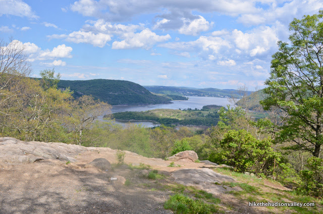
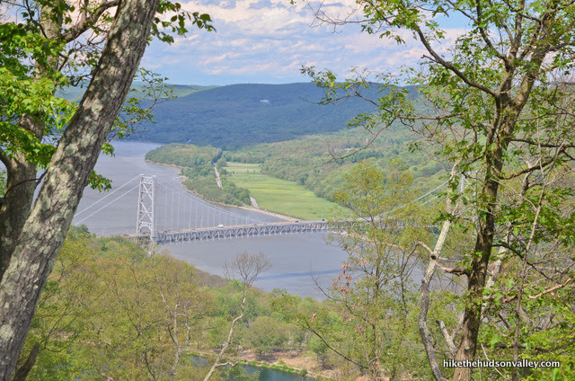
11. Just a few minutes beyond the rock slabs, you’ll emerge onto your first bona fide viewpoint of the day. There were several folks resting here when we ambled through. You get a view up the Hudson to the north, along with a glimpse at the Bear Mountain Bridge.
From here, it’s just 325 more vertical feet and .8 miles to Perkins Tower. You could that walking on your hands, right?
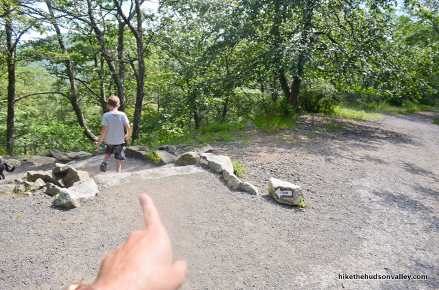
12. Less than ten minutes after the viewpoint, after some more climbing, the trail crosses Perkins Memorial Drive, aka Cheaters’ Highway. (Watch out for cars, and feel free to smile, wave, and mumble “cheater” under your breath as they go by.) Look to your left to pick up the trail again.

13. After crossing Cheaters’ Highway, you’ll pass another beautiful section of trail that the cheaters will never get to see. So who’s really getting cheated here? Right? Right???? Right.
About six minutes after the road crossing, you’ll arrive at a junction with a blue-blazed trail. From this junction, your vertical climbing is pretty much done. Congratulations! It’s just .4 smooth-sailing miles to the tower from here!
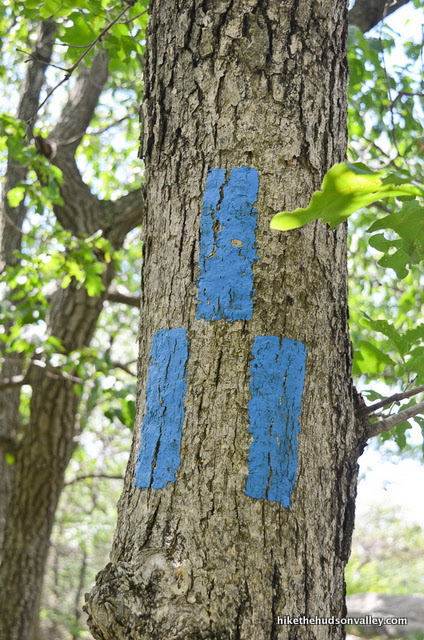
Turn left here (toward a big boulder, away from the Blue Trail) to continue on the Major Welch Trail.
14. In just a minute, the Appalachian Trail joins us from the right. Keep heading straight on the now-dually-blazed Major-Welch-and-Appalachian-Trail hybrid.
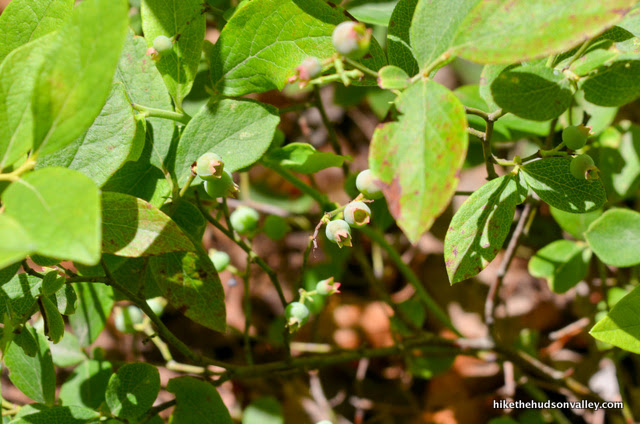
If you’re here in July or August, keep on the lookout for blueberries in this stretch. There are plenty of bushes here, but they weren’t quite ready for us in late June.
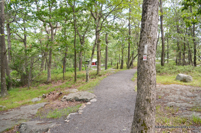
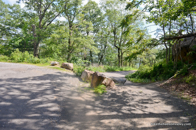
15. Keep following the double-blazed (white and white-with-red-circle) trail. In another moment, the trail crosses a gravel road, and you’ll stay straight/right to keep following the blazes.
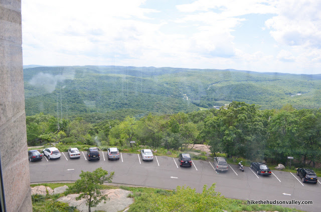
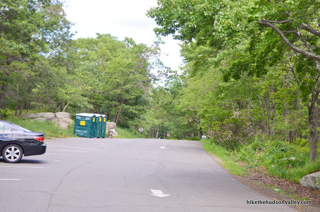
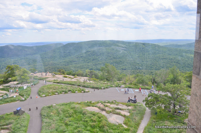
16. Shortly after crossing that road, you’ll start to get a glimpse of the tower parking lot through the trees. You’ll also get a gander at the little building with the vending machines.
“Vending machines by the road? For people who got all hungry working the gas pedal to get up the hill?” I asked. My son liked that one.
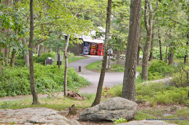
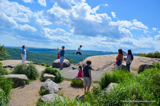
17. In just another moment, you’ll emerge into the (sigh) parking lot.
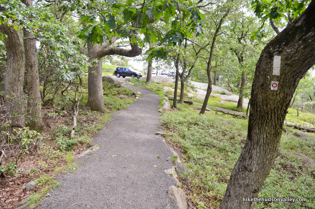
To your left, porto-potties! (And in the vending machines, Pringles!) Woo hoo!
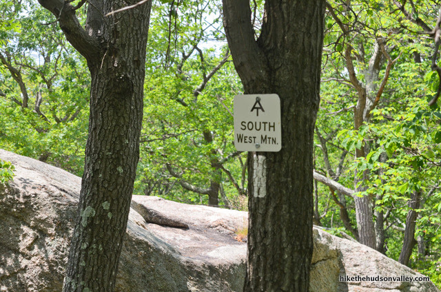
Even better – straight ahead, Perkins Memorial Tower, named after the place that served pancakes this morning to all the people who drove up here.
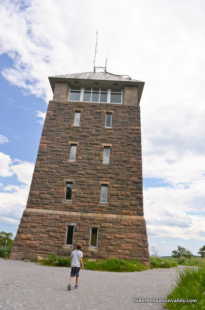
Kidding! It’s really named after George Wallbridge Perkins, the first president of the Palisades Interstate Park Commission. Thanks, George!
18. Venture around to the other side of the tower. On my first visit to this spot (as a cheater), the door was locked (karma for cheating). On our most recent visit, though, it was wide open. If it’s open for you, hop in there and check it out!
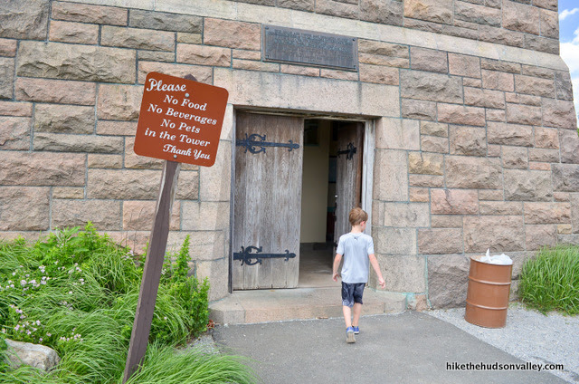
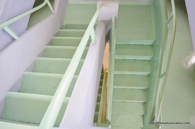
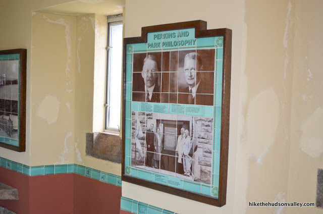
What a cool spot. You’ll find exhibits and information all over the place, along with some 360-degree views at the top.
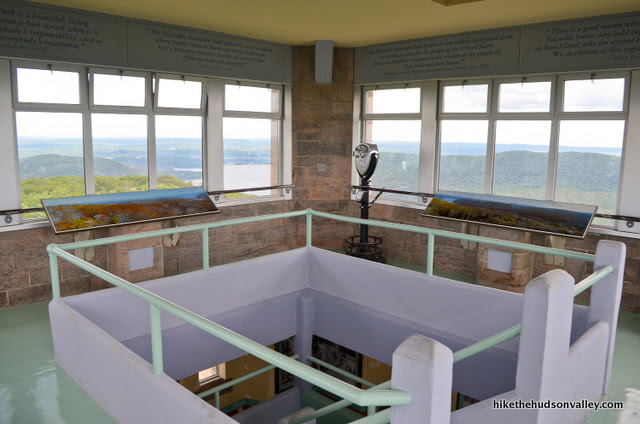
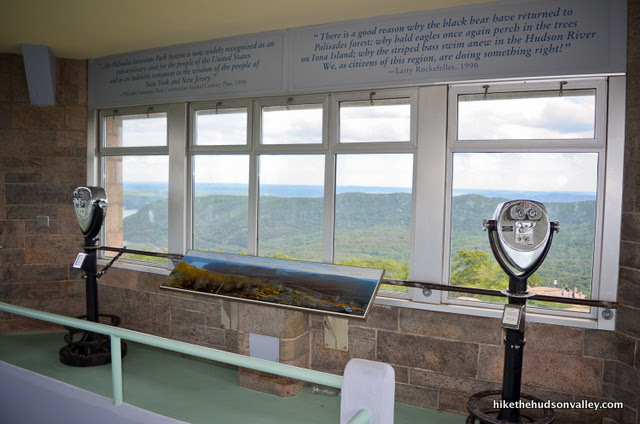
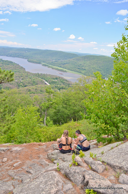
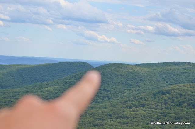
19. When you’re done up there (or if you couldn’t get in, because you’ve done something bad), hop across the street to check out the views. This is the true money spot. Soak it in. See the NYC skyline over there?
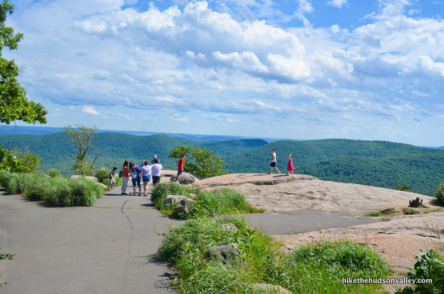
Perhaps you can even find a friendly cheater (obvious by their lack of sweat and synthetic clothing) to take a photo for you.
What a nice place to be, no matter how you got up here (but especially if you didn’t cheat).
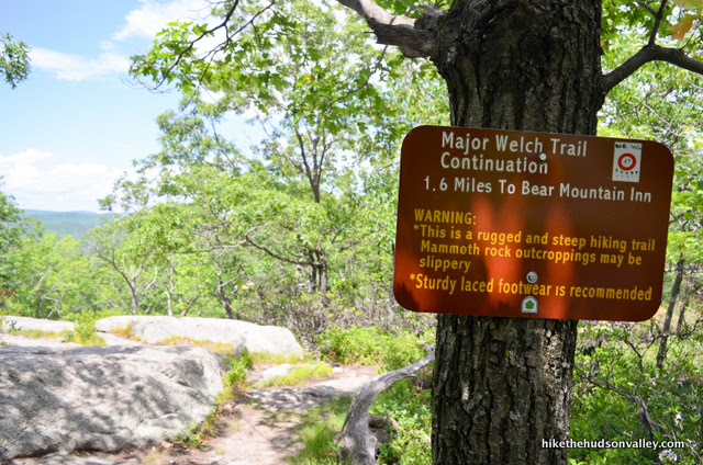
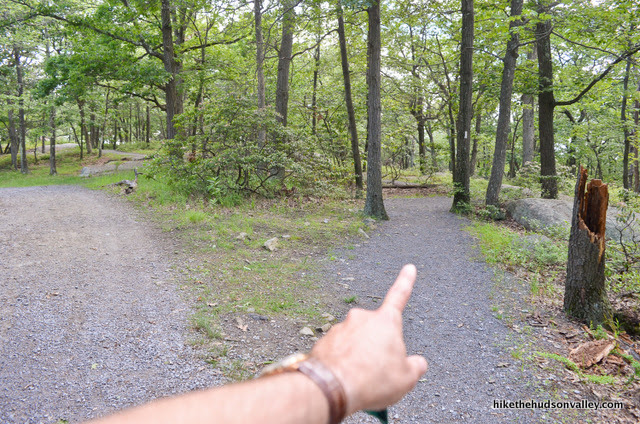
20. When you’re done ogling the money spot, it’s time to hop on the Appalachian Trail for our descent. To pick up the trail, when you’re standing at the overlook, turn to face Perkins Tower, with the view at your back. Turn right to head downhill for a moment on the paved road (the loop for cars, not the paved footpath).
Almost immediately, you should see the white-blazed Appalachian Trail heading downhill to your right.
As of this writing in August 2017, this short section of trail is under construction, with the entrance blocked off.
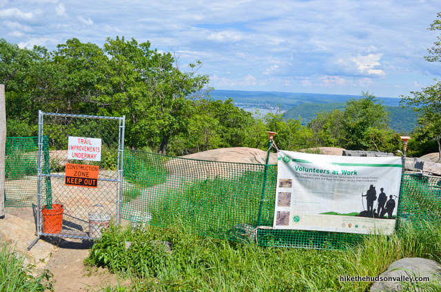
If that’s no longer the case when you visit, enjoy the new trail section, and start following those white blazes, person of the future! You can skip to Step 21 now (where the Appalachian Trail crosses the road in just a minute).
Temporary step: If the Appalachian Trail is still under construction during your visit, just follow the road (and the plentiful temporary signs) downhill. In a couple of minutes, when the road splits, take the right fork, toward Scenic View (not EXIT).
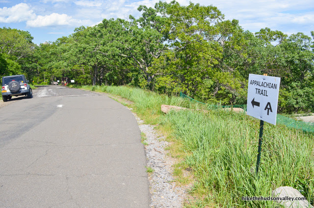
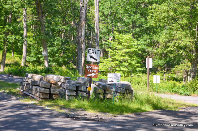
In another minute, stroll straight past a turnoff on your left for a picnic area.
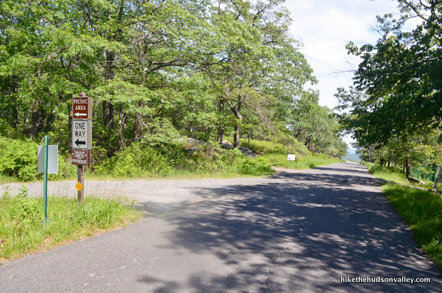
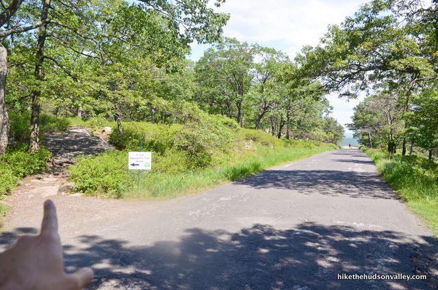
Immediately after that picnic area turnoff, the well-marked Appalachian Trail heads into the woods on your left. That’s where you want to be – turn left to hop on the Appalachian Trail here.
21. Now that you’re on the Appalachian Trail, you can just follow those white blazes all the way back to the start of today’s loop (from Step 2 above). I’ll keep on blathering here, just in case anyone finds it useful, but I will not be offended at all if you don’t read any further. Really. It’s fine.
You’re still here? Great! Man, I’m really offended by all the people who aren’t reading this anymore. But not by you. You’re cool.
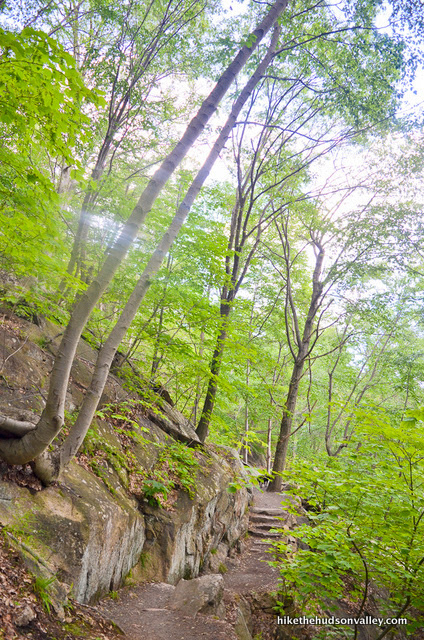
From the road crossing, the White Trail descends through picturesque woods, until it plops you out onto another road in about five minutes. Cross the road to the right to head back into the woods – make sure to look for those white blazes on the boulders lining the road, too.
22. Enjoy the views and watch your step! Less than five minutes after crossing the road, keep a lookout for a sharp left turn in the trail, marked with two white blazes. My son almost wandered in the wild green yonder here.
23. One minute after that sharp left, you’re dumped onto another road. Turn right to walk along the road (which doesn’t have much traffic, but we did see one car driving along here).
You’ll walk on this road for about five minutes, noting the blazes on the boulders as you go. When you reach the cul-de-sac, follow the trail as it veers off to the right.
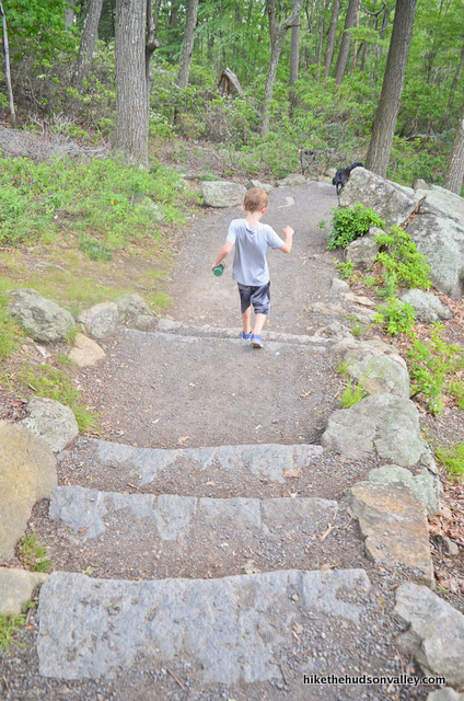
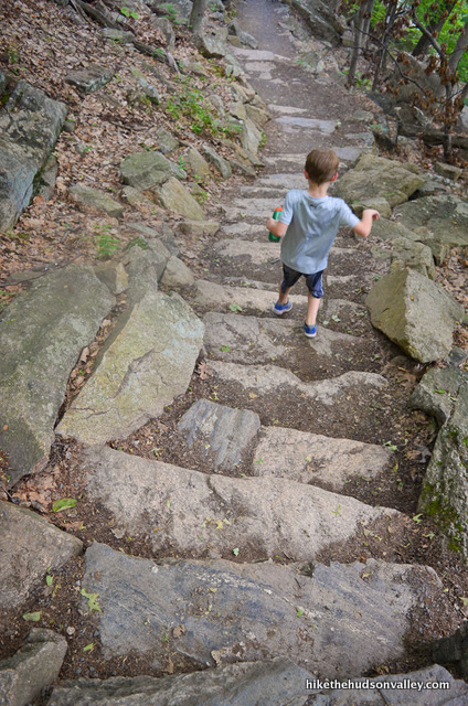
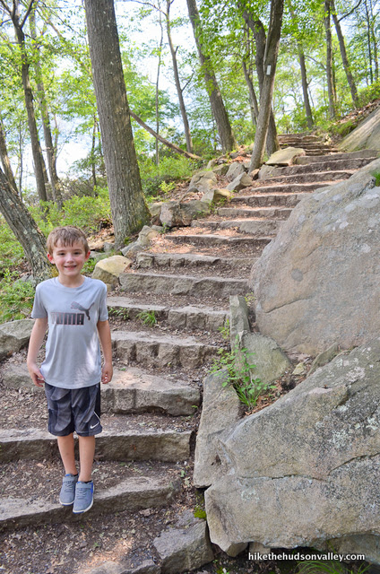
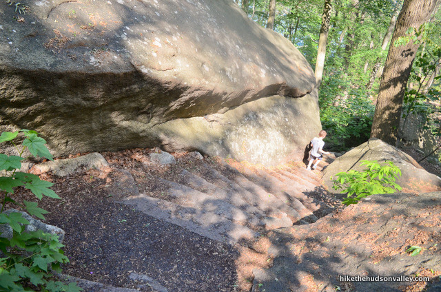
24. Immediately after you veer right at the cul-de-sac, the trail turns left, and you can hop down the stone steps to gratefully leave the pavement behind.
25. Welcome to Land of the Stone Steps! There are about 1,000 stone steps between you and the end of the loop. My son counted the steps until the novelty wore off – he made it to 200. By the time we got to the bottom, we both agreed that 1,000 seemed like a pretty good estimate. (UPDATE September 2017: In the comments below, Andrew counted all the steps and came up with 716. I don’t know if I’m more impressed at the dedication of the people who built those steps, or Andrew’s dedication for taking the time to count them all. You’d probably get to over 1,000 if you counted the steps on the Major Welch Trail, too. Anyone want to give us a count on those steps?)
26. After many more steps and some beautiful stretches of trail, you’ll pop out onto another nice view, this time looking south down the river. (Took us about 12 minutes to get here from the cul-de-sac.)
You can also get a hint of the Bear Mountain Bridge through the trees.
27. Just a couple minutes (and many more stone steps) after that view, you’ll cross a footbridge that looks like it took some serious know-how to build.
28. From the footbridge, it’s about five minutes to your next trail junction, when you pop out from some cool rock formations to find the Blue Trail heading off to your right, downhill. Don’t go that way!
Turn left, slightly uphill for a moment, to continue on the White Trail.
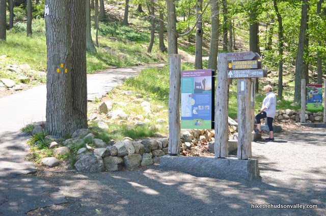
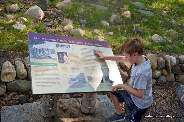
29. Check out the educational signage as you marvel at the last few (dozen) stairs for the day.
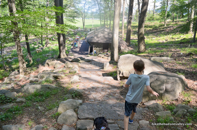
In just a moment, you can catch a glimpse of Hessian Lake through the trees.

And then, boom! You’re back where you started.
30. Your options from here:
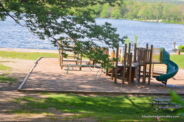
- Play on the righteous playground right over there
- Check out the grub options in the Bear Mountain Inn
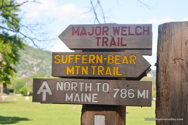
- Hike the remaining 786 miles to Maine, grab a nice lobster dinner
- Head straight back by the Bear Mountain Inn to locate your car in the parking lot
We chose the last (and perhaps lamest) option, after reading some more educational signage.
Whatever you choose to do from here, I hope you’re glad you chose to do this hike today! Congratulations on hiking to one of the most beautiful spots in the Hudson Valley, even when you could have cheated. Your honesty entitles you to at least an extra 1,500 calories at dinner tonight, and one full-size can of Pringles. Enjoy!
Directions
Directions to the trailhead: This park is located immediately south of the Bear Mountain Bridge, on the west side of the Hudson River, on Route 202/Route 9W. If you’re coming across the bridge from the east, enter the roundabout, then take the last exit for Route 202 west and Route 9W south, toward Haverstraw. You’ll immediately see Hessian Lake on your right. In just a moment, at the stoplight, veer right onto Seven Lakes Drive, then turn right at the Bear Mountain Inn to follow the signs for PARKING. At the parking lot entrance, let the attendant relieve you of $10, find a spot, then hop out and let the adventure begin!
You can also get directions by checking out the Bear Mountain State Park entry on the HiketheHudsonValley.com Google map.
Sorta nearby address for your GPS: The park lists its address as:
Route 9W North
Bear Mountain, NY 10911
While there’s no street address, for most mapping apps, you can simply enter “Bear Mountain State Park” and it will take you to the right place.
GPS coordinates of parking area: 41.31204, -73.98869 (Clicking will open in Google Maps or the Apple Maps app, depending on your browser/device.)
Resources & Interactives
Super-cool Google Earth flyover of hike route:
Google Terrain Map of hike route:
Related resources: If you’re looking for actual facts and/or useful information, visit these resources:
- The official Bear Mountain State Park homepage
- A nice trail map for the area from NYS Parks
- An even better map from the NY-NJ Trail Conference (thanks, guys!)
- A nice write-up for this exact same hike from the NY-NJ Trail Conference
- The homepage for the aptly named Trailside Zoo
- The informative Bear Mountain State Park Wikipedia page
Want to support trails in the Hudson Valley? Here’s one great way: Visit the New York-New Jersey Trail Conference homepage and click on Volunteer, Donate, or Shop! (Then you can volunteer, donate, or shop, depending on your mood.)
FYI, it looks like several trails in Bear Mountain State Park remain closed due to storm damage from July 2023. The route described here is closed (both the Major Welch trail and the AT). Full closure map as of Feb 2024: https://parks.ny.gov/documents/parks/BearMountainBearMountainTrailClosuresMap.pdf
Hopefully they get it reopened soon!
Thank you so much for the heads-up, Adil! I’ve added a “FIVE-ALARM, ATOMIC-WEDGIE TRAIL ALERT!!!” at the top of the Background section above, and hope to remove it sometime soon. Very much appreciated!
I work at Bear Mountain and have talked to people who work for the state. The problem was finding volunteers to work in the trails and the constant rain that have kept the trails closed. The state looks to be reopening Perkins Tower on April 1st possibly for people to drive up there and possibly some parts of Appalachian trail being open. I would still wait for official confirmation however has that could be subject to change but the goal from what I have heard is to try an be open by Summer. Lots of hikers come in asking questions but you can still walk the Hessian Loop
Thanks so much for the update and the info, Peter!
Hi Mike!
I’ll be with my elder parents and don’t want to take them on technical terrain, so we’re looking at doing the AT both ways. Actually we’re looking to train on stairs specifically, so this is a great find. I was wondering if you had recommendations for any easy trails (walks really) to lengthen the amount of time spent? Looking at AllTrails I’m thinking the Hessian Lake Loop.
Thanks in advance! Really appreciate all your write ups.
Hello, Bobbie! The lake is quite scenic – that sounds like a wonderful way to get in a little more exploring. The grounds are interesting all around the inn, too – you could add more distance by just strolling around, checking out the carousel and other sights. And if your folks are looking for stairs to climb, that stretch of the AT should be just the ticket! Stairs after stairs, then more stairs. Hope you all have a wonderful hike and visit!
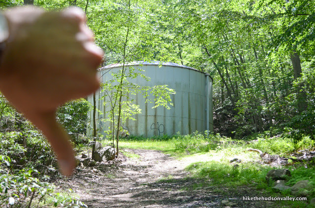
I want to thank you for the detailed instructions. But for anyone looking here please note the Welch trail requires fitness and good ankles knees and hips. It’s basically three hours of uphill climb with little flat terrain. I consider myself reasonably fit and it was challenging. I hurt for days after and I don’t think I’ll be back. The views are amazing but it hurt. The kids were alright (I mean not any worse than us maybe better but equally determined never to do that again). Bring lots of water and snacks and a walking stick or find one in nature. The downhill is one hour of stairs some very steep. Hang in to the walking stick. Your knees will thank you.
On a side note right around the water tanks there’s down trees that block the trail. Need to go to the right and around the trees where it says here not to go. But that wasn’t why the trail was harder than is enjoyable for us.
CS, thanks for your candid comment, and I’m sorry you didn’t have a better experience out there. This hike is indeed a a gut-buster (and a knee-buster), and won’t be for everyone. I gave it a difficulty rating of 8/10, which is defined in this site’s FAQ as “This might hurt tomorrow. And the next day.”, so at least it sounds like we’re on the same page there. I wish you many happy and fun future adventures, and hope your kids will still join you for them!
We are avid hikers. This is by far the best/most honest review of a hiking trail. Your attention to details, and the many pictures, made this hike very easy for us. We appreciate your time, efforts, and energy it took to create your review. We had a very enjoyable hike with the family as we celebrated Father’s Day 2022. Your review inspired us to hike these trails. Your detailed description prevented us from being separated/getting lost in the woods. Thank you for this extremely helpful review. May you stay healthy, and enjoy many hikes.
Thank you so much, Gai Bos! Your kind feedback is very much appreciated, and I’m so glad to hear that you all had a great day out there. Many more healthy and happy adventures to you as well!
Thank you SO much for this guide! I really appreciate the work you put in to create it. It was spot on perfect. This was my first (and solo) hike here and I enjoyed every second. I cannot wait to come back!!
That’s wonderful to hear, Carla! So glad you had a great day out there, and that this guide was useful to you. Thanks for taking the time to leave such a nice comment – made my day. Here’s wishing you many more happy adventures out there!
We were there yesterday and the parking lot at the top was closed – so far fewer people. Last time we were there several years ago in the summer, the lot was open and the summit did have a different feel. But you can tune that out and still enjoy the fruits of all those steps and rock scrambling. We did it clockwise. I really dislike all those steps so chose to rock scramble on the way down. I think this is the more difficult way to go but the other reason why we clockwise is because you have Lake Welch escorting you the last mile or so, as opposed to having it behind you. The tower was closed yesterday, maybe because it’s off season, but that was okay with us because we were able to enjoy it last time we were there. Lastly, we did not realize we could have a great cocktail and craft beer and very decent food with a great view at the Bear Mountain Inn before we headed home.
*Hessian Lake!
Thanks for a great trip report, Angela! Sounds like an ideal time to be up there. And from your recommendation, sounds like the beer and food acquisition should be the official final step of the trail guide. Happy adventures to you!
Wow! I was just browsing some of my old hiking grounds. I grew up in Brooklyn in the 50s. A few friends and I would take the “D” train to 34th st Penn station and get the trailways bus up to bear mt. From there we get on the AT trail. It was quite a hike up to what looks similar to your photos except back them there wasn’t any roads, no loops to drive and no other trails. There was a “lean-to” there with a wood stove and we spent my days there away from the city. You could see the Hudson way down and the city skyline on clear days and nights. Watched the 4th of July fireworks from there one year. Back then it was rare to see another hiker.
Such a nice guide! We did this trail. With our twin daughters who are almost 3. It was… an experience 😛 especially the scramble up the Major Welch rock faces with the kids on our backs. we picked up cans and bottles around the trail going down to the inn because people are still not good.
Thank you for this detailed guide! My partner and I did the route this weekend to take in the fall scenery.
For other city people: We took the Coach USA day trip bus from Port Authority Bus terminal in Manhattan which gave us plenty of time to do this hike and also wander around and explore the area.
The scramble up the rocks on the Major Welch trail was challenging but very fun, and I’d rather go up that way than down it! And your photos and detailed instructions helped us avoid any doubt of which way was the right way to go. Also, thought you would like to know that although there were plenty of people, there was no trash on the trail!
Thanks again!
Thanks for the great guide and suggestion! We did this today (Saturday morning) arriving around 10 am and had no trouble parking. The lot did seem to be very full on our way out around noon. The trail was EXTREMELY busy and we were passing people pretty much the entire time. Other than that, fun climbing and beautiful view.
Hi, I did the hike earlier today with a few others and it was absolutely stunning. We did the hike in reverse this time and it was slightly steep at points going down but otherwise a very senic route.
Just for future hiker, when we went onto the Major Welch Trail it has been blocked off by a small road block stating there was potentially dangerous hiking conditions (presumably due to the recent storm). However, we encountered another group hiking up the trail, so we decided to try it out. Aside from a few fallen trees that were easy to hop over, we didnt notice any concerns. Although I typically would not reccomend this, I definitely dont believe the warning should hinder anyones desision to hike the very senic trail.
I have noticed this at a few other trails as well. After a recent storm it’s common to have large chunks of trails blocked by fallen trees. Check the trailhead for any notices. I know Fahnestock currently (11/17/20) lists a few trails closed for tree maintenance. If a tree falls in the woods and you ARE there to hear it…it may be the last thing you hear.
Thank you so much for such an excellent and detailed guide! My sense of direction is abysmal and I did the hike yesterday with my fiancé following your instructions and it was perfect (you probably saved us from like a zillion arguments about directions!)! Thank you for taking the time to share!!! ⛰❤️
Sarah, I can’t tell you how much this comment made my day! Thanks so much! Here’s wishing you and your fiancé a lifetime of finding other things to argue about 🙂
Hi
I hiked the shorter version of Anthonys Nose by parking at the Bear Mountain Inn and walking across the bridge . We want a longer hike but feel that the hike from camp smith might be too much . What do you think of again parking at the Inn , walking the bridge to the tollhouse and the Camp Smith trailhead and instead of retracing our steps we head down the shorter way leaving us close to the bridge ? What do you think will be the distance from the trailhead at Camp Smith to the bottom of the trail by the bridge ? Thank you
Hi, Joe! I *think* it would be about 4.3 miles from the toll house up the Camp Smith trail to Anthony’s Nose, and down to the 9D trailhead by the Bear Mountain Bridge. You can park right at the toll house, though, so I’d consider launching your adventure from there, rather than the Bear Mountain Inn. I wouldn’t attempt the road walk from Bear Mountain Bridge all the way along 202 to the Toll House, either — the road is quite twisty and not ideal at all for pedestrians. The good news is that the Camp Smith Trail hits the Appalachian Trail just beyond Anthony’s Nose, so if you’re looking for more hike, you can just keep going until you hit Maine! Hope that helps – happy adventuring out there!
I did this hike solo (and for the first time!) today and was very grateful for this post! I used this as my reference guide and trail map. You nailed it, thanks very much!
Thank you for the very detailed guide! I just have some questions about the steep open rock slabs between step 10 & 11. How long did you take you to climb those steep rocks? Would it be possible to do it without any hiking shoes/boots? If so, were they slippery? I was also planning on bringing my six-year-old Shih Tzu but I’m nervous she wouldn’t be able to make it up past those rocks and I’m also nervous about holding her while we climb up in case we slip and fall…
Hi, Kelly! While the rocks are not that much of an obstacle, I would still recommend having good hiking footwear for this hike — it is long and quite rocky in spots, and if you try to do this hike without some good, stiff-soled shoes, I’d expect your feet to be quite unhappy with you by the end of the day. As long as you go in dry weather, those rocks shouldn’t be too slippery, though, and I wouldn’t expect them to slow you (or your pooch) down too much. If your Shih Tzu is comfortable hiking these kinds of distances, I can’t imagine she’d have any trouble with this section. My 45-pound dog hopped right on up with no problem. (If she’s not a regular hiker, though, I’d recommend working up to this hike with some shorter ones first, just to make sure she’s up to it.) I hope this all helps — good luck to all of you if you decide to give it a go!
I know this was the wrong link, but I enjoyed it immensely and it was like I was walking the trail with you. I will now look up on the map where this place is, but I don’t think I’ll ever be able to get there. (We live in Spain).
Thank you for your lovely mistake,
Lisca
I did this hike today with a friend and it was amazing — great views and a fun scramble on the way up. The guide was so good I didn’t need to check it (except once!) and felt like a champ for knowing where to go and what to expect along the way.
It took us (2 adults and a pomeranian huskie) just 2.5 hours in case anyone was wondering about the timing — but then we didn’t linger much at the views, only enough to take a couple of selfies of course.
What a great hike. …. completed it today and can’t wait to do it again. I’d totally underestimated Bear Mountain because of the road to the summit, those “cheaters” totally miss out on the spectacular
Thank you for the great, detailed guide for the hike. It was s great resource for the planning and execution of our hike which was part of a tour our boy scout group did along the Hudson River.
Hi Mike,
I am planning a visit to NYC end of April, thinking of visiting Bear Mountin and going a hike on 4/27. do you think I would catch a worth it scene? or trees would still have no leaves? concerned that I would be disappointed
Hi, Kamal! I say yes, you will catch a worth-it scene whether or not the leaves are out yet. The view is amazing whether the trees are brown or green, in my humble opinion. Hope you’re not disappointed (and I suspect you won’t be) if you give it a whirl!
The homepage for the aptly named Trailside Zoo
That link leads to Spam.
Thanks for catching that! Looks like the old link worked on some devices and not others. I removed the “www” in the link, which seems to have fixed it everywhere. Much appreciated!
Thank you for this guide! I did this hike today on September 27, 2018, and the new section of the AT was open! That Major Welch was no joke. I was huffing all the way up. There were quite a lot of felled trees. In particular, at step 7/8: after crossing the seasonal stream, there is a giant fallen tree blocking the trail, and the view of the trail. It looks like the only way to go is towards the “giants hot tub”. Just go around that tree.
Thanks so much for the update, Vanessa! And greetings from the future! (Just had another comment bring me back to this comment section – so sorry for my late reply here.)
Did this hike yesterday as part of Hudson Rover Valley Ramble. There was a NYNJTC booth at the trailhead near Hessian Lake and the guys there told me the new section of the AT is almost done. When I got to the peak we could see them working on the last little section of stairs (see photo).
This was a really fun hike and had more rock scrambling than I expected on the Major Welch Trail. You are absolutely right about the trash, however. There was a fair amount of litter along the AT on the way down and at the summit as well, even inside Perkins Tower. Really drives me crazy.
Hi, Thanks for the Bear Mountain guide. My two teenagers and I had a had quite the adventure. For some reason, I thought I read that the loop would take about 2 hours and I used this information to plan our trip. I waited until later in the day so we would have better light. We were going to take the Welch trail up and the AT down as you suggested. We got a bit of a late start and didn’t get to the top until about 8pm. Our party had separated just before the tower (one took the road to get there and the other two stayed on the trail) and it took a little while to get back together. You can already tell where this is going. Since I realized we were going to run out of light, I didn’t take the time to really think about how to begin our decent. I made the unfortunate decision to take the ‘shortcut’ to the AT (with the money shot and tower behind me) which I now realize put us on the wrong part of the AT (headed back towards Georgia). If I had better notes from your blog, I might not have messed up. My bad. Anyway, I knew we were supposed to cross the road twice and that didn’t happen (at least not near the top). When we did cross the road the second time, it was too dark to continue in the woods, so we decided to stay on the road heading downhill (thinking we were on Perkins road). We walked about 1/4 mile and behind us facing in the other direction was a sign ‘Bear Mtn Inn – 4 miles’. We now realized we were much further away and still had a 4 mile walk back to the car. We did run into a policeman who stopped to make sure we were OK (tx). He was headed up to the tower with a report of two 12-year olds walking. Hopefully, they made it out OK. Total time for our trip was about 4.5 hours. The morning after – We’re all a little more stiff and sore than we expected, but overall, it was well worth it. Thanks again, -jims
Jim, so sorry you had such an unexpected adventure out there! It sounds like you weren’t following the instructions above when you started heading for Georgia, but if there’s anything I can do to modify this trail guide to make sure others don’t hit the same problem, please let me know!
We were in the Hudson Valley for a vacation this past week and used your blog every day to identify hikes to take. Thanks so much for all of your hard work, info and insider view. One item you might want to warn people about… we were going to hike part way up Bear Mountain today, but a local said there were rattle snakes out on the rocky sections – not something we were prepared to encounter. I assume that info is accurate and wanted to pass it on. Thanks again.
I came across your blog when searching for a hike in the area. Living in the city for 8 years I have never hiked up any mountain and never been to bear mountain either.
Took Memorial Day off work with my husband and decided to hike up using your guide. It was quite busy in the parking lot and all but once we started hiking it wasn’t bad at all. People along the way but still plenty space to chill and enjoy the views.
It was quite a hard way up but man was it worth it.
I kept your blog open the whole way up to make sure we were on the right path and read out tidbits to my husband – love your humor.
Can’t wait to try more hikes now. Maybe a little easier before going back up the major Welch trail 😉
Thank you.
Super helpful! Thank you for writing this.
There is also a bus from Manhattan to Bear Mountain (which I’ve not yet tried), for those looking for carfree-accessible hike. (Enter Bear Mountain as your destination on the Coach USA site for the schedule.)
We went to today by car. A lovely, snowy day. Bonus: the road was closed due to the weather, so there were no cheaters (or cars) up top or anywhere but down by the inn!
You guys are tough, Steve! Sounds like an awesome day to be up there. Thanks for all the info and pics you’ve posted here!
I hiked this today as my first solo hike! That initial ascent was killer, but luckily for me, there wasn’t a lot of people around to see all the sweat dripping down my face. I went on a Saturday at 9 and only passed two groups on the way up (Major Welch); on the way down the Appalachian, however, there was quite a bit more people. Thanks for this guide; it was super helpful!
Question – why not do up and back on the AT instead of a loop? Which trail would you chose for a first timer?
Hi Mark — I always choose to do a loop when it’s an option, just to see more stuff. Taking the AT up-and-back would certainly be an option — it’d be the shortest way to do it, but I would recommend taking the loop (as described above) if you can swing it. The views and little scrambles along the Major Welch Trail are well worth it.
Thanks for this great post and for the Google Map markers! I cheated once but wow, climbing yesterday was amazing. I’m especially thankful for the warning to NOT go to the Giant’s Hot Tub. Whew!
Thank you, Nathan! Really glad to hear this guide was helpful to you, and hope your comment will help inspire others to become reformed Bear Mountain cheaters like us 🙂
Excellent guide. I counted the steps. 716.
Wow, that takes some serious dedication to count all those steps. I updated the trail guide above with your official count. Thanks, Andrew!
I must sadly admit that I have been a lifelong cheater when it comes to Bear Mt. I have hiked up to Anthony’s nose three different ways (including from the Bear Mt. parking lot) but have always driven up the Cheater Highway. In my defense I am usually with the non-hiking members of my family. One of these days I will leave them to picnic, zoo and carousel while I hike up and over.
A word about the trailside zoo…I’ve read many a thru hiker complain about its ‘ugliness,’ but remember that all the animals in the zoo were rescued from near death and are for one reason or another unfit to go back to the wild. Take it for what it is. Also be sure to check out all the revolutionary war history in the trailside museums. AND don’t forget to scamper down the short trail that goes under the Bear Mt. bridge and down to the river.
If you like cool cars, there is a weekly Wednesday night car show on the lawn between the carousel and the inn during the summer. Regular parking fee is your admission.
If you leave the non hikers at the park and head across the bridge up to Anthony’s nose, be sure to arrange a time to wave to each other. We could see the fam standing by the flagpole at the inn from the Nose, pretty cool.
One last thing I like to do while cavorting with the cheaters. See how many different languages you hear being spoken up there. It’s like a microcosm of the World. Consider how lucky you are to live in such a beautiful ‘neighborhood.’