Background
If you find this free trail guide useful, please provide payment by picking up at least one piece of litter on your hike. Cha-ching! Thanks for being awesome! (And here’s a quick primer on Leave No Trace, too, to help us keep the trails nice and fresh for each other.)
Background you can feel free to skip: During my most recent hike up Brace Mountain, three things made a big impression on me:
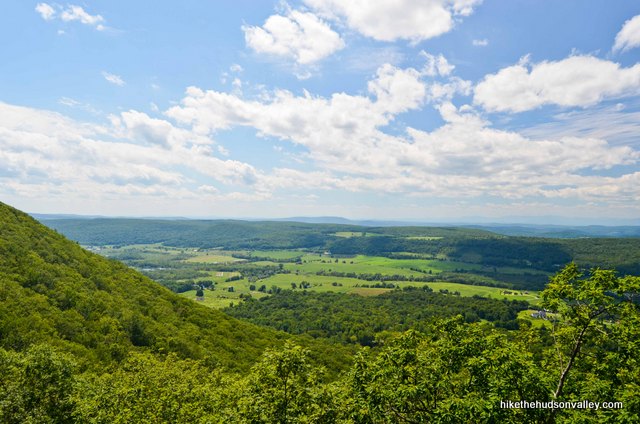
1. The amazing views from the highest point in Dutchess County.
2. The rugged beauty of the South Taconic Trail.
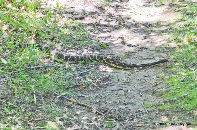
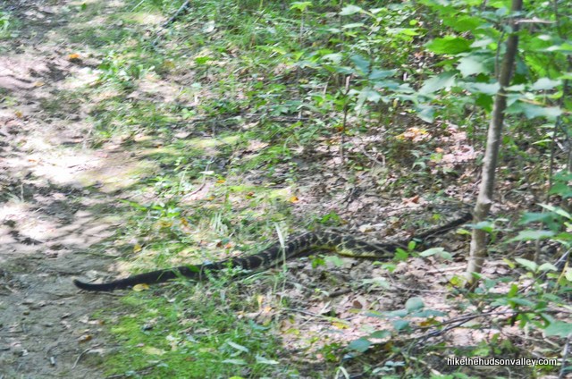
3. The giant (4+ foot?) timber rattlesnake that rattled right next to my ankle, then slowly meandered across the trail as I got my heart palpitations under control. 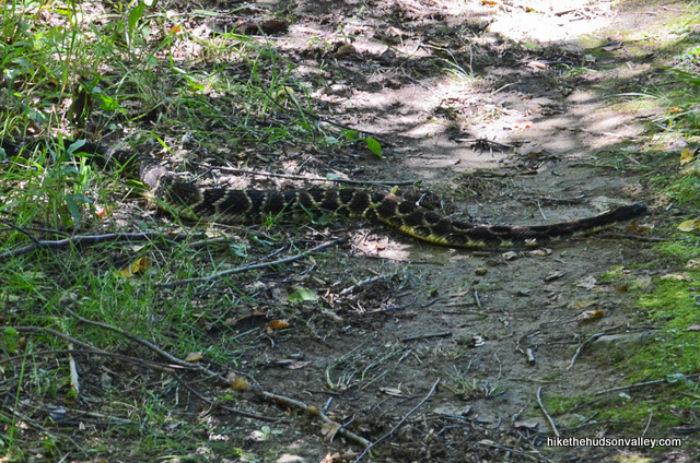
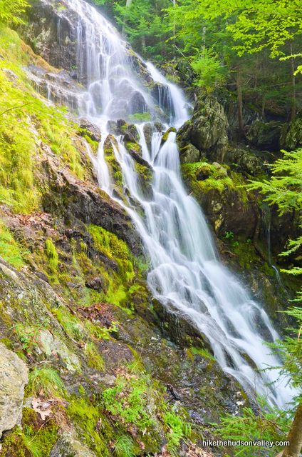
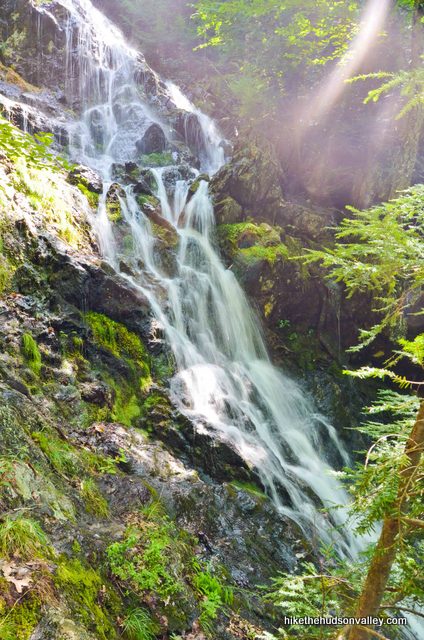
Also, there’s a beautiful waterfall! And did I mention the views? Man, it is gorgeous up there.
And the South Taconic Trail is really… Hello? Hey, where did everybody go?
Oh, you’re still hung up on the rattlesnake thing? Actually, I kind of am, too (as you may have noticed by the 37 rattlesnake references so far). This route up Brace Mountain is one of my favorite hikes in the Hudson Valley – it is stunning and wonderful in so many ways. It’s also the site of the closest call I’ve ever had in the outdoors, so even though you probably won’t have any rattlesnake run-ins, it seems prudent to emphasize some mindful stepping out there. (I’d also recommend reading the extremely informative Timber Rattlesnakes and Copperhead Snakes page, which is alternately comforting and horrifying, from the always helpful Catskillmountaineer.com. And for a nice, soothing take on this critter, check out timberrattlesnake.net.)
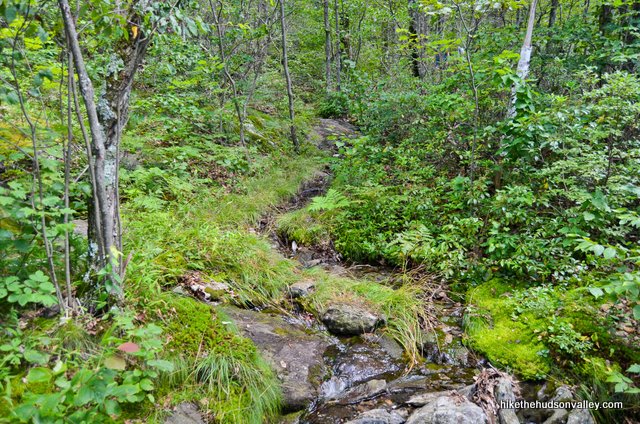
Right after my snake incident (which I documented in more detail in one of my weekly columns here, in case you’re not already sick of hearing about it), I ran into a group of four ladies coming down from the summit.
“Dude, there was a giant rattlesnake just off the trail down there!” I said, motioning excitedly. They stared back at me, not returning my excitement.
“We saw a three-footer on a rock up there, sunning itself,” one of the ladies replied, ho-hum, pointing up the way I was headed. “They don’t bother anybody.”
All of a sudden, I felt like Indiana Jones in the snake pit. I gulped and continued climbing, glad I brought my hiking poles to serve as decoy legs. Fortunately, the rest of the day was only eventful in the way you’d hope for a hike to be.
This happened on the sunny afternoon of August 10, 2013. A couple weeks later, my neighbor hiked this exact route and saw no snakes. A co-worker of mine also hiked this route earlier in the summer and saw no snakes. The range of the timber rattlesnake runs pretty much from here to Texas, too, so this really could have happened anywhere. Also, I nearly stepped on that giant snake, and he decided to warn me, rather than attempt to kill me, so, you know, he did me a solid.
Update May 25, 2014: From a comment that just got dropped on this site’s Facebook page: “Hi Mike, man you weren’t kidding about the snakes on the NY side of Brace. As I was coming back down the trail near the waterfall, a copperhead was in the middle of the trail, staring at me and hissing a little.” I’m wearing hip waders next time I come here.
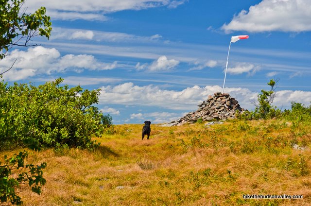
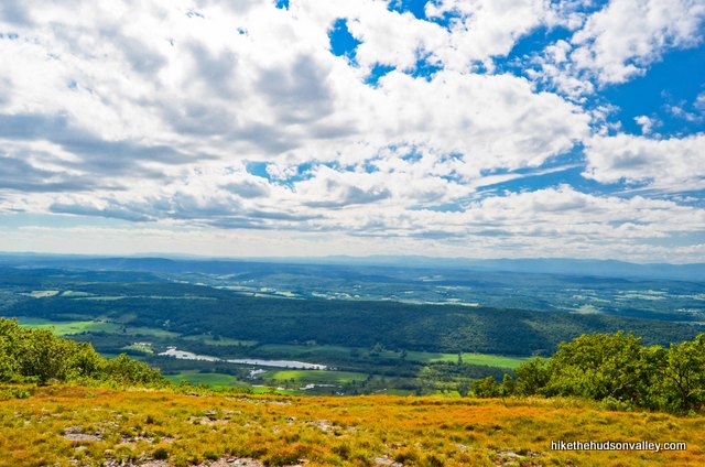
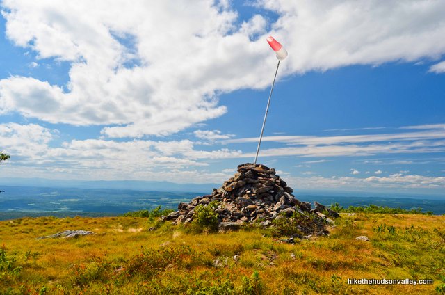
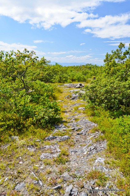
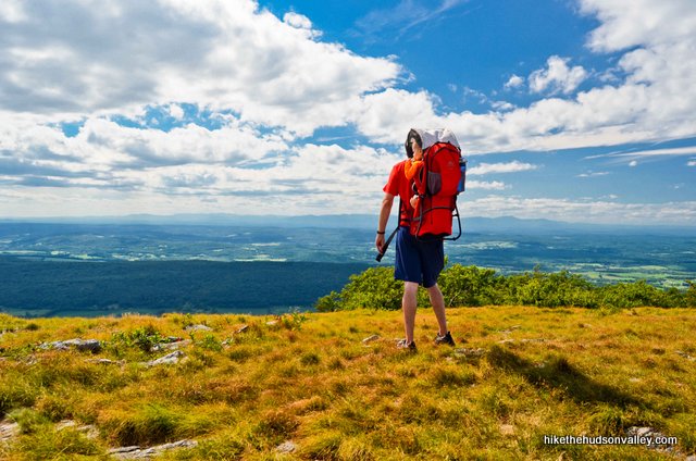
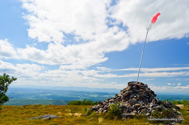
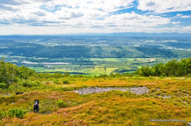
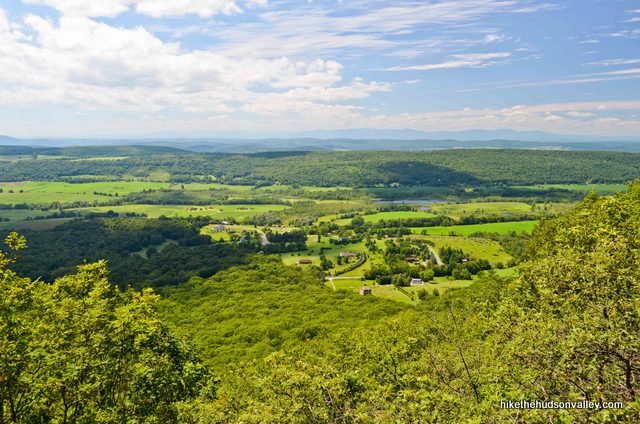
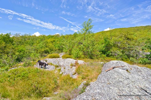
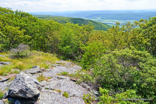
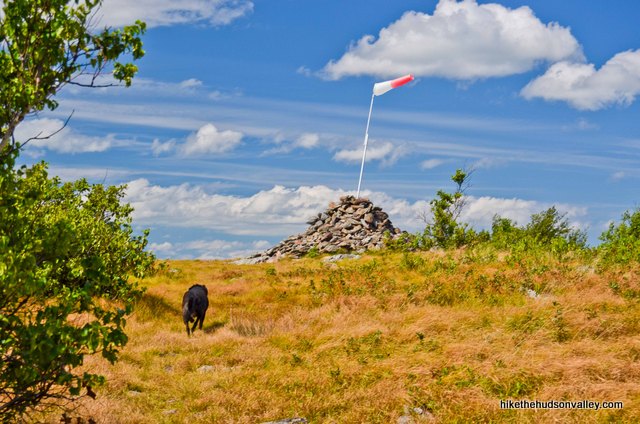
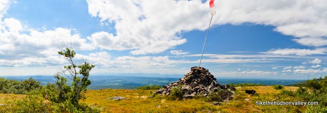
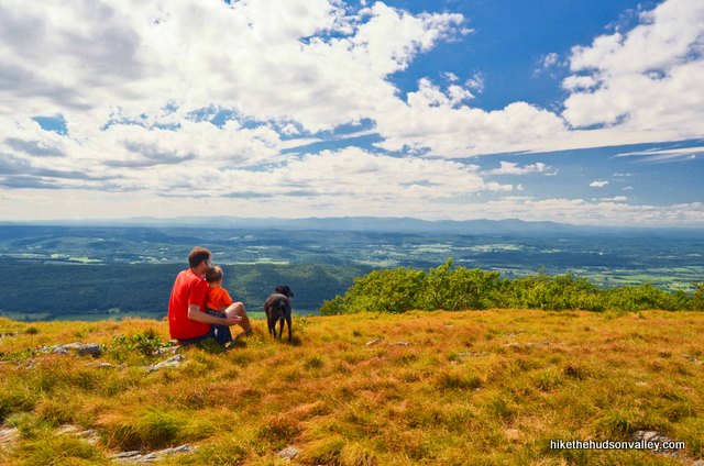
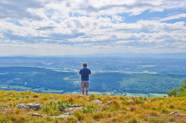
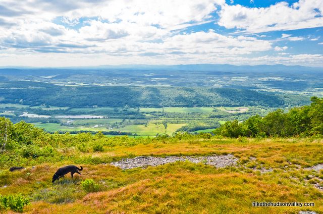
Okay, okay, enough with the snakes already. Let’s talk about the hike. It’s gorgeous at the summit of Brace Mountain, the highest point in Dutchess County, where a huge cairn sits surrounded by a grassy meadow, looking out over an enormous view of the Hudson Valley, clear across to the Catskills.
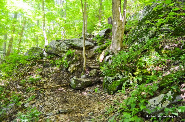
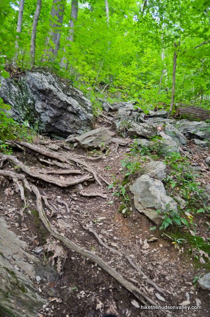
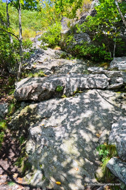
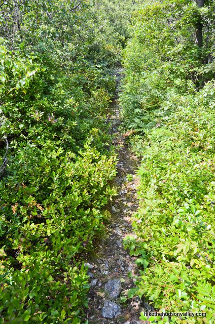
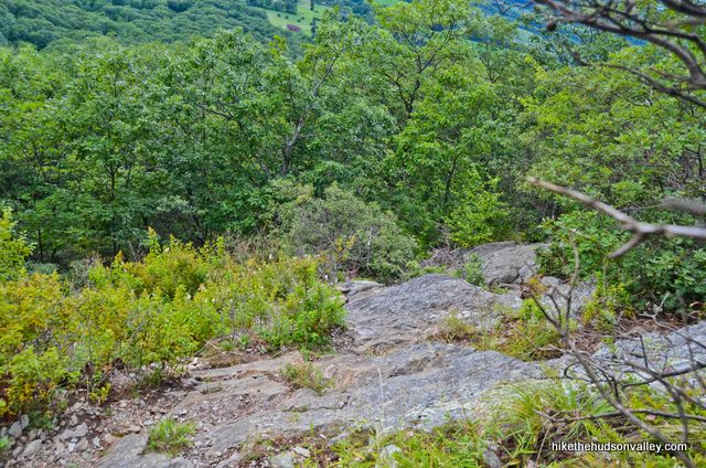
Getting there is a wonderful, very difficult experience, with steep, rocky terrain that will require you to use your hands at times.

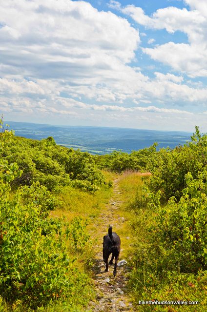
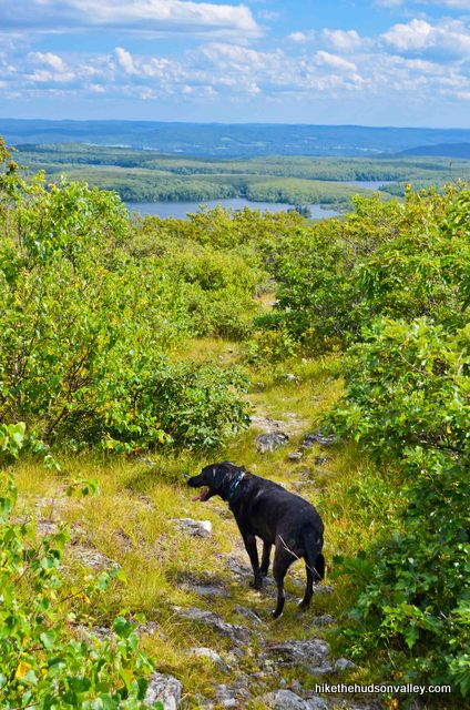
If you’re thinking of bringing a dog here, my forty-pound dog loved this hike until the very end, almost back to the car, when the rocks began wearing on the pads of her feet. She’d been doing lots of jumping from rock-to-rock all day, and by the end, she was stepping gingerly, her pads a little scraped up. (She was fine the next day. She also kept her distance from the snake – perhaps she’s not so dumb after all.)
So while I may be slightly hysterical regarding the snake situation, I really do highly recommend this hike. It’s a unique and sincerely awesome experience, one of the best in the area. Just, you know, watch where you step.
Trail Guide
Bonus unsolicited advice: Don't depend on having cell service in the woods - it can be spotty out there! Download this trail guide to your phone before you head out. (It's easy to do on iPhone and Android.) May your connection to nature be strong, even when your connection to the internet is weak.
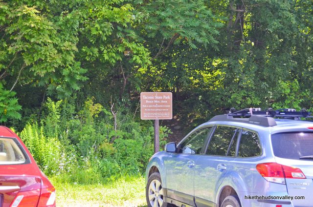
1. From the pull-off on Quarry Hill Road (see “Directions to the trailhead” below), head into the woods on the trail beside the sign reading “Taconic State Park – Brace Mtn. Area.”
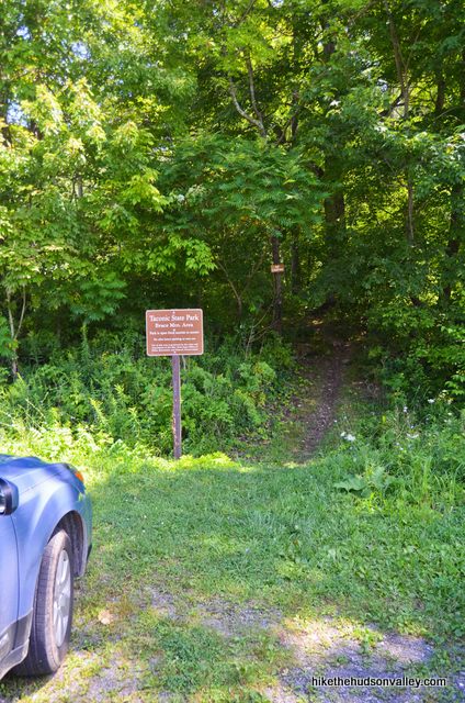
**UPDATE July 2017** Thanks to SWJ’s very helpful comment below, it appears that the beginning of this hike is now blazed yellow, with the white blazes taking over again at .8 miles. The signs pictured below have also been updated. Otherwise, the route is unchanged, and the trail guide below should still do the trick as written. Thanks for the updated info, SWJ!
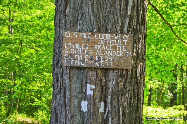
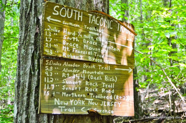
2. In just a moment, stop to check out the sign above the three white blazes marking the start of the South Taconic Trail, the only trail you’ll be travelling on today. Notice the part that warns you about the “VERY DIFFICULT” climb ahead? That sign is not lying. But only 1.9 (rather strenuous) miles from here to the summit! (It took me about one hour, forty-five minutes to get to the summit from here.) Let’s do this thing.
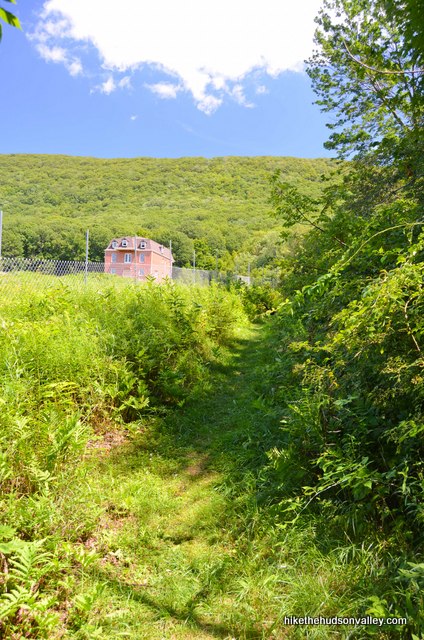
3. Follow the trail beside the meadow and into the woods to the right of the big brick house, and be assured that it just FEELS like you’re trespassing, but you’re not. No worries – you’ll be in the wilderness soon enough.
4. Optional step: Almost step on a coiled rattlesnake. Change underwear, continue hiking.
5. In less than ten minutes (.2 miles from the trailhead), arrive at another posted sign. It warns you that in another .2 miles, you’ll arrive at a “hard 1/4 mile climb.” This sign is also telling the truth. Over the next .5 miles (the steepest section of the hike), you’ll ascend 700 feet.
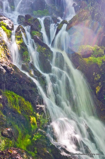
6. Going up! In another quarter mile, a pleasant brook joins just off to your right, giving you something to listen to other than your own panting. In another few minutes, the brook puts on quite a show, cascading down a steep rock face. I was here the day after a good hard rain, so I may have just lucked out, but man, when it’s going, these are some beautiful falls.
7. Continue scrambling over the rocky terrain past the falls as you head toward the summit of South Brace Mountain (a minor speed bump on our way to the top of regular old Brace Mountain — it’s .9 miles and 740 vertical feet to the top of South Brace Mountain from the falls.)
8. Ten minutes after the falls, your first views of the day open up to your left. Not too shabby! Plenty more where these came from, too.
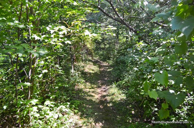
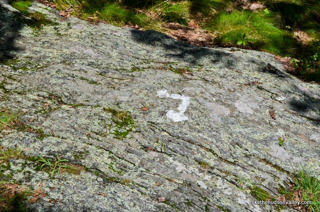
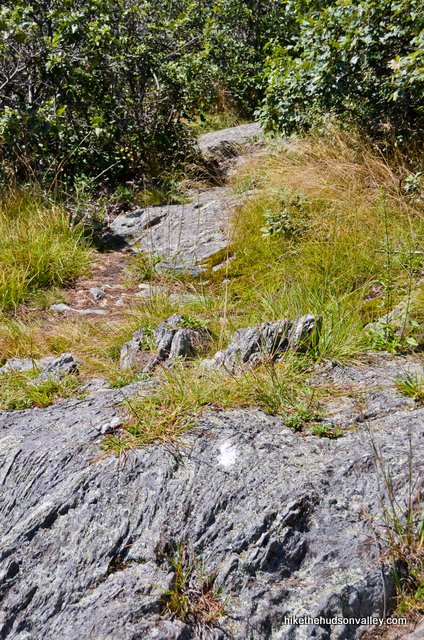
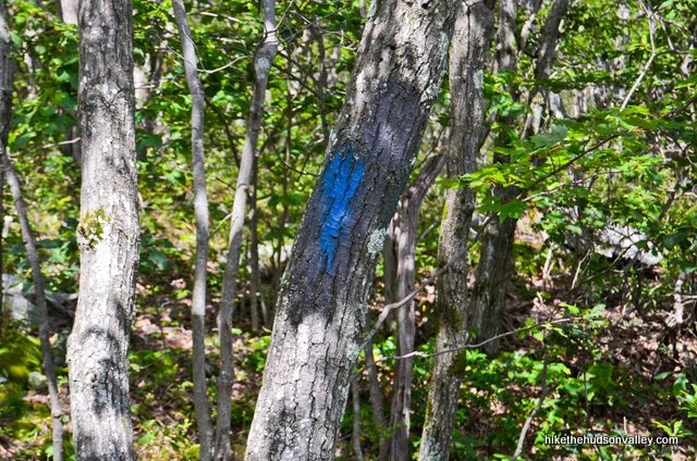
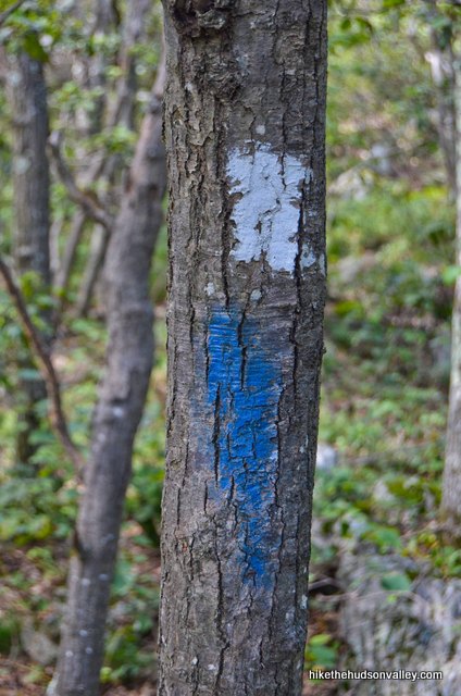
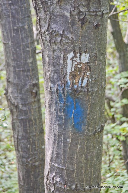
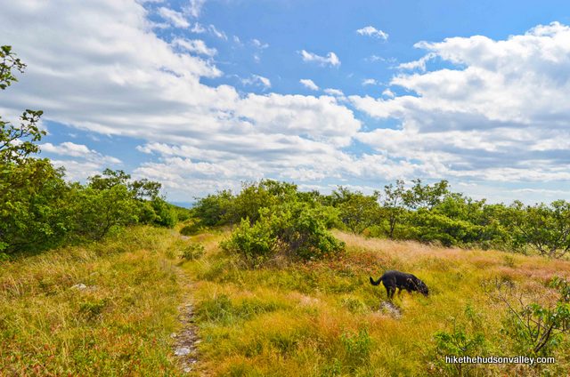
9. The trail alternates between woods and open rock faces, crossing the occasional stream. During those rocky stretches, keep your eyes peeled for painted blazes on the ground.
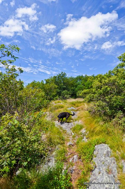
10. Just keep on chugging, carefully following the white blazes and enjoying the beauty of the South Taconic Trail. Though you’ll see them on the way back, don’t forget to check behind you occasionally for some nice intermittent views.
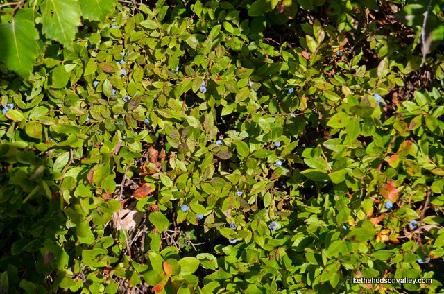
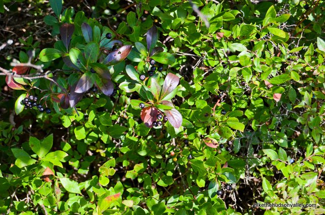
If you’re here at the right time of year, you might also notice some blueberry and huckleberry bushes along the trail. (If you notice any of the bushes rattling at you, perhaps move along to the next bush.)
11. Near the summit of South Brace Mountain, I noticed a couple out-of-place blue blazes. Just ignore them and make sure you keep following the White Trail.
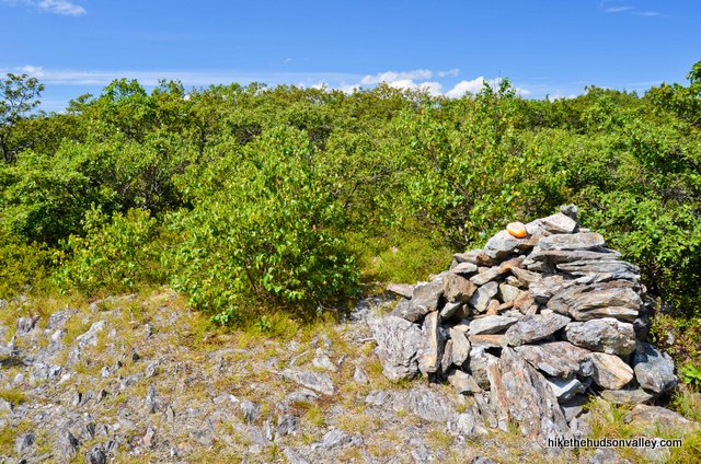
12. A large cairn lets you know that you’re very close to the summit of South Brace Mountain (my GPS marked the actual summit in another 300 feet).
13. From the summit of South Brace Mountain, it’s an easy half-mile stroll across a gentle saddle to the top of Brace Mountain. You may notice the occasional rogue blue blaze as you plunge through some more wooded areas. The South Taconic Trail does its best singletrack impression in this stretch, too.
14. And then, BLAMMO! There it is. The money spot.
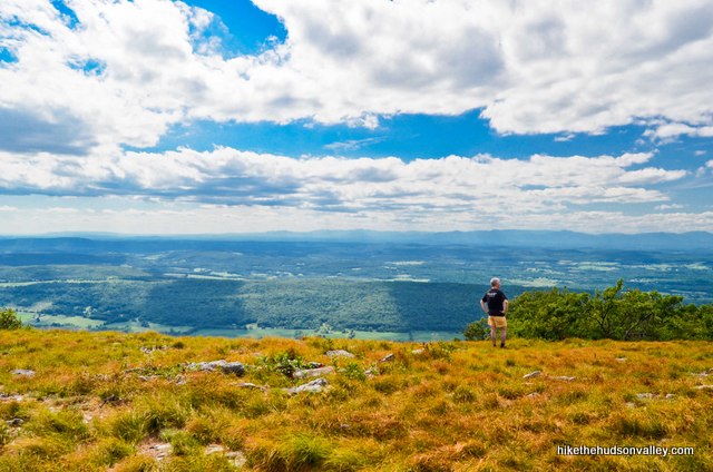
Such a unique place. This has to be one of the best summits in the area. Plenty of elbow room here, and views in almost every direction.
Have a seat. Take your time. Soak it in.
15. When you’re done communing with nature and/or eating candy bars, retrace your steps back to your car (in case you got turned around while mesmerized by the view, make sure that if your back is to the view and you’re facing the huge cairn, you hang a right onto the South Taconic Trail).
It took me about 70 minutes to get back to the car from here.
Enjoy the views on the way down, and step carefully in those steep spots!
16. A hop-and-a-skip down the mountain later, and hello again, civilization! We’ll miss you, nature.
Thanks for all the amazing views and good times! And for, you know, keeping your venom to yourself.
Directions
Directions to the trailhead: From the Taconic Parkway and Rt 44 in Pleasant Valley, take the exit for Route 44, then turn right off the exit to hop on 44 East. Follow signs to stay on 44 East for the next 12.6 miles. At the stoplight in the center of Amenia, turn left to hop on Rt 22 (also still labeled as Rt 44). Continue following Rt 22 North for the next 14 miles, saying bye-bye to Rt 44 when it splits off to the right in the town of Millerton. In 5.4 miles after Rts. 22 and 44 split, you’ll turn right off of Rt 22 onto White House Road, which shortly becomes White House Crossing Road. In less than a mile, this road dead-ends into Boston Corners Road. Turn left onto Boston Corners Road. In .2 miles, turn right onto Deer Run Road.
Hello over there, mountains! We’re coming to see you.
In .5 miles, turn left onto Quarry Hill Road, which was unmarked as of late summer 2013. (No worries about getting lost here – if you miss the turn, which is your first and only option that isn’t somebody’s house, you’ll end up in a cul-de-sac in just a moment.)
Follow Quarry Hill Road as it loops around to the trailhead, just after a field with a brick house in the back.
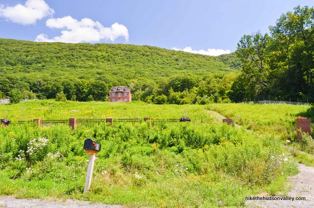
The well-marked pulloff is on the left.
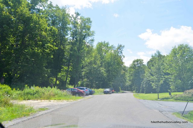
Find a spot, hop out and let the adventure begin!
You can also get directions by checking out the Brace Mountain II (South Taconic trailhead) entry on the HiketheHudsonValley.com Google map.
Sorta nearby address for your GPS: This intersection is right around the corner from the trailhead:
Quarry Hill Road and Deer Run Road
Millerton, NY
Just turn left onto Quarry Hill Road from Deer Run Road and follow it for .5 miles to the trailhead parking on your left. Rock and roll! (And rattle.)
GPS coordinates of parking area: 42.03258, -73.50463 (Clicking will open in Google Maps or the Apple Maps app, depending on your browser/device.)
Resources & Interactives
Super-cool Google Earth flyover of hike route:
Google Terrain Map of hike route:
Related resources: If you’re looking for actual facts and/or useful information, visit these resources:
- My other Brace Mountain trail guide for a nice hike to the same summit from the other side of the mountain
- A great Brace Mountain write-up (also climbing from the other side of the mountain) from the always helpful Berkshirehiking.com
- A nice overview of the entire South Taconic Trail from Berkshirehiking.com
- The brief, informative South Taconic Trail Wikipedia page
- A nice series of Brace Mountain/South Taconic Trail photos from taconichiking.com
- An alternate 7-mile hike up Brace Mt. from the New York-New Jersey Trail Conference
- Some very cool shots of paragliders launching from Brace’s summit on this excellent photo page (thanks for sharing these pictures, Katherine!)
- A PDF trail map from NYS Parks (see the right-hand side, where the White Trail is marked ST (for South Taconic), close to Riga Lake)
Want to support trails in the Hudson Valley? Here’s one great way: Visit the New York-New Jersey Trail Conference homepage and click on Volunteer, Donate, or Shop! (Then you can volunteer, donate, or shop, depending on your mood.)
Hi Mike ,
Looks like gorgeous terrain and views. I have been looking for areas that may hold rattlesnakes ( for photography purposes). Are there sections of the hike where these snakes are more likely to be found than others? I will be hiking there for the first time in the summer of 2021. I appreciate you sharing your pictures with all of us!
No signs of snakes. But I also missed a couple of turns and am convinced that post waterfall really can use more blazes.
Massive amounts of dolomite and on several occasions I mistook that for a blaze.
Honestly underestimated this trail and will have to go back since time only allowed for south Brace.
Also learned my dog is very afraid of the packs paragliders carry. We encounter 4 on our way back down.
No snakes yesterday 8/28/21.
And no people either, for that matter!
I’m hoping to hike the South Taconic Trail, 1st week of December. Other than what’s been written, would you have any advice please?
Really depends on weather and trail conditions. If snow and/or ice are present, make sure you have microspikes – because you’ll be putting yourself at risk of serious injury if you aren’t wearing them. The entire 21.3 miles can be done in a single day as a point-to-point with 2 cars.
Hi, Mike. My college friend and old hiking buddy who lives in the Hudson Valley put me on to your site years ago, and I’ve been using it ever since. Thanks for all the research and sharing! Now, I’ve graduated to hiking on my own and even leading my city friends out for some views. I’m wondering if you could recommend the best trails for some fall foliage hikes! I thought I could just filter through those with the best scenic views, but there are so many to choose from. I’m monitoring the foliage reports. What do you say?
Hey, Lilly! Every hike gets that much more awesome in the fall, but if I had to choose which ones to focus on, I’d recommend any hike with a 5-camera or a 4.5-camera scenery rating. You can sort the trail guides on “The Hikes” page, or use the “Search Hikes” page to narrow them down. Those are the hikes with the biggest views, so your retinas will get exposed to the maximum number of leaves. Any of those would be awesome (as would many with lower scenery ratings, too). Hope that helps!
So glad the site has been useful to you — happy adventures to you and your friends!
No snakes today! But fair warning, the South Taconic Trail (white) south of South Brace continues to be very poorly marked–there was a good stretch where we saw no blazes at all.
Did this hike today. Icy around the waterfalls area but doable once past it. Trail markers are updated. Starts out as yellow from the parking lot branching to white to get to summit. Even the signage is now new. Some of the trail markers located on the boulders were hard to find because of the snow so take your time.
I did “the wall” part of the hike today with my 11 y.o. daughter, it was an awesome scramble! The frozen waterfall was magestic. There was a lot of verglas on the rocks, so bringing microspikes along with hiking poles was a very wise idea. Our active 40lb pup enjoyed it too.
One of the really pleasant features of this hike is that it does not take ages to get to interesting parts, the fun starts within 0.3 miles from the trailhead. I am definitely coming back to explore the entire ridge.
Thanks for an excellent site, this is about our 4th hike inspired by it!
Did this hike today, as I already did most of the other side when I visited the Connecticut high point and NY/CT/MA tripoint but didn’t continue on to Brace due to time constraints. You can’t stress enough how steep the scrambles are and the leaves didn’t make them any easier. Surprisingly wet, even though it has been pretty dry lately. Probably half of the hike was spent on the scrambles. Signs have been updated with new state park signage, but the South Taconic Trail (white) is poorly marked for about 1/4 mile south of South Brace. Don’t follow the blue blazes when they go in a different direction as you head back to the trailhead, but the former blue trail becomes overgrown very quickly. Trail is generally well-worn and easy to follow. Saw a little snow in the shade near the summit.
Thanks so much for the warnings and updates, Josh!
Well, I must be afraid of death or something! Tried this hike today and I was terrified of the rock scrambles. Maybe it was more difficult covered with fall leaves, but more likely I just don’t like scrambling. Views at the top were absolutely stunning, but I would not do this hike by myself in the fall ever again. Perhaps with another person so they can spot where I fall (ha! j/k, kind of).
Love the website, thank you, and keep it up!
First and foremost would just like to thank you for compiling this list of hikes I started working on them in October and yesterday completed my 4th on the list being Brace. It’s an outstanding list thus far. The other locations I’ve hikes are Breakneck, Anthony’s Nose and Stormking.
In terms of this hike I’ve done Breakneck and I honestly thought Brace II was harder. Breakneck is a loop with the back half being leisurely and relatively flat down hill walk with only having to climb on the way up. Brace II on the other hand you have to deal with that challenging climb twice, once on the way up and then again on the way down.
The other issue I think which has been brought up frequently is the very poor blazing once you hang that left at the sign after that steep ascent. Still subpar. While I am not an experienced hiker I was with two other people and we struggled at time locating blazes and there were long stretches closer to the top where there weren’t any. We back tracked a few times and it was just frustrating. If anyone has contact into for the parks department I would like to send some correspondence to them to encourage to reblaze it.
All in all it was a good challenging workout of a hike. Not as many opens views along the way as Stormking or Breakneck but the pay off at the end is pretty magnicent.
Thanks again for this great list. I hope to hike as many as I can in the future!
That’s so great to hear, James! (About the site being useful, not about the blazes being hard to follow.) I really appreciate the feedback. Sounds like there’s been some new blazing near the bottom of the trail — maybe the rest of the trail is in the works? In any event, thanks for the reminder to play a careful game of “Find the Next Trail Blaze” up there in the meantime.
Hi. Did this hike yesterday. Good fun! Not sure if you’re aware, the portion of the trail, from trailhead to junction with South Taconic, has been re-blazed Yellow. Fairly well marked. Sign post near trailhead looks new-ish too. See attached.
Thanks, SWJ — that’s very helpful, and I had no idea! Can you tell me at what step above the yellow blazes give way to white? Step 2? Is that old sign I have pictured in Step 2 still there?
Many thanks!
It’s yellow from step 1, just leaving the parking area, for 0.8 miles; not quite sure which step that would be.
No, the sign in step 2 is not there. And the one in step 5 is newer; but exact same info.
Thanks so much, SWJ! I’ve updated Step 1 of the trail guide to point down to your comment, and to alert people about the yellow blazes and new signs. Much appreciated!
Thanks for the great directions (on this and every other hike!) This site has really been my go-to guide for hiking in the area! And I love the recommendations if it’s safe or not to bring my dog! Brace Mountain was a terrific hike for him (with only one or two challenges! Fun to watch the hang gliders launch at the top! And thankful no rattlesnakes yesterday!!!
That’s awesome, Alexandra – thanks so much! Glad your pooch is having fun out there, too 🙂
This hike looks seriously awesome and I was thinking of going tomorrow, but it turns out the summer the snakes like to come out to play. I saw this comment on NY’s DEC website:
“In the summer, gravid (pregnant) females seem to prefer open, rocky ledges where temperatures are higher”
and I had this little nightmare vision of myself doing one of the rock scrambling parts of the hike, sticking my hand up on an open, rocky ledge, and getting bitten by an angry rattlesnake. So, I’m thinking of doing Alander mountain instead
Although apparently most rattlesnake bites aren’t fatal. “most.” “fatal.” yippee.
Hi Leah! Sorry I’ve hyped up the rattlesnakes so much — that one just made an impression on me 🙂 See Alexandra’s comment above for a more typical Brace Mountain experience. And really, you COULD bump into a rattlesnakes on just about any of the hikes around here, including (especially?) those in the Taconics. Mt. Alander in particular seems to be the hike where the most rattlesnakes sightings are reported, so if you’re looking to avoid any chance of seeing a rattlesnake, that’s about the last place I’d recommend. But really, they do seem to have decent personalities — and according to this site, 98% of all snake bites occur to people who were “messing with” the snake, which it sounds like you’re unlikely to do.
Hope this info is helpful. Whatever you choose to do, happy adventuring out there!
Aaand we ended up going, despite the fear of rattlesnakes! We did not spot any but we did see a garden variety, way less threatening looking snake. Thanks for the directions, tips, and an awesome website!
June 25, 2017. We hiked the trail today. Awesome hike, beautiful views and I’m happy to report no snakes!!! There were a group of paragliders taking off from the summit. So fun to watch! Thanks for your great website and trail descriptions, we use it often.
Sounds like an amazing day, Sue! And thank you for the kind words!
The snake is an Eastern Hognose and is not poisonous.
Hi Grant,
That snake most definitely rattled at me, and rattlesnakes are very common in the Taconics. I’m no herpetologist, and you sound quite confident — after comparing images online with my own pictures, though, I’m still 97% sure it was a timber rattler. Anyone else want to weigh in? I’m inclined to offer to eat a Vibram sole of medium thickness if that turns out to be something other than a rattlesnake.
I hiked this trail in November of 2016 and was wearing bad shoes and went all the way to the summit and on my way back stepped on a rock and had bad footing and heard a crack and fractured my tibia and fibula. A rescue team had to bring me a mile back to the summit and a helicopter had to fly me to Millerton and then an ambulance had to drive me to Sharon hospital. Had to have surgery. But I will go back, awesome hike. Next time I will wear good hiking boots and use hiking poles and watch where I put my feet better (including watching out for snakes).
Daryl, I’m so sorry to hear about this experience — I can’t imagine how traumatic the whole ordeal must have been, including what must have been a very scary time before the rescue team showed up, and a difficult recovery. You sound like quite a resilient person to be talking about getting back out there. The bar is pretty low for having a better hike next time, but I hope you have a wonderful trek next time you give it a go, and hope you’ll be fully recovered soon. All the best to you.
Adding my thanks for the good info. Your snake photos freaked us out but we went anyway. Saw 0 snakes and lots of pretty things. It’s a lovely hike (think they’ve updated the trail quite a bit). We took our 22 lb Tibetan terrier. He’s a trooper and loves rocks but was definitely tired after. Kept him on the leash this time because…snakes. And looked up nearest emergency vet in advance which I’ve decided is a good thing to do in general now. Thanks again for the great site.
Just finished hiking this with my son. Good, strenuous workout and tougher than I expected but once you are on the ridge it is worth it. I read something before going up that this is not a hike to try when it’s wet. Very true as it was extremely slippery after the early morning rain. Leave the dog and small kids home unless you can carry them.
Is overnight parking permitted at the trailhead? I plan on doing an overnighter loop in 2 weeks and we wanted to use this trailhead as our starting point. Thanks!
Shannon, you probably found out already. No, the NY trailheads in this area do not allow overnight parking, they all say “park closes at dusk”. But if you go in on the Mass side there is overnight parking used for a few camp sites in Mt Washington park and on the AT. How was your hike!
do you ever guide private hikes?
That’s a flattering question, Stu – thank you! I mostly just guide private hikes for my kids these days, when I can get them to stop chasing each other around the house. But it might be a fun thing to do one of these days – thanks for the thought!
In the meantime, I don’t know anyone who has used them, but a Dutchess County Tourism page linked to these guys, and their site looks very nice: http://www.hikeny.com/
These dudes also reached out to me a while back, and they seem legit: https://yourguidetoadventure.com/adventure_travel/breakneck_hike_nyc
Hope this helps!
Mike,
I would join a group hike if you ever put one together! Either for a trail that you have already reviewed or a new one. I love the work that you do – it has helped me get back into hiking and enjoying the woods that we have so close to home. Please keep up the good work.
Jim
Mike –
Just wanted you to know that I alerted some of my colleagues in the NYNJ Trail Conference, and they hope to get out on the trail to touch up some of the white blazes. Hopefully this will help alleviate the challenges I mentioned in my previous comment.
Steve in Jersey
Thanks so much, Steve! Appreciate all the great info, and thanks for sounding the alarm! And thanks to the NY-NJTC for being so awesome.
Just completed the hike this afternoon. Wanted to alert anyone doing this for the first time that the trail is badly in need of reblazing, particularly above the waterfall (which by the way was non-existent due to lack of rainfall). There were many tree markings that could barely be distinguished from lichen growth, and vice versa. And the white markings on rocky outcroppings were oftentimes even harder to distinguish from bands of quartz embedded in them. Pretty much every party that I passed on the trail up and back was commenting about it. Thank heavens for Mike’s instructions.
On the plus side, the views are every bit as fantastic as Mike described.
One thing not mentioned above, but which was a very pleasant surprise: Brace Mountain is the jumping off point (quite literally) for parachuters. There must have been a dozen of them hovering above the mountain when I arrived.
I’m interested in taking this hike in July. Would you say it’s an easy hike to do in the middle of summer? I’m more concerned about how long you’re out in the open while hiking versus in the shade of the trees. Also, what time of year did you go? By the look of the meadow being yellow, it’s fallish? Do you know if the summer would yield such beautiful colors and water for the waterfalls (ie, sometimes water flow may be weaker)?
Hi, Irina! Sorry I missed this comment earlier — perhaps you’re considering an August hike here now? I hope so! If you haven’t already been, the hike is mostly under the cover of trees in the beginning, but there are long (and gorgeous) stretches of being out in the open near the top. I went on August 10, 2013, and loved it. I also got lucky with the waterfall, which would normally be pretty dry this time of year — it just happened to have rained hard the day before my visit. Hope this helps!
Good Morning Mike,
First of all, I’d like to thank you for taking the time and effort in creating this website. I’ve referenced it numerous times when planning hikes around the Hudson Valley.
I, like you, hike with something called a “child” strapped to my back. I’m interested in going to Brace Mountain and would like your feedback on this hike when carrying “baggage”!
Also, have you ever done Breakneck Ridge with your son? That’s another one I’ve traversed alone but am cautious on taking my lil’guy.
Thanks again for all the great info!
Nick
Nick,
Thanks so much! Yes, I did do this hike with my youngest son on my back, but I can’t say it was the smartest decision I’ve ever made — there’s a section after the waterfall that was rather tricky, with a sheer section of rock that required some light scrambling. If I’d had another adult there to help give me a hand or a boost, it probably would have been a piece of cake. As it was, I think most people would have called proceeding on my own a somewhat questionable decision. If you’re very cautious (which is a wise thing to be in these circumstances), I’d highly recommend at least having someone else there to help. I also recommend trekking poles when kid-carrying — their added stability and safety more than make up for any added dorkiness (perceived or otherwise).
And I wouldn’t try Breakneck with a kid on my back – I’ll wait until they’re older and can take a crack at it themselves. It’s just too steep. This is also coming from a guy who fell flat on his face while kid-carrying, on a perfectly flat stretch of ground (hence the recent addition of trekking poles).
I hope this helps, and I wish you and your kid many safe and awesome adventures out there!
Mike, once again – your information was very helpful! Had a great time yesterday on the mountain all by myself! I think this might be the last time anyone can climb this one if we get any more snow. The trail was a little tricky in some spots, but well worth it once you got to the top. They do need to work on the trail blazes – some of the white markings are very hard to find. Still it was a great hike!!
Glad you had a great day out there, Jim! Thanks for taking the time to share these comments.
Can I camp on this trail?
– Denmark
Hi Denmark – so sorry I missed this comment when you initially posted it! No, camping is not allowed here. There is a cabin on nearby Alander Mountain (http://hikethehudsonvalley.com/alander-mountain-ii/), though – I believe that one is fair game. Hope that’s not too late to help!