Background
If you find this free trail guide useful, please provide payment by picking up at least one piece of litter on your hike. Cha-ching! Thanks for being awesome! (And here’s a quick primer on Leave No Trace, too, to help us keep the trails nice and fresh for each other.)
Background you can feel free to skip: The piece of Appalachian Trail that ascends from Route 9D towards the overlook at Anthony’s Nose feels like a 500-vertical-foot staircase.
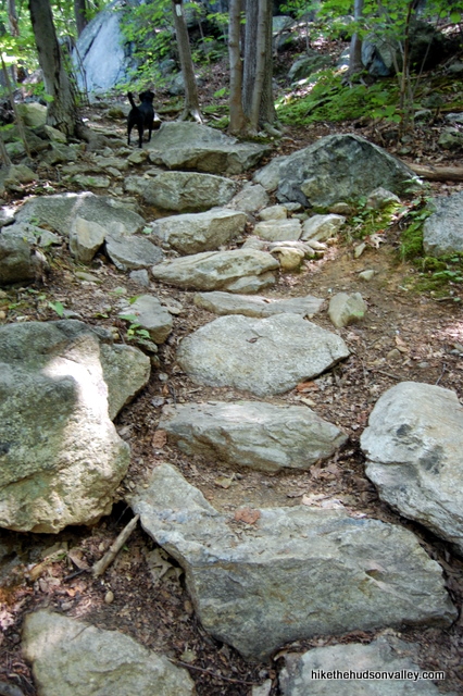
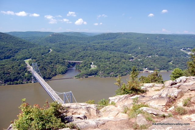
It feels like that because that’s pretty much what it is: a well-maintained outdoor staircase that brings you to one of the nicest overlooks in the Hudson Valley, with a sprawling, rocky clearing that affords plenty of nice places to take it all in. It’s like you’ve scored tickets in the skybox for the Bear Mountain Bridge.
This hike is only steep for the first .6 miles, then it’s smooth sailing all the way to Anthony’s Nose, following an old, relatively flat road for about .75 miles to the overlook.
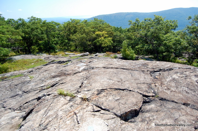
On the warm weekend afternoon when I was here last, there were a decent number of fellow hikers taking in the view, but there’s plenty of room for everyone. If you’re looking for a little more solitude, there’s a smaller viewpoint just around the corner on top of a huge rock, perfect for plopping down for a picnic.
If you have a couple of hours to burn and you’re looking for a decent workout on the way to a beautiful overlook, you should definitely pick Anthony’s Nose. You’d have a hard time finding a nicer nose to pick in the Hudson Valley.
**UPDATE May 15, 2015** Here’s another trail guide for an alternate path to Anthony’s Nose, one that features a few more nice views along the trail. Both great hikes, and you’d be well-advised to try each of them once. Or more than once.
Trail Guide
Bonus unsolicited advice: Don't depend on having cell service in the woods - it can be spotty out there! Download this trail guide to your phone before you head out. (It's easy to do on iPhone and Android.) May your connection to nature be strong, even when your connection to the internet is weak.
1. From the parking area on the shoulder of Route 9D, just north of the Bear Mountain Bridge, head north along the shoulder of 9D, away from the bridge. Believe it or not, you’re hiking the Appalachian Trail right now. (I hate hiking along roads, too, but this is a short jaunt, and you’ll be in the woods soon.)
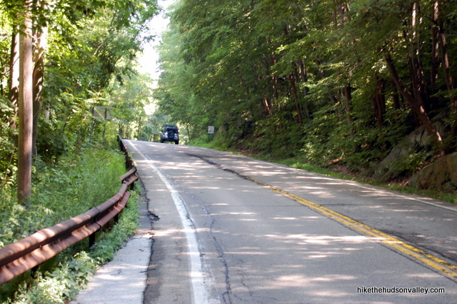
2. Just past the Putnam County sign on the right side of the road, you’ll see a kiosk and white blazes marking the start of the hike. Turn right to head uphill here, following the white blazes of the Appalachian Trail. (You might also see a car or two parked here, but there’s not much room, so I like to park closer to the bridge, even though walking along the road isn’t my favorite thing to do.)

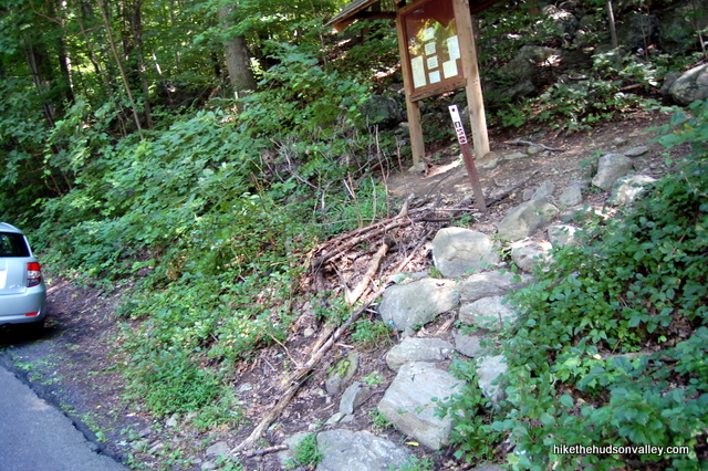
3. Climb! The rocky trail heads steeply uphill, occasionally leveling off for a moment or two. There are some unmarked trails weaving around the hillside here – be careful not to get bucked off the white-blazed Applachian Trail, which is very amply marked.
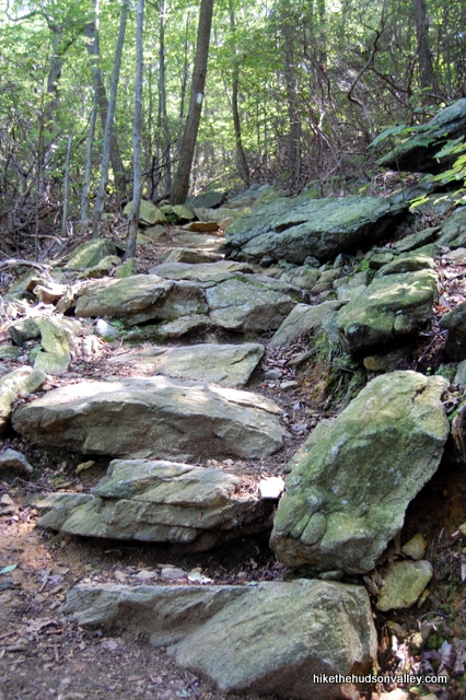
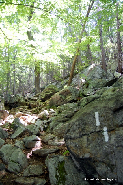
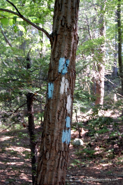
4. The next junction is coming up in about .5 miles, after you climb 415 vertical feet from the road. It took me 25 minutes from the road to get to this junction with the blue-blazed Camp Smith Trail. At the junction, turn right.
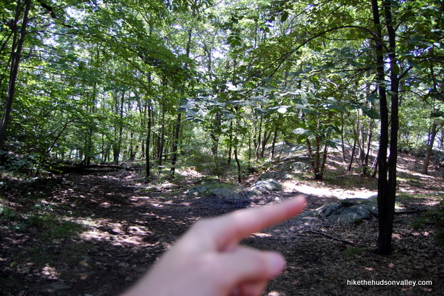
**UPDATE July 2019** According to Connie’s helpful comment below, the tree pictured below with the white-and-blue blazes looks different now, perhaps with just some blue circles on it? Whatever the tree and its blazes look when you venture past, be sure to turn right here! (And make note of this junction so that you can find it on your return trip!)
**UPDATE August 2020** Hikers have gotten lost on their return trip because they missed this junction (and the left turn you need to make to head downhill on the White Trail later to return to your car). Please make careful note of this junction so you don’t miss it on your way back later in the day!
5. Take note of the beautifully tagged trail register on your left. You just might find some jars of PB&J inside.
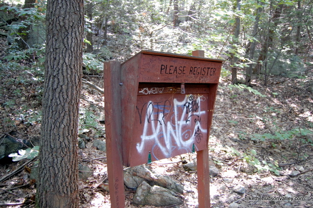
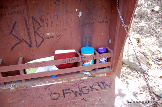
**UPDATE 2/28/2015** According to Sonya in the comments below, this trail register is no longer there. Looks like you’ll have to get your PB&J at the grocery store instead (and thanks for the update, Sonya!).
**UPDATE 1/9/2023** According to Alison’s helpful comment and photo below, there’s now some very helpful, clear signage posted here to help guide you toward Anthony’s Nose. That’s much more helpful than peanut butter and jelly jars! Perhaps not as delicious, though.
6. Enjoy the calm, gradual ascent of the Blue Trail – at this point, you’ve earned it. It’s about .6 miles to Anthony’s Nose from here, and you’ll only gain about 100 more feet in elevation along the way. This section of trail is so easy, the freeloading toddler on your back may want to walk it himself.
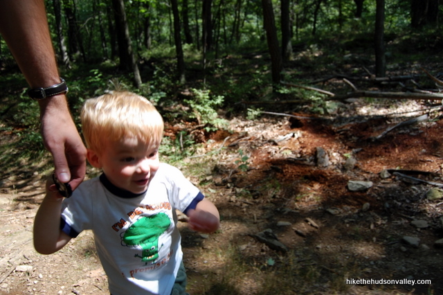
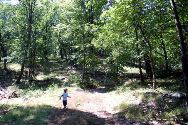
7. After .6 miles (which took me 30 minutes, walking at toddler pace, but will probably take you more like 15), you’ll come to a T-shaped junction, where the Blue Trail splits off to the left, up and over some rocks. Straight ahead, an unmarked trail is blocked with some branches that are correctly advising you not to proceed in that direction. Anthony’s Nose is just a hop-and-a-skip to the right – follow the clearly tromped trail to the right to arrive at your destination.
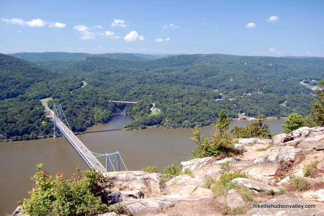
8. And what a destination. As you emerge onto the rocky clearing, the view opens wider with every step you take, and the Bear Mountain Bridge stretches across the river right under your feet.
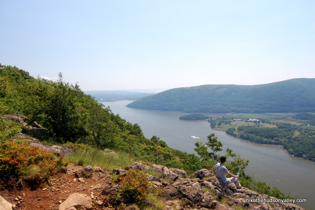
9. This is a prime place to munch some snacks. If the rock formation heading down the slope is Anthony’s Nose, then Anthony’s Forehead makes a great picnic spot.
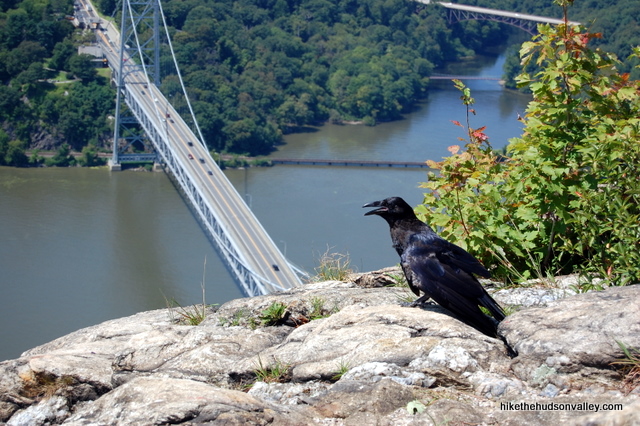
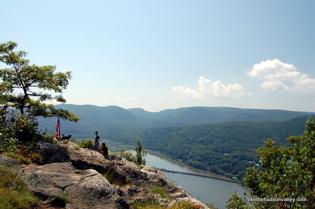
10. When you’re done hanging out, wandering the length of the rock formation to make sure you’ve taken in all the views, head back to the T-shaped trail junction in the woods just behind you.
11. Optional step: There’s another small view if you follow the Blue Trail just beyond the junction (a right/straight turn onto the Blue Trail, opposite the way you came in), just beyond a small cairn (pile of rocks). This is also a nice spot to have a picnic, on the off chance Anthony’s Nose is congested. It’s smaller than the view you’ve already seen, but it’s a nice spot – check it out if you’d like, then come back to the junction. Total travel time for this step: five minutes or less.
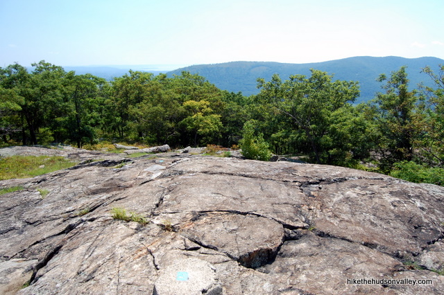
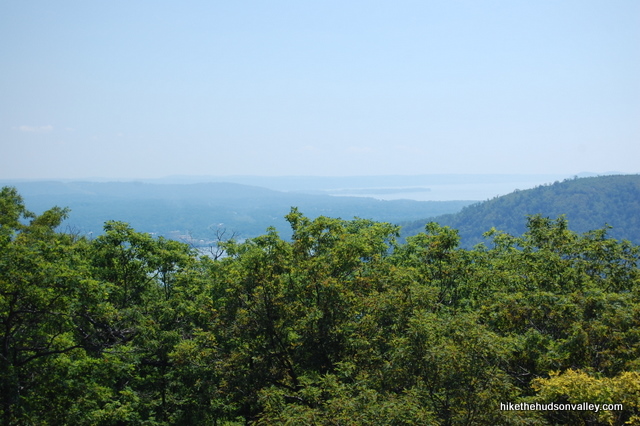
12. Retrace your steps back to your car. Follow the Blue Trail back to a left turn onto the white-blazed Appalachian Trail, just past the graffiti-emblazoned trail register (that might not make the best landmark anymore, on account of it no longer being there). Hop down the stone steps all the way back to Route 9D, then turn left along the road, keeping a lookout for traffic, all the way back to your car.
Aren’t you glad you picked Anthony’s Nose?
Directions
Directions to the trailhead: From the village of Cold Spring, head south on Route 9D. About 8 miles after Cold Spring, look for the Appalachian Trail kiosk on the left side of the road, just before you get to the Bear Mountain Bridge. That kiosk marks the start of the trail, but you’ll park a few hundred yards south of there, where there’s a nice wide pull-off on the right-hand side that can hold plenty of cars. (You might also be able to squeeze into one of the few spots on the northbound shoulder next to the kiosk, but I’ve never been able to score a spot there, and having to jockey around on a busy road is enough to scare me off of trying. If you get lucky and find some room, though, parking here would save you from some road strolling.)
You can park right in front of the “End 9D” sign on the right-hand side of the road. Straight ahead, you’ll be able to see the cables of the Bear Mountain Bridge stretching over the road. Carefully hop out (cars travel fast here – stay on your toes!) and let the adventure begin.
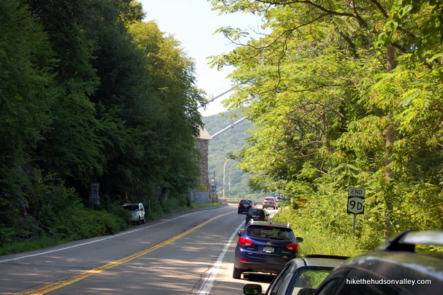
You can also get directions by checking out the Anthony’s Nose entry on the HiketheHudsonValley.com Google map.
Sorta nearby address for your GPS: The intersection of Route 9D and Route 202 in Cortlandt Manor, NY is just a couple hundred yards south of the pull-off for the trailhead, which is on the right-hand side of Route 9D if you’re heading south.
GPS coordinates of parking area: 41.32033, -73.97879 (Clicking will open in Google Maps or the Apple Maps app, depending on your browser/device.)
Resources & Interactives
Super-cool Google Earth flyover of hike route:
Google Terrain Map of hike route:
Related resources: If you’re looking for actual facts and/or useful information, visit these resources:
- The concise Anthony’s Nose Wikipedia page
- A cool Anthony’s Nose panoramic photo from this location scouting site
- A longer hike to Anthony’s Nose detailed on NYCdayhiking.com
- For several Anthony’s Nose options, plus many other excellent hikes in the area, check out this page from CatskillHiker.net
- My other Anthony’s Nose trail guide, approaching from the other side of the mountain
Want to support trails in the Hudson Valley? Here’s one great way: Visit the New York-New Jersey Trail Conference homepage and click on Volunteer, Donate, or Shop! (Then you can volunteer, donate, or shop, depending on your mood.)

It looks like they added some clear signage at the junction with the blue trail! It’s a bit icy this time of year but manageable. Thanks for the guide!
Thanks so much for the helpful update, Alison! I’ve updated the trail guide above (Step 5) with a pointer down to your comment. Very much appreciated!
Thank you so much for this great guide! We almost called it quits trying to find the trailhead as gps was taking us all over and we kept missing it!! Your pictures and explanations helped us stick with it and it was a great hike! Thanks you!
So glad you didn’t have to call it quits, Michelle! Thanks so much for the nice comment, that’s really nice to hear that this guide came in handy for you. Here’s to many more great hikes for you and your crew!
The trail is clearly marked…camp junction has nys posted signs directing you and so does the overlook.. the boy scouts made a nice wood deck for the kiosk.. there is now 9/11 memorial with an american flag at the outlook.. there is also an other outlook unmarked about 400ft from scenic outlook Look for a faint footpath to the left of the trail. Follow this unmarked trail a short distance uphill towards some concrete footings. This was the site of an airway beacon that once stood guard on Anthony’s Nose. There are two survey markers, one on the footing and one on a rock slab nearby.
I’m planning to go with a group on Saturday when it’s supposed to rain on Friday and Saturday early morning. The forecast says there won’t be any rain by the time we get there. Do you think this hike is doable since it’ll be raining on Friday and early Saturday?
Hi, Jovan! It would be ideal to give the rocks some time to dry before you head up the mountain, just because the beginning of this hike is steep and could be quite slippery when wet. (The forecast for Saturday has taken a turn for the worse, too. Booo!) I’d recommend going when the conditions are better if you can, but otherwise, some good hiking boots, trekking poles, and an abundance of caution could help you stay safe and on your feet. Hope that helps! (And I’ll also be hoping that the forecast for this weekend improves!)
Hi – I was wondering since the Metro-north Manitou station is closed if there was an alternative stop that I could still do the hike and NOT go via Camp Smith. I really want to do this hike but don’t have a car. Any feedback is appreciated!
Hey was wondering how this view would look at sunset. Must be awesome. But I was just wondering how the hike would be going back down since it would be kind of dark
Hi, Matt! It is indeed a beautiful west-facing view for the sunset, but you would need a good headlamp or flashlight (or both!) for the return trip – there are plenty of rocks and steep spots to be wary of. (These days, you’d also need micro-spikes for dealing with the ice and snow.) Stay safe and enjoy if you decide to give it a go!
How long time wise does it take to complete the hike?
Hi, Kevin! I gave my estimate as 2.5 hours above, but that time includes doing the hike with a toddler on my back, so you may find that you can do it faster if you’re not lugging your offspring up the mountain. Have fun if you go!
Great hike and directions to get to the hike. However, on the way back down it’s not as easily marked and somehow at some point we followed the white the wrong way and missed the whole staircase section and ended getting out at a totally different point. Think we exited at 202? We didn’t go back in and try to retrace our steps because it was already 7pm. But it would be great if something was added like watch out on the way back and stay to the left after the spiky tree cause the trail splits or something. We made our way back to our car on the roads but would have preferred staying on the right hike.
Glory — I’m so sorry that happened to you, that must have been awful! In Step 4, the trail guide currently says this, in the July 2019 update:…” (And make note of this junction so that you can find it on your return trip!)”
I’ve just added this update based on your comment:
**UPDATE August 2020** Hikers have gotten lost on their return trip because they missed this junction (and the left turn you need to make to head downhill on the White Trail later to return to your car). Please make careful note of this junction so you don’t miss it on your way back later in the day!
I hope this added emphasis will help others to avoid the same fate. Let me know if you think of anything else that should be mentioned there. Wishing you many more successful adventures out there!
Hello,
What time do you guys advise to arrive ?
Hi, Indira! If you’re visiting on a weekday (which I’d strongly recommend), you can visit whenever you’d like! On a weekend, I would get there by 9am to be safe. Hope you have a nice hike whenever you go!
Thank You so much !
Hey…so the picture you have of the blue/white we did not see. We saw a tree with 2 blue circles. Of course that should have been fine but we went left partly because I was only reading every other word and partly because I was going by the pictures. Thought that might be worth an update even though it was my bad for not reading where you clearly say go right
Connie, thanks for the helpful feedback! I’ve updated Step 4 above with a link down to this comment to help others avoid making the same mistake, and to advise folks that the blazes in that area may be different now. Hope you didn’t wander too far in the wrong direction (you could have ended up in Maine!). Appreciate you taking the time to leave this comment — thank you!
Ha! We were wondering where we would’ve landed! Didn’t go to far and it was a nice addition…love rock staircases!
Hey. Do you think five year olds could do this hike? Thanks!
I have the same question and would be interested if you or anyone else has any experience to share.
I saw quite a few kids on this trail (not a trail for enjoying the quiet in nature)…. 5 might be a bit too young, but definitely saw maybe 8 year olds.
Hi, Eitan and David! I wouldn’t make the blanket statement that EVERY five-year-old could do this hike, but it would certainly be doable for some subset of hearty little adventurers. Whether it can be done without their companions enduring some amount of whining will depend on how many snacks you bring. But yes, if you have a kid who really likes to hike, there’s nothing that would prevent him/her from enjoying this hike, though you may want to give them a hand over the steepest parts. And you may want to consider the version of the hike that I’ve documented as Anthony’s Nose II, which removes the road-walking aspect of the hike, and spreads the vertical climb out a little more. Hope this helps!
Did Nose II today and it was a blast. Saves us from highway walking and with your guides we knew exactly where the hard parts were coming. The twins are 4 1/2 and they killed it. Thank you for the consistently indespendanle sage advice. Keep up the good work!
Thanks for a nice guide. Is this place part of some State Park? I want to bring my drone on a hike but not sure if there are no restrictions.
Bear Mountain State Park
Hudson Highlands State Park
Looking to do this tomorrow. Anyone know if any special equipment will be needed? How’s it looking up there?
Thanks!
Are there porta potties around ?
Hi Bg — nope, no facilities on this hike. You might be well-advised to make a pit stop on the way here.
Good afternoon. Isn’t there another parking area when you cross the Hudson River coming from the Bear Mountain park side over to 9D Cortlandt Manor? Someone told us that if you make a right coming off the bridge that there is another parking area where you can access a trail that also takes you up to Anthony’s Nose…
Hi Jan! Absolutely, that’s a great way to do this hike. I’ve written that version up as Anthony’s Nose II (via Camp Smith Trail). Hope that helps!
Happy new year New York hikers!!! I’m wondering if anyone can give me an update of the trail conditions of Anthony’s Nose as of today? Mostly if there’s snow? Many thanks 🙂
Hi there, Lee! Scenic Hudson just posted a handy update on trail conditions around the area today. Here’s the link. Hope that helps!
Hi Mike, is this hike good for a cub scout pack with parents and little cubs. I am looking for something not too steep and fairly moderate to hike. can you give me the actual address if I do decide to post this hike and is there a fee and how is the parking over there. thanx for your time.
I’d personally say No, for the hike as listed. The first portion of the the hike along the AT, is quite steep. Short legs might have trouble. Plus parking is along route 9D, which can be narrow and crowded with cars going 40-45mph.
However, there are lots to the South, both midway (prob best) and further down at the end of the Camp Smith Trail. This route i have only decended (from Nose to mid-parking lot) and it was not that bad as I recall (maybe someone else can chime in). It might make for a safer parking situation and slightly easier hike.
http://www.nynjtc.org/files/cst.pdf
Hi Claudette! I agree with Will — if you’re going to do this with several small children, it will be better to approach Anthony’s Nose from the other side, where the incline is more gradual, and you can avoid walking along the road. Here’s my write-up on that version of the hike (there’s no fee, and directions to the trailhead are given at the bottom of the guide): http://hikethehudsonvalley.com/the-hikes/anthonys-nose-ii-via-camp-smith-trail/
My son did that version of the hike when he was five years old, and he loved it. Hope you have a great trip if you give it a go!
Would like to take the train on the weekend to this hiking trail, already know directions etc. but my question is that can we find any restaurant/restroom nearby in Manitou or Peekskill station afterwards? Thank you!
There are a few restaurants walking distance from the Peekskill Metro North station including the Peekskill Brewery, which has amazing food and great beer!
It looks like it is possible to hike from Manitou station, up Anthony’s Nose, and down to Bear Mountain toll house. Can I get from there to Peekskill on a trail or footpath? There looks like there will be a sketchy part where I might have to walk along the road between the toll house and the bridge to Peekskill… Although this is from this map and Google Streetview.. If anyone has hints let me know!
http://www.gpsies.com/map.do?fileId=zqtmzyawcwpuqzsx
Does anyone know if this trail of dog friendly??
It sure is! Brought my pooch here many times, from both directions. She’s a big fan.
Very nice.
Are there ever any wild animals around this site?
Thanks! Besides birds and chipmunks, I’ve never seen any, but I’m sure there are plenty of critters of varying size all around here.
Directions were very helpful since this trail is one of the few (that ive looked at) in the area that is totally not on Google Maps.
The AT is definitely the rougher section for my out of shape self, once we made it to blue it was great, and even kept going down to the parking lot down the other end of blue, which was probably a longer but easier descent than back down the AT. Only problem was walking back along the highway, a couple areas do not have much of a shoulder.
Here’s a panorama I took from the top.
Thanks, Will! Glad the directions were useful. Very cool panorama – never seen one displayed like that before!
Thank you for posting directions up to Anthony’s nose, we would not have found this gem without your instructions.
Last fall I took my daughter and some friends. Some hikers had left food garbage and near the edge of the overlook, the area was swarming with wasps, including GIANT ASIAN HORNETS.
I urge visitors to proceed with caution, particularly visitors with children. The edge of the overlook is basically a precipice. Needless to say, a dangerous place to be running away from stingers.
love this trail. there are ants at the top, they like to eat tomatoes, bring extra for them
We hiked this today in a couple of inches of snow, with a 10-year-old and a 12-year-old. The path was well trodden so a bit packed down and icy, but overall it was a beautiful winter hike with glorious views (thanks to the bare trees) the entire time. Our kids have regular snow boots and they were fine, although the final descent to the car involved some butt-sliding. The peanut butter trail register seems to be gone. Thanks for the great directions! Love your site!
Sonya, I come from the future to thank you for your update (and to apologize for not thanking you sooner). I updated the trail guide many years ago based on your comment, but should have also thanked you. Better late than never, I hope! Thank you!!!
The toll house is the beginning/end of the Camp Smith Trail. The trail leads to Manitou Mountain and continues on to Anthony’s Nose. Manitou mountain is a smaller mountain just south of Anthony’s Nose. This route is longer and offers more viewpoints than the more popular route in the northern side, on Route 9D near Bear Mountain Bridge. Continue on the trail and you will see a view of the BM bridge and the side of Anthony’s Nose. The trail keeps ascending and descending as you approach Anthony’s Nose. Once you reach the view point from Anthony’s Nose with a view of the BM bridge right below, just simply retrace and follow the same trail back to the toll house. Total length from and to the toll house is about 6 miles. Start from the toll house if you want a much longer hike with more viewpoints than the more popular route. There is a small dirt parking lot by the toll house.
Hi, I was reading other websites and they said to park at the Toll House and start off at the Camp Smith Trail. Just wondering what is the difference. I want to avoid parking on the side of the road and also walking along the road. Thanks.
Hi Lewis! Yes, that’s another great way to do Anthony’s Nose, and it’s a hike that’s on my coming soon(ish) list. Some guides list the hike that Nemophilist outlines below (thanks for the great pointers, Nemophilist!). You can also do a shorter version (which is the hike I’ll write up) that’s a nice 2.6-mile roundtrip. Follow Route 6 east from the Bear Mountain Bridge for a couple of (scenic!) miles, then find a large pulloff on your left, just as the road takes a hard bend to the right. Follow the blue-blazed Camp Smith Trail to your left from the parking pulloff, all the way up to Anthony’s Nose. All there is to it! Somehow, I’ll make that into a twenty-page write-up, though. That’s how I roll.
Enjoy it if you check it out!
Thanks Mike. It looks like there are 2 bends that go right. the 1st is a 90 degrees bend and the other one looks like 180 degrees bend. Just wondering which one you are referring to. Also, how long do you think it will take to do this 2.6 mile roundtrip hike? Thanks
Ok I went on google maps and see the large parking pulloff you are talking about. Looks like it’s the 2nd bend if coming from the east. Between the bridge and toll house. Thanks!
That’s the one, Lewis! Here’s a Google Street View shot of the parking area: http://tinyurl.com/le3s27f
As far as the time to do the up-and-back 2.6 miles, it took us just under 2.5 hours, but we were walking much of it at my four-year-old’s pace, with a fair amount of dilly-dallying baked in.
Have fun out there!
Hi Mike,
We went there last weekend. We went by 202 from other side of the bridge ( west of Hudson). So once we crossed the bridge we took left and entered 9D. This is where I saw the 9D END sign on the left side of the road ( since we were coming from the 202). we parked on right side of the road ( going towards north) . We were in a hurry and the cars were so fast that didn’t want to wander around aimlessly. I asked couple of hikers and they said they were also looking for it. Since we were not sure we went to October Fest in the bear mountain state park. I want to try it again. I wanted to check how far is the walk on 9D to get to the kiosk? The road goes up and I think turns right. Didn’t see that kiosk till that turn.
Thanks Very Much,
Maloy
Hi Maloy! Just checked my GPS log from the hike — it’s .17 miles along the road (from where I parked, within eyeshot of the bridge cables) along the road until the kiosk and turn into the woods. Just takes a few minutes. Hope you get a chance to check it out next time!
I was curious if anyone knows a way up Anthonys nose or breakneck that would be possible with a large dog, I have a 90lb German shepherd, I wouldn’t mind taking a longer trail in if it was possible. If I could make the peak with her it would be an amazing picture. Thanks guys
Hi Brian! Anthony’s Nose should be a piece of cake for her. No problem spots there for any pooch who can climb stairs (like, lots of stairs, but stairs). I’ve seen big dogs do Breakneck, too, but as I mentioned in that trail guide, it requires some hoisting and pushing. Still doable for most healthy dogs, but it’s a team effort there. I put more details about my own experiences with pooch-hiking there in that guide (http://hikethehudsonvalley.com/breakneck-ridge/). Hope that helps, and hope you get some great pics if you give it a shot!
Good hike! Good views! Not as hard as it looks or sounds! 🙂
Great hike, not too long so it’s a great view for effort. I always seem to spend a long time at these money spots. Thanks for all the effort you put into this site. I’ve done 5 so far and and looking forward to my next hike. I have lived in the HV all my life and have driven past many of these places 100’s of times. Always took them for granted, not anymore!!!
This site was so helpful and accurate! Along the route, there were many other groups quoting your site! Thank you!!
That’s awesome, Lia – thanks so much!
Hey! We’re really excited about trying this trail. Any advice about how to get there from NYC via public transportation (as in, we will not have a car with us at all)?
Excellent! This article gives transit directions to Anthony’s Nose and several other hikes in the area: http://www.dnainfo.com/new-york/20130708/new-york-city/top-summer-hikes-for-car-free-new-yorkers
Hope that does the trick!
You can take the Bear Mountain Short line bus 7 days/week from Port Authority. You get off at the Bear Mountain Inn and walk either 9w (kind of unsafe) or the Southern border of Hessian Lake and up to the traffic circle and simply walk across the bridge…left on 9D on the other side…and to the kiosk. The walk to the trailhead is maybe 1.5 miles and very scenic – especially walking over the bridge.
Great sense of humor! We are going there tomorrow. Thank you very much.
Aw, thanks, Peggy! Much appreciated. Hope you had a good visit.
Would you recommend this hike in the winter as well?
Hi Elie! Somebody just asked me the same question about Mt. Beacon, asking if it’s safe to hike there in the winter (right after we had a big snowstorm here). Here’s the answer I gave, which applies to Anthony’s Nose (which is very steep in spots) as well:
“I’m afraid I won’t be much help on this one – I’ve never been up there in the snow before. I can’t promise that it’d be safe. Beautiful, most definitely, but you’ll have to prepare responsibly and make good decisions for yourself. (Sorry to be lame, but without knowing people’s abilities and experience, I’m really hesitant to make blanket recommendations about hiking in potentially dangerous conditions.) Whatever you decide to do, and whenever you get there, I hope you enjoy it and take lots of pictures!”
Another useful resource for planning winter day hikes is this page from the Appalachian Mountain Club: “Essential Winter Gear for Northeastern Hikes” — http://www.outdoors.org/publications/outdoors/2002/2002-winter-gear.cfm
Hope that’s helpful!
Thanks so much for your directions! Went there yesterday for an autumn hike and it was so gorgeous. The leaves on the rocks made it a bit slippery but overall it was fantastic.
I cannot seem to find a trail map on this one. Do you have a link to a map I could use?
John — I’m not aware of any online maps for this hike, either (though you can click on the GPS goodies section above to see a Google terrain map tracing of the hike route). For a paper map, you can’t beat the official New York-New Jersey Trail Conference map set – money spent on their maps is always money well-spent: http://www.nynjtc.org/product/east-hudson-trails
Hiked this one today with a friend. We had a great time and your directions to the trail were very helpful.
Thanks so much for your great info! Never would’ve know about/found Anthony’s Nose. I took my 13 and 8 year old boys yesterday and we all had a GREAT time! Beautiful, fun…and a great time of year to do it! Keep up the great work!
Thanks so much for this awesome guide. My friends and I used it today, and also used your guide for Breakneck last weekend. Great job on both! And thanks again!
**freeloading toddler….LOVE IT! great info – thanks so much!
hi, is this far from public transportation? Thanks
Hmmm…It’s five miles from the Peekskill train station. Wouldn’t be a bad cab or bike ride, but that would be quite a stroll.
According to this site it’s quite close to Manitou Station? Am hoping to try it this weekend. http://www.dnainfo.com/new-york/20130708/new-york-city/top-summer-hikes-for-car-free-new-yorkers
Thank you. Beautiful photos, and explicit directions. We live close by, and may try it, in spite of advanced age!
Thank you! I hope you have a great day out there if you decide to check it out.
This is an awesome website!! Thanks for the great photos. Just one note on this hike: there is a good ample pull off for parking just north of the kiosk. Maybe on a weekend it’s full…
MG,
Thanks, and thanks for the suggestion! I just updated the parking section to clarify things. There are some spots right next to the kiosk, but it’s so limited, and that road is so busy, that I hesitated to recommend it in the trail guide. You’re right, though — if someone gets lucky and finds some room there right next to the kiosk, that would be a much better place to park. Thank you!
Hoping to go with the family on Father’s Day. Thanks for the helpful information!
Sounds like a great thing to do on Father’s Day! If you made the trek, I hope it was a good one.
This was one of our first hikes, just enough for beginners. Wonderful views on top, easy to find parking, and easy to follow the trail. Thx! 😀
Awesome! Glad you had a good day out there — thanks for the nice comment!
I’m thinking of parking by the bear mountain inn and walking thru the zoo and over the bridge to the blue trail and down the white and back to
The bm inn . Any idea how long the distance is ? Thanks
Can you bring a dog or would he not be able to do it?
There aren’t any tricky spots — if the dog can handle the climb and distance, shouldn’t be an issue. Have fun!
Great site! The description was super-accurate and very helpful.
Mike C.,
Awesome! I’m really glad to hear it. Thanks for taking the time to write!
Mike T.