Background
If you find this free trail guide useful, please provide payment by picking up at least one piece of litter on your hike. Cha-ching! Thanks for being awesome! (And here’s a quick primer on Leave No Trace, too, to help us keep the trails nice and fresh for each other.)
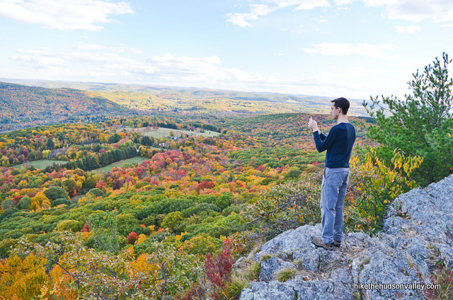
Background you can feel free to skip: “That’s what I’m talkin’ ‘bout,” my buddy Jeff said as we stepped out onto Lion’s Head, soaking in the sprawling view.
We were on our way back from climbing nearby Race Mountain, and while we thoroughly enjoyed that hike, the view at Lion’s Head, a much shorter hike, was even better.

The climb to Lion’s Head will make you huff and puff, but before you can start with the serious whining, boom, you’re done. This is a short hike, but it’s not a freebie. Be prepared for a few steep stretches to earn that view.

Otherwise, your main tasks at Lion’s Head will be to just enjoy the hike, take in the sights, and be glad you’re not somewhere else for a little while.
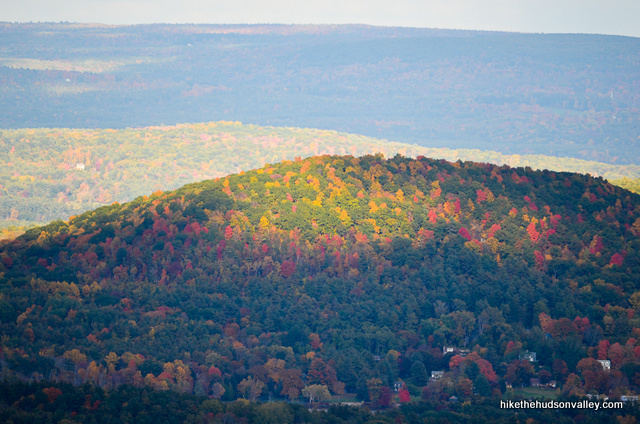

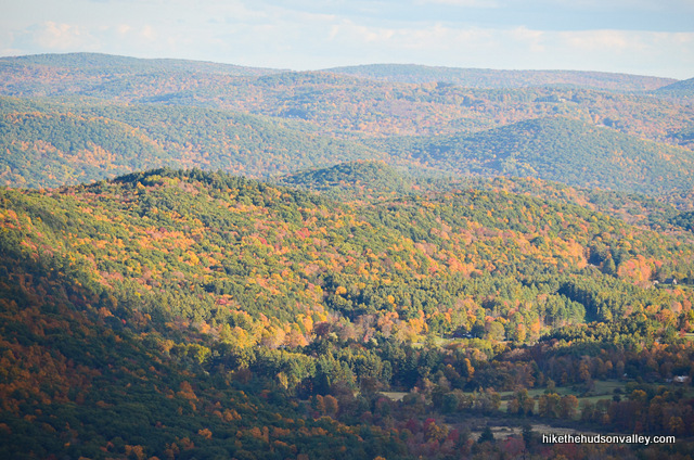
Berkshirehiking.com says that Lion’s Head “might have the distinction of being the shortest hike with the greatest views in western Connecticut. ” If there’s a different hike that deserves that distinction, I’d sure love to know where it is. This is a great hike that packs a full day’s worth of views into a compact little package. If you find yourself in the neighborhood, and maybe even if you don’t, you should find some time to perch yourself atop Lion’s Head.
Trail Guide
Bonus unsolicited advice: Don't depend on having cell service in the woods - it can be spotty out there! Download this trail guide to your phone before you head out. (It's easy to do on iPhone and Android.) May your connection to nature be strong, even when your connection to the internet is weak.
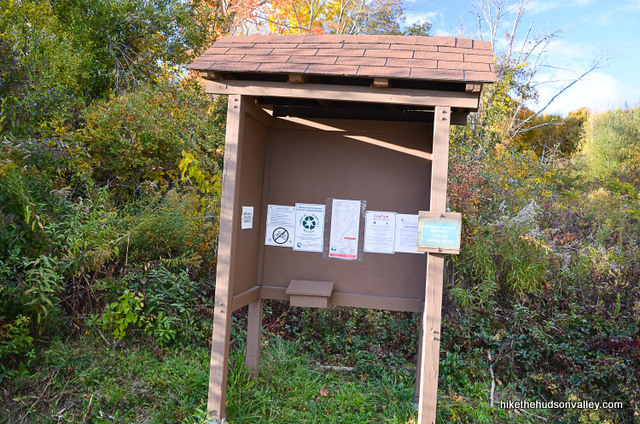
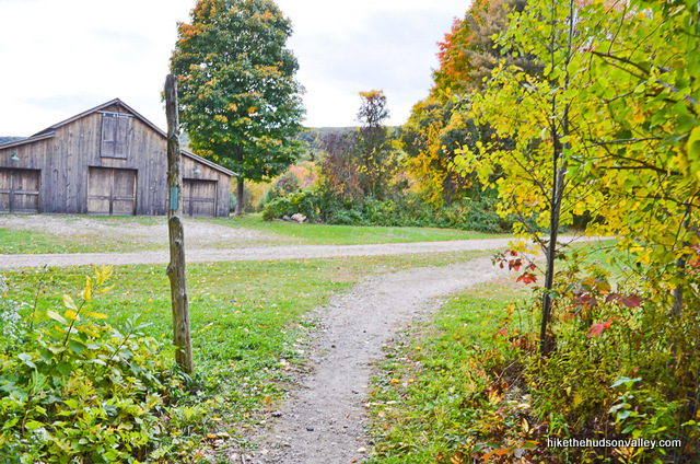
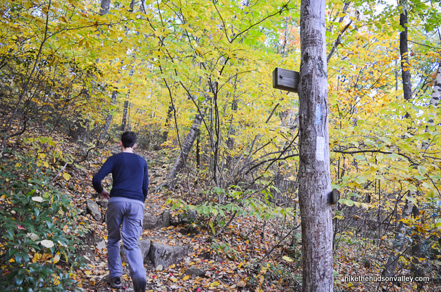
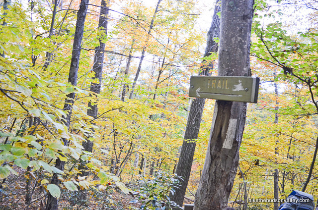
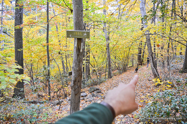
1. From the parking lot (see “Directions to the trailhead” below), stop by the kiosk for various warnings and rules of the trail. When you’re done, hop on the trail to the right of the kiosk. (There’s a big wooden sign marked “TRAIL”, and you may also notice some blue blazes as you go.)


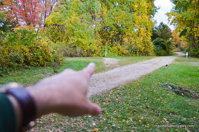
2. In just a few minutes, you’ll emerge into a beautiful meadow where you can juuuust get a glimpse of your climb for the day, straight ahead. We see you hiding up there, Lion’s Head. Roar!
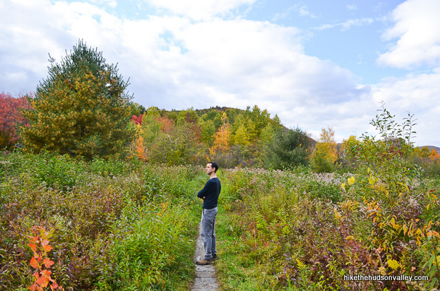
You’ll also notice that the trail here runs through some fairly residential areas – please heed the copious warnings to respect land owners and stay on the trail. Let’s keep things harmonious out here.
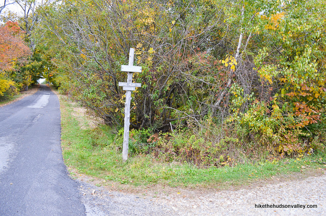
3. Less than ten minutes from the start of the hike, you’ll pop out onto what feels like somebody’s driveway (this is what remains of Bunker Hill Road).
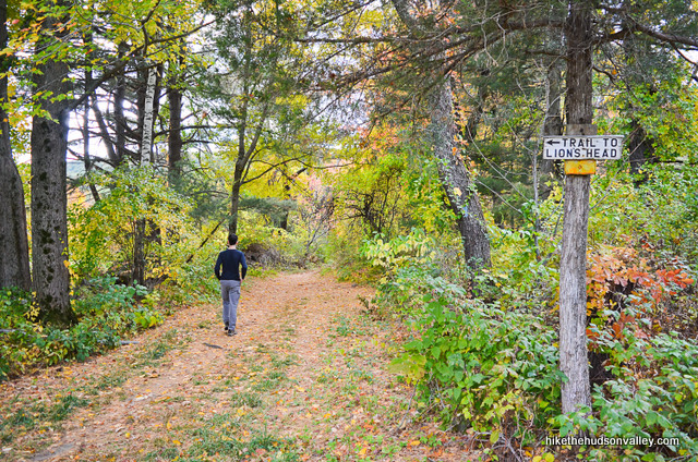
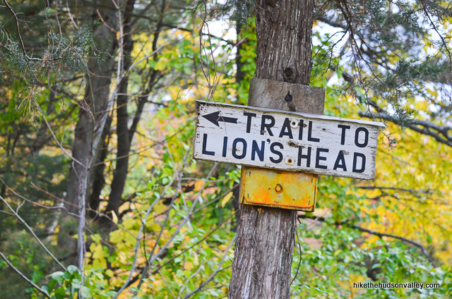
The trail cuts diagonally across the road/driveway – as soon as you join the road, look immediately to your left for the blue-blazed trail to Lion’s Head, which is nicely marked with a wooden sign. Turn left here to hop on that trail.
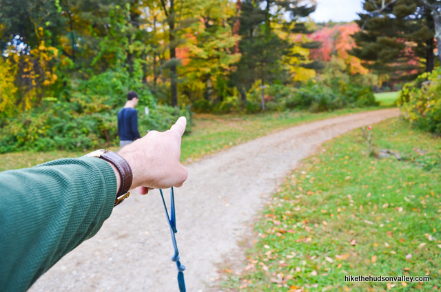
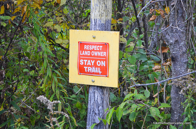
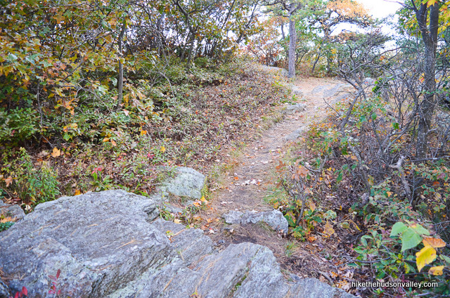
4. Follow the blue blazes and stay on the trail. You almost don’t need blazes here – you could just follow the “RESPECT LAND OWNER – STAY ON TRAIL” signs. You were going to do this anyway, of course, being the respectful outdoorsperson that you are. I bet you even picked up some litter, didn’t you? Thanks for being awesome.
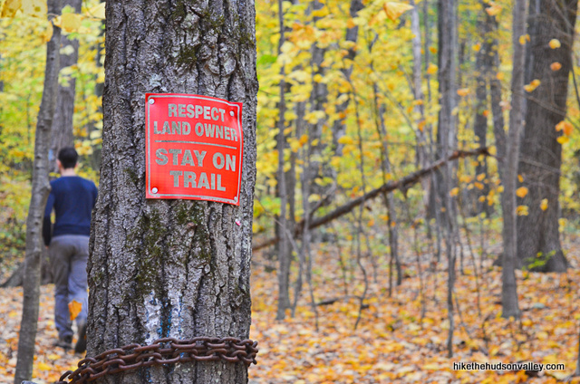
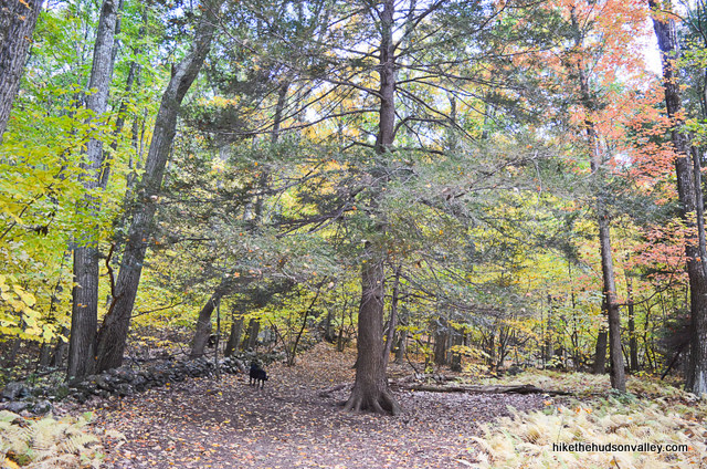
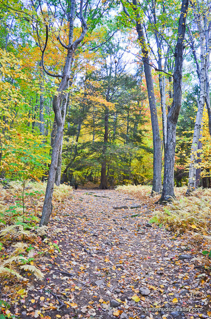
Otherwise, just enjoy strolling through the woods, smelling the smells, ogling the nature, and respecting the land owners.
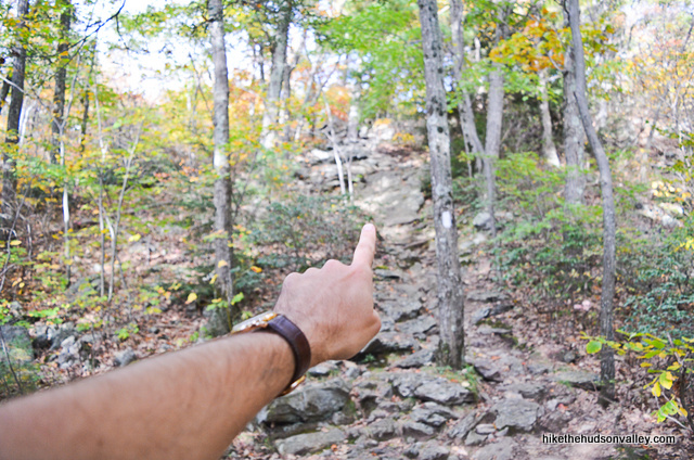
5. You’ll climb this hill for about 300 vertical feet before you bump into the white-blazed Appalachian Trail (it took us 12 minutes from the “Trail to Lion’s Head” sign).
The White Trail joins you from the right, ascending the hill. Stay straight/left to continue climbing, now following those white blazes.
Be sure to check behind you as you go, making note of this intersection for the descent — you don’t want to get tricked into following the White (Appalachian) Trail 1,000 miles or so in the wrong direction. People would wonder why you weren’t home for dinner.
From here, it’s just 225 vertical feet to Lion’s Head! You ate 225 vertical feet for breakfast this morning, right?
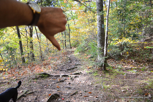
6. Follow the White Trail for another seven minutes (or so) until you come to a little flat area, where the White Trail ascends to your right, and a smaller Blue Trail heads off straight/left. Stick with the White Trail for your steepest climb of the day – don’t get lured onto the Blue Trail.
Thumbs down for you, Blue Trail, trying to trick us into missing Lion’s Head! Shame! SHAAAAME!
(Edit: BerkshireHiking.com says that the Blue Trail here is just a meandering route to Lion’s Head, in case you didn’t want to tackle the steep section of the White Trail. So you can apparently get to Lion’s Head going either way. Sorry, Blue Trail! We’re cool, if you’re still talking to me.)
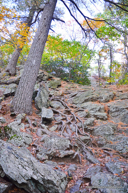
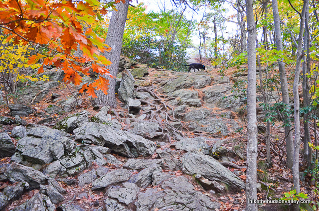
7. Happy climbing! Just a couple more minutes to some lion-headed goodness. Gotta earn it, though.

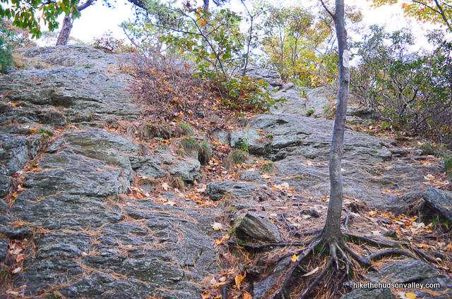
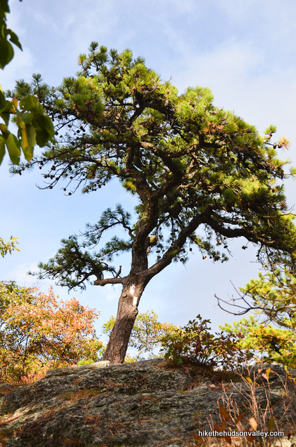
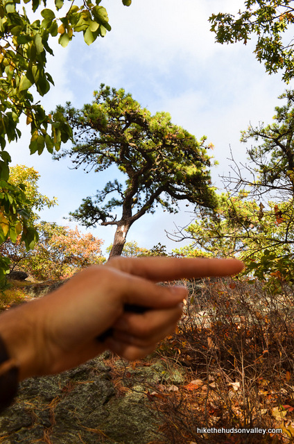
Right at the top of the climb, the two white blazes on the trunk of a friendly (but deceptive) pine tree advise you to turn left. Don’t do that. Turn right.
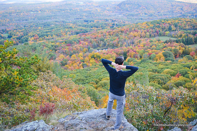
8. After turning right onto a very short unmarked trail, sha-BAM! Sha-BLANG-O! ROOOOAR!!!!
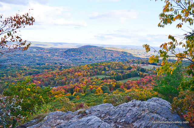
9. If you brought a lion cub with you, this is the place to hold it over your head while a single beam of sunlight shines on you both. (You can assume that any elephants and gazelles in the woods below are bowing back at you.)
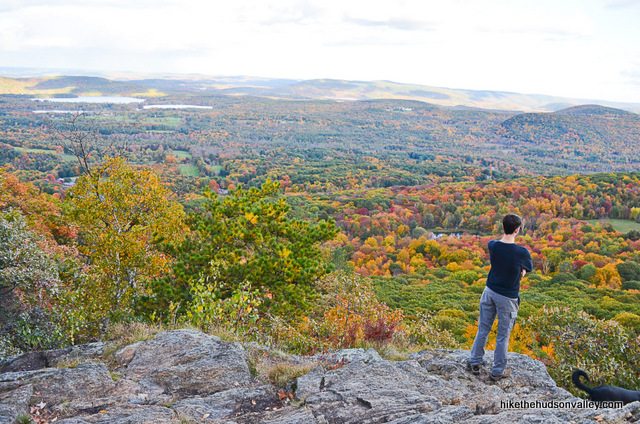
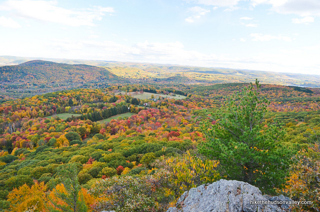

Enjoy Lion’s Head. Grab a seat. Take it all in. Eat a granola bar. Turn to your hiking partner and say, “Look, Simba. Everything the light touches is our kingdom.”
10. Optional step: Sing “The Circle of Life” in your best Elton John voice.
11. When you’re done surveying the Pride Lands, retrace your steps back to your car. It took us 30 minutes to plunk our way back down (with some stops for pictures).
Partway down the hill, when the Appalachian Trail splits off to your left, be sure to stay straight/right, toward Bunker Hill Road and the Blue Trail.

Otherwise, it’s smooth sailing all the way back, including that little jaunt across the driveway/Bunker Hill Road.
From there, it’s just a hop, skip, and a roar back to your car.

Hope you enjoyed your trip to Lion’s Head! Now let’s go sing “The Circle of Life” over some pizza.
Directions
Directions to the trailhead: From the intersection of the Taconic State Parkway and Rt 44 (northeast of Poughkeepsie), head east on Route 44 for 40 miles (be sure to turn right to stay on 44 in Millerton – going straight would put you on Route 22). 5.5 miles past Millerton, just as you’re entering the village of Salisbury, CT, turn left onto Factory-Washinee Road (Google Map image of intersection). Follow Factory-Washinee Road until the fork with Mt. Riga Road – remain right to stay on Factory-Washinee, which now becomes Bunker Hill Road. Continue on Bunker Hill Road until you come to the well-marked hiker parking lot on your right, with a sign that reads “HIKER PARKING” and “LIONS HEAD TR”.

Pull in, hop out, and let the adventure begin!
You can also get directions by checking out the Lion’s Head entry on the HiketheHudsonValley.com Google map.
(I tried to work in a joke about how this hike actually starts on Breed’s Hill Road, not Bunker Hill Road, but that would just be confusing, and it might still be too soon for Revolutionary War humor anyway, so I will spare you, unless you’ve just read this sentence, in which case I apologize.)
Sorta nearby address for your GPS: This address seems to put you on the right spot, but please be sure you park in the hiker lot and not at somebody’s house:
84 Bunker Hill Road
Salisbury, CT
GPS coordinates of parking area: 41.99876, -73.43789 (Clicking will open in Google Maps or the Apple Maps app, depending on your browser/device.)
Resources & Interactives
Super-cool Google Earth flyover of hike route:
Google Terrain Map of hike route:
Related resources: If you’re looking for actual facts and/or useful information, visit these resources:
- A very nice write-up on this hike from BerkshireHiking.com.
- Some nice Lion’s Head pictures and reviews on TripAdvisor.com
- Some pictures of a longer hike that incorporates Lion’s Head on taconichiking.com
More Lion’s Head pictures from the hike’s Flickr album:
Was this trail guide useful to you? Please leave a comment!
Want to support trails in the Hudson Valley? Here’s one great way: Visit the New York-New Jersey Trail Conference homepage and click on Volunteer, Donate, or Shop! (Then you can volunteer, donate, or shop, depending on your mood.)
Hi! Thank for this amazing and thorough review! I’m planning my 7-year old’s first backpacking overnight and we’ll be staying at Riga camp, just beyond Lion’s Head on the AT. One question: did you go with this trailhead over the AT parking area on Route 41 simply because the one on Bunker Hill Road is closer? I think we’ll be taking the AT for the longer trek and the experience, but curious if you had any further intel on the differences between the two. Thanks again!!
Drew, thanks so much for the kind words and great question. I honestly didn’t even know about the parking area on Route 41. If you have found that to be a better route, or have any notes on it that could be helpful for others thinking about taking a longer version of this this hike, it would be great if you could share them. Thanks!
Drew, the small parking area on Route 41 (Undermountain Road) is a great entry point to hike the AT up to Lions Head and beyond. Just be careful not to leave any visible valuables in your car. Unfortunately, there have been break-ins in the past. You could also park further up 41 at the Undermountain Trail trailhead parking area. It’s more open, bigger and sees more activity, with people parking there to summit Bear Mtn and beyond into Sages Ravine. You could hike to LH and the shelter southbound from the Undermountain/AT junction.
This was my first hiking experience – Absolutely perfect directions – thank you! I was able to enjoy this with no stress and no worry of getting lost!
Thanks so much for the kind comment, B! Welcome to hiking, and here’s wishing you many more happy adventures out there!
Thanks to your website, my boyfriend picked this hike. He was like an expert, pointing out everything, such as the deceptive tree. At the top, he proposed! So thank you for having this hike and this website! It was a great hike, hardly any people along the way, and we were alone at the top.
That’s so awesome, Meagan — congratulations to you both! Sounds like you all picked a perfect time for it, too! What an amazing place to propose. I hope all the Lion King references in the trail guide didn’t spoil the mood. But just one quick question: Can you feel the love tonight? No, really, I wish you both all the happiness in the world, and thanks for sharing your story here! Congrats!
Thank you very much for the useful and detail info. My kid wants to hike up to Lion’s head.
Thanks, Angel! Your kid sounds like a wise person – you should listen to this child! (Hope you have a great visit if you decide to go!)
Great trail and great directions to the best view!
We did this hike with plans to get to the top and watch the sunrise! We used your directions to make sure – even in the dark with headlamps- we didn’t get lost!
Perfect spot to drink some coffee and watch the sunrise!
Thanks for all your work on these hikes! This is my go-to site to check when looking for new hikes!
That sounds like a magical morning, Alexandra! Thanks so much for the kind words. Here’s wishing you many more happy adventures out there!
This was a great short hike if you don’t have a ton of time, or if you just don’t want to go on a death march!
A little deceptively steep on the way up, but not really that horrible, the last bit presents a little bit of a scramble, but then you have an amazing view out over CT with very little work to get it.
Make sure you pay attention and turn right at the top of the scramble or you’ll miss the payoff.
Thanks for highlighting this tail!