Background
If you find this free trail guide useful, please provide payment by picking up at least one piece of litter on your hike. Cha-ching! Thanks for being awesome! (And here’s a quick primer on Leave No Trace, too, to help us keep the trails nice and fresh for each other.)
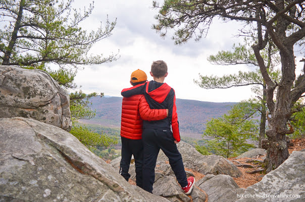
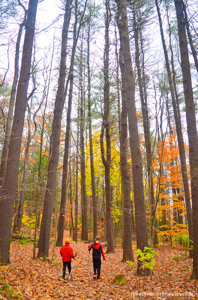
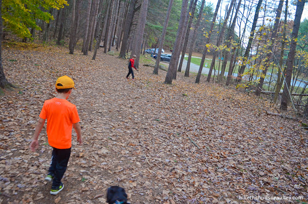
Background you can feel free to skip: “You know what? I’m taking the afternoon off. Let’s go have an adventure,” I said to my two sons on Election Day 2019.
Their school was closed. My wife was away on business. In not nearly enough years, my kids will be eye-rolling, phone-tapping teenagers, so it’s important to create opportunities to take them on adventures before they realize that they’re supposed to be embarrassed to be seen with me outside of the house.
On that November Tuesday, a visit to Monument Mountain turned out to be the perfect choice.
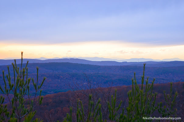
I was drawn to this place by an Instagram picture from cpgettys (Cathy Gettys), posted to Instagram in October 2019 and shared here with permission (thanks, Cathy!).
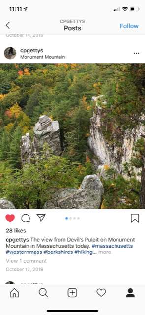
Devil’s Pulpit? Monument Mountain? I’d never heard of these places before, though they looked like they’d fit right in at Minnewaska. A quick search on Google Maps showed that the trailhead in Massachusetts was about 90 minutes away, no further than many of our favorite Catskill hikes.
On that November Tuesday, we didn’t have a perfect day outside, with gray clouds in the sky and no hint of sun in the forecast. But it still felt pretty perfect out there. Not sure how a half-day’s vacation could have been put to better use.
“What would you guys give the scenery rating of this hike, out of five cameras?” I asked my sons as we worked our way down the mountain.

“Five cameras! Definitely five cameras. No, SIX!” they screamed.
“I’m thinking maybe four. The view was great, but it wasn’t, like, GIGANTIC. Plus, you can’t go higher than the maximum. You can’t give 110% effort, and you can’t give six cameras. That’s a pet peeve of mine,” I replied.
“FIVE CAMERAS! FIVE, DADDY!! PROMISE YOU’LL GIVE IT FIVE!!!” they yelled in unison, as if they’d been rehearsing.
So. while this may be a controversial move in my household, I’ve settled on 4.5 cameras (which rounds up to five!). It is indeed gorgeous up there, with several panoramic views and interesting rock formations.
I did seriously consider giving it five cameras — the views really are wonderful! — but I reserve the five-camera rating for only the most gargantuan views. It’s important to preserve the integrity of my made-up rating system.
How many cameras would YOU give? If you haven’t been to the summit of Monument Mountain to know whether you agree with me or my kids, you should really put a visit here somewhere near the top of your to-do list. It’s a wonderful hike that deserves a spot in your rotation. Whether you come here on Election Day or any other day, you’ll never regret voting to visit Monument Mountain.
Note of caution: While I had a blast bringing my kids here, this hike does have its dangers, namely that the trail comes close to huge drop-offs in several spots.

You must exercise extreme caution near the summit, and you must never wander off-trail anywhere on Monument Mountain. (In general, most tragic hiking stories begin with someone wandering off-trail.) I’d be extremely wary about coming here if there is any chance of ice/snow at the summit, and would strongly recommend against coming here in the winter unless you are experienced in winter hiking and have the appropriate gear (micro-spikes, trekking poles, etc.) to ensure you don’t lose traction, which could be fatal here.
It’s unfortunately quite easy to find stories of recent severe accidents at Monument Mountain:
- 2019: Hiking fall from cliff leads to dramatic rescue
- 2017: Great Barrington Fire Department Responds to Monument Mountain Reservation to Rescue Injured Hiker
- 2016: Body of 67-year-old hiker recovered from Monument Mountain
- 2016: Injured hiker rescued from Monument Mountain
Step carefully and stick to the trail, and you shouldn’t have any problems. But PLEASE be careful up there, and when I read about you in the paper, let it be because you won the Fields Medal and/or streaked the World Series, not because you visited Monument Mountain.
Trail Guide
Bonus unsolicited advice: Don't depend on having cell service in the woods - it can be spotty out there! Download this trail guide to your phone before you head out. (It's easy to do on iPhone and Android.) May your connection to nature be strong, even when your connection to the internet is weak.
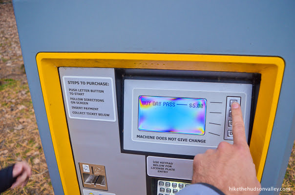
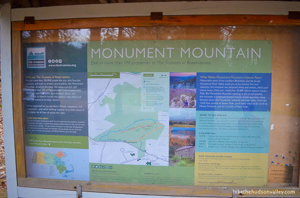
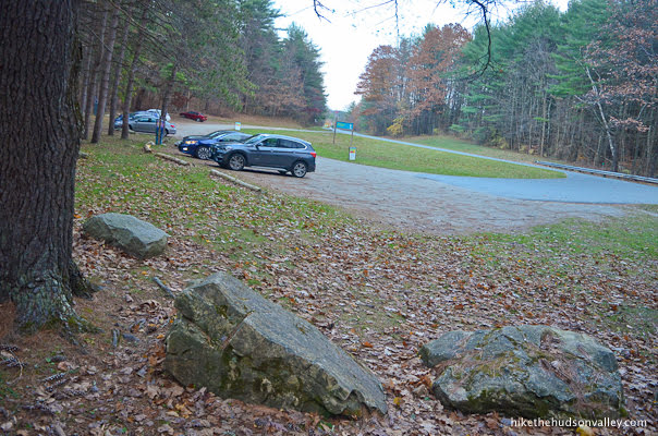
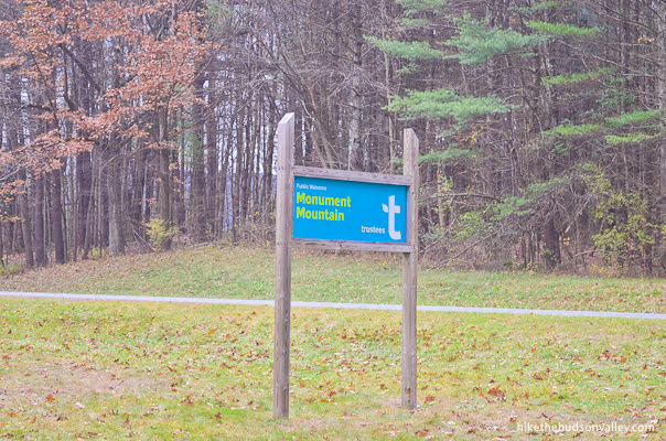
1. From the well-marked, horseshoe-shaped parking lot (see “Directions to the trailhead” below), take a moment to settle your debts with the parking meter.
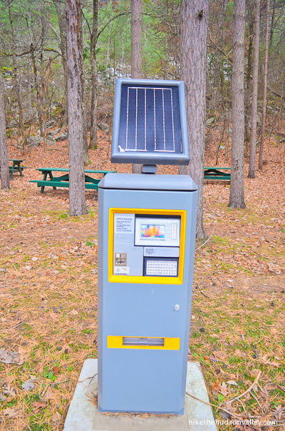
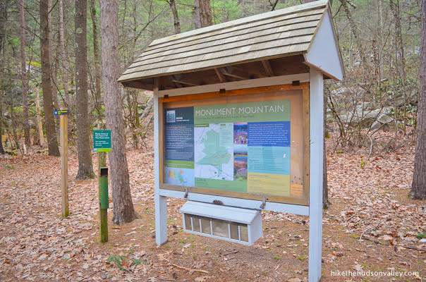
At the adjacent kiosk, you’ll find a nice trail map, along with some good information about Monument Mountain. Might as well learn something while we’re here!
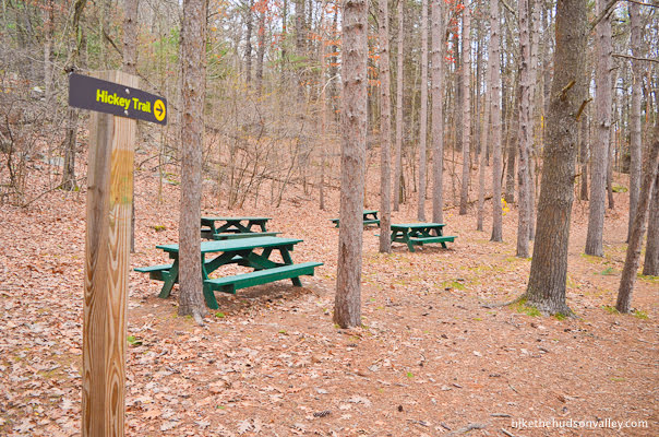
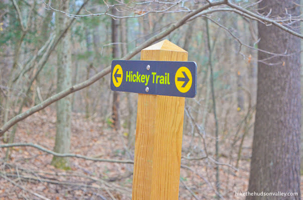
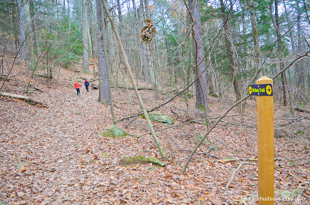
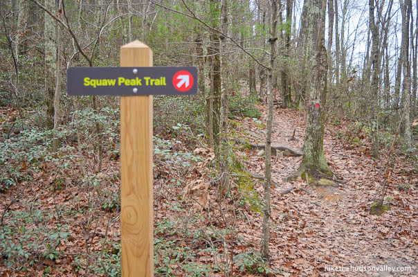
2. Facing that kiosk, with the parking lot at your back, turn right to follow the signs for the yellow-blazed Hickey Trail. Our loop for the day just began – we’ll arrive back at this spot in 3.5 miles or so, with many happy new memories (and maybe a blister or two).
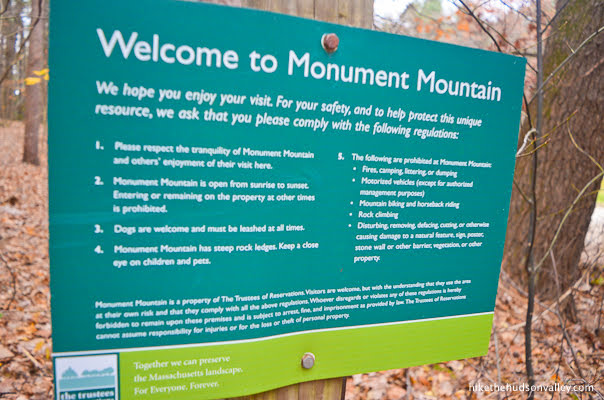
3. At the start of the yellow-blazed Hickey Trail, you’ll find some signage with rules and warnings. Please take a moment to read (and heed!) these signs.

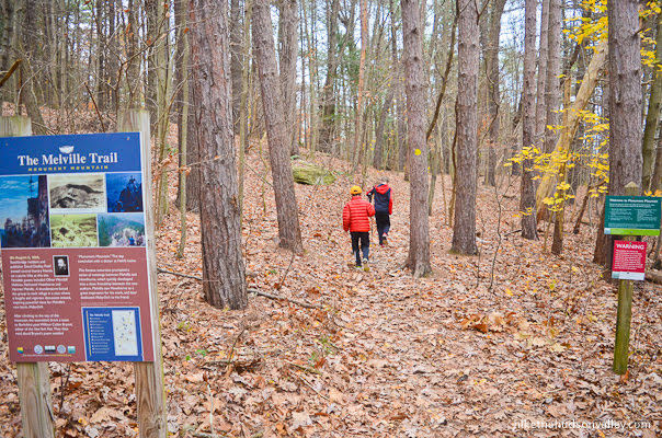
Don’t get confused by the sign marked “The Melville Trail,” which is a broader tourism effort to help folks explore the places around Massachusetts that inspired Herman Melville. Monument Mountain is one of the places on the Melville Trail (Melville’s visit here in 1850 apparently inspired some aspects of Moby Dick), and you are correctly hopping on the yellow-blazed Hickey Trail here. (If you started hunting for a “Melville Trail” to climb Monument Mountain, you’d really be chasing a white whale.)
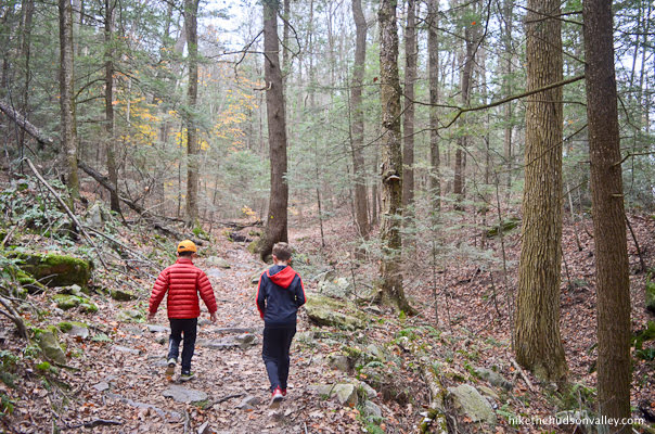
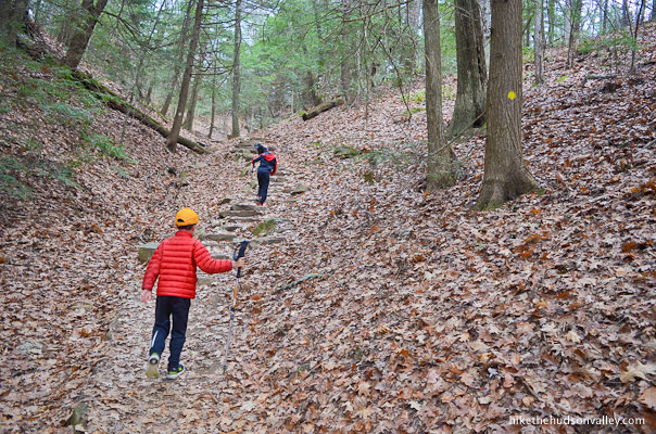
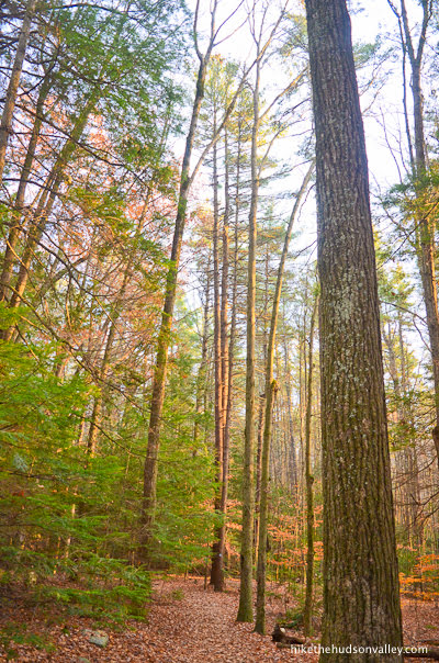
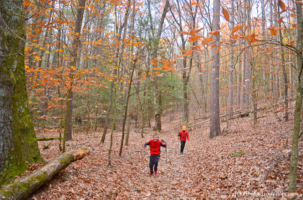
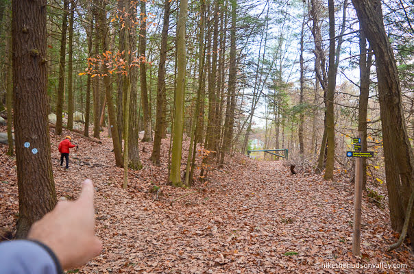
4. Follow the plentiful yellow blazes as they lead you through some beautiful woods.

Up to your left, you may even catch a glimpse through the trees of the mountain you’re about to climb. Hang on, mountain! We’re on our way!
Enjoy this peaceful stretch of warm-up trail, before things take a decidedly more vertical turn in a bit.
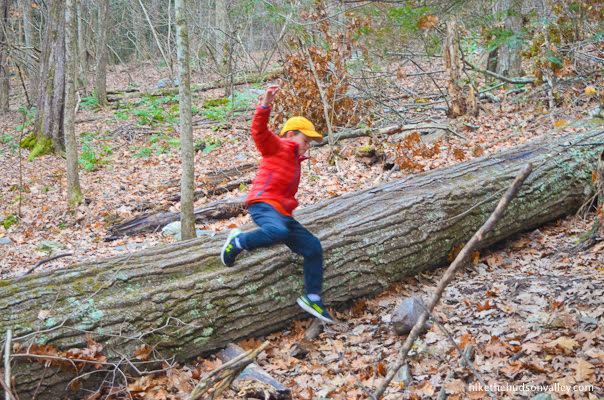
If you come across a tree that has fallen across the trail, have no fear. You’re a hearty adventurer!
**UPDATE May 2021** Thanks to Raj’s helpful comment below for pointing out that some trails have recently been renamed at Monument Mountain — Squaw Peak Trail is now Peeskawso Peak Trail, and Indian Monument Trail is now Mohican Monument Trail. While I can’t update my pictures, I will update the text below with the new names. Thanks for the heads-up, Raj!)
The next trail junction (with the red-blazed Squaw Peeskawso Peak Trail) is coming up in 1.4 miles and 600 vertical feet from the parking lot. If you’d like to skip my blathering about the Hickey Trail and jump right to that junction, you can skip on down to Step 9 below. It’s like a Choose Your Own Adventure! Whether you choose to read the intervening steps or not, see you at Step 9!
5. You’re still reading! Awesome! I could tell you were cool from the way you laughed at the Moby Dick joke. Or maybe it’s those pants. Anyway, onward and upward!
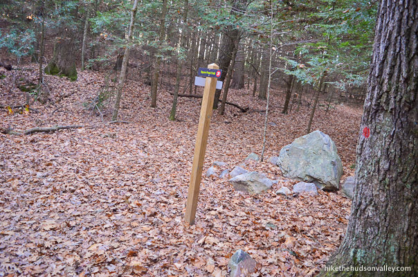
About ten minutes from the trailhead, some helpful signage lets you know that you’re still on the right path.
From that sign, the trail continues ascending through the woods. At this point, you’ve climbed about 200 vertical feet, with less than 600 vertical feet (spread out over the next mile) until the summit. Almost there, kind of!
Don’t forget to stop and hydrate! Your fellow adventurers will wait for you (some more patiently than others).
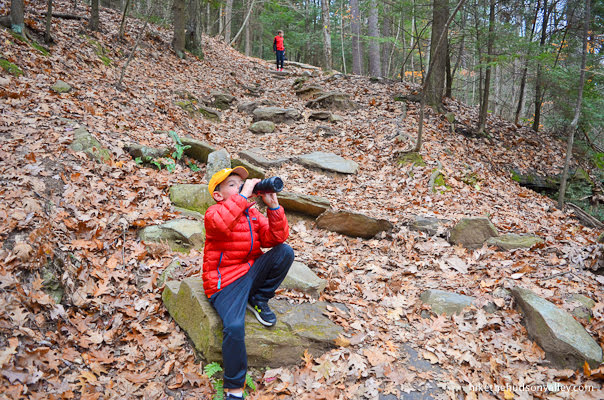
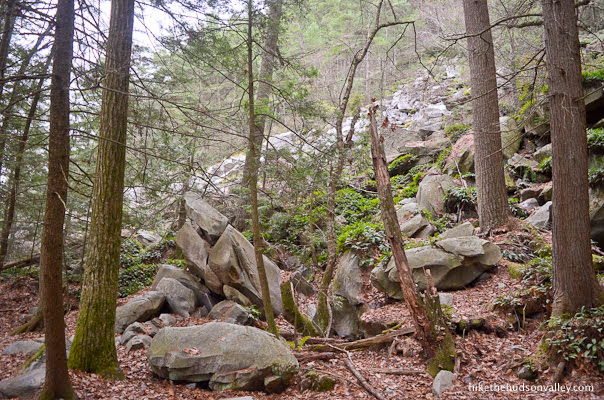
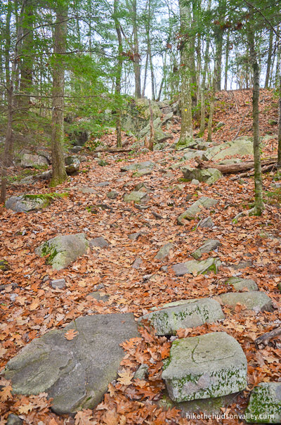
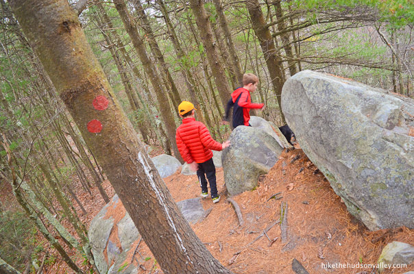
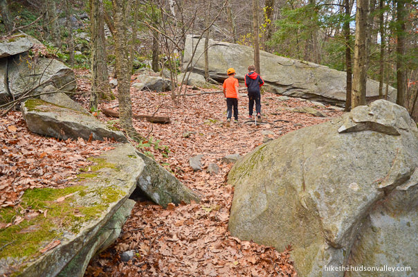
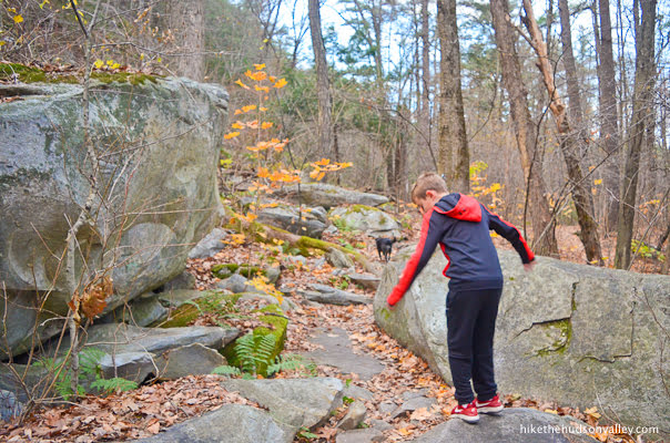
In a few more minutes, you’ll pass some interesting rock formations, which serve as a nice appetizer for the many more awesome rocks you’ll see today.
Just past those rocks, you may notice an old fork where it looks like the trail may have been rerouted, with a pile of sticks suggesting you don’t go left. Take their advice, and keep right to stay on the trail.

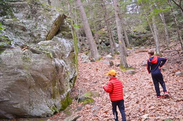
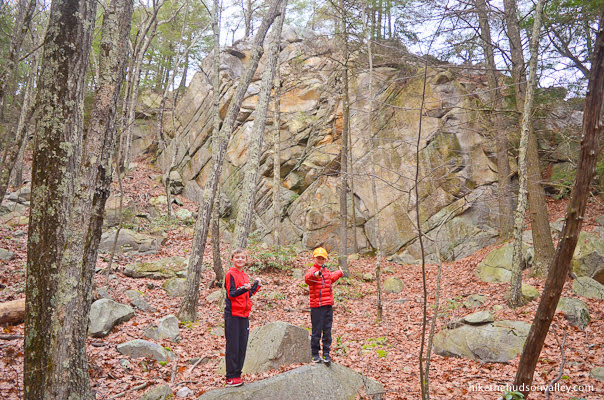
6. From that old junction, in just a minute, you’ll see a talus field rising up to your left.
In another minute, you’ll hear a stream babbling to your right. Pause for a moment and listen to what it has to say.
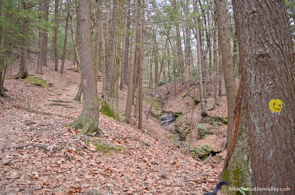
Climb just a bit more, and the trail crosses the stream. It was an easy hop across on our visit, but could be trickier in very wet conditions.
If you’re a kid, before you hop across, be sure to stick your hand in the water to verify that it’s cold.
Tell everyone in your hiking group: “Put your hand in there. It’s cold!”
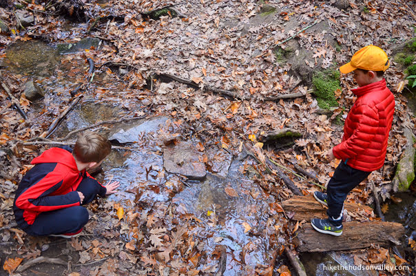
“Yeah, it is cold!” your little brother will verify.
Now that that’s settled, can we keep going before somebody falls in, guys? Please?
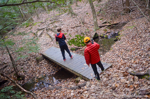
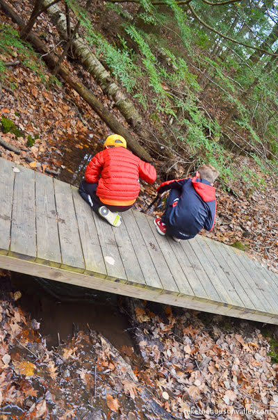
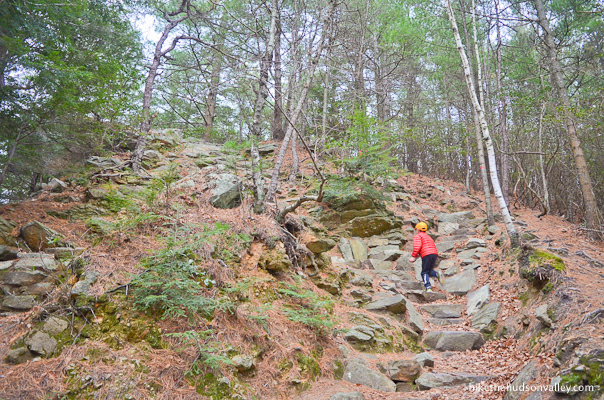
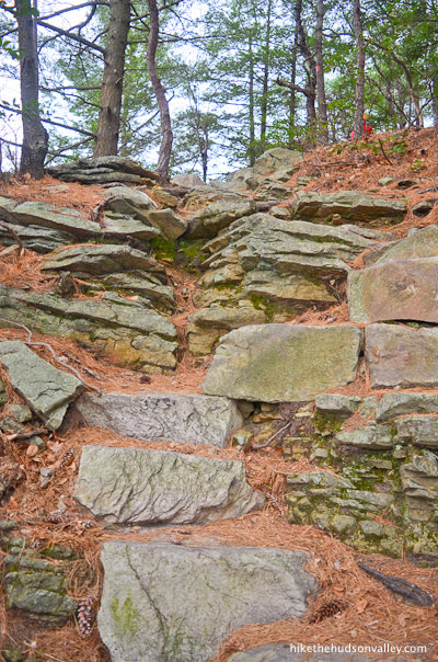
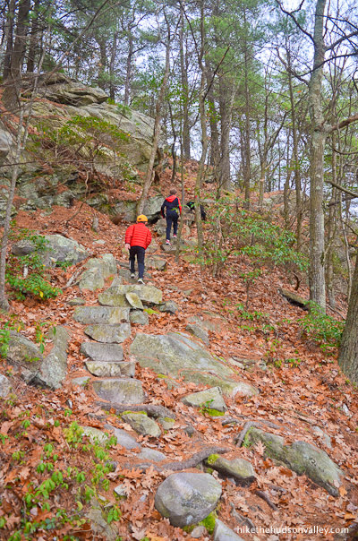
7. Right after the stream crossing, admire the fancy trailwork of the stone steps that you’re ascending. Thanks, whoever did that backbreaking manual labor!
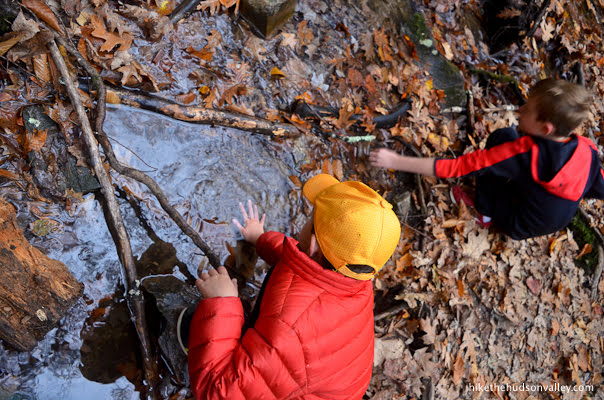
8. Immediately after the steps, you’ll find more fancy trailwork in the form of a wooden footbridge over the stream you just hopped across a few minutes ago.
Here, you’ll want to use your trekking poles to verify that the creek bed is gloppy.
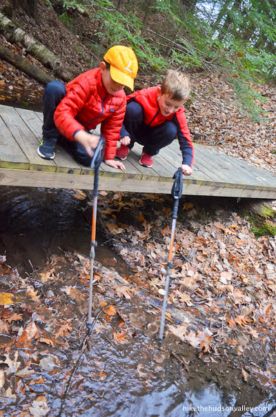
Take your time. This is for science, after all.
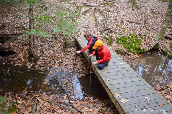
Yep, okay, it’s gloppy. Guys, can we keep it moving? Hello?
8. After the bridge, no more Mr. Nice Mountain!

9. Keep climbing, and less than ten minutes from the bridge, you’ll arrive at a small clearing with some helpful signage.

You’ll also notice a large stone monument on your right.
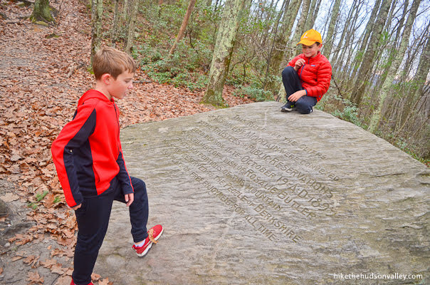
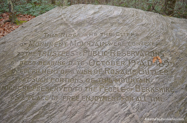
The monument reads: “THIS RIDGE AND THE CLIFFS OF MONUMENT MOUNTAIN WERE CONVEYED TO THE TRUSTEES OF PUBLIC RESERVATIONS BY DEED BEARING DATE OCTOBER 19 AD 1899 IN FULFILLMENT OF A WISH OF ROSALIE BUTLER THAT SUCH PORTIONS OF THIS MOUNTAIN MIGHT BE PRESERVED TO THE PEOPLE OF BERKSHIRE AS A PLACE OF FREE ENJOYMENT FOR ALL TIME”
They ran out of room to write: “ (OR IF NOT TOTALLY FREE, THEN PERHAPS WITH A REASONABLE FEE FOR PARKING. LIKE, FIVE SIX BONES OR SO?)”
In any event, thanks, Rosalie! We all owe you one.
At this monument, we bid adieu to the yellow blazes of the Hickey Trail. Thanks for the good times, Hickey Trail!
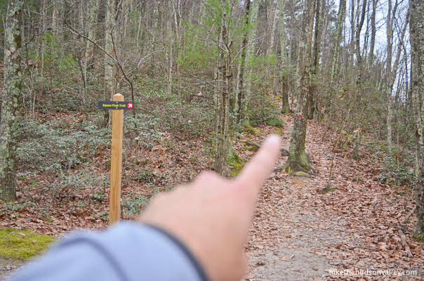
10. From here, continue straight on the red-blazed Peeskawso Peak Trail. (If you have helpful assistants, you can ask them to point to the correct trail on the sign.)

You’ll find another helpful sign and red blazes leading the way.
From this junction, it’s just .2 miles and 150 vertical feet to the summit. Onward and upward!
11. Upward, indeed.
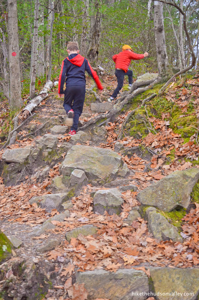
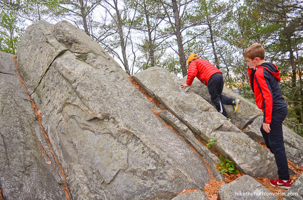
While this section of trail probably doesn’t quite qualify as a rock scramble (you don’t HAVE to use your hands), it is quite steep. A rock omelet, perhaps?
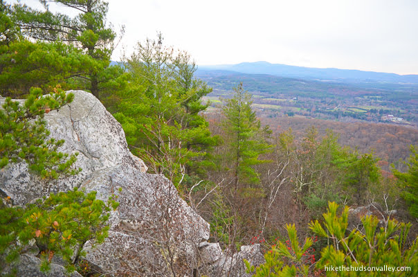
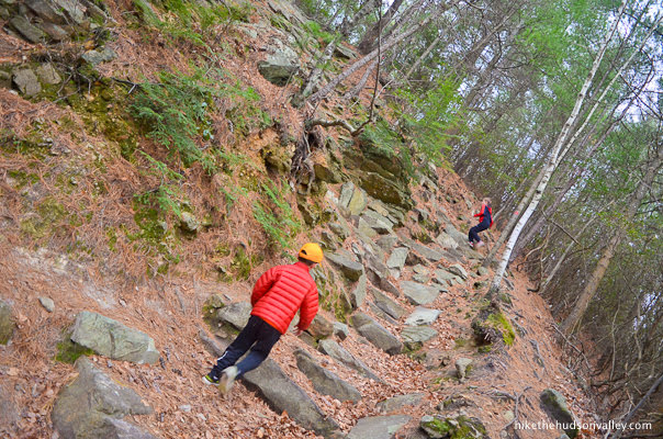
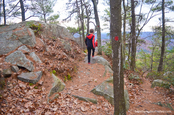
Keep following those red blazes, and in a few minutes, you’ll start to get some views off to your left.

The trail starts to feel like a big playground of rocks. Feel free to (carefully!) treat it as such.
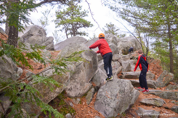
Careful here – the trail does wander very close to some steep drops. You may have to holler at your kids and tell them to wait for you.
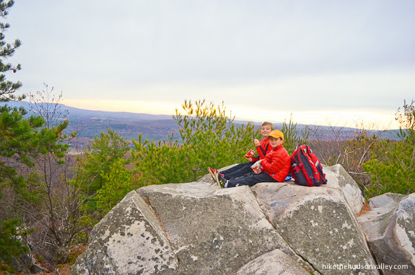
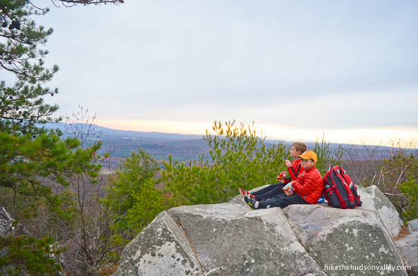
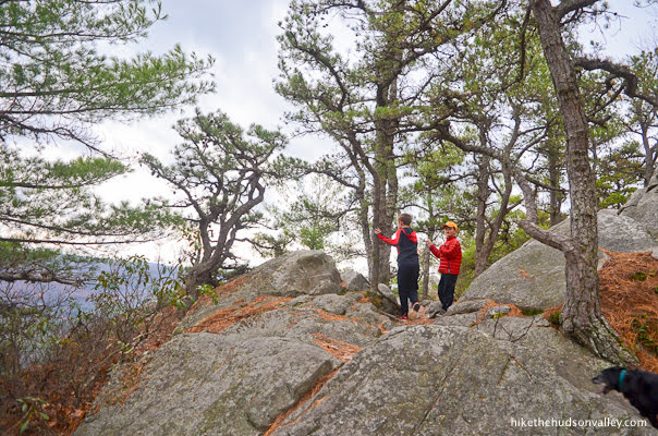
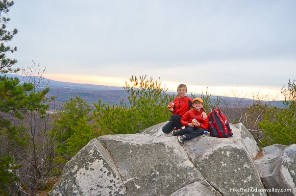
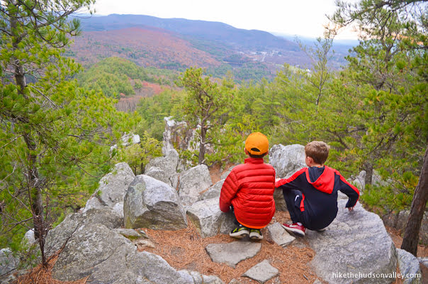
12. Arrive at the summit of Monument Mountain, when you’ll have views over both sides of the mountain. (You’ll know you’re at the summit when you can sit on some rocks and see a long swath of the horizon to your right.)

If you brought Cheez-Its, now is the time to bust them out! No, not for you, animal. We brought dog stuff for you. Leave the child alone.

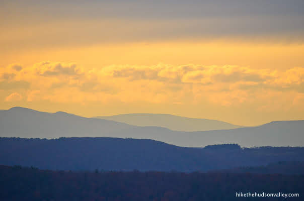
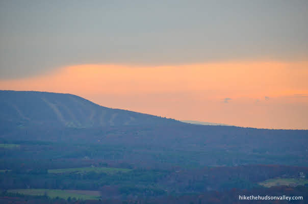
Enjoy the long view over fields and mountains, with a ski area (Butternut?) visible to your right.
What a nice spot.

Enjoy those last few Cheez-Its! The hiking snack of champions.
13. When you’re done marinating in the view, continue along the red-blazed Peeskawso Peak Trail to complete your loop. You may notice some old graffiti carved into the rock as you go. I saw one carving dated 1888.
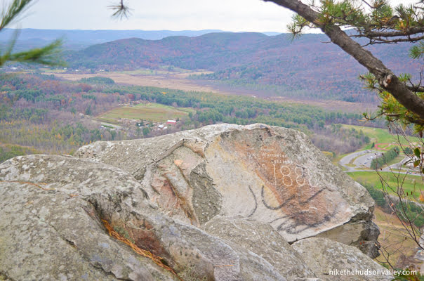
Graffiti always sucks, but at least super-old graffiti has style. (If you’re considering etching or painting anything while you’re up here, please do it on a sketchpad and put it in your backpack when you’re done.) Fortunately, graffiti isn’t as much of a problem these days, since the park service has trained local bears to eat anyone using spray paint or carving their initials in these woods. (Whether or not that’s true, it can’t hurt to start the rumor.)
Careful here! It’s a long way down.
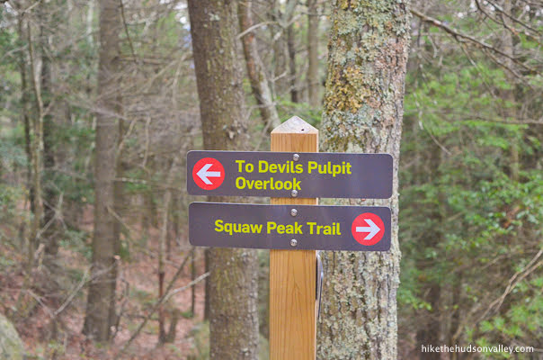
14. About 500 feet beyond the summit, the trail descends to another well-marked junction.
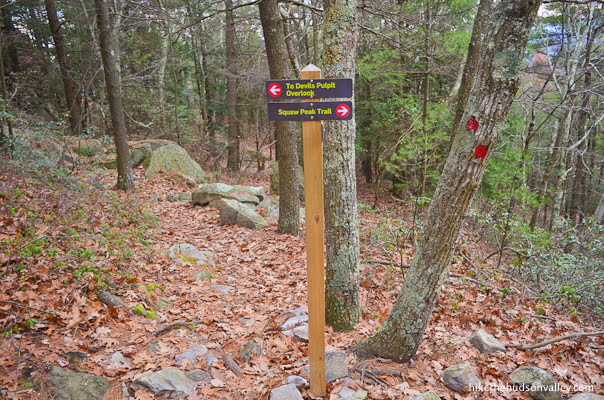
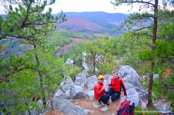
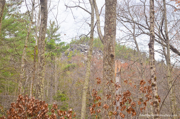
It is a short, steep hop (less than two minutes) up to the Devil’s Pulpit overlook from here. If you have enough gas in the tank, you should absolutely take the time to check it out. It’s worth it!
Take the left fork to climb up to the Devil’s Pulpit overlook.

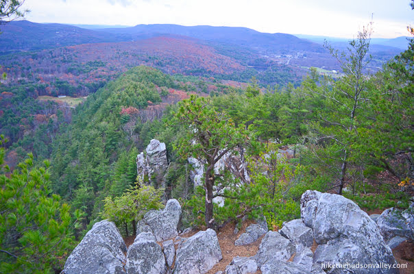
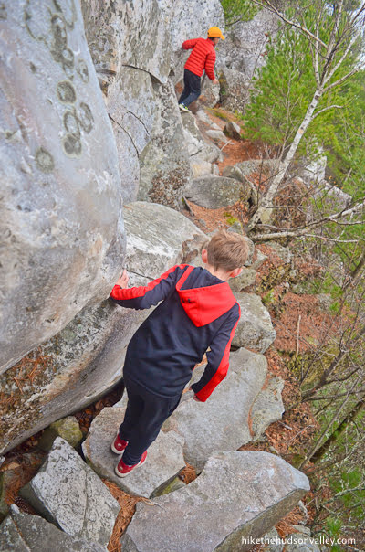
15. Follow those red blazes right out to the rocky outcropping.
Careful here! There are huge drop-offs and tricky footing all around. Sticking to the trail is definitely the right strategy. Fortunately, the trail planners created this overlook to give you a perfect view of Devil’s Pulpit, our very own natural Leaning Tower.
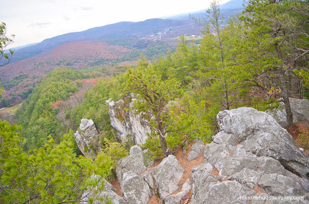
This is the view that brought me to Monument Mountain, and it did not disappoint. If you saved any Cheez-Its, now’s the time!

When you’re done checking out the awesome view, retrace your steps back to the junction with the (also) red-blazed Peeskawso Peak Trail.
16. Continue straight/downhill at the junction to keep following the Peeskawso Peak Trail to lower elevations.
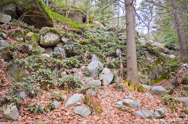
17. Large rock formations loom above as the trail continues descending.
From the overlook junction, you’ll descend 500 feet over .6 miles to your next well-marked junction, where you’ll meet up with the blue-blazed Indian Mohican Monument Trail.
Here, the Peeskawso Peak Trail ends, and you’ll take a left to continue descending, following the happy blue blazes of the Mohican Monument Trail.

18. From this junction, you have about a mile of relatively easy strolling to complete the loop back to the parking lot. Enjoy it!
About halfway through that mile, the trail takes a sharp bend to the left, then begins to parallel Route 7. Just after that bend, you’ll arrive at a junction with an emergency access trail that cuts down to the road.

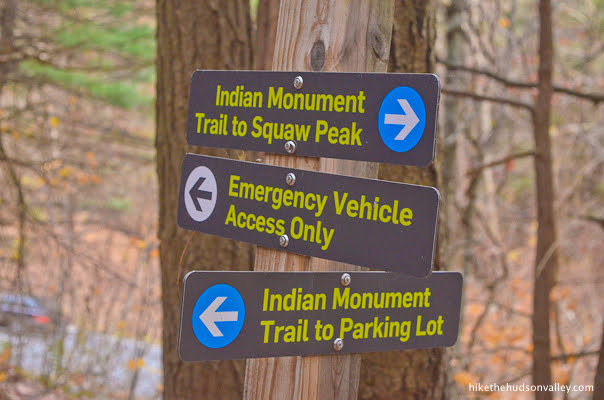
Take the left fork here to stay on the blue-blazed Mohican Monument Trail.
Otherwise, enjoy the smooth sailing! Took us about 15 minutes to stroll the final .5 miles from that junction to the parking lot. In this stretch, you’ll want to concentrate on the trail and the pretty hill to your left, doing your best to ignore the constant cacophony of civilization on the road directly to your right.
La, la, la! I can’t hear you, car! I’m too busy pretending that you are just a stiff breeze rustling through the branches.
Yes, we are still in the woods. So peaceful and serene. And so much stiff breeze rustling through the branches!
19. And then, there’s the parking lot! Hello, wheels!
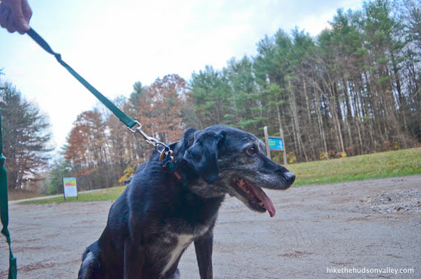
Be sure to tell your doggy what a good girl she is (if she’s a girl). Yes, you’re still spry, you sweet old girl. Yes you are. Extra treats for you tonight. Who’s the best doggy? You are. That’s who. Yesh. Wooga wooga. You.
That’s it! Go locate some pizza, pronto! You’ve certainly earned it. If anyone asks how your hike was today, be sure to answer, “Dude, it was MONUMENTAL!” (If they don’t at least give you a courtesy smile after learning the name of this hike, you don’t have to share your pizza with them.)
Can you think of a better way you could have spent five six bucks today? Me, neither.
Directions
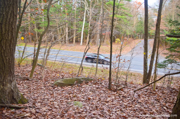
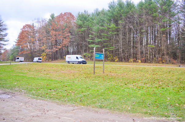
Directions to the trailhead: From the Hudson Valley, your best bet is to put “Monument Mountain reservation” in Great Barrington, MA into your mapping app of choice and follow the directions from there. Both Google Maps and Apple Maps, as of this writing in 2020, will take you right to the correct place with that destination plugged in. (You can verify by zooming in on the destination and confirming that it’s taking you to the horseshoe-shaped pulloff along Route 7.)
Roughly, from Poughkeepsie, you’ll take the Taconic Parkway north for about 40 miles, then take the exit for Rt 23 East. You’ll officially follow Rt 23 all the way into Great Barrington, but Route 41 will join you for a bit and will share co-branding. In Great Barrington, you’ll turn right on Route 7 (State Road/Stockbridge Road) North. Follow Route 7 North for 3.5 miles past Great Barrington, and arrive at the very well-marked horseshoe-shaped parking lot for Monument Mountain in a few minutes, which is accessible from both the northbound and southbound lanes (it’s on your left if you’re heading north).
Here’s the view from the parking lot, looking out at Route 7:
Turn in, hop out, and let the adventure begin! After paying this guy a visit, of course.

Note on winter parking: According to HousatonicHeritage.com’s Monument Mountain page, this parking lot is NOT plowed in the winter. Make sure to bring your Cybertruck if there’s a lot of snow when you visit! (Or maybe pick a different activity, unless you brought some industrial-grade traction devices for your feet to make sure you don’t slip off the cliffs up top.)
Sorta nearby address for your GPS: As noted above, just plopping “Monument Mountain reservation” in Great Barrington, MA into Google Maps (or mapping app of your choice) will take you to the right place. (You can verify by zooming in on the destination and confirming that it’s taking you to the horseshoe-shaped parking lot along Route 7.)
GPS coordinates of parking area: 42.2432604, -73.3351135 (Clicking will open in Google Maps or the Apple Maps app, depending on your browser/device.)
Resources & Interactives
Super-cool Google Earth flyover of hike route:
Google Terrain Map of hike route:
Related resources: If you’re looking for actual facts and/or useful information, visit these resources:
- The official Monument Mountain homepage
- Tons of user reviews from the hike’s TripAdvisor page (the #1 thing to do in Great Barrington!)
- Some nice information and history on Monument Mountain from the always-awesome BerkshireHiking.com
- Some more historical notes on the Monument Mountain Wikipedia page
And also take a moment to peruse these reminders to step carefully and stick to the trails out there:
Want to support trails in the Hudson Valley? Here’s one great way: Visit the New York-New Jersey Trail Conference homepage and click on Volunteer, Donate, or Shop! (Then you can volunteer, donate, or shop, depending on your mood.)
Beautiful! Well worth the climb. Had it all to myself on an early Wednesday morning.
Looks like a wonderful time to be there – thanks for sharing this shot here, Susan!
Hi Mike, we hiked up today in pouring rain (not our plan, but Mother Nature has her ways…) and it was awesome, the rain made the fall colors seem to pop and as always your guide was spot on- I even told my husband the rock omelet joke as we hit the scramble, we were both huffing at that point so it gave us a good laugh. Thanks!
Thank you so much for the kind words, Debbie! Really glad you and your husband had a great day out there. You must have really nailed the timing on the omelet joke to sell that one – we make a good team! All the best to you both, thanks for brightening my day with this comment.
Thanks for the glowing review, Mike. I’m the (current seasonal) ranger at MM and it’s always nice to hear from past hikers. I’ve caught myself a few times repeating the little asides from your article.
(One tiny note– the parking fee’s gone up a buck to $6!)
If you happen to be in the area, there’s been a new side trail added to the property (Willow’s Trail) that heads up to a viewpoint called Flag Rock. The rock itself is sadly a fairly frequent target for some rather distasteful graffiti, but the view over Housatonic can’t be beat. I invite you to come back if you’re in the area, though I probably won’t see you since the entrance to Willow’s Trail is on MA-183 rather than off the parking loop on US-7. The parking at that entrance is free.
Thank you so much for the kind words and helpful update, Tony! I’ve amended the parking cost in the trail guide above, and hope to visit the new side trail soon. Thanks for all you do to provide awesome hiking experiences for us all. Really appreciate the work you do!
My hubby and I will be hiking this trail on October 12. Thanks for being so thorough! And we love all of your little funny sayings.
Thank you so much, Lona — hope you and the hubs had a great hike!
Hi,
I want to thank you for your incredibly detailed instructions for the hike to Monument Mountain. We are planning to go in October. I will follow your guide and know we will have a good time. Many good observations and tips. So nice to get information from fellow travelers, (and their two adorable kids and dog), than “official” sites that always have something to sell.
Thank you so much for your kind words, Jan! I hope you have a wonderful hike when you visit. Don’t forget to pack the Cheez-Its! :-). You’ve made my day – much appreciated!
Thanks for the write up and the photos! My wife and I went there today and it was fantastic. It took us (two reasonably fit adults) about two and half hours to do the loop, including the Devil’s Pulpit, and we were in no hurry.
The trail names have changed. Squaw Peak Trail is now called Peeskawso Peak Trail. Indian Monument Trail is now Mohican Monument Trail. I’m assuming this was done to show more respect for the native Americans!
I did fill one of my pants pocket full of litter that I picked up, so the trails are now very slightly cleaner. 🙂
Raj, thank you so much for your very helpful comment! I’ve updated the trail guide above with the new trail names (can’t do much about the pictures, but at least the text is current now). Really appreciate you letting us all know about the changes. And on behalf of all the eyeballs that won’t have to look at the litter, thanks so much for picking up some trash during your visit! Glad you had a great day out there – here’s wishing many more happy adventures to you and your wife!
Hey there! I am looking for a hike you posted about where you and a buddy took your kids and (I believe there were 5 of you all together?) and it looked like there were “rock caves” that the kids climbed down into. Does this ring a bell? Thanks!
Hi, Melissa! Good memory! Yes, indeed, that was Bear Hill Preserve: https://hikethehudsonvalley.com/hikes/bear-hill-preserve/. I’m afraid the bad news is that it’s currently closed due to Covid. Hope that helps, and hope to see it open again soon!
Trail was open on 10/17/20, but the parking lot was very full when we arrived in the early afternoon…cars parked on the grass and down rt. 7. Take the time to go up to Devil’s Pulpit. We saw many ahead of us skip it. It was much less crowded than the ‘summit’ rocks where it seemed everyone was congregating. We were in the area all weekend and kept pointing out the mountain from different angles saying, “we hiked up there!”
Local tip, stop at Asia Barong South of the Mt. on Rt. 7 and have a look at all the cool and HUGE Asian carvings and antiques.
Thanks for the helpful info, Jeff! I completely agree, it would be a travesty to skip the tiny little climb to Devil’s Pulpit. That’s the best spot on the hike! (Well, at least one of the best. But probably the best.) And thanks for the recommendation on Asia Barong — we’ll have to check it out next time!
This one is closed for Covid http://www.thetrustees.org/places-to-visit/berkshires/monument-mountain.html
Haley, thank you so much for the heads-up! I’ve updated my trail closure list (https://hikethehudsonvalley.com/hudson-valley-trail-closures-and-parking-restrictions-due-to-covid-19/) with Monument Mountain today. Really appreciate your help to keep that list current.