Background
If you find this free trail guide useful, please provide payment by picking up at least one piece of litter on your hike. Cha-ching! Thanks for being awesome! (And here’s a quick primer on Leave No Trace, too, to help us keep the trails nice and fresh for each other.)
“Oh, sure, I’m a hill and THAT’S a mountain. Phhht,” nearby Bull Hill (height: 1,421 ft) will say, casting a side eye at Yorktown Heights’ Turkey Mountain (height: 837 ft).
It’s true that Turkey Mountain might not tower quite as high as other landforms in the area, but the distinction between what makes something a hill and what makes it a mountain might seem rather academic when you’re sucking air halfway to Turkey Mountain’s summit.
The view from the top certainly makes it seem like the thing you’re standing on deserves to be called a mountain, too.
This is a perfect little hike for the times when you want to get outdoors, break a sweat, check out a nice view, and get home before anyone is too mad at you for being gone.
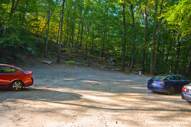
As I pulled into the Turkey Mountain parking lot at 5:53am on a Sunday, I fully expected to be the only person there. There’s never anybody there when I arrive at a trailhead at sunrise (with the goal of getting home in time for breakfast). But there were already a couple other cars there, and several hikers chatting in the parking lot. A couple of them had already completed the hike! That’s hard core.
I saw a handful of hikers on the trails, too, as I made my way around the loop. When I came off the trail at 7:30am, several cars were pulling into the parking lot.
That morning only provided one data point, but from the number of people I saw at a time when I expected to see nobody at all, I can reasonably surmise that Turkey Mountain is NOT a well-kept secret. You’d do well to visit here at an off-peak time (weekdays, evenings, sunrise, etc.) if you’re looking for some solitude here, and even then, you might not totally find it.
But whenever you visit, you will find a very pleasant hike that you’ll be glad you tackled.
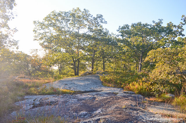
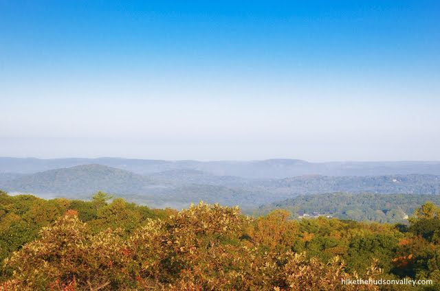
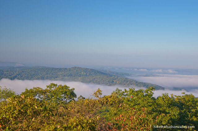
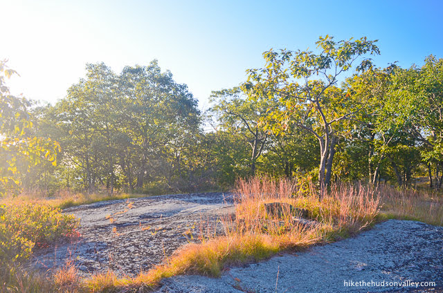
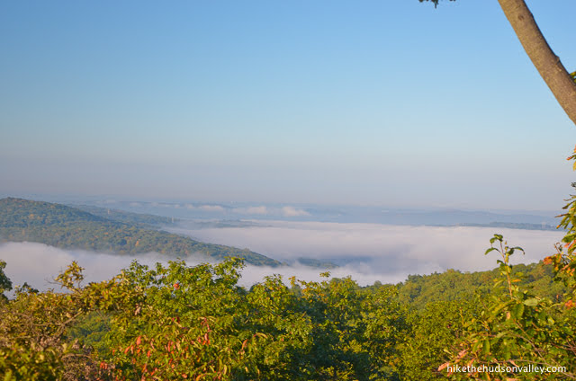
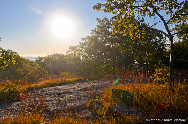
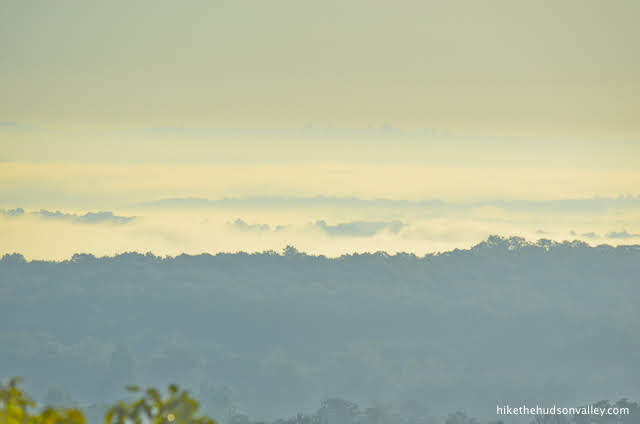
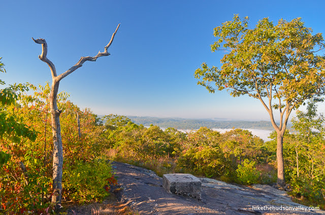
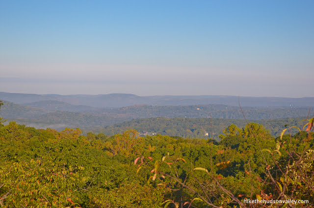
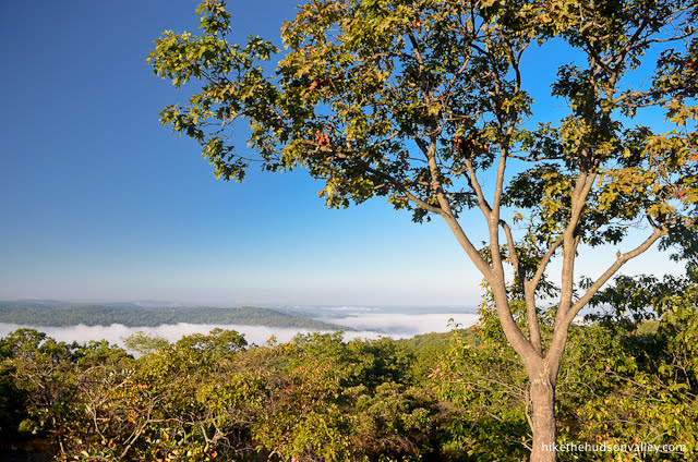
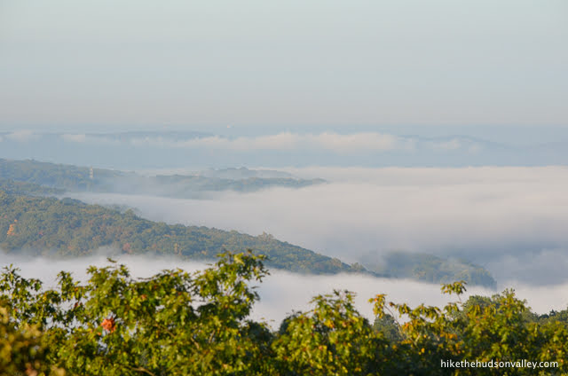
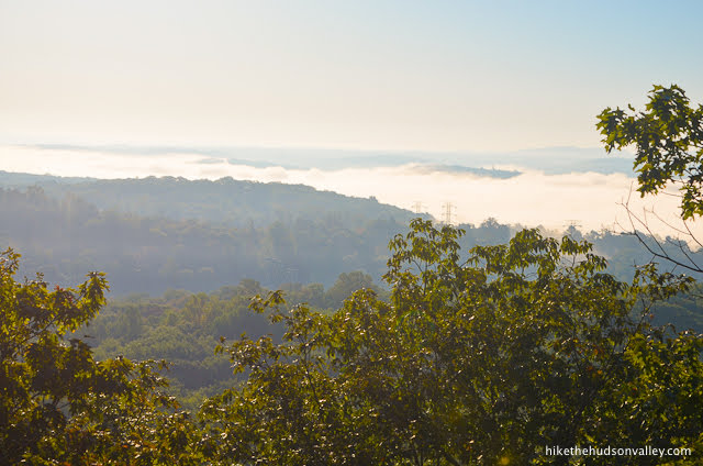
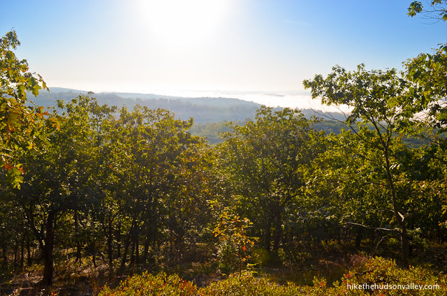
The view at the top is not the biggest in the area, but it is big enough to be a proper reward for all the huffing and puffing you’ll do to get to the summit. The banner image at the top of this page is zoomed in a bit for dramatic effect – with your bare eyes, the views look more like these two pictures:
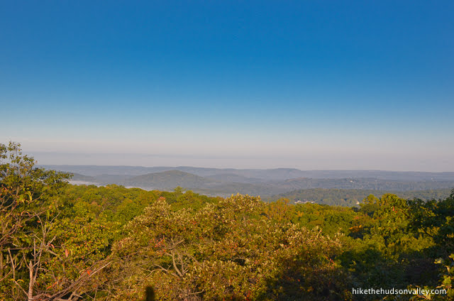
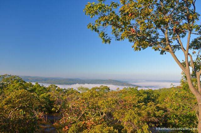
Apparently, you can get a glimpse of the NYC skyline from here on clear days, but my visit had too much fog and haze to verify that claim. I couldn’t really get too upset about it, though. What a nice time to be up there.
For the trail guide below, I’ve chosen the most direct loop (up on the Blue Trail, down on the White Trail) to visit Turkey Mountain’s summit and return to the parking lot, but if you’d like to earn some more steps during your visit, there are plenty of other trails to explore. (And there’s a nice free map from the NY-NJ Trail Conference to help you explore them.)
If you’re looking for a quick hike to a nice payoff, you’ll have a hard time picking a nicer hike than Turkey Mountain, or, as it’s known locally, Turkem Lurkem Mountain. (Nobody actually calls it that, but maybe you and I can get it started?)
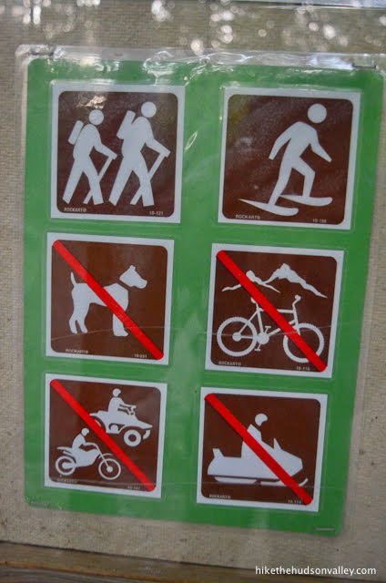
Pooch proclivity: No doggies allowed. Booooo! (One hiker – who had two friendly dogs with him – told me that there used to be a large “No Dogs Allowed” sign right by the parking lot, to which someone had added a handmade “No Cats Allowed” addendum. Since I’d left my dog at home (she would have loved this hike!), I was wondering if “No Dogs” is still the official policy, since that sign is no longer there (perhaps due to some vigilantism). Indeed, unfortunately, it’s posted right there on the kiosk, in brown, white, and (most importantly) red.
Maybe it’s just miniature schnauzers that aren’t allowed?
But, sigh, the official policy is still “No Doggies Allowed” at Turkey Mountain for some reason, so it’s best we don’t muck around with our pooches where we’re not wanted. This policy is also the reason that it has taken me many years of living in the Hudson Valley before visiting this hike. Hiking with my dog is one of my favorite things to do, so I’ve always skipped over Turkey Mountain (which is a shame, because it’s such a nice hike). In any event, as much as it may break your canine-loving heart, you’ll need to leave Fido at home for this one.
Trail Guide
Bonus unsolicited advice: Don't depend on having cell service in the woods - it can be spotty out there! Download this trail guide to your phone before you head out. (It's easy to do on iPhone and Android.) May your connection to nature be strong, even when your connection to the internet is weak.
1. Before we begin, make sure you grab the free Turkey Mountain trail map from the always-awesome NY-NJ Trail Conference.
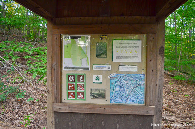
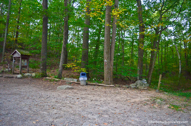
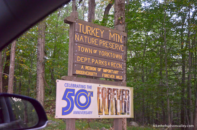
2. From the parking lot (see “Directions to the trailhead” below), head over to check out the kiosk. Might as well learn something while we’re here.
I also checked out the nice “ADOPT-A-PARK” sign (thanks for keeping this place tidy, Yorktown Land Trust!) to see what that crumply notice tacked to it said.

Oh, there may be timber rattlesnakes around? My, that IS interesting!
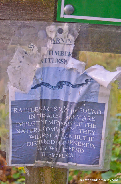
If you like to obsess about snakes like I do, you can check out my “Snakes on a trail” post to feed all of your ophiologic neuroses. Bottom line, eastern timber rattlesnakes are docile — the golden retrievers of the pit viper world, really — and while you are HIGHLY unlikely to see one here, if you do luck out and see one, just leave it be, and it should return the favor.
Also of note: There’s a trash can! Nice place to deposit other people’s litter, should we encounter any.
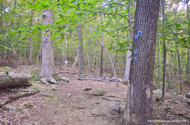
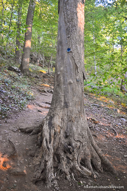
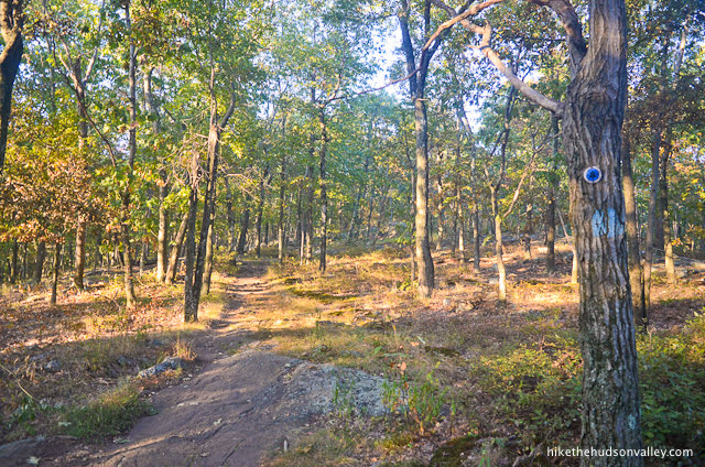
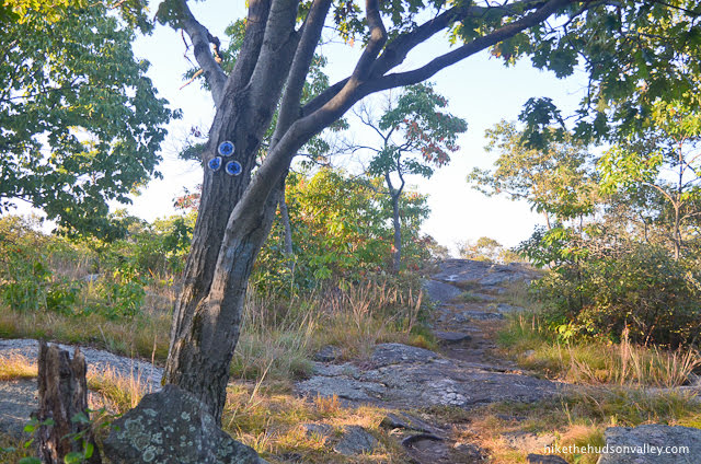
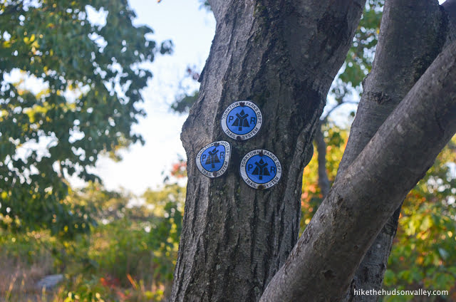
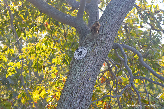
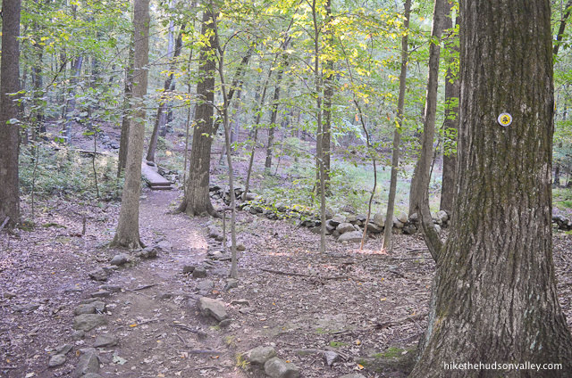
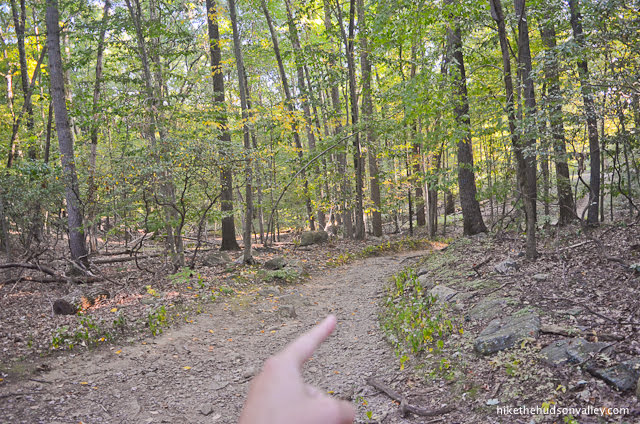
3. On the opposite side of the parking lot from the kiosk, you’ll find a tree marked with six blazes, three for the start of the Red Trail, three for the start of the Blue Trail.
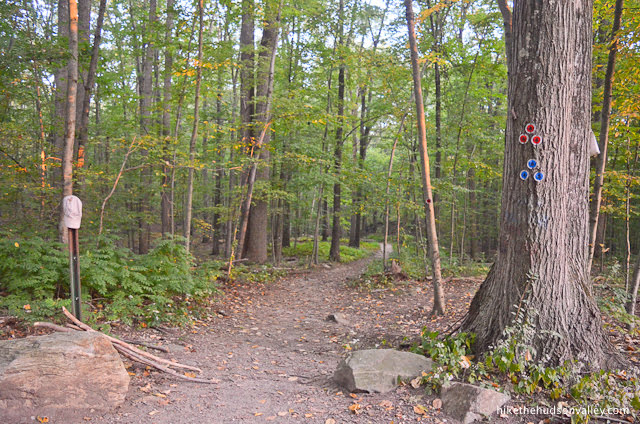
We’ll be following the Blue Trail all the way up to the summit. Hop on this many-blazed red/blue monster to get started.
4. Almost immediately, the Red Trail splits off to the right. Stay to the left to keep following the Blue Trail. Goodbye, Red Trail! We hardly knew ye.
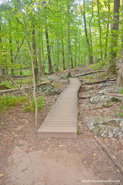
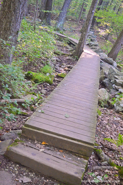
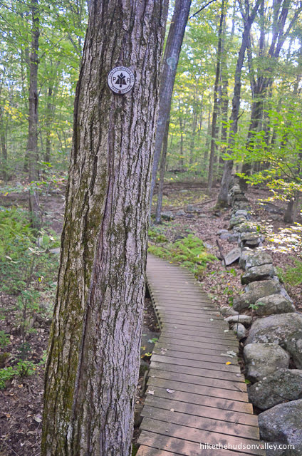
5. In a couple of minutes, you’ll find some nice trailwork in the form of little wooden walkways, which you’ll especially appreciate it if you’re visiting in very squishy conditions.
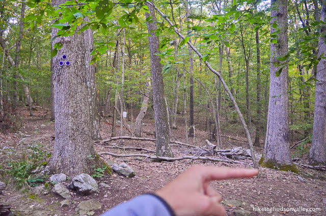
6. One minute after the walkways, you’ll arrive at a trail junction, with three blazes on your left marking the start of the Purple Trail.
Stay to the right to continue following the Blue Trail.
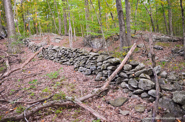
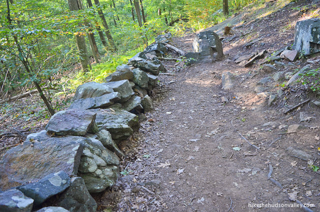
7. In another minute, you’ll stroll past a picturesque stone wall.
Shortly after that wall, you may notice a tree that has recorded the initials of everyone in the area who should really know better.

Fortunately, the park service has trained local bears to eat anyone who attempts to carve anything else into the trees here. (That may or may not be true, but it can’t hurt to start the rumor. Also, it’s possible that they’ve been trained to eat anyone who litters.)
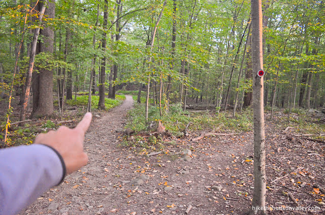
Just after that tree, the Red Trail splits off to your right (how does it keep doing that?). Stay straight/left to remain on the Blue Trail. From here, it’s just about one mile and 400 vertical feet to the summit! That’s nothing for you, right? You eat 400 vertical feet for breakfast. And second breakfast. And elevenses.
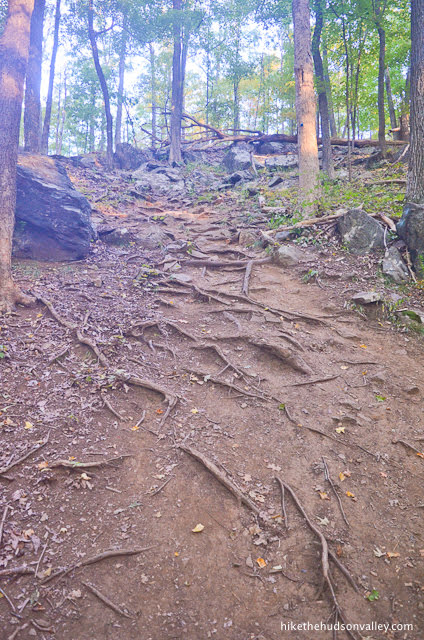
8. Keep following those blue blazes as the Blue Trail strenuously encourages you to gain altitude. What a nice section of trail.

In this area, I noticed one spot with a blue arrow painted on a tree, pointing left. Look just beyond that tree to see the next blue blaze, straight ahead. Not sure why that left arrow is there, but just keep following the plentiful blue blazes, and you’ll be all set.
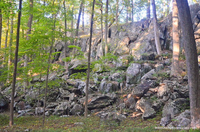
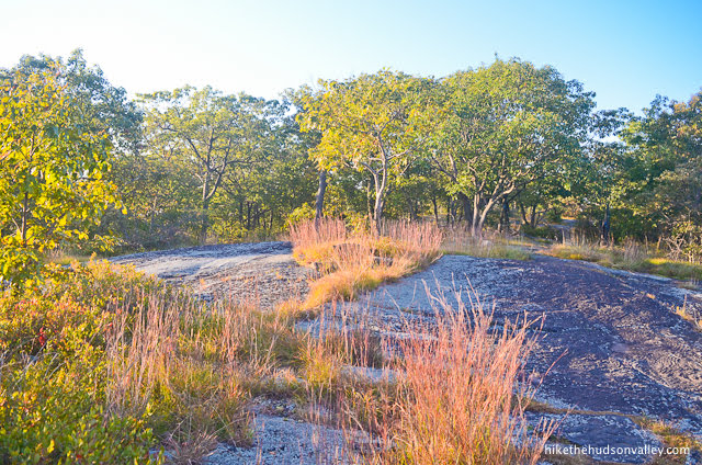
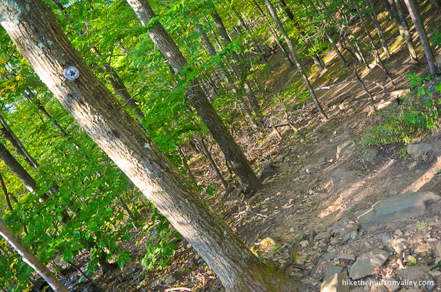
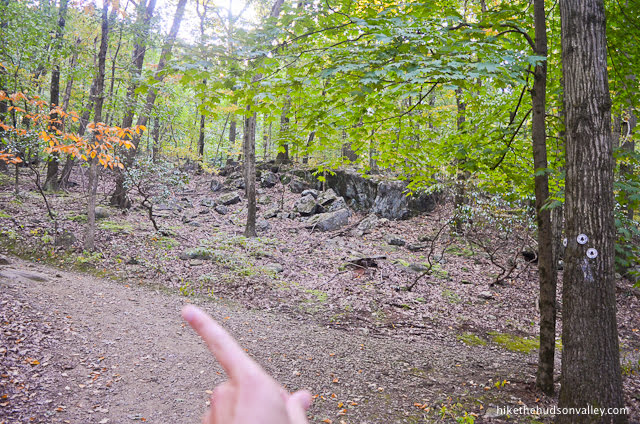
As you climb, you’ll notice some interesting rock formations to your left.
You’ll also notice the sound of your wheezing.

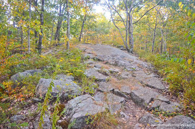
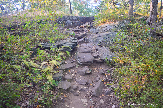
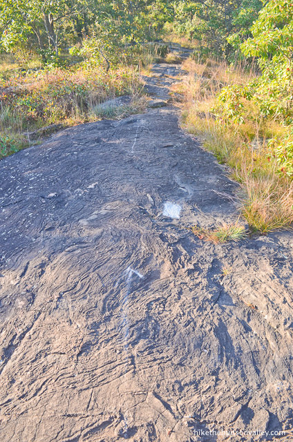
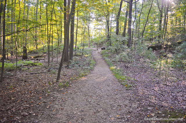
After much huffing and puffing, the trail levels out again to take you through some (more) scenic woods.
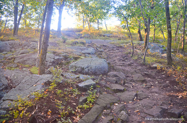
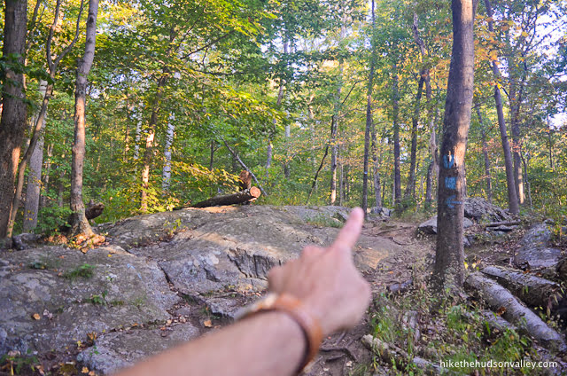
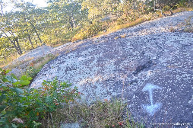
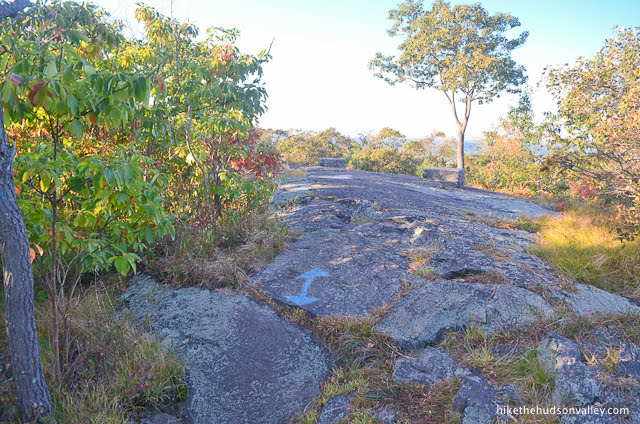
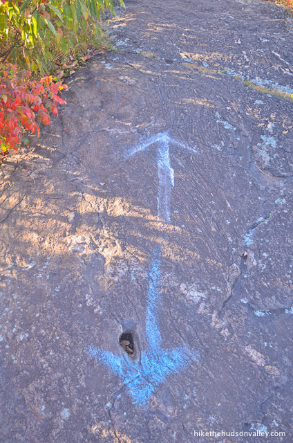
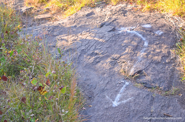
As you near the summit, the trail becomes quite rocky, and you’ll need to keep a sharp eye out for painted arrows on the rocks to help keep you on the Blue Trail.
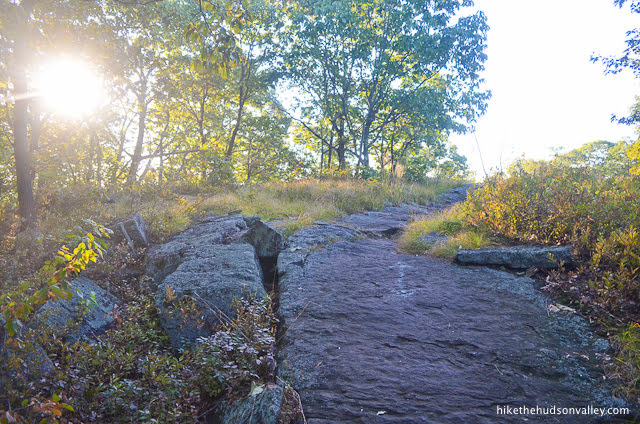
Starting to feel like you’re on top of a mountain up here, isn’t it? (With all due respect to Bull Hill, that’s because you are!)
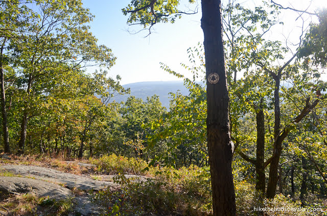
9. Just before you get to Turkey Mountain’s summit, you’ll come to a rocky clearing with a (very) small view to your left.

This is a nice spot to relax for a moment. If you have a zoom lens, you can make the view look much bigger.
10. After you’re done with your view appetizer, keep hoofing toward the main course, following the blazes and painted arrows.
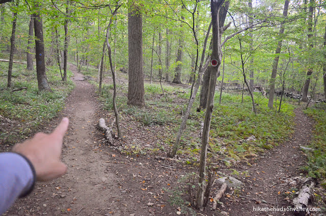
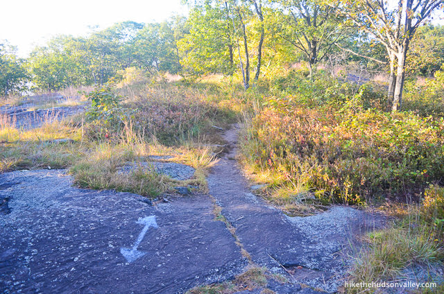
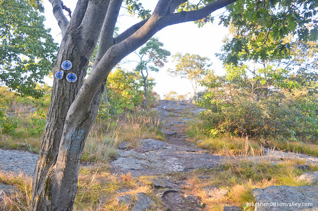
Just a couple of minutes after the little view, you’ll arrive at the end of the Blue Trail, marked with three blue blazes.
The trail continues straight beyond this tree, now marked as the White Trail (though you may still see a blue arrow or two).
The money spot is just ahead!
11. When you come to a spot with some concrete blocks placed as if maybe you should stand on one of them (you should!) to get a better look at the view, you’re at Turkey Mountain’s money spot!
Take your time to gobble up the view. It really hits you right in the gizzard, doesn’t it? If there’s still some early morning mist in the valley below, well, that’s just gravy.

Just keep basting your eyes in that view. Really feast on it. The houses in the distance look like little giblets from up here, right?
Give your drumsticks some time to rest while you keep stuffing that view into your eyes for a few more minutes.
This view really goes all the way up to the rafters, doesn’t it? (I’m sorry, I know these turkey puns have gotten pretty fowl.)
Take one last gander (hey, how’d a goose pun get in here!?) at the valley below. Okay, that’s enough of that. Honestly. Once you’ve had your fill of the view, let’s wattle down the other side of the mountain.
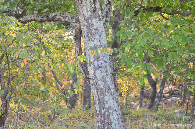
12. We’ll follow the White Trail to continue our loop back to the parking lot. Facing the view, the White Trail continues to your left. It can be tough to pick out the white blazes on some of the trees – can you find the blaze in the picture below? It’s camouflaged like it’s hiding from predators.
Keep a sharp eye out for the painted markings on the rocks that show the Blue Trail behind you, the White Trail ahead. Follow the white arrow onward and downward!
13. You could lose your way here if you weren’t carefully watching for painted arrows and blazes.
The arrows are especially helpful at pointing you in the right direction.
Less than five minutes from the money spot, you’ll arrive at one more small view, your last one for the day.
If you left any room, gobble this one up, too.
14. It’s all downhill from here! From the little view, it took me about 21 minutes to get back to the parking lot, including some stops for pictures.

Just keep following those white blazes all the way back to your car. (You really don’t need me anymore. I won’t be offended if you stop reading now and concentrate on following those blazes.)
You’re still reading! I could tell you were cool from the way you didn’t throw your phone down in disgust at all those horrible puns back there.
You’ll pass some nice trailwork on your way down.
And some nice fern work.

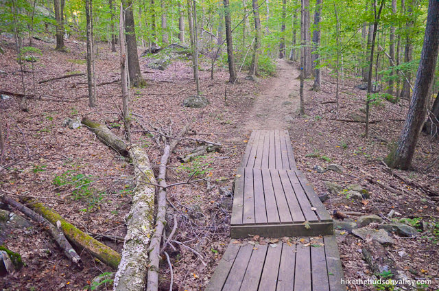
About ten minutes from the last little view, you’ll come to a nice boardwalk/bridge.
Right after that bridge, you may notice a tree with a single yellow blaze. I don’t know what’s going on with that blaze, but don’t fret. You’re still on the White Trail.

In just another moment, you’ll arrive at another nice boardwalk. This one features a white blaze to confirm that you’re still on the right track.
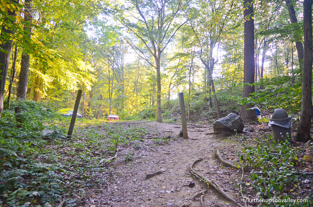
15. Shortly after the second bridge, you will be presented with some opportunities to get lost on marked and unmarked trails.
According to the trail map, the Green Trail joins you from the right (twice!), the Red Trail joins you from the left (thrice!), and you’ll head straight through an intersection with the Yellow Trail. I didn’t notice all of these intersections, but fortunately, sticking on the White Trail is always the right answer, and it’s also the easiest thing to do.

In another minute, the trail takes a hard bend to the left. Keep left to follow the white blazes.
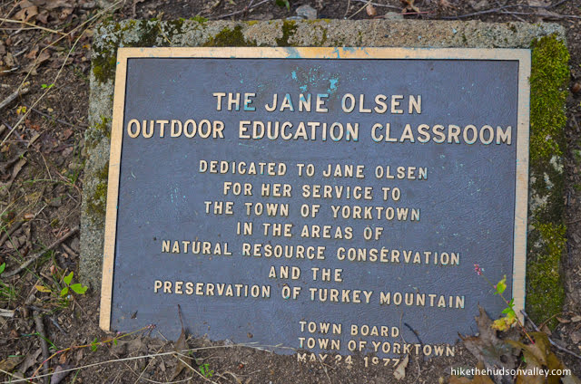
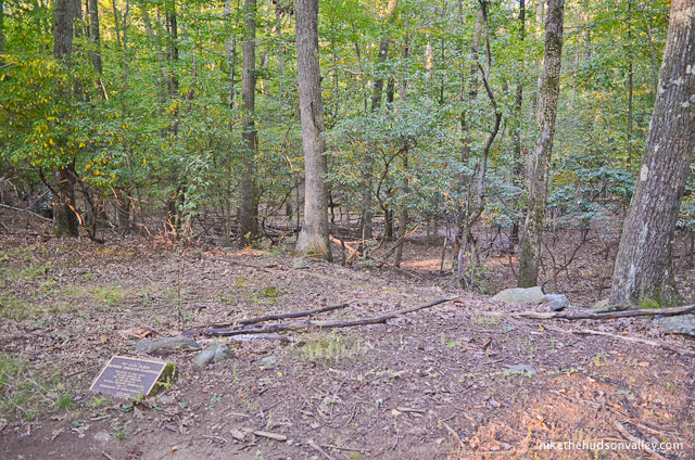
(Out of curiosity, I took a quick stroll to the right to see why that unmarked trail was there. Turns out, it’s an outdoor classroom. You can juuuust see the plaque from the White Trail. What a nice idea!)
16. In the next section of trail, you may notice that yellow blazes are now appearing along with the white ones. For some reason. Keep an eye out for the plentiful white blazes, ignore the yellow ones, and you shouldn’t have any trouble.
When the Red Trail joins you from the left (for the third time?), veer to the right to stay on the White Trail. (From this point, you’re about one minute from the parking lot.)

17. The trail gently rises through the woods up to the parking lot.
Hello, trash can! Here, have some trash we picked up from people who weren’t raised correctly.
Hello, car! Take us to food!
Hope you enjoyed your visit to Turkey Mountain! You’ve earned the right to eat whatever you want for the rest of the day. Happy gobbling! (And sorry again about the puns. I was going to delete some of them, but I just can’t help who I yam.)
Directions
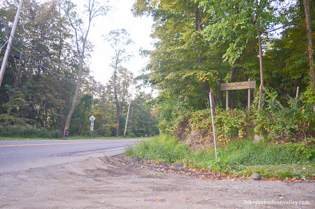
Directions to the trailhead: From the Taconic Parkway headed south from Poughkeepsie, you need to go about 20 miles beyond Fahnestock State Park. As you approach Yorktown, take the Underhill Ave exit. Turn left onto Underhill Ave. In about 1.7 miles, you’ll turn right at the light onto Saw Mill River Rd (NY 118). In another 1.6 miles or so, turn right onto Croton Heights Rd, which is marked with a wooden “Turkey Mountain Nature Preserve” sign (you’ll also see a large sign on the left for Peter Pratt’s Inn).
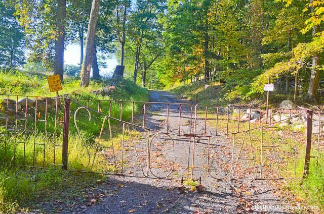
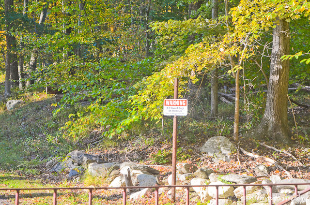
Follow the gravel driveway straight back to the large parking lot. Along the way, you’ll pass a metal gate on your left that says “Sanctuary.” A sign right behind that says “Warning: K-9 Guard Dogs on Premises.” Isn’t that redundant? Are there feline guard dogs? Is any event, this is not the hike! This is a place you’d visit if you were a character in a Stephen King novel. Keep going!
Just look on the right-hand side of the road for much friendlier signage.
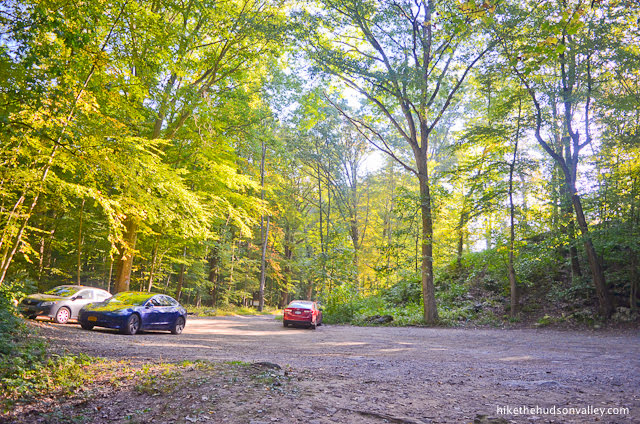
The road takes you straight into the parking area. Find a spot in the fairly large lot, hop out, and let the adventure begin!
Sorta nearby address for your GPS: You can just plop “Turkey Mountain Nature Preserve” into Google Maps (or the mapping app of your choice) and it will take you to the right place. (Just verify that the location is on Croton Heights Rd in Yorktown or Yorktown Heights – I’ve seen it written both ways.)
GPS coordinates of parking area: 41.24663, -73.78897 (Clicking will open in Google Maps or the Apple Maps app, depending on your browser/device.)
Bonus note: Thanks to friend-of-the-site Jeff Kent for providing this helpful comment on the Hike the Hudson Valley Facebook page:
If you’re so inclined you can ride your bike here via the Northway which is right across the street from the driveway. https://www.visitwestchesterny.com/things-to-do/outdoors/trailways/north-south-county-trailway/
Resources & Interactives
Super-cool Google Earth flyover of hike route:
Google Terrain Map of hike route:
Related resources: If you’re looking for actual facts and/or useful information, visit these resources:
- The free Turkey Mountain trail map from the always-awesome New York-New Jersey Trail Conference
- The official Yorktown Turkey Mountain homepage
- A nice write-up with some local lore on Explore-Hudson-Valley.com’s guide
- The extremely concise Turkey Mountain Wikipedia page, which seems to exist solely to say that this place is a hill, not a mountain (perhaps authored by Bull Hill?)
- Great info on the park and hike from the New York-New Jersey Trail Conference’s Turkey Mountain Nature Preserve page
Want to support trails in the Hudson Valley? Here’s one great way: Visit the New York-New Jersey Trail Conference homepage and click on Volunteer, Donate, or Shop! (Then you can volunteer, donate, or shop, depending on your mood.)
It’ll be better for your knees to go up the steeper white trail (it’s about half a mile to the top) and then down the blue (after about .5 mile along the ridge) as coming down the North-East ridge of the hill is less steep and rocky. (Total loop 2.1mi)
The no-dog rule seems to be more of a guideline as they say as there are a lot of dogs. Please keep yours under control and clean up as they are mostly worried about dogs causing trouble for people and deer.
Beautiful hike and great workout! Just make sure you bring bug spray.
Hi Mike,
I completed this hike today! What a nice little hike! Drove up from NYC with a friend, took about 90 mins to hike, and had an amazing brunch at “tasty table” about 15 mins away! I just wanted to say thank you for all your posts! I have used many of them throughout the years, and I truly appreciate your commentary, directions, and work you put in!
Hope you’re doing well!
That’s great to hear, Christine! So glad you had a great hike out there, and really appreciate your kind words about this site. Thanks for taking the time to brighten my day. Happy adventures to you!
Hi Mike,
My family is abroad and I was looking for a hike not too far (Westchester resident) and not too lengthy. This was the perfect one!
Went in today (Saturday) around 1pm. Plenty of parking was available. Trail wasnt crowded either. Although most of the few (see what i did there) that were there had their dogs with them! Not sure if they knew the no-pooch rule or honest mistake.
All in all it was a good solo hike for me. Got it done in just about an hour and also got manhattan skyline views.
Thanks for the details here and keep up the good work.
Danish – thanks so much for the kind words, nice trip report, and great photo! Very much appreciated. Glad you had a great day out there and made the most of the time while your family is abroad. Hope you find some more nice places to explore in the area!
This is a perfect hike for outdoor activities! We will visit this place again in the summertime. Thank you for the information!
Hello,
This hike seems perfect to me, however I was wondering about to things.
One, what is the parking situation like? I’ll be coming at about 9 am on a sunny weekend (however it is forecasted to be pretty cold). Do you think I’ll be able to fund a spot?
Two, I see the rating is a 4/10, do you think that a (somewhat small) 6-month old puppy could do the hike?
I appreciate any advice!
Best,
JBK
Parking is tight on sunny weekends, but maybe 9:00 will be early enough and the cold will be enough to keep the crowds down. They have really cracked down on cars parked along the driveway or road. I think your puppy should be ok.
Hi Jeff,
Thanks for the advice!
Best,
JBK
Just an FYI, the coordinates to the parking lot are not correct. It takes you to someone’s house in a fancy neighborhood. Added 10 more minutes to reach my destination. ♀️ Just type the name into Google maps and you get there just fine.
Parking was extremely limited at 9am and people were lining up on the side of the drive up when we left at around 11:30am.
We somehow started with blue blazes but then lost them and ended up following the white blazes to the top. It was doable but several in our group needed to stop a few times. Going down we found and followed the blue blazes. Gorgeous hike and it was a beautiful day (Sat Oct 3, 2020).
So sorry to hear about the problem with the GPS coordinates! I’m curious if the old coordinates correctly routed you onto Croton Heights Road (the driveway for this hike)? The old pin was dropped right on the parking area, and I wonder if the mapping app tried to bring you there through private property. To make sure this doesn’t happen to anyone else, I’ve moved the coordinates to the entrance to the park, just slightly after you would have correctly made the turn onto Croton Heights Road, then everyone can just follow the driveway and signs from there. (And as we’ve both noted, just typing the name of the hike into Google Maps does the trick, too.) So sorry for that inconvenience, and thanks for helping to make sure nobody runs into that problem again – should be fixed now!
As for the hiking route itself, if you took a left onto the Purple Trail early on, and followed that to Red, then to White, perhaps that’s what happened? Let me know if there’s something I could update in the guide above to make sure nobody else has the same problem. Glad you made it with your own custom route. You picked a great day for it, too.
Thank you for the helpful feedback and beautiful photo!
I gotchyer skyline right here, buddy…nice (short but legit) hike. No crowd midday Friday right after a rain…nice.
So great to see my local romping grounds finally covered! Can confirm the NYC skyline can be seen peeking out over the distance from the top–Always a rewarding sight when the skies allow it.
Going off what Jeff said, I’m not sure how new the no dog policy is. I’ve been climbing Turkey Mountain for ten years or so and have been greeted by a friendly dog or five every time I’ve been on the trail.
I will add that the lot does get VERY crowded, especially midday on the weekends–We don’t have too much to do around here in Yorktown 😉 There will be times cars line all the way down the entrance road, which is both likely illegal and makes navigating your car out of there a bit tricky. So make sure to get there moderately early!
Thanks so much for the kind words and helpful info, John!
I think the No Dogs rule might be new. I used to bring my old dog here all the time and saw many others. This hike does get very crowded and when I was there a couple weeks ago they had put No Parking signs along the driveway. In the past it was not unusual to see cars all along it which led to some tricky maneuvers to get turned around. This hike is short enough that you can do it both ways which is good as it’s quite different if you go up the steep way.
Always great to hear from you, Jeff — appreciate you sharing this info on your stomping grounds!