Background
If you find this free trail guide useful, please provide payment by picking up at least one piece of litter on your hike. Cha-ching! Thanks for being awesome! (And here’s a quick primer on Leave No Trace, too, to help us keep the trails nice and fresh for each other.)
Background you can feel free to skip: The tagline for Bushkill Falls, right there on its homepage, is “The Niagara of Pennsylvania.”
That’s a bold claim, right? Have you seen the Niagara of New York & Canada? It’s quite impressive! That’s like a dude setting up his online dating profile with the tagline, “The Thor of Poughkeepsie.” Have you seen the Thor of Asgard? Are you sure you want to invite that comparison?
Before visiting, I wondered if Bushkill Falls might be setting up visitors for disappointment with its tagine, but I needn’t have worried.
After meeting my (awesome!) sister at Bushkill Falls and hiking the longest loop available there, we had to agree that “The Niagara of Pennsylvania” was a fair description after all, if perhaps a tad aspirational.
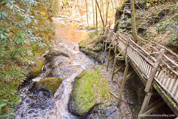
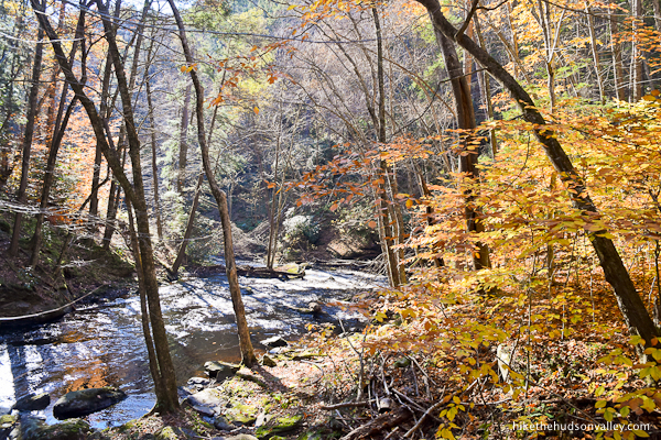
What a beautiful place! The waterfalls here are gorgeous, and the trails leading to them, complete with wooden bridges and pleasant boardwalks, are a highlight in their own right.
Which isn’t to say that the waterfalls at Bushkill Falls are anything like Niagara Falls. They both have gift shops in common, though! You’ll find a well-stocked one at Bushkill Falls.
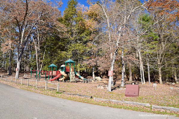
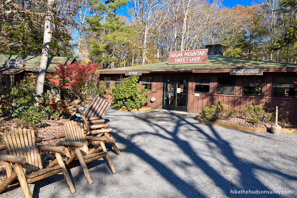
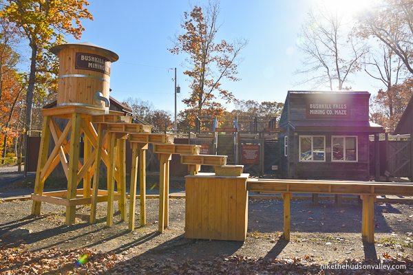
You’ll also find the Sugar Mountain Sweet Shop! And a little playground! And some historical exhibits! And a maze! And paddleboat rentals! And a sluice thingie for gold panning! And other stuff!
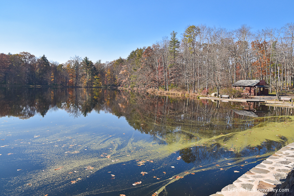
However you might feel about the touristy trappings of the area immediately surrounding the parking lot, the eight waterfalls at Bushkill Falls, and the intricate system of trails, bridges, stairs, and walkways that bring you to them, are absolutely impressive. This place deserves a spot in your hiking rotation.


This park is privately owned and administered (and has been since 1904), and admission tickets are part of the deal. We paid $15 bucks each for our weekday visit in late 2021 (weekend tickets cost a few bucks more). Current rates are available here.
I was a little bummed about the expense, but after enjoying the impressive infrastructure here, as well as the sights themselves, I did not have any buyer’s remorse. (Knowing what I know now, though, I’d have hiker’s remorse if I’d never hiked here.)

My sister and I chose Bushkill Falls because it was a good halfway point for each of us – she was coming up from near Philly, I was coming over from the Hudson Valley. If you’ve got a friend in Pennsylvania, this is a great spot to meet them for a hike.
This might be a good time to recognize that Bushkill Falls is not at all in the Hudson Valley, as the name of this website might suggest. It is certainly day-trippable from the Hudson Valley, though, so I stand by its inclusion here. (And if the Hudson Valley ever annexes the Delaware Valley, we’ll be off to a head start with our trail guides.)
After driving so far to get here, it seemed criminal to hike anything other than the longest route that visits all the waterfalls. There are shorter options available if you prefer them, but the route I’ll describe in the trail guide below is the longest hike at Bushkill Falls you can do without backtracking, and it hits all eight waterfalls.
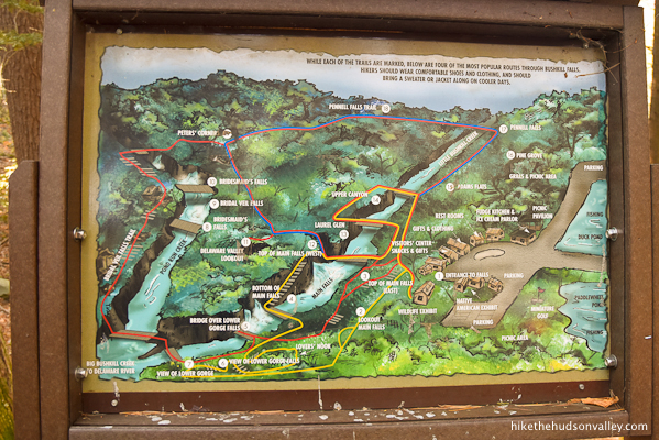
While it’s always wonderful to have free maps, I found the official trail map (posted throughout the park, and available online here) a wee confusing – the Red Trail appears to follow a non-traditional pattern, impossible to follow in its entirety without looping around and/or backtracking.

If you’re looking at that map, the path we took (and which I’ll outline below), goes like this: 1 -> 3 -> 5 -> 7 -> 19 -> 18 -> 17 -> 15 -> 14 ->3 ->1. That seemed like the right way to do it.
The only point of interest that we missed was the “Delaware Valley Lookout” (near number 11), but we came here to see waterfalls, after all. I didn’t have any regrets about the route we chose, and it’s the one I’ll likely follow in subsequent visits. And there will be subsequent visits! (If you decide to visit the Delaware Valley Lookout while you’re here, please let us know in the comments if we missed something awesome.)
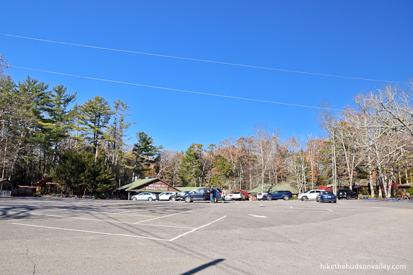
Bushkill Falls is not a well-kept secret. My sister and I both burned a day of vacation to meet here on a chilly Monday in November. The large parking lot was mostly empty in the morning.

By the afternoon, considerably more cars had joined the party.
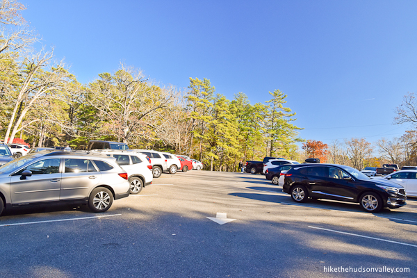
To the left of the main lot, another sign pointed down a gravel road to a very large auxiliary parking lot, which was empty on our visit. If both lots happened to be full during your visit, you’d be sharing the outdoors with LOTS of other nature lovers.
I’d advise visiting on a weekday, if you can. You’ll save a few bucks and have way more elbow room out there.
Whenever you visit, just be sure that you do! The Niagara of Pennsylvania may not have the same gallon-per-minute rating as the Niagara of New York & Canada, but it has plentiful charms all its own.

Other points worth mentioning:
- Bushkill Falls is NOT open year-round. They’re closed from mid-November through early April. Their daily operating hours also change throughout the year. Be sure to check their Operating Hours and Schedule before your visit.
- We visited in November, when the streams in the Hudson Valley were running low, and I was concerned that Bushkill Falls might dry up, like some of our local waterfalls do. I called Bushkill Falls (888.287.4545) to make sure the falls were running, and, just as the friendly person told me, they were indeed flowing well. Nice to be able to call a human to check on conditions before you go.
- Leashed pets ARE allowed here (see their General Information page for confirmation), so have a great day out there with your leashed dog and/or iguana.
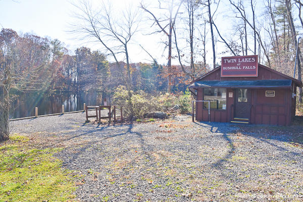
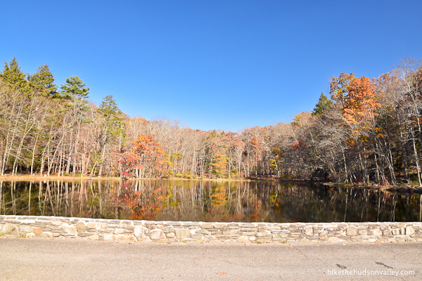
- Paddleboat rentals and fishing are some of the many add-on activities you could partake in here. Those activities were closed during our visit, but the ponds (on either side of the entrance driveway) looked pleasant. (Not “I wish I could swim in them!” pleasant, but pleasant.)
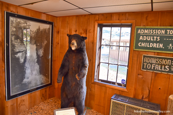
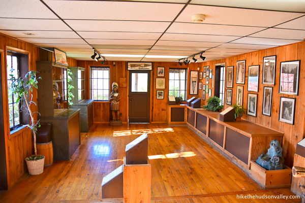
- There’s a free “Story of Bushkill Falls” cabin bordering the parking lot, and it has some interesting exhibits. Not a bad way to kill a few minutes, especially if your hiking partner hasn’t arrived yet.

Trail Guide
Bonus unsolicited advice: Don't depend on having cell service in the woods - it can be spotty out there! Download this trail guide to your phone before you head out. (It's easy to do on iPhone and Android.) May your connection to nature be strong, even when your connection to the internet is weak.
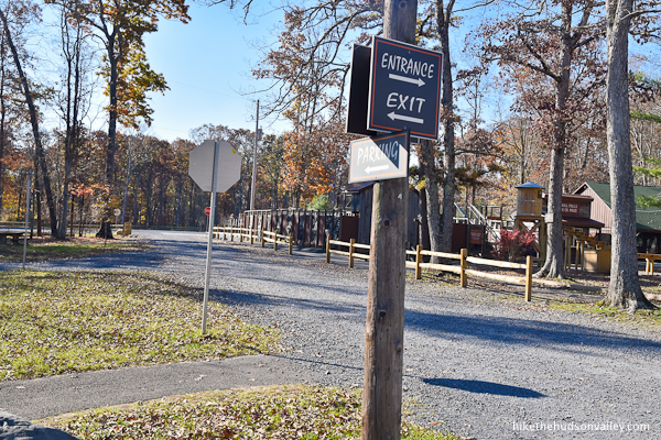
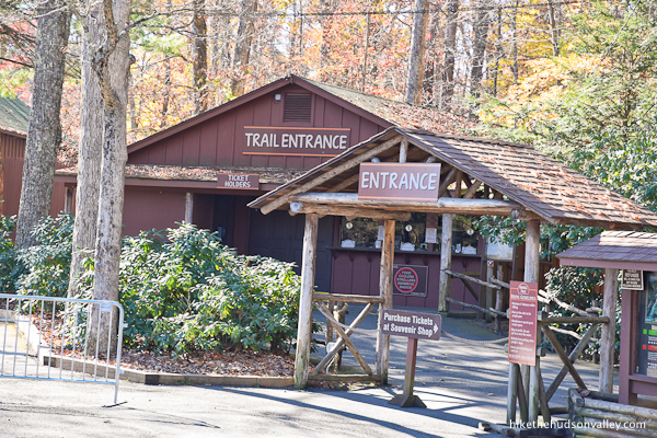
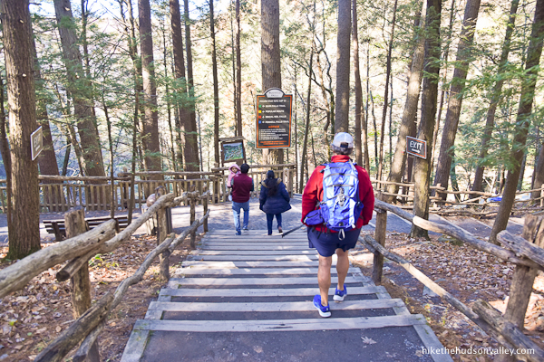
1. From either of the parking lots, (see “Directions to the trailhead” below), make your way to the ticket-procuring area. (On the day we visited, signs directed us to buy tickets in the gift shop, though it did look like there was a separate ticket building to the left that’s used on busier days.)

2. To the left of the gift shop, you’ll find the well-marked TRAIL ENTRANCE. Hop on that trail and let’s check this place out! (That entrance was closed during our visit, and we entered the woods via the exit trail beside the gift shop – the trails all converge as you head into the woods, so either one works.)
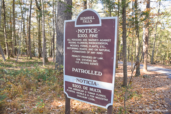
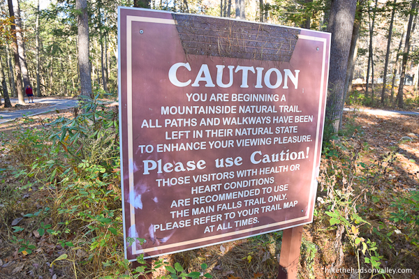
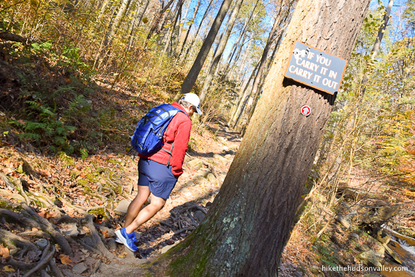
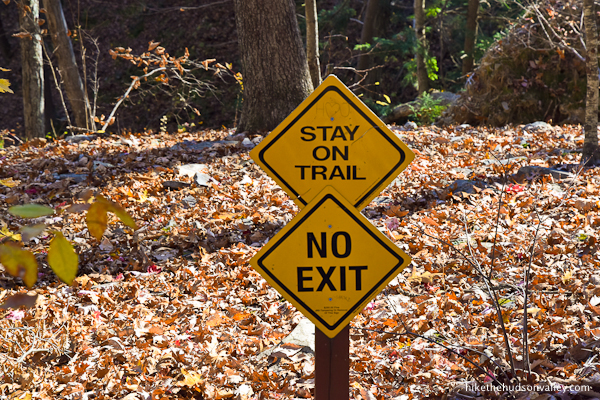
3. Take note of the various rules and warnings. Cliff’s Notes version: stick to the trails, leave no trace, don’t take stuff, and get ready for a hike! All stuff we were going to do (or not do) anyway, so that works, right?
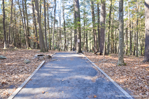
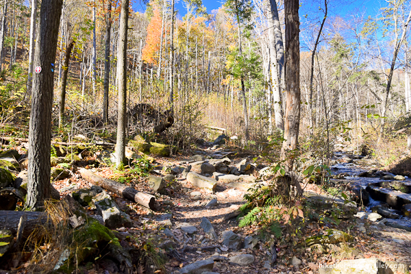
4. Follow the wide gravel trail downhill, to your first decision of the day (besides whether to buy fudge or not).
Decision time! If you want to chicken out and take the less strenuous, yellow-blazed popular route, now’s your chance! (I have no idea what’s down the Yellow Trail, except for less exercise. Maybe that’s why it’s popular?) If you’re up for an actual hike on the Red Trail, though, meet us at the next step. Otherwise, enjoy the popular route! (You don’t earn any fudge, though.)

5. You’re still here! I knew you were hard core. (Your footwear and can-do attitude gave it away.) Let’s do this thing!
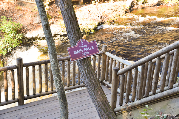
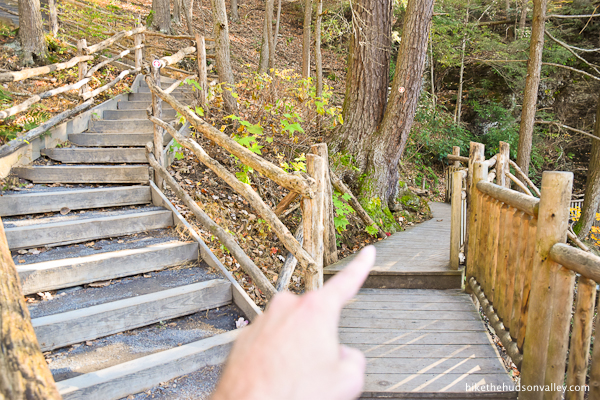
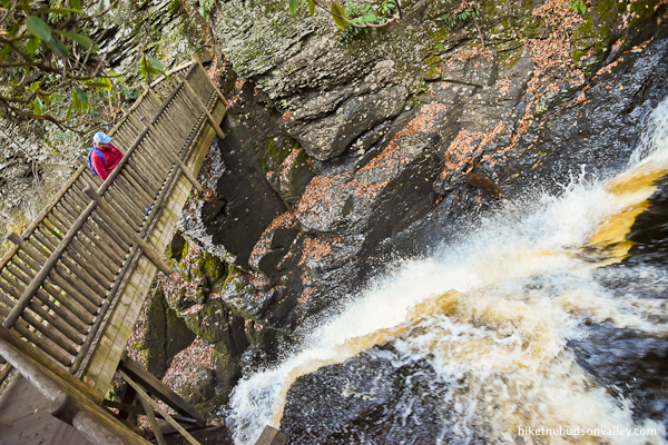
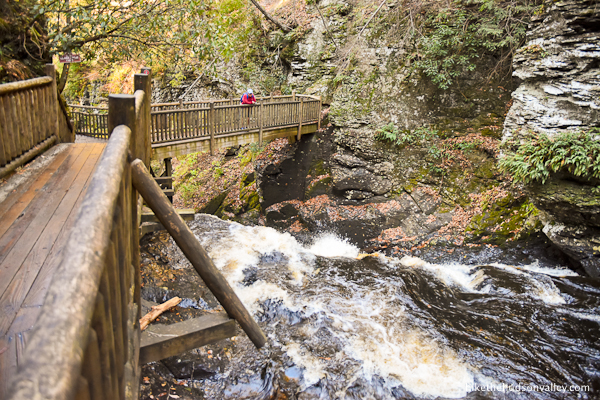
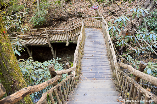
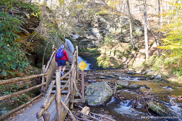
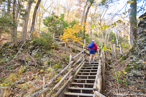
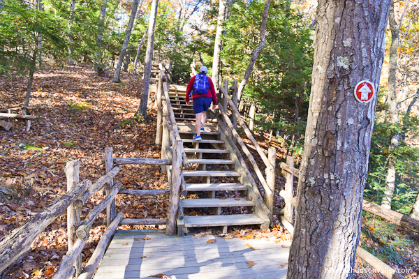
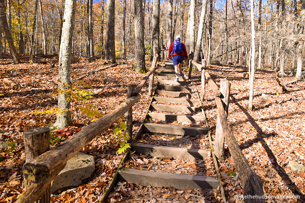
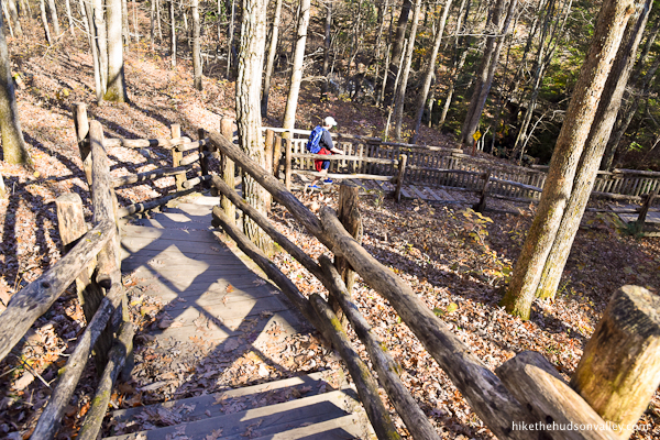
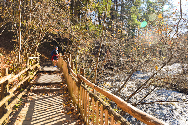
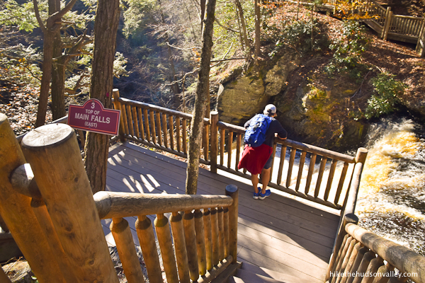
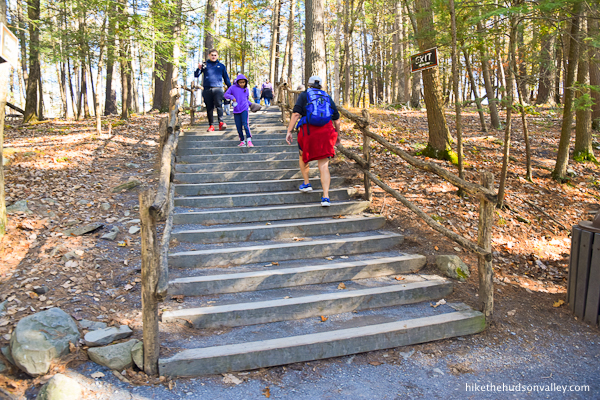
Follow the Red Trail down to the Main Falls overlook.
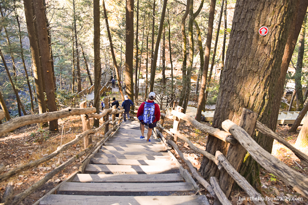
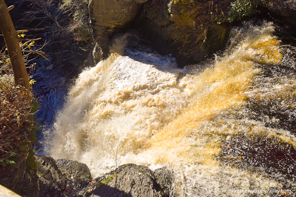
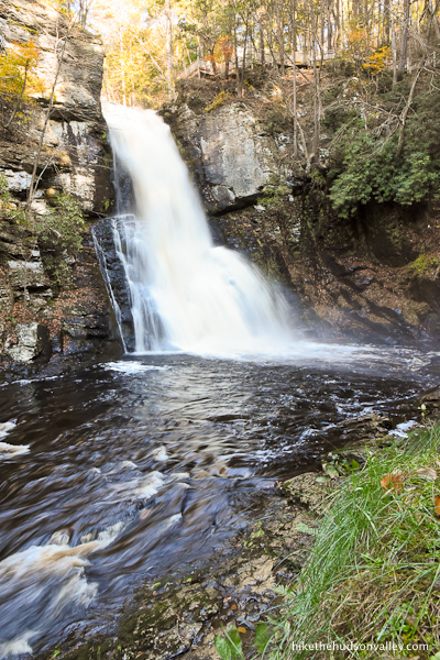
The stairs take you right down to the top of Main Falls (east).

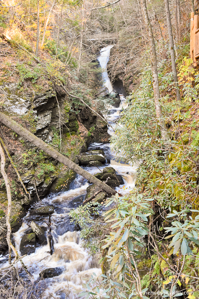
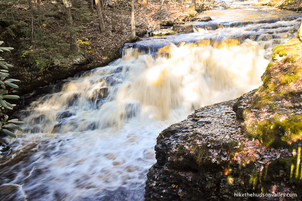
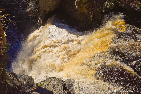
This is the largest, most Niagara-like waterfall at Bushkill Falls. (If you wanted to give it a name with a little more pizzazz than “Main Falls,” I think we can all agree that “Gushy McGee” is the right choice. Feel free to call it that from now on.)
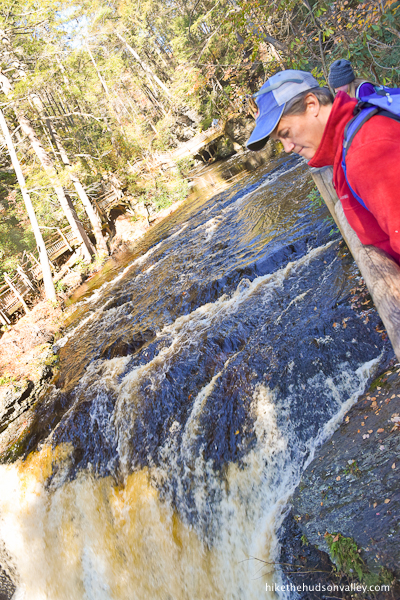
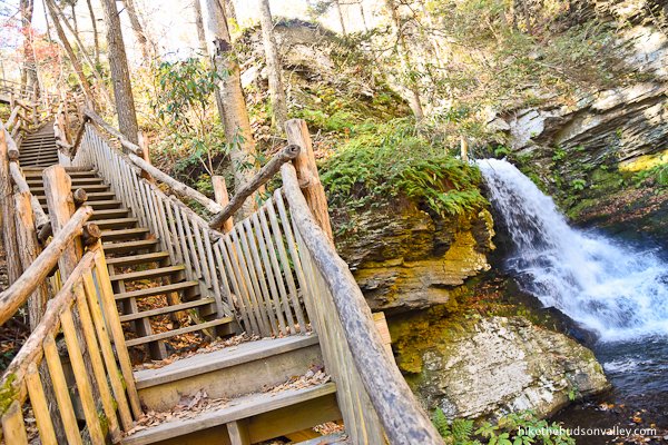
You can get an even better look at ol’ Gushy from down below. Facing the falls, turn to your left, then take the stairs downhill, to your right.
Down we go!
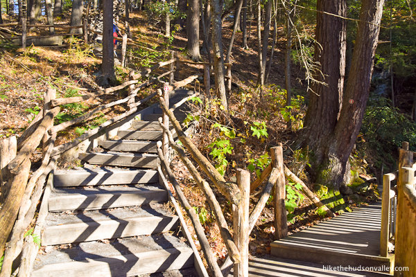
6. Enjoy this cool section of trail, with the rock face on your left, and Gushy McGee visible through the trees to your right.

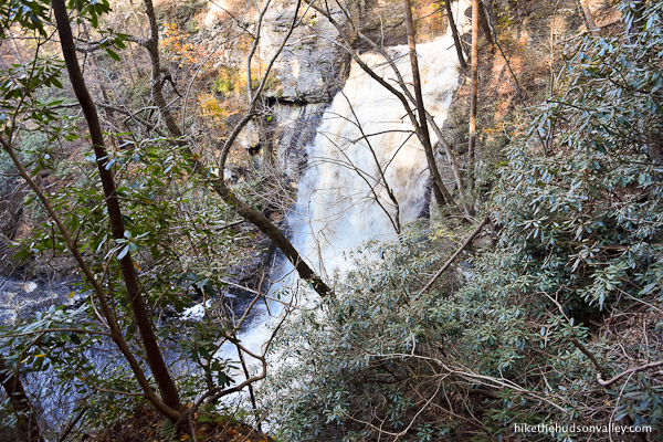
As you continue, the view widens, and you get an unobstructed look at the falls. What a beautiful place.

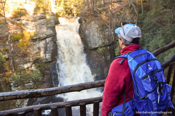
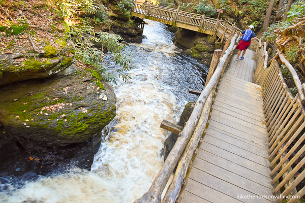
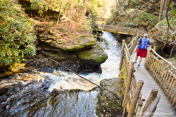
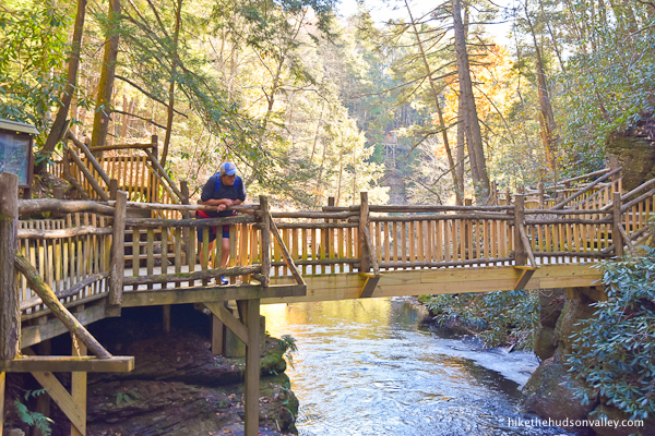
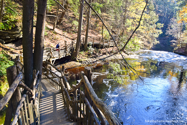
7. From the bottom of the stairs, turn right to walk back toward the falls. (You’ll retrace these steps in a minute, coming back downstream once you’ve basked in the mist for a bit.)
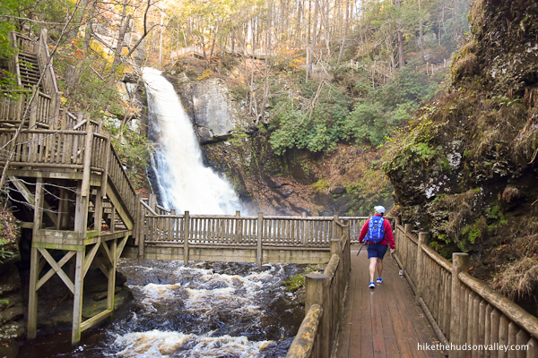
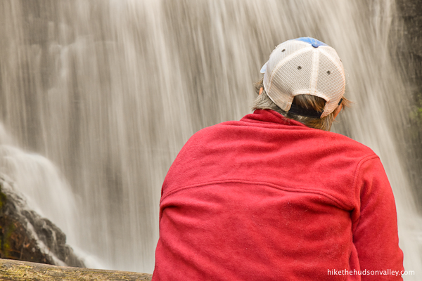
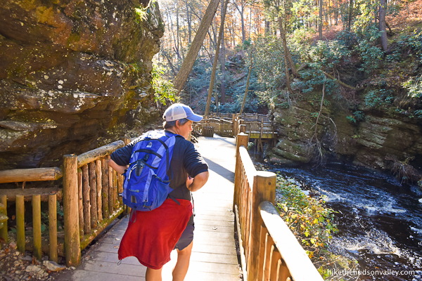
From the bridge spanning Little Bushkill Creek, you can see, hear, and feel the falls. It’s like a 4-D theater, but in real life.
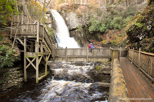
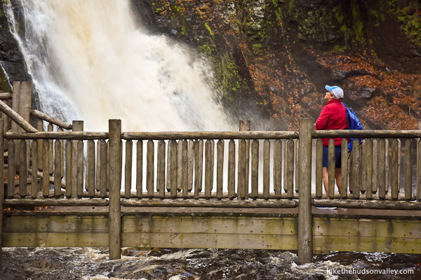
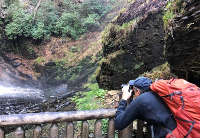
Even if you don’t have a tripod, you can set your camera on the fencepost and try to get that shutter speed juuuust right. Good luck!
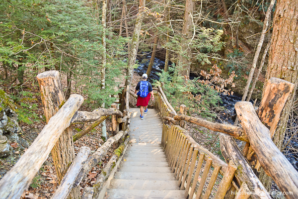
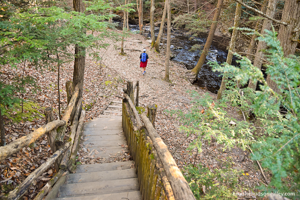
8. When you’re done marinating in the mist of Main Falls (aka Gushy McGee), retrace your steps back to the stairs you descended to get here, and continue following the boardwalk downstream to another impressive viewing platform disguised as a bridge.

You’ll see this spot marked as “5: TOP OF LOWER GORGE FALLS.

When you’re done scoping out this spot, continue heading downhill on the Red Trail.
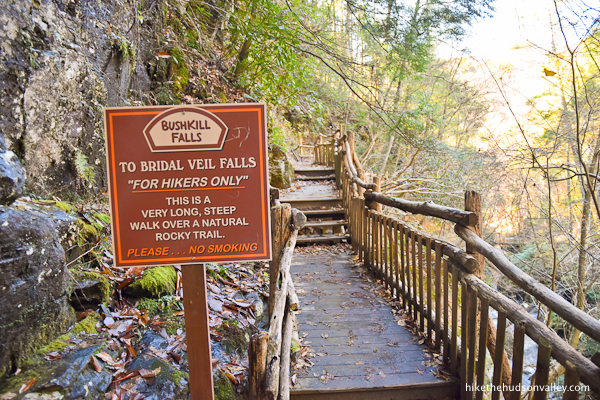
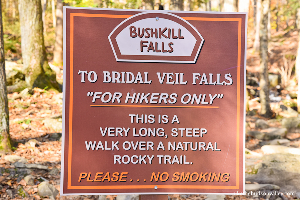
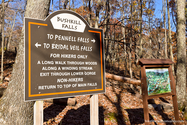
9. In just a minute, you’ll come to a “FOR HIKERS ONLY” warning sign. Hey, we’re hikers! That works out nicely. Everything after this sign is just for us. Sweet! Onward and downward! (After a few upward stairs.)
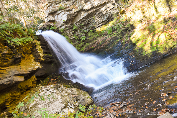
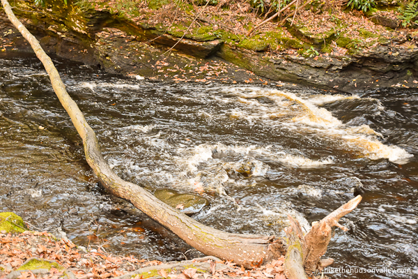
Arrive in another moment at “6: LOWER GORGE FALLS.”
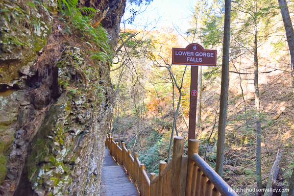
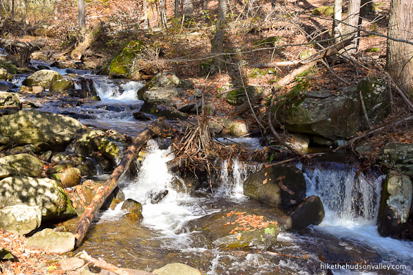
While the falls here are more of the “pleasant cascade” than the “roaring raw power of nature” variety, the trail continues to give you the best possible views.

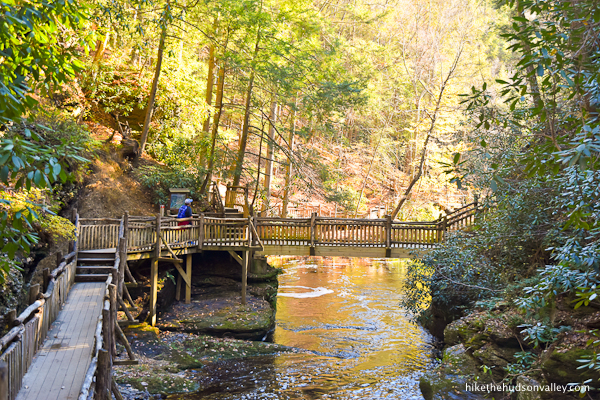
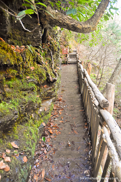
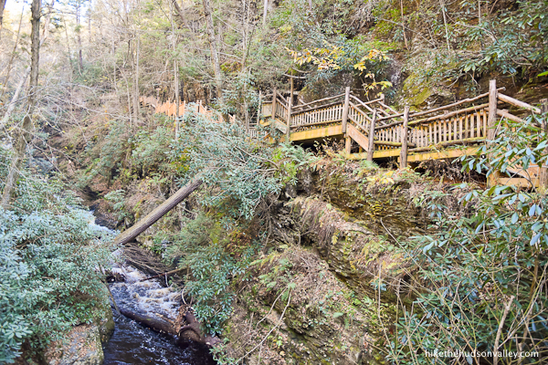
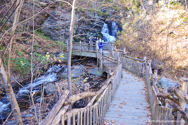
The impressive boardwalk brings you all the way to the bottom of the gorge, where it deposits you beside the creek.
10. At the end of the boardwalk, you’ll find another posted map, along with another “FOR HIKERS ONLY” warning. Good thing you’re still a hiker!

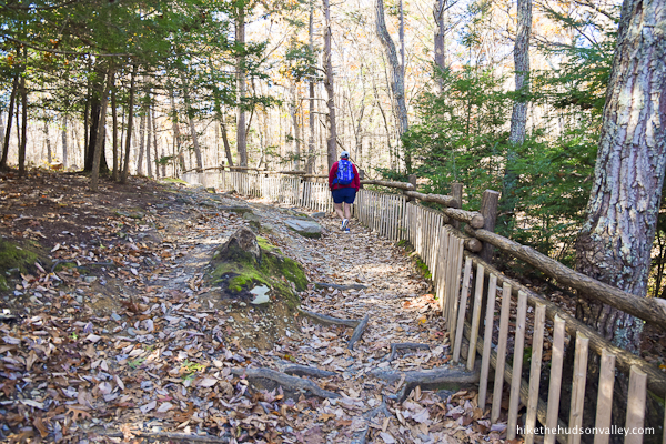
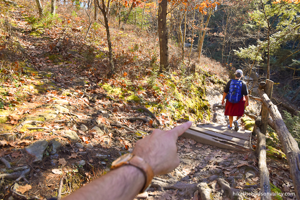
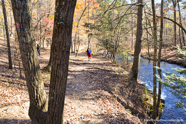
Follow the Red Trail as it bends to your right, uphill and upstream, now following the pleasant Pond Run Creek.
11. This section of the hike leaves the boardwalks behind and becomes a proper trail. Over the next .7 miles, you’ll climb about 275 vertical feet.
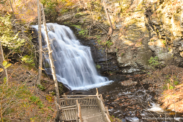
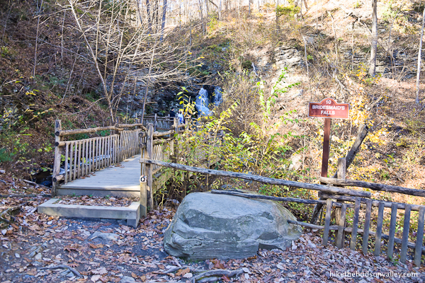
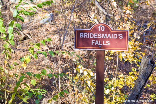
Keep climbing, and you’ll hop on more nice boardwalks as you approach Bridesmaid’s Falls. The trail takes you right to them. These falls would be a destination all by themselves anywhere else.

When you’re done checking them out, keep climbing!
12. Immediately after Bridesmaid’s Falls, boom, another waterfall!

Bridal Veil Falls, named after the horrible tragedy that befell a newly married… wait, no, I’m thinking of every other waterfall. I think these ones just kinda look like a bridal veil.

The viewing platform invites you to hang out for a while, gazing into the cascade and not thinking about the stairs that are waiting just behind you.
When you’re ready for them, head over to those stairs and – you guessed it! – keep climbing!
13. In just another minute, you’ll approach another (!) waterfall.
You’ll never guess what this one is called. Seriously. Take a guess.
You know that feeling from writing high school essays, when you’re searching for another word that means the exact same thing as a word you just used, so you don’t end up using the same word again? The person who named these waterfalls never felt that feeling.
Two Bridesmaid’s Falls, right next to each other, separated only by Bridal Veil Falls. Am I missing a metaphor here or something? Seems funny to name this waterfall Bridesmaid’s Falls, when a better name is so obvious: Gushy McGee, Jr. Right?
In any event, I didn’t get too close to Gushy McGee, Jr., because a group of young selfie-takers was hanging out there, and I didn’t want to intrude on their Instagram feeds.
But it looked nice! Check it out if you can.
14. After you’re done checking out Gushy McGee, Jr. (that naming convention makes much more sense to me), proceed up even more stairs.

(If anyone in your hiking party complains about the elevation gain, feel free to remind them that waterfalls aren’t nearly as impressive when they don’t have anything to fall from.)
Eventually, the stairs end, and you’ll follow a scenic fence beside the energetic Pond Run Creek.
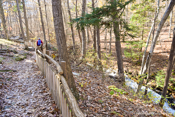
Looking for a spot to stop and contemplate stuff? The bridge that crosses Pond Run Creek in just a moment is a fine place to do just that.
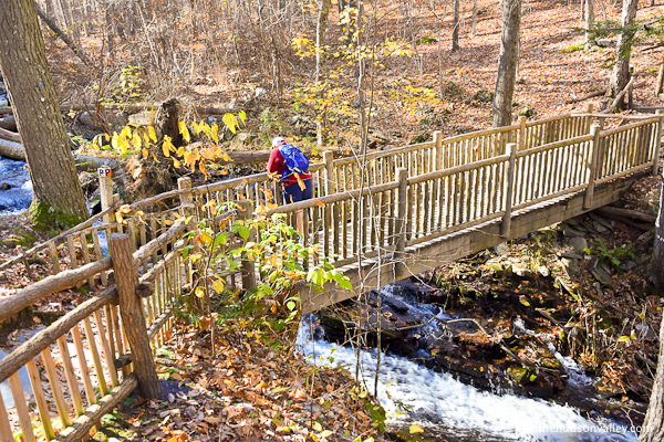
(If you happen to spot any little fishies in there, you might give them a heads-up that they have some wild times ahead.)
15. From the bridge, good news: More steps to climb!
Shortly after those steps, the trail mercifully levels out. You’ll pass some peaceful benches as you stroll along.

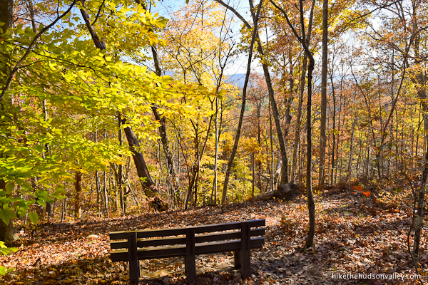
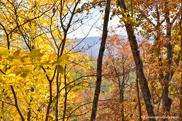
You might even catch a limited view through the trees.
Careful not to get bucked off on any unmarked trails. We’re in a “keep following the Red Trail” situation right now.
Less than ten minutes after the bridge, you’ll arrive at the junction marked as Peter’s Corner, complete with plenty of signage.
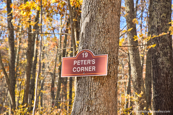
Don’t be scared by the warnings – the most strenuous climbs of the day are behind you (plus, you’re a hiker, as evidenced by the fact that you’ve blown past 30 warnings for non-hikers by now). You’ve ascended about 500 vertical feet today, and can now enjoy a nice, slow descent until the final climb, when you’ll return to your car from Main Falls (aka Gushy McGee, Sr.).
At this junction, follow the sign straight to continue toward Pennell Falls (which is .3 miles ahead). Still many awesome sights to see – let’s get to it!
16. The Red Trail now shares co-branding as the Pennell Falls Trail.

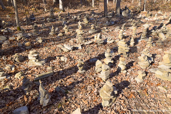
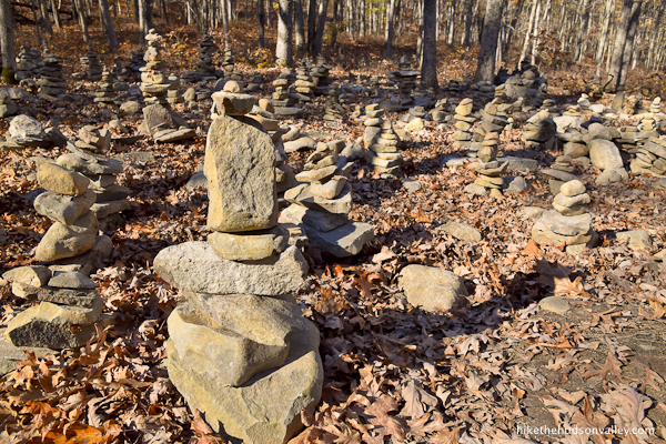
We passed a massive balanced-rock garden in this stretch. Not sure if this is officially sanctioned or not, but at least it’s contained to this one small area. (The first time I saw balanced rocks, I said, “Oh, cool!” After the millionth time, though, the novelty wore off. This trend just seems like a desecration of Leave No Trace, a destruction of critter habitat, and another way for people to say, “Look at me!” instead of, “Look at nature!” Not as bad as graffiti or carvings, but same ballpark. But maybe I’m just turning into an old crank. Anyway, rocks!)
17. The nifty trailwork continues as you descend toward Pennell Falls.
From Peter’s Corner, it took us less than 10 minutes to arrive at the impressive Pennell Falls. What Pennell Falls lacks in dramatic drops, it makes up for with enthusiasm.

Pennell Falls is the scrappy short kid that somehow gets all the rebounds anyway. It does all it can with the height nature gave it.

18. When you’re done admiring Pennell Falls and its roaring scrappiness, continue along the Red Trail downhill, following the fence and ignoring unmarked trails.
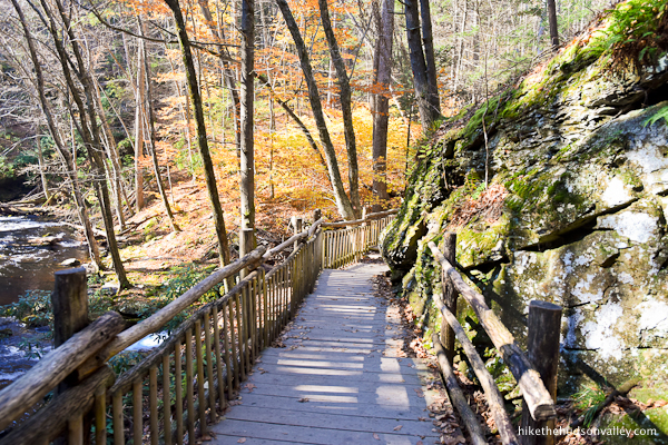
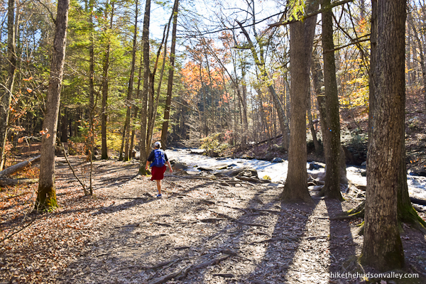
Have you become inured to the awesome trailwork yet? No? good! There’s more of it here.
The section of trail beyond Pennell Falls was one of my favorites of the day. Just a pleasant stroll next to a mountain stream. Nothing wrong with that.
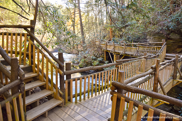
In a few minutes, once again, you’ll find helpful boardwalks to take you where you’re going.
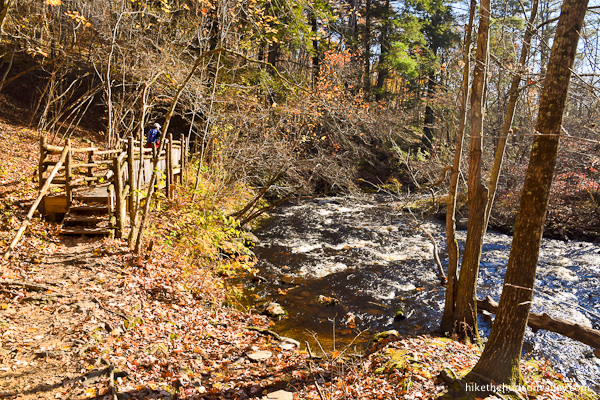
This stretch is marked as “16: PINE GROVE,” and while it doesn’t have any towering waterfalls or crazy natural features to explore, it’s just an awfully nice place to be.
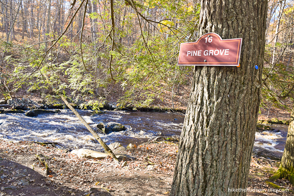
As you exit Pine Grove, you’ll find one more awesome boardwalk to take you around the bend, back toward to top of Main Falls (aka Gushy McGee, Sr. Have we made that a thing yet?).
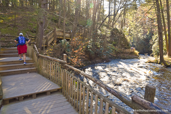
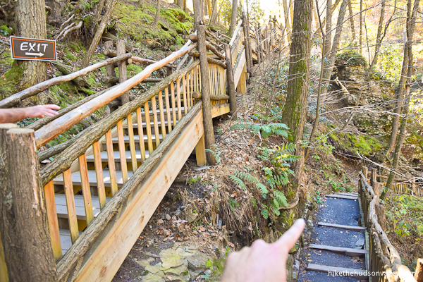
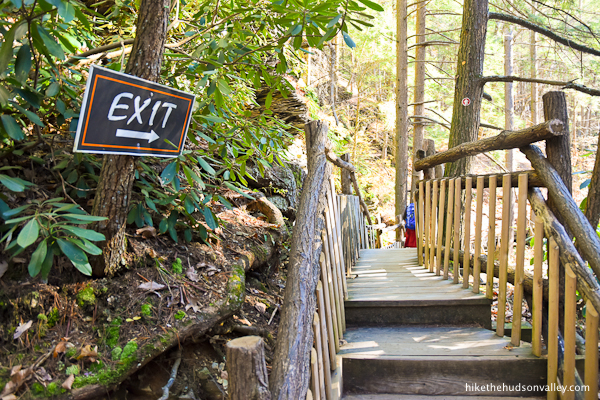
19. In just another moment, you’ll be presented with an opportunity to bail out and head toward the exit up a staircase to your left. DON’T GO THAT WAY!
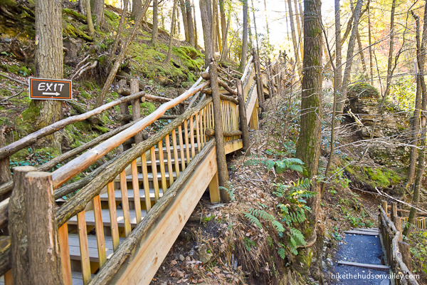
An awesome stretch of bridges and lush scenery through the top of the gorge awaits you to the RIGHT, even though it kinda looks like you’re supposed to go left. Take the RIGHT fork here! (Unless you enjoy missing out on awesome things, or are injured.)
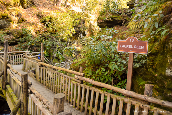
20. Aren’t you glad you went right?

This spot is officially labeled “13: LAUREL GLEN,” and if you didn’t get all your staring and pondering done at any of the previous bridges, you’ll have more great opportunities here.
21. At the base of a bridge over Little Bushkill Creek, you’ll have another opportunity to exit to the left.
If you chose to cross the bridge, you’d head over to the western vantage point for Main Falls.
We were getting antsy about our long respective drives home, though, so we opted to exit here (plus, we felt like we’d already gotten the best possible views of ol’ Gushy). If you’d like to explore the other side of the falls, now’s your chance! (And please drop a comment below if you find anything awesome over there.)
22. Whether you chose to explore the other side of the creek or you’re bailing out now (like we did, no shame in it!), follow the EXIT sign to the left, which will take you back toward the top of Main Falls.
Hello again, old friend! Still gushing, are we?

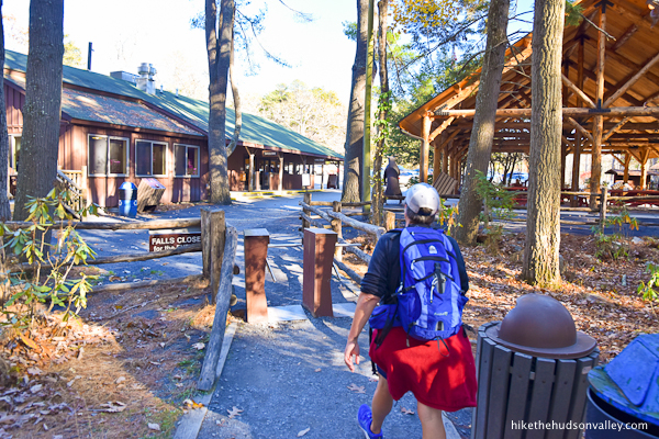
23. After you’ve said your goodbyes to ol’ Gushy, turn around and make one last climb for the day, back toward the gift shop and parking lot.

Were there this many stairs on the way down? Also, why didn’t anybody warn us that this trail was for hikers only?
Keep following the trail to the parking lot.
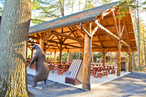
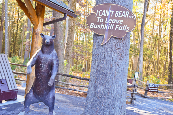
Don’t forget to say bye to the bear!
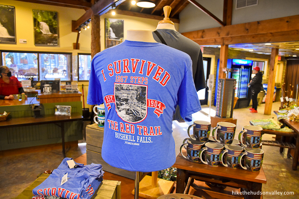
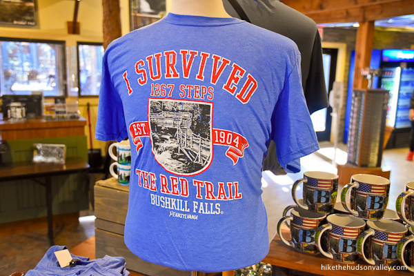
Congratulations! You survived the Red Trail! (If you’d like the T-shirt to prove it, the gift shop would be happy to oblige. According to that shirt, you climbed 1,267 steps today! Feel free to do the loop again and double-check that count. I estimated closer to a zillion, but 1,267 sounds about right.)
That’s it! Unless you’re planning to paddleboat, mini-golf, traverse the maze, browse the shop, or pan for gold, your day at Bushkill Falls is complete. Hope you enjoyed your visit to the Niagara of Pennsylvania! It stacks up pretty well against that other Niagara, doesn’t it?
Have fun replacing all the calories you spent today! Maybe you can find some good pizza somewhere – you’ve earned at least three slices. Or perhaps it’s time to conquer Sugar Mountain?

Directions
Directions to the trailhead: From the Hudson Valley, head west on I-84. You’ll stay on 84 for about 42 miles from the Newburgh-Beacon Bridge, crossing the Delaware River and into Matamoras, PA. Shortly after crossing into PA, take the exit for 209 South. You’ll follow 209 for about another 27 miles, then make a right at the very well-marked intersection for the aptly named Bushkill Falls Road (there’s a stoplight here).
Proceed for another 1.5 miles, then find the well-marked entrance to Bushkill Falls on your left (there’s a great big sign on the right).
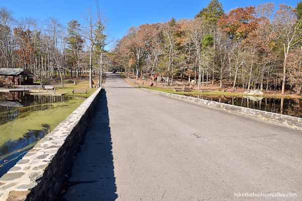
Drive past the ponds on the long driveway.
Find a parking spot either in the main lot straight ahead, or in the auxiliary lot to the left. Park, hop out, and let the adventure begin!
Sorta nearby address for your GPS: Just popping “Bushkill Falls” into Google Maps will take you to the right place. It’s a well-known spot.
GPS coordinates of parking area: 41.11752, -75.00731 (Clicking will open in Google Maps or the Apple Maps app, depending on your browser/device.)
Resources & Interactives
Super-cool Google Earth flyover of hike route:
Google Terrain Map of hike route:
Related resources: If you’re looking for actual facts and/or useful information, visit these resources:
- The official Bushkill Falls homepage
- The official Bushkill Falls trail map
- The Bushkill Falls entry on Tripadvisor.com, complete with a zillion user reviews
- A nice write-up with absolutely gorgeous photography on uncoveringpa.com’s “Bushkill Falls: Is It Worth Paying to See this Waterfall in the Poconos?“
- The Bushkill Falls Facebook page, in case you’d like to make your friendship with this place official
Want to support trails in the Hudson Valley? Here’s one great way: Visit the New York-New Jersey Trail Conference homepage and click on Volunteer, Donate, or Shop! (Then you can volunteer, donate, or shop, depending on your mood.)
Thanks for all the pictures and information. Although my senior friends aren’t able to hike this kind of trail, we have an online walking club and can imagine traveling to places like this. Your picture help to bring it to life for us.
Thanks so much, Melanie! Glad this guide is useful to you. I wish many more happy adventures to you and your walking club!
Thank you for all the great info. My wife and I are avid trail seekers and your site is by far the best we’ve seen. We’re from the south and excited about seeing more of what the world has to offer.
Tried to hike this trail last Friday with my reactive dog, and when I got there it was clear that this trail was not for us. Reactive dog owners, the trailhead reads more like an amusement park than a trailhead in terms of canine stimulation — best to leave your anxious dog at home. (Wound up doing nearby Mount Minsi instead, which was great for a hot day — it has a truly epic rhododendron tunnel near the summit).
Hi, Sarah! Sorry to hear you and your pooch didn’t enjoy Bushkill Falls. There is a lot going on there. Mt. Minsi sounds like a perfect alternate plan! I enjoyed the awesome view of Mt. Minsi from Mt. Tammany, and look forward to seeing the view from the other side of the river as soon as I can make it happen. Thanks for the recommendation!
We skipped Bushkill Falls when we visited the area last fall because…well because we’re cheapskates. We did hit all the other (FREE) waterfalls up the road though including Raymondskill Falls, Tumbling Waters, Dingman’s Falls and Shohola Falls towards Hawley. The only one requiring any hiking was Tumbling Waters at PEEC.
Thanks for the recommendations, Jeff! Those falls all look beautiful – will have to make time to check them out, too!