Background
If you find this free trail guide useful, please provide payment by picking up at least one piece of litter on your hike. Cha-ching! Thanks for being awesome! (And here’s a quick primer on Leave No Trace, too, to help us keep the trails nice and fresh for each other.)
Background you can feel free to skip: Of all the trails in the Hudson Valley, you’re most likely to bump into me on this one. We found out about this hike early last year and went back six times before winter. It’s nice and close for Poughkeepsie-folk, and a relatively easy hike for people who don’t want to tackle a big ol’ mountain. But it still manages to offer a pulse-quickening hike to a beautiful overlook.
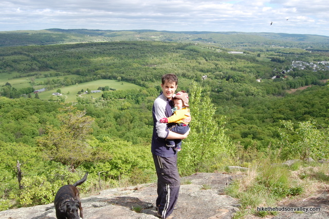
This trail has the added coolness factor of being part of the Appalachian Trail, which lets you go home after a 2-mile walk to tell everyone that you hiked the Appalachian Trail today. Not the whole thing, but maybe about half.
If you go on a pleasant weekend afternoon, expect some company. You might even pass some through-hikers on their way to Maine. I’ve rarely seen this place crowded, but there’s a good chance you’ll have a chance to chat with another hiker or two at the overlook.
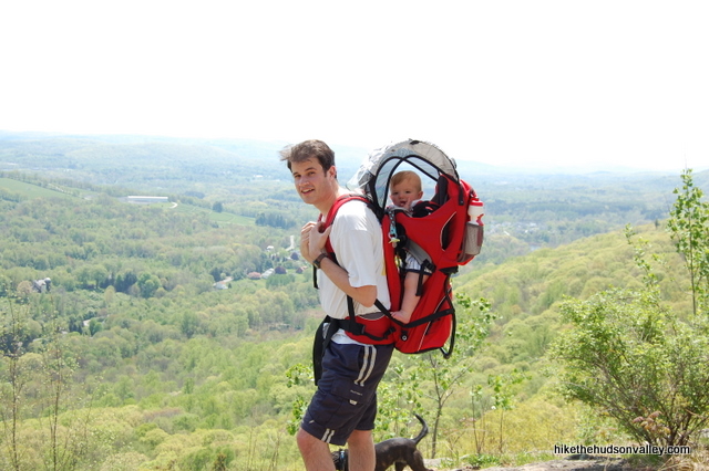
About ten minutes into the hike, just before a wooden footbridge over a seasonal creek, turn around and notice the flat little straightaway you just walked through. This is the exact spot where I tripped and smashed my face while wearing a baby on my back. I wrote a newspaper column about the experience (I write one every week, with varying degrees of success) – if you have nothing better to do and/or you’re at work right now, you can read that column here.
I’d have no idea that this hike existed if it weren’t for the excellent Cats Rock write-up at Berkshirehiking.com, which extends its range into eastern NY and western CT. I’ve found BerkshireHiking.com to be a terrific resource that accurately documents some really great spots in the area, and I highly recommend it to anyone interested in hiking around here. (Update 2/23/2016: For several years, I inadvertently carried over a typo in the name of this place from BerkshireHiking.com — the official name is Cat Rocks, not Cats Rock, as I’d initially written it up. That actually makes way more sense. Apologies to anyone who still calls it Cats Rock in their heads, like I do.)
If you’d like to make a longer hike out of Cat Rocks, check out the Berkshirehiking.com Cats Rock entry for some different ideas – the hike I’m documenting below is just a short jaunt, but you can extend it if you’re looking for more.
Trail Guide
Bonus unsolicited advice: Don't depend on having cell service in the woods - it can be spotty out there! Download this trail guide to your phone before you head out. (It's easy to do on iPhone and Android.) May your connection to nature be strong, even when your connection to the internet is weak.
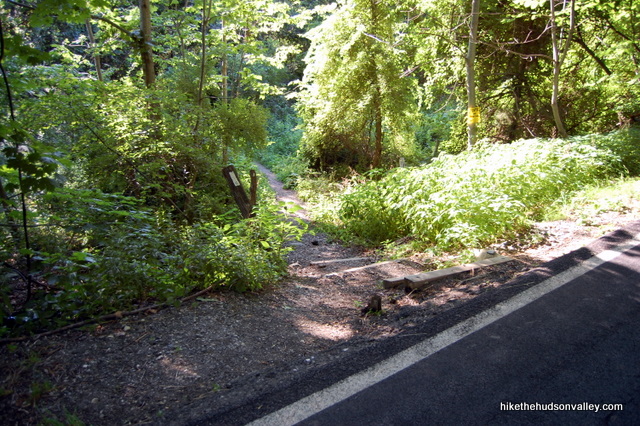
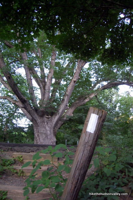
1. From the parking area on the shoulder of County Route 20 (West Dover Road), underneath the giant oak tree, carefully cross the street and head down a few stairs to begin the hike, following the white Appalachian Trail blazes. (UPDATE 9/28/2013: Make sure you head into the woods on the opposite side of the street from the giant oak tree, or, per Alex’s comment below, you may find pizza, but you won’t find Cat Rocks.)
(Also, I just stumbled upon a trail guide that calls this oak tree the Dover Oak, and claims it’s the biggest oak tree on the Applachian Trail. I have no idea if that’s true, but it’s pretty cool if it is.)
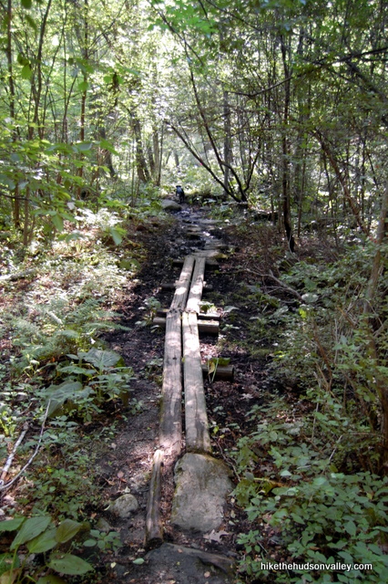
2. The area at the bottom of the stairs might be a little marshy, but this is the only spot on the trail that you’re likely to find any mud. Some nice wooden walkways are provided to help you keep your feet dry.
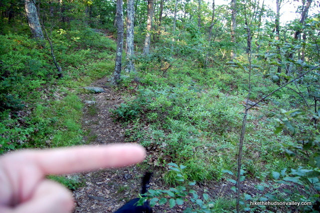
3. The trail turns uphill and stays pointed that way for the remainder of the hike, including one very steep, rocky section just as the trail turns uphill (a comment below reports a dog having trouble at this spot. My medium-sized dog has scampered right up here many times, but this is not everyone’s experience – be prepared to give your dog a boost, if you have a canine companion with you. This is the steepest spot on this hike, and the only place that might give your dog pause.)
**UPDATE December 2020** There’s apparently an unmarked route around the steep spot if it’s too much for you or your pooch. See Liz’s comment below if that interests you (and thanks, Liz!)
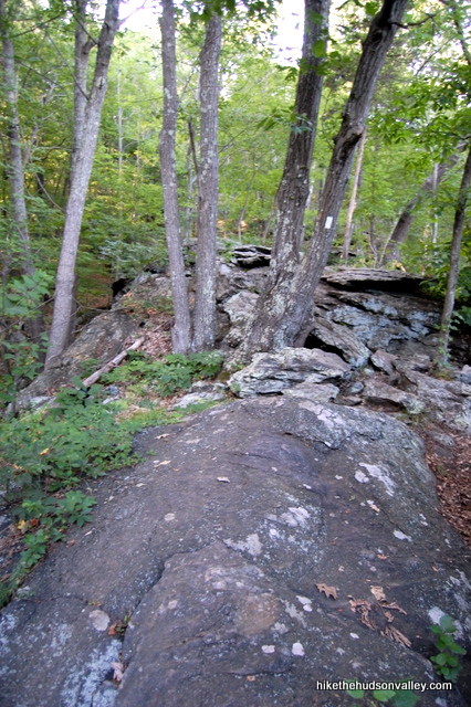
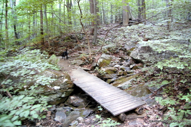
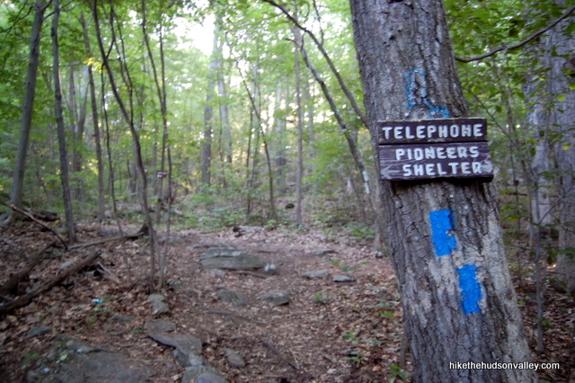
After ten minutes, cross a wooden footbridge over a seasonal stream. Another 10-15 minutes after that, you’ll come to the only trail junction on this hike, an intersection with the short spur trail to the Telephone Pioneers Appalachian Trail shelter.
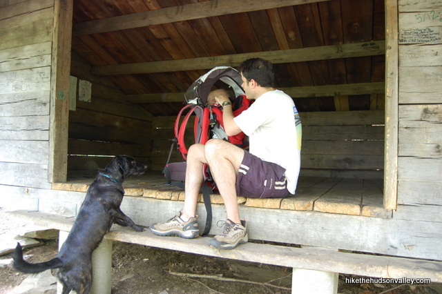
4. Optional: If you’d like to check it out, the AT shelter is a few hundred yards off to the left, down the Blue Trail. It’s kind of cool to think of people walking all the way from Georgia to Maine camped out right here.. When it’s in full effect, too, the stream running across the Blue Trail on the way to the shelter is picturesque, with some small cascades further up the hill. Check it out if you’d like – but if you see people there, you might want to give them some peace. The roundtrip would be less than 10 minutes.
5. Back at the junction with the Appalachian Trail and the Telephone Pioneers spur trail, keep heading uphill on the white-blazed Appalachian Trail. (A right turn if you didn’t visit the shelter, straight if you did.)
6. You have about another 10-15 minutes of climbing to get to Cat Rocks. Just keep following the white blazes. When the trail flattens out, keep a sharp eye out for the unmarked trail leading through the bushes to your right. There are actually a couple of unmarked trails heading down to Cat Rocks. They’re easy to spot, but if you weren’t paying attention, you could miss ‘em.
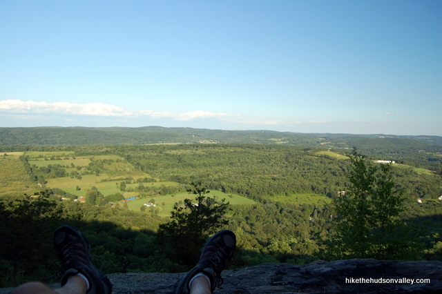
7. Follow the unmarked trail maybe 100 feet down to Cat Rocks. Plunk down and enjoy the view.
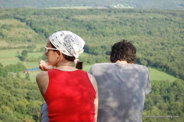
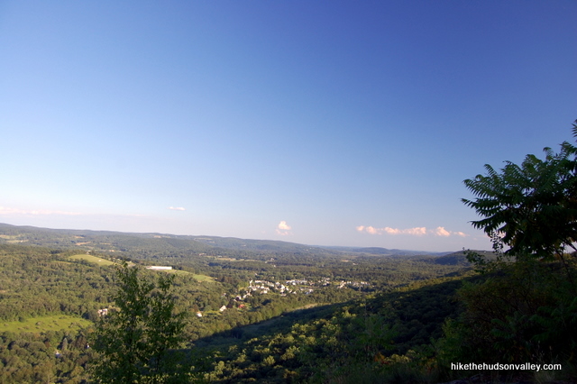
There are plenty of bigger views in the Hudson Valley, but for a two-mile roundtrip, it’s tough to beat this one. Relax for a while and soak it in.
If you hear a yowling sound, you’re probably being surrounded by the pack of feral cats that gives this place its name. You’ll want to hide any balls of yarn you might have in a nearby tree. Actually, I have no idea why it’s called Cat Rocks, but it’s a cool name for a cool place. You’re actually sitting on the summit of West Mountain right now, but Cat Rocks is way catchier.
8. When you’re done lounging on the rocks, retrace your steps along the Appalachian Trail back to your car, under the huge oak tree.
You’ll be forgiven if you decide to tell people that this hike is the cat’s meow.
Directions
Directions to the trailhead: Coming from Poughkeepsie, take 55 East past the intersection with Rt. 82 to a left turn onto Bruzgul Road (County Route 21). Stay on County Route 21 as it changes names 17 times for no good reason. Just past the bottom of a really big hill with hairpin turns (you’ll know it when you drive it), hang a right onto County Route 20. After maybe five minutes, you’ll see a big red barn on the left with a giant American flag painted on it.
Slow down after that barn. The trailhead is coming up soon on the left, just after you pass a yellow pedestrian sign that is pretty much your only indication of the trailhead. Park under a huge oak tree, on the left shoulder of the road.
You can also get directions by checking out the Cat Rocks entry on the HiketheHudsonValley.com Google map.
Sorta nearby address for your GPS: The intersection of Blackberry Road and West Dover Road in Pawling, NY, is about a mile north of the trailhead parking (the parking is on West Dover Road, more prominently known as County Route 20). My old-ish Garmin Nuvi lets me put in an intersection as a destination, so hopefully yours does, too.
GPS coordinates of parking area: 41.60316, -73.61145 (Clicking will open in Google Maps or the Apple Maps app, depending on your browser/device.)
Resources & Interactives
Super-cool Google Earth flyover of hike route:
Google Terrain Map of hike route:
More Cat Rocks pictures from the hike’s Picasa album:
Want to support trails in the Hudson Valley? Here’s one great way: Visit the New York-New Jersey Trail Conference homepage and click on Volunteer, Donate, or Shop! (Then you can volunteer, donate, or shop, depending on your mood.)



We did this hike today. Nice little jaunt! Very little remaining snow and not much mud to deal with. But dang it was cold! The comments on Alltrails made me think it was really hard, but this 58-year old did fine. Very pretty views from the top!
Glad you had a great day out there, Kelly, and that the steep parts didn’t slow you down. Thanks for the nice trip report!
Went for a quick trip up this morning. Trail conditions were perfect and the view was great!
Did thIs hike today, quite the leg burner! I’m not sure if you mentioned it keeps going up…and up….and up! Awesome view from Cat Rocks (once I got there after going up) and seeing the shelter was pretty cool also.
Great write up as usual!
There is a much easier way to get to Cat Rock. Go all the way to the end of Gardener Hollow Rd off Rt32 in Beekman. It is the West Mountain state forest parking lot (recently much improved). From there, walk back to where you entered the parking area, then straight across to the carriage trail. Do not turn left onto “Penny Lane”, nor right onto Gardener Hollow, go straight,
You will be walking on the carriage trail with a house to your right. Go down the trail past the gate and then on a couple of hundred yards more. The AT crosses the carriage trail. There are white blazes on both sides, but sometimes they are hard to see. (If you get to some small ponds, you went too far!) . Turn left onto the AT to go to Cat Rock. (If you go right, the AT takes you south to Nuclear lake).
So, go left through a break in the stone wall, then hike for about 1 1/4 miles to get to the overlook. The trail is white blazed and easy to follow. There is a great vernal pool on the way, it is full of frogs in the spring time. This is a much easier trail to Cat Rock, maybe a 3…
Thank you so much for this info, Tom! I had no idea! Really appreciate the directions – will have to check it out!
Thanks, your directions are spot on. Trail in condition today
Thanks so much, Pete — appreciate the kind words and the update on trail conditions!
Pingback: 3 Days in Dutchess County | Ultimate Itinerary - Pass The Sushi
Chose to take this one from The Tree parking spot over Cat Rocks to around Nuclear Lake today. Was very nice thanks for your write ups, super helpful. For reference this option took me almost exactly 4 hours, going at a good clip but did spend some quality time watching some ducks take their morning bath.
Nice, Kevin! Sounds like a great way to spend the morning, for both you and the ducks. (And also a great option for folks who aren’t ready for their hike to end at Cat Rocks.)
Love your site, thank you so much. I live about half a mile from Cat Rocks (I know, lucky me).
On number 3 above where you talk about the rocky climb. If you come back about 35 feet there is an unmarked (i think) but obvious trail that leads up and around the rocks. I sometimes push my poor dog so hard going up I let her take it easy coming down and go this way.
Hope this helps.
Liz, I’m so sorry it has taken me so long to respond, but I come from the future to say, “Thank you for the kind words, and for the helpful tip!” I’ve updated the trail guide above with a link down to your comment for those who find that steep spot too gnarly. Very much appreciated! (Also, if you’re still in 2018, brace yourself for 2020. It’s a real doozy.)
Love your site and all the humor, hope to hit Cat Rocks in the next week or so. My wife and I did Anthonys nose, both trails from your directions had a ball both times .Also did Depot hill recently and your tips and advice were on the money this will be our first foray with one of our 2 pooches and I’m sure this is going to be a lot of fun Thanks For Sharing
Thank you, Tom! Hope you all have a great visit whenever you give it a whirl, and glad the other trail guides worked out for you, too!
My husband and I with dog in tow did this hike yesterday and the view is magical. Directions were simple & easy and we all had a great time. Thanks for spending the time to explore so the rest of us don’t have to spend 6 hours figuring out where to get to the good stuff!
Thank you so much, Lauren!
We did this hike today and had a lot of fun although we did go 2 and a half miles in the wrong direction at first because we didn’t realize that the trail was aross the road from the parking area. (Even though it is clearly stated…:’) But it wasnt all for naught because we actually saw a large cat (We are thinking it was a bobcat) as we were cresting the giant hill on our way back up to go to the correct trail. So while we didn’t see any cats at Cat Rocks its not impossible to imagine.
My sons girlfriend is new to hiking. He has to work so we are planning a hike and I saw the name Cat Rock ( she loves cats). Thanks for the info here and the photos. Hoping she picks this hike as the place we will go. If not I will do it another time 🙂
Is this hike something a 9 yr old and almost 7 Yr old do?
Kara, the hike from West Dover Road (Dutchess County Rt 20) is predominantly up hill with the distance to Cat Rocks being 0.9 miles. I suspect your nine year old will find it fun, but may be a bit of a challenge for your younger one. About a quarter mile before reaching Cat Rocks you will pass by the Telephone Pioneers Shelter where you can take a break. Hope this is helpful and if you do decide to do this walk I would be interested in how you made out. Enjoy!
Thanks Jim, we did take the hike yesterday and my boys loved it and had no issues at all even with the inch of snow on the ground. Gorgeous views for sure!!!
Hi Kara! I agree with Jim’s comment. My son did this hike when he was about four years old, and aside from helping him up the steep rocks in the beginning, he was good to go on the rest of it. Hope your kids enjoy it, too!
I am the chair of the Dutchess/Putnam Appalachian Trail Management Committee and I would like to make contact with you about pictures taken from Cat Rocks. I would very much like to obtain a few good shots from this view point.
Hi!
We did this hike yesterday and it was a great trail and view, pooch and ourselves all had a great time. We did both the actual Cats Rock trail, and then afterwards we walked for a few minutes on the north section of the trail to check out the cow farm. But I wanted to give one word of warning for everyone especially those with pups: when we got home we found a BUNCH of deer ticks in his fur. Not sure if they are from the trail or from the marshy area near the cow farm, but everyone should be alert about checking carefully for ticks after this trail!
I have a young, athletic dog, but it turns out she wasn’t sure-footed enough for the rocky section of this hike. I have walked other (longer but flatter) stretches of the Appalachian trail with her without a problem, but she came up lame after this hike.
When we came to the steep rock section that’s pretty close to the start, my dog looked at me as if to say “Trail? What trail?” I should have taken that a cue to turn back.
I also realized how unused I am to hikes with this much slope in a short distance. When we hit the top of Mt. Egbert, I thought of your site and how you rated this hike a 5 in difficulty. I should probably prepay for a Medi-vac helicopter to pick me up if I ever try one of the hikes rated a 9 or 10 in difficulty.
I have taken the nearby Depot Hill hike and it seemed a lot flatter and easier than this one, though your guide seems to indicate they are similar in the amount of ascent.
Suki,
So sorry to hear about your experiences here! I hope your dog is feeling better now. I just updated Step 3 in the trail guide with a link down to your comment, a picture of that spot, and a warning to pooch-hikers that not every dog will be able to scamper right up there. As for Depot Hill, you’re right — my GPS reported the ascent there to be 685 ft, compared to 717 ft here, just about identical. Depot Hill spreads the ascent out over 3 miles of rolling hills, while Cats Rock gives it all to you in a one-mile uphill wallop.
I hope you and your pooch find some more hikes that you enjoy around here (sans Medi-vac!). Happy adventuring!
Hey there! Love your website and grateful for all the info. I attempted this trail and somehow ended up by a marsh with a boardwalk which took us right to a highway by a train stop(which had a pizza truck that we were happy to find). However, we did not reach a lookout point after an hour of walking so we decided to head back. Did we not go far enough or did we take a wrong turn somewhere?
Alex – thanks for the kind words even though today’s hike didn’t work out quite like you’d expected! Sorry to hear that Cats Rock wasn’t in the cards for today, but glad you at least got some pizza out of the deal. Step 1 of the trail guide says “carefully cross the street and head down a few stairs to begin the hike,” but my guess is that you went the other way right off the bat. Or is it possible you parked on the other side from the oak tree, then crossed the street per the instructions? Whatever went wrong there, I updated the trail guide above with a link down to your comment and some more explicit instructions about starting the hike into the woods opposite the oak tree, so hopefully nobody else will run into the same problem. Thanks for helping to improve the trail guide, and I hope you can mount another Cats Rock expedition sometime soon!
Hello there!
No, I totally overlooked the “cross the street” thing. We parked under the oak, went UP some stone stairs after seeing a white arrow pointing up and went through the back of a cow farm. It’s confusing because there was a marshy area with boards laid down so I figured we were in the right spot. That path took us down towards the marsh/boardwalk area and then to the train depot and road after that. I saw a lot of hikers going the other way…so that part might be a part of another trail??? Yes, I will have to try again!
A
You went N. on the AT rather than S. There are people who live on 20 who don’t even know the historical value of Dover Oak. It’s 300+ years old! I would like to add that this can be accessed from MetroNorth trains. 20 runs right through downtown Pawling but the weekend/Hoiiday Appalachian Trail stop one stop N. of Pawling will give you a nice couple mile Southward trip on the AT before reaching 20.
We had an epic day! We would have never known about this hike if it wasn’t for your site. Thanks for responding to my facebook question as well! Keep up the great work!
Awesome, Denise! I hope you (and your pooch) have many more epic adventures out there.
Stumbled across your informative and hilarious write-ups during my search for accessible hiking trails from NYC. My fiancé and I have been reading up on your reviews and we just wanted to thank you for providing very useful information on such great trails! We will definitely be returning often each time we decide to get away from the city. This weekend, we’re off to do some backcountry camping in Cats Rock so I’ll leave my balls of yarn at home.
P.S. We appreciate the humor that you insert in your reviews. It makes reading them that much more fun!
You just made my day — Thanks so much for the very nice words, and I hope you have a blast this weekend! Make sure you store all your camping catnip in tabby-proof barrels.