Background
If you find this free trail guide useful, please provide payment by picking up at least one piece of litter on your hike. Cha-ching! Thanks for being awesome! (And here’s a quick primer on Leave No Trace, too, to help us keep the trails nice and fresh for each other.)
Background you can feel free to skip: If you were a swamp, how would you prove your greatness? The depth of your muck, the decibels of your frogs, the height of your bulrushes?

Sure, these things could make you a perfectly fine swamp. But if you wanted people to call you the “Great Swamp,” you would need something that sets you apart.
What about having James Earl Jones narrate your educational YouTube video? That sure couldn’t hurt, right?
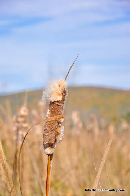
If you take a few minutes to watch that video, you’ll learn many other ways that the Great Swamp, just north of Pawling, NY, earns its name. It runs for nearly 20 miles through 4 towns, it lies in a 62,000-acre watershed, and the swamp itself covers about 6,000 acres, making it one of the largest wetlands in New York.
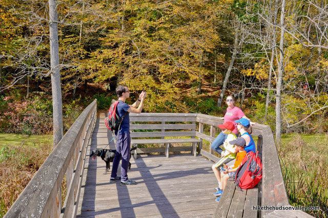
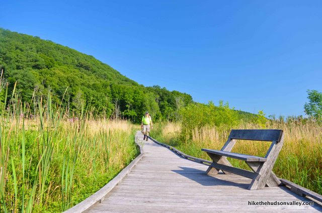
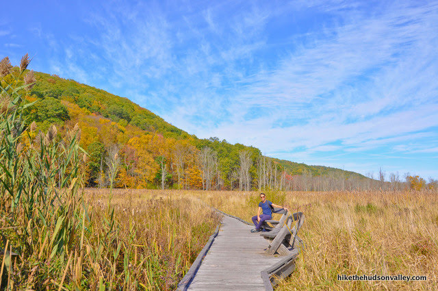
For hikers, though, the greatest feature may well be the sweet Appalachian Trail boardwalk that runs for 1,600 feet over the swamp, including a 34-foot bridge over the aptly named Swamp River, complete with benches for you to relax and let out your inner Swamp Thing.

The boardwalk opened in 2012, after 75 (probably muddy, and definitely awesome) volunteers spent 2.5 backbreaking years building it.
An Appalachian Trail volunteer told me that some of the pilings upon which the boardwalk rests had to be drilled thirty feet down before they hit solid ground (see this AppalachianTrail.com article for more details on the project). Every time you stroll across the Great Swamp without getting muck up to your armpits (a feat that wouldn’t have been possible prior to 2012), you should thank everyone who dreamt this thing up and had a hand in building it. What an awesome local destination.

Which brings us to another thing that makes this swamp so great: the network of awesome organizations that support it, including Friends of the Great Swamp (FroGS) (homepage and Facebook page) and the award-winning Harlem Valley Appalachian Trail Community (info and Facebook page). These folks do amazing work to make this stretch of trail such a special place for the rest of us to visit. Thanks, cool people!
Speaking of cool people, to see some excellent photos of long-distance AT hikers who are going WAAAAY further than we are today, check out these super-cool hiker portraits of folks as they passed through the Great Swamp, taken by Jane Haslam and Justin Goodhart (two very talented local photographers).
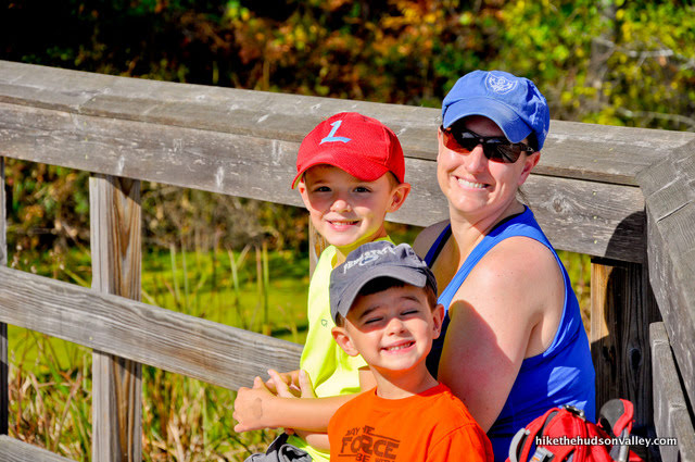
If you’re lucky, you might also run into Jane Geisler, a New York-New Jersey Trail Conference AT volunteer for over forty years (!!), who greets hikers as they get off the train in the morning, providing information about the Great Swamp, Appalachian Trail, and surrounding area (this hike shares the distinction with Breakneck Ridge of being a hike with its very own train stop). She handed me a couple maps and gave some great info on the morning we visited. Thanks, Jane! Here’s a shot of her in action, helping a dude who’d just hopped off the train:
I also owe much gratitude to Stancy DuHamel of the Harlem Valley Appalachian Trail Community (and several other awesome trail-related organizations) for keeping me informed of local trail news and events, offering advice, being an outstanding advocate for local trails and hikers, and dedicating so much of her time toward making the Hudson Valley a better place to live and visit. Thank you for everything you do, Stancy!
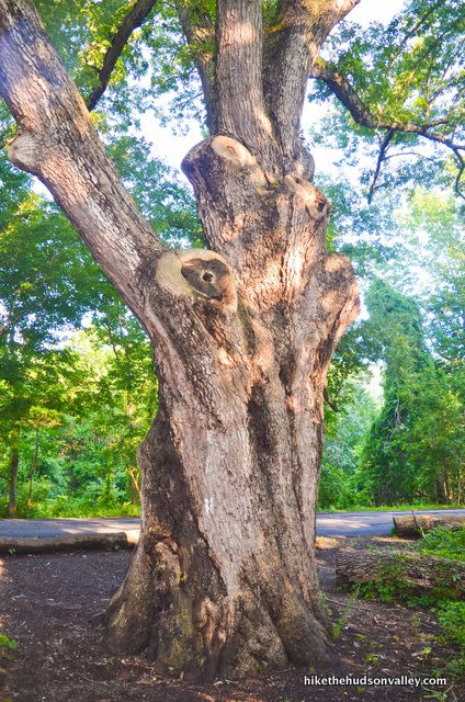
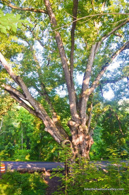
Back to the task at foot: The hike I’ve documented below goes well beyond the boardwalk and the Great Swamp, traversing a non-trivial hill to visit the Dover Oak, the largest (and oldest?) oak tree on the entire Appalachian Trail, sporting a circumference of twenty-two feet. At 114 feet tall, it’s also the largest white oak in New York. Many online estimates mention that the Dover Oak is over 300 years old, though a DEC official is quoted in this blog post as guessing closer to 150 years, while cautioning that nobody can really know.
Looks more like 300 years to me, ‘cause it’s big! That’s just science.

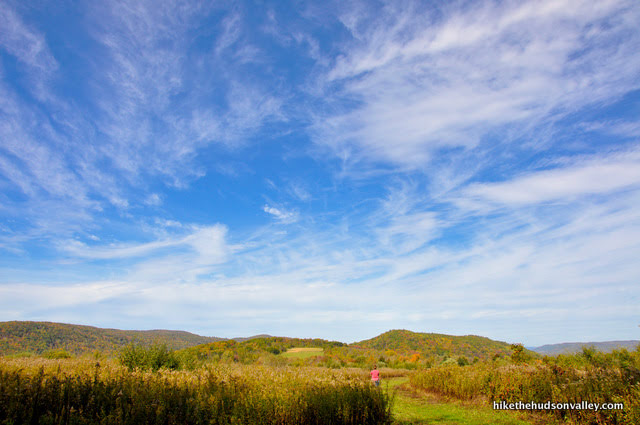
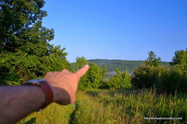
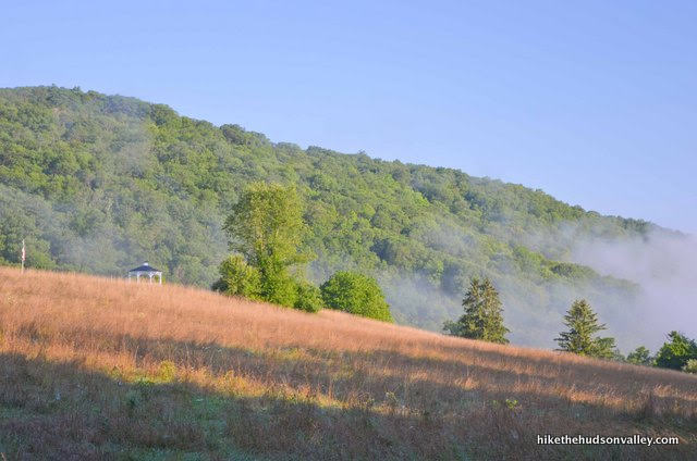
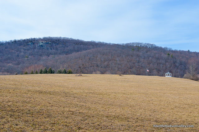
The Dover Oak is an amazing local landmark, and visiting it makes this hike a nice, 4.9-mile round trip, so it seemed like a good endpoint. Before you reach the Dover Oak, you’ll also crest a hill that gives you a pleasant (but not earth-shattering) view across a meadow to some nice rolling hills.


Not a money spot, exactly, but still a very nice place to be.
The Dover Oak is the endpoint of this hike, but since it is a very versatile tree, it can also serve as the trailhead for the short jaunt up to Cat Rocks, which continues along the Appalachian Trail up a steep hill to a beautiful view of the valley below. It would be a LOT of hiking to tackle Cat Rocks and the Great Swamp in one day, and I would recommend doing it as two separate excursions, but it is an option if you’re a crazy hiking swamp monster.
While the default version of this hike is the 4.9-mile up-and-back trek from the Great Swamp to the Dover Oak, you can really tailor this hike however you’d like. Your options, from easiest to hardest:
- Stroll the boardwalk and turn around at the end of it. Total distance: .6 miles round trip. Total ascent: Really close to zero feet.
- Stroll the boardwalk, then climb the hill to the pleasant meadow-and-hill view at the top. Total distance: 3.2 miles round trip. Total ascent: Around 400 feet.
- Stroll the boardwalk, then hoof it all the way to the Dover Oak and back. Total distance: 4.9 miles round trip. Total ascent: 817 feet.
- Stroll the boardwalk, hoof it all the way to the Dover Oak, then climb up to Cat Rocks for the view from the money spot. Total distance: 6.9 miles round trip. Total ascent: 1,534 feet.
- Walk all the way to Georgia, then come back, take a shower, and tell everyone where you’ve been. Total distance: 2,901.4 miles round trip. Total ascent: 647,460 feet (thanks, Appalachian Trail Distance Calculator!).
So, those are your options! While I recommend the Dover Oak option, I’d be remiss if I didn’t point out that you can actually drive right up to the Dover Oak on West Dover Road and park right next to it.
“Dude! We could have just DRIVEN here?” your friends will say.
“The whole point of hiking is to WALK!” you’ll reply. Then you’ll quickly make up and be friends again, because this tree is so amazing, and because it would take too long to find other people willing to put up with all your weirdness.
You COULD also do this hike in reverse, starting at the Dover Oak and hiking to the Great Swamp, but I prefer to start at the boardwalk, because the personality of the Great Swamp changes from season-to-season and hour-to-hour. I like the idea of seeing it twice in the same day, and having it be a different experience each time.

I will also note in the trail guide below when people who are NOT crazy hiking swamp monsters may want to turn around and go home. After you crest the hill with the pleasant view, you descend back into an area that can be quite swampy and overgrown.

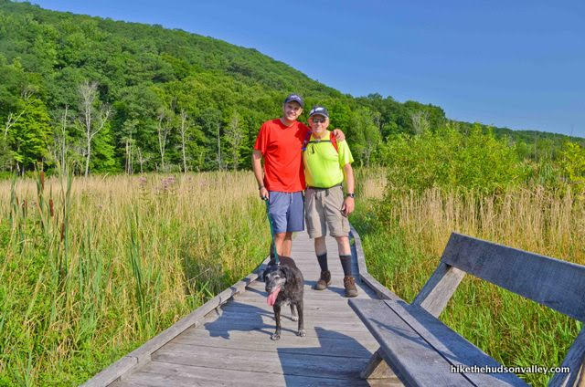
On my most recent visit here, I was SO glad my dad was my hiking companion through this stretch. The man has not complained about anything since 1972, when he misplaced a socket wrench. Anyone else might have felt the need to whine about the swampiness, and have their attention redirected to the name of this hike.

“This is a really nice hike!” he said, after emerging from a thicket of swamp grass, his clothing soaked from the morning dew being dragged across his body countless times. Depending on how dense and wet this section of trail happens to be during your visit, your hiking companions may also need to employ a certain amount of stoicism to enjoy the day to its fullest.
However much of this hike you decide to tackle, though, the Great Swamp definitely deserves a spot on your to-do list. James Earl Jones was right. This is much better than a pretty good swamp. It is, indeed, a great one.
Trail Guide
Bonus unsolicited advice: Don't depend on having cell service in the woods - it can be spotty out there! Download this trail guide to your phone before you head out. (It's easy to do on iPhone and Android.) May your connection to nature be strong, even when your connection to the internet is weak.
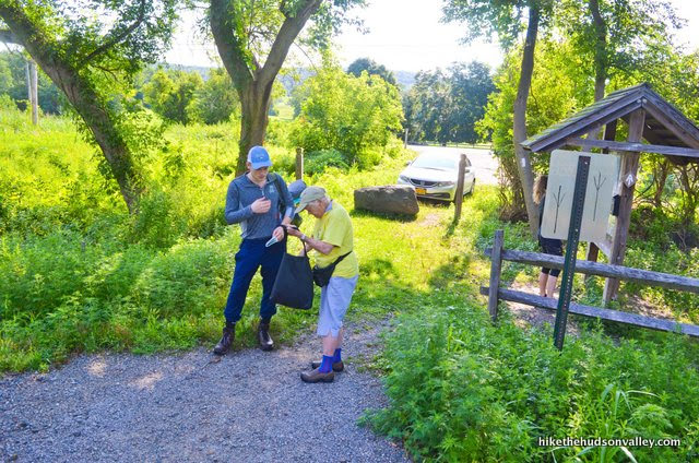
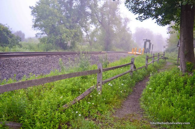
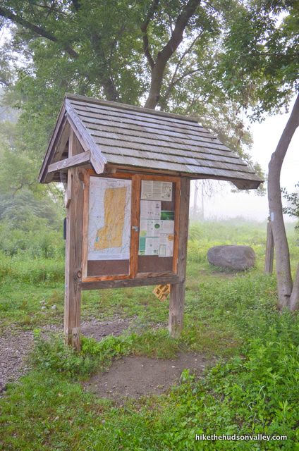
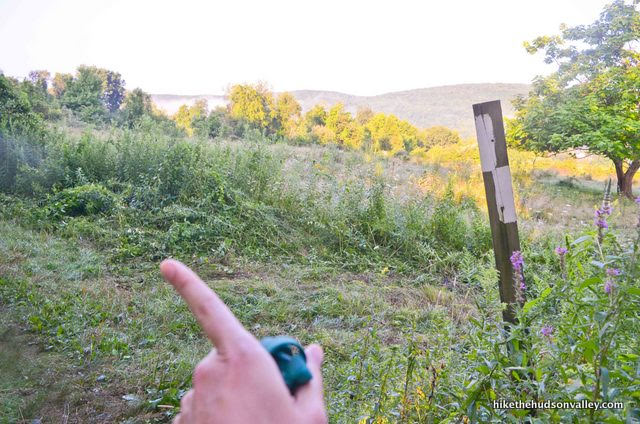
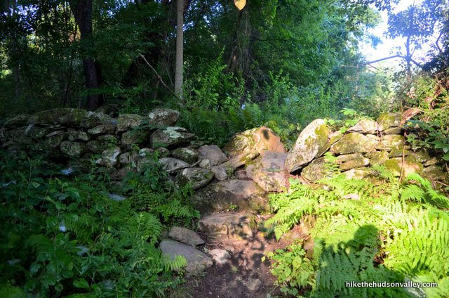
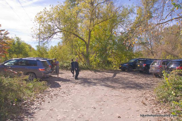
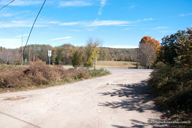
- From the parking lot (see “Directions to the trailhead” below), head over to the split rail fence and turn right to follow the trail as it parallels the train tracks toward the kiosk and little MTA stop.
2. Check out the information posted to the kiosk. Might as well learn something while we’re here.
3. Carefully cross the tracks, checking out the awesome little Appalachian Trail MTA stop as you go. On weekends and holidays, hikers can get dropped off and picked up here, like a backwoods version of Grand Central. (Also, just like at Grand Central, you can stand on one end of this station and whisper, and a person on the other side of the station will be able to hear you as if you were standing very close to them. Crazy!)
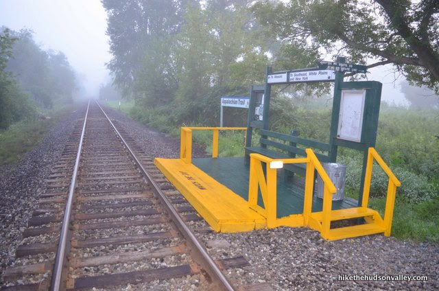
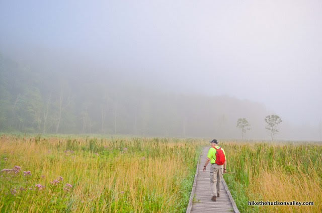
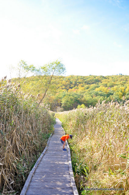
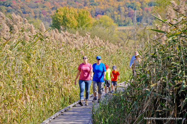
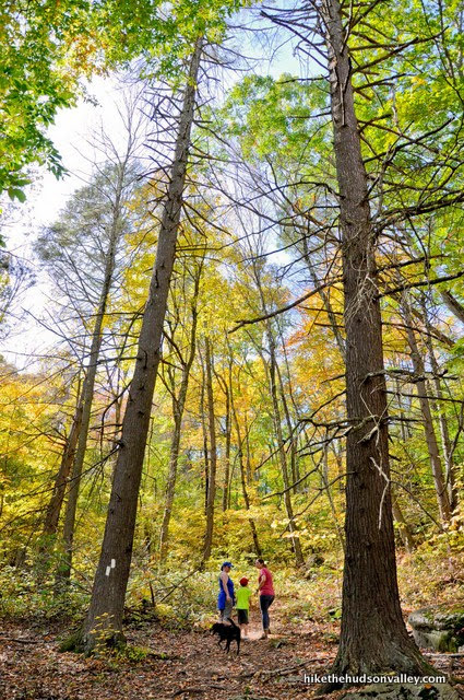
4. Directly across the tracks from the MTA stop, it’s swamp time! Hop on the boardwalk, noting the white blazes of the Appalachian Trail. You are heading southbound on the trail right now. If you’re feeling spry and looking for some fresh peaches, Georgia is straight ahead!

5. Stroll. Listen. Smell.
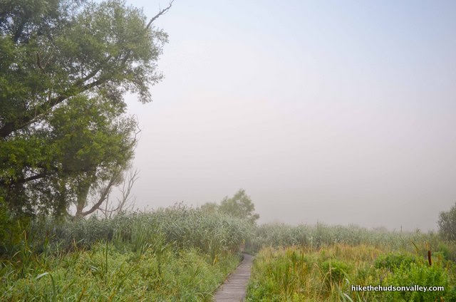

What’s wrong with this place? Nothing. Nothing at all.

Whew, gotta rest! Been hiking for five minutes already! Take a load off and enjoy the benches and chairs as you go.

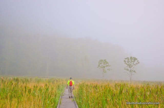
Also, enjoy the mist (if it’s misty out). Or the leaves (if it’s leafy out).
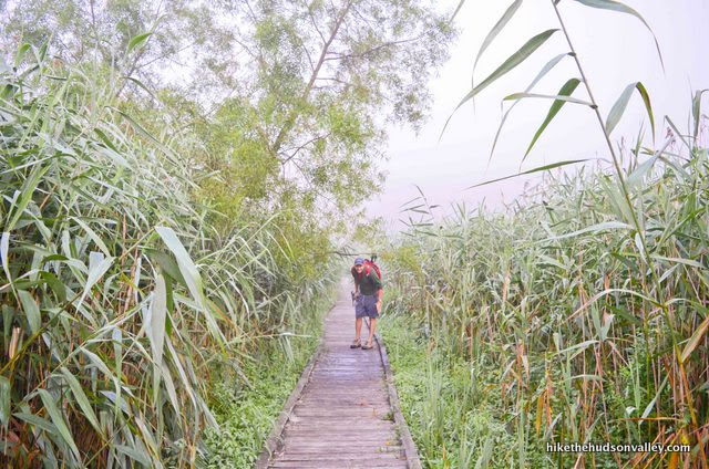
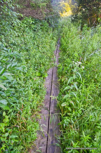
After 1,600 feet of greatness, the boardwalk widens, and you’ll cross over the aptly named Swamp River, which is more swamp than river. There’re benches here, too!
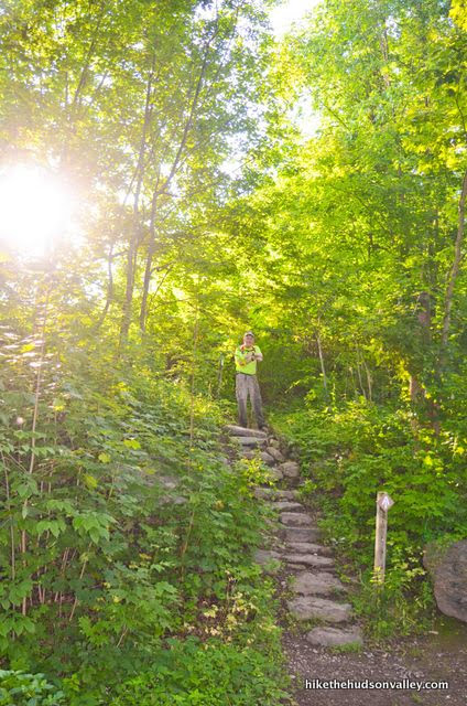
6. When the boardwalk ends, make a right turn at the bottom of the steps to follow the white blazes of the Appalachian Trail.
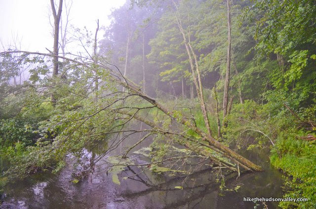
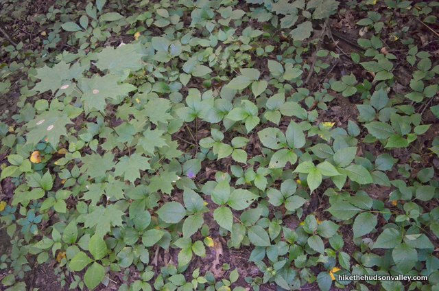
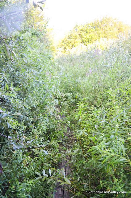
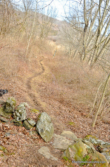
You’ll want to stick carefully to the trail in this section – the greenery here is about 85% poison ivy in spots.
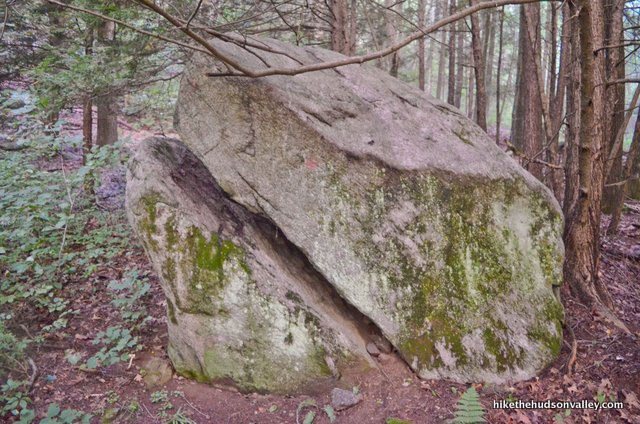
If you’re the first one in your hiking group to spot the rock that looks like a snapping turtle head coming out of the ground, that entitles you to pick all the M&Ms out of the trail mix in any of your friends’ backpacks.
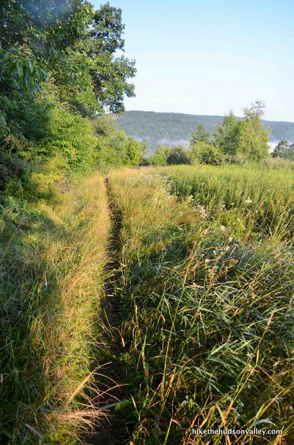
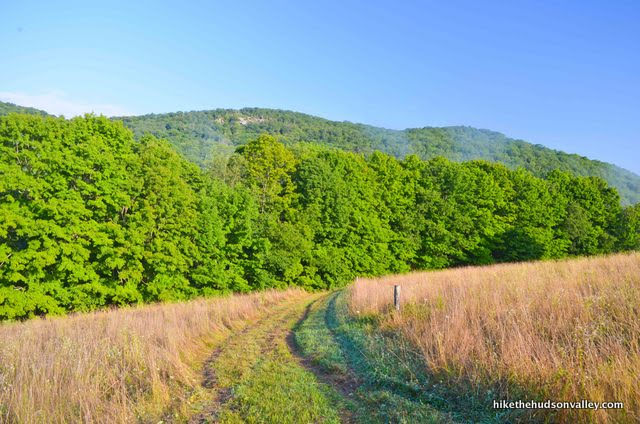
7. The trail winds through beautiful woods, where you’ll just keep following the white blazes up, up, and up. Over the next mile, you’ll gain about 400 feet in elevation.

Just keep climbing. You got this!
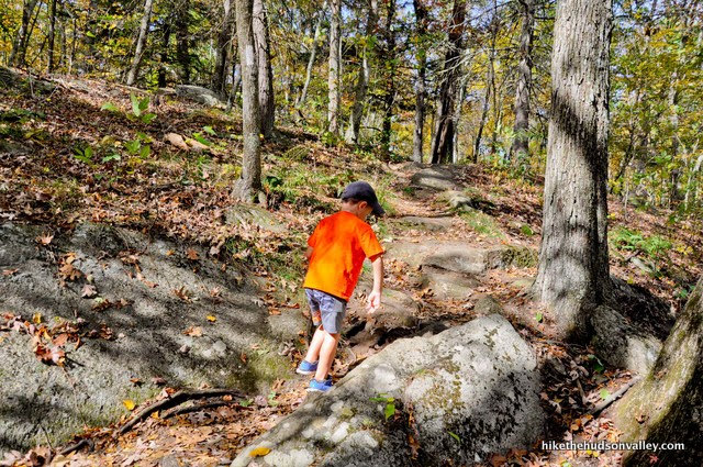
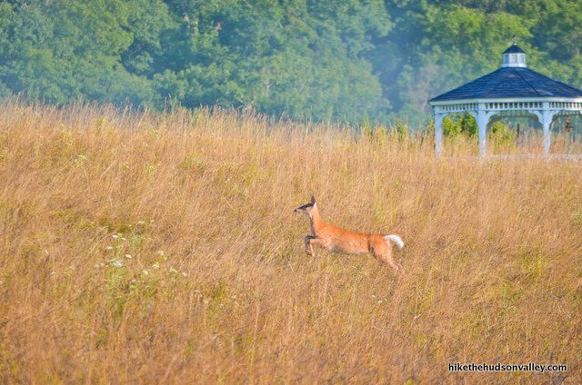
8. When you finally reach the top of the hill, the trail emerges from the woods, with a wide, pleasant view opening up to your right. Nice spot, right?
You’ve come about 1.6 miles so far. It’s another .9 miles to the Dover Oak from here, with a descent of 240 feet. The trail ahead can get quite overgrown and swampy in the next section, depending on the conditions when you visit.

If you brought friends with you today who don’t like hiking that much, you might want to turn around now, so they’ll still be your friends tomorrow. (That should at least buy you some time to find some heartier friends.)
If you continue reading from here, I’ll assume you’re going to the Dover Oak, and maybe even to Cat Rocks (if you’re a crazy hiking swamp monster). No shame in turning around, though! If that’s what you decide to do, just retrace your steps back to your car, and enjoy the stroll back across the boardwalk! Happy trails, Swamp Thing!
9. Okay, hard-core Dover Oak people – let’s do this! Onward and downward! Continue following the Appalachian Trail as it becomes a single-track affair through the grass.
In just a moment, you’ll be able to see a hill straight ahead, with a rocky outcropping near the top. That outcropping is Cat Rocks.
The view from up there is quite nice, but you’d have to be feeling awfully spry to tackle that hill today. The Dover Oak is right at the bottom of that hill. Just a hop and a skip, right?
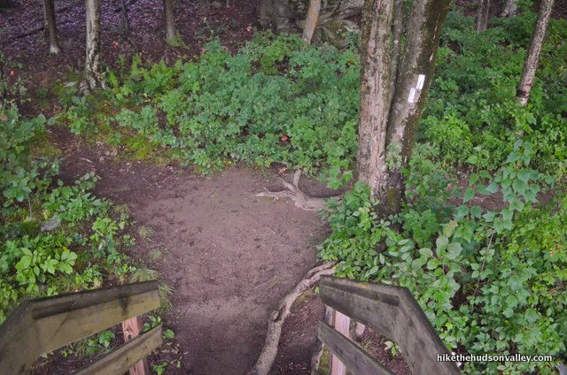
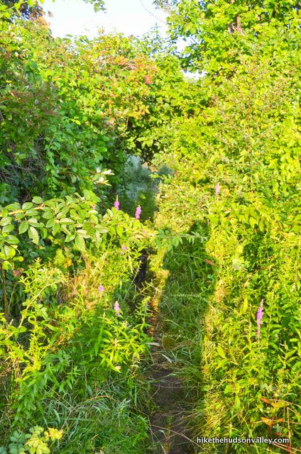
In a couple minutes, you’ll pass through a thicket that can be a bit overgrown, then you’ll arrive at a trail marker on a post that is advising you to turn left with its two blazes. Follow that post’s advice and make a 90-degree turn to the left to stay on the trail.
From this turn, it took us 30 minutes to reach the Dover Oak.
10. The trail continues descending, offering some strategically placed planks to help keep your lil’ tootsies dry in the boggiest places. Nice trailwork!
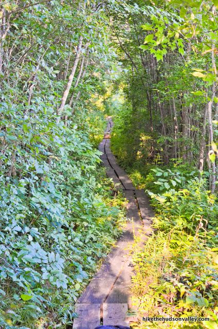
Depending on the conditions when you visit, you may still find some mud. (If anyone in your hiking party complains, please refer them to the title of this trail guide.)

If you visit in drier months, the vibe here will be considerably less verdant. The bulrushes may even give you a little elbow room.

After trekking across quite a few planks, you’ll pass over a little stone wall.

Then you’ll emerge into another wide-open field.
You may find that you’re not the first one here.
You’ll also notice a gazebo and flagpole across the field.
While you might wonder if this gazebo is a place for weary hikers to relax, the “NO TRESPASSING” sign posted to the left of the flag lets you know that this land was NOT made for you and me. This land is somebody else’s land.

Just stay straight on the Appalachian Trail, which maintains a nice wide berth from the gazebo.
11. Immediately after passing the gazebo, the trail descends toward the Dover Oak – you’ll probably hear some road noise as you get closer. That’s W. Dover Rd (County Rt 20), which runs right past the Dover Oak.
As you hit the treeline, you’ll descend some stone steps and pass a marker for W. Dover Rd.
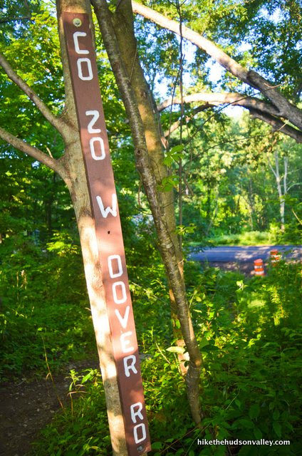
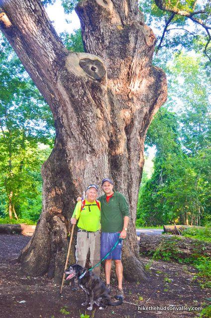
12. THAR SHE BLOWS! The Dover Oak. The largest, honkingest oak tree on the entire Appalachian Trail. The biggest white oak in New York. Twenty-two feet of oaken circumferential goodness.

Careful you don’t wander into W. Dover Road while you’re ogling its magnificence. If you brought your entourage, now would be a great time to snap a shot with your favorite celebrity tree. (It’s very gracious about standing still while you take pictures. It hasn’t let fame go to its twigs.)
13. Decision time! Are you a regular, sane person? If so, proceed to the next step. Are you a crazy hiking swamp monster? If so, proceed on up to Cat Rocks (1 mile and 717 vertical feet from here), come back here, give yourself a high-five, then proceed to the next step. Have fun up there, crazy person!
14. Whether you’re a sane person or a crazy person, time to head home! From the Dover Oak, do NOT cross the road. Head on back up the stone steps behind the tree, and proceed to follow those white blazes all the way back to the Great Swamp and your transportation home.
From the Dover Oak, it took us an hour and twenty minutes to get back to the boardwalk.


If you’re here with your dad, take a moment to thank him for teaching you to love hiking. (And for spending all that time helping you with your algebra homework. You probably never sufficiently thanked him for that.)
Hello again, car! Thanks for bringing us to this great place. Now take us to food!
Directions
Directions to the trailhead: From the intersection of Route 22 and Route 55 in Pawling, NY, the parking lot is 3.0 miles north on Route 22, on the left. You’ll see signs for the Appalachian Trail train stop, which shares the parking lot used by hikers. (If you get to Native Landscaping, you’ve gone about 100 yards too far.)
Turn left onto the short gravel road for the parking lot, then you’ll find a small lot on your left.
Here’s the view from the edge of the parking lot, looking back out at the street.
And here’s a Google streetview image of the driveway, to help you recognize it (it can be tough to spot your first time here).
Once you’ve found it, pull in, climb out, and let the adventure begin!
Sorta nearby address for your GPS: Just plopping “Appalachian Trail MTA” into Google Maps will take you to the right place (depending on your device, it will even show you that the Harlem Line services that stop). The entrance to the parking lot is immediately behind that stop. Alternately, you can use the address for Native Landscaping (an awesome supporter of the local trail community), which is immediately north of the turnoff on Route 22.
991 NY-22
Pawling, NY 12564
From there, the gravel driveway to the small parking lot is on the same side of the street, about 100 yards south of the very well-marked Native Landscaping.
GPS coordinates of parking area: 41.59249, -73.58803 (Clicking will open in Google Maps or the Apple Maps app, depending on your browser/device.)
Resources & Interactives
Super-cool Google Earth flyover of hike route:
Google Terrain Map of hike route:
Related resources: If you’re looking for actual facts and/or useful information, visit these resources:
- The Friends of the Great Swamp (FroGS) homepage, and their Facebook page
- The Harlem Valley Appalachian Trail Community Facebook page
- This great Youtube video about the Great Swamp, narrated by James Earl Jones
- This cool list of filming locations for the movie “A Quiet Place,” portions of which were filmed very near the Dover Oak. *Finger over lips*
- This article from WPDH about the ridiculous-looking steak margarita sandwich at nearby Vinnie’s Deli in Pawling, which was featured as a celebrity chef’s guilty pleasure on the Food Network. I’ve been meaning to try one of these things for like three years.
- Some interesting history on the Great Swamp’s Wikipedia page
- This ApplachianTrail.com article on the building of the Great Swamp’s boardwalk
- These great hiker portraits from Jane Haslam and Justin Goodhart
Want to support trails in the Hudson Valley? Here’s one great way: Visit the New York-New Jersey Trail Conference homepage and click on Volunteer, Donate, or Shop! (Then you can volunteer, donate, or shop, depending on your mood.)
Thank you for this – did the hike and loved it. W-Sun there is a wonderful food truck, DC Malaysian Food, just a short walk from the parking area (turn left, toward the landscaping business, then cross the road). They made us a truly delicious post-hike lunch. Current hours/menu here: https://www.facebook.com/profile.php?id=100077743098808
Z – thanks so much for the nice feedback and the recommendation! I’m always on the lookout for good post-hike grub. Very much appreciated!
The food truck is still there (we went on Saturday) and it was great!
Mike, This post is amazing! Great job. much appreciated. Plan to do this hike tomorrow.
Did this today including the extension to Cat Rocks. It took us a little under 3 hours total. It rained last night so we were a little concerned about mud given the name of hike. It was a little slick in some spots but completely fine with hiking boots. The trail was very well-marked and easy to follow. Generally very pleasant and would love to come back when things are a little greener
We loved this hike! Has the most dramatic start of any hike in the area – cool little train station then a boardwalk cutting through gorgeous nature. We went this past Sunday morning. The temps were in the 70s and it had recently rained so there was some mud but only a couple spots. Saw lots of newts. The section at the top of the climb was very overgrown, glad I wore pants. We turned around at the Dover Oak. Took us – 2 adults, 3 teenagers and 1 slow dog – 2.5 hours. Overall a beautiful area.
Forgot to mention that bugs were not an issue. Mosquitoes love me and I didn’t get one bite or even see a mosquito.
Jenn, thank you so much for the wonderful trip report, all the kind words, the cool photo, and your update on the mosquito situation! (Nice to hear verification from someone else that the mosquitoes are surprisingly not the predominant feature of this hike. ) Here’s to many more wonderful adventures to you and your family!
Is this something you can bike?
Hey Mike – Awesome write up. Thanks! Given that it is THE great swamp how bad are the mosquitos on a random summer day? On a scale of “no problem” to “If you take a nap you’ll need a transfusion if you ever regain consciousness” where would you rate it? I’ve done some swamp time where it really requires head nets, long sleeves, etc. The pictures you shared look like we’re on the “no problem” side of the equation though right?
Thank you, Kirk! You would indeed expect significant mosquito traffic in a place called the Great Swamp, right? I have visited in February, October, and August, and only noticed them during our early-morning August hike. It wasn’t so bad — I didn’t wear bug spray, and a head net would have been completely unnecessary. I’m sure it must get awfully buggy there at times, but it’s never been a significant issue on any of my visits. Perhaps the boardwalk helps to keep you above the fray a bit? I’d be curious to hear if others have had a different experience there, but I’d say a little of your favorite repellent should be all you need, if anything at all.
We did Cat Rocks today and it was super buggy. Afterward, we drove to the train station and did the boardwalk part of the Great Swamp and it was not buggy in the slightest. I’m not sure why but this is current and factual.
Do you think someone using a 4 wheel rollator could do part of this swamp hike? The part that looks like a boardwalk seems doable although possibly not wide enough for someone to pass? But not sure about getting onto the trail from the parking area.
Gerrie, that’s a great question! I want to say: “Yes, it should be fine,” but also don’t want to be responsible for setting someone up for an unpleasant experience out there. Take a good look at the very first picture in the trail guide — that would be the most difficult section to navigate, along with the little hop over the railroad tracks. If the person using the rollator can get over those obstacles, the boardwalk itself shouldn’t present any problems (there are no steps until the far terminus of the boardwalk), and there are even several nice places to sit and rest along the way. I’d also expect it would be plenty wide enough for people (and possibly large, galumphing dogs) to pass — though most of the boardwalk does not have railings, so good balance is a must. I hope that helps you to make an informed decision — best of luck if you decide to pay it a visit!
Hi Mike. Thank you for a terrific hike and a great guide to follow. My sister Lisa, her dog Mazzy and I had a terrific time on this hike. And getting to that beautiful oak tree was the best part of the hike. We can’t wait to do more of your wonderful hikes and following your trail guides. Thank you Mike…you ROCK.
I’m getting very strong vibes that YOU rock, Sandi! Thanks so much for the kinds words! Here’s wishing you and your crew many more wonderful adventures out there.
Thank you so much for posting about this and all the step by step instructions and pictures. My sister, dog and I just got back from hiking it. Great trail! Great time! And best of all thanks to your instructions we didn’t get lost. Beautiful trail and the old oak is amazing. thank you!
That’s wonderful to hear, Lisa! Thanks so much, glad you all had a great day out there!
Hey Mike thank you so much for the mention and shout out ….. I’ve used your hiking guides for a while now and they are a tremendous resource …… Next time you are in the Pawling area why don’t you let us know we can grab a coffee and add your portrait to the Harlem Valley AT Hikers portrait page …. I’ve added a picture to this comment of the lovely Jane Geisler that I took a couple of weeks ago – she is an absolute treasure
What a wonderful picture, Jane – thanks for sharing it here! And thanks so much for the kind invitation – hope to catch up with you over some coffee in Pawling!
Look forward to it
NYNJTC has an even longer hike including this that will take you around Nuclear Lake and back. Just don’t miss the turn for the lake if you do decide to go that way! My @13 mile hike was close to 18miles! Oops!
Wow! That is quite a hike! Thanks for sharing that suggestion. Here’s the link that you mentioned, for anyone crazy-Swamp-Monstery enough to go past Cat Rocks all the way to Nuclear Lake: https://www.nynjtc.org/hike/appalachian-trail-dutchess-county-ny#dialog-hike-description. Might as well just go to Georgia at that point 🙂
Hey, Mike. Thanks for an excellent guided tour of this hike. It was both informative and entertaining. The photos were most helpful for map-and-trail-challenged people like me. Loved the terrain map and Google Earth flyover, too.
Thank you so much for all the nice feedback, Susan! Very much appreciated!
How is the side going towards Main across the Road?
Hey, Alejandro! I asked about that when I was there, and Jane Geisler (the volunteer mentioned above) told me that heading the other way goes through the Pawling Nature Reserve. Sounds like a nice stroll through the woods, but a long way to the next money spot. I’ve never been there, though – would love to hear from anyone else who has ventured that way, and to hear if anyone would recommend it!