Background
If you find this free trail guide useful, please provide payment by picking up at least one piece of litter on your hike. Cha-ching! Thanks for being awesome! (And here’s a quick primer on Leave No Trace, too, to help us keep the trails nice and fresh for each other.)
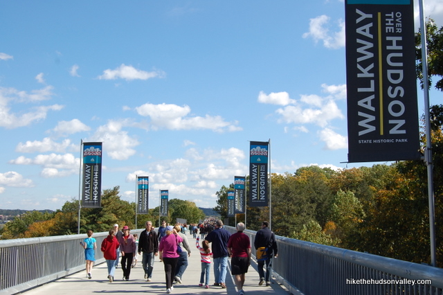
Background you can feel free to skip: The moment the Walkway over the Hudson opened to the public in 2009, the Hudson Valley instantly became a cooler place to live by at least 14%. On a nice day, you can expect to see a constant stream of humanity out there, and I often see people I know, which makes me feel like I live in Mayberry, if Mayberry had incredible views of the river, the Catskills, the Hudson Highlands and the Mid-Hudson Bridge.
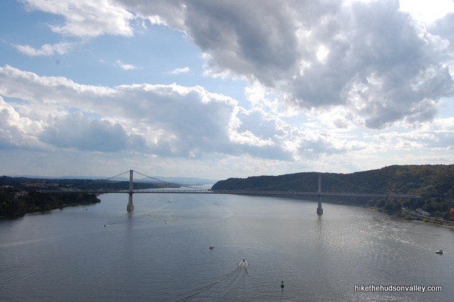
If you live anywhere near the Walkway and you haven’t visited yet, seriously, I have no idea what you’re waiting for. It’s beautiful at all times of year, and it’s one of the only hiking destinations that gets plowed in the winter, making it an excellent cure for cabin fever.
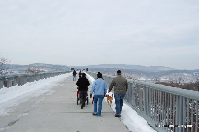
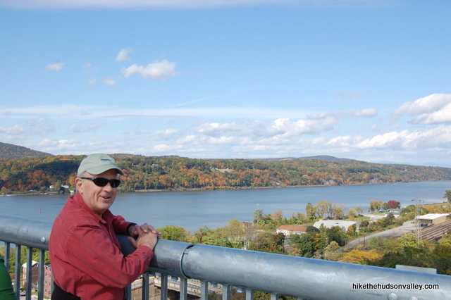
Whenever my out-of-town friends dither about whether they’re willing to drive a few hours to see me, I say, “Dude, we have the longest raised pedestrian walkway in the WHOLE WORLD here. Whatever excuse you have, it’s not good enough.” If that doesn’t work, these glowing Yelp reviews probably won’t either, but they do help present a strong pro-visit case.
Even though the Walkway stands 200+ feet over the Hudson, you never really get that stomach-dropping feeling from it, perhaps because all the concrete makes it feel like a regular road. A regular, awesome road with extraordinary views, educational signage, snack vendors at either end (when it’s warm), lots of friendly people and some cute pooches to boot.
I’ve also recently noticed that besides your garden variety walkers, bikers and roller-bladers, there are increasing numbers of people on the Walkway locomoting in ways you don’t see every day:
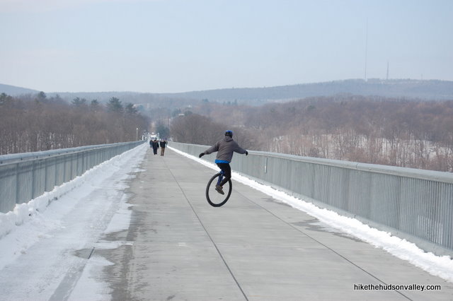
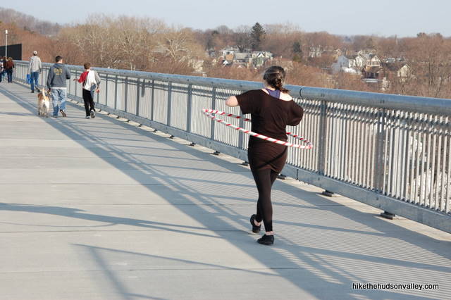
How cool are these people? They give the place more of a carnival atmosphere, like we’re in Venice Beach instead of Poughkeepsie. I really dig that.
This walk only ranks a 2 of out 10 on the Scientific Hike Difficulty Rating Scale, mostly because it’s completely flat and paved the whole way. Still, if you stroll the entire three miles out and back (parking lot to parking lot), you’ll know you’ve gotten some good exercise.
This park wouldn’t exist if a lot of very determined people didn’t work very hard to turn a rusted old rail bridge into an awesome tourist attraction. Thank you, thank you, thank you to all the people with the vision and determination to make the Walkway a reality. You’ve made the Hudson Valley a better place to live and visit.
Trail Guide
Bonus unsolicited advice: Don't depend on having cell service in the woods - it can be spotty out there! Download this trail guide to your phone before you head out. (It's easy to do on iPhone and Android.) May your connection to nature be strong, even when your connection to the internet is weak.
Trail guide:
1. From the parking lot, walk across the bridge.
2. When you reach the opposing parking lot, or you just feel like turning around, turn around and head back to your car.
3. Seems like there should be a step 3.
Directions
Note about parking: As of this writing (April 2012), it costs five dollars to park on the official lots on either side of the river (Poughkeepsie or Highland). On a nice day, the lots on both sides get full. You can overflow park along Haviland Road outside the parking lot on the Highland side (or in the free rail trail lot next to the Walkway lot), and I’ve always been able to find a spot at the eastern end of Brookside Ave on the Poughkeepsie side (you can park all along the side of the road there), about a block from the park entrance. I usually just park in the main lots if I can — it’s hard to think of a better way to spend five bucks.
Directions to the Poughkeepsie trailhead: Poughkeepsie can be a maze, and the directions to the parking lot will be very different depending on which direction you’re coming from. I recommend checking out the Walkway over the Hudson (Poughkeepsie entrance) entry on the HiketheHudsonValley.com Google map to figure out the best way here.
Sorta nearby address for your GPS: The eastern parking lot for the Walkway is at this address:
61 Parker Ave
Poughkeepsie, NY 12601
GPS coordinates of eastern parking area: 41.7121, -73.92582 (Clicking will open in Google Maps or the Apple Maps app, depending on your browser/device.)
Directions to the Highland trailhead: From Rt 9W in Highland, take the first turn north of the Mid-Hudson Bridge exit onto Haviland Road (right turn if you’re heading north on Rt. 9W). The entrance to the Walkway is on your left in less than a mile.
You can also get directions by checking out the Walkway over the Hudson (Highland entrance) entry on the HiketheHudsonValley.com Google map.
Sorta nearby address for your GPS: The West Entrance/Park Office for the Walkway is at this address:
87 Haviland Road
Highland, NY 12528
(Google Maps shows that address at the top of Haviland Road, just off of 9W. Just keep heading straight on Haviland Road and you’ll be at the entrance in just a moment.)
GPS coordinates of western parking area: 41.71023, -73.95726 (Clicking will open in Google Maps or the Apple Maps app, depending on your browser/device.)
Resources & Interactives
Super-cool Google Earth flyover of hike route:
Google Terrain Map of hike route:
Related resources: If you’re looking for actual facts and/or useful information, visit these excellent resources:
- Walkway.org
- New York State Parks page for the Walkway
- The Walkway’s Facebook page (with lots of great updates and photos)
Want to support trails in the Hudson Valley? Here’s one great way: Visit the New York-New Jersey Trail Conference homepage and click on Volunteer, Donate, or Shop! (Then you can volunteer, donate, or shop, depending on your mood.)

My wife and I plan to visit Walkway Over the Hudson. All I know is that it is the longest pedestrian walkway in the world. But after reading your post, I never expected this attraction could be this exciting. I am interested in biking across the Walkway. I appreciate that you included a section for directions. It would be helpful since it’s our first time visiting the place. But I want to know when the best time to visit the place is.
Hi, Chazal! Thanks for the kind words, glad you found this page useful. As for the best time to visit, the Walkway is busy on weekends, but you can always find parking. If you’d like some more solitude out there, and to have to dodge fewer pedestrians/dogs/fellow bikers, weekdays are much less crowded – you might find that more relaxing. The foliage was at peak quite recently, so get out there this weekend or later this week if you can! The real answer is that the Walkway is wonderful whenever you visit – hope you have a great time whenever you can make it out there!
This is the best information. So thorough. Thanks.
Great place for a family walk as well as a bIke ride. I made a cool short video of my last walk over the bridge. https://studio.youtube.com/video/GxSBID5QL34/edit/basic
Pingback: The 11 Hudson Valley Hikes That Get Googled The Most - Kingston Creative
People of the future, be on the lookout for the nights that the Walkway is open from 7 – 9PM. I don’t know how many times a year they do it, but they did it in the beginning of October this year (2017). It’s a completely different experience at night. For one it’s dark, no really! They have very minimal lighting on the walkway, just enough to keep you from bumping into people…which happens anyway. Secondly, it’s very crowded, so get there before 7 to park in the lot on Parker Ave. If the lot is full you can park on the street on Brookside Ave. They have telescopes set up at mid-span and some people (and dogs) get all decked out in glow sticks. Highly recommended.
October 2017 info:
http://walkway.org/event/member-moonwalk-3/
Both ways it is 2.56 miles. It is 212 feet over the Hudson at maximum height. Please take note and correct.Thank you.
Thanks for keeping me honest, Gary! (That can be a full-time job.) Parking-lot-to-parking-lot, I clocked it at three miles, and Google Maps just verified that. You’re right that most people don’t do it that way, and if you turned around at the gate on the far side (from either direction), it would be much closer to 2.5 miles. My GPS also reported the max altitude to be 306 ft (above sea level, not above the Hudson), and that sounds like the right ballpark to me, even though the span is 212 feet over the river. If any of that looks wrong to you, let me know. I appreciate your help to keep this site as accurate as possible!
Crossing the Walkway for most is across & back (2.5 miles). This 6 mile route makes a South loop of the area. After crossing, make a left onto & follow alongside Haviland Road for 1.5 miles leading into the Johnson-forio Memorial Pk & then crossing the FDR Mid-Hudson Bridge (pedestrian walkway alongside traffic) ending with a series of Northward & Eastward roads in town to get you back to where you began in Downtown Poughkeepsie.
Our first trip to the walkway ended with a trip to the ER after my 2 year old daughter took a tumble from her stroller and landed on her head. Other than that we had fun!
http://kiscodad.wordpress.com/2010/09/14/walkway-over-the-hudson/
Great web site. Very nicely done. You should do Ulster County near by hikes ie: Franny Reese Park , Illinois mountain and Black Creek. That visitors to Walkway could do easily.
I’ve never heard of Illinois Mt. before – will definitely look into it. Franny Reese is already written up on the site, so we’re good to go on that one. And I’ll put Black Creek on the Coming Soon(ish) list — it definitely deserves a write-up as well.
Thank you, Larry!