Background
If you find this free trail guide useful, please provide payment by picking up at least one piece of litter on your hike. Cha-ching! Thanks for being awesome! (And here’s a quick primer on Leave No Trace, too, to help us keep the trails nice and fresh for each other.)
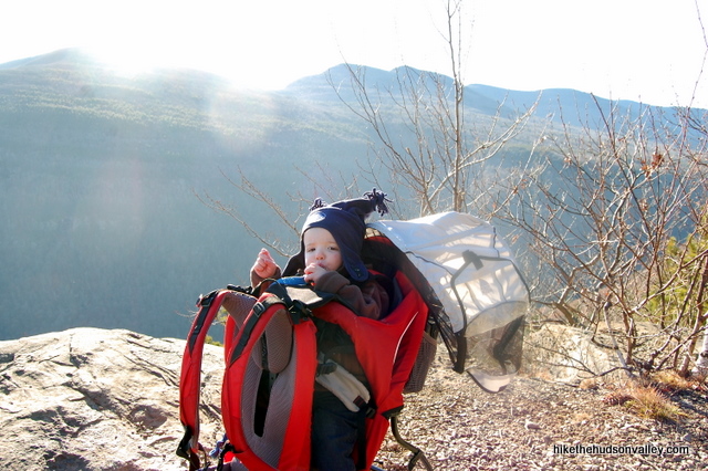
Background you can feel free to skip: When I stepped out onto Huckleberry Point late last year, the view was so beautiful that I don’t remember if I swore in front of the baby riding on my back, but if I did, I forgive myself. This is a view that deserves a colorful exclamation.
It had been nearly a decade since my wife and I had hiked out to Huckleberry Point. I had only fuzzy memories about a very nice overlook there, and something about a chair made of rocks. Searching around on my hard drive, I dug up some old shots from our original Huckleberry hike. Sure enough, there was Kara, sitting on her throne of rock.
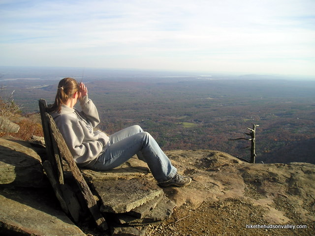
When I strolled back out here recently, I found that the rock chair is no longer there, and maybe that’s for the best. Nature doesn’t really need any help for this place to be awesome. Besides, my new hiking partner (our son Evan) would have needed some booster rocks anyway.
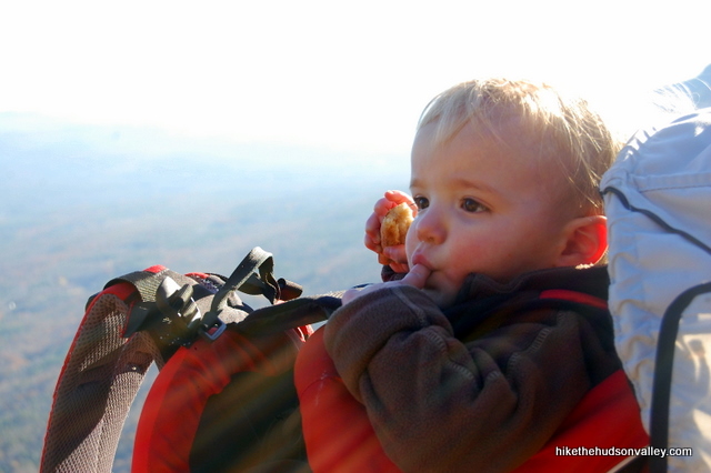
Kara took that day off from hiking, enjoying some peace and quiet back home, but standing on Huckleberry Point, right at the edge of the Catskills, overlooking the Hudson Valley beneath, I decided that I need to drag Kara back out here. Huckleberry Point is a special place, and one you should make a point to visit if you’re at all interested in awesome views that don’t require an all-day hike to earn.
When someone says that the hike to Huckleberry Point is flat, they mean that it’s Catskill Flat, which also happens to be a great name for a country band. There are some decent climbs along this hike, including an increasingly steep descent (ascent on the way back) as you near the overlook. But for the reward of a really sweet Catskill overlook, you’ll have a hard time finding a hike that requires less exertion.
If you’re looking for a great hike that might even be appropriate for people who don’t like hiking that much, this stroll is most definitely your Huckleberry.
Trail Guide
Bonus unsolicited advice: Don't depend on having cell service in the woods - it can be spotty out there! Download this trail guide to your phone before you head out. (It's easy to do on iPhone and Android.) May your connection to nature be strong, even when your connection to the internet is weak.
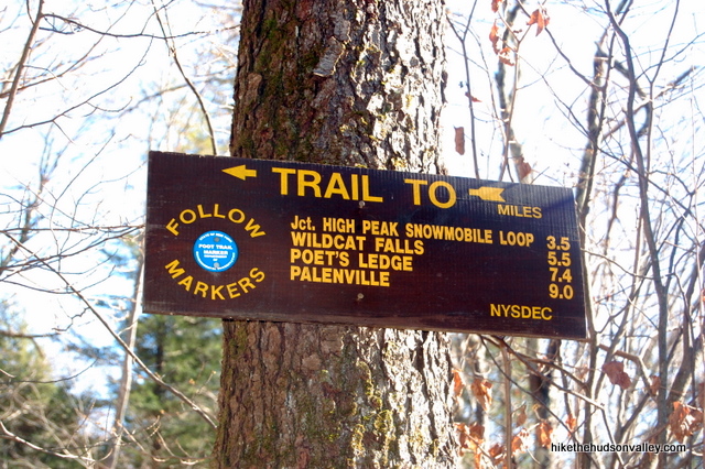
1. From the parking area that doesn’t mention anything about Huckleberry Point, head over to the registry box, just beyond which you’ll see a sign that also doesn’t mention anything about Huckleberry Point.
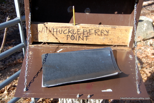
When you open up the registry box to sign in, though, you’ll find that some helpful fellow Huckleberrian has taken the time to let the rest of us know that we’re in the right place. Thank you, whoever did that.
2. After signing in, follow the red and blue trail markers along the very well-worn (and sometimes slightly muddy) woods road.
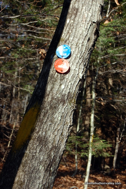
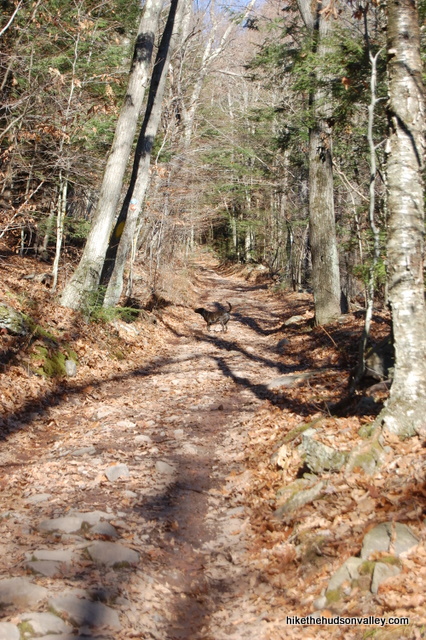
3. Be careful not to get bucked off the road. About 15 minutes in, you’ll have to veer right at a fork to stay on the trail as an unmarked road departs to the left.
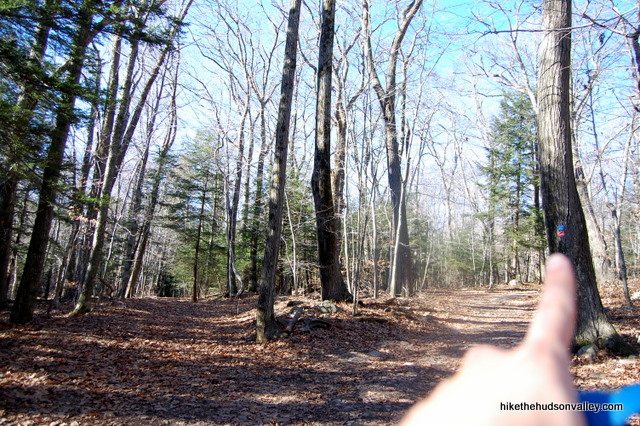
4. About five minutes after that, a sign directs you to turn right to stay on the Blue Trail. Follow that sign’s advice and head to the right.
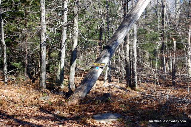
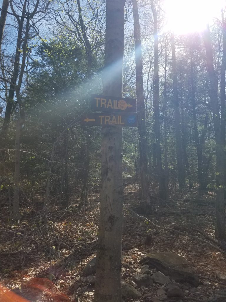
5. Just a few minutes after that, you’ll arrive at the well-marked Blue/Yellow junction. Turn right here to hop on the Yellow Trail, which you’ll follow all the way to your destination.
**UPDATE August 2020** This step has been updated various times over the years as the signage at this junction has changed from quite good (it used to say “Huckleberry Point” on the sign), to non-existent (just bare tree), to half-existent (just a Blue Trail marker, no mention of Yellow). I erased all those old updates because friendly hiker Katharine graciously emailed me a picture with the current state of the signage here. Thanks so much, Katharine! (And thanks to whoever put up the signs!)
6. About ten minutes after joining the Yellow Trail (which can be a wee bit muddy at this part), you’ll come to a stream crossing that is probably the trickiest part about this hike, depending on the conditions. The trail seems to suggest that you just walk right through the stream as if it’s not even there. Just a few feet upstream, though, you can pick your way across some logs pretty easily. I’ve never gotten wet here, but I could see it being a problem if the water was high. In fact, this very nice trail guide from catskillmountaineer.com says, “Cannot be forded after significant rain fall. Easily forded otherwise without getting your little toe wet.”
I’ve never gotten my toes wet here, and I hope you don’t have any problems, either. I’d expect the rain would need to be fairly biblical to create an issue.
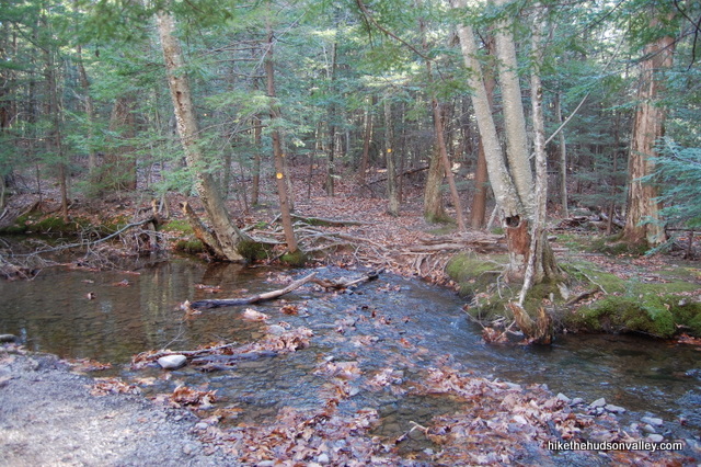
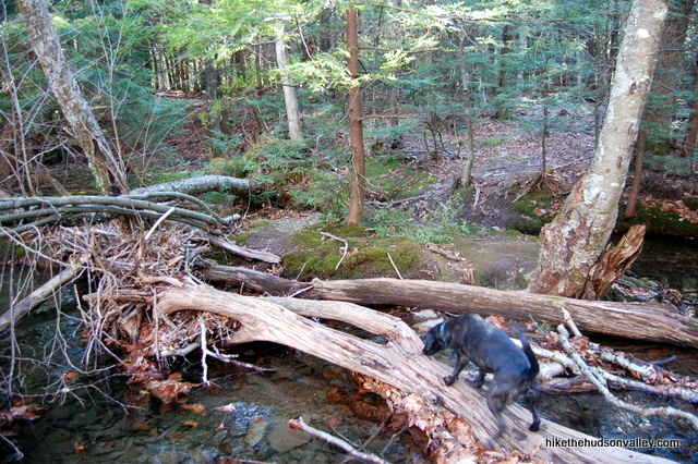
7. From the stream crossing, it took me 34 minutes to reach Huckleberry Point, strolling at a decent pace and stopping to take a few pictures. Just keep on trucking, following those yellow markers, and you’ll be there in no time.
8. When you get there, you’ll know you’re there. The Catskills loom above to your right, and the ground falls away to your left, leaving a sweeping panorama that stretches past the far-off Hudson River. Take your time, have a seat and enjoy it.
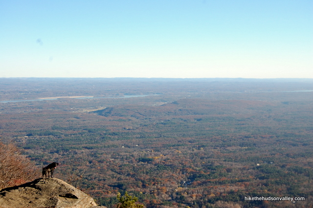
9. When you’re done taking it in, head back the way you came. Just a few minutes after you start heading back, you might notice an unmarked trail heading off to your right through the pine trees, while the Yellow Trail heads left. I hadn’t noticed this trail on my way in, but it’s a very short trail to a nice campsite. You probably have to get here early in peak season to claim it, but it was empty when I stopped by. Check it out if you like, or just keep heading on the Yellow Trail to make your way back.
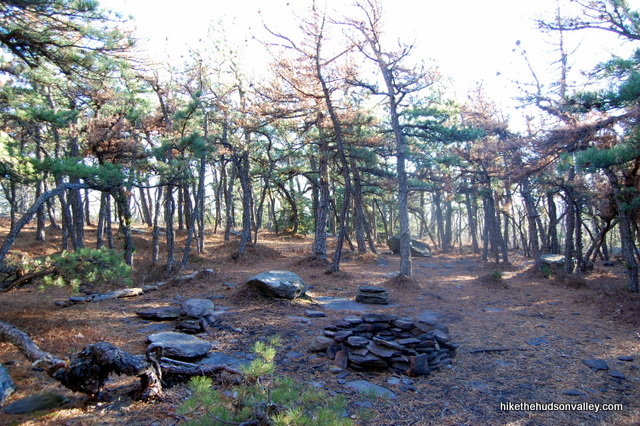
10. The only turn you have to worry about is the junction with the Blue Trail, where you’ll turn left to leave the Yellow Trail. It took me 40 minutes from the campsite to that junction, with some stops for pictures.
11. As you head back down the woods road and start getting close to your car, you can hear the burbling brook off to your left. Seems a shame the trail couldn’t tread closer to that stream – what you can see of it from the trail looks beautiful. Back in the parking lot, you can stroll down the hill to have a look, if you’re so inclined.
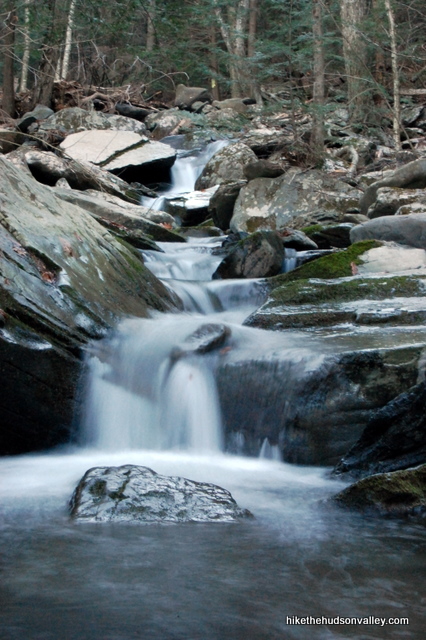
12. Otherwise, hop back in your car and try to think of a nicer place you’ve visited recently. Also, make a point to tell at least three people, “I’m your huckleberry,” in the next 24 hours.
Directions
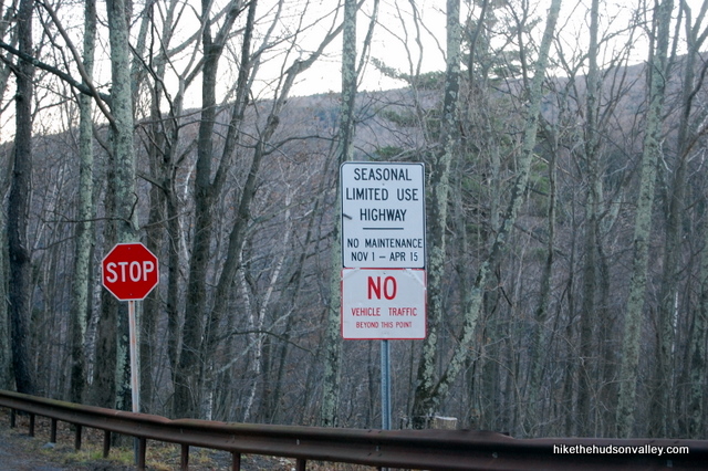
Directions to the trailhead: From the NY Thruway (I-87) headed north, take exit 20 for NY-32 toward Saugerties. From the off ramp, take a left onto NY-212 (Saugerties-Woodstock Road) and stay on it for 2.3 miles, where you’ll then take the right fork onto County Route 35 (Blue Mountain Road). After 1.5 miles, turn left to stay on County Route 35, which becomes W Saugerties Road, and then becomes County Route 33 as you keep heading straight. This road departs civilization and becomes Platte Clove Road, which climbs steeply and is unmaintained in the winter, closed from Nov 1 – April 15. I was here on November 12, before there had been any snow, and everyone seemed to be cheerfully ignoring the “No Vehicle Traffic Beyond This Point” sign. I imagine in the spring, this road must take a while to thaw out. I wouldn’t press my luck with this road, and I’d advise you not to, either. Best to try it after April 15 or before Nov 1.
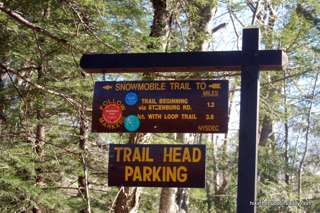
The trailhead parking is on your right towards the top of the hill, and is pretty well-marked, except that it doesn’t mention Huckleberry Point (I don’t know if they swap these signs out for different seasons, but when I was there, it said “SNOWMOBILE TRAIL TO: TRAIL BEGINNING via STEENBURG RD.: 1.2 miles,” among other things. It’s the only trailhead on your right, so if you see it, that’s the right place to be. It’s just after a tiny little bridge with guardrails on either side. (I took the picture below on the way out of the parking lot, so if you’re coming up Platte Clove Road from the directions above, this is the reverse of how the sign will look. Sorry ’bout that.)
Worst-case scenario is you drive past it, arrive at the very clearly marked “Platte Clove Community” on your right, and backtrack about a mile to the trailhead parking lot.
You can also get directions by checking out the Huckleberry Point entry on the HiketheHudsonValley.com Google map (and see the note on Google Maps’ directions in the GPS section below.)
Sorta nearby address for your GPS: The Platte Clove Community is about a mile north of the trailhead on Platte Clove Road. Its address is:
2255 Platte Clove Road
Elka Park, NY 12427
Note: If you’re coming from the south or east, make sure that your GPS route knows Platte Clove Road is accessible. I noticed Google Maps likes to avoid that road, perhaps because it’s closed in the winter. Going the long way (through Tannersville) will cost you 25 minutes.
GPS coordinates of parking area: 42.13378, -74.08201 (Clicking will open in Google Maps or the Apple Maps app, depending on your browser/device.)
Resources & Interactives
Related resources: I haven’t found too many other official Huckleberry Point resources online, but you can visit these other excellent trail guides for some different perspectives:
- Catskillmountaineer.com
- Localhikes.com (with some nice user reviews)
Want to support trails in the Hudson Valley? Here’s one great way: Visit the New York-New Jersey Trail Conference homepage and click on Volunteer, Donate, or Shop! (Then you can volunteer, donate, or shop, depending on your mood.)

From June 2024
This is a really great bang for your buck – the hike isn’t too hard and the payoff is great. Like another person already said the trail is very well marked now. Huckleberry Point has its own signage and when the trail switches over from blue to yellow it will be very obvious. Got here by following the GPS directions – the road up here is crazy steep and I think the road we took is seasonal…so if you are trying to do this in fall or winter the route we took is closed off and you’ll have to go around another way.
Thanks for the guide, these days trail is clearly marked except for one right turn. Strava tells me we went 6.53 miles.
Hiked Huckleberry Point Trail 6/17/21. Have a few updates. There’s a pretty good size parking lot for the trail at 2425 Platte Clove Rd, there’s a sign at the entrance on Platte. I don’t remember if the sign mentions Huckleberry.
At the sign-in area there is an updated trail sign, kinda behind the sign-in area, that shows all the trails, Huckleberry Point is listed. I wish I had seen your post earlier as it was a little confusing as to which way to go for Huckleberry. Best advice is take 3 rights and it will get you to the Huckleberry lookout. Totally worth the hike….views are awesome and the mountain laurel was in bloom yesterday…gorgeous. Enjoy !!!
We wanted to hike and of course visited your site for recommendations! We did the Huckleberry trail today 05/09/2021 and the Platte Clove Road was completely closed off with road blocks. A local hiker guided us back to 32 north and then 23A, so we went around and came back to Platte Clove road from Tannersville. The whole area is amazing and we will hike the Huckleberry trail again. Thank you always, your website and information are great!
Very useful guide, thanks!
My family and I found this hike more strenuous than advertised. We definitely felt as though we had climbed a big mountain. Further it was very muddy, wet and slick, basically the whole way. We had fun, but it was not an easy hike and I was glad I told our friends who are scared of hiking not to come today.
CJ, thanks for sharing your perspective and experiences here! This hike can be muddy when other trails are mostly dry, and it’s pretty much mud everywhere these days, so I can only imagine how sloppy it must have been out there for you all. The condition of the terrain must have made the going more difficult, too. Glad you managed to have fun anyway, and perhaps your friends would enjoy this one when things dry out a bit. Happy adventures to you and your family, and here’s to drier times ahead!
Hi!
I’m going to be coming up to the Catskills area in a few weeks, and I was wondering what hike(s) I should do. We will be staying in a cabin near Mt Tremper, but we also have a 3-month-old puppy, so Tremper Mtn. was out of the question. I saw this guide, and I thought that it MIGHT work. Could you give any advice on if this hike would work, and if not, any other hikes in the area?
Thanks!
Jonah
When I did this hike there were a lot of dogs – there’s a stream about 3/4 of the way to Huckleberry Point that’s a perfect spot for dogs to splash around.
I know that dogs are allowed – I researched that beforehand – my question was is the terrain suitable for a puppy as small as Zena (she is 3 months old and about 15 lbs). Do you know? If not, does anyone else know?
Hi, Deborah and Jonah (and Zena)! As long as the 4.5-mile distance doesn’t scare you off, I would expect this hike to be a wonderful romp for your pup. There’s nothing in terms of the terrain itself that should give you any trouble. My dog loved this hike, and we had no problems at all. Hope that helps, and hope you have a wonderful visit!
Thanks for the advice! I know that 4.5 miles is quite a lot but we’re going to come really early and take a lot of breaks, so its ok. After I take the hike I’ll make sure to send some pictures in!
Best,
Deborah, Jonah, and Zena
Called the town of Hunter to make sure Platte Clove road is opened- I figured it’s Mid – May it should be- the town announced on its website it is opened as of Friday, May 19!
The hike was great today, was muddy at a few points, the view was beautiful! The drive leading to the parking lot for the trialhead was breath-taking. Went up and back within 3 hours (and that’s me hanging out at the summit for 45 minutes)- definitely going back.
Hiked this beauty today! The trail was beautifully blanketed in snow for May! Sadly, it is only accessible from the Hunter side as the seasonal road closure persists. There is a new sign denoting the Yellow trail split. Views for days as always!
Excellent writeup. I did part of the hike yesterday (10/29/19) but didn’t have time to do the whole thing. I often travel Platte Clove Rd on my way home to NJ from our Catskills shack and stopped on a whim. Now that I know what kind of view is at the end, I’ll do it again soon!
BTW, if you drive from the Tannersville direction, you should be able to access the trailhead lot year-round. The sketchy part of Platte Clove Road, which is officially closed in the cold months noted above, is from the parking lot on down toward Saugerties.
Thank you, Dan, for the kind words and helpful tip! Enjoy the view when you have time to check it out!
Excellent writeup, directions, warnings, and pictures. . We are heading to the Catskills late April 2020. Thank you for taking the time to post. It is already on our agenda to try this.
Two, “Senior” Hikers
Thank you so much, Donna! I hope you have a wonderful visit in April!
We tried to get to Huckleberry point recently, but made the mistake of going on a beautiful Saturday when it was too crowded. Sunday was rainy so we went for a look and managed a legal parking spot by the red house/Plattekill Falls trail which in addition to the falls themselves features an amazing view from “inside” the clove. Definitely stop by if you have a few minutes. Be VERY careful on Plattekill Road, it can get really sketchy and cars have gone over the edge recently.
Gorgeous views. What a great hike. Not too strenuous and a huge payoff. Lots of places to chill and have lunch. I did not see the stone seat at the overview but there was a nearby campsite with stone seats as you described. We popped across the road and checked out Plattekill Falls after, which is well worth the visit and potentially a great place to take a dip. See photo.
Thanks Matthew, I’m headed up this way in Oct 2019 and was just popping in here to add Plattekill Falls ‘across the street.’
Today was lovely for this hike! Thanks for the clear instructions. The road was indeed open, even though some signs indicated it was still closed. I didn’t encounter anyone on my path, but did cross paths with a deer.
Thank you so much for the update, Liz! Really glad to hear that the road was open and all went well. Sounds like you picked a perfect day for it!
Road is closed. No way to get to the trail head.
Morgan, so sorry (and surprised) to hear that! The road used to re-open on April 15. Was there any indication explaining why the road is closed? I’m wondering if the seasonal closure went later than usual this year, or if something else is going on. Thanks for sounding the alarm to help others avoid the same problem!
I saw some chain link fencing, my guess was that the road might have been washed out
Do you know if you still can’t get to it? 🙁 my fave hike in the spring with the flowers
Not sure, it’s an hour and 20 min from me so I don’t want to drive all the way down again to be disappointed.
Mystery solved! Looks like the road opened later than usual in 2019, due to construction: http://townofhuntergov.com/platte-clove-mountain-road/. According to that link, the road has opened as of May 1. Looks like it should be back on its normal (Nov 1 – April 15) closure schedule going forward.
As always great write up! Enjoyed this hike solo today and had the summit to myself. Love the in your face view of a portion of Devils Path.
Pingback: Small, but in a good way - Upstater
Hit up Huckleberry Point today. Broke trail on the last bit after some others had turned around but I really enjoyed it with the snowshoes. Thanks for the great directions! You’re always the first place I come when I need to find a hike.
Awesome, Christopher! Thanks so much. It must have been gorgeous out there this weekend.
Just did this hike yesterday with my 6 year old and my 1.5 year old on my back. Great hike and very useful trail guide. We didn’t encounter as many people as I thought we would. For anyone interested in going this time of year I definitely suggest shoes with good grips on the bottom and trekking poles. The ground was covered in so many leaves that it was hard to get your footing without slipping especially on all of the steep parts.
My two sons (11 and 12) and I finished the trail today. We had rain yesterday and it was very wet for 3 or 4 places on the trail. Very rocky especially on the initial “road” trail. Not for the faint of heart, but not horrible either. This was the first “real” hiking trip with my two sons, and they were able to accomplish it very easily. I found a couple of sites that say that this is a 3.5 mile hike round trip, that’s flat out wrong … it’s almost 1.25 miles further, but for someone who wants a good all around hike for a beginner … steep parts were very steep, flat parts were nicely flat, roots, trees, rocks, cliffs, other hikers of all ages (I saw a dad carrying a 3-4 year old and a baby in a pack). Well hiked, we saw almost 30 people between ascent and descent. And the views are incredible.
We hiked to Huckleberry Point on Sunday, April 17.
Platte Clove Road was open but note it’s a steep twisty road with few guiderails. The journey up is not for the faint of heart. If you take Route 16 (Platte Clove Road) from Tannersville, it’s more gradual.
Anyway, we found the trail parking lot without incident, but it was quite full by noon (we got the last spot). After signing in, we made our way to the blue trail. As of April 17, there was no mention of Huckleberry Point but the people coming down were friendly and assured us we were on the right trail.
Please note, there will be a spot where you will see the blue trail go slightly left and a yellow trail that goes to the right. Take the yellow. It will lead you to the point and to probably some of the best views the Catskills could offer.
Round trip took about 3 hours. Sturdy shoes are recommended as is a picnic for the top.
Took this hike today and as always the instructions were really good. There are a few different places to rest and take in the view at Huckleberry Point, which is lucky because the look out was packed today when I got there.
If you plan to do this hike over the next few weeks or while winter is around, be prepared for an interesting time. I have really good hiking boots, but I don’t have Crampons — and after today i might have to buy them. This hike was icy from the start. The crazy thing about ice and snow for me is that it’s actually easier to navigate on the way up as opposed to the way down.
Outside of that, the views are great, and they just made me more excited about future trips to the Catskills.
Hi Mike,
the sign is back up! It was pretty packed today, but for a good reason. Best time of the year to go hiking!
Best,
Phil
Hi Mike,
Thank you for creating and updating this site. I was/am new hiker to the Hudson Valley and I found your site so informative that I dispensed with the hiking book I had purchased and relied on your descriptions to plan our treks. Just to let you know, we met a number of people who “lost ” the trail to Huckleberry–even this group who had been on the trail in the past–due to the lost trail sign. We were able to help some folk avoid the same fate by giving them your precise directions [and web-link]. Huckleberry was as wonderful as promised, even with the rain. I’m a Hudson fan and am looking forward to more hikes in the area! Thanks again for providing us with the tools for a great hike!
My husband and I attempted to do this hike today, but unfortunately we parked at the incorrect trailhead, a little ways down and across the street from the correct one. By the time we figured out where we’d gone wrong, and where we should be instead, we were too tired to complete this hike. We should have followed your instructions more carefully, but in the summer when the trees are full, the correct trailhead parking sign is more difficult to find. Also, we wanted to let you know that someone has added yellow spray paint as blazes along the beginning of this trail.
I did this hike about two weeks ago. When I got there the parking lot was full and I wound up parking on the road, so I was surprised when that I had Huckleberry Point all to myself when I got there. It’s a beautiful spot. In fact I think it really is one of the best views in the Hudson Valley, especially for the effort. It’s just enough of hike that you know your hiking, but not so much that you want to die half way there.
Hi Mike, finally made it to Huckleberry Point today. It was spectacular. Took a picture of something that may come in handy with your directions. At the turn off point from the Red/Blue trail, there are no longer yellow markings at the entrance to the yellow trail. We had to walk about 1/4 mile in before we started seeing the yellow markings. It’s a bit deceiving when you see the sign that says “trail” and we were inclined to turn left but followed your write up, turning right but it took a while before we saw any sign of yellow. There is, however, a rock formation that is growing at that exact spot where hikers should turn right to start the yellow trail. Thought that would help any future visitors find their way to the beauty of Huckleberry Point! Thanks again for this awesome website you’ve created!!
Hey Mike, I’m taking two friends here this Sunday….do you think, with all the rain we’ve had this past week, the stream will be passable? I hate to make the long drive, start hiking and find out we can’t pass! Just looking for your experienced opinion! Thanks! Beth
Hi Beth! I’m afraid I don’t know, although I would expect with all the snow melt and recent rain that the water level will be very high. I think you’ll be running a real risk of having to turn around. Sorry to be a Nervous Nellie, but if it was me, I’d probably pick a different hike to tackle this weekend. Hope you and your friends have some excellent adventures, whatever you do!
Thanks for the input, Mike. That’s what I sort of figured. We’ll wait another few weeks (can’t wait – it’s been on the list!) but find something else fabulous to do instead. Enjoy the beautiful weekend we’re finally in store for!
Great directions, just got back from Huckleberry Point with two 9 year olds, easy as pie. Thanks so much!
That’s great — hope you all enjoyed it!
Thanks so much for this thoughtful and clear presentation of Huckleberry Point. I only wish other sites had such precise, fool proof guides to local hikes. Thanks, I’m now leaving new york city for Huckleberry Point!
John, I hope you don’t mind that I took the liberty of posting your comment to this site’s Facebook page. You picked an awesome day for it – hope you had great hike!