Background
If you find this free trail guide useful, please provide payment by picking up at least one piece of litter on your hike. Cha-ching! Thanks for being awesome! (And here’s a quick primer on Leave No Trace, too, to help us keep the trails nice and fresh for each other.)
Background you can feel free to skip: The hike to Giant Ledge is so popular, you can go to Google Maps and start typing “Giant Led…” and it will complete your thought with “Giant Ledge trailhead, Phoenicia, NY, United States.” Most trailheads are tough to search for on Google Maps, if you can find them at all, but the Giant Ledge trailhead is easier to find online than your nearest IKEA.
On our first visit here many years ago, my wife Kara and I visited Giant Ledge on a Saturday evening. It was like Woodstock up there. Beatles songs were playing on someone’s boombox. Tents were pitched all over the place. Laughter and loud talking echoed through the woods. Awesome, this place is. A well-kept secret, it is not.
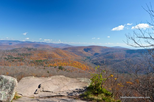
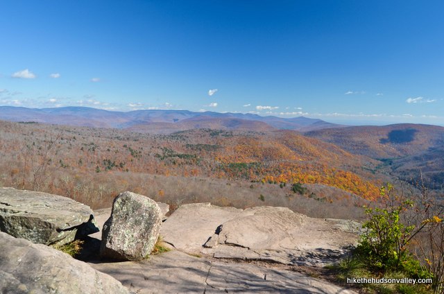
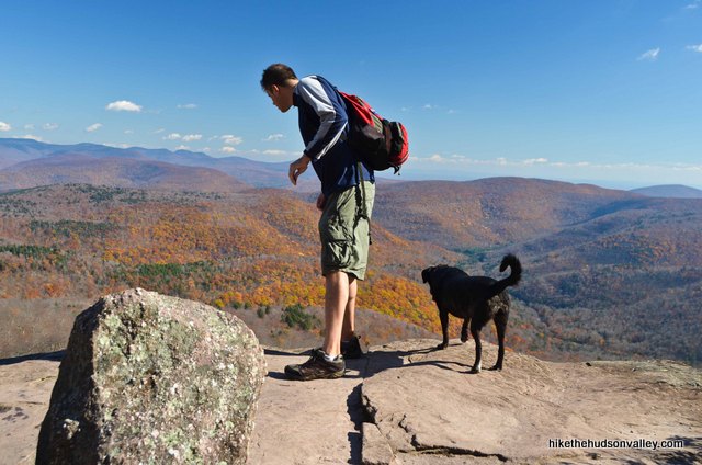
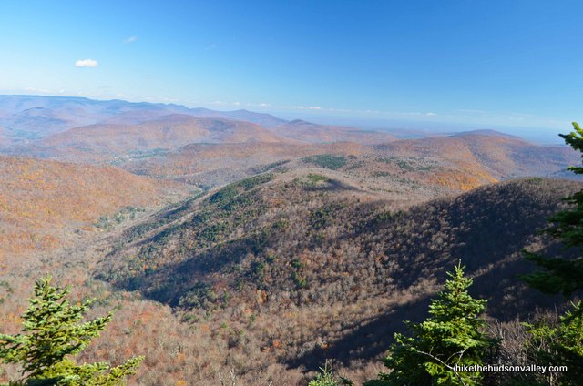
One step out onto that first ledge, though, and it’s easy to see why this place draws crowds.
On my most recent visit, I took a day off and came on a chilly late-October Friday. If you can visit on a weekday, or off-season, or both, you might just luck out and have the place to yourself.
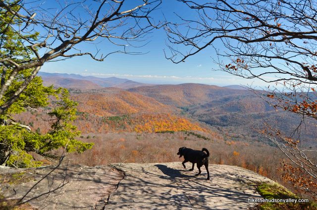
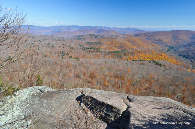
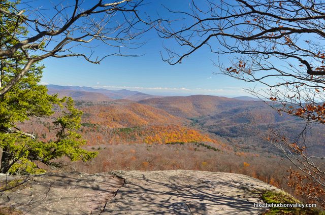
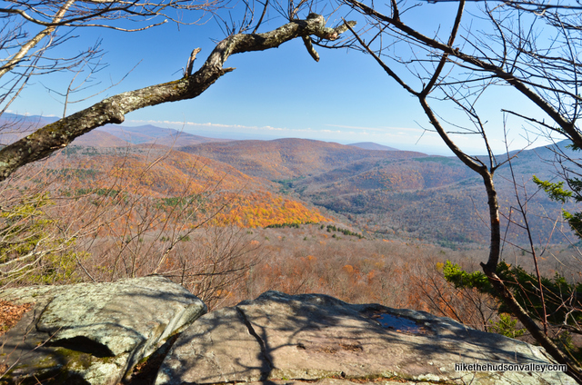
This hike is called Giant Ledge, but there are actually five distinct ledges where you can walk out and have the whole world (or at least a really large, Catskilly slice of the world) open up before you.
It’ll be a 3.2-mile roundtrip if you just visit the first ledge and then return to your car. If you go all the way to the fifth ledge, it’ll be a 4.0-mile roundtrip. The view from each ledge is awesome, but they’re pretty similar. Good to know that you have other options, though, in case you’d like a ledge to yourself and some of them are occupied, as they likely will be. Just keep heading down the trail and there’ll be another ledge in a few minutes.
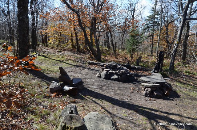
One more item of interest – there are two large campsites right near the ledges, clearly marked and tucked back into the woods. I’ll point them out in the trail guide below, in case you’d like to join the carnival up there one night.
If you’re interested in taking a more strenuous hike and bagging one of the Catskill 3500’ summits in the process, you can continue along the trail straight up Panther Mountain, about two miles (and 1,000 vertical feet) one-way from the first ledge. My guess is that for at least 80% of visitors, Giant Ledge will be the final destination, which is as it should be. For the casual dayhiker, climbing Panther will be overkill.
If you do climb Panther, though, you’ll be rewarded with some pretty awesome views – similar to Giant Ledge, but with a little more of that “I’m on top of the world” vibe.
I know – I just told you not to climb Panther, then I told you how nice the view is up there. Still, really, the view on Giant Ledge is pretty much equally awesome, and the hike to that point has some steep sections. If I was bringing friends on this hike who weren’t super-crazy hiking goons, I wouldn’t even consider dragging them up Panther, too.
However big a hike you decide to tackle at Giant Ledge, just be sure that you do come check it out. Besides taking in all the awesome views, maybe you’ll make some new friends up there. Then you can ask them to turn down their boomboxes.
Trail Guide
Bonus unsolicited advice: Don't depend on having cell service in the woods - it can be spotty out there! Download this trail guide to your phone before you head out. (It's easy to do on iPhone and Android.) May your connection to nature be strong, even when your connection to the internet is weak.
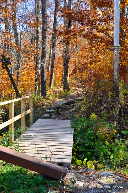
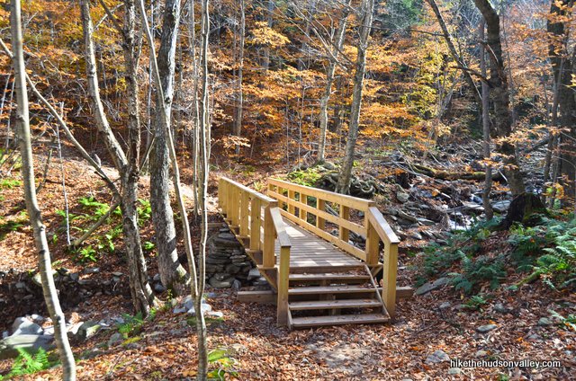
1. From the parking area on County Road 47 (see “Directions to the trailhead” below), turn to face uphill. The trail starts just to the right of the guardrail directly uphill from the parking lot. Carefully cross the road, go around the guardrail, and hop across the little footbridge to begin your adventure.
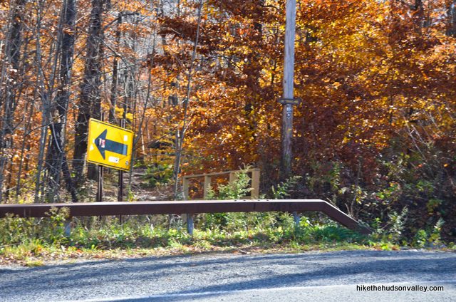
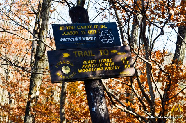
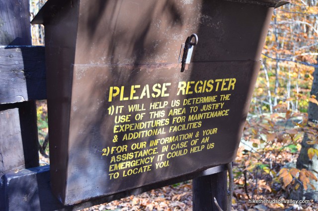
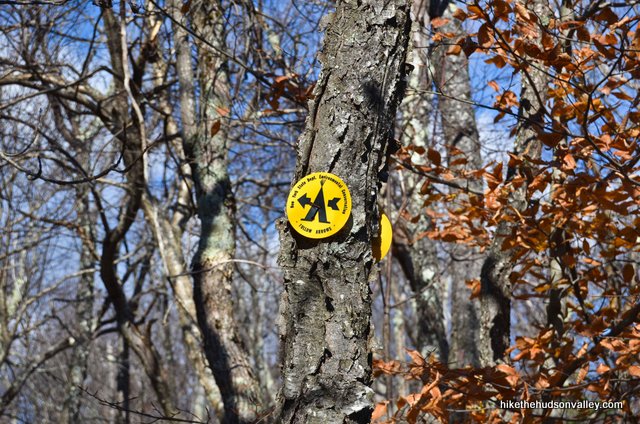
2. Notice the sign telling you that you only have 1.5 miles left until Giant Ledge? Woo hoo! You’re already almost there! Kind of. Sign in at the register to make sure this trail gets credit for your visit. You’ll be following those yellow blazes for the next .8 miles or so.
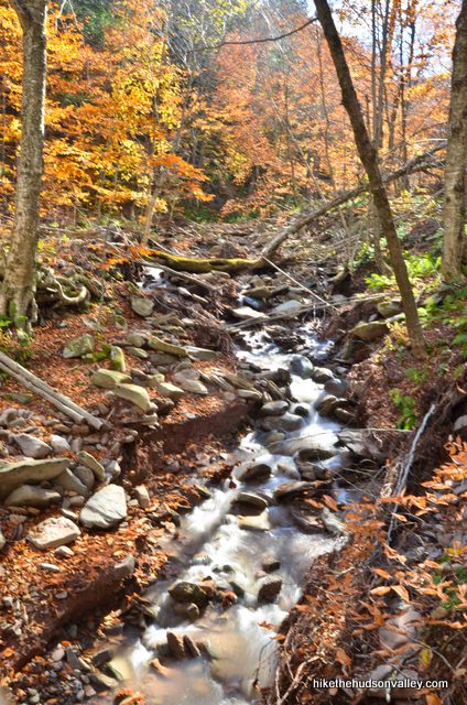
3. In just a moment, cross a wooden footbridge that goes over a picturesque stream.
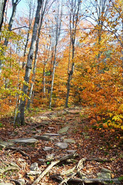
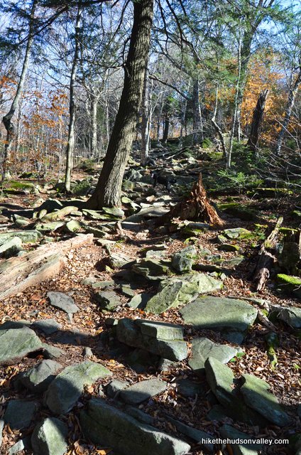
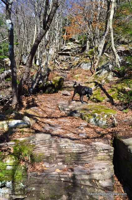
4. Has anyone ever told you that this hike is easy? They lied. It is Catskill Easy, but not regular-world easy. Over the next .7 miles, you’ll climb 725 feet over often-rocky terrain. Next stop: junction with the blue-blazed Giant Ledge-Panther Mountain-Fox Hollow Trail. It took me twenty minutes from the footbridge. See you there!
5. Did I mention this section is not easy? Just wanted to make sure we’re clear on that point.
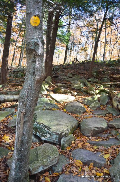
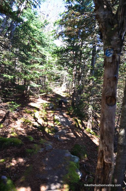
6. At the top of a steep section, the trail makes a sharp left, and then, right in front of you, you’ll see the trail junction with the blue-blazed Giant Ledge-Panther Mountain-Fox Hollow Trail. Turn left here to follow those blue blazes all the way to Giant Ledge. Only .75 miles to go!
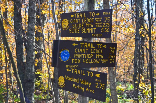
**UPDATE September 2018** Take a moment to pay special attention to this junction, locking it into your memory for your return trip to your car. Apparently, it’s a common mistake for hikers to accidentally take the Blue Trail from here when they’re coming back down the mountain, rather than retracing their steps on the Yellow Trail back to their car at Giant Ledge Parking Area. Don’t let that happen to you! (And thanks for the heads-up in the comments, Stav! Hope your experience can save others from making the same mistake.)
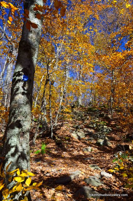
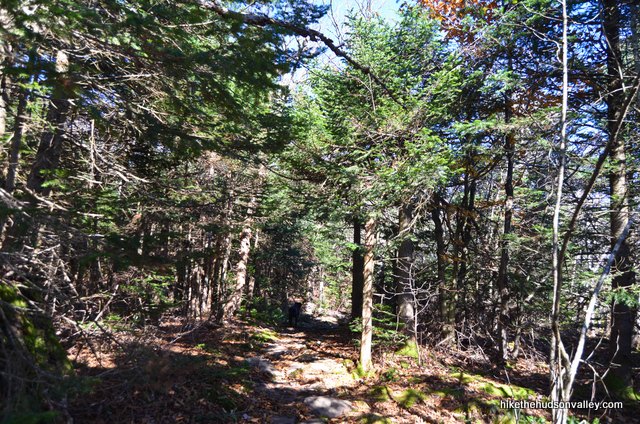
7. Over the next .75 miles, you’ll climb another 410 feet on the Blue Trail. Enjoy! You may also find some wet sections here, where you’ll have to hop around the puddles. Good thing you paid the extra twenty bucks for the Gore-tex shoes, right? Right?
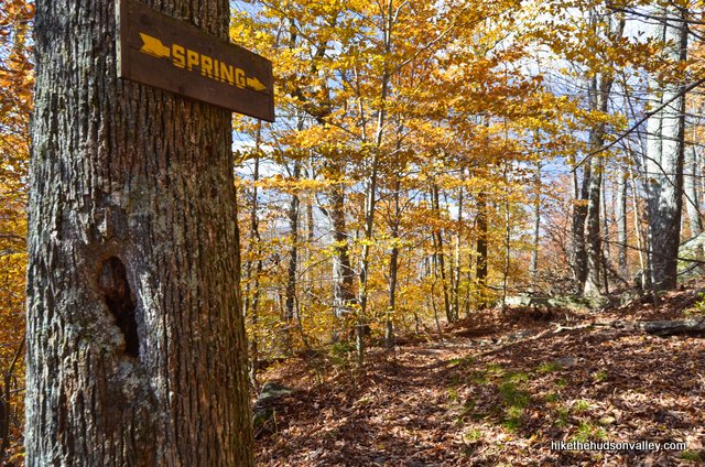
About 15 minutes after the trail junction, you may notice a side trail to a spring splitting off to your left. Just ignore it and keep heading straight. Unless, you know, you need water and you brought a purifier. In that case, you’d probably want to check out the spring.
8. Immediately before the first ledge, you’ll see a yellow campsite marker pointing to the left. A short way down that trail, there’s a nice, spacious campsite. There’s a bigger campsite a few minutes down the trail, too. If you’re not planning on staying the night, my apologies for wasting your time with this paragraph.
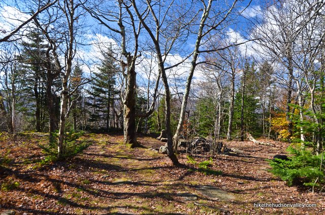
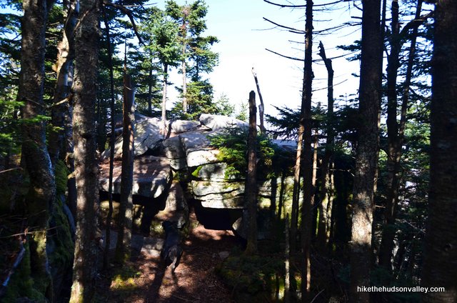
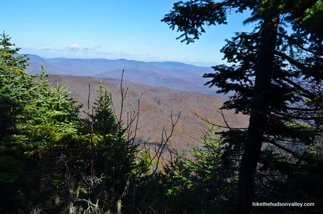
9. Just past that campsite marker, keep an eye out on your right for the first ledge. Hell-ooo! What a view. If you can find a spot here to relax and soak in the view, you might very well want to make this your final destination.
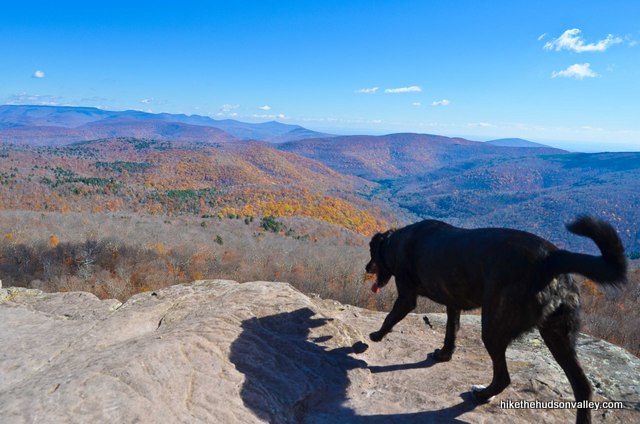
Careful at the edge. One step too far, and this really will be your final destination. Like, ever.
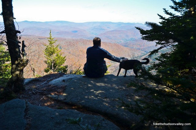
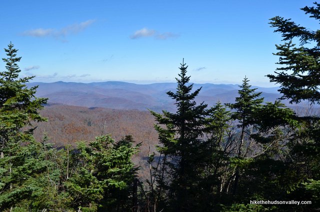
10. After you’ve had time to enjoy the view, if you decide you’d like to head back now, by all means, do it. You’ve seen the view at Giant Ledge – it’s really only very slightly different from the next four ledges. They all look out in the same direction. From this first ledge, it’s .8 miles down the Blue Trail to the fifth ledge, with the others dotting the way in-between, if you want to add them all to your retinal collection.
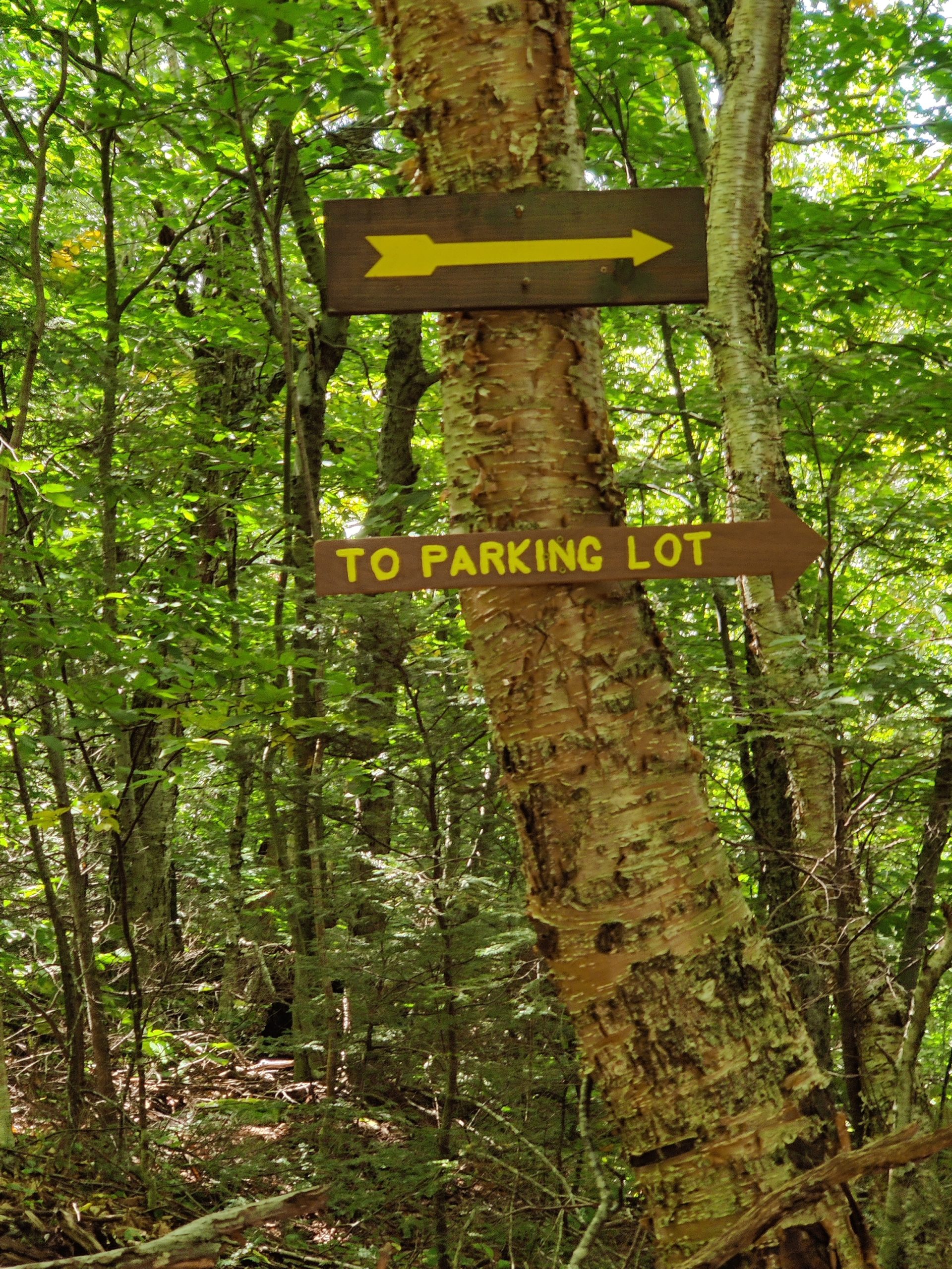
If you head back now, hope you enjoyed the trip! Retrace your steps back to your car – the only junction you have to worry about is the right turn onto the Yellow Trail about halfway down. (**UPDATE September 2020** Thanks to friendly hiker Denis for sharing this image of that junction in the comments!)
Be sure to eat some pizza tonight – you’ve earned it!
If you continue reading from here, I’ll assume you’re tackling Panther Mountain, too. If you’re doing that, see you at the next step, crazy person!
11. On to Panther Mountain! Did we finally ditch the Giant Ledge people? Man, were they slowing us down, or what? (Just kidding, Giant Ledge people. I’m just trying to make the Panther people feel cool, since they’re about to burn at least 1,000 calories to see basically the same view they’re already looking at. Just kidding, Panther people! You’re going to be so glad you did this.)
12. To climb Panther, keep heading straight along the Blue Trail, passing all five ledges at Giant Ledge, as well as the turnoff to the second DEC campsite. Immediately after you pass the final ledge, the Blue Trail drops 200 feet in the saddle between Giant Ledge and the Panther ascent. I hate losing altitude just to have to gain it again, too, but until someone installs a zipline here, this is what we’ve got.
13. From the bottom of the saddle to the summit of Panther, you’ll ascend 730 feet over 1 mile, following the blue blazes the whole way.
About halfway into that climb, you’ll notice the forest change. For the first time in my life, I marked a spot on my hiking GPS with the label “Smell.” Just as the trail reaches about 3,400 ft in altitude, you can smell the difference as you enter the alpine forest at the top of Panther. Everything just feels different – cooler, darker, more remote. That’s worth the price of admission right there, even without the very nice views you’re approaching.
14. About 15 minutes after entering the alpine forest, you’ll see a short little unmarked side trail to your right, heading toward some big rocks.
Carefully clamber on top of these rocks for your first Panther views. Not bad, right?
15. From that rock, it’s a flat .3 miles to the summit of Panther. You’ll pass some smaller views on the way there – don’t be fooled into turning around yet.
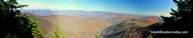
You’ll know you’re at the right spot when you reach a nice flat rock, right beside the trail, where you can sit and take in the wide-open view before you. There’s not a ton of room right here, so hopefully you left most of the crowds back at Giant Ledge. It took me less than ten minutes to get here from the rock that we clambered up for our first Panther view.

Here’s my best attempt at a panoramic stitch of the view:
Enjoy a granola bar or two, mentally (or actually) high-fiving yourself and anyone else in your crew for bagging one of the Catskill 3500’ summits. Nice work! Now let’s go home.
16. Retrace your steps back to your car. Take the Blue Trail back down Panther, back up the little saddle (dude, more uphill?) to Giant Ledge, then turn right on the Yellow Trail for the last .75 miles back to your car.
For the rest of the day, ask everyone you meet, “What size ledge did you climb today?” Then tell them how big yours was.
Directions
Directions to the trailhead:
From the New York Thruway (I-87) headed north from Poughkeepsie/New Paltz, take exit 19 for the Kingston-Rhinecliff Bridge, then head west (away from the bridge) on Route 28. Get comfortable – you’ll stay on Rt. 28 for another 30 miles. At Big Indian, turn left onto County Road 47 (Oliverea Road – sometimes also marked as Fire House Road). If you see the Peekamoose Restaurant and Tap Room on the left, that’s bad news – you just missed the turn.
After turning onto County Road 47, in 7.4 miles, you’ll come to a hairpin turn to the right, heading up a large hill. Parking for Giant Ledge is on the huge shoulder on the right side of the road, just before that hairpin turn. A wooden sign on the shoulder marks the parking lot.
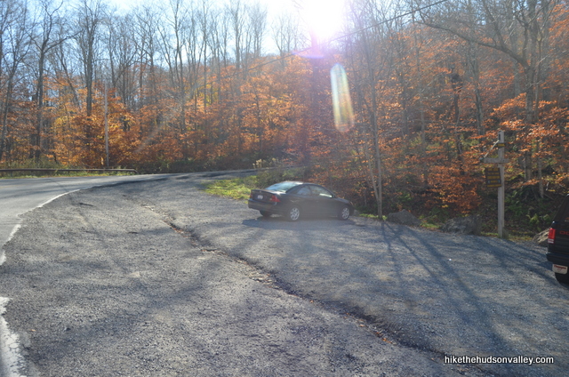
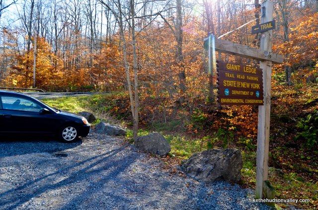
Pull off onto the shoulder and get ready to begin your adventure! You know you’re at a classy hike when there’s a porto-potty in the parking lot. Feel free to hit that now, too.

You can also get directions by checking out the Giant Ledge and Panther Mountain entry on the HiketheHudsonValley.com Google map.
Sorta nearby address for your GPS: The Slide Mountain Forest House is 3.7 miles northwest of the trailhead, on the same road. Coming from Route 28, heading southeast, just keep heading past the Forest House to the hairpin-turn parking lot described in the “Directions to the trailhead” section above.
Here’s the address for the Slide Mountain Forest House:
805 Fire House Rd
Big Indian, NY 12410
GPS coordinates of parking area: 42.02662, -74.40383 (Clicking will open in Google Maps or the Apple Maps app, depending on your browser/device.)
Resources & Interactives
Super-cool Google Earth flyover of hike route:
Google Terrain Map of hike route:
Related resources: If you’re looking for actual facts and/or useful information, visit these resources:
- The official DEC Slide Mountain Wilderness homepage
- A great write-up of the same hike from the venerable Catskillmountaineer.com
- The amazingly thorough Panther Mountain Wikipedia page
- Some cool information and pictures about a nearby meteorite hit from this bunch of big-brained Canadians
- The Catskill 3500 Club Panther Mountain page
- Some very nice winter pictures from the Peaks & Paths blog
Want to support trails in the Hudson Valley? Here’s one great way: Visit the New York-New Jersey Trail Conference homepage and click on Volunteer, Donate, or Shop! (Then you can volunteer, donate, or shop, depending on your mood.)
I can’t tell you the last time I’ve commented on a blog but I absolutely had to for this one! This read was super fun, engaging, entertaining, and knowledgeable. Thank you for sharing your expertise with the rest of us!
Thank you very much, Michelina! That was very nice of you to come out of commenting retirement to leave this one – much appreciated!
I’m planning to head over here this weekend. I was wondering if the trail could be hiked at night – I heard the ledge offers some good night time photography. If so, how safe is it and would I need to get a permit?
Hi Harris — so sorry I didn’t get a response to you sooner! You already know this now, but for anyone else stopping by later, no need for a permit, but definitely a need for a great headlamp. As long as you’re watching your step, it is not dangerous. But those cliffs would almost certainly be fatal if you fell off, so you’d need to be very confident in your vision and traction (the clifftops themselves are flat, so unless there’s rain or ice, slipping shouldn’t be a problem). Hope you got some great night photos if you made it out there at night, Harris!
Hi there! Thanks for this post!
I’m hoping to head up there in a couple weekends for the fall foliage and I’m wondering if it’s possible to park overnight in that parking area since I’m hoping to camp overnight. Are any permits needed? I’ve done quite a bit of googling and understand camping 150 ft from trails, developed areas and water, but I can’t find anything for the life of me about overnight parking. Any tips would be much appreciated!
Hi, Trevor! No need for a parking permit up there, you can park overnight. It will be very crowded up there on a nice fall weekend, though – try to show up early if you can to make sure you get a spot (or be willing to wait until some day hikers come back down). Hope that helps, and have a great trip!
Thank you for the fast response! Really appreciate it.
Mike,
Thank you for such an incredible guide. The details you provide are really helpful. And I love your writing style. Made me smile reading about the hike from a chilly day in Nashville. Do you have any recommended guides for mountain biking and/or road biking? I bought a couple of books at the Nest Egg in Phoenicia but wish I had a guide to cycling the Catskills written by you. 🙂
Thanks,
Kristin
You made my day with this comment, Kristin! Thanks so much for the kind words. I’m afraid I don’t have much to offer for biking advice, except to advocate for checking out the bounty of rail trails around here. The one by Ashokan Reservoir is beautiful, and the Dutchess Rail Trail to the Walkway Over the Hudson is awesome. And there are many, many more. Hope you have many more great adventures up this way. (And please bring us some BBQ next time you’re here!) 🙂
Thanks for this great info! Looking to hike it in the winter, any tips/posts for that? Also do you know where in the catskills this image was taken? Thank you!
That’s hard-core, Lena! I can’t take credit for this excellent post on winter hiking preparedness, but I did share it recently on the site’s Facebook page here. Lots of great info there! You’ll need spikes for sure — it’s very steep in spots, and quite rocky. And you’ll want excellent traction to be anywhere near those ledges. Also, that is a seriously beautiful photo! I don’t recognize the spot, but would love to know if someone else does. Hope you have a beautiful and safe adventure out there if you decide to go!
I know you warned me but I really wasn’t prepared for the crowds yesterday. It was total amateur hour. Entire groups take over each ledge so you can’t even get out for the view. We moved on to Panther and – as you said – very few do that part. It was peaceful and the views were amazing. By the time we turned back to the ledges, the crowds had left and we enjoyed the views. Is this hike worth it? 100% yes. But consider going in the afternoon if you want to avoid groups of 20+ cidiots.
Thank you for the amazing info! We’re staying at the Urban Cowboy and this resource is awesome for finding great hikes in the Hudson Valley area!
Did this hike for a 2nd time since last April, and its honestly my favorite Catskills hike! Some days I don’t have the time or energy for a 5-6 hour hike. Up to the Giant Ledge & back is a decent challenge with a breathtaking view. Took me an hour to get to Giant Ledge, then an hour back down.
Last April I made it up to Panther Mountain, but this time I turned back after Giant Ledge since the view from Panther is not too different if you’ve stopped at Giant Ledge. But for first timers, do both viewpoints!
The climb up to Panther is genuinely simple, the hardest piece of the climb is too Giants Ledge. For any individual who needs to know the reality.
Thanks for dropping by, Lana! I agree that’s it’s straightforward to head up to Panther from Giant Ledge, though it does add about 3.7 miles and 1,000 vertical feet to do so. I guess it’s in the legs of the beholder about whether that is simple or not. Appreciate you sharing your perspective here!
Hi there. The elevation of Giant Ledge is 3200 ft and Panther is 3720, making the difference in elevation only 520 ft. Consult a list of the Catskills “Highest Hundred” if you don’t want to take my word for it.
Hi, Shay! Thanks for providing those numbers, glad to see that they match the elevation numbers I provided above. Add in the 200′ saddle between Giant Ledge and Panther, and you’ve got an elevation change of about 710 feet on the way out (from the last ledge, down the saddle, and up Panther from the bottom of the saddle), then another 200′ to climb the saddle again on the way back. Until someone installs that zipline I requested, it adds at least 900 vertical feet to climb Panther. Totally doable and a wonderful climb! But it does add some exertion to climb Panther, too.
Mike,
Loved the honest write-up. You seem like the right person to answer this question:
My wife and I like to hike but prefer not to clamber up and down rock quarries where we spend all our time looking at our feet rather than out at the view. Got any good suggestions for hikes that take this into account? While we liked the Giant Ledge views, the rock scrambling made it barely worth the effort.
Bruce, I’m so sorry for missing this comment when you first left it! Yes, if you’re looking for huge payoffs with relatively flat terrain in the Catskills, you’d have a hard time finding a better hike than North-South Lake to Artist’s Rock and Newman’s Ledge. (You could even cut that hike a little shorter by turning around at Sunset Rock, and you’ll still have scored several huge views without having to do any scrambling or very serious climbs.) Hope this advice (belatedly) helps!
Hi! Thanks for the awesome guide(s). FYI I did this today and there was a nice sign pointing to the parking lot where the blue and yellow trails reconnect. It’s hard to miss on the way back do hopefully fewer people will get lost!
Thanks so much for the kind words and helpful photo, Denis! I’ve included it in the trail guide (Step 10) to help folks know what to expect on the way back down, along with a link down to this comment. Very much appreciated!
Hi, I was there today. It was awesome! I realized something new as well. They put some sort of gate to block off the wrong turn.
I was wondering if you had a more specific location for the parking. I can’t seem to find it on a map. I was able to find the road you said it was on, but I can’t find the hairpin turn you make a reference to. Thanks!
It’s close to Esopus Creek if you can find that on a map.
Just keep following Oliverea Rd to the Southeast on a map or click on the GPS coordinates he posted in the directions and it brings you right to it.
Hi, Jesse! I hope this feature does the trick for you — keep scrolling down in the “Directions” section above, to the part that says “GPS coordinates of parking area” in bold. Click the GPS coordinates there using your device of choice, and a mapping app (either Google Maps or Apple Maps) should drop a pin on the exact spot. Let me know if that doesn’t get the job done! (And thanks to James W for providing a good answer, too!)
Hey Mike. Did great ledge and didn’t plan on but did Panther mountain. Was one of those days, you know you head out early to do Anthony’s nose, only to find out still closed ( FYI mental note) thought NY was unpaused!! Didn’t want To waste time….. so we decided to head to great ledge was on the hit list. Beautiful day!!! So we went for it. Amazing hike. Not crowded at all. Maybe had to wait at a few of the ledges nothing too bad. You were right. Beautiful view. Hike to panther one word muddy. Muddy. Muddy. ;maybe 3 words). Your directions spot on as always. Managed to find some ice cream at panda parlor on oUr way back home. Perfect end to great hike. Thanks again for everything you do!! Hike the Hudson
Thanks so much, Cara and Steven! Glad you had a great day out there! Much respect to your contingency planning skills 🙂
I was gonna do this hike with a couple friends. We won’t be able to do it early, how are the views more towards sunset? Is it worth it?
Hi, Aidan! The views should be gorgeous at sunset (or any other time, really), but since the ledges face east, you won’t have a direct look at the setting sun. Will still be an amazing place to be at that time of day, as long as you have plenty of good flashlights or headlamps for getting back down the very steep and rocky trail, which will be treacherous going after dark. Hope that’s helpful – happy adventuring to you and your friends!
The crowds go away in the afternoon. So, for me, that’s the best time to do this hike.
Thanks for the tip! Did this hike yesterday, it was always on my to do list but the crowds have kept me away for a few years. It was well worth it, spectacular views from the ledges. I was glad I went up to Panther, even though the view there plays second fiddle to the ledges, just a bit too many trees for that classic wide open view. However, the trail to Panther was wonderful! Love that evergreen feel, and so many huge rocks with low hanging fern draping over the side. Great stuff.
Excellent, Lou — glad you had a great day out there! And yeah, I’m with you on the Panther view. Still worth it, but not quite as wide-open as we’d like it to be, right? Somebody should move one of the ledges up there 🙂
Thanks so much for this write up! We are not avid hikers but were able to view all 5 great ledges, summit Panther Mountain, hike the woodland valley trail, and explore an unmarked trail with your help! The views were incredibly worth it.
However, we did have one unfortunate circumstance. My phone fell out of my bag on the third ledge and managed to bounce just right and tumble over the edge. I wasn’t very close to the edge at the point, so just a reminder to everyone to make sure your belongings are secure even if you aren’t close! Does anyone know if there is an opportunity to locate items which have fallen over the edge? From my research it doesn’t look like a trail runs close enough to search for them. Thanks for your help!
Oh no, Monica — I’m so sorry to hear that! If you’re going to drop a phone somewhere in the Hudson Valley, over the edge of Giant Ledge has to be somewhere near to top of the list of most unfortunate places.
My initial thoughts are that the phone is lost forever. If you REALLY wanted to mount an expedition, you could attempt to use the Google Map in the “Resources” section above — if you click in the top-right corner of the map (on a phone, sorry to rub salt in the wound), the Google Maps app will open, showing your location against that map, with all of its pins. I don’t think I’m seriously advocating doing this, but you COULD use that map to bushwhack your way toward the third ledge from the area beneath the ledges, heading toward the pin marked “Ledge three”. If you look at the pin marked “Blue Jct,” you’ll see a trail that runs under the ledges, though not directly under — if you started your bushwack from that trail, it COULD possibly be doable, though I have no idea what the terrain is like down there. If you got close to the “Ledge three” pin, then maybe you could call your phone, or use Find My iPhone or something similar, to make it ring, assuming it’s still functional (and you have cell service, and the phone is somewhere that can be reached from the ground), which seems like a dicey proposition, since I’ve shattered a phone by dropping it from pants-pocket height. If you REALLY want closure and to feel like you’ve done everything you could do, that’s probably how I would tackle it. Please be careful if you try anything like that — I’d hate for anything worse to happen from here. Hope that helps, and let us know if you ever do find it! Good luck!
Is there any way to do this hike from the Woodland Valley Campground, and if so, are there any special maps I should bring
Hi Jonah — it is indeed! (And sorry for my late reply!) If you look at the Google Terrain Map in the “Resources” section above, you can see the trail that leaves from the pin marked “Blue Jct,” which heads straight down to Woodland Valley Campground. For the best maps of the area, you can’t beat the official New York-New Jersey Trail Conference maps for the Catskills: https://www.nynjtc.org/maps/catskill-trails-map
Is attempting this during rain a horrible idea?
yes. The first part of the hike is fairly easy, but if you head to Panther, the rain will definitely be a pain.
Jim, I agree with Dave — the trail is quite steep and rocky, and will be extremely slippery in the rain. Would be much better to go when it’s dry. Good luck out there!
Mike, great work! Thanks for taking the time to help us out. I will be sure to pay it forward in many ways. Heading out there Saturday, will do all the good deeds. Let ye know how it goes.
Thanks for the guide! We found it very useful when hiking Giant Ledge this week. We enjoyed the hike very much but I did want to add/ warn travelers that we got lost on our way down. When we arrived at the cross point where the blue trail meets the yellow trail, we took the wrong path down. I am not sure how it happened, we felt it was the only possible option, but we were wrong. After walking that path for about 15 minutes, we noticed there aren’t any yellow trails marks around and that the trail looks different than what we remmembered walking. When we started walking back we met another traveler who also took this path, and was convinced it’s the right trail. We continued with him, just to find he was wrong. We walked this path for about 45 minutes, it goes around the mountain and hits the road at the end. From there we had to walk another mile on the main road to our car. It was a very unpleasant experience, and from talking to other people I undersatnd that it happens quite often. Keep that in mind when going down, and make sure you chose the right path! Happy hiking!
Stav, so sorry to hear you had that experience! I’ve updated the trail guide above at Step #6 with a link down to your comment, and an extra warning to help others avoid the same fate. Hope that helps cut down on the number of unhappy hikers out there! Really appreciate you taking the time to post your comment, and helping to keep others from doing the same thing.
Thank you, Mike!
hi!
just wondering how many miles the hike is round trip?
Hi, Michelle! The hike documented above is a 3.2-mile roundtrip, or 6.9 miles if you add Panther to the mix. For all the hikes documented on this site, you can find the hike’s key stats in the right-hand sidebar (on desktop) or right at the top of the page, just under the banner image (on mobile). Hope that’s helpful – happy adventuring!
This is great! I’ll be heading out to Giant Ledge tomorrow with a friend. My first time I have gone there. Awww…
How was it? Thinking of going out next Saturday, maybe staying at Woodland Valley Campground. Hoping it’s not too crowded this late in September…?
Boy! I must say the write up oddly encouraged me to take up this hike 😀
While searching for hikes & trails in Catskill, landed on this page and it made sure I hike Panther Mountain (Yeah I know – Crazy person I am)
Thanks again – thoroughly enjoyed your writing!
While we loved (and shared) this terrific post. The line “if you see the Peekamoose Restaurant – that’s bad news….” although meant as a directional indicator, ……our restaurant is never bad news. We welcome hikers after a well-spent day in our mountains! http://www.peekamooserestaurant.com
– Marybeth Mills, owner, Peekamoose Restaurant.
We love Peekamoose! Our go to every time we are staying overnight in the area
We love Peekamoose!! We go every year when we visit the area. We once drove over an hour each way just to eat there again!
Did Giant Ledge today with our dog. It was a perfectly challenging hike for a couple of people who are in moderate shape. The rocky ascents were tough and we almost turned back, but I’m glad we didnt. Beautiful views and fun to push through. Just wanted to note that it felt like more than a 5/10, and the rockiness was especially challenging for our lab, who slipped a few times.
I’m very interested to know who built this trail and when? Quite an undertaking.
Hi Rebecca! After considering your comment and looking back over some of the other hikes I’ve rated as a 5/10, I agree with you — I just goosed this one up to a 6/10. Thank you for the feedback! (As far as the building of the trail, I don’t know the answer there, but maybe someone more knowledgeable than me will stroll through the comments here and share their wisdom with us.)
Awesome, Mike – thanks for your responsiveness. The 6 makes me feel a little less tired this morning. 🙂 And thanks for providing such a great resource. We’ve used it several times, and have pledged to use it more!
I train and exercise regularly and I felt challenged physically with some parts of the climb. I felt a little defeated but now reading other experienced hikers were challenged as well, it made me feel better. Thank you for writing about watching for the correct trail on the way down, as I can totally see where this can happen, had I not known to keep an eye out! Lastly- the Peekamoose ROCKS! 🙂
Hi – Can anyone confirm whether there is spring water coming out of the pipe? Do you need to purify that water first before drinking? Thank you.
Pingback: The 67 Most-Instagrammed Locations in the Catskills - Kingston Creative
What an incredible hike! My friends and I went around 10am on a Tuesday so the trail was nice and quiet, and we had the ledges all to ourselves. One thing I cannot stress enough: bring some form of bug repellent. Seems obvious enough, but we spent our time up top hopping from ledge to ledge to avoid being swarmed. Not sure if we just manged to hit a particularly bad day (we did go just after a few days of rain) but we definitely could have planned for that a bit better! Also, nearly stepped on a little snake on the way down- the lil guy went on his way with no bother but just be sure to keep an eye on where you’re walking! All in all, this hike more than deserves those 5 cameras.
Pingback: Bovina and Andes, NY (21/52) – 52WeekendsNY
Pingback: Bovina and Andes, NY (22/52) | 52weekendsNY
Thanks so much for the sharing! The article and comments are awesome and super helpful.
We plan to have a day hike there this weekend. But the description of hiking the Parther Mountain scared me a little bit:) Since my husband and I are definitely not “super-crazy hiking goons”, I am a little hesitate about whether should we do the Parther part. How would you rank the difficulty if comparing the part of Parther trail to “Cascade and Porter” trail and “Esther and Whiteface” trail in ADK (we finished in a August’s weekend)? If the Parther part is even difficult than that two, we will definitely reconsider about hiking it this time. Thanks so much!
So I plan on hiking this mountain in a couple of days, but was wondering does the easier trail still have the same views that these pictures are showing on this page?
Hi Sienna! If you don’t climb Panther Mountain, you’ll still see everything up to and including Step 10 above. Enjoy the hike!
Thank you so much for this write up. I just did this hike with my friend yesterday (We are Panther People! lol) and agree we found that final scramble up Panther more than a little challenging (and also the climb back up to the ledges on the way down) but that final view from the top of the world really did make it worth it. My favorite views that day were from the top of the large rock near the Panther summit and that final small ledge. It seems someone has taken the Panther Mountain summit marker so we were unsure we actually hit it until we came down and checked our maps and trail guides. Thanks for the awesome write up and confirmation that Panther people are actually the coolest. We thought so, but you helped us be sure!
We camped in the area last summer, but didn’t manage to get any hiking in. This year we did Overlook Mt. and this here great big ledge sucker. Although we went on a Tuesday, the parking lot was already full. We had to park below it in the grass. Let me first say that we did this as a family with my wife (not a hiker), my 16 year old son (plenty capable though not 100% into it), my 12 year old son who was not at all interested and has ankle and weight issues…he bailed just before the yellow/blue split…my older son and I went the distance. Also my 8 year old daughter who played along, but was more than happy to bail out with Mom and her brother. Though the yellow section is less than a mile, it’s pretty dang rocky and has several steep sections. It seemed long to me because we kept stopping. The first .5 mile of the blue trail is dead flat, but towards the end there are a couple nasty steep sections with much larger rocks. I’d rate it higher than a 5 (especially if you have non hiker types with you), maybe if I had gone solo I’d feel different.
I plan to come back by myself in the fall and do Panther plus.
One additional note: a bridge on 28 a few miles before you get to 47 is under construction. Follow the detour and you end up ON 47…so no need to look fr the turn, you’re already there.
Hey there! Great trail description!
Does anyone here know if there is an easy-to-find campsite at the beginning of this trail? A few friends and I are planning to get up to this area in the evening, camp overnight, and then hit the trail first thing in the morning. Would be great if we didn’t have to do too much routefinding/hiking in the dark.
Any thoughts appreciated!
Norm
Have a great trip, Norm! I’m afraid I don’t know of any right near the parking area (never looked), but I’d bet there are some tucked away back there. As long as you’re 150 feet from the trail, stream, and road, you should be okay. This page gives some good tips, and links to some camping maps for the area: http://www.dec.ny.gov/outdoor/41282.html
Hope that helps – enjoy it out there!
Thanks for the insight dave!
I think we’re planning to keep going all the way to foxhollow then come back. Do you know if the blue blazes remain easy to follow on the North side of Panther Mountain?
Thanks again!
Norm
planning on taking a hike next week possibly nov 23. how are the foliage this time of year?
Hey — I went a few weeks ago, and most of the leaves are down at this point. However– the views are still amazing.
Here’s a nice shot from three days ago that someone posted to the site’s Facebook page. Still beautiful, but the foliage is all down. Have a great hike!
Okay so let meh ask you this: Do you think that Giant Ledge/Panther and Wittenberg should be separated by 1 point, difficulty wise?
Thanks for the compliment 1 do like to liven things up whenever possible. Have a good day. I enjoy your site.
Hi Jay — I clocked Wittenberg as .3 miles longer than Panther, with 531 ft. more ascent. I gave Wittenberg a 10/10 for difficulty, and Panther a 9/10. I could see the argument for knocking Panther down to an 8 (since we’d have to move to the Spinal Tap scale to make Wittenberg more difficult), but it really just felt more like a 9 to me. Maybe it was climbing the saddle on the way back that did it. Which is all a long way of answering: Yes, one point seems about right to me, but I respect that others will have differing opinions.
The hike up to Panther is fairly easy, the hardest part of the hike is to Giants Ledge. For anyone who wants to know the truth.
Thanks for livening up the comments section, Jay!
Just did this hike today and I’m really confused as to what mountain Jay hiked below. The portion of the hike from The Giant Ledges up to Panther was definitely a tough climb and I felt like it had steeper areas than the way up to the ledges.
The hike to the Ledges and back probably would have been too short for the amount of time it took to get out to this spot, but luckily since it was late in the fall and a little cold, we had the place pretty much to our selves until we started heading back from Panther Mt.
The trail is super easy to follow, but challenging. The saddle between the Ledges and Panther was fairly deep and you definitely paid for it on the way back.
The views were outstanding, even though it was overcast, the mountains in the background gave off a blue tint, and were just stunning.
I definitely agree that heading all the way up to Panther is worth it, but it also 100% makes this hike a 9 out of 10 difficulty.
Thanks so much, Dave! I meant to respond to Jay’s comment when he left it — I re-read the trail guide at that time, and still felt that it accurately depicted the hike (as I remembered it), and decided not to make any changes. Your comment seals the deal for me.
So glad you had a great day out there! Hope you enjoyed a well-earned, larger-than-usual dinner tonight.
I was on the trail today also with my wife and 18 month old son. What a great day especially in November! This was our first trip to the Catskills and it did not disappoint! The 3 mile up and back is the sweet spot for me, especially since I carry the lil guy on my back.
There were some steeper parts that required a short “breather” on the way up but nothing too crazy.
And the views from the Ledges were amazing!
Well worth the trip and I recommend it for anyone looking for a short hike with a great payoff!
I’m certain your write up is incorrect concerning which sections are difficult.
The most difficult part of this hike is getting to Giant Ledge (with the rocky sections you describe being the accurate part).
But, Panther is a relatively easier hike from Giant Ledge, it’s just that you’re already tired out from the steep rock ascents associated with your initial trip up to Giant Ledge. It’s not a long distance to Giant Ledge but there are steep sections which make it more on the difficult side of moderate. Panther Mountain has some steep sections as well, but it’s not as bad as the trip to Giant Ledge. Not sure why Panther would be 9/10? Panther should be 5/10 where as Giant Ledge should be 7/10 for the steep rocky sections that might hinder some older or less fit folks.
Meaning once you get to Giant Ledge, Panther is a 5/10 FROM Giant Ledge. But your review makes it appear that Panther has steeper, rockier traverses than does Giant Ledge, not true. The initial trip up to Giant Ledge is more steep and rocky.
Hi Jay,
Dave’s comment above just brought me back to your comment — I’d meant to respond when you left it, apologies for not getting back here until now. After reading this guide over again, it’s my opinion that it accurately depicts this hike to the best of my abilities (you know, given what they are). I can see your point about the steep, rocky sections in the beginning of the hike — but to me, doing a 3.2-mile hike with some steep sections warrants a 5/10, while tacking on an additional 3.7 miles and 1,000+ vertical feet appropriately nudges that difficulty to a 9/10.
Thanks for taking the time to post your thoughts here – I want to encourage people to poke and prod at these guides to help them be as useful and accurate as possible.
Happy adventuring!
Mike
Actually reviewing my post, Panther is more like 3/10 from Giants, and Giants Ledge 4/10 from the lot, making the entire hike more like 7/10. But 9/10, really?
Wittenberg would be more like a 9/10.
The idea of an “out of 10” difficulty rating scale is a wee subjective no matter how you slice it (even though I used science!). We’re within two points of each other, so I’m comfortable calling it a day. (I gave Wittenberg a 10/10, so my scale is just slightly wimpier than yours.) Thanks for your input and follow-up, Jay!
If you happen to be a geology geek, this may be of interest to you…
http://hudsonvalleygeologist.blogspot.com/2013/05/panther-mountain-impact-structure.html
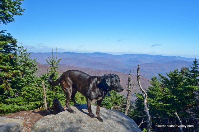
I noticed you had a dog (labbie?) with you on this hike. How was it for him/her? I’m looking for a good hike with my labbie in the Catskills, but from my experience many of the peaks have rock scrambles that present a challenge for dogs. I haven’t done giant ledge or panther before so any input on your dog’s experience would be helpful. Thanks!
A friend and I did this most awesome trail a few weeks ago. I love your humourous take on it. Had me chuckling while reading as I retraced every single rock…and every little scramble up and down that blasted path. Absolutely incredible views from Giant and Panther. Proud to say…I’m a Panther person! We had a great time, saw a LOT of butterflies enjoying the views and had lunch on the rocks at Panther’s summit before heading down. I love your idea of a zipline over the col!!! Yes, that would be a great alternative. I too hate losing altitude just to climb back up…Some of those rock scrambles were quite fun as well. But oh my if that view wasn’t worth every single step. No matter what peaks I have climbed, and what will be coming in the future, this is definitely one of the best hikes I have done, including my section hikes of the NY Appalachian Trail. The stop at the spring is worth it too for some ice cold spring water on a hot day. It was absolutely freezing, and after some filtering with my Sawyer Mini to lose the potential cryptosporidium and giardia beasts….the BEST water I’ve had yet out in the woods.
Catskillblogger, I hope you’re all healed up after your tumble! Definitely give this one another go when you feel ready to…You won’t regret it and as Mike said…a guaranteed better time the second go around 😉 Hike safe!
I attempted this hike this past weekend. I wish I had read this first…lol. I’m not an experienced hiker, and only made it about halfway before I slipped and bashed my face into a rock and had to turn around and go back. My only few of the day was the Margaretville ER.
Oh no! So sorry that happened! Must have been a very scary experience. On the plus side, if you ever come back here, you’re pretty much guaranteed to have a better experience than you did the first time. Hope you’re feeling better and all is well!
This is great! I’ll be heading out to Giant Ledge tomorrow with a friend. My first time. Awww…
Ok, Panther people…loosen the attitude. We only have a few hours. 🙂
Dawn, your comment cracked me up (cracked me up eight months ago, too, when I should have replied). I hope you had a great visit!