Background
If you find this free trail guide useful, please provide payment by picking up at least one piece of litter on your hike. Cha-ching! Thanks for being awesome! (And here’s a quick primer on Leave No Trace, too, to help us keep the trails nice and fresh for each other.)
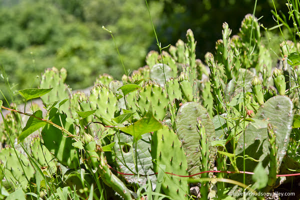
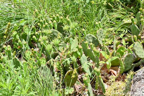
Background you can feel free to skip: Just when you think that making a concerted, multi-decade effort to see all the best hikes in (and around) the Hudson Valley will cease to yield cool new stuff to see, you find out that there’s a wild cactus grove in northern New Jersey.
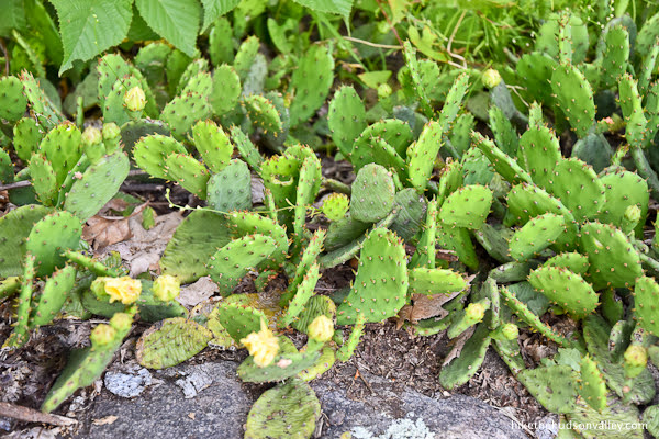
These cacti must know that they could live somewhere warmer. But like us, they choose to live here anyway. These prickly pears and us – we understand each other.

After stumbling upon this spot, I’ve found that there are several other places in and around the Hudson Valley where you can find wild cacti. Was I just not noticing them before? In any event, Cactus Ledge at Ramapo Valley County Reservation in Mahwah, NJ, earns its name just the way you’d hope, offering hikers a chance to feel, just for a moment, like they’re in a Roadrunner cartoon.
Watch for falling anvils! And also, watch for views of the NYC skyline.
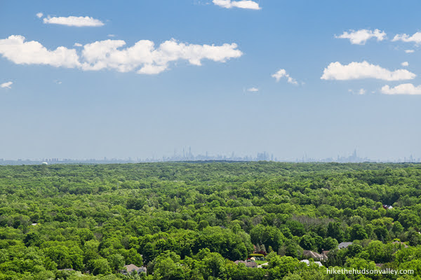
Are there other places where you can look at a wild cactus grove and the Empire State Building at the same time? Maybe! But I sure don’t know any.
This hike offers many other highlights, including a stroll around a beautiful lake, a pulse-quickening climb on well-marked trails, and a beautiful view from Hawk Ledge that immediately precedes the main event up at Cactus Ledge.

You can see all of this by doing this hike as a three-mile up-and-back affair (to Cactus Ledge and back), with a total ascent around 475 feet.
My family enjoyed the Catcus-Ledge-only version of the hike so much that we came back here to do the whole five-mile Vista Loop, which continues from Cactus Ledge to see several more interesting sights, including a waterfall, a dam, a reservoir with a nice rocky overlook, and another viewpoint with views that would be more impressive if you hadn’t already gotten spoiled at Cactus Ledge.

Doing the entire loop adds about 2 miles, and doubles the ascent to around 948 feet.
Whichever route you choose, you really can’t go wrong at Ramapo Valley Reservation. The only mistake you could make would be not visiting this place at all.
Also, can it be our thing to do your best Roadrunner impression when you reach Cactus Ledge? I feel like that should be our thing. Meep meep!
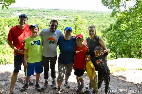
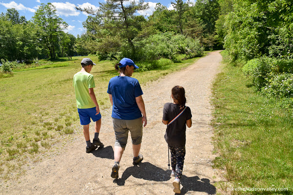
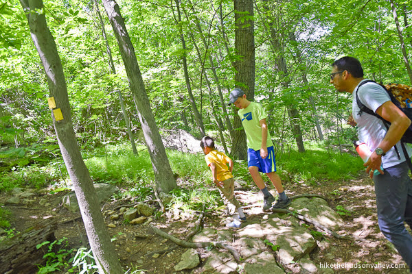
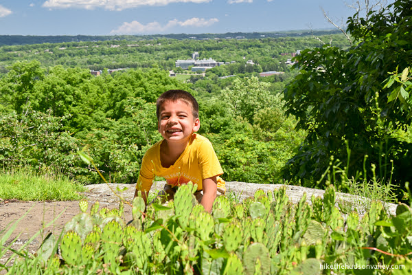
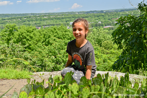
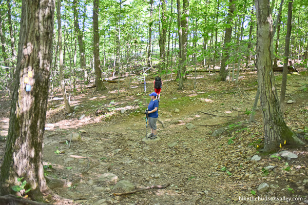
Personal note: A friend from my hometown (Chadds Ford, PA — home of the Fightin’ Suburbanites) moved to NYC many years ago – though we hadn’t reconnected outside of occasional Facebook comments, I wondered if he was still hiking like he used to do in our old Boy Scout days.
Then one day, he reached out randomly to let me know that his family had been using the trail guides on this site for many years. To make it even better: unlike my own family, Neel’s family thinks I’m funny!
We decided to get our families together for a hike, with the promise that I’d include Neel and his family in the resulting trail guide.
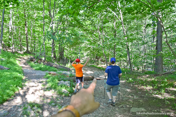
Here they are! If you ever get a chance to go hiking with this family, you should definitely take it. This crew is awesome.
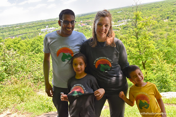
They even surprised me by showing up in Hike the Hudson Valley T-shirts!
This trail guide is dedicated to Neel, Sarah, Milli, and Ehan. Thank you all for being so awesome, and for making this hike such a memorable experience. Y’all are the coolest.
Other points worth mentioning:
- There’s a great, free PDF trail map for Ramapo Valley County Reservation from the always-awesome New York-New Jersey Trail Conference. The yellow Vista Loop on that map is your huckleberry, and is described in detail below. (The map is really all you need, but since you’ve read this far, I’ll go ahead and write the rest of the trail guide. Seems rude not to.)
- This should go without saying, but PLEASE don’t touch the cacti. While they don’t all have obvious spikes, they’re covered in tiny, hairlike spines that could require parents to use their teeth as tweezers to pull them out of their kids’ hands. Don’t ask how we know.
- When we first visited this hike on June 4, the cacti had little red buds on top.
 When we came back on June 19, the buds had turned into beautiful yellow blooms.
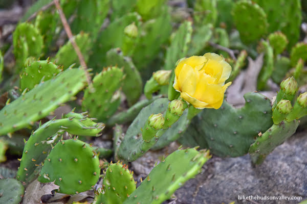

Don’t know if you’d really need to plan your trip around these flowers – this hike would be beautiful at all times of year — but if cactus flowers are your thing, late June is the time to see ‘em! - On our second visit here, partway up to Hawk Rock, some friendly descending hikers warned us that a bear had been spotted somewhere up the trail that day. We continued on and didn’t see any bears – in fact, I’ve never seen one while hiking – but they’re certainly around. The NY DEC has a nice, succinct page on what to do during a black bear encounter. (Much better to read that page now, so that the bear doesn’t have to wait for you to Google it once you’re in the woods.)
Trail Guide
Bonus unsolicited advice: Don't depend on having cell service in the woods - it can be spotty out there! Download this trail guide to your phone before you head out. (It's easy to do on iPhone and Android.) May your connection to nature be strong, even when your connection to the internet is weak.
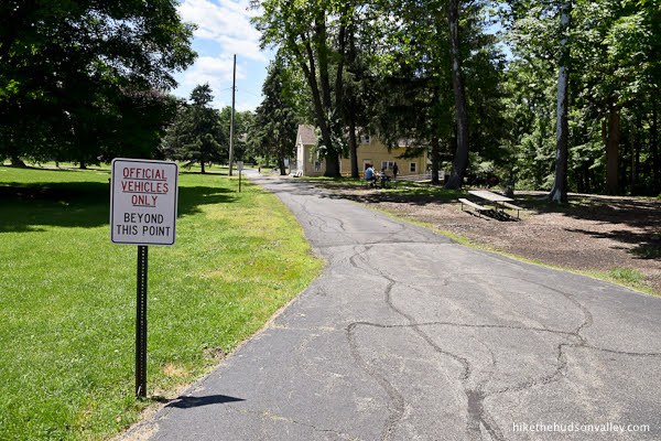
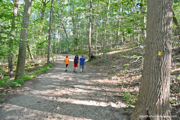
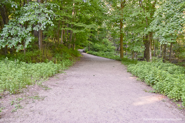
1. From the giant parking lot (see “Directions to the trailhead” below), turn to face the woods, with your back to Route 202 (Ramapo Valley Road).
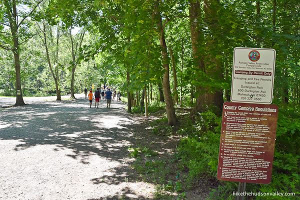
At the edge of the parking lot, you’ll see a kiosk with a wide trail heading into the woods. You CAN start here, but there’s a more direct approach to the left.

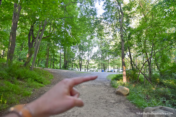
See that yellow building waaay over to the left of the parking lot? That’s the comfort station (it provides comfort to those who need to go to the bathroom).
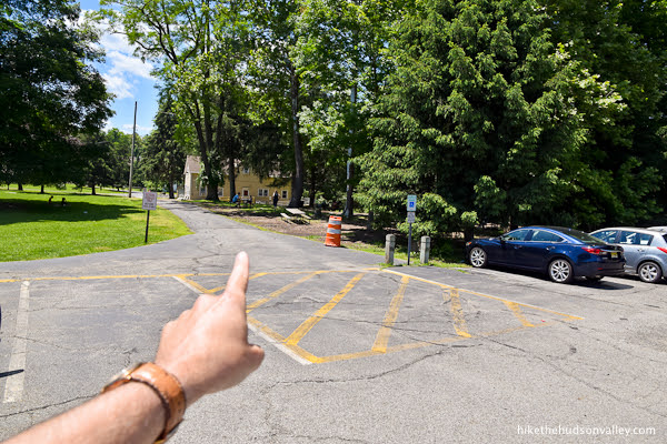
Head toward the comfort station, beyond the “Official Vehicles Only Beyond This Point” sign, which should really say, “Official Vehicles and Hikers — and Maybe Dogs, Too — Only Beyond This Point,” but that might require a larger sign.
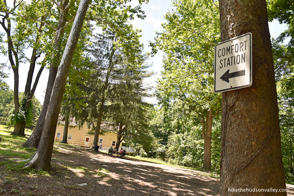
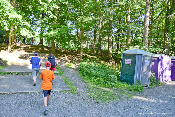
2. Just before you get to the comfort station, turn right to head down the steps. (If you need to seek comfort first, we’ll wait for you at the steps. Take your time.)
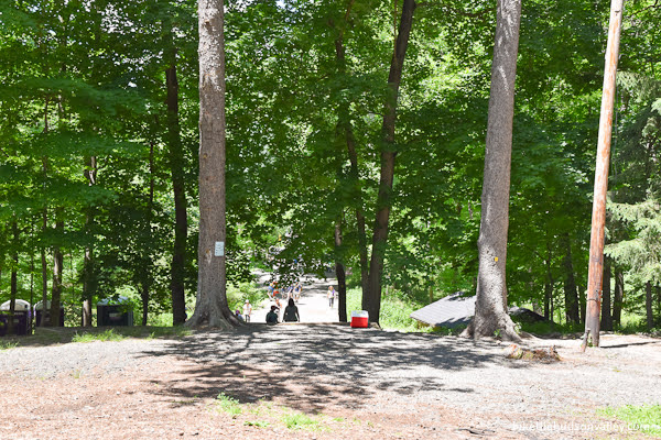
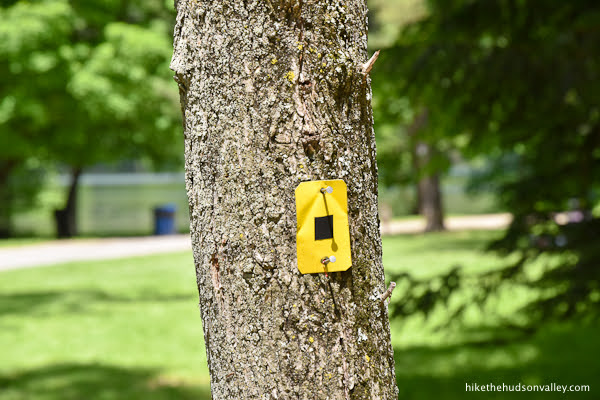
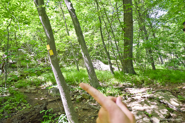
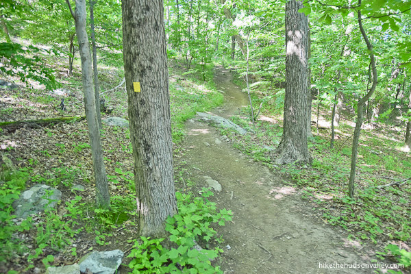
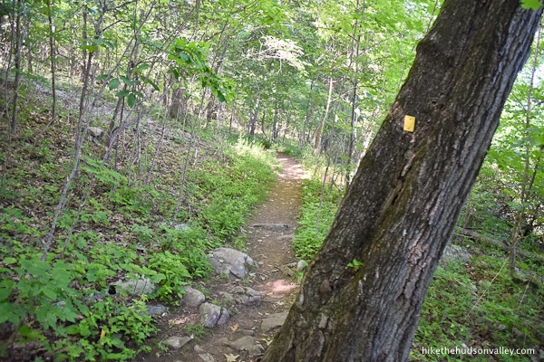
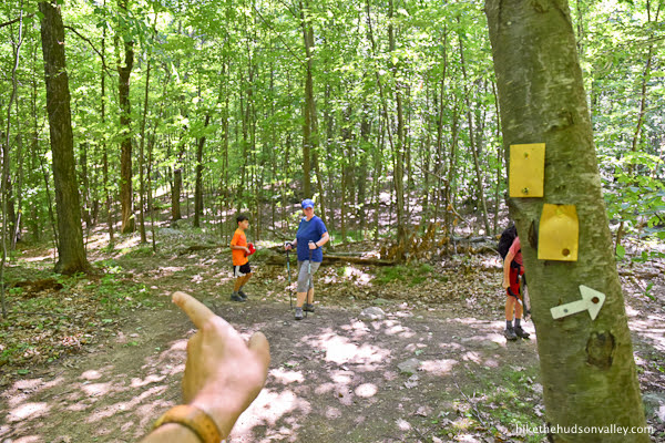
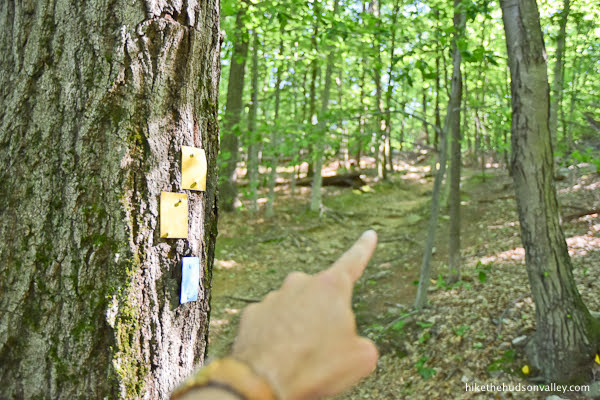
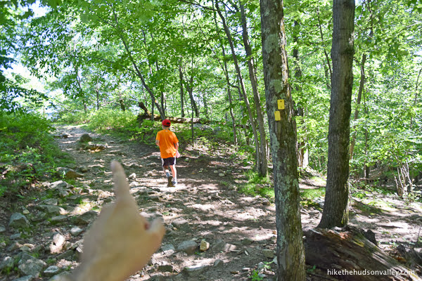
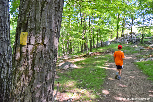
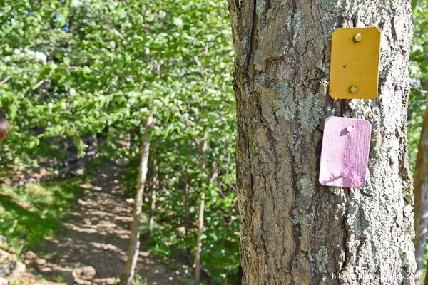
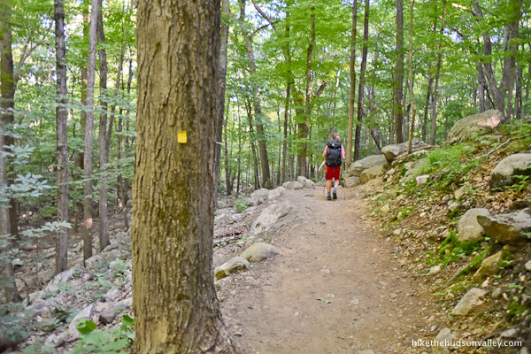
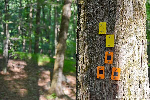
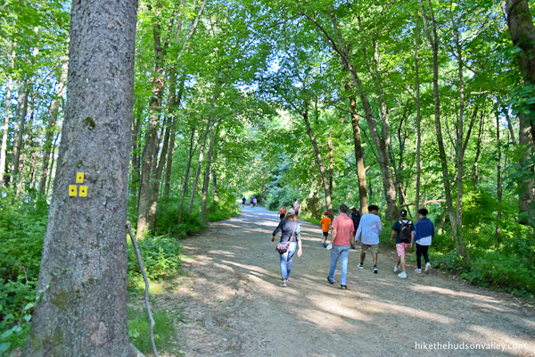
You’ll pick up your first trail blazes of the day here – yellow with a black spot in the middle.
At the bottom of the steps, porto-potties! So many sanitation options here — this hike is a comfort-seeker’s dream!
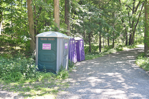
If you need some comfort today, seems like the yellow comfort station 100 yards from here would be a better option. But as Paul Simon sang about porto-potties: “I do declare, there were times when I was so desperate, I took some comfort there.”
Or something like that. Moving on!
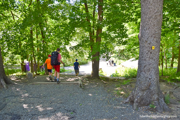
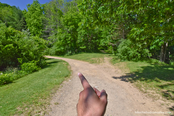
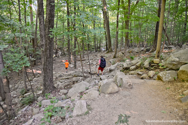
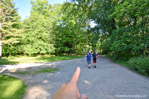
3. Follow the wide Yellow/Black Trail (which is more like a road) straight from the bottom of the steps.
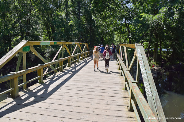
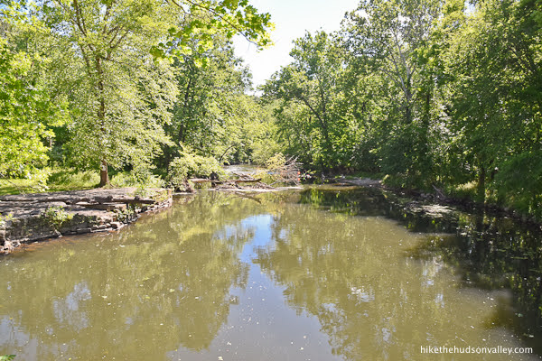
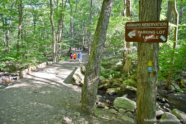
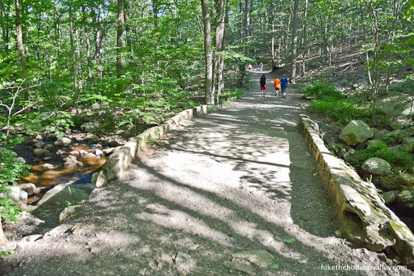
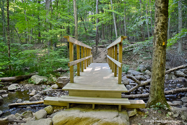
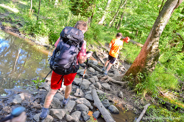
4. In just a moment, you’ll cross the Ramapo River on a substantial footbridge.
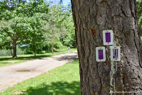
5. Just after the bridge, take the right fork onto the Purple Trail. (If you’re doing the Vista Loop today, this is where your loop will begin and end.)

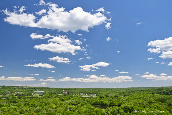
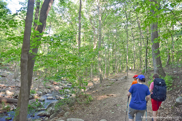
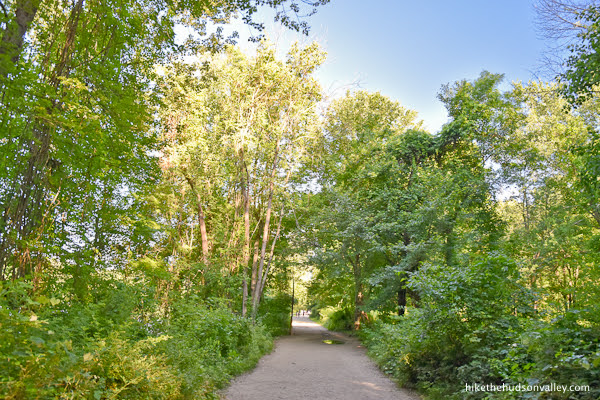
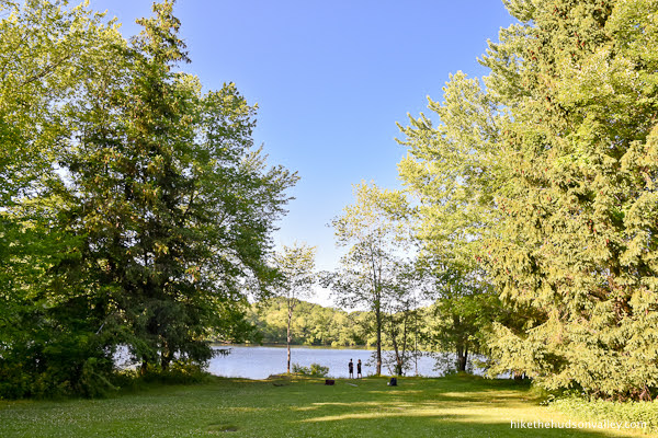
6. As you stroll along the Purple Trail, you’ll have nice views across Scarlet Oak Pond.

Stick to the main trail, ignoring the temptation to wander onto any unmarked trails.
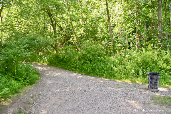
On the far side of the lake, the trail wanders back into the woods.

You’ll find a scenic trash can here that you can stuff litter (and/or litterbugs) into.
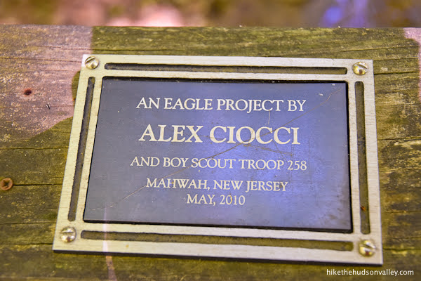
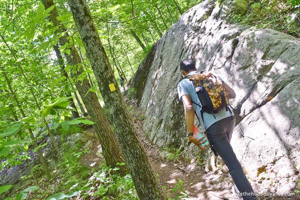
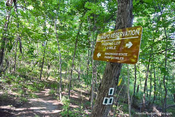
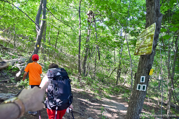
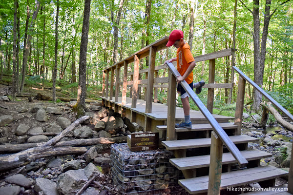
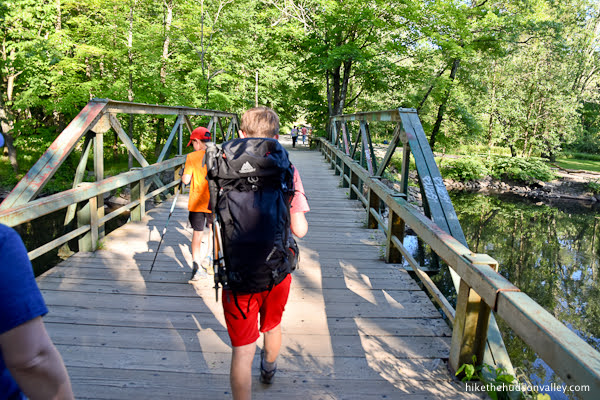
7. About ten minutes from the start of the Purple Trail, you’ll arrive at a wooden bridge on your right. Turn right here to cross the bridge and hop on the Yellow Trail. From here, it’s just .6 miles up to Cactus Ledge.
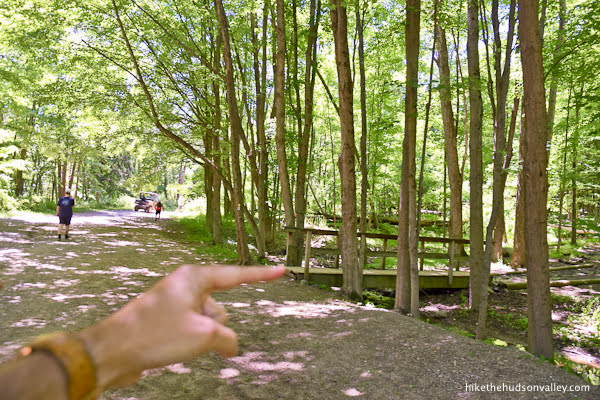
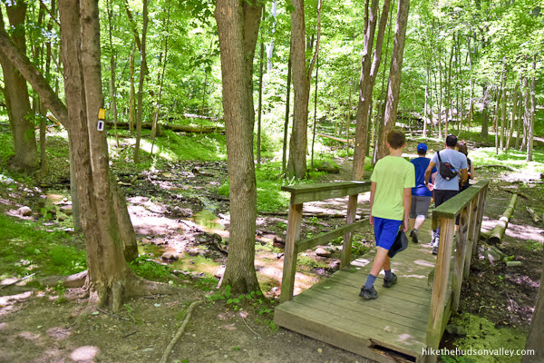
Also, thanks to Eagle Scout Alex Ciocci and Boy Scout Troop 258 from Mahwah, New Jersey for the awesome bridge! Great job! My dry tootsies very much appreciated your hard work.
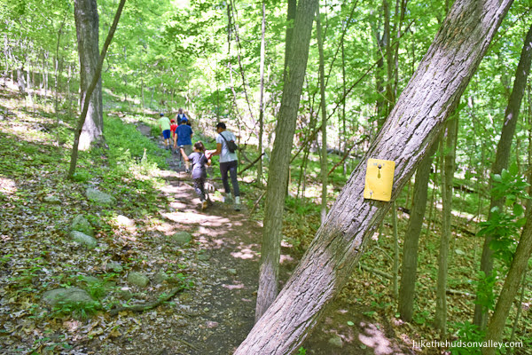
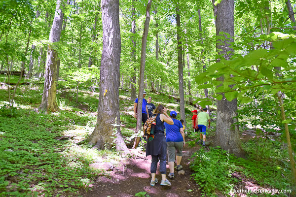
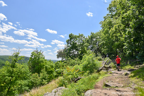
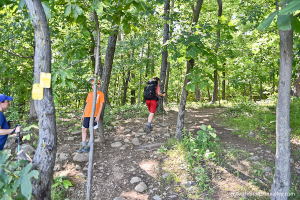
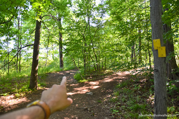
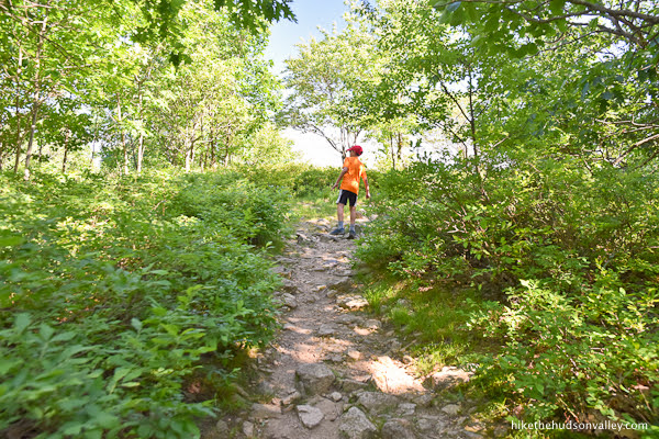
8. Time to climb! It’s .4 miles and 260 vertical feet from here to the views at Hawk Rock. Keep following those yellow blazes up and up.


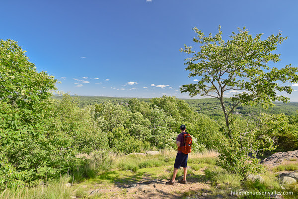
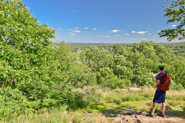
9. Emerge onto Hawk Rock for your first vista of the day. If you’re here on a nice weekend afternoon, you’ll likely have some company. Plenty of room for everyone!


What a nice spot.
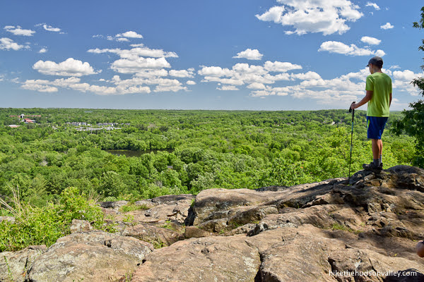
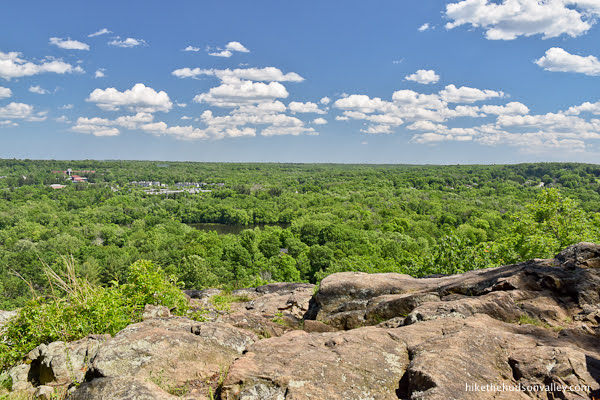
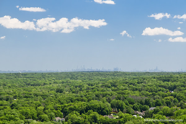
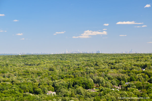
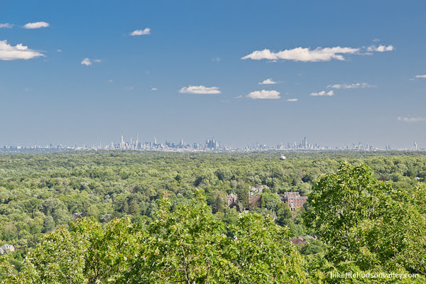
You can juuuust see the tops of the NYC skyscrapers on the horizon.
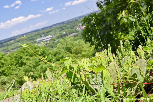
The only thing we’re lacking here is some cacti. Let’s go find some!
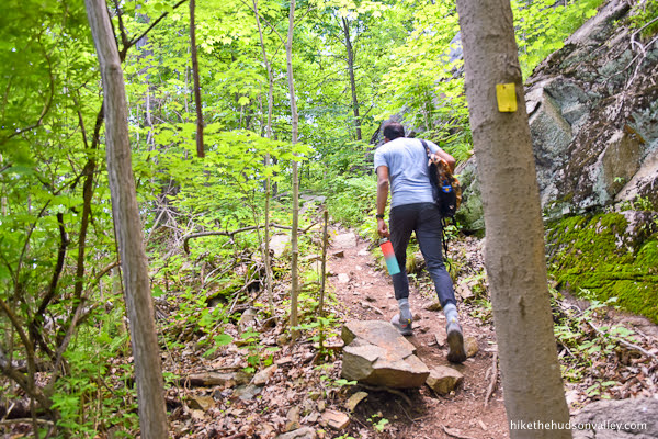
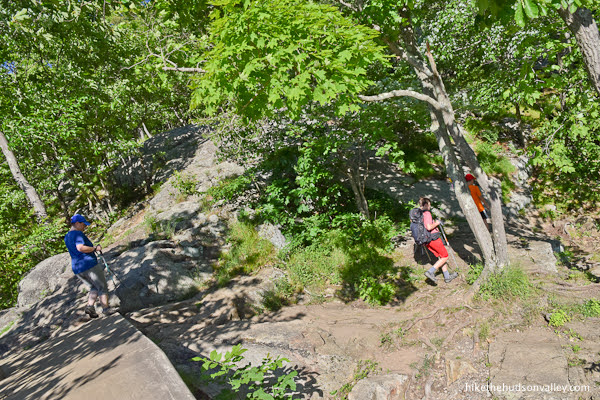
10. It’s about ten minutes (.2 miles, 110 vertical feet) to Cactus Ledge from Hawk Rock. Just behind Hawk Rock, keep following the Yellow Trail uphill.
The trail bends to the left and keeps climbing past some interesting rock formations.
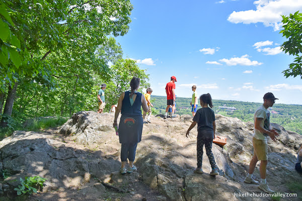
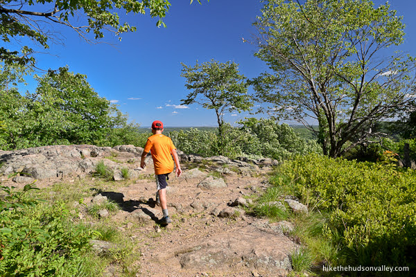
11. About ten minutes after Hawk Rock, the canopy opens up.

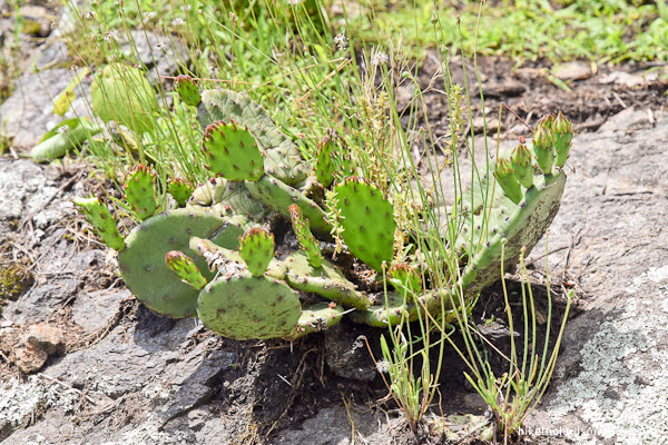
And what have we here? Cacti! Are we in New Jersey or Arizona?
Also, MEEP MEEP! (Don’t forget to say that out loud. That’s our thing, remember?)
In case you missed the warning above, please DO NOT TOUCH the cacti! They don’t look that spiky, but they have tiny little hairs that will stick in your fingers (thanks to the kids in our party for confirming this, so that you don’t have to). Do yourself (and the cacti) a favor, and admire from a distance.
You’ll find patches of them all around the trail and the ledge. They’re not all so obvious, but look around, and you’ll see them dotting the hillside.
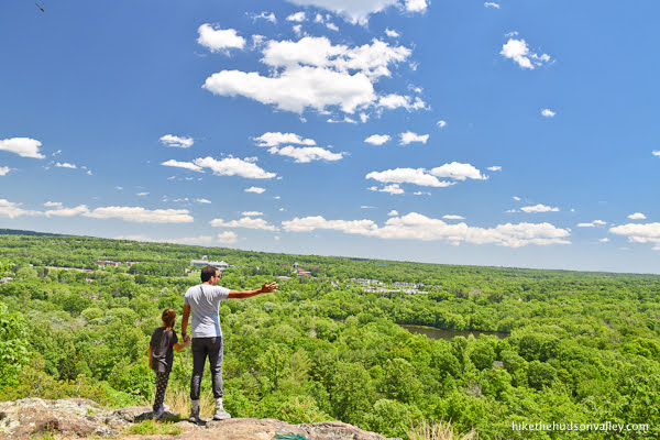
Don’t forget to look up, too, where you’ll see an even better view of the NYC skyline than the one from Hawk Rock.
If you can find any cute kids to (carefully!) pose in front of the cacti, this is the place to snap some pics.
12. Decision time! If you retrace your steps from here (Yellow Trail back down past Hawk Rock to the Eagle Scout bridge, where you can turn either left or right to loop around the lake on the Purple Trail), your hike today will be 3.0 miles. We chose this route on our first visit here – even with a lot of dawdling, we were still back to the cars in less than an hour. If that’s your choice, go ahead and retrace your steps, and I hope you had a wonderful hike today! Meep meep to you, good person(s).
If you’re still reading, that means you’re doing the whole five-mile Vista Loop. You must have eaten a big bowl of ACME birdseed this morning!
From Cactus Ledge, it’s 3.4 miles to the end of the loop, with an additional total ascent of about 500 feet. Let’s blast off from here and leave a little cloud of dust where we used to be. Meep meep!
13. Continue following the Yellow Trail into the woods behind Cactus Ledge.
We had much less company on this part of the loop. Enjoy the relative solitude in this stretch.
Your next junction is .2 miles from Cactus Ledge, when you’ll come to a junction with the terminus of the green-blazed Halifax Trail.
Turn left/straight here to continue on the Yellow Trail.
14. About five minutes beyond the junction with the Green Trail, you’ll come across a double-yellow blaze by an unmarked junction. Doesn’t matter which path you choose, they’ll meet up again in a minute. But I *think* left is the official way to go, so let’s go that way.
15. .3 miles beyond that unmarked junction, you’ll arrive at another junction, this time with the white-blazed (and aptly named) White Trail.
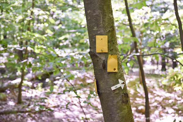
TURN LEFT AT THIS JUNCTION! See that little white arrow on the tree? It’s telling you to turn right IF you want to get to the White Trail, which you do NOT want to do.
Nice try, little arrow! You didn’t fool us. The yellow blazes are telling us to turn left. They’re our real friends.
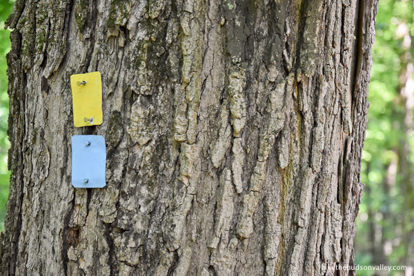
16. Your next trail junction comes up in about .2 miles, when the blue-blazed Ridge Trail joins from the right. Stay straight to follow the yellow blazes. For the next stretch, the blue and yellow trails share co-branding, like those Doritos tacos at Taco Bell, except not disappointing.
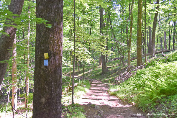
17. In another .2 miles, the Yellow and Blue Trails split, and the Yellow Trail heads uphill to the right.
Take the right fork to keep following the Yellow Trail, even though you don’t feel like going uphill anymore.
18. Just after that fork, the Yellow Trail bends to the right, and a short spur trail (marked with a black star on a yellow blaze) heads to the left.
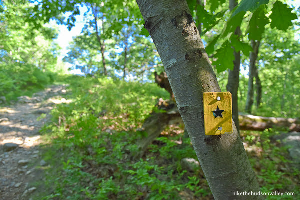
Take a left here to follow the spur to a nice, wide-open viewpoint. (It’s a very short side excursion, maybe 100 yards or so – definitely worth it.)
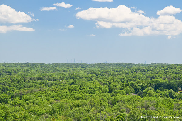
19. From this viewpoint, you get a great look at the NYC skyline (even better than the vantage from Cactus Ledge or Hawk Rock).
You’ll also find many rocks upon which to perch – plenty of elbow room here.

It’s not the most panoramic view in the Hudson Valley, but it’s certainly a great spot to hang out for a bit.
20. When you’re done soaking in your last big view of the day, take the star-blazed spur trail back down to the Yellow Trail, then turn left on the Yellow Trail to continue along the Vista Loop.

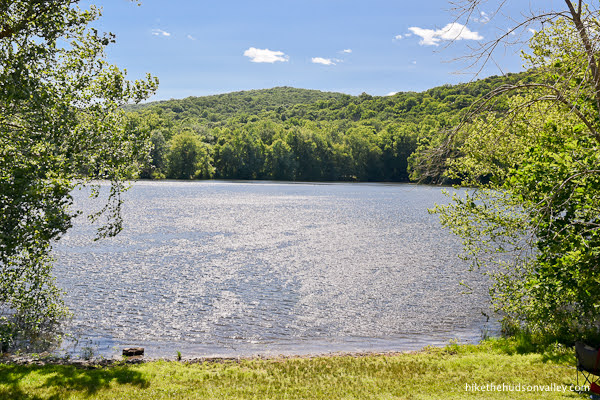
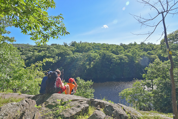
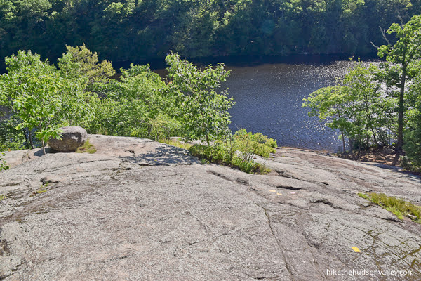
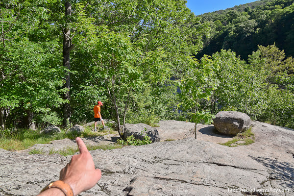
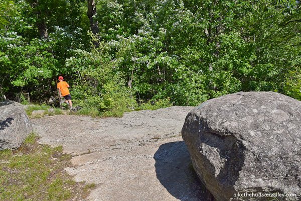
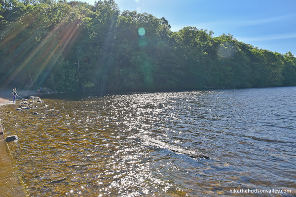
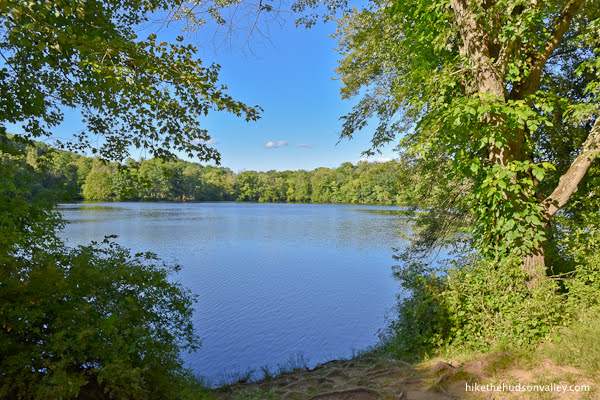
21. In about fifteen minutes, the Yellow Trail takes you to one of our favorite spots on the loop: a beautiful, rocky slope overlooking the MacMillan Reservoir.
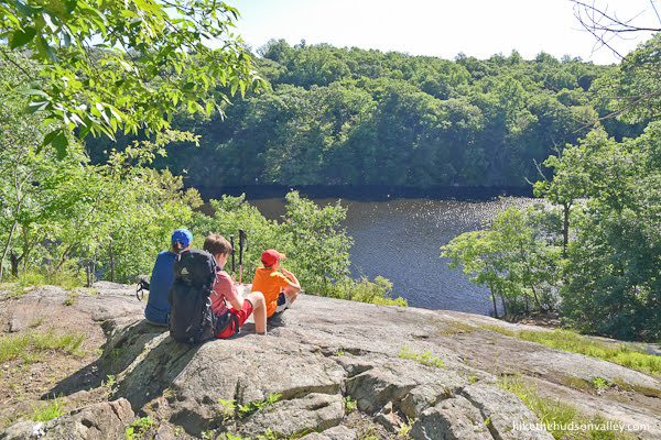
What a nice place.
After you’ve sufficiently chilled out here, follow the blazes down the rock face, then turn left into the woods again by a big ol’ boulder. It can be tricky to pick up the trail here, so keep a sharp eye out.
22. The Yellow Trail now shares co-branding with the pink-blazed Reservoir Loop. (If you wanted to call this trail the Strawberry Lemonade Trail in your head, nobody would blame you.)

This stretch passes another nice little spot to stop and gaze at the water.

The Yellow/Pink Trail pops out at the edge of the dam on MacMillan Reservoir. Several trails converge here, so you’re likely to have some company.
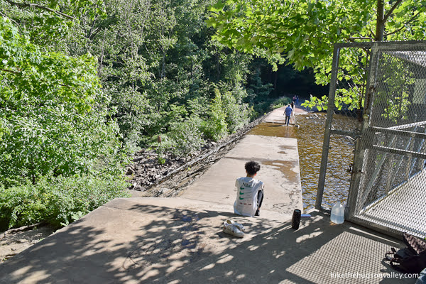
Carefully stroll onto the dam to check out the scene.
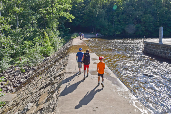
The reservoir would be much more scenic without that big stone hoobajoob (technical term) in your face.

Try to ignore the hoobajoob and focus on the 99% of the reservoir that is quite scenic anyway.
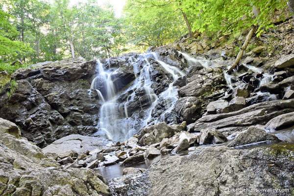
The spillway running over the dam feeds the waterfall that you’ll be visiting soon. Hope it’s flowing well today!
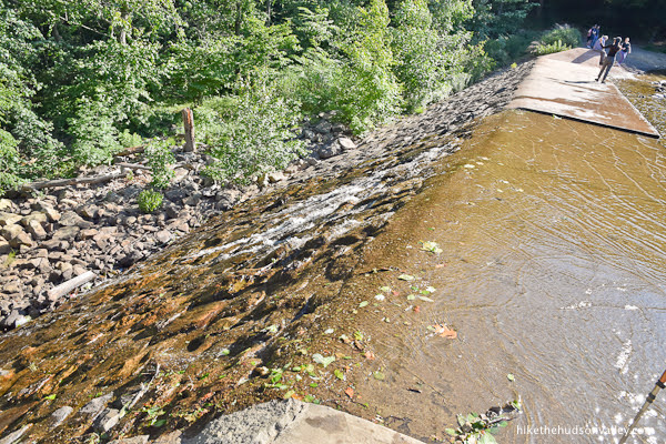
23. When you’re done (carefully!) exploring the dam, retrace your steps back to the Pink/Yellow Trail, then turn right (assuming the dam and spillway are behind you) to hop down beyond the base of the dam on the Pink/Yellow Trail.
When you see an unmarked trail heading off to the left, take the right fork to stay on the Pink/Yellow Trail.
24. In one more minute, you’ll arrive at the end of the Pink Trail. Stay straight across this junction to hang in there with your buddy, Yellow Trail.

A sign lets you know that you’re just one mile from the parking lot. There’s still plenty more cool stuff to see along that mile!
Cross the bridge, enjoy the burbles of the creek, and keep following those yellow blazes.
25. One minute beyond the bridge, bear right at the fork when the Blue Trail splits off to the left.
A sign at the intersection lets you know that there’s a waterfall this way. Yes, please!

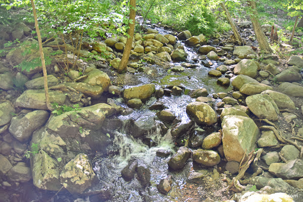
26. The Yellow Trail heads downhill for the next quarter mile, treading close to the creek in this pleasant stretch.

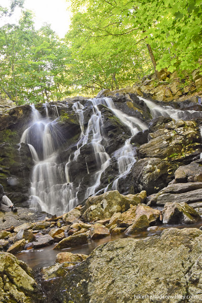
27. Less than ten minutes from the previous junction, sha-BAM! Waterfall in your face.
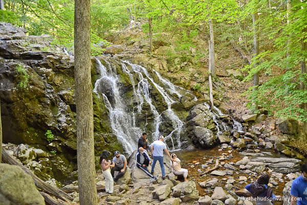
The cascade here is much larger than I was expecting. This waterfall could be a destination by itself on any other hike. This one has to compete with all the cacti and views, though.

28. When you’re done soaking up the waterfall with your eyeballs, continue downhill on the Yellow Trail.
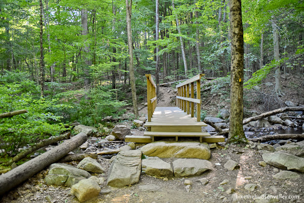
In just a couple minutes, you’ll arrive at the spot where the Yellow Trail crosses the stream. How are we gonna get across? How about ANOTHER awesome Eagle Scout bridge?

Nice work, Angus! Truly an impressive project.
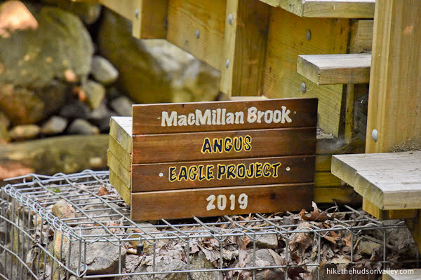
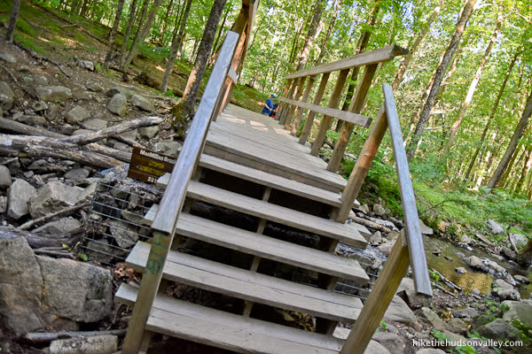
Go ahead and cross the bridge, then look back and marvel at what an awesome job Angus did with this thing.
29. Just past the bridge, you’ll come to a many-blazed junction with the orange and black blazes of the River Connector Trail.
The Yellow Trail hasn’t steered us wrong yet, has it? Stick with it here, taking the left fork to stay on the Yellow Trail.
Brief aside: The official Ramapo map says this about the River Connector Trail: “Difficult crossing in high water.” That is true! We briefly explored that trail, and found it to be a muddy, mosquito-y Swampy McSwamperson. We quickly made a U-turn and apologized to the Yellow Trail for ever trying to leave it.
30. Follow the Yellow Trail as it morphs into a dirt road.
In less than five minutes, you’ll arrive back at the loop trail around Scarlet Oak Pond.
Turn right here to continue around the pond.
31. Hello again, all the people!
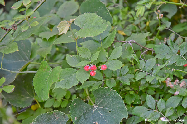
Continue following the loop (officially known as the Vista Spur here, marked with yellow-and-black blazes) around the pond. If you spy some raspberries along the trail here, you might wonder why nobody has eaten them yet.
32. What a nice stretch of trail. This is your grand finale. Enjoy it!
In just over five minutes, arrive at the junction that marks the start and end of your loop today. Recognize this spot? Welcome back! Go straight here to keep heading toward home.
Hello again, non-Eagle-Scout bridge! (I bet Angus and Alex could whip one up just as good, though.)
Hello again, porto-potties! So comforting to see you again!
And the comfort station! You’re the most comforting of all!

Though it is comforting to see our car again, too.

Whichever version of the hike you tackled today, the next order of business is calorie replacement. Where’s the best pizza in Mahwah? Let’s go find it!
Hope you enjoyed your hike at Ramapo Valley Reservation. Until next time! (And also, meep meep! That’s still our thing.)
Directions
Directions to the trailhead: This park is located just across the New York border into New Jersey, very close to I-87. From most spots in the Hudson Valley, head south on I-87, pass the scenic rest stop in Suffern, and then take Exit 15 for I-287/NY-17 South. Continue on I-287 South for just a moment, then take exit 66 for NJ 17 South toward Mahwah. (Then say “Mahwah” in the voice of the priest from “Princess Bride,” because it feels like you’re supposed to.) Almost immediately, take the exit for 202 South, then turn left onto 202 South. In 1.9 miles, you’ll find the well-marked, spacious parking lot for the Ramapo Reservation on your right. Turn into the lot, find a spot, hop out, and let the adventure begin!
Sorta nearby address for your GPS: Just popping “Ramapo Valley County Reservation” into Google Maps will take you to the right place. (As of this writing in 2023, the destination pin shows a random spot in the middle of the woods, but if you look at the road directions, you can verify that they take you to the correct large parking lot on Route 202, near Scarlet Oak Pond and Continental Soldiers Park.)
GPS coordinates of parking area: 41.077887,-74.186922 (Clicking will open in Google Maps or the Apple Maps app, depending on your browser/device.)
Resources & Interactives
Super-cool Google Earth flyover of hike route:
Google Terrain Map of hike route:
Related resources: If you’re looking for actual facts and/or useful information, visit these resources:
- The official Ramapo Valley County Reservation homepage
- The great, free PDF trail map for Ramapo Valley County Reservation from the always-awesome New York-New Jersey Trail Conference
- The mildly informative Ramapo Reservation Wikipedia page (which is useful mostly for giving the A-OK for shortening the name of this place to Ramapo Reservation)
- The TripAdvisor page for Ramapo Reservation, which ranks this place as the #1 thing to do in Mahwah! #1! Take that, other things to do in Mahwah!
Want to support trails in the Hudson Valley? Here’s one great way: Visit the New York-New Jersey Trail Conference homepage and click on Volunteer, Donate, or Shop! (Then you can volunteer, donate, or shop, depending on your mood.)
Thank you so much for this guide! I went hiking today and it was so easy to navigate.
Kindest regards,
Daria
That’s so wonderful to hear, Daria! Really glad this guide was useful to you. Thanks for taking the time to comment and make my day 🙂
Hi. I’m a boutique tourist concierge located in Greenwood lake, New York. I, Curie experiences and adventures for people visiting the Warwick Valley and surrounding areas. Would love to chat with any hikers interested in leading hikes for guests. Please reach out at 845-595-1300 thank you!