Background
If you find this free trail guide useful, please provide payment by picking up at least one piece of litter on your hike. Cha-ching! Thanks for being awesome! (And here’s a quick primer on Leave No Trace, too, to help us keep the trails nice and fresh for each other.)
I wouldn’t say that Gertrude’s Nose is the best hike in the Hudson Valley, because that would be like saying, “Mint chocolate chip is the best ice cream.” Wait, bad example. Mint chocolate chip really is the best ice cream.
But I still won’t call Gertrude’s Nose the best hike in the Hudson Valley, because the phrase “best hike” means different things to different people, and might depend on your mood or the weather or your zodiac sign.
Still, I will say that no list of the best hikes in the Hudson Valley would be complete without at least considering Gertrude’s Nose. For many people, I would expect this hike to land somewhere near the top of that list. It does for me.
Of course, how much you enjoy this hike will depend in large part on how much you enjoy hiking 7.5 miles in one shot (many other guides list this hike as 8 miles, so my GPS might have lowballed this one a smidge). This is a long, strenuous loop with rugged terrain and several steep sections, and it’s not to be attempted lightly.
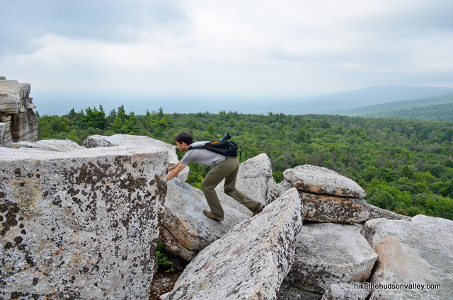
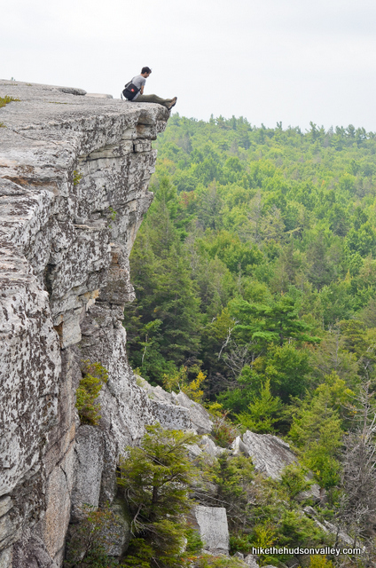
It will also depend on how much you enjoy heights, since the clifftop trails and vertigo-inducing perches are a highlight of this hike.
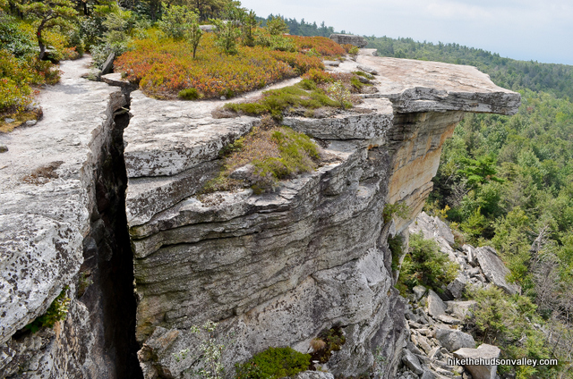
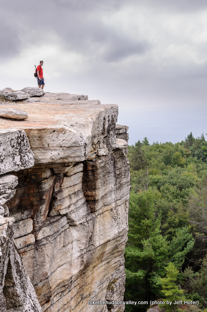
All throughout our visit to Gertrude’s Nose, I kept saying, “Dude, I can’t believe I’ve never been here before.” Just goes to show how lucky we are to live in the Hudson Valley – you can hike here for a decade and still keep discovering awesome new places to explore.
And this place is awesome. But is it the best hike in the Hudson Valley, which would put it in the running for the best hike pretty much anywhere? Well, you’ll have to give it a whirl and decide for yourself.
As long as you’re up for a long, strenuous day, you won’t regret picking Gertrude’s Nose.
Trail Guide
Bonus unsolicited advice: Don't depend on having cell service in the woods - it can be spotty out there! Download this trail guide to your phone before you head out. (It's easy to do on iPhone and Android.) May your connection to nature be strong, even when your connection to the internet is weak.
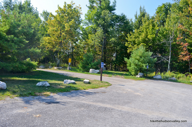
1. From the upper parking lot (see “Directions to the trailhead” below), walk to back-left corner of the lot, just past the last parking spot (marked handicap), and continue following the dirt road that curves to your left.
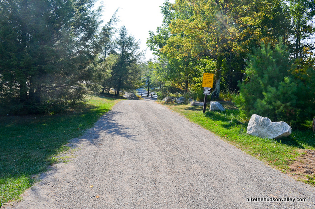
2. Thirty seconds later, boom! First view. That didn’t take long, did it? Take a few moments at the split-rail fence to gaze out over Lake Minnewaska.
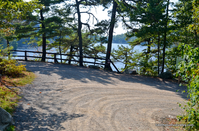
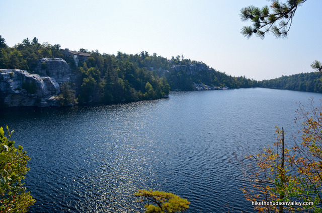
3. When you’re ready, facing the lake, turn to your right to continue downhill on the dirt road, which shortly becomes marked with the red blazes of the Minnewaska Lake Loop (heretofore referred to as the Red Trail).
4. At the Red/Orange intersection, take the left fork to continue downhill on the Red Trail.
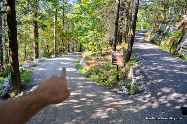
5. In a couple minutes, you’ll pop out next to a beautiful swimming beach, famous for its beautiful views, pristine water, and leeches.
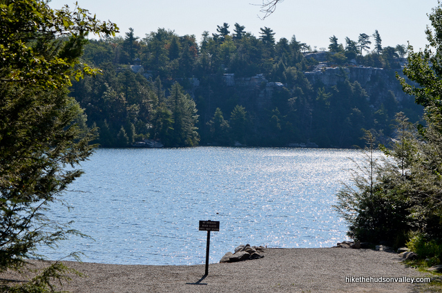
Let’s try not to think about the leech part (they may well be a thing of the past by the time you read this, anyway). But if you do think about it, it’s really hard not to also think about that memorable leech scene from Stand by Me (the best movie ever made), right?
– “Vern, there’s something on your neck!”
– “Yeah, right. I’m not falling for that one, LaChance.”
– “No, Vern, there is something on your neck!”
– “AAAAAAAAAAAAAAH!!!!!!”
Anyway, moving on…
6. Opposite the beach, maybe a hundred yards back, you’ll see the very nice bathroom facilities. Need to use ‘em? Fire away! We’ll wait.
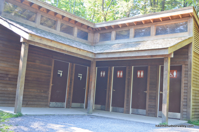
When you’re done going potty and/or frolicking with the leeches, keep following the Red Trail, which sticks to the road just to the left of the bathrooms.
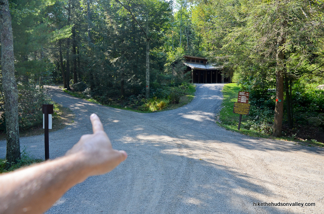
7. Follow the Red Trail as it meanders through the woods. “Trail? Dude, this is a road,” you might be thinking.
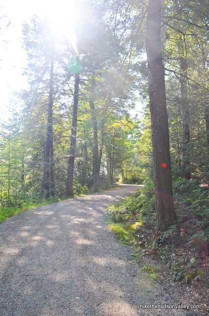
Fair enough, but don’t worry, you’ll have plenty of trail under your feet today. After clambering over your seven-zillionth rock later on, you might even look back at this smooth-sailing portion of the day with fondness.
In a couple minutes, bear left at the fork to remain on the Red Trail. Okay, fine, the Red Road.
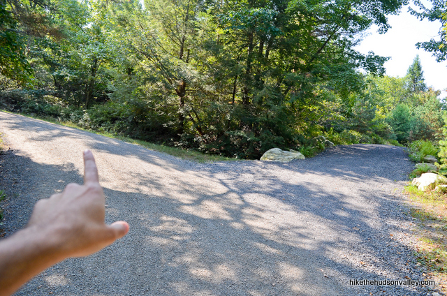
8. Two minutes later, when the blue-blazed Castle Point Carriage Road departs to your right, stay straight/left to continue on the Red Road.
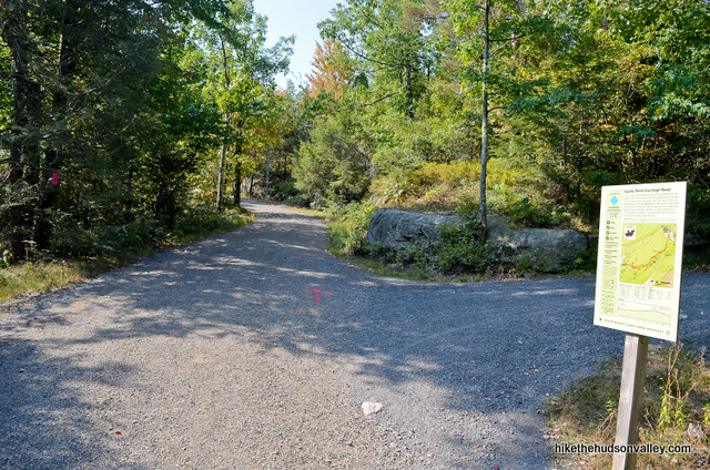
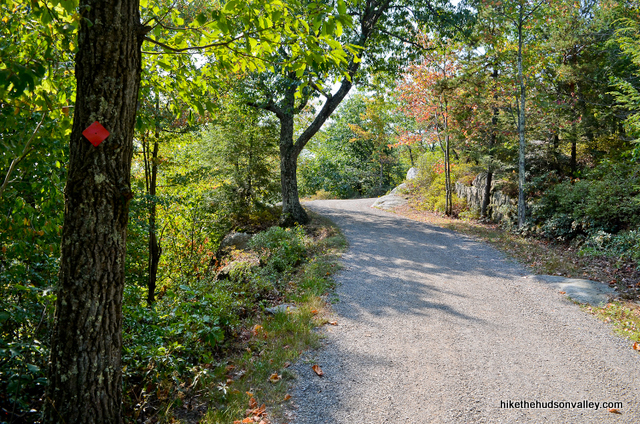
9. It took us eight minutes from the Castle Point Carriage Road intersection to reach the next junction, where we’ll bid adieu to the Red Road as it departs to our left (thanks for the good times, Red Trail/Road – see you again in about 5.5 miles, when we’ll have lots of awesome new memories and blisters!). Here, take the right fork to hop on the yellow-blazed Millbrook Mountain Carriage Road.
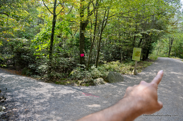
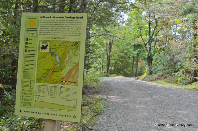
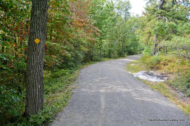
10. It took us five minutes to reach the next junction, at which I nearly had a heart attack, because I thought the trail was closed. (My buddy Jeff had driven three hours to come visit, I’d burned a day of vacation to take him for a hike, and I thought, for a moment, that we were going to have to spend the rest of the day tapestry shopping in New Paltz.)
The sawhorse blocking the (also yellow-blazed) Hamilton Point Carriage Road will likely be gone by the time you visit, but in September 2014, the Hamilton Point path was closed. Lucky for us, we were headed left at this fork to stay on the yellow-blazed Millbrook Mountain Carriage Road. Take the left fork here to continue on your way.
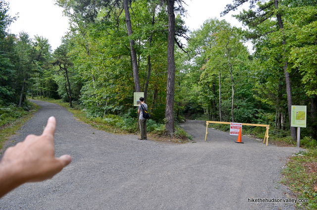
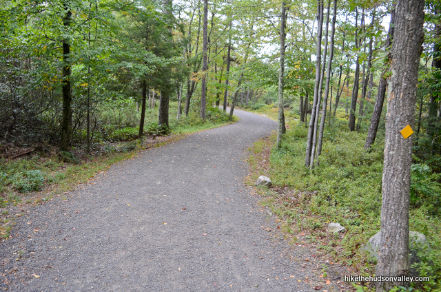
11. In about ten minutes, shaboom.
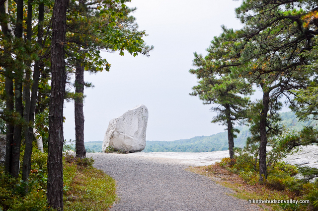
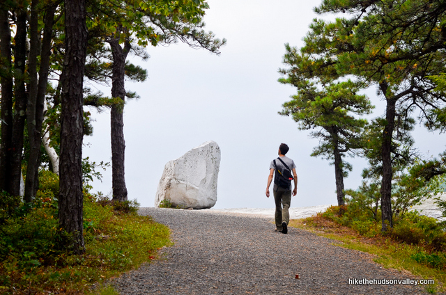
Patterson’s Pellet: Easily one of my all-time top three favorite pellets.
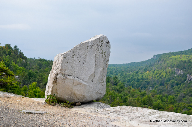
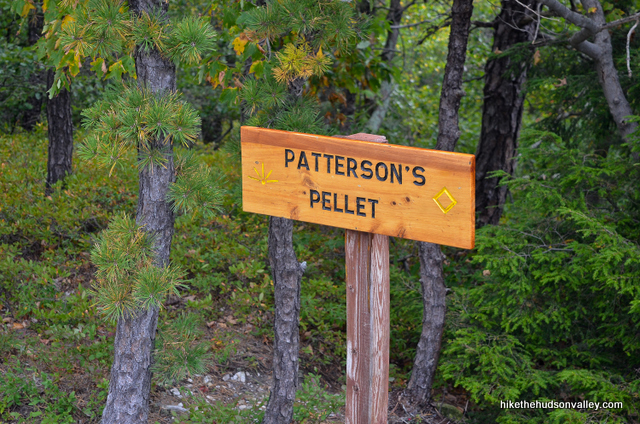
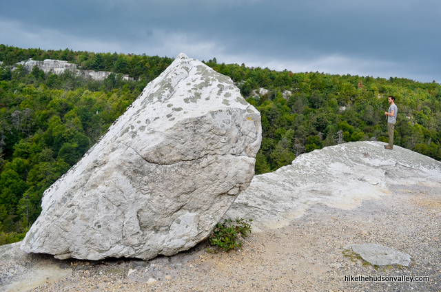
Oh, what the heck, let’s go ahead and call it my number one favorite pellet. Patterson’s Pellet, you had me at pellet. And also at your amazing, unique view. What an awesome place.
12. From Patterson’s Pellet, keep trekking on the Yellow Trail.
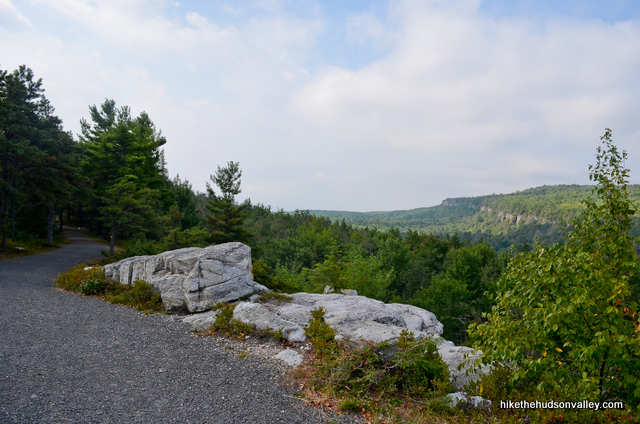
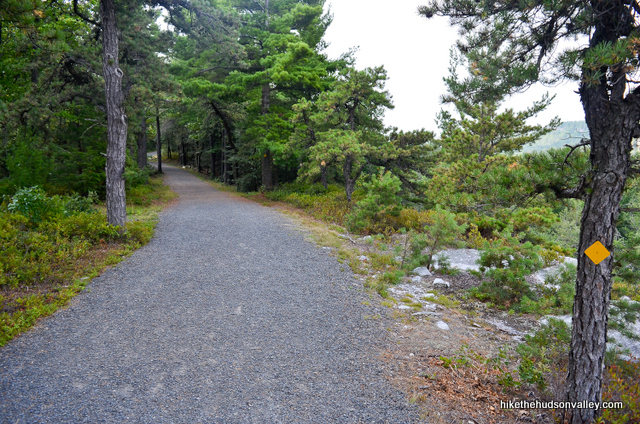
It took us just under ten minutes to reach the next junction, a right turn onto the red-blazed Gertrude’s Nose Trail (heretofore referred to as the Red Trail). Hop onto the Red Trail here and say adios to your pampered carriage-road ways. Time for some actual trails now.
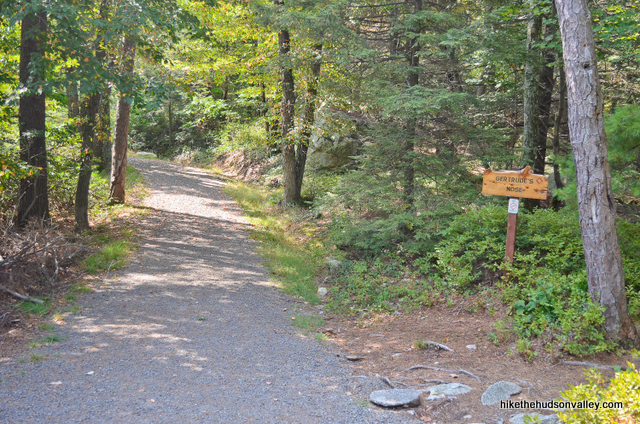
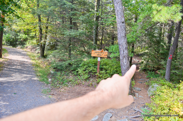
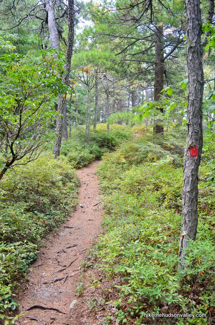
13. Just a few minutes on the Red Trail and, once again, shaboom. Didn’t we just have a shaboom?
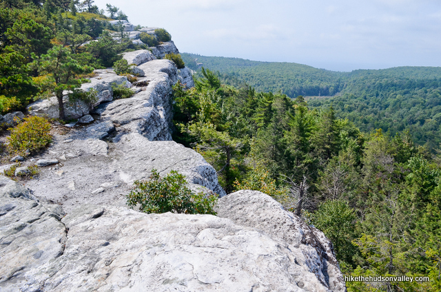
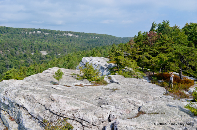
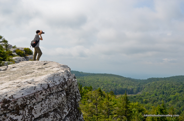
Enjoy the clifftop stroll with more panoramas than you can shake a wide-angle lens at.
As a general rule of thumb in life, I’m never having a bad time when:
– I don’t know what day of the week it is
– I’m doing something that could be described with the words “panoramic clifftop stroll.”
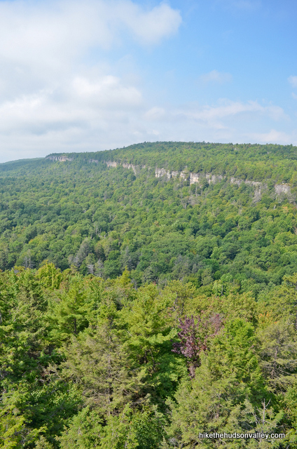
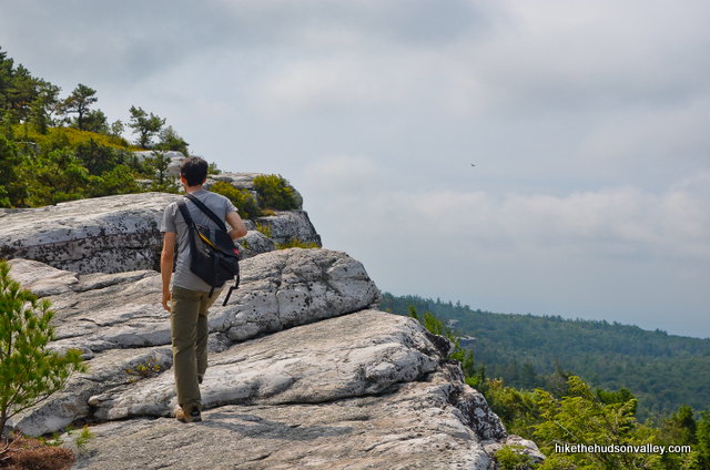
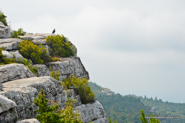
You’ll be doing a lot of the second one today. And if you don’t know what day of the week it is right now, you’re scoring double!
14. The trail leaves the cliffs (momentarily) and plunges back into the woods.
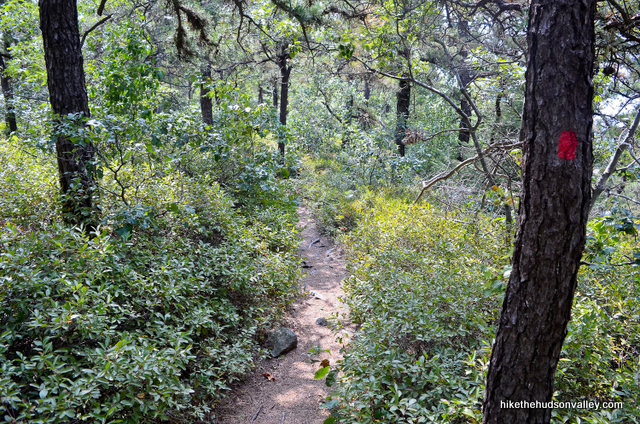
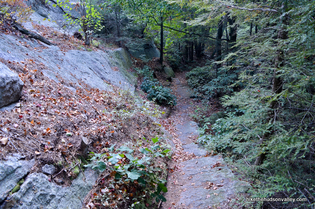
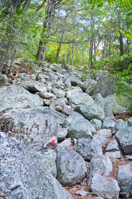
You’ll have some of your steepest, rockiest descents of the day in this section. Step carefully!
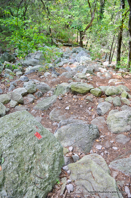
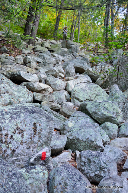
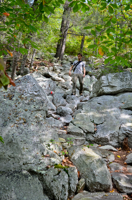
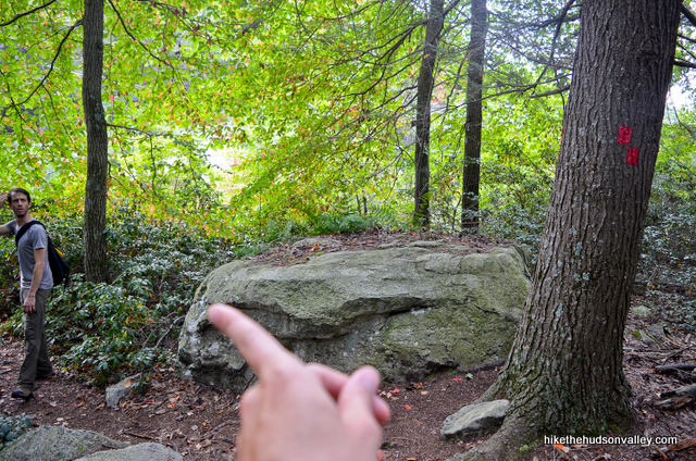
15. The trail flattens out after the rockiest descent. After about five more minutes, you’ll see a double-blaze indicating a turn to the left (the top blaze is offset to the left). A less attentive hiker could wander off-trail here – good thing you’re on the ball!
Immediately after that left turn, you’ll pop into a little clearing with power lines overhead. If they mess with your Zen, just pretend they’re parallel vines on T-shaped trees.
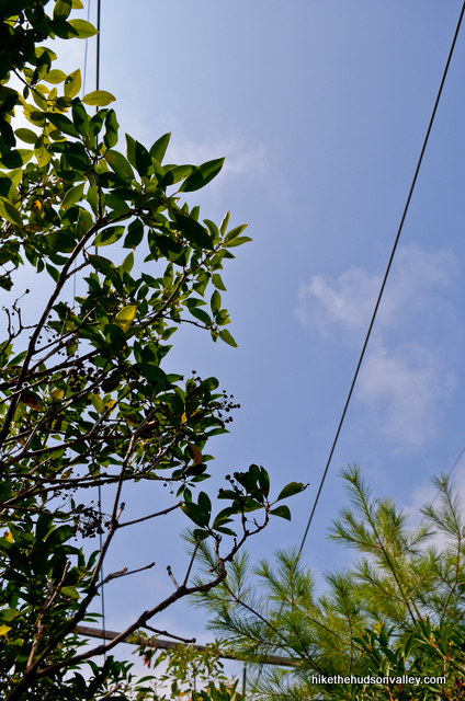
16. Immediately after the power lines, you’ll emerge onto the edge of a cliff.
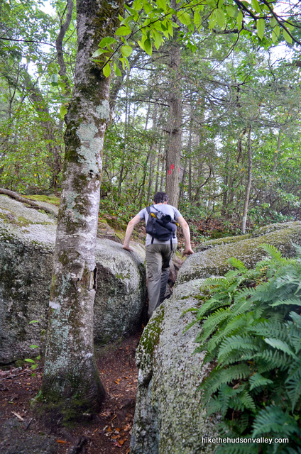
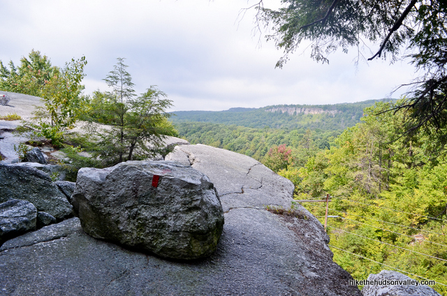
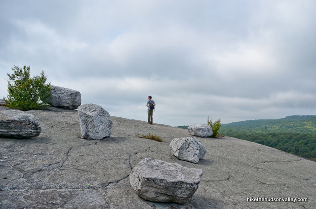
This is just an appetizer. The main course is coming up very soon.
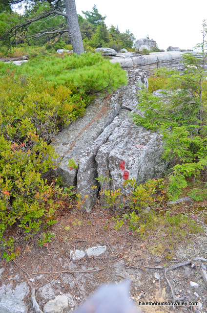
Follow the red blazes until the rock face narrows, where you’ll hop down to the left, into the woods again.
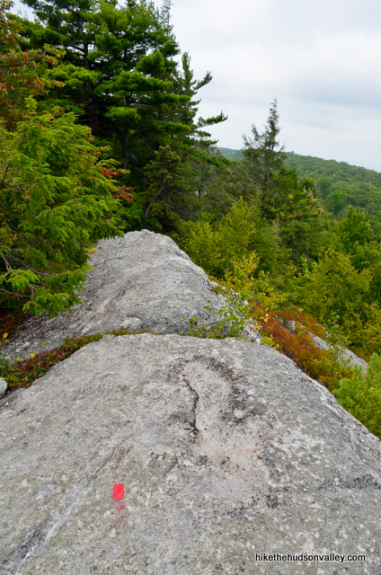
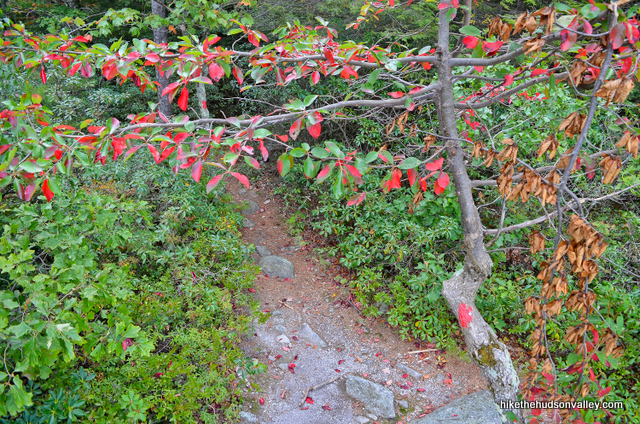
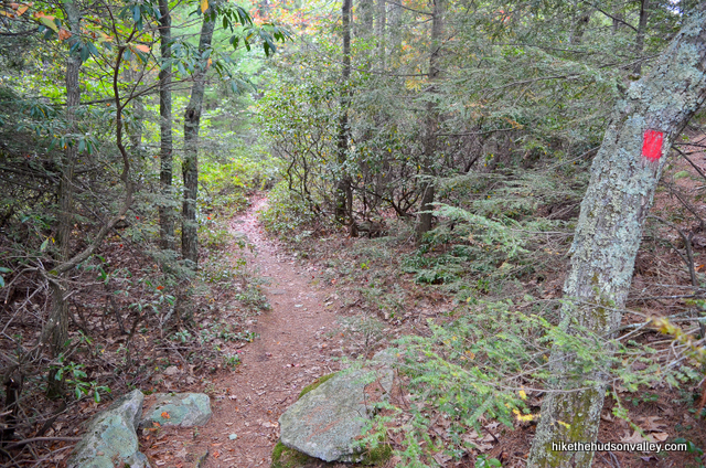
17. When you emerge from the woods again, in front of you you’ll find one of the longest sustained stretches of awesomeness anywhere in the Hudson Valley (or anywhere else, for that matter). You’re also on the same ridge as the eponymous money spot of this hike: Gertrude’s Nose.
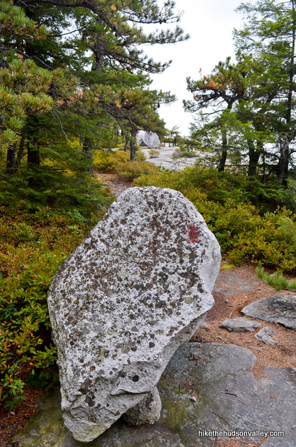
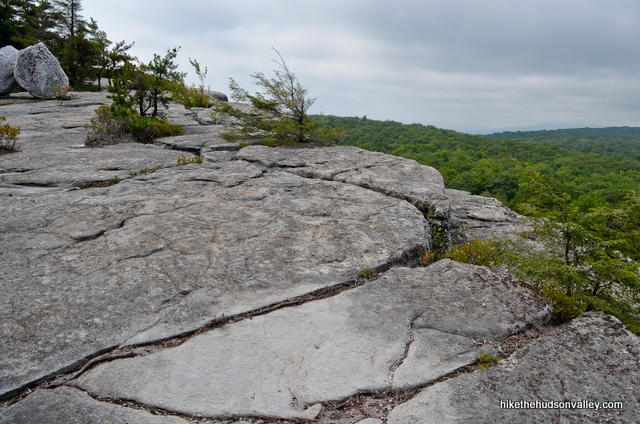
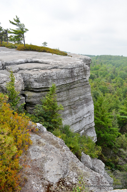
Follow the red blazes as the views and cliffs just keep getting bigger.
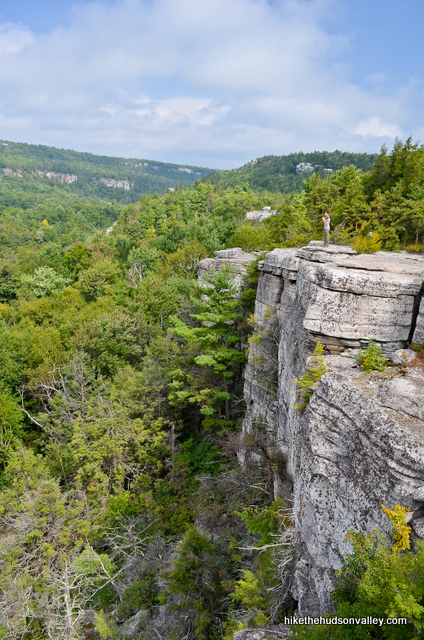
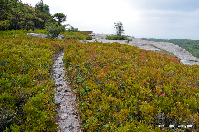
When I first saw this ledge sticking out from the top of the cliff, I thought that must be Gertrude’s Nose. Turns out, Gertrude’s Nose is a bit further up the trail. This is fairly close though – Gertrude’s Chin, perhaps?
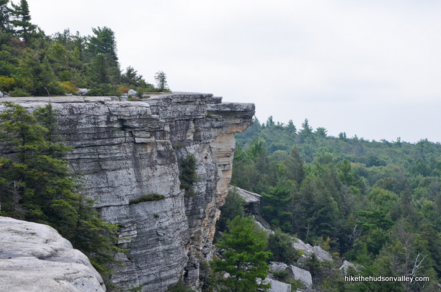
Stepping out onto some of these cliffs is a wondrous experience. It also feels like an IQ test in which your score is dropping with each step closer to the edge.
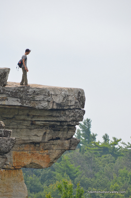
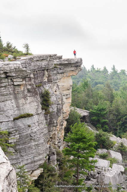
From Gertrude’s Chin looking down, you might notice a giant pile of rocks far below. Fancy people would call those rocks talus or scree.
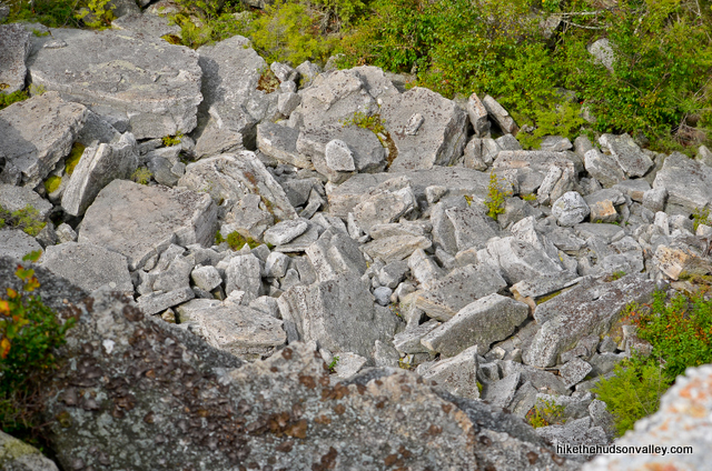
You know how those rocks got down there? Quickly, that’s how.
Also, do you know why those rocks are called scree? Because when Wile E. Coyote is standing on the edge of a cliff, and that cliff breaks off, here’s the sound it makes: SCCCCCRRRRRRREEEEEEEEeeeeeeeeeeeeeeeeeeee……………fwoomp.
I guess what I’m saying here is: “Enjoy the view! What amazing place, right? Also, please apply judgment and caution liberally.”
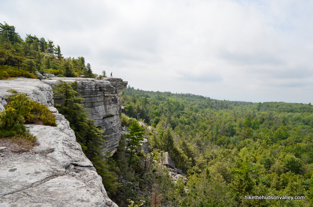
Along this stretch, you’ll find many very cool cliffs to explore.
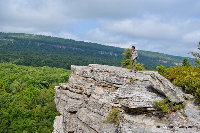
I recommend that you exercise more caution than my friend Jeff at these places, lest you risk creating some of your own personal scree.
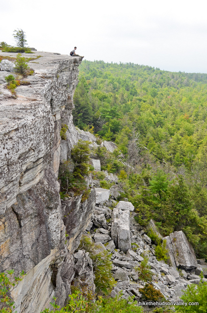
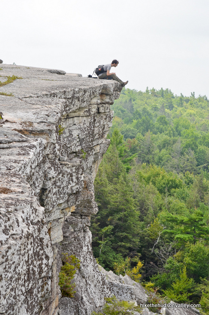
18. When you’re done scoping out the greater Gertrude’s Chin area, continue following the red blazes. We’ve hiked 3.4 miles so far. Only 4.1 to go! We’re just getting warmed up, right?
In this next section, you’ll notice the red blazes at times veering inland, away from the cliffs.
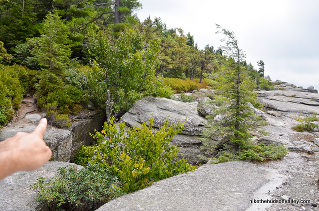
The blazes do a good job of taking you to the cliffs when it makes sense, and steering you away when necessary. Please stick to the blazes, even though you may be tempted to stray.
**UPDATE November 2020** From a Minnewaska trail steward’s helpful comment below: “When hikers leave the trail, it creates erosion on these [endangered] plant species. If the erosion continues, we might never see these species again. The broom crowberry can only be found in the Shawangunks.” PLEASE stick to the red blazes here, which will ensure that your inadvertent tromping doesn’t stomp rare species out of existence.
Keep chugging on what is surely one of the nicest stretches of trail in the Hudson Valley, or anywhere else.
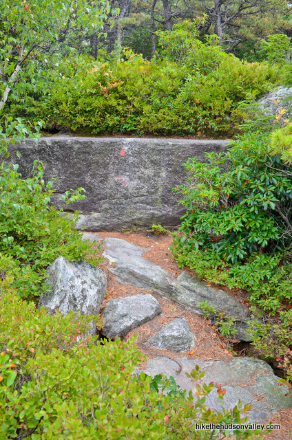
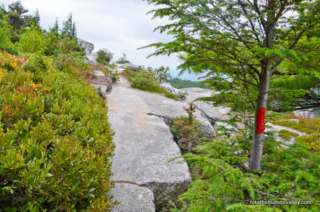
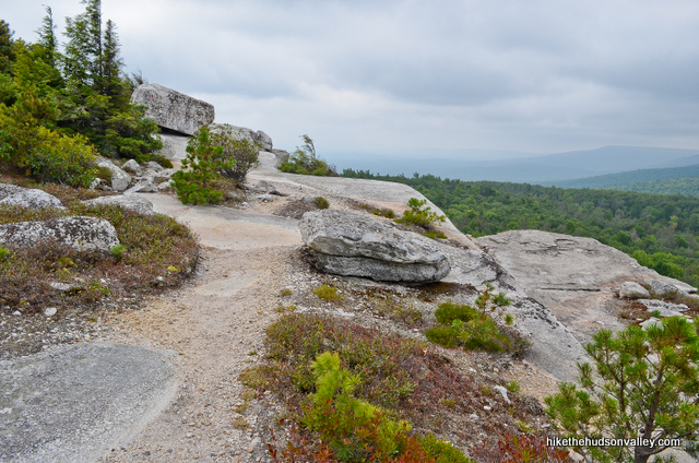
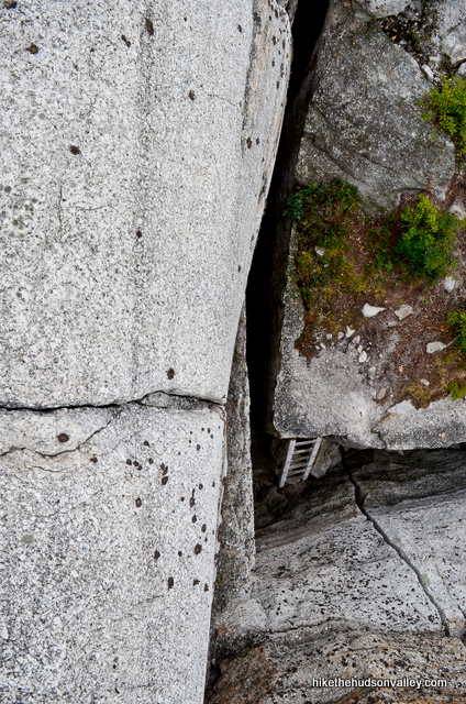
Bonus points if you can spot an out-of-place ladder far below. I bet the people who use that ladder have a way more adventurous life than me.
In any event, from Gertrude’s Chin, you’ll stroll along the cliffs with westerly views off to your right for about .5 miles.
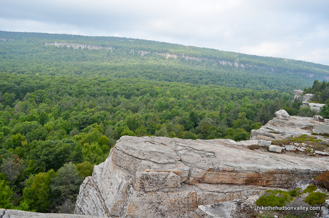 If you don’t follow the blazes, prepare to do some backtracking, unless you’ve recently been bitten by a radioactive spider. Otherwise, you’re not gonna make that jump, no matter how long you stare at it.
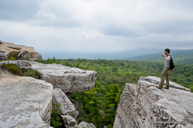
The trail then takes a hard bend to the left, opening up a completely different view to the south and east.
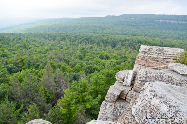
Poking along, goofing off and taking pictures, it took us 25 minutes from Gertrude’s Chin to get to this spot, which is Gertude’s Nose proper.
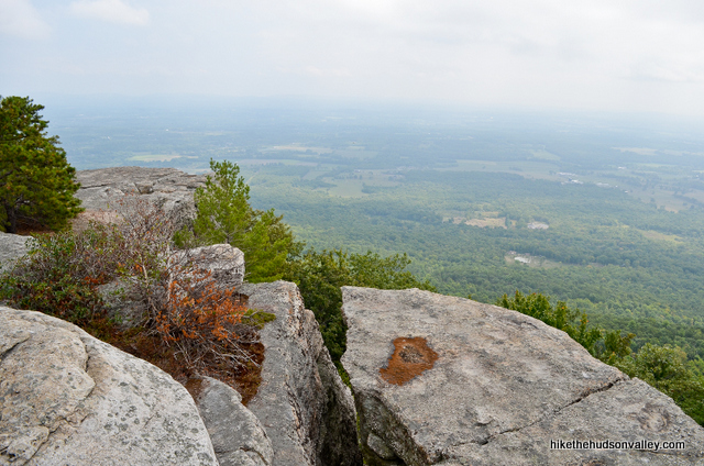
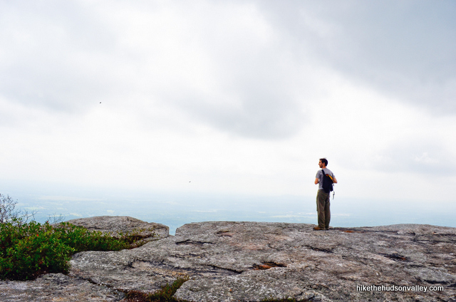
I’m not sure if the name “Gertude’s Nose” applies to one rock formation in particular, or this entire bend in the cliffs, but whatever the case, if you’re standing there right now, I bet you’re glad you picked Gertrude’s Nose. (And if Gertrude’s Nose is one rock formation, and you know which one it is, please attach an image in the comments below!)
19. After that hard-left bend, you’ll enjoy more clifftop views for quite a long stretch. On any other hike, any of those views would be the money spot. On this hike, though, ho-hum, another gorgeous view with awesome rock formations in the foreground. Yawn. We’re spoiled.
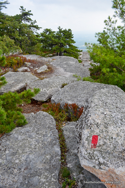
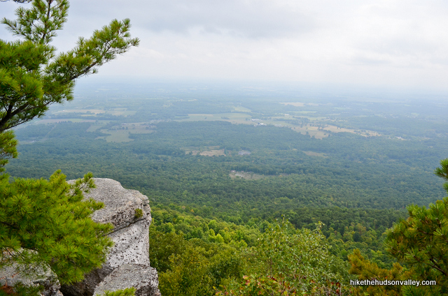
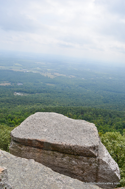
You’ll always see a buzzard or two in the air around here, but right around Gertrude’s Nose, we had a squadron overhead, almost flying in formation. It looked like a scene from Memphis Belle.
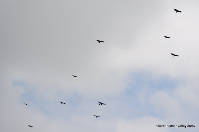
Anyway, keep following the red blazes and enjoying those views.
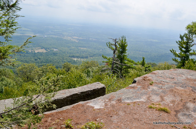
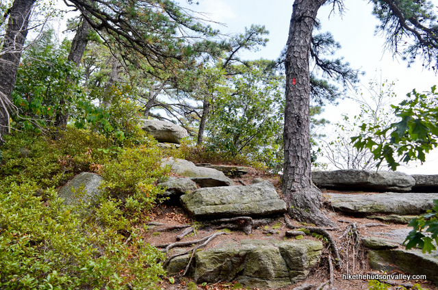
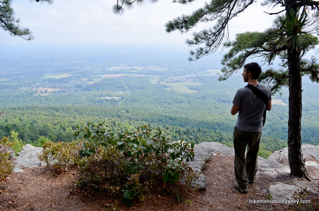
20. In about .8 miles from Gertude’s Nose (it took us 30 minutes, poking along), you’ll cross the power lines parallel vines on the T-shaped trees again.
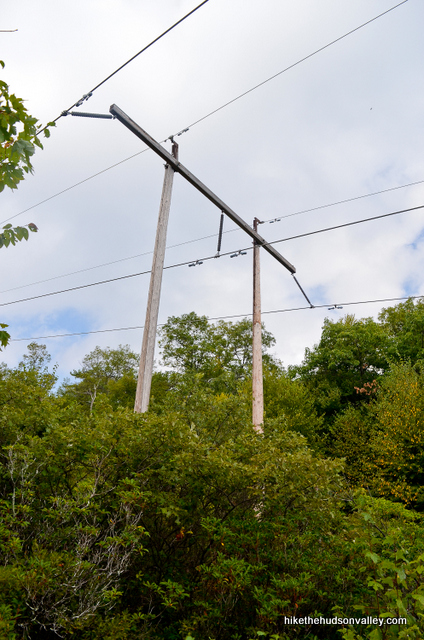
Just after those lines vines (in one minute or so), one of the coolest unmarked features of this hike is coming up. Keep a sharp eye out on your right for an unmarked trail that splits off when the Red Trail continues to the left. (At this fork, as of September 2014, you could see a double-red blaze straight ahead, just up the trail.)
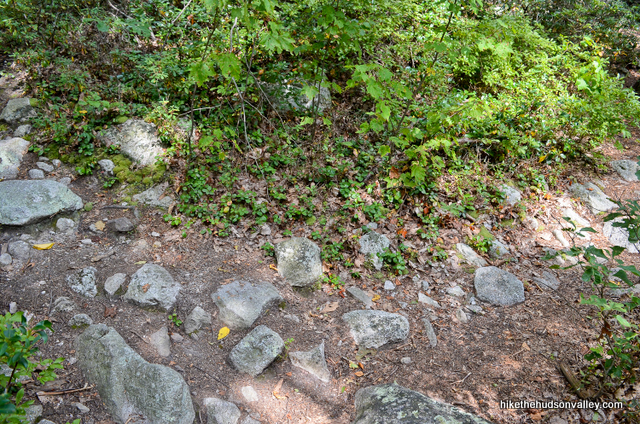
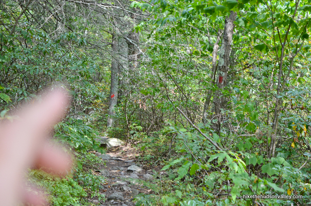
Take the unmarked right fork here for a very short (100 yards or less) foray to a very cool (literally and figuratively) hole in the ground that blows cool air even during the hottest months. As you approach the hole, you can feel the air getting colder all around it.
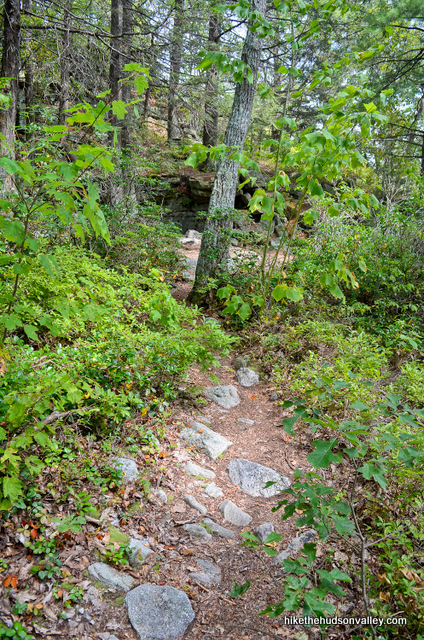
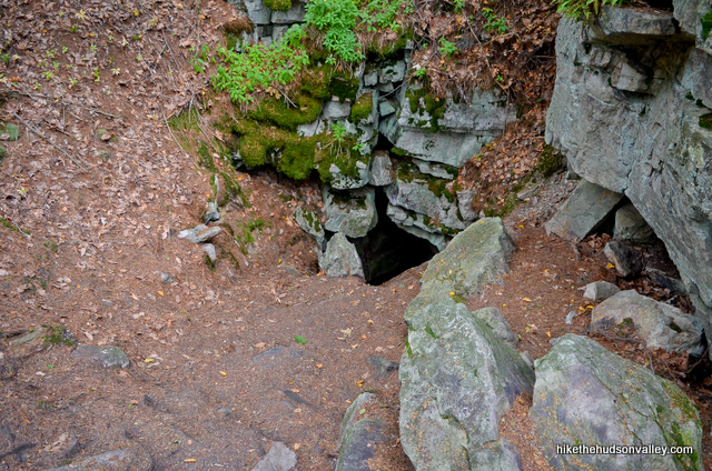
Get closer still, and you can feel the cool breeze blowing straight up at you. Nature’s air conditioning. A welcome spot on a hot day.
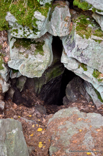
Awesome, right?
Also, Gertrude might prefer that we not assign Gertrude-based anatomical nomenclature to this particular natural feature, so I’ll just leave it alone.
When you’re done checking out Gertrude’s unmentionables, head back to the Red Trail and turn right to continue on your way. (Tip of the hat to the NY-NJTC guide for this hike for pointing out this unique place – never would have found it otherwise.)
21. If you like rocky trails, you’ll really enjoy this next section.
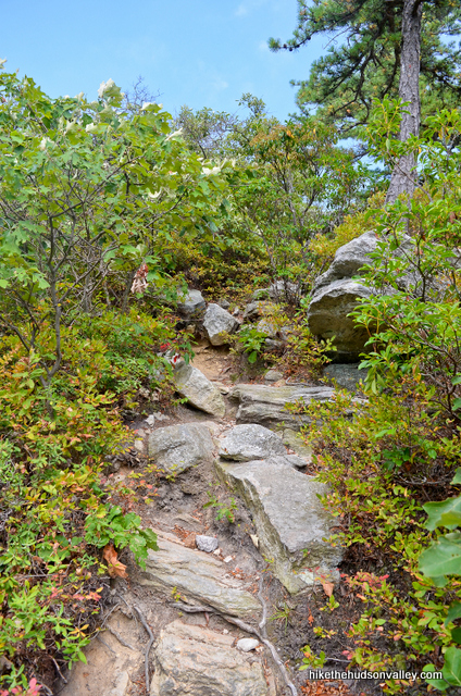
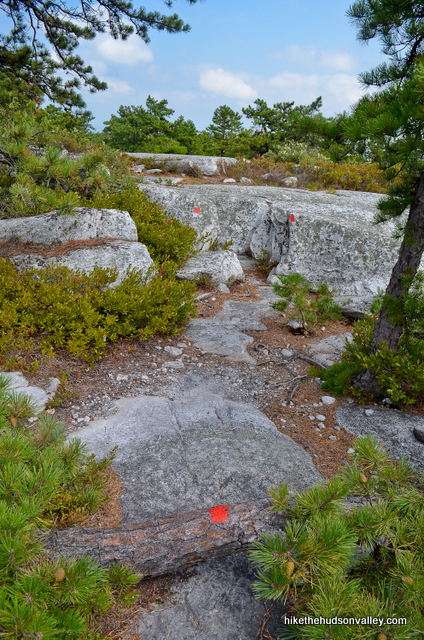
In just over ten minutes from Gertrude’s unmentionables, you’ll pop out onto a really cool rock face peppered with pitch pines.

You’ll also have some clambering to do.

Less than ten minutes after that open rock face, you may notice a carriage road off to your left, running parallel to the Red Trail. Ignore it (for now) and continue following those blazes back toward the cliffs. (We’ll be coming back to this road later, so keep half an eyeball on it.)
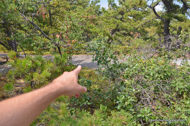
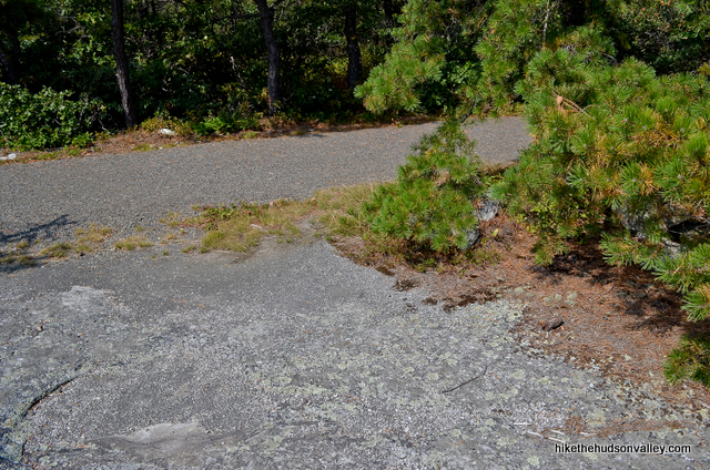
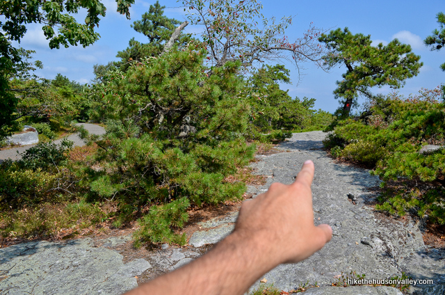
22. Just a short hop up that rise, and you’re treated to one last giant view for the day, from the top of Millbrook Mountain.
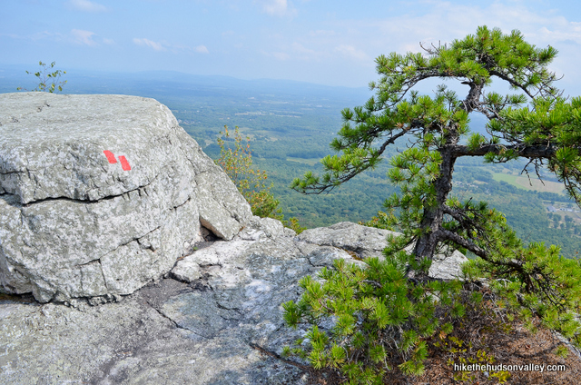
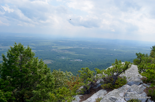
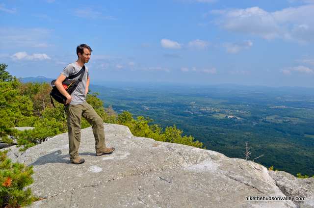
Take your time here and enjoy the huge view. You’ve earned it, right?
How you holding up so far? 5.4 miles down, 2.1 to go. Once you’ve appropriately marinated in the view, let’s head for home.
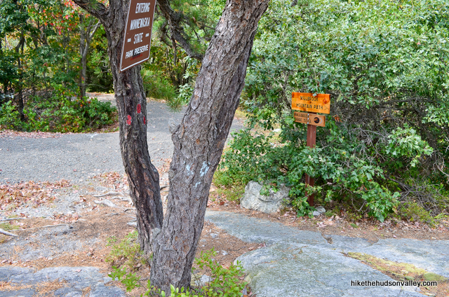
23. There are several ways you could snake down to the red-blazed Millbrook Mountain Trail that will take you back to Lake Minnewaska from the summit of Millbrook Mountain. The easiest way to describe it is to head downhill, backtracking to the carriage road you saw just a few minutes ago, which ends in a little mini cul-de-sac down there (hang a right when you find the road and you’ll find the cul-de-sac momentarily). That little cul-de-sac is where you want to be.
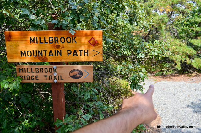
At that cul-de-sac, you’ll see plenty of signage. You want to follow the path just to the right of the signs that say “MILLBROOK MOUNTAIN PATH” and “MILLBROOK RIDGE TRAIL,” which head into the woods in the same direction the road was going, before it decided to hang a U-turn on itself.
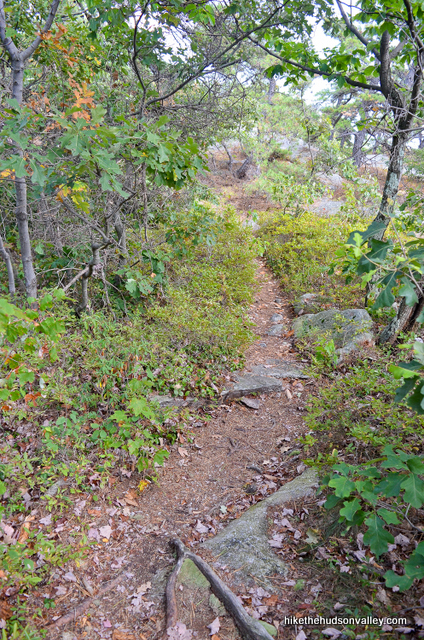
Scoot through the woods for a moment (one minute or less) and you’ll see some old red blazes, and then another signpost in the middle of a small clearing.
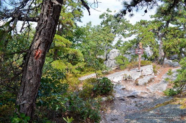
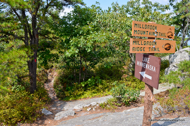
You may also see the three red blazes that mark the start of our next (also red-blazed) trail – the Millbrook Mountain Trail. Follow the signs pointing you to “LAKE MINNEWASKA” and “MILLBROOK MOUNTAIN TRAIL” – Lake Minnewaska and your scenic leeches, here we come!
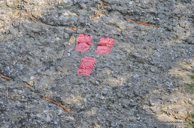
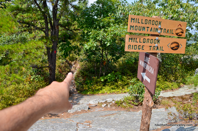
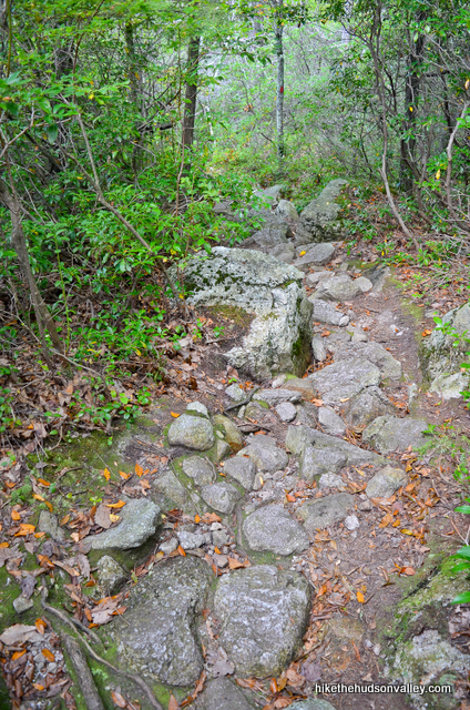
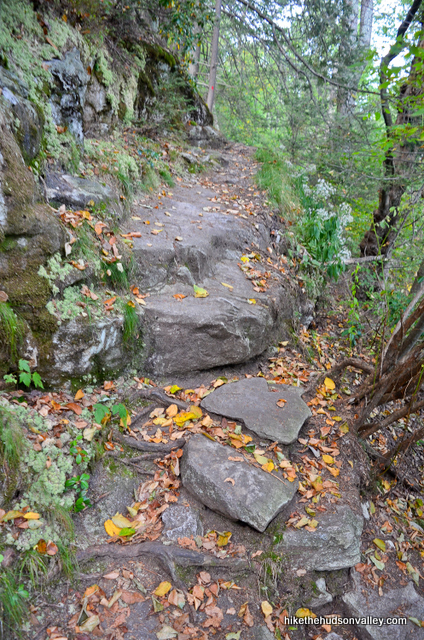
24. From the beginning of Millbrook Mountain Trail, it’s a straight shot all the way back to Lake Minnewaska, following those red blazes to the shore of the lake, about 1.2 miles away. It took us about 35 minutes to get there.
Along the way, you’ll find lots of rocks (this is the kind of insightful commentary you can expect from a free online trail guide).
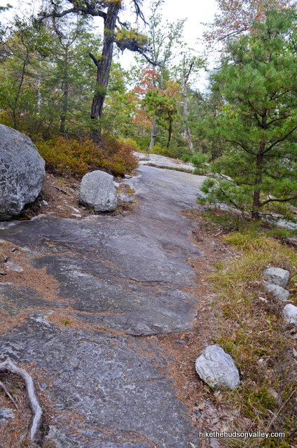
And, about two-thirds of the way there, you’ll have one more nice view, across the Gunks to Skytop Tower at Mohonk Mountain House.
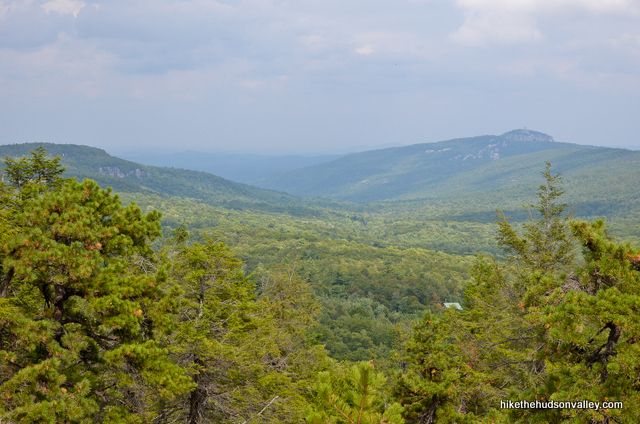
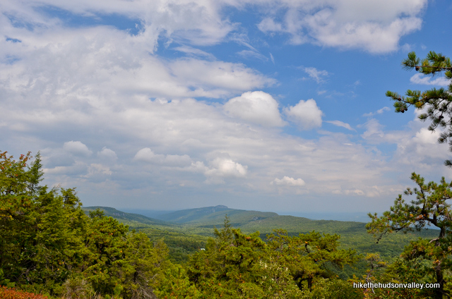
Otherwise, happy trudging, and hang in there! See you at the lake in another .3 miles or so.
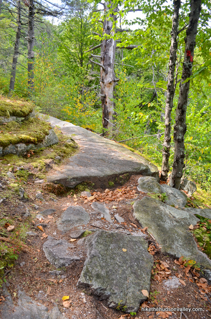
25. Hello again, lake!
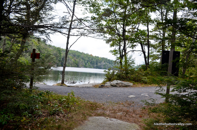
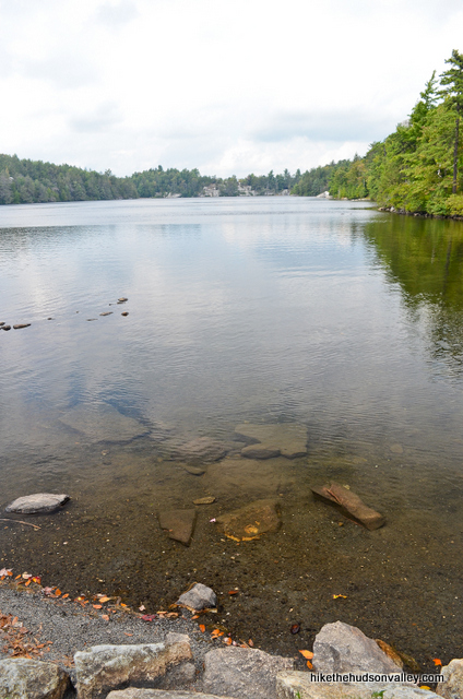
Turn right at the lake to hop back on our old friend, the red-blazed Minnewaska Lake Loop.
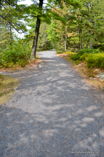
26. In just a moment, keep right at the fork to stay on the Red Trail.
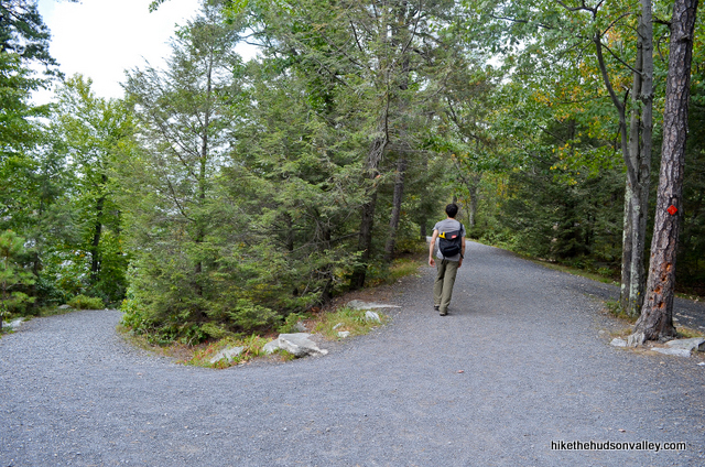
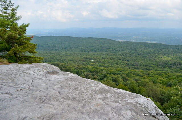
27. At a left bend in the road, you’ll see a little unmarked trail to your right. If you’re still feeling spry, you could hop up on those rocks for another view. If you weren’t already spoiled from the rest of the day, you’d think that view was pretty awesome. But you are spoiled. If you’re feeling beat, you could skip this step and nobody would blame you.
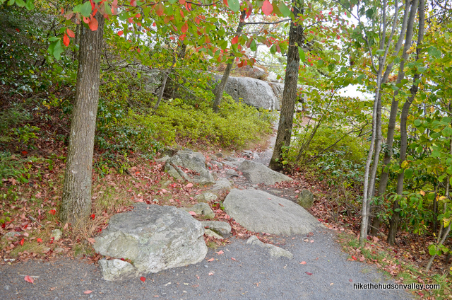
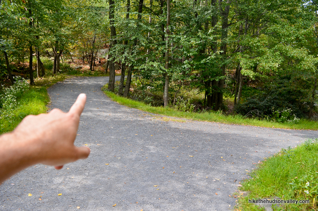
28. Just after that unmarked trail, stay left at the fork to remain on the Red Trail.
29. The road leads uphill, across a clearing with picnic tables. At the top of the rise, the road widens, and you can see some rocks to your left.
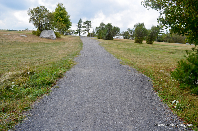
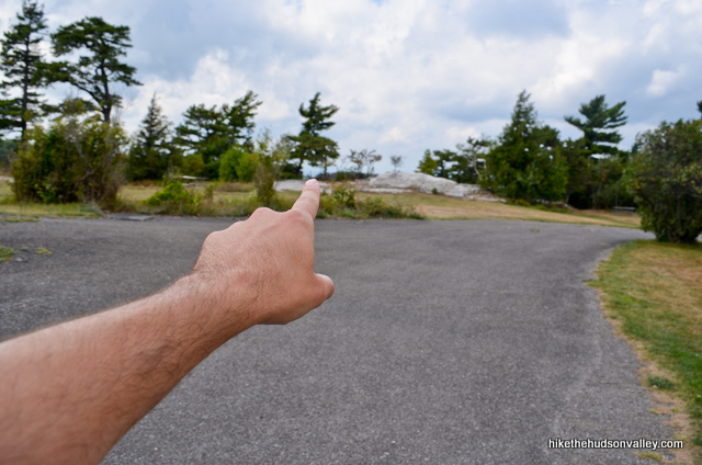
Hop up on those rocks for one last view for the day, across Lake Minnewaska and beyond. This has to be one of the nicer spots in the world, no? It’s especially gorgeous because you can’t even see the leeches from up this high.
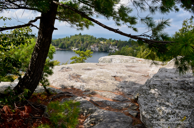
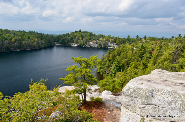
(Better photographers than me have taken some really awesome shots from up here.)
30. From that overlook, head back to the gravel road, and turn left to continue on your way. In just a few moments, keep left at the fork to stay on the Red Trail.
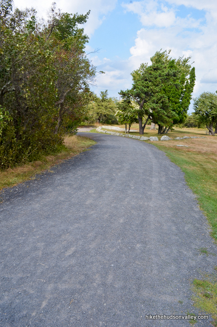
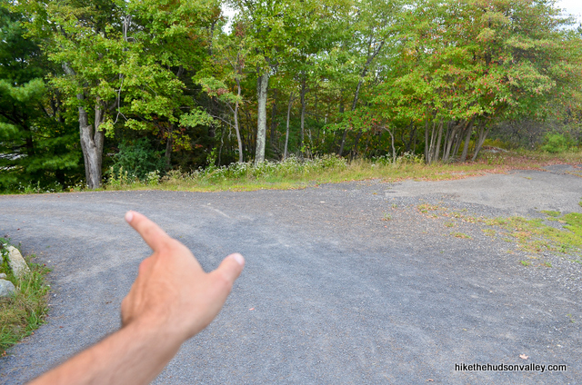
31. In just another minute, pass a gazebo that overlooks the lake. If it’s unoccupied, you should probably consider occupying it.
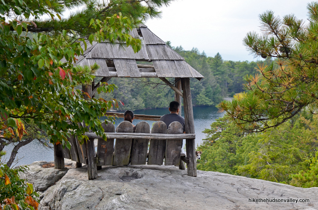
32. As you keep heading downhill, you’ll come to a junction with a building off to your right. Hang a left to stay on the main road.
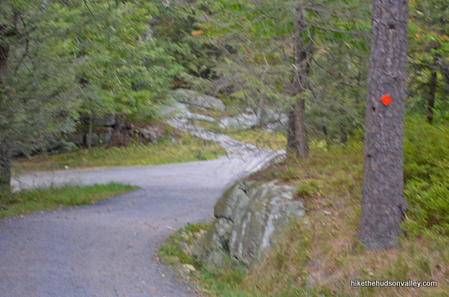
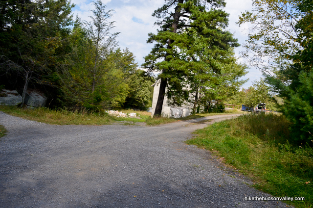
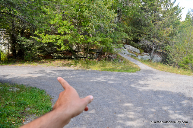
33. Just after that turn, you’ll walk under a picturesque wooden bridge. From this spot, you’re about five minutes from the parking lot. w00t!
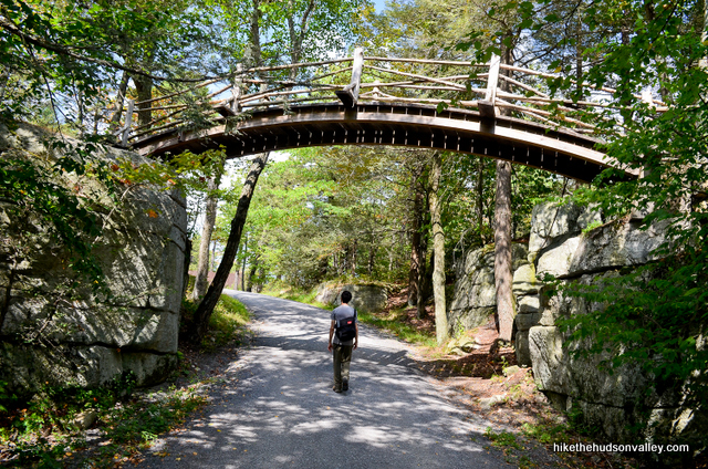
34. Keep sticking to the main road (still marked with red blazes) and ignoring the various offshoots.
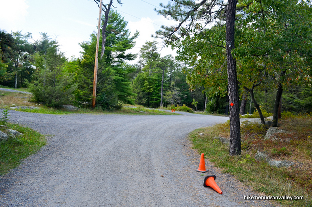
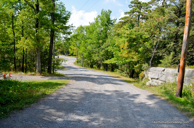
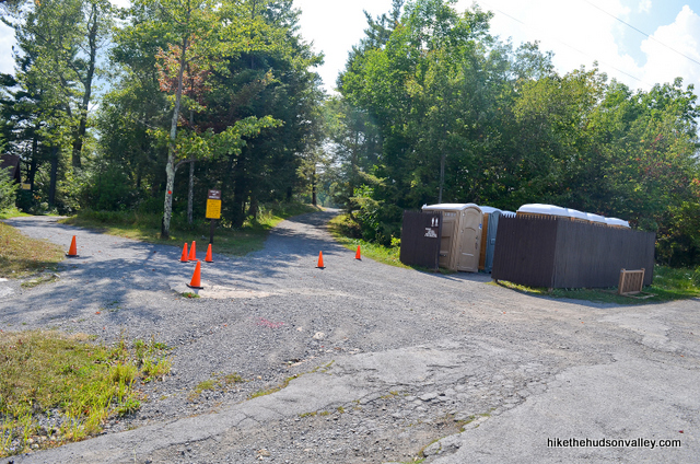
Shortly after the bridge (it took us four minutes), you’ll arrive at a junction with a bank of porto-potties. You want to take the path immediately to the left of those porto-potties. (And if nature is calling, bang-o, it’s your lucky day.)
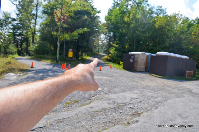
35. See those cars across the field, to your right? Hopefully, one of them is yours, or a friend’s. Otherwise, enjoy your walk to New Paltz!
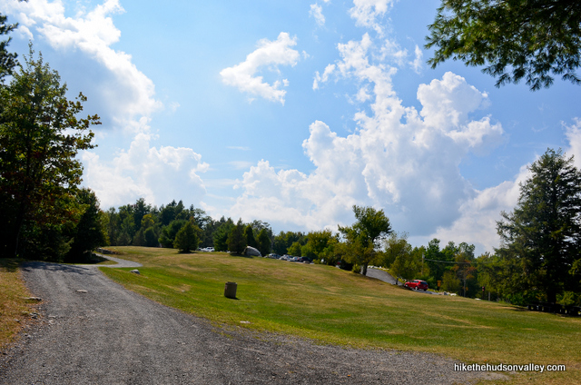
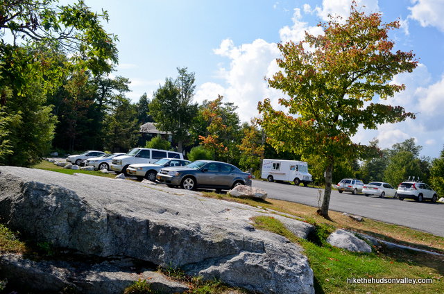
If you have do wheels at your disposal, though, that’s a wrap! Congrats on knocking out a very tough hike And for picking Gertrude’s Nose!
Directions
Directions to the trailhead: From New Paltz, head west on Route 299. Follow 299 until it dead ends into Rt. 44/55, where you’ll make a right turn. Follow 44/55 past the hairpin turn under the Shawangunk cliffs and past the Trapps parking area on your right. Continue another 3 miles past the Trapps parking area to find the well-marked entrance to Minnewaska State Park Preserve on your left. Stop at the guard shack, pay the fee, then continue uphill, until you reach the upper parking lot. The traffic flow here was changed in 2017 – apparently, it’s a left turn after the guard shack to get to the upper parking lot now. (Thanks for the helpful tip in the comments, James!)
Hop out and let the adventure begin!
You can also get directions by checking out the Minnewaska II: Gertrude’s Nose entry on the HiketheHudsonValley.com Google map.
Sorta nearby address for your GPS: The New York State Parks page gives the address for Minnewaska as:
5281 Route 44-55
Kerhonkson, NY 12446
Google Maps chokes on that address, though. If your GPS doesn’t like it, either, you could try the intersection of 44/55 and Jenny Lane in Kerhonkson, NY, which is about a mile west of the very well-marked Minnewaska entrance on 44/55.
GPS coordinates of parking area: 41.72877, -74.2373 (Clicking will open in Google Maps or the Apple Maps app, depending on your browser/device.)
**UPDATE/WARNING for 2019** Here’s an official warning from the Parks Service on the multiple construction projects underway at Minnewaska this year:
|
|
|
Resources & Interactives
Super-cool Google Earth flyover of hike route:
Google Terrain Map of hike route:
Related resources: If you’re looking for actual facts and/or useful information, visit these resources:
- An excellent (and more succinct!) trail guide to the exact hike described above from the always-awesome New York-New Jersey Trail Conference
- The New York State Parks page for Minnewaska
- The official Minnewaska trail map
- The surprisingly informational Minnewaska Wikipedia page
- More Minnewaska hikes from the New York-New Jersey Trail Conference
- More nice pictures and trail descriptions on this CNY Hiking page
More Gertrude’s Nose pictures from the hike’s Flickr album (and a special thanks to my buddy and photographer extraordinaire Jeff Hofer for providing some of his awesome pics to use on this page):
Want to support trails in the Hudson Valley? Here’s one great way: Visit the New York-New Jersey Trail Conference homepage and click on Volunteer, Donate, or Shop! (Then you can volunteer, donate, or shop, depending on your mood.)


What would be appropriate age level for a child to attempt this trail?
I have 12 almost 13 year old Boy Scouts and a 9 year old daughter who had done 3 mile hikes in Ramapo Mountain State forest in NJ.
Hi, Jason! This is a tough hike primarily due to its length — 8 miles is a long haul for anyone, and might be a stretch for kids of that age. If a three-miler is their longest hike to date, you might want to start with something shorter at Minnewaska — my other Minnewaska trail guide details a six-mile hike that has lots a great highlights and is significantly easier. That said, the terrain itself for this hike should be doable for them, and it is a gorgeous loop. If you do attempt it, be sure to leave plenty of time for breaks, snacks, water, and hanging out to soak in the views. They’d surely love the views, but might not love the length. Good luck if you give it a go!
Hi,
Can you recommend some day hike tours to Gertrude’s Nose (or the like) from NYC please? I am arriving in NYC on 3/5 and leaving on 13/5.
Thanks!
Thank you so much for this! I am a descendant of Gertruy/Gertrude Esselstyn (1650–1719) who married Jacobus Bruyn (1645–1694) who built their home nearby, and the rock was named after her nose, of course! I hope to make it to the Hudson Valley this fall and visit.
Tracy, that is so cool! Thanks for taking the time to comment and share that history! What an honor to have such a gorgeous place as a namesake – I hope you’ll get to visit this year!
Mike, Thank you for your wonderful trail and photo guide to Gertrude’s Nose. I hiked to Gertrude’s Nose in the early sixties from Camp Ridge-Ho (Girl Scout Camp at the end of Camp Ridge Rd.). Since we were SSW of Gertrude’s Nose we likely used a different trail. But that doesn’t matter, your photos were a hike down memory lane. I remember a section where there was a rope to help climb a steep section between boulders. It was probably only a couple of feet but it was a big deal for an eleven year old.
Such nice memories, Jane! Thank you for sharing them here, and thank you for your kind words. Happy adventures to you!
Be very careful and aware at step 24. We got lost and ended up on the Coxing Trail as we were losing daylight. Had to take that to the Trapps and hitch hike back to the upper lot. Not sure if anyone else has gotten turned around here, but the Rangers we spoke to said it happens very often. It’s not a clear path when the red and blue trails meet. Just FYI
I’m so sorry you had this experience, Elena! If there’s anything I could do to clarify the instructions, or any helpful pointers that might have prevented you from getting turned around, please let me know and I’ll update the trail guide in that spot. Thanks!
Thanks Mike! It wasn’t your guide that had issues, the markers for the trail are very hard to see at step 24. While it is a straight shot to the lake, you can easily be taken off trail bc it’s so over overgrown and not well marked. The rangers we spoke with said people get off trail almost everyday and they are aware of it. There must be a junction, although we didn’t see it, where the trail meets the Coxing Trail. There no sign that we saw so it’s just poorly marked. It was a mistake on our part for not paying more attention for sure. Just wanted people to be aware as they took that step.
Thanks!!
Hi I did this hike like pretty late in the day was told that we couldn’t do it but did it anyways. Pretty sure this picture is of the nose. But could be wrong when I googled it it seemed to be the shelf but when we got there all trails said it was the first cliff we got to. We came up from the left trail so I am not sure. But if it loads I do think it looks like a women’s face. Cool hike.
I totally see a face in there, Jeremy! Sure seems like a valid theory to me! And that is a beautiful photo – thank you for sharing it here!
Thanks I think we did ok with the photos but due to the time we arrived and had to leave I don’t think we got as good of pictures as we could have. I think we did the hike in 3.5 hours. I think they said it takes about 5 hours normally. Also only having our iPhones it’s kinda of limited. Here’s the one of the shelf we got kinda close to sunset I think this is the week for the foliage. Tough to time time off work with the seasons. Lol
What a gorgeous shot! I think you did better than okay! Thanks for sharing this one here. 3.5 hours is really hoofing it — surprised you had time to take any photos going that fast!
To follow the route described above you are required to pay a $15 per person day use permit. The MM trail accesses the Monhonk Preserve. No one told us that until we got up there at the cul-de-sac and saw the signs. You can defer to the MC trail to get back to the Lake Minnewaska visitors center. Otherwise, plan ahead and pay for a permit
Hi, Rachel! Your comment caused me to call the Minnewaska park office to make sure I understood the official policy on that sliver of trail that crosses briefly into the Mohonk Preserve right at the Millbrook Mountain overlook (Step 22 above). The very helpful Minnewaska park manager got on the line, and said that he had never heard of anyone having trouble there. You do not need to purchase a separate Mohonk pass to hike that tiny section of trail, which very quickly returns you to Minnewaska. If you parked at Minnewaska, you only need to pay the Minnewaska parking fee. If you instead parked at the Mohonk Preserve to climb Millbrook Mountain (which is another beautiful hike that I’ve written up here: https://hikethehudsonvalley.com/hikes/millbrook-mountain/), then you would indeed need to purchase the more expensive hiking passes from the Mohonk Preserve for each hiker. The hike I’ve described above is a very popular loop, and can be legally completed with just the Minnewaska parking pass. Sorry for the confusion up there – hope that helps clear things up!
Author mentions “In this next section, you’ll notice the red blazes at times veering inland, away from the cliffs. If you choose to follow the cliffs instead, be warned that you may have some backtracking”.
Please do not “choose to follow the cliffs instead”. Why? Lake Minnewaska is a park preserve meaning there are endangered species such as the broom crowberry and pitch pine trees. On the nose, “social trails” have developed much like you can see on his image after bullet point 17. Social trails have developed due to hikers walking off the marked red blazes. Minnewaska marked the trails the way they did for a specific reason.
When hikers leave the trail, it creates erosion on these plant species. If the erosion continues, we might never see these species again. The broom crowberry can only be found in the Shawangunks. Stewards such as myself set up at the nose to share this education but we can’t be there every day or every moment. So please do your part and be stewards yourselves.
Justin, thanks so much for taking the time to leave this thoughtful and educational comment. I’ve amended the trail guide above from “polite recommendation” to “polite mandate” to stick to the red blazes, and have removed the picture of my friend hopping over a chasm when he briefly left the Red Trail. I’ve also added a clip from your comment above, to help people understand what’s at stake, and how they can play a helpful role in preserving these rare plant species. Please don’t hesitate to reach out if there’s ever anything else that can be done on this site to drive awareness and communication in preserving this special place, and I hope these changes help this trail guide to play a more helpful role here.
Thanks for everything you do as a trail steward!
Did this hike last week, just wanted to note there’s a fair bit of construction happening at the beginning of this trail (looks like they’re building a new visitor center or something) which changes the guide a little bit at the beginning. It’s still easy to follow though. Just go to the handicap parking spots and go straight to get on the path (I believe it has a sign for Carriage Trail) and follow that pathway and signs until you hit the beach/bathroom area, and you link back up with the trail guide there at step 5 (the direction/picture for step 4 is the same, but the sign isn’t there anymore if I remember right).
All that said the rest of the guide is great as usual, and of all the hikes on this site that we’ve done, this was my #1 favorite. Not too difficult, not too easy, and at 8 miles with this level of difficulty you definitely are ready to stop by the end but aren’t completely wrecked, plus there’s the cliffside grassy park with a super nice view over the lake you can crash at. Top 1 overall views for a hudson hike in my opinion as well. I went on a Tuesday so there was no wait getting in, if you can possibly go midweek then its worth it.
The air-conditioned funky cave thing is also so weird and cool, a bit tricky to find with a couple of little side paths around there (probably from people looking for this), but just keep poking around and you’ll find it eventually, and no real risk of getting lost at that spot.
Thanks so much for the guides!
Pro-Tip for those looking to do any of the Minnewaska trails; Get there early!
The park doesn’t open until 9:00. We were there around 8:15 and were probably the 30th car in line.
Make sure you’re ready to hit the ground running as soon as they open, which was around 8:45am on saturday. Boots tied, packs ready and directions established so as soon as you get in, you park the car, lock the door and put as much distance between you and the other guests as possible. It worked out well for us and it gave us plenty of time to hang out and take pictures at Gertrudes Nose.
Obligatory, we did see a small rattlesnake on the way down as well as a good sized Rat snake. We heard the rattle snake way before we saw it as the group in front of us wasn’t giving it much space.
Enjoy!
Hiked this today and followed the route as you laid it out in the above. Super easy to follow your directions and the photos were a great help as well.
I definitely underestimated this hike. The milage wasn’t a concern for me going into it, but, the rocky trail and temp increase later in the morning made me happy I brought extra water. The last two miles I was pretty much out of steam and was pretty happy when I got back to the lot.
All in all, this was an awesome hike, and had been on my list for quite some time so I was glad to have done it. I arrived at 9 am and really didn’t see anyone else taking this route. I was on the cliffs and at the Nose by myself, and didn’t encounter anyone else until I was making my way around the loop (by the cold spot). Looked like lots of folks were doing the trail clockwise as opposed to the counter clockwise I went.
Should have read all of this (including the comments) BEFORE we hiked Gertrude’s Nose on my 36th birthday this past Sunday
30% chance of rain in the forecast made us feel confident the odds were on our side….as it turns out, the odds WERE NOT on our side. I also wore running sneakers with little tread-which made the final 2 miles of this hike VERY interesting. If you take the hike counter clockwise, in the rain, the final portion becomes a stream-that you have to walk in. Which would be really fun if we came prepared with water shoes, and shoes with good grips on the bottom, and 80° weather-but instead we had none of those things…I also slowly lost the will to live as we went further and further along the trail.
A word to the wise-don’t waste your cell phone batteries on photos, you’ll need them should you decide to give up on life and hope that a forest ranger will find you somewhere before you’re dead. The only thing that kept me trekking to the end was the circling vultures, who were also waiting for me to die.
All kidding aside-I didn’t regret the hike, I just wished we had been a little better prepared, and had better weather.
For my 36th birthday I wanted to do something that made me feel alive…nothing will help you feel more alive than feeling like you might die in the woods on the same date you entered this world 36yrs ago.
Enjoy!
Hiked this today (11/4) and the trail was SUPER wet. That one section going down was basically a running stream and there were a few points you had to cross over a bit of rushing water. Reccomend waterproof shoes if you go any time soon. Totally worth it though, amazing views throughout the trail and your guide was awesome and super helpful!!
Hi Jennifer! I’m thinking of doing the hike this upcoming weekend… how was the foliage? Thanks for the tip on waterproof shoes!
Still a decent amount of leaves left on the trees! I was surprised how many were still on after the crazy winds Saturday. Have fun!!
Thank you so much for this trail guide! I did the hike on Sunday 10/14 and I screenshotted this trail guide on my phone and used it along the way to help make sure I was on track.
There’s a new trail sign on the entrance to Gertrude’s Nose that makes it very easy to see. And just a heads up for anyone looking to try this trail soon – some of the rocky parts on the Millbrook Mountain Trail (not photographed in your trail guide) were basically a creek this last time I went. Two other times I went it was dry, so it may have just been due to a rainy summer and a lot of rain late last week, but be warned: If it’s rained recently, this trail gets muddy, and at some points, the trail is has flowing water running over rocks. I strongly recommend waterproof shoes.
I’ve included a picture of the creek-trail just to give you an idea of what I mean. Thanks again for this awesome guide!
We were tentative about making this hike until reading your incredibly detailed adventure. Some other accounts made it sound more intimidating than it was, but for sure, it is not for anyone who’s not in decent shape. My wife and I did this trail last weekend on a beautiful early fall day, and absolutely loved it. It was one of the more diverse trips we’ve done, with regular elevation changes varying from trail, to scramble to water crossings and flat, open vistas which really kept the entire trip interesting. We did the loop counter clockwise at a ranger’s suggestion, hitting the Millbrook Mountain Trail first, which presented the more challenging sections of the trail early, (in my opinion.) After days of rainfall, what might have been a mildly challenging scramble at one point, turned into a pretty challenging uphill traverse of 500 – 600 feet through a rushing stream down to the small falls and pool. It was invigorating heading up, but a small group heading down was having a very difficult and slippery time. All in all, we totally agree with your assessment and recommendation. Thanks so much Mike!
Did this hike today! Wonderful views and even though it’s on a ridge, shade was thankfully available at regular intervals. I noticed the cool air coming from some of these holes, too. Are these ice caves similar to the ones in Sams Point?
As someone mentioned earlier, this is in my opinion a moderate trail (much less & easier scrambling than say the High Point trail at Sam’s Point) that becomes very advanced if you go after a big rain or snow. Some of the trails were washed out in the park and that long stretch of rocky trail near the stream crossing is very steep and slippery when wet even with good hiking boots. Exercise caution if you your balance isn’t good, or are with little ones.
Saw lots of ghost pipes, ate some ripe blueberries, and saw lots of huckleberries everywhere!
Completely stumbled upon this trail and lookout by accident, as we were trying to reach the Castle Point(?) viewpoint. It’s really easy to wind up on the wrong trail, as there are so many different paths.
Nonetheless, Gertrude’s Nose is probably the best panoramic view I’ve come across in all my NY hikes. Very happy we wound up here by accident.
Be aware of bears. One did run across the trail about 20 feet ahead of us. An adrenaline-inducing but scary moment!
Completely stumbled upon this trail and lookout by accident, as we were trying to reach the Castle Point(?) viewpoint. It’s really easy to wind up on the wrong trail, as there are so many different paths.
Nonetheless, Gertrude’s Nose is probably the best panoramic view I’ve come across in all my NY hikes. Very happy we wound up here by accident.
Be aware of bears. One did run across the trail about 20 feet ahead of us. An adrenaline-inducing but scary moment.
Hey Mike, finally got to do this hike yesterday with my friend, Wendy. Mesmerized. I just kept saying “Oh my God, look at that” over and over and over – so many beautiful views, it was unbelievable. Your guide was absolute perfection (no surprise – they always are and I always recommend your site to anyone and everyone who will listen), and, at first, we were like “this is a 9 in difficulty? why??” Then, after we got to the top of Gertrude’s Nose or chin or whatever part of her we were perched on top of, and we were plunged back into the woods, we realized the long trek back to the parking lot had to be the reason why it was a 9. Honestly, I was bored after the view at the top (with a few exceptions – like the view of Skytop Tower) and think, next time, I’m going to get to the Nose, turn around and head back the way we came, rather than do the full loop. My GPS clocked it at 9 miles too, which I found interesting – and ass kicking. Ha ha…but I can’t wait to go back and do this again – just not the full loop! And, I agree with some of the other comments – parking is insane and people are CRAZY the way they drive so be careful when you’re coming out from the trail. The lunatic drivers who show up late in the day are aggressive about finding a spot – ANYWHERE – even past the signs that say “no motor vehicles beyond this point”. Thank you so much for all of the time and effort you continue to put into these write ups. It’s SO appreciated!
Thanks so much for all the kind words and useful feedback, Beth! I agree about the last leg being a slog after so much awesomeness, but I’m a sucker for a good loop. Your variation sounds like a nice way to hit some of the best highlights while keeping the total mileage down. Glad you had an awesome day out there!
My girlfriend Sam and I did this hike earlier today.
Just wanted to put it out there that the parking lot opens at 9am–is a new thing?–and the fee is $10 per car. We arrived a little after 8 and waited for the park to open with some other surprised morning people. The “upper parking lot” is a left turn from the guard shack, not straight ahead.
Thanks so much for your directions and pictures. As always, following this hike was a breeze. Such a beautiful day in Minnewaska!
-James
Yes, the gatehouse and traffic flow at Minnewaska and Awosting have been completely redesigned as of spring 2017.
Thank you both! I’ve updated the parking lot description above with a comment about the new traffic flow. As for the 9am thing, I think it’s always been that way. Good excuse to sleep in and/or eat some pancakes first 🙂
A great and very detailed write-up. We did this hike yesterday and it was awesome. Thanks!
Excellent — thank you, Jim!
This was truly one of the scariest experiences of my life. PLEASE NOTE THAT WE WENT IN THE WINTER WHEN EVERYTHING WAS ICED OVER. Poor planning on our part.
It was a beautiful (and long) hike, but we made the mistake of going while it was snowing about about 10 degrees out. The last 1/3 of the hike (towards the waterfall) was on the side of a steep slope, completely iced over. We had several come to Jesus moments as tears began to fall along with the last of the fading daylight. By the grace of God, we made it through and I vowed to never do this hike again in the winter.
I would still try again in the summer. Views were killer and it was a full day of adventure to say the least.
hi my group and i are doing this in late january. is it safe?
OMG! This was the very best hike ever. We just could not get over the views, amazing, amazing amazing! thank you so much for your great trail guide, your website is amazing. Again this hike was the very best.
One bad thing, bathrooms were definitely not usable.
This absolutely truly was the best hike ever and one I will never forget. We were so afraid that we had missed the color waiting this far into October to do this hike, but we couldn’t have been more wrong. It was amazing. The views along all the cliffs were truly breathtaking. I don’t know how we could ever find a hike that would top this one, especially with all the autumn color. Your directions were excellent, and it was an incredible day. But I must agree, the bathrooms were absolutely disgusting, could not be used!!!
What a great web site, thank you! As a Gunks local I get to all of the Mohonk area hikes many times a year, so I can confirm that as of Fall 2016, Hamilton Point carriage road (the sawhorsed-off trail in your writeup) is fully open, and the Gertrude’s Nose trail head is well marked with a big interpretive sign.
I can also report that I have seen bears on the Millbrook Mountain carriage road on three separate occasions in the past year, which just makes the hike that much better!
Thanks for the kind words, excellent photo, and great info, globecanvas!
Did this hike 10/15/16. Parking was out of control. All lots were full and they were ticketing people parked along the road. I understand it is peak foliage season so I definitely recommend going on a weekday and not o the weekend. Otherwise great hike!
thanks for the tip!
Took this hike last week again for the ridiculous views. Rather than going all the way, I made it a there and back, turning around after getting in some meditation on Gertrude’s nose (The overhangs are really the meat of this hike anyway 🙂 )
BTW! There is now a nice big sign pointing the way to the Gertrude’s Nose trail! (Step 12.5ish) I’ve attached a picture.
Thank you, Dave! Glad to hear it about the sign. I took the warning off of Step 12 — hopefully, the new sign looks something like the one shown in that step 🙂
When you go out and back, are you following the loop counterclockwise? Thanks for any help!
Thank you so much for this, I did this trail today and whenever I was unsure I would check back here. The pictures were very helpful!
I can not thank you enough for your detailed tour guide. I went yesterday with my sister and we followed your exact route. the photos with each step made our lives so much easier where we didn’t have to guess about where we were going. Thank you so much
Mike, thank you so much for keeping this blog. The trail guides are some of the most helpful things I could ask for. Got lost several times, but thanks to your pictures, we managed to get back on track. I appreciate your help!
This was a great hike! Thanks for the excellent guide, and pictures to go along. During the hike, my friends and I found the ladder you mentioned, retrieved it, and placed it in a new location. Perhaps future hikers can make use of it!
Photo
Photo won’t upload, sorry
That’s a shame — if it’s in JPG or PNG format, you should be able to click the “Choose File” button on the comment submission form to upload it. Would love to see it!
Thanks so much, Ashok! How did you get down there? And how far did you move it? Seemed like it was carefully placed for a reason – hopefully it will still be useful (and findable) to people in its new location.
The ladder belongs to a friend of mine. Hope it’s still there for them.
Yesterday we went for a hike and ended up at the base of Gertrude’s nose. After some serious rock scrambles and squeeze we happened upon this random ladder from your picture. Good thing it was there, although precariously placed it was rather helpful to get to our million dollar view. Thanks for all the great tips and pictures.
Thanks for this lovely, lively description.
One quick comment- it is worth mentioning that there is not a single source of drinking water in the park, except for a concession stall selling small water bottles. BYO or you’ll be in a problem.
We asked some park staff why there’s no water and got answers like “we have no well and no water line”, and “we want to keep it natural”. They also told us not to drink water from the lake.
I think for a park that serves many hikers and bikers, from close and far, this borders on a public health hazard.
I’m quite sure this does not border on a “public health hazard.” Knowing to bring water on a hiking or biking excursion is about as basic as knowing to put your sneakers on first. And, NO it is not the responsibility of the park staff to explain why they don’t supply sneakers. Any regular visitors to the park will tell you that selling bottles of water to folks who didn’t bring their own will ultimately lead to thousands of empty water bottles littering the park. Sorry to be so harsh, but please don’t make this sound like such a calamity.
Dear Chris,
No water in a park may make perfect sense to you, or for that matter to any other regular user. However, the park is not meant to serve only regular users.
With all modesty, having traveled over 15 countries, I have never encountered a park charging entrance fees that doesn’t have a single source of water. Not to say that the fees are the reason why water is supposed to be supplied- just to highlight that this is not some god-forsaken park in the middle of nowhere. We are talking about a park that had probably a dozen employees on duty when we visited (not without reason- it is very popular) and well over a hundred cars of visitors.
As for whether this is “calamity” or not- well, maybe for you it isn’t. For someone who traveled almost 3 hours to get to the park, and then has to go to the closest town to get water, risking losing his parking spot (as a regular user you’ll know they fill very early in this park), this can ruin your day.
You may be an experienced hiker, but someone with less experience might be tempted to leave with less than enough water due to the lack of availability. Considering how hot and humid the weather can become in the park, I think this is a choice people should not be faced with.
I agree that selling water bottles on the park is not the best way to keep it clean. However, bottles ARE being sold at the concession stand. These are small bottles, which means you’ll be buying quite a few of them if you choose to get water this way, and, naturally, that comes with quite a premium. Wouldn’t it be simpler to supply the most basic service you can expect in a public park, drinking water?
Some of the confusion here lies in that this is a nature preserve and not a public park in the vein of Central Park which has amenities that many city folk are used to. The ‘pack it in, pack it out’ ethos here means that you are responsible for everything you may need and also need to carry out anything you bring in or make, eg waste. The Park Rangers are there and are a visible presence if indeed you feel like you are in some sort of danger from dehydration, but as conscientious trail runners and hikers we are responsible for ourselves, which can be a very empowering thing if you let it be.
To clarify, there are many water sources in this park including streams, brooks, and waterfalls. While not pre-packaged in a plastic bottle, if you’re feeling thirsty and don’t think you will carry water with you items like Sawyer’s mini water filter or a LifeStraw might be useful. Minnewaska is a beautiful park, let’s keep it that way without the bottles and trash.
providing fountains is very normal
Mike, my boo and I just hiked Gertrude’s Nose at Minnewaska State Park. We just wanted to thank you because without your expert guidance and help through the blog, we would have never made it! We would have missed some of the best views if it wasn’t for your blog. Again, thank you so much, we’ll be heading up to Overlook Mountain tomorrow and will, of course, be visiting your page again for your expertise!
Thanks so much, Jayme! That’s really fantastic to hear. May you and your boo have many more great adventures out there!
Wow. Seriously – Wow.
This hike was amazing. I’ve done your minnewaska loop prior to this, but figured on black Friday I would OptOutside and check out Gertrude’s Nose. Wow am I happy that I did.
The lady and I took this hike and showed up a bit too early. I like to get to the mountain before 8am so i can spend some time at the payoff without a bunch of other people. Unfortunately Minnewaska doesn’t Open until 9am — So we had to wait it out for a while. The wait was worth it though.
The trail starts off innocent enough, even once you get past the Pellet, everything is fairly calm and then even downhill for a bit. When you start to get out to the ledges it’s just an almost endless amount of huge views that are just among some of the best I’ve ever seen in the Hudson Valley – which is saying something.
After stopping at probably 5-6 different payoff points, we finally decided to make the trek in. if you’re thinking about doing this hike and you want to make it a 5-6 out of 10 as opposed to a 9 out of ten, just turn back and head back down the way you came in. You wont be missing much, and you’ll have a much easier hike back. If you want to do the full loop, move forward and get ready for some pretty strenuous terrain.
The length and second half of this hike make it very tough, but the views are fully worth it.
Definitely put this one on your list!!
A friend and I hiked this over the weekend, such a stunning hike with incredible views throughout.
One note: Owing mostly to our carelessness, we totally missed the Gertrude’s Nose trail where it veers off the Milbrook Mountain Carriage Road. The indicator sign is missing, so you have to look for the red-blazed tree. By the time we realized our mistake, we were nearly at the cul-de-sac area on the MMCR, so we ended up continuing along the MMCR until its termination, and then hopping on the Gertrude’s Nose Trail (doing this hike in reverse, in a sense). It was still epic, so basically the moral of this story is that even if you are idiots like we were, you’ll still find the views and they’ll still make your day! 😀
Thank you, Taylor! I just updated the trail guide above with a heads-up about the sign (Step 12). Hope that helps other hikers avoid the same issue – much appreciated!
how dog-friendly is this? I would love to do this with her. She is very athletic and pretty nimble. She has done a few of the 46ers in the adk high peaks with me. Is there alot of scrambling?
I left my pooch behind for this one, just because I’d never visited Gertrude’s Nose before and wasn’t sure if the pads on her feet would hold up on such a long, rocky hike. Technically, there was nothing that would have slowed her down – there’s really no scrambling to speak of. Sounds like your pooch would probably knock this one out no problem, as long as her pads are ready for many miles of rocky terrain. Good luck and let us know how you fare if you all give it a whirl!
My boyfriend and I did this hike over Memorial Day weekend. The hike was beautiful and definitely worth it! While we missed a couple turns, both were careless on our part and had it not been for your AMAZING directions, we certainly would not have noticed we had even passed our turn. Thank you so much for these instructions, they were incredibly helpful and clear. We cannot wait to take another hike on your list!
I’ve done breakneck ridge and bonticou crag and table rocks hikes in the last week….. Thinking about this on Friday…How does this hike compare technically ?
Sorry for not replying here sooner, George! On the off chance you haven’t found out for yourself already, there’s not much technical about this hike – it’s just challenging due to the length and rolling climbs.
this was a great hike and the views were spectacular! only thing of note is that the park entrance fee is now $10 as of April 2015
So glad to hear it! And thanks for the current info – I just updated the cheapskate alert above with the new price. Much appreciated!