Background
If you find this free trail guide useful, please provide payment by picking up at least one piece of litter on your hike. Cha-ching! Thanks for being awesome! (And here’s a quick primer on Leave No Trace, too, to help us keep the trails nice and fresh for each other.)
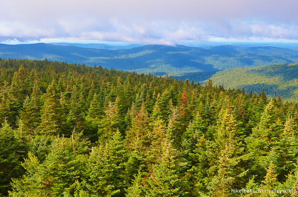
Background you can feel free to skip: There’s something about the view from the fire tower on Balsam Lake Mountain that almost, just ALMOST, makes you forget how far you had to drive to get there.
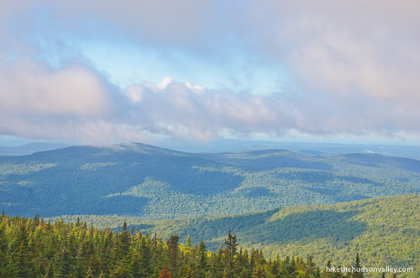

That view is surely one of the finest in the Catskills, rivaling the also-awesome views from the fire towers on Overlook Mountain and Hunter Mountain, and topping the still-wonderful views from Red Hill and Mt. Tremper (though these things are subjective, and the towers really shouldn’t feel like they have to compete with each other).
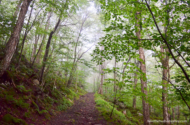
The trails to get to the fire tower on Balsam Lake Mountain offer many magical moments along the way, including a stroll through the dense balsam fir forest near the summit.

While the roundtrip distance for this hike is a fairly beefy six miles, with approximately 1,214 feet in elevation gain, the ascent is spread evenly over the hike, resulting in a long, (mostly) gentle ramp up to the tower.

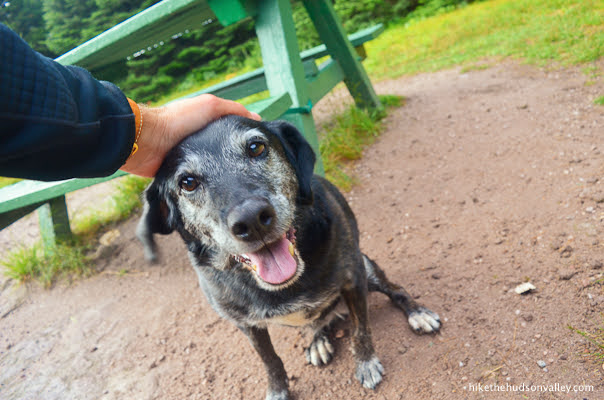
My old pooch isn’t as spry as she used to be, but I decided to bring her on this hike anyway, since it looked like a relatively easy climb, as far as Catskill hikes go. We were both glad for that decision.
Given that Balsam Lake Mountain is one of the Catskill 3500 high peaks, and that this hike ascends 1,200+ feet over six roundtrip miles, the trek is about as easy as you could hope for, though the term “easy” is extremely relative here. (Also, never tell your hiking companions that a hike is going to be “relatively easy.” They’ll be throwing those words back in your face every fifty vertical feet or so.)
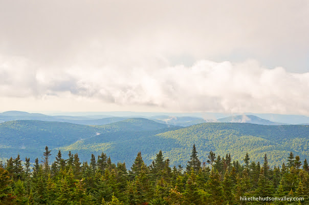
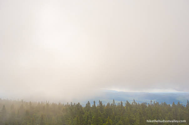
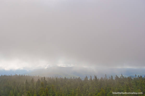
Also, when I speak of the gigantic view from the top of Balsam Lake Mountain, I’m making somewhat of an educated guess. On the morning I visited, the clouds whipped across the top of the mountain as the view played peek-a-boo.

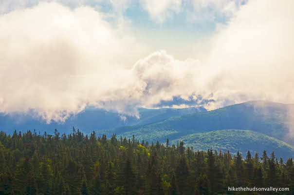
One moment, you could see for miles.

The next, inches.
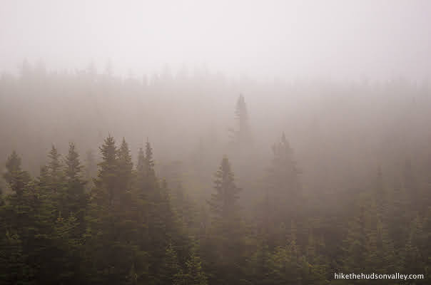
While I never got to see the ENTIRE view all at once, I did eventually get to see it all, revealed in pieces.
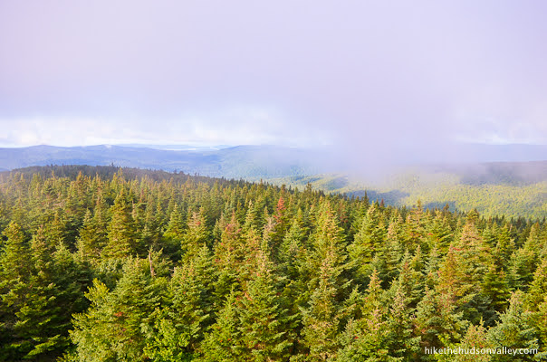
It was worth the wait. There’s just something special about gazing at the horizon over the tops of those balsam firs.
Besides the amazing view, a big part of Balsam Lake Mountain’s charm is its remote location, further west than any of the other Catskill fire towers. It’s a bit of a haul out there (unless you live in the western Catskill region, which you probably don’t, unless you’re a balsam fir), which is a big part of the reason that it took me a couple of decades of living in the Hudson Valley before I finally visited this spot. I wish I’d done it sooner.
“Finally, I visited the fifth and final Catskill fire tower!” I said after climbing Balsam Lake Mountain. This statement became incorrect in October 2019, when the Upper Esopus Fire Tower at the Maurice D. Hinchey Catskills Visitor Center opened. (I have since also visited that sixth tower, which is just a short stroll from the parking lot at the visitor center. It doesn’t have the same I-just-did-a-hike-and-now-I’m-on-top-of-a-mountain kind of vibe as the other five, but it’s still a super-cool spot to visit if you’re in the area.)
Also, the name “Balsam Lake Mountain” seems to suggest that you might see a lake here. There is indeed a Balsam Lake, but the trail to the fire tower doesn’t take you there. For this hike, the emphasis is definitely on the “mountain” part of “Balsam Lake Mountain.”
If you love remote hikes to gorgeous views, Balsam Lake Mountain should be high on your list of places to visit. It may be a long drive to the trailhead (unless, you know, you live close to it), but for all the awesomeness to be found here, you’ll have a hard time choosing a better destination. The mileage you’ll put on your car is well worth it for the mileage you’ll put under your feet.
Trail Guide
Bonus unsolicited advice: Don't depend on having cell service in the woods - it can be spotty out there! Download this trail guide to your phone before you head out. (It's easy to do on iPhone and Android.) May your connection to nature be strong, even when your connection to the internet is weak.
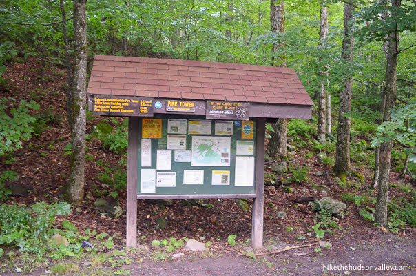
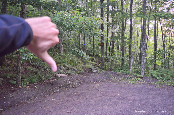
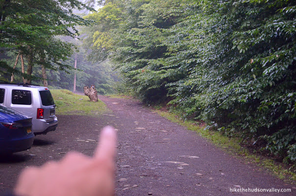
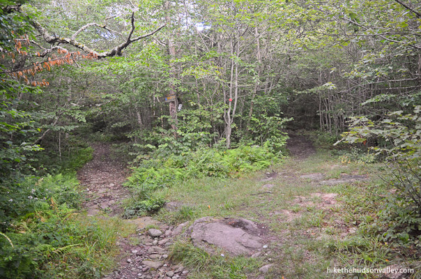
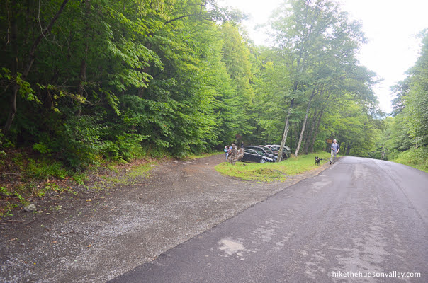
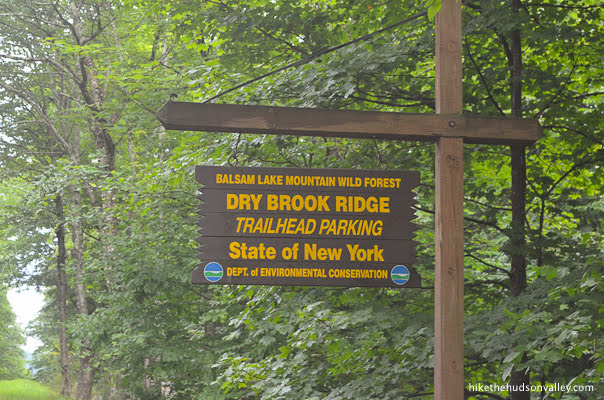
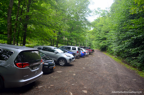
- From the parking lot (see “Directions to the trailhead” below), head over to check out the kiosk. Might as well learn something while we’re here.
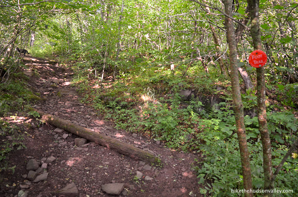
See that trail just to the right of the kiosk? It’s a trap! Don’t get on it! (It probably goes somewhere nice, just not to the fire tower.)
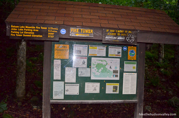
Looking back at the kiosk, you’ll notice signage that points to the left for the fire tower, along with a mileage estimate of 2.75 miles one-way. Let’s start chipping away at those miles!
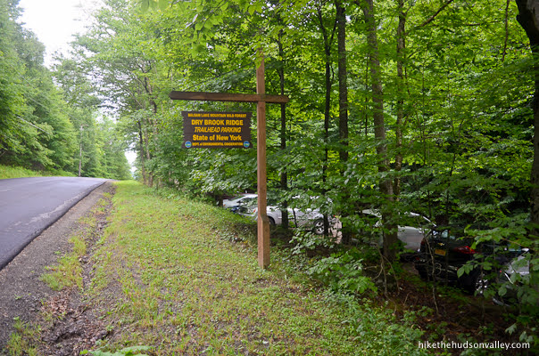
2. Facing the kiosk, turn left and walk to the end of the parking lot, all the way to the road.
Along the way, you might even notice a blue blaze on that stump. You’ll see lots more of those blazes today.
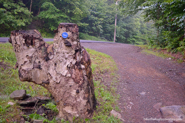
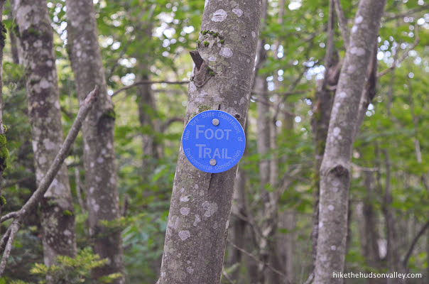
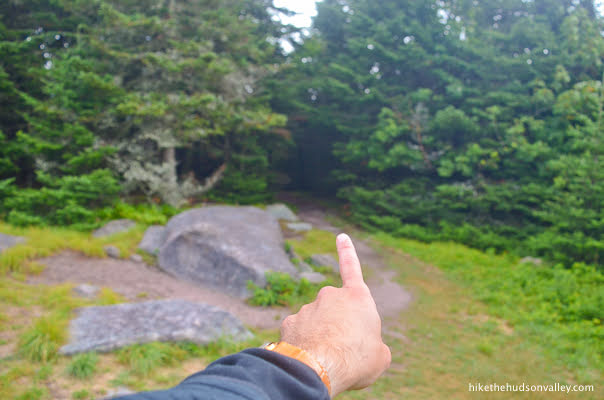
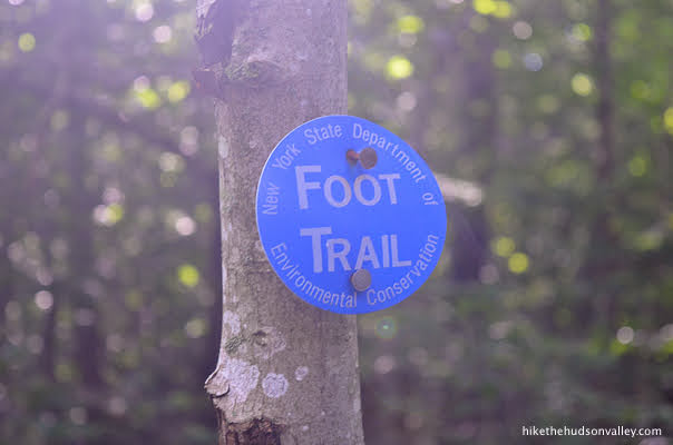
3. When you reach the end of the parking lot, you’ll see the Blue Trail entering the woods on the far side of the road. Carefully cross the road here to hop on that trail.
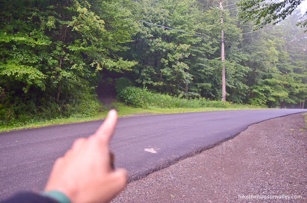
At the start of the trail, the sign estimates that you are now 3.0 miles from the fire tower.
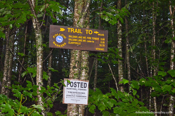
Hey, wait a minute, the sign at the kiosk said 2.75 miles! How are we farther away now? It would take a smarter person than me to explain how both of those signs are correct. (My GPS clocked this hike at just over 6 miles, so I’m inclined to side with this second sign, though I applaud the first sign for its optimism.)
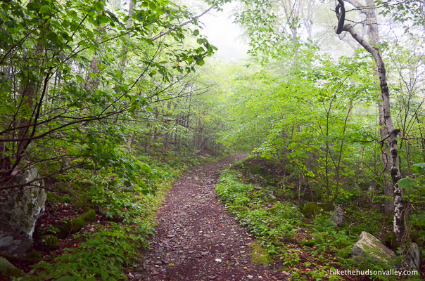
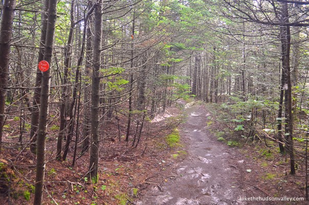
You’ll be on the Blue Trail for the next 2.5 miles, gently ascending approximately 782 feet until the next trail junction. (You can skip to that junction at Step 6 below if you want to minimize the amount of my yapping you’ll read today.)
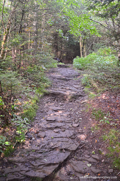
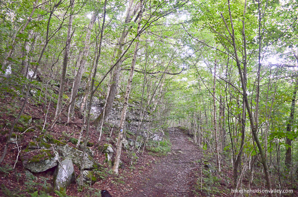
4. The Blue Trail is wide and smooth in this section, making the altitude and mileage gain as painless as possible.
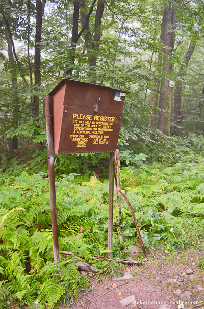
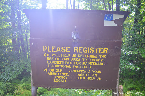
In just over five minutes, you’ll arrive at the trail register. Take a moment here to log your visit.
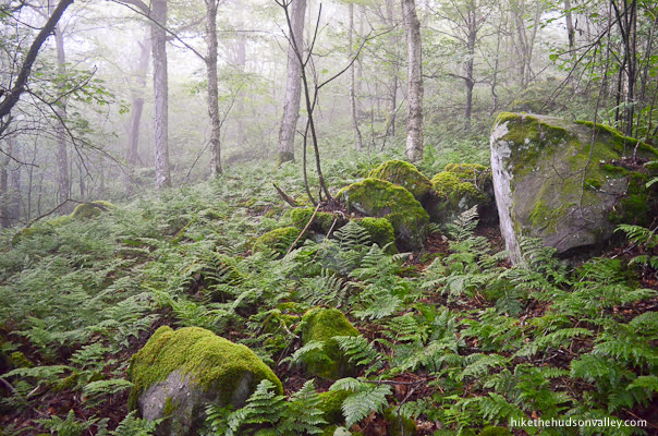
5. Enjoy the ferny peacefulness of the next stretch of trail.
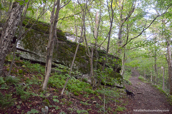
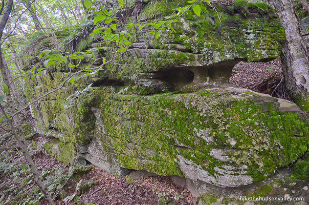
About 25 minutes after the trail register, you may notice an interesting rock formation on your left that looks exactly like a Pixar version of a U-haul truck.
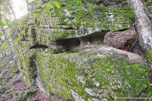
See it? It has eyeballs inside its windshield like it’s on its way to hang out with Mater and Lightning McQueen! The moss isn’t growing where the wheels should be. Please tell me I’m not the only one who sees this. It’s a perfect U-Haul! It has a Mom’s Attic, for crying out loud!
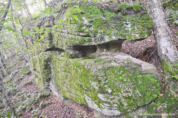
In any event, the trail continues winding uphill past U-Haul Rock. Let’s get a move on!

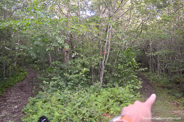
In about twenty minutes, you may notice an unmarked trail heading off to your left. Don’t get bucked off onto that trail! We’re looking for a continue-on-the-Blue-Trail type situation right now.

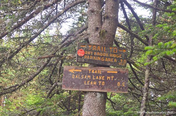
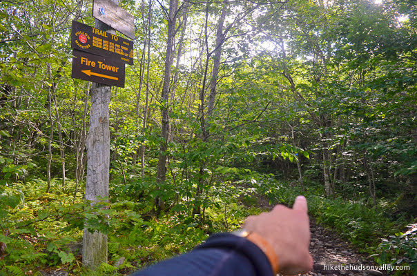
6. About five minutes after that unmarked junction, you’ll come to a well-marked junction with the Red Trail.
Standing at this fork, take a look at the sign behind you.
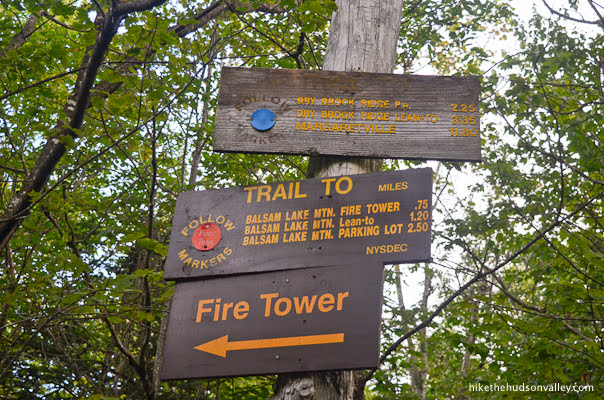
Hey, only .75 miles to the fire tower! Thanks for the good news, sign! (There’s not another sign around the corner that says we’re 1 mile from the tower, is there?)
Take a right turn at this junction to hop on the Red Trail, which we’ll follow all the way to the tower.
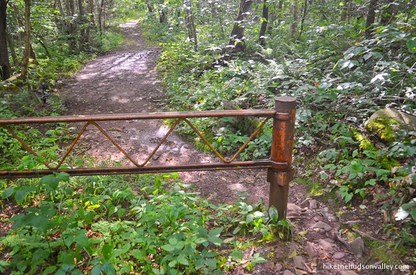
7. Almost immediately, you’ll come to a big metal hoobajoob (technical term) that helps to ensure that people are using their feet, and not giant cacophonous peace-destroying machines, to visit the tower. Just walk around it, following those red blazes.
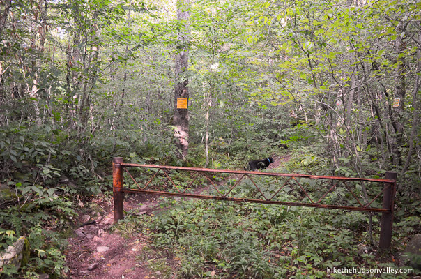
Thanks for keeping out the cheaters, big metal hoobajoob!
8. Over the next .75 miles, you’ll ascend about 450 feet on the Red Trail.

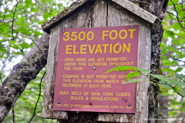
About ten minutes after the big metal hoobajoob, you may notice the 3500’ elevation marker.
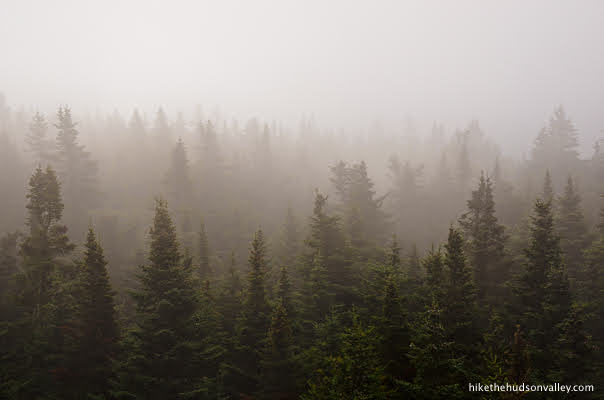
About ten minutes after that, you’ll enter a(nother) magical trail section that feels like an alpine tunnel.
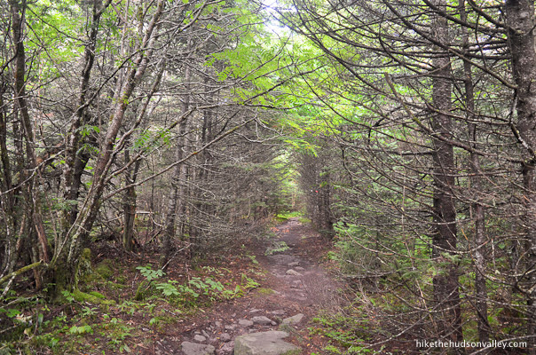
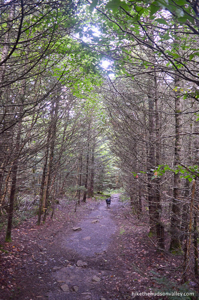
What a gorgeous place. And what’s that light at the end of the tunnel?
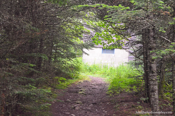
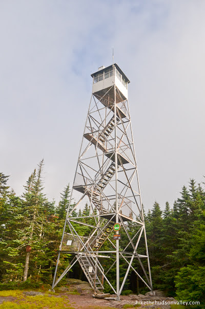
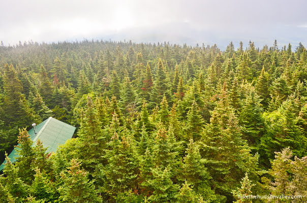
It’s a ranger an observer cabin! (Thanks to Tom Rankin for teaching me that these things are not ranger cabins, but observer cabins. I shall correctly observe the difference in the future!)
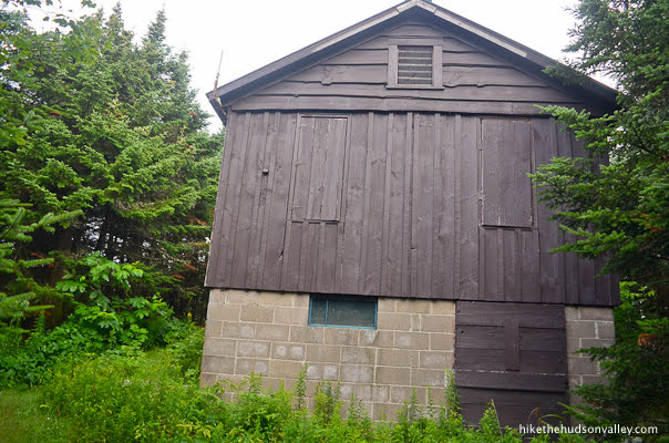
As you approach the (observer!) cabin, look above the trees to see if you notice anything peeking back at you.
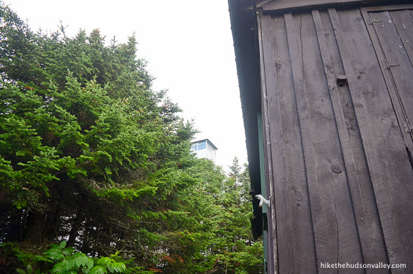
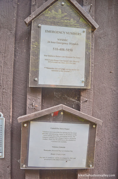
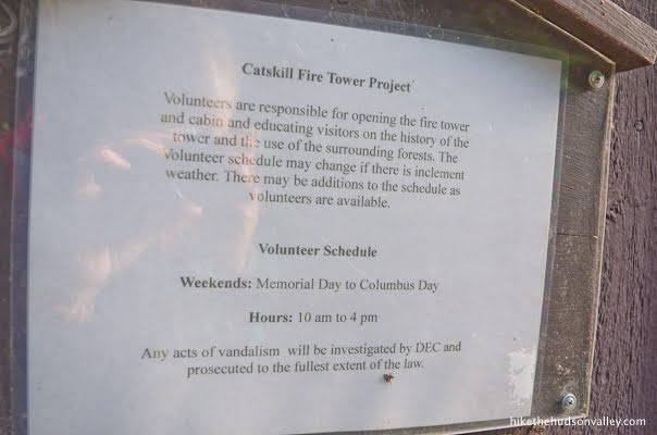
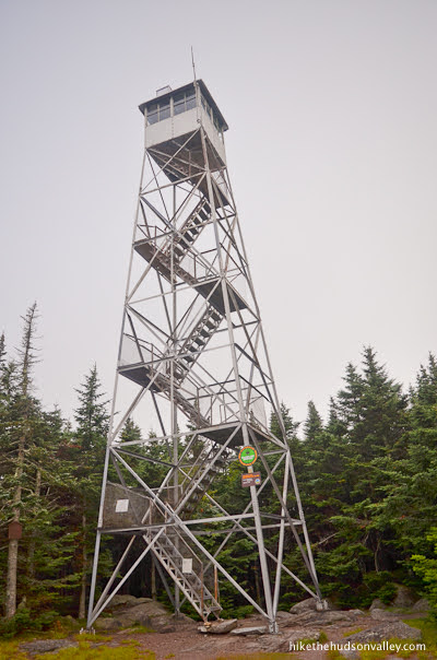
The tower! Let’s check this thing out, shall we? Head past the cabin toward the tower, taking note of the posted emergency contact numbers (hope you don’t need those today!) and volunteer schedule for opening the cabin of the tower. (And a special thank-you to the awesome volunteers who do so much to help the rest of us have amazing experiences up there!)
Just beyond the cabin, you’ll notice some signage that agrees with a subset of the previous signage that it is, indeed, 3.0 miles (not 2.75) back to the parking area.
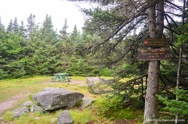
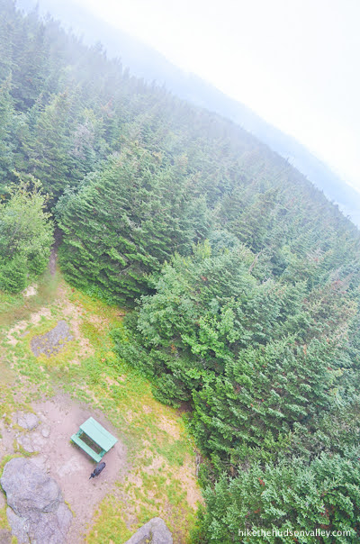
9. Emerge into the clearing with a picnic table and the big fat fire tower.
You made it!
“You just leashed me to the picnic table so you can climb the tower by yourself, didn’t you?” your dog will ask you.

“Oh, you brought string cheese? We’re cool. Have fun up there!”

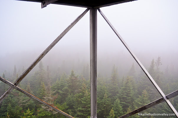
10. Let’s climb that tower!
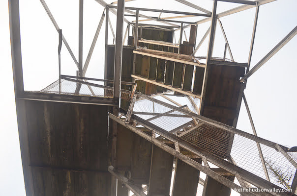
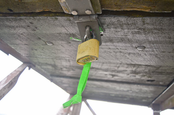
If you’re visiting at a time other than a peak-season weekend (when awesome volunteers open the cabin), you’ll find a scenic padlock blocking your way into the cabin.
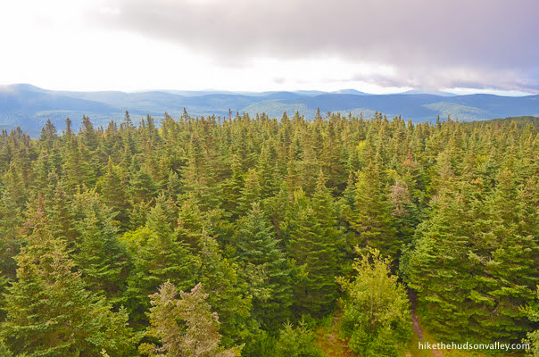
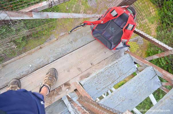
Have no fear! The view is quite gorgeous from the last platform below the cabin. You’re already so far above the trees, I can’t imagine the view would be much different from a few feet higher.

There’s not a ton of space up there, though. It’s only two planks wide, just enough room for you, your backpack, and perhaps a very close friend or two.
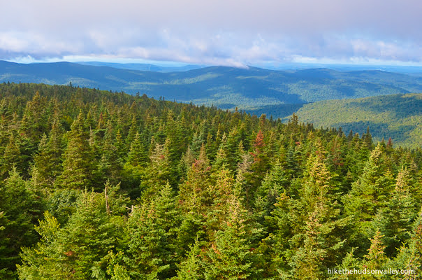
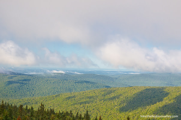
Even from below the cabin, man, that view.
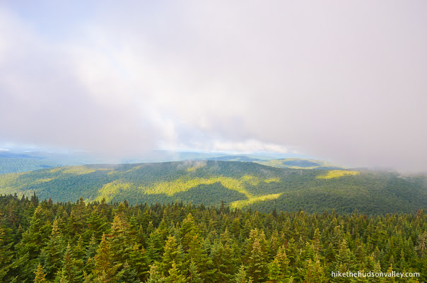
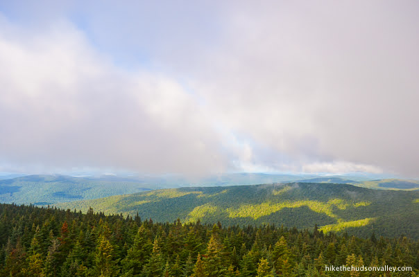
If some clouds blow over the mountain while you’re up there, at least you still have pretty trees to look at.

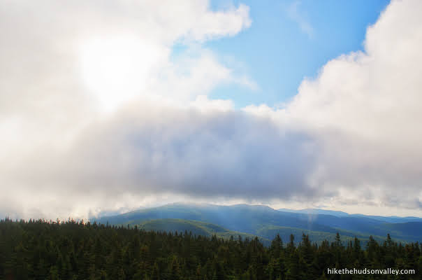
If you’re up there on a sunny day (or during a sunny moment), the view stretches on and on.

Clouds incoming!


“Hello down there! I’m waiting for the clouds to move again! Don’t worry, I have more string cheese in my backpack! You’re a good girl. Yes you are.”
11. When you’re done marinating your eyeballs in whatever view the mountain provided today, climb back down to the clearing.
You’ll be retracing your steps all the way back to the trailhead, starting with hopping back on the Red Trail. (Don’t forget to give a treat and a pat to any hiking companions who waited patiently for you.)

12. Follow those red blazes back through the balsam fir tunnel.
From the tower clearing, it took us 16 minutes to get back to the big metal hoobajoob.
13. Just past the hoobajoob, head straight at the junction to hop back on the Blue Trail toward Dry Brook Ridge Parking, just a 2.25-mile hop-and-a-skip from here.
14. From that junction, it took us 18 minutes back down to U-Haul Rock.
And another 13 minutes to the trail register.
And another 7 minutes back to the parking lot. Careful crossing the street! (I know, I know, but I have to say it anyway.)

That’s it! You did it! Now there’s nothing left to do but enjoy that nice, long drive home, which should give you plenty of time to reminisce about what an awesome day this has been. Enjoy it! (And don’t forget to give one more piece of string cheese to any deserving hiking companions.)
Directions
Directions to the trailhead: From I-87 headed north from the lower Hudson Valley, take exit 19 for NY-28 in Kingston, and hop on 28 West. Enjoy the scenic drive on 28 West for the next 35 miles. Take a left on Galli Curci Road (County Route 49A) toward Belleayre Mountain. Stay straight on 49A for over five miles even as it changes names a few times (Galli Curci, High Mount-Mapledale, Todd Mountain Road). When 49A (now called Todd Mountain Road) dead-ends into Dry Brook Road, take a left. Continue straight on Dry Brook Rd (County Route 49) for 1.4 miles, then turn right onto Mill Brook Road. Follow Mill Brook Road for 2.2 miles, then find the well-marked, horseshoe-shaped parking area on your right.
Pull in, climb out, and let the adventure begin!
Sorta nearby address for your GPS: Simply putting “Dry Brook Ridge Parking Area” into Google Maps on your phone will put you in the right place, at the DEC parking area on on Mill Brook Rd (Google Maps will list the address as “Margaretville, NY 12455”).
GPS coordinates of parking area: 42.07045, -74.57368 (Clicking will open in Google Maps or the Apple Maps app, depending on your browser/device.)
Resources & Interactives
Super-cool Google Earth flyover of hike route:
Google Terrain Map of hike route:
Alltrails recording of hike (click here to open in Alltrails app or Alltrails.com, depending on your device):
Related resources: If you’re looking for actual facts and/or useful information, visit these resources:
- Great updates and information on the Balsam Lake Mountain page
- The informative Balsam Lake Wild Forest page from the New York DEC
- A nice (and succinct!) trail guide from CatskillMountaineer.com for the same hike described (in lots more words) above
- The AllTrails page for this hike, which has lots of useful user reviews
- The surprisingly informative Wikipedia page for Balsam Lake Mountain
Want to support trails in the Hudson Valley? Here’s one great way: Visit the New York-New Jersey Trail Conference homepage and click on Volunteer, Donate, or Shop! (Then you can volunteer, donate, or shop, depending on your mood.)
My parents live about a 5 min drive from Balsam and this has, and will always be, a summer rite of passage. You described it beautifully. 2 notes: we always call “u haul” rock elephant rock. And the very last part (steep) is marked with yellow. See you on the trail.
Christine, thanks so much for the kind words and the update! I’m sure that rock can look like an elephant, too, but I just can’t make my brain see anything but a Pixar-style U-Haul. That’s great that you all have a name for it, too!
For your comment on the very last part having yellow blazes, can you confirm exactly where they turn to yellow? From Step 6, where the Blue Trail and Red Trail intersect? Have the blazes up there been changed recently, from red to yellow? (I’m assuming the trail to the tower is still quite well-marked, but I’d love to make sure this trail guide is as up-to-date as possible.)
Thanks so much for your help!
Awesome hike today and oh boy the smell of balsam was strong! We’re fortunate enough to be able to hike week days, so we only saw 3 people over the entire 6 miles. And only 1 other car in the lot. There are no long-distance views except from the tower. But that’s fine because the forest is beautiful! We were looking for some decent mileage but not extreme difficulty, so this was perfect. It is a longish drive from POK, but not too bad. Plus we got to stop in Phoenicia for ice cream on the way home! Thank you for the excellent guide.
Sounds (and looks) like a perfect day to be there, Kelly! So glad you had a great hike, and thank you for taking the time to leave such a nice comment!
One of the prettiest and certainly the most fragrant part of this lovely mountain is in the first quarter mile south of the fire tower. Before retracing your steps back down the route as you describe, I suggest you take this short, mostly flat, walk south from the fire tower before turning back. Dense balsams shade a soft footpath and fill the air with their scent. I am fond of this mountain and usually drive to the parking area at the end of Beaverkill Rd. near Balsam Lake and climb to the fire tower from the South just to walk through this section of woods.
Thanks so much for the beautiful description and recommendation, SP — I look forward to checking that section out next time!
Really enjoyed myself on this trek today, thank you! I too had issues with fog, headed back down the mountain for a bit and the sun broke through, so treked back up 🙂 Thanks for all you do, I look forward to crossing more off in the future!
Hi! First, I wanted to say that I went up this wonderful mountain last weekend. The sky was as blue as blue could be, the view from near the top of the fire tower was spectacular, and the directions you gave were clear as…well, as clear as the view! You are right that it is a long way from Poughkeepsie. But mostly a nice drive, and well worth it. The only drawback was the wind, which was whipping fiercely up on the tower–I began to wonder whether I was about to be blown away.
Second, and more generally, thank you! I have a few guidebooks to hiking etc. in the area (I actually learned about Balsam Lake Mtn. from a snowshoeing guide), but none of them are as detailed, as amusing, or as informative as the ones you post. I’ve used your posts to help me choose destinations not only for solo hikes, but also for hikes that include my daughter and her 4-year-old; we did Teatown reservation, Kaaterskill Falls, and a couple of others recently based partly on your recommendation. More to come; the little guy loves it!
Anyway, can’t tell you how much I appreciate your hard work, deathless prose, and passion for the terrific hiking opportunities in these beautiful part of the world. Thanks x 1,000,000.
Stephen, what a nice comment! My goodness, this made my whole week. I really appreciate all of the feedback and kind words, and am glad that this site has been useful to you and your family. Here’s to many more happy adventures to all of you!
Wonderful report great pictures and good narrative. Please don’t report that these amazing adventures are in the Hudson Valley they are located in the high peaks of the Catskill Park. Located in the Catskill region. The Catskills have no kinships to Tarrytown, Nyack, Haverstraw Newburgh and Kingston all located in the Hudson Valley. We who live and work in the Catskills are proud of our identity,. Saying that thank you for this great work.
Tony Lanza
Tony, thanks for sharing your perspective here! I will make more of an effort going forward to make sure I don’t incorrectly call the Catskills part of the Hudson Valley, since they are indeed a separate region. I honestly hadn’t thought much about it before, and the Internet agrees with you that the two are distinct. I have hikes from CT, MA, NJ, and various spots in NY featured on this site, and I certainly don’t mean to annex all of those areas into the Hudson Valley through their inclusion here (though you’re all welcome to join us if you’d like!).
Thanks for your kind words, and for helping to keep this site as accurate as it can be. Happy adventures to you!
I wanted to go to Slide Mountain this week (12/3), but I fear the recent rains have made the initial stream crossing impossible without a flotation device or sturdy watercraft. Dry Brook has a much nicer ring to it…perhaps I’ll have a go at Balsam (Lake) Mountain.
Jeff, indeed, this hike should be plenty passable – no stream crossings to worry about. Good luck and enjoy if you give it a go!