Background
If you find this free trail guide useful, please provide payment by picking up at least one piece of litter on your hike. Cha-ching! Thanks for being awesome! (And here’s a quick primer on Leave No Trace, too, to help us keep the trails nice and fresh for each other.)
“Mt. Tremper? Is that the hike with the rattlesnakes and the bad views?” my wife asked me when I reminded her of my hiking plans for the weekend.

“Well, maybe. Only one way to find out!” I said.
Even though Tremper Mountain is one of the more popular hikes in the Catskills, it had never bubbled to the top of my to-do list, largely because of these two quotes from the very informative Catskillmountaineer.com trail guide for Mt. Tremper:
“It has been reported that there are approximately 100 Timber Rattlesnakes that den at the old blue stone quarry on Mount Tremper.”
“Most of the trees around the Fire Tower have now grown up to almost the full height of the tower, so the view is limited.”
I’m willing to high-step around some rattlesnakes for a mind-blowing view, but huffing and puffing for 6+ miles for a limited one? Hmmmm. The value proposition here didn’t sound compelling.
(Incidentally, the risk of getting bitten by a rattlesnake is so small as to be functionally non-existent. I documented everything I could find about venomous snakes in the Hudson Valley in this blog post — Snakes on a trail — in case you like to obsess on this topic like I do.)
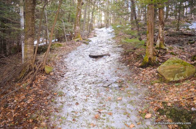
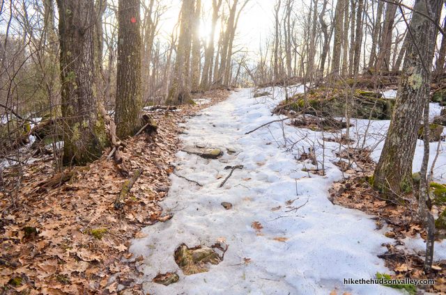
The more I thought about it, the more I realized that both problems (snakes and seasonal views) could be solved by visiting this hike at the right time of year: early spring, when it was still cold in the Catskills, before the leaves and snakes emerged for the year, but most of the snow had melted.
That plan turned out to be a good one.

I visited Mt. Tremper on Sunday, April 7, 2019, getting there right at daybreak (I had to get my son to a birthday party in Poughkeepsie that afternoon, so it was either get there early or don’t get there at all). There were zero cars in the parking lot when I arrived at 5:31am.
When I came off the trail at 9:28am, with tired legs and happy new memories, the parking lot was nearly full. (On its official page for the area, the DEC lists this lot as having a 10-car capacity.)
This is a popular hike, and it looks like you’d do better to visit at an off-peak time (weekdays or very early on weekends) to guarantee yourself a parking spot. 5:31am on a Sunday is apparently plenty early. (See the “Directions” section below for more details on parking and overflow parking. And my son got to the birthday party on time, in case you were worried.)
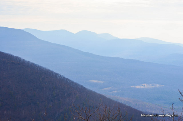
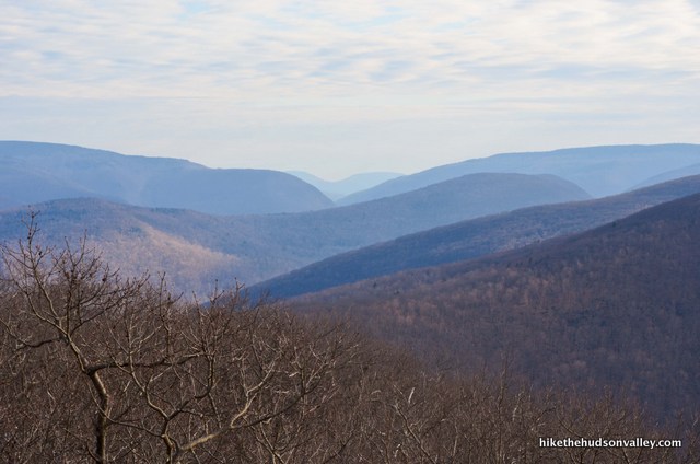
As for the views being seasonal, I can see where the foliage would indeed take away some of the view. At 47 feet tall, the tower does stand above the surrounding trees, but not by a whole lot.
I wouldn’t classify the view as seasonal, though, which generally means you can’t see squat for half the year.
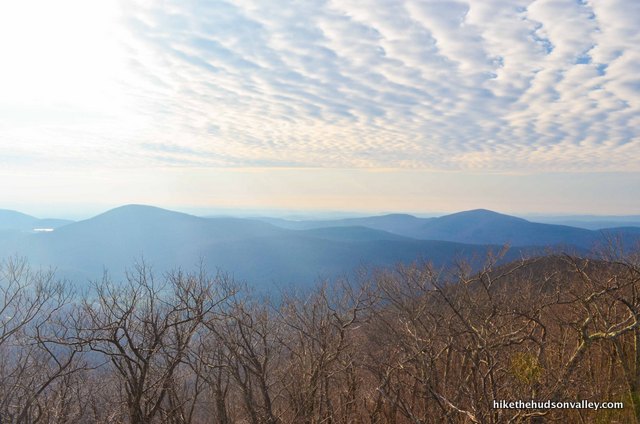
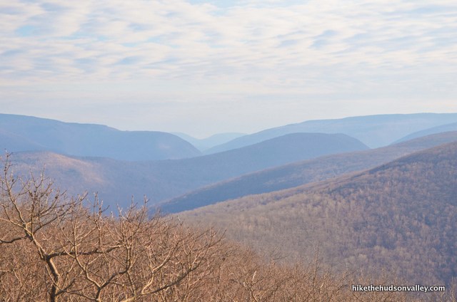
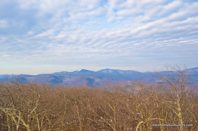
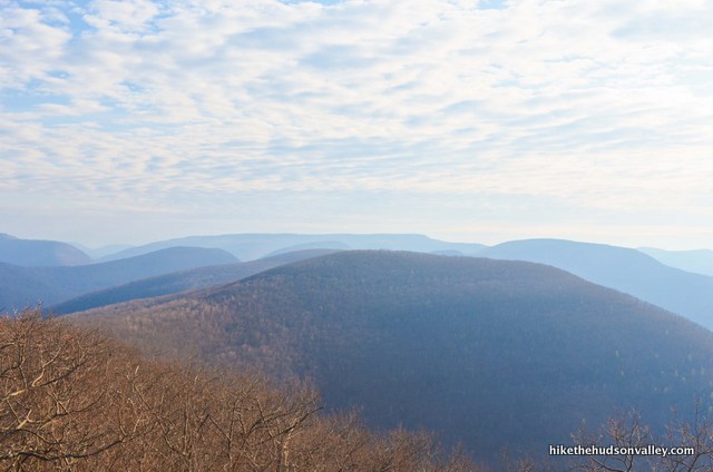
Here’s a panoramic shot of the view from the tower:
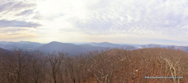
If you picture the trees at full-blast foliage, you’d really only lose a little of the view on the right. While the leaves might mess up your view-soaking mojo just a little bit, there’s still plenty of unobstructed viewing to be done in all seasons.
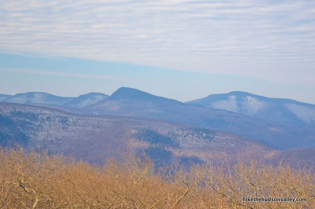
Thanks to Tracy Rakin, friend of the site and hiker extraordinaire, we don’t have to guess what it looks like up there with the leaves out! Here’s an image she shared on Hike the Hudson Valley’s Facebook page on May 25, 2019 (and shared here with permission):

Looks even nicer here than it did in my imagination. Thanks, Tracy!
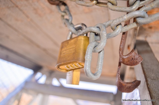
Tracy’s picture shows the view from the cabin, which isn’t always accessible. While I know I just recommended hitting this hike at on off-peak time, you should be aware that if you visit on a weekday, or a weekend between Columbus Day and Memorial Day, you will turn the last flight of stairs on the fire tower to be greeted with a big fat padlock in your face, keeping you from entering the cabin.
**UPDATE February 2024** Thanks to the helpful comment from ES below, which lets us know that the padlock is gone, and the cabin is open year-round! Hooray! Disregard any whining you may find below about padlocks and such. And enjoy the views from eight feet higher than I did!
While the views are still quite nice from the platform beneath the cabin, it’s rather cozy at that spot. The platform is only large enough for you and maybe one or two of your very closest friends. (Or, if nobody you knew wanted to get up at 4am on a weekend, your snack-laden backpack.)

During peak season weekends, though, super-awesome volunteers open the cabins of all five Catskill fire towers, including Mt. Tremper. From the Catskill Center website:
“During the summer months our Catskill Fire Tower Project volunteers open up the tower cabs on weekends for visitors to enjoy the stunning panoramic views of the region. Volunteers are generally present on weekends between Memorial Day and Columbus Day with the cabs open between 10am and 4pm. You should also check the signage at the trailhead to ensure that a cab will be open and staffed before you start your hike.”
Thank you so much to all the volunteers who donate their time to help the rest of us have great experiences out there! You all must be very cool people.
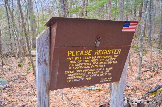
So that tackles the issue of seasonal views. As for the snakes, the kiosk at the trailhead confirmed CatskillMountaineer.com’s warning about timber rattlesnakes in the area.
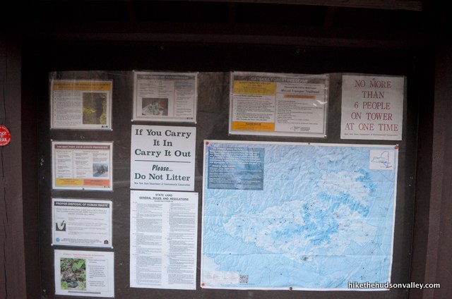

In case you can’t read the bold red font in the photo above, here’s what it says: “ATTENTION – TIMBER RATTLESNAKES MAY BE ENCOUNTERED. PLEASE KEEP PETS LEASHED.”
While the Catskills do have some trails where dogs are allowed off-leash, this is not one of them. For good reason.
In the awesome and informative public Facebook group “Catskill Trail Conditions,” someone recently asked about the snakes on Mt. Tremper. Commenters generally agreed that while snakes are indeed found on the mountain, especially near the bluestone quarry (not visible from the trail) at about 1,500 feet in elevation, most people never see them on this hike. One person reported being a volunteer on Mt. Tremper for nine years and never seeing a rattlesnake there. Does that make you feel better? Me, too! Kind of!
Though I purposefully visited this hike when rattlesnakes were extremely unlikely to be encountered, it sounds like that level of paranoia is unwarranted (that’s why it’s called paranoia).
Watching your step? Good idea. Not visiting Mt. Tremper at all? Bad idea. The views from the tower may not be the most panoramic in the Catskills, but they are still quite something to behold. If you’re looking to take a beautiful tromp in the Catskills, you should seriously consider being a Mt. Tremper tromper.
Bonus note: I completely lost cell service (Verizon) in the parking area. It came back partway up the mountain. Something to be aware of if you’re trying to coordinate with anyone from the trailhead. (This is nature’s way of telling you to stop looking at your phone.)
Trail Guide
Bonus unsolicited advice: Don't depend on having cell service in the woods - it can be spotty out there! Download this trail guide to your phone before you head out. (It's easy to do on iPhone and Android.) May your connection to nature be strong, even when your connection to the internet is weak.
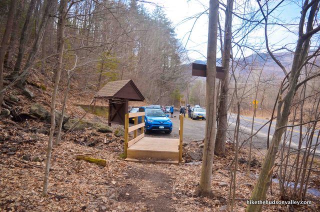
- From the parking lot (see “Directions to the trailhead” below), head over to check out the kiosk. Might as well learn something while we’re here.
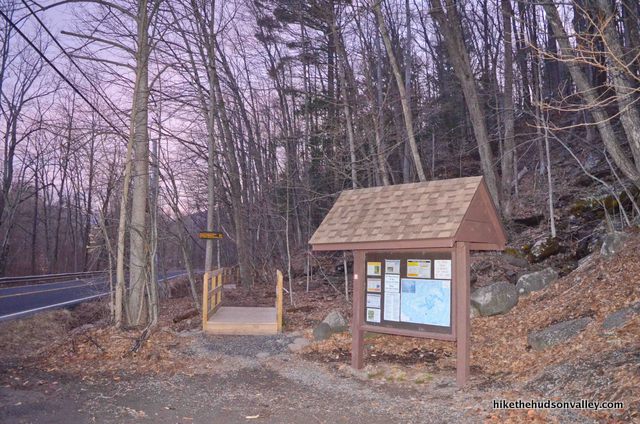
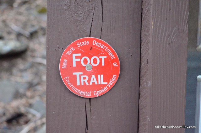
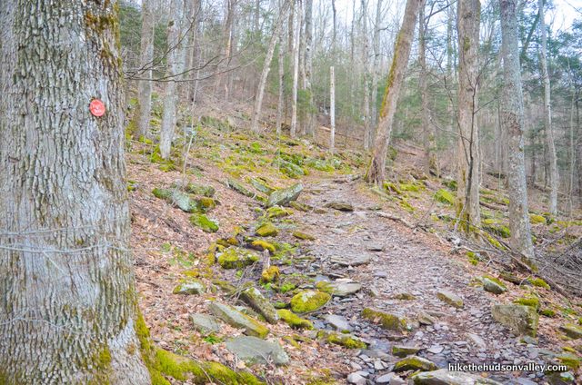
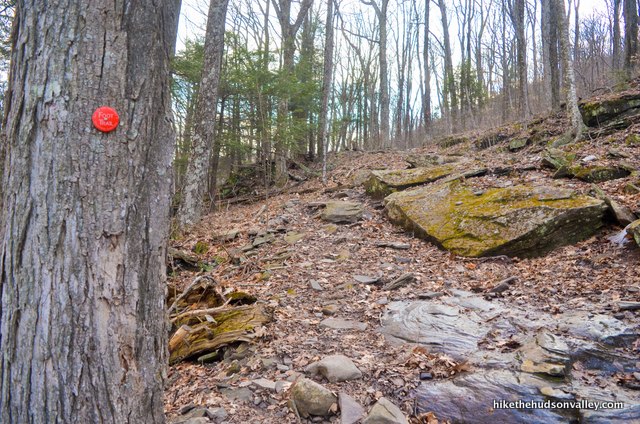
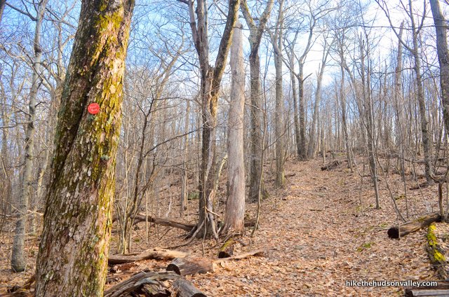
You’ll see your first red blaze here, which is the only blaze you need to know for a successful visit to Mt. Tremper. It’s all Red Trail all the way to the tower from here. You don’t really need me at all! But since we’re both here, I’ll go ahead and write a trail guide anyway. Seems rude not to.
You might take special notice of the wildlife warnings, namely the ones about rattlesnakes and bears.
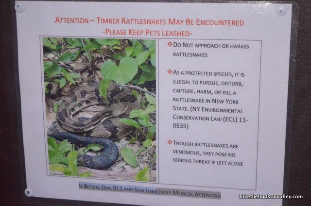
Yes, we will keep our pets on leashes. And we won’t step on coily, rattley things. Got it.
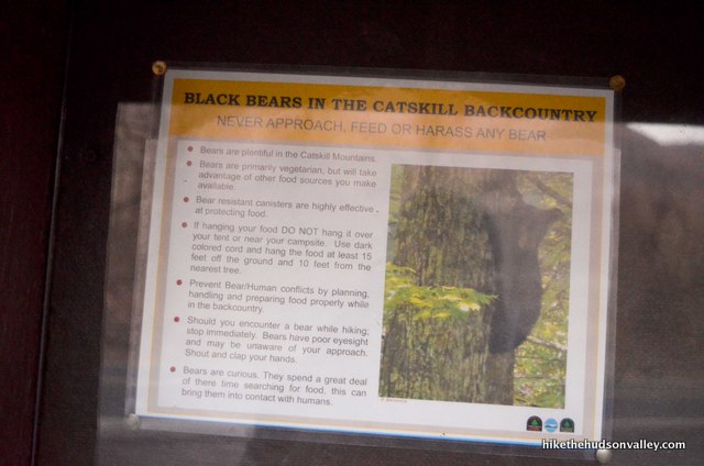
Black bears hang out here, too? Aren’t they scared of the snakes?
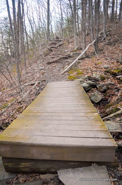
After carefully reading and heeding the warnings (and girding the loins), let’s do this! Go across that footbridge when you’re ready to tackle this mountain — onward and upward!
2. Just past the kiosk and little footbridge, you’ll see an informative sign at the start of the trail. To the fire tower from here: just 3 miles! (I clocked it at 3.25 miles, but if I were you, I’d believe the sign over me, too.) The sign also encourages you to do the math: The elevation change between here and the tower: 2,740 ft. – 800 ft. = 1,940 feet. (I clocked the total ascent at 2,192 ft., which includes a little extra roaming and up & downs, so that seems about right.)

You up for busting out 6+ miles and 2,000 vertical feet today? If so, you came to the right place! (If not, it’s not too late to hop back in the car and go hunt down some good pancakes.)
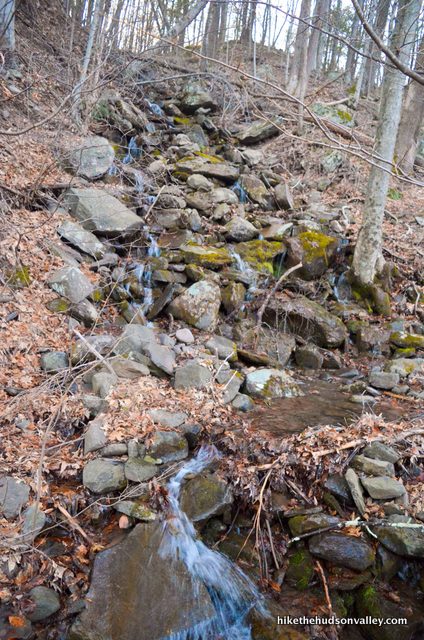
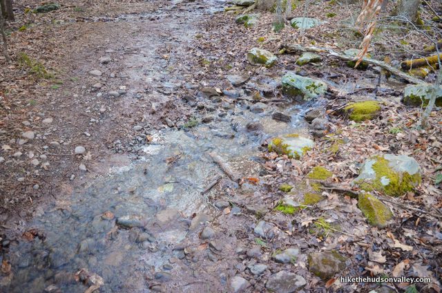
3. Hop over a cascading (probably seasonal) stream on another very nice footbridge.
Now turn your attention upward.
And upward again.
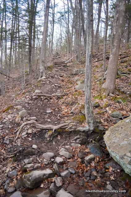
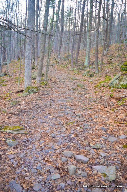
Dude! This is steep! Don’t we get a little practice mountain first? Oh well. Might as well start chipping away at those 2,000 vertical feet sooner than later, right? Just keep following those red blazes.
4. After trekking .4 miles and 200 vertical feet from the parking lot, you’ll arrive at a junction with an unmarked trail, where you’ll also find the trail register.
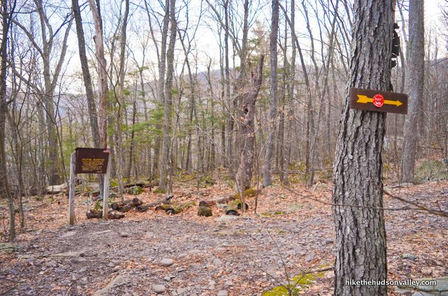
After you’ve signed in, turn right (uphill, as you might expect) to continue following those red blazes, which will lead you all the way to the fire tower.
You really, truly don’t need me anymore. If you choose to stop reading here, that’s cool. I won’t be offended. Have fun storming the tower!
5. You’re still here! I could tell you were cool from the way those wildlife warnings at the kiosk didn’t scare you off.
A few minutes after the register, you may have to hop over a (probably) seasonal stream.
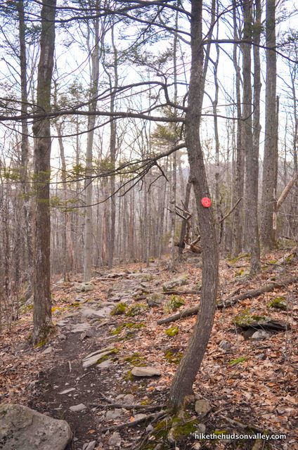
Otherwise, those red blazes won’t steer you wrong. They will steer you up, though.
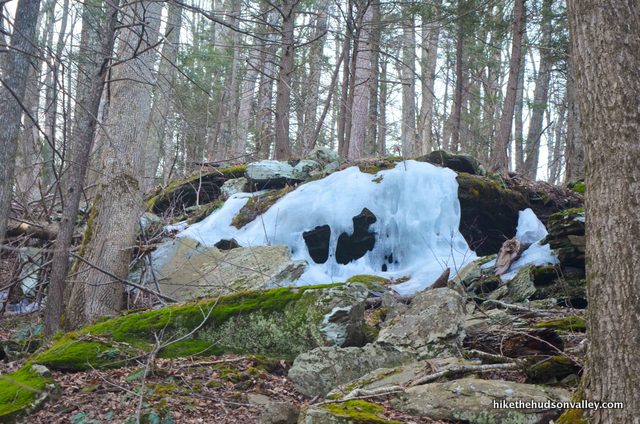
As you climb, even in spring, you might see signs of harsh Catskill winters.
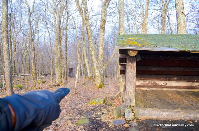
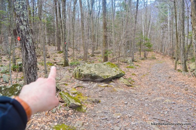
Your next obvious landmark will come about an hour from the trail register, when you’ll see the trail split.
To the right, you can just catch a glimpse of the roof of the Baldwin lean-to shelter. The Red Trail continues to the left, which is the way you want to go. If you’re curious what you’re missing at the shelter, here’s what it looks like:
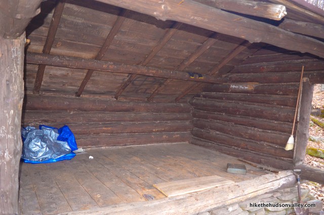
What’s that over there? An outhouse! That could be great news, if you’re in a desperate situation.
Once you reach the shelter, you have climbed 2.3 miles and 1,465 vertical ft. Getting there! Whether you decide to check out the shelter or not, just keep on trudging up the Red Trail. Let’s get to the tower already!
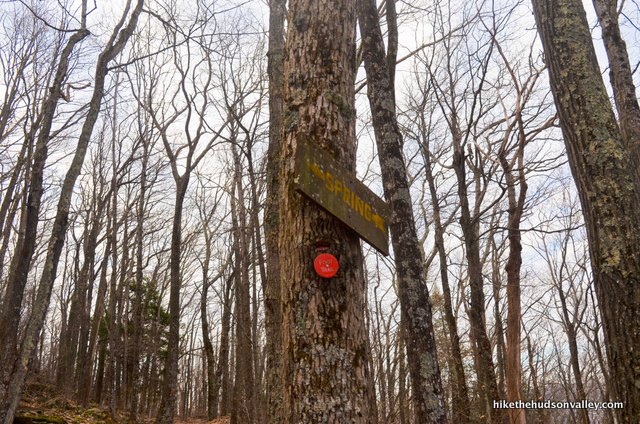
6. About five minutes after the shelter, you’ll arrive at another junction, this one for a spring.
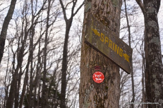
You can see the water pipe from the Red Trail.
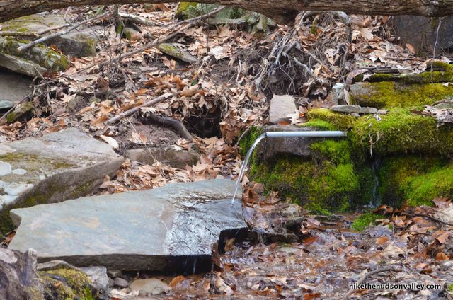
As a general rule, I don’t drink untreated water, unless I’m in the mood to invite potential violent gastrointestinal distress into my life. It’s probably fine, but I recommend slaking your thirst from the water you packed instead. (Unless you have a water purifying device with you – in which case, happy purifying, and bottoms up!) Nice to have a water source so near to the trail, should you need one.
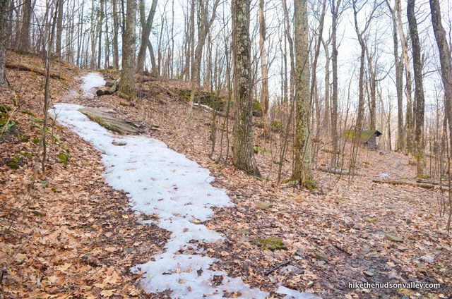
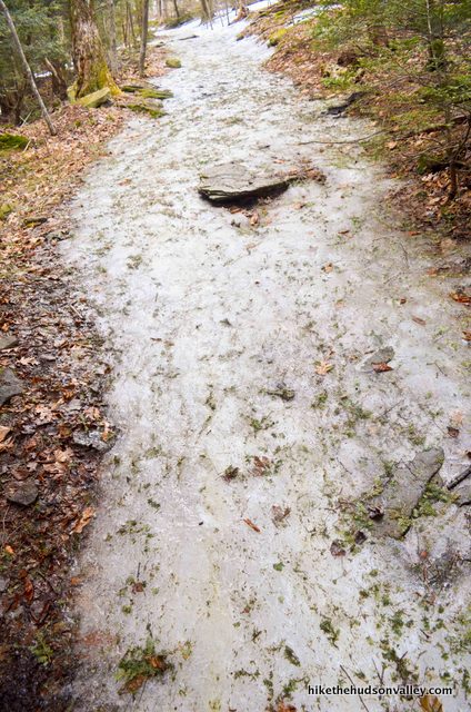
7. The vibe becomes more alpine as you continue climbing. (I needed to pop on some micro-spikes to ascend some icy spots here.)
Just keep following those red blazes!
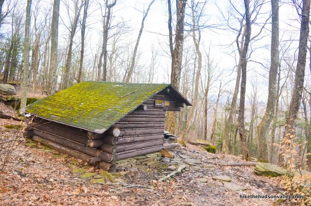
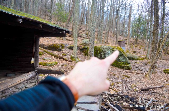
About 30 minutes after the spring, you can catch a glimpse of another trail shelter in the woods.
The trail wanders right past this one. If you are looking at this shelter, you are very, very close to the tower.

And another outhouse, in case you didn’t get a chance to finish your business at the first one.
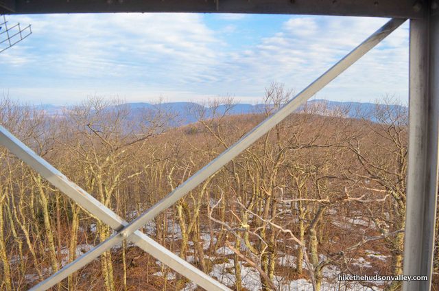
8. Just a few moments past the shelter, SHA-BOOM! Tower in your face!
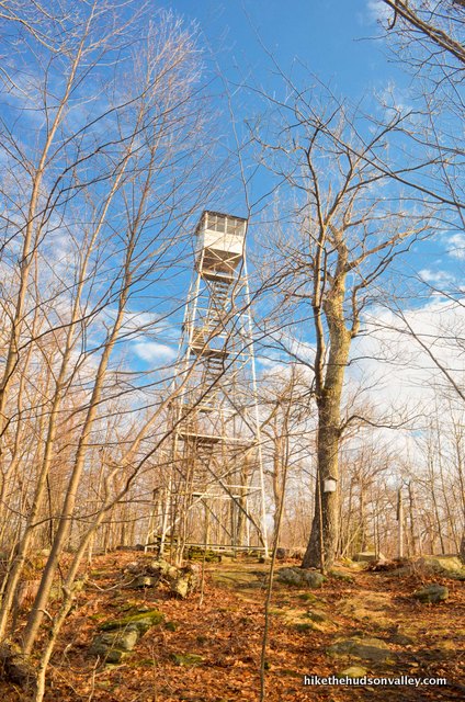
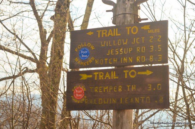
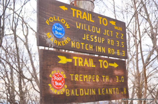
Just before the tower, you’ll see some helpful signage.
You may appreciate this sign more after coming back down from the tower, when it helps you make sure you follow the Red Trail back down the mountain.
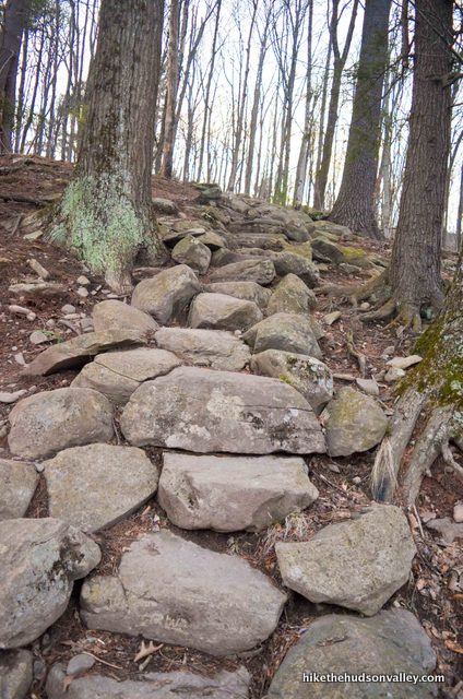
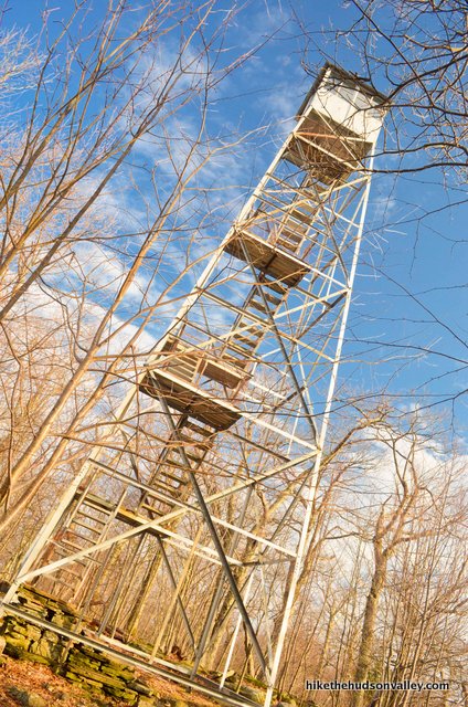
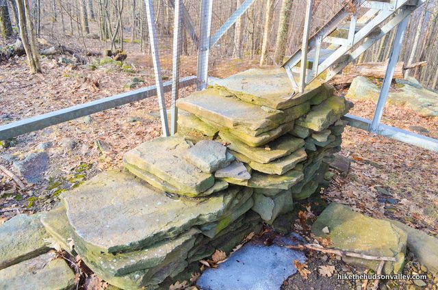
9. Let’s climb this bad boy! Take a moment to appreciate this fine example of “Staircase Resting on Rock Pile” architecture.
Onward and upward!
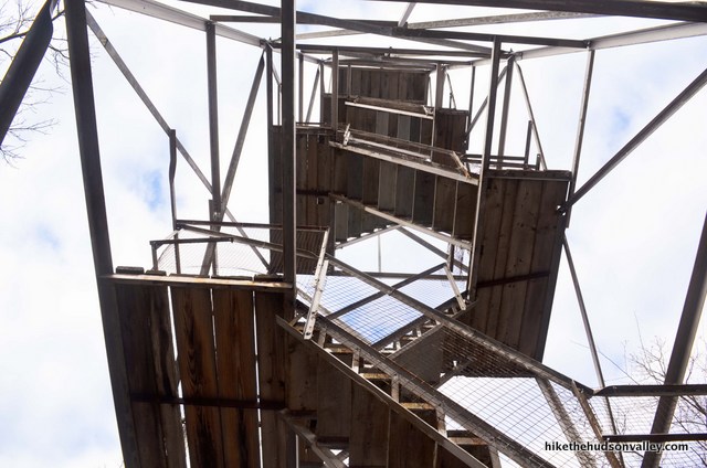
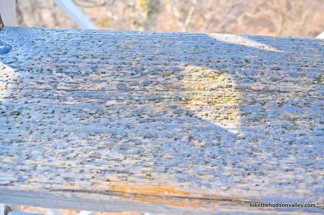
The tower feels quite sturdy, and the steps are in good shape, but you can tell they take a beating from micro-spikes in the winter.
If you are visiting anytime other than a weekend between Memorial Day and Columbus Day, you are likely to be greeted with a big fat padlock in your face above the final flight of stairs, preventing you from entering the tower’s cabin.
**UPDATE February 2024** In case you missed the update above about the helpful comment from ES, the cabin is now open year-round, and that padlock should be long gone. Of course, if you’re standing there right now, you probably don’t need this update. But still – hooray!!!

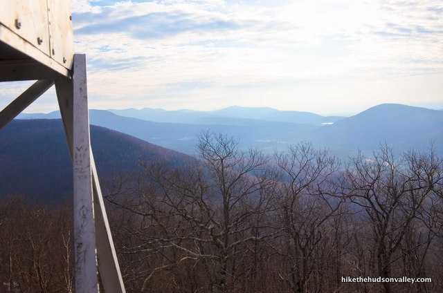
No matter! You can still soak in the views from the stairs just below the padlock.

What a nice spot.
Those 2,000+ vertical feet were worth it, right?
You will note that if you can’t get into the cabin, it is rather cozy on the topmost platform beneath the cabin.
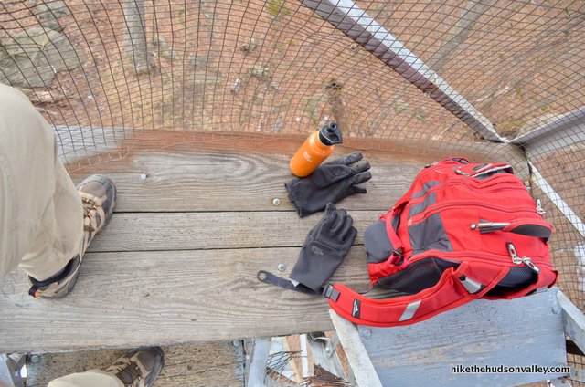
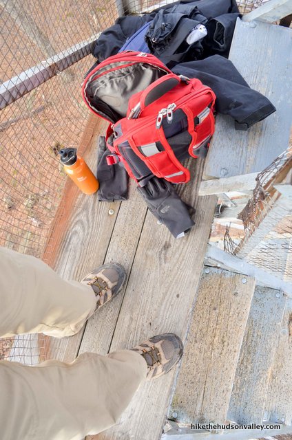
If you have multiple hikers in your party, you may want to climb the tower in shifts. I was by myself, and I barely had room to set up my yard sale up there.
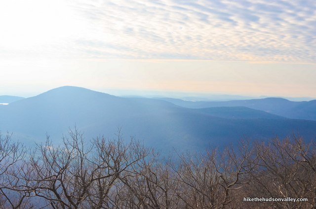
Let your retinas marinate for one last moment in that view.

10. Retinas all worn out? Nothing to do now but retrace your (millions of) steps back to your car!
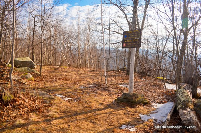
Head back down and get your bearings from the sign near the bottom of the tower, making sure you’re descending on the Red Trail toward “TREMPER TH.”
11. Follow those red blazes all the way back down! It took me 24 minutes to get back to the spring junction (with some stops for putting on micro-spikes and falling on my butt anyway).
From the spring junction, it took me 55 minutes to get down to the trail register. Remember to turn left at the trail register to keep following the Red Trail!
From there, it takes about ten minutes back to your car. The total descent took me 89 minutes.
Hello again, car! Great to see you! Did somebody say something about pancakes?
Directions
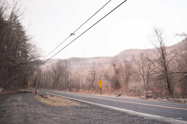
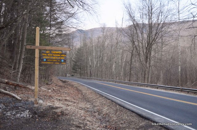
Directions to the trailhead: From the Kingston-Rhinecliff Brige, head west on 199 until it just becomes 209 for reasons that still aren’t entirely clear to me. About 5 miles after the bridge, take the exit for NY-28 North to Pine Hill. Stay on NY-28 for 18 miles, where you’ll then take a slight right onto NY-212 East. .5 miles after that turn, you’ll turn left onto Mt. Tremper-Phoenicia Road. After 2.1 miles, you’ll arrive at the well-marked parking area for the trailhead on your right.
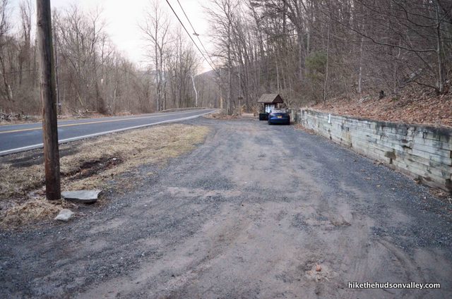
(Here’s a Google streetview image of the parking area.)
Pull in, climb out, and let the adventure begin!
If the parking lot is full, I noticed on Google Earth that there’s another pulloff just up the street. (See the aptly named “If the parking lot is full” section below if you experience this phenomenon.)
Sorta nearby address for your GPS: Just plopping “Tremper Mountain trailhead parking” into Google Maps will take you to the right place. Alternately, you can use the address for Uncle Pete’s Campground:
570 Mt Tremper-Phoenicia Rd
Phoenicia, NY
Just head north a short while (about .6 miles) from Uncle Pete’s Campground on Tremper-Phoenicia Rd and you’ll see the well-marked parking area on your right.
If the parking lot is full: When preparing this trail guide, I noticed a large gravel shoulder in Google Earth that appears to provide overflow parking for this hike, just a short distance further north on Tremper-Phoenicia Rd, on the opposite side of the street.
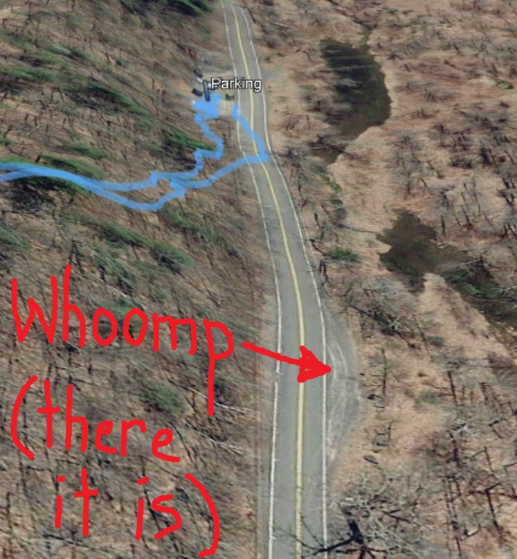
Here’s a Google streetview image of the spot:
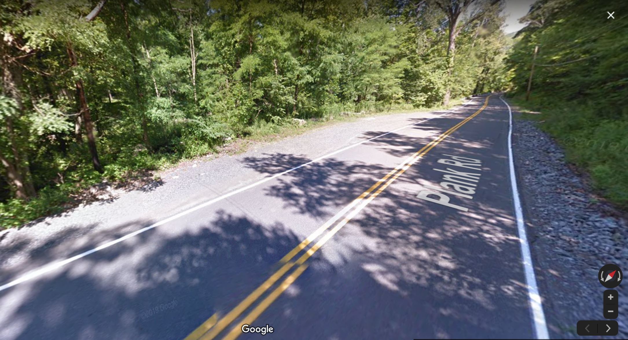
Be sure to obey all posted parking regulations (as of this writing, it doesn’t look like any are posted, but don’t get towed on my account). The good news is that it looks like you have further options available if the main lot is full.
GPS coordinates of parking area: 42.06609, -74.30312 (Clicking will open in Google Maps or the Apple Maps app, depending on your browser/device.)
Resources & Interactives
Super-cool Google Earth flyover of hike route:
Google Terrain Map of hike route:
Related resources: If you’re looking for actual facts and/or useful information, visit these resources:
- The official DEC page for Phoenicia-Mt. Tobias Wild Forest, which encompasses Mt. Tremper
- The very informative Mount Tremper Wikipedia page
- The awesome (and much more concise than this one!) Tremper Mountain & Tremper Fire Tower trail guide from CatskillMountaineer.com
- Another nice Mt. Tremper guide from CNYHiking.com
- A nice write-up on hiking Mt. Tremper from the Poughkeepsie Journal: “Mt Tremper is a pleasant hike if you know what you’re in for”
- Trail condition updates from the Catskills Visitor Center in Mt. Tremper
Want to support trails in the Hudson Valley? Here’s one great way: Visit the New York-New Jersey Trail Conference homepage and click on Volunteer, Donate, or Shop! (Then you can volunteer, donate, or shop, depending on your mood.)
Fine write up. Noticed there was no further mention of the shnakes off the trail? I fretted about that lot for a while before talking to an old ranger – no trouble in 30 years being up there. Be respectful, they hear you clomping along and get out the road etc. Non the less, I’ll be heading up there mid October to finish up the Fire Tower Challenge 🙂
I did this hike today, and the fire tower was unlocked. A sign at the trailhead said it is now open year-round.
Thank you, Mike, for this and many other helpful guides.
That’s wonderful news, ES! I’ve updated the trail guide above in both the “Background” and “Trail Guide” sections to let folks know the good news, with a link down to your comment. Very much appreciated!
Dear Mike,
Thank you for all your incredibly well-made hiking trail guides. They are useful and cheerful! Looking forward to adding Mt. Tremper and its venerable firetower to my “collection.”
Sincerely,
Patrick
Thank you so much, Patrick! Really appreciate the kind words, and hope you have a great time collecting Mt. Tremper 🙂
The people i met along the way on this hike, 3+ mile uphill slog were grand. Especially those on the way down that granted, “…you’re almost there…” encouragement. That natural spring that’s on the left on the way up was life-giving.
Sounds like an awesome day, Ruben — thanks for sharing your experiences here!
I put this hike off for so long for the same reasons, and just did it recently. The views from the fire tower are NOT AT ALL limited, even after the leaves have come in. The view is a first-rate 360° panorama of some of the finest Catskills peaks. I was so happy I did this hike.
That’s really nice to hear, Sean — glad you had a great hike up there, and thanks for the report!
Most comprehensive trail review and trail guide I’ve ever read! Funny, too! :-). Great job, thanks!
Thank you so much, Tina! This was one of my favorite comments to read, too, so now we’re even!
How’s it going Mike. Nice to see some new hikes in the Phoenicia area! Anyone done this recently? Are there ice/snow up there?
Ricky, thanks for the kind words, and I’m so sorry for the late response! I haven’t been up there since the spring, but if you’re even looking for info on Catskill trail conditions in the winter, this page from the Catskills Visitor Center is a great resource: http://catskillinterpretivecenter.org/trail. They keep that page current and updated regularly with tips and recommendations. Hope that helps!
LIKELY THE BEST AND MOST THOUGHT OUT AND DETAILED REVIEW YOU WILL FIND ON THIS HIKE – THANK YOU – THIS MORE THEN PREPARED ME
This comment made my day – thank you so much, db! Really glad this guide was useful to you.