Background
If you find this free trail guide useful, please provide payment by picking up at least one piece of litter on your hike. Cha-ching! Thanks for being awesome! (And here’s a quick primer on Leave No Trace, too, to help us keep the trails nice and fresh for each other.)
Background you can feel free to skip: I’m pretty sure the hang glider launch ramp at Thomas J. Boyce Park was still in use back in 2000 when I first visited this spot, but not anymore. There are tall saplings growing up in front of it now, and only someone with a manglewish would dare step more than a couple feet out onto that rickety thing.
It’s a shame that the ramp is no longer in use, because now the trees are taking the place over. Check out the view from the summer of 2000:
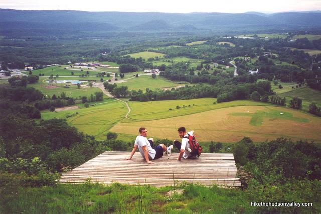
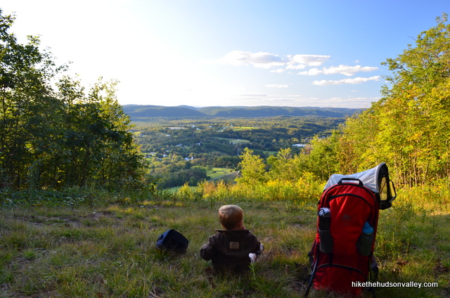
And here’s a shot from September 18, 2011:
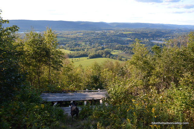
The view is still nice, but nature is reclaiming this place. Even so, it’s a very pleasant spot to sit and relax, overlooking a rural area with hills and mountains on the horizon, and you can imagine what it would have been like to take a running leap off that ramp.
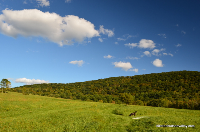
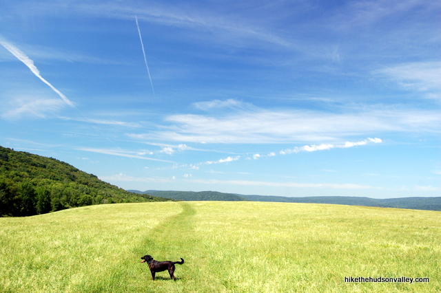
Even with the disappearing view, this hike is still a must-do, thanks to the beautiful meadow that you stroll across to get to the climb. This must be one of the most gorgeous meadows in the Hudson Valley.
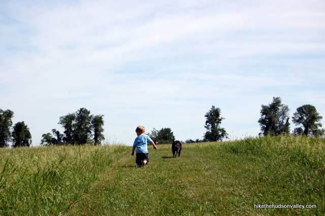
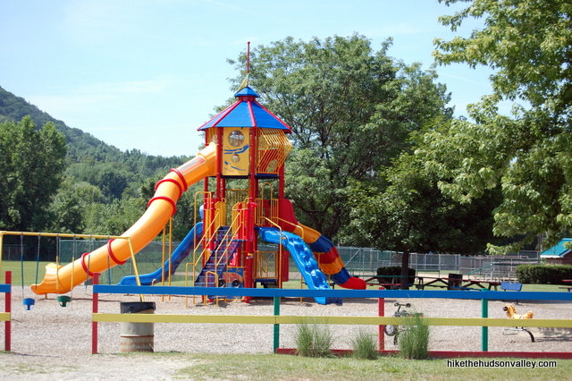
Plus, for the little hiker, there’s a pretty awesome playground right beside the parking lot.
When you head out to Boyce Park (and if you’ve never been, you should definitely make it a point), you’ll want some good footwear and a camera. But you can leave the hang glider at home.
Trail Guide
Bonus unsolicited advice: Don't depend on having cell service in the woods - it can be spotty out there! Download this trail guide to your phone before you head out. (It's easy to do on iPhone and Android.) May your connection to nature be strong, even when your connection to the internet is weak.
**UPDATE January 20, 2014** The trail to the overlook briefly wanders onto an adjoining property that recently changed hands, and the new owners do NOT want hikers on their land, which will be a hunting and wildlife preserve (see the comments below). Please obey all posted signs. The overlook is no longer accessible via the trail described below. Bummer. The meadow is still a righteous place to visit, though! And the sliding board still rocks the house!
Trail guide:
1. From the parking area, take a look at the large hill looming behind the park. At the top, just to the left of the summit, do you see the little clearing with a wooden platform? That’s where we’re headed.
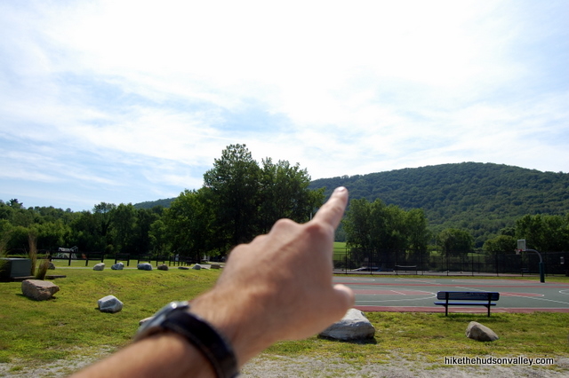
2. Walk past the basketball courts and soccer fields on the dirt road leading towards the hill.
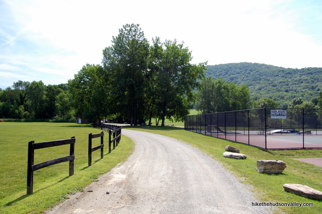
You’ll come to a gate that’s normally closed, with permitted park uses posted.
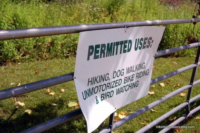
Walk around the gate and continue on the road, which rises gradually into the enormous field. You’ll see an equestrian ring off to your right. You don’t need to do anything there, unless you brought your horse. If you’re lucky, at about this point, your wife will take a shot of you and your baby that completely misses all your bald spots, and this will be your Facebook profile picture for the next several years.

3. You’ll come to a fork in the road where you can go straight or left. It doesn’t matter which way you go. Both roads (paths, really, at this point) meander in the general direction you’re trying to go. (UPDATE August 2013: If you choose to go straight, make sure to turn left before you hit the treeline. One hiker reported going straight into the trees to discover a nice NO TRESPASSING sign there.) Just make your way towards the back-left corner of the field — the trail you’re looking for is tucked into the very furthest back-left corner of the meadow. You’ll see a house peeking over the left border of the park.

4. If the conditions are right as you stroll across the field, try your best to take artsy pictures.

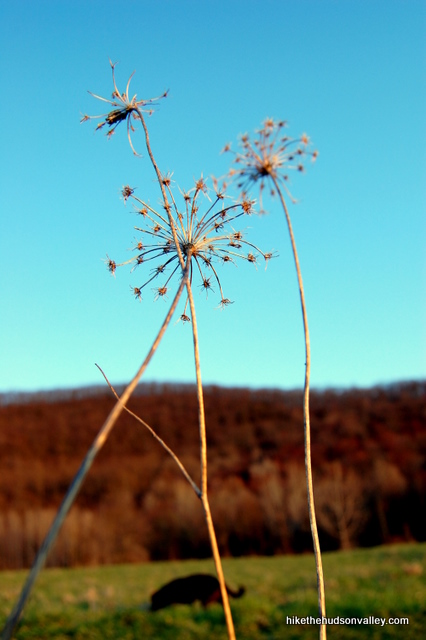
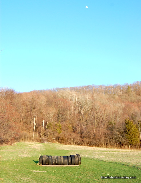
5. You’ll pass some horse jumps made of tires. If you forgot your horse, the jumps won’t do you much good. The trail up the hill begins just past the last jump. Plunge into the trees there, in the back-left corner of the meadow, and you can’t miss the trail. (In case you missed the update at the beginning of this trail guide, you can’t get to the overlook anymore without trespassing. So, you know, now would be a good time to hang a U-turn.)
6. Once you enter the woods, the trail can be a little overgrown and damp, depending on the time of year and previous weather conditions. Have no fear — it quickly turns into a nice, clear, well-drained trail, and remains that way until the top.
7. Follow the unmarked-but-well-traveled trail up a steep and steady climb to the clearing with the hang glider launch ramp. It’s not a long climb, but it’s not messing around. I’ve seen people give up and go home. Still, you can hoof it up there in about 20 minutes.
8. Once you get to the top, drink in that view and take some pictures. The view isn’t gigantic, but it’s a nice place to relax and pretend you’re about to take a flying leap off the hill.
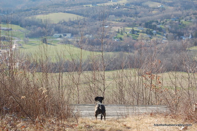
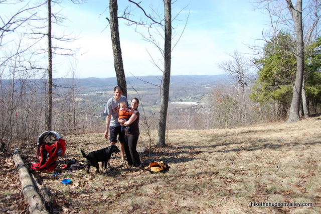
9. If you brought your family, hang your camera from a tree to get everyone in a picture.
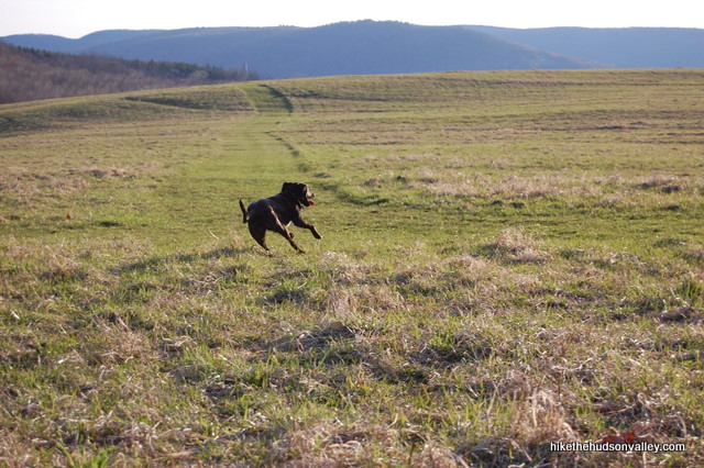
10. After you’ve sufficiently chilled, head back the way you came. Somehow, the field always looks cooler on the way out. Such a nice place. Don’t forget to have a frolic before you go.
Directions
Directions to the trailhead: Coming from Poughkeepsie, take 55 East past the intersection with Rt. 82 to a left turn onto Bruzgul Road (County Route 21). Stay on County Route 21 as it changes names 17 times for no good reason, eventually dead-ending onto Route 22, just north of Pawling. Take a left at the dead-end, and Boyce Park will be on your right in a hundred yards or so. Park in the main lot.
You can also get directions by checking out the Boyce Park entry on the HiketheHudsonValley.com Google map.
Sorta nearby address for your GPS: The Wingdale Elementary School is right across the street. Plugging its address into your GPS will get you close:
6413 New York 55
Wingdale, NY 12594
GPS coordinates of parking area: 41.6485, -73.55805 (Clicking will open in Google Maps or the Apple Maps app, depending on your browser/device.)
Resources & Interactives
Super-cool Google Earth flyover of hike route:
Google Terrain Map of hike route:
Want to support trails in the Hudson Valley? Here’s one great way: Visit the New York-New Jersey Trail Conference homepage and click on Volunteer, Donate, or Shop! (Then you can volunteer, donate, or shop, depending on your mood.)

I haven’t seen all of the Hudson Valley’s meadows, but I have to agree, this one is very nice. Definitely not worth driving a long way to explore this park, now that you can’t go to the launch platform. But, if you live close by and want solitude, this does the trick. The trail is marked with spray painted arrows on the grass. I guess they won’t be much help with snow on the ground, but very helpful on a nice fall day. When you get to the half way point, a small hill on the meadow blocks the view of the park. It’s so quiet and peaceful that you can relax, enjoy the scenery, clear your mind, and imagine a simpler time.
Thanks for the nice update and perspective, Dave! Was just thinking about this hike recently – so sad that it’s not what it once was, but as you said, still plenty of space to relax and enjoy the scenery out there.
Hi, I was there this morning. Two large signs advising “private property “and overlook closed at red blazes. I didn’t see any blazes but turned around just past overlook that faces east.
A bit unsettling, trail had a lot of leaves, but didn’t seem like it was getting much use.
No trail markers anywhere.
Plenty of better hikes if the neighbors want take this away from the public.
Thanks so much for the update, Billy! So sad that this hike isn’t the gem that it once was. Appreciate you dropping by with a recent report — I’d been wondering what the situation was like over there. Here’s to better adventures ahead!
I know you posted that it might run on private property. Did anyone get that from the town officials that runs the park or are you going by Jeffrey Ferraro post? Does he also live in Bristol conn?
Looking at the GPS snapshots posted I don’t see it. It looks like the town owns it
Hi Floyd – I don’t really know any of the particulars here, other than the discussion that’s been posted in these comments. I have it on good account from Stancy (a trusted and awesome local trail advocate) that the trail in its previous incarnation did indeed wander briefly off of town property. I’m still hopeful that a decent resolution will be reached for hikers to access the views up there — if anyone has more current information, please post it here!
Was just there. Nice loop around meadow. That’s it. You can vary the route, but you can’t go up the hill.
My Kids 6,10&16, and I , did this yesterday, Saturday 2/18!
Absolutely beautiful
Wore snow pants bc the snow was still a few inches steep, we did hit the sign that said hikers can’t go to the overlook
Still worth the drive out
Very pretty, not challenging.
Does anyone know if these trails are still inaccessible, and if so are there alternative trails that are equally challenging and scenic in this park?
Looking at the site you posted it looks like he should not even be on the hangglidder spot. Someone today told me the there are brand new chairs tie wrapped to a tree. Jeffery should not be using towns land to burn fires and watch the sun set. I will continue to find out more and to contact the right people in town and get to the bottom of this. I don’t think this is right for someone to block this path off. Maybe the town can just take this land from him using the mighty court system. Hikers are not criminals sometimes they are doctors and lawyers and people people with deep pockets. If Jeffery does not own this land but has taken on his own to protect someone else, maybe they should be contacted to let them know what is going on and that a hornets nest is being stirred.
Reading the posts on this site I have seen the signs posted by Jeffery. He posted them on town property. I see the only way up to the top as of right now is through the town Property. I feel if the new owner feels this way. People should contact the town and let them know what is going on. I lived here for 50 years and hiked and camped out many of times. The people of this town has done the same. If he wants to close off this trail than we can place a gate at the bottom and ask that he finds another way up the mountain. As for the fire at the top he states that the woods might catch on fire. Then he should not light one and burn the towns property. As for building a small rock wall I also think he got the rocks from the towns side to keep us out.
What a angry man he is. I will keep my eye out for fire buring on top of the mountain and call the fire department.
Food for thought.
It’s a shame that the platform is no longer accessible. My husband proposed to me on the platform 15 years ago. We live nearby and we could see the opening in the tree line from our back deck. We have seen nature take over the last few years and the out cropping is slowly filling in. Still romantic, none the less 🙂
Aw, what an awesome (and beautiful) spot for a proposal! Then, if you had said no, he could have just hang glided off the end!
It really is a shame to lose this spot. Looking at the old picture of the way it used to look is sad – nature really has taken back a good chunk of the view (when you could even get there), and the ramp barely even exists anymore. I hope there’ll be a happier ending for the view-and-nature-loving public here one of these days. Thanks for sharing!
Is there a verdict on the status of the property? I’d like to check this place out at some point.
The trail to the overlook apparently ventures briefly onto an adjoining property, on which hikers are no longer welcome. The meadow is still gorgeous, and the boardwalk looks very cool, too (you can see it on the terrain map in GPS Goodies above). This trail guide is due for an update – will get it done soon!
I just added an update right at the beginning of the trail guide. Hope that helps to clear things up! (And sorry the update doesn’t have any better news in it.)
Hi Mike & Jeffrey,
Can I join the conversation off-line?
Stancy
Sure thing, Stancy! I’ll forward you the conversation we’ve had to date.
Yes, you are. The last leg of your trail marking may seem to be on the boundary line, but its not. The actual trail is on private property. As a matter of fact, the new owner built a small stone wall to designate where the town land and the private land divide. Unless you hike directly up the side of the hill toward the front of the old platform ( which is NOT safe to stand on ), you have to trespass on private property in order to get to the overlook. I’ve seen the No Trespassing signs and boundary markings on the trees. Since you have my email, perhaps it’s best for us to email separately rather than through this posting so as not to confuse people? I can give you more information that way.
Even IF the overlook is owned by the Town of Dover, you still need to trespass on private property in order to gain access to it. There is no other way to get up there safely other than to trespass. The property is clearly posted with signs and the property boundary lines are marked by red paint on the trees. New owner even built a stone wall to prevent access from the lower trail. It’s pretty clear to me that they don’t want anyone trespassing on their property. Can’t blame them as it is their private property and they pay the taxes. I’m pretty sure that they are also tired of trespassers leaving empty beer and soda bottles up there and other litter and potentially starting a forest fire as there seems to be a fire ring up there as well. I saw a lot of litter when I was up there in September. You may not want to encourage folks to go up there as you are subjecting them to illegally trespassing on private property by recommending them to go up there. I know that I’m staying clear as there are many other trails to hike.
I just took a look at the GPS trace of my most recent hike up to the overlook at Boyce Park, and it stays entirely within the boundaries of the Boyce Park parcel shown in the Dutchess County Parcel Finder: http://hikethehudsonvalley.com/wp-content/uploads/2012/03/Boyce-Park.jpg
Here’s a link to a screen grab of a GPS trace of the entire hike outlined above: http://hikethehudsonvalley.com/wp-content/uploads/2012/03/Boyce-Park-GPS-trace.jpg
The red line, which traces the hiking route, never ventures off the Town of Dover’s property. I don’t want to steer people where they’re not welcome, but from the maps, I don’t see where any trespassing would occur. Am I missing something?
Just a bit of advice to all who try to hike this trail in the future. There is a new owner of the property that this overlook/hang gliding platform is on. The owner has posted NUMEROUS NO TRESPASSING signs. TRESPASSING is a crime in Dutchess County and I’m told that the property is patrolled by the Dutchess County Sheriff’s office. I would recommend that you take this trail off of your recommended site as you are promoting Trespassing.
Thanks for this information, Jeffrey. I just looked up Boyce Park on the Dutchess County Parcel Finder, and it looks like all the land mentioned in this trail guide, including the overlook, is owned by the Town of Dover. Here’s a link to a screen grab from the Parcel Finder: http://hikethehudsonvalley.com/wp-content/uploads/2012/03/Boyce-Park.jpg
The trail hugs the border, but I’m pretty sure it stays comfortably within. I also heard from a few people this summer who used this guide successfully, with no mention of “No Trespassing” signs along the trail. Sounds like you may have more recent info than me; I just want to make sure I completely understand the situation before I update the trail guide.
This hike has been a favorite for many years — I’d be sad to see it go. Thanks for any further insight you can provide.
Hi HHV —
I live in Wingdale, a hamlet of Dover in southeastern Dutchess, and love this site! i noticed when i checked Google Terrain Map (very cool) that the boardwalk behind the ball fields is not on it. I actually found the boardwalk when prepping to run a geocaching event for our Rec Dept. Can you add that spur?
I sent this link to the Dutchess County Healthy Communities Trail Map fellow at County Planning, asking him to add Boyce Park. THANK YOU!
Stancy DuHamel
Stancy,
There’s a boardwalk? I had no idea! Can you provide a little more detail about it — where is it, how long is it, anything else I’d need to know? I’ve got a full plate this summer, but I’ll absolutely put it on my to-do list to get back out to Boyce Park and update the trail guide.
Thanks for the heads up and the kind words!
Mike Todd
will do – i can get it in on a gps map and get you a screen shot, or something like that. hahaaa
these are just great photos! especially of the dog jumping around
great shots of my favorite park! Wonderful place to dog walk
Thanks so much, Amy! It really is a great spot.