Background
If you find this free trail guide useful, please provide payment by picking up at least one piece of litter on your hike. Cha-ching! Thanks for being awesome! (And here’s a quick primer on Leave No Trace, too, to help us keep the trails nice and fresh for each other.)
Background you can feel free to skip: Do you hike Castle Craig, or do you storm Castle Craig?

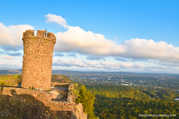
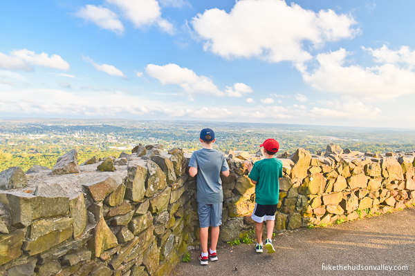
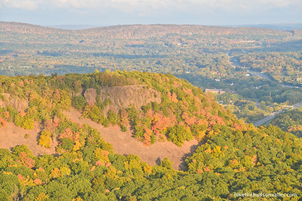
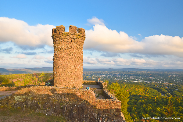
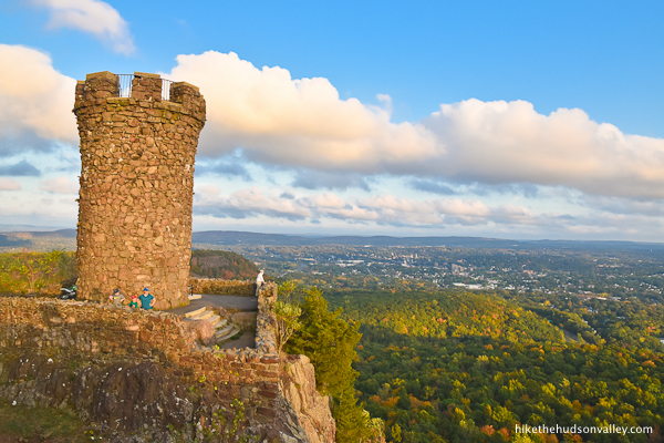
This question may cross your mind as you approach this unique stone tower that overlooks Meriden, CT, offering enormous views of the surrounding area.
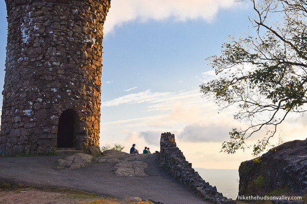

The good news is that you can soak in these gigantic views from the tower by just strolling through the archway and up the steps, no catapult necessary (in fact, while the surrounding signage isn’t explicit on this point, sieging the castle is probably frowned upon).

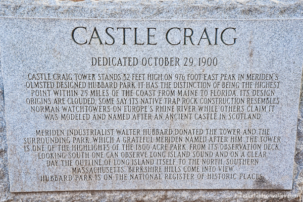
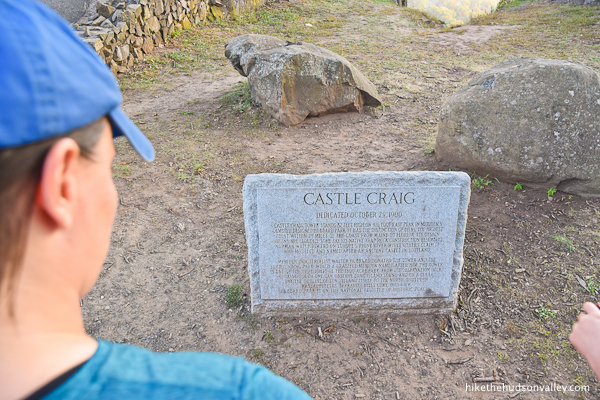
According to its historical marker, the 32-foot castle, opened on October 29, 1900, was donated by local industrialist Walter Hubbard. The castle has the very specific distinction of being the highest point on the Eastern Seaboard within 25 miles of the coast. Cool! Right? Pretty sure that’s cool.
Castle Craig might be named after an old Scottish castle. Or it might inspired by “Norman watchtowers on Europe’s Rhine River,” which were apparently prevalent in France and England in the 11th century. To be historically accurate when you visit, you should either pack haggis or brie, depending on which theory sounds better to you.
Whatever inspired it, thanks for the cool castle, Walter Hubbard! Also, are people industrialists anymore? I feel like if you put “industrialist” on your resume, the interviewer would really need to know more. For starters, which industry? All of them?
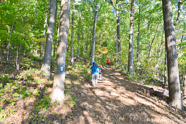
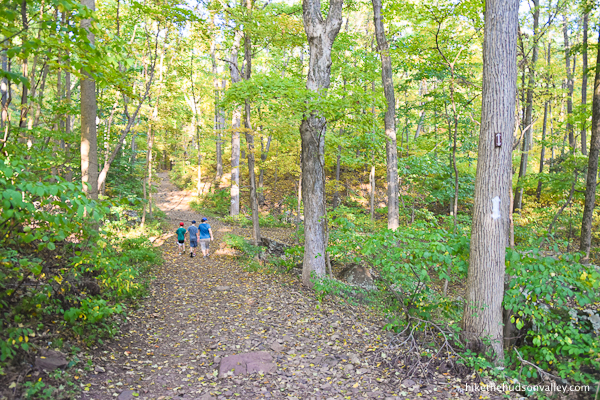
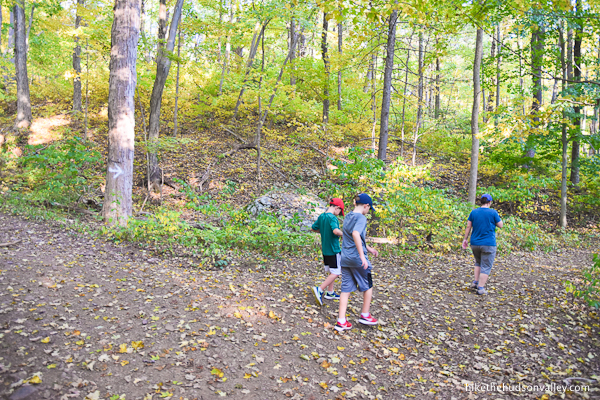
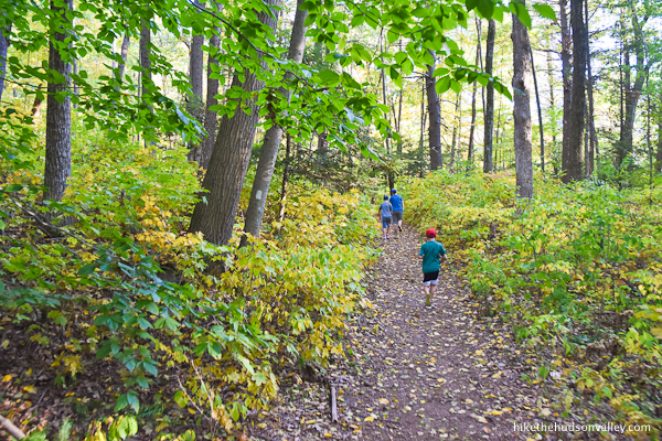
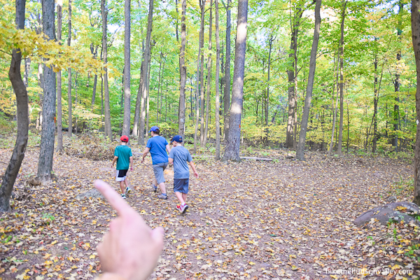
What were we talking about again? Ah, yes, the hike! The 3.6-mile roundtrip stroll to the castle takes you through some picturesque woods, gently ascending toward your royal destination.
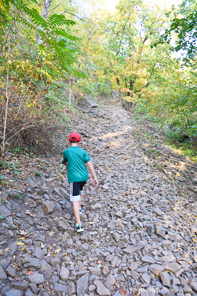
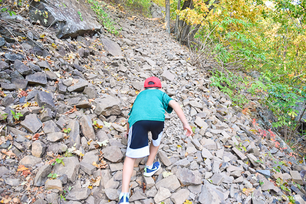
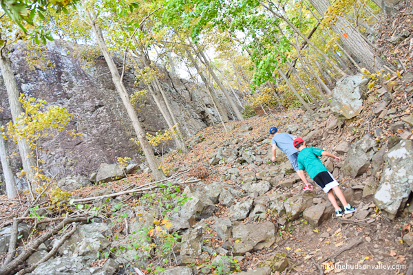
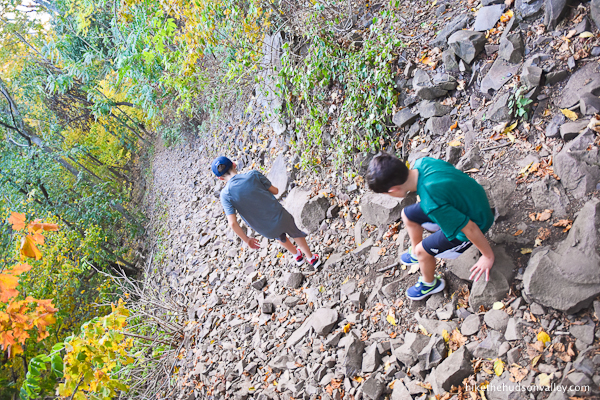
The climb gets decidedly less gentle in the final stretch, where you may have to use your hands just a bit to clamber over some rocks.
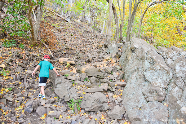

You’ll also be stepping on plenty of loose rocks out there. Sturdy footwear is important when you’re storming a castle.
Notable item for your awareness: As you approach Castle Craig all sweaty from the climb, you’ll emerge onto a driveway that cheaters can (and do!) use to drive right up to the castle.

Like Bear Mountain, this hike features a road, complete with a parking lot, that lets the flip-flop wearing masses join you at the top.
But fear not, castle stormers! There’s a gate at the entrance road to Castle Craig that is locked from Nov 1–May 1. (Hikers park at Hubbard Park, so that gate isn’t a problem for us.) Even on dates when Peak Drive (aka Cheaters’ Driveway) is open, the gate is only open from 10am-5pm. We visited on a Monday evening in September, timing our hike so we’d arrive at the tower just after 5:30pm. It was perfect. We had the castle to ourselves for a solid 15 minutes before some other friendly hikers strolled up. Not a car in sight, except the tiny ones way off in the distance.
(If you visit in the evening to avoid having to share your castle with cheaters gas-powered view-enjoyers, be sure to leave plenty of time to get back to Hubbard Park in the daylight, and have a good flashlight or headlamp with you, just in case. The descent took us 43 minutes, and it was starting to get dark by the time we got back to our car. Be sure to look up the exact sunset time on the day you visit so that you can plan accordingly.)
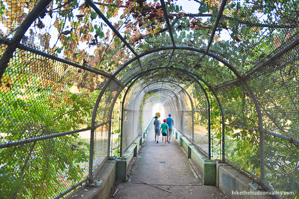
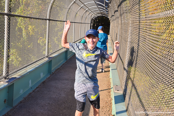
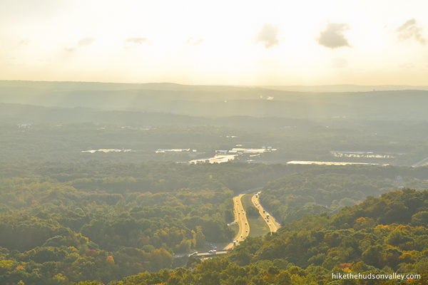
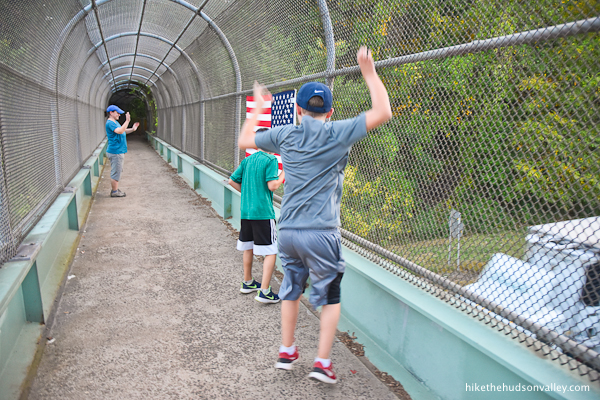
One more notable item for your awareness: This hike crosses over I-691 via a pedestrian bridge. It’s loud, and the noise stays with you for a significant portion of this hike. If you’re looking for a serene experience in the woods, you might want to pick a different hike.
On the plus side, if you stand right over the lanes of traffic and make the honk-your-horn motion to trucks, they WILL oblige. And that might just make your day.

One last notable item for your awareness: Before this hike, I had never seen a copperhead (one of the two venomous snakes native to our area) in the wild before. Can’t say that anymore! My wife almost stepped on this little guy.

Look at how cute! I thought it was a baby rattlesnake at first, but the internet taught me that young copperheads have light-colored tails to lure their prey. Who knew? In any event, as is always good practice wherever you hike – watch where you’re stepping! Copperheads could be anywhere around here, but this one happened to be on the trail to Castle Craig. (I’m sure this guy will be long gone by the time you venture out on these trails, anyway, right? Right? Hey, where’d you go?)

Astute hikers might also point out that Meriden, CT is not in the Hudson Valley. I certainly agree with those hypothetical people! But it is well within day-tripping striking distance from the Hudson Valley, so I’m including it on this site. People of Meriden: We are not storming your castle with the intention of annexing it to the Hudson Valley! (We are a little jealous of your nearby Costco, though.)
If you find yourself in Connecticut looking for an adventure, you should absolutely give this unique hike a try. The views from Castle Craig are some of the best you’ll find this side of the Scottish Highlands. Or maybe the French Alps.
Trail Guide
Bonus unsolicited advice: Don't depend on having cell service in the woods - it can be spotty out there! Download this trail guide to your phone before you head out. (It's easy to do on iPhone and Android.) May your connection to nature be strong, even when your connection to the internet is weak.
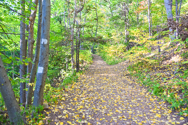
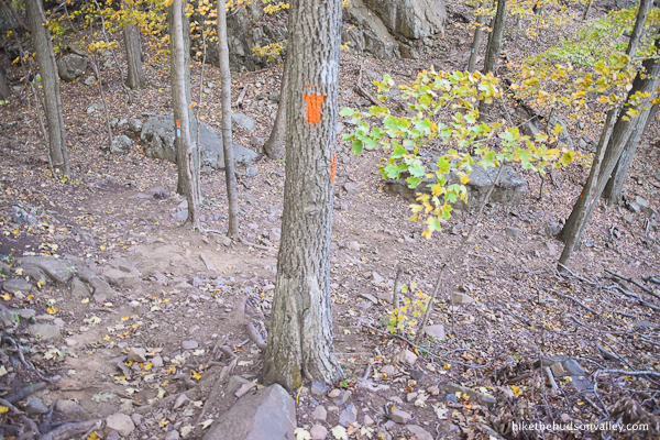
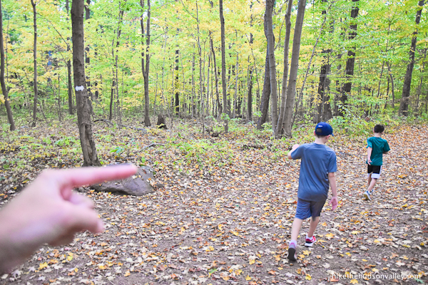
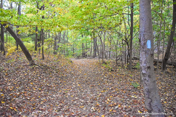
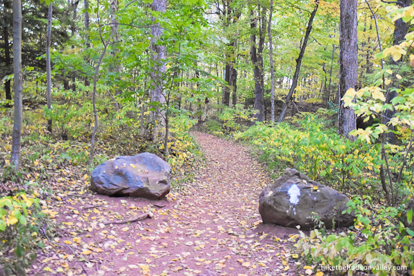
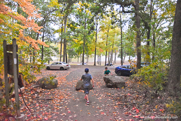
1. From the small hiker’s parking lot at Hubbard Park (see “Directions to the trailhead” below), head past the big boulders at the top of the parking lot to hop on the White Trail.
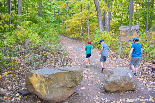
The posted wooden trail map was pretty faded as of our visit in September 2020, but if you stare at it long enough, you can still make some sense out of it.
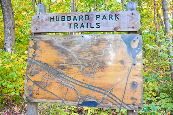
(You would do well to check out the free online Hubbard Park trail map, too.)
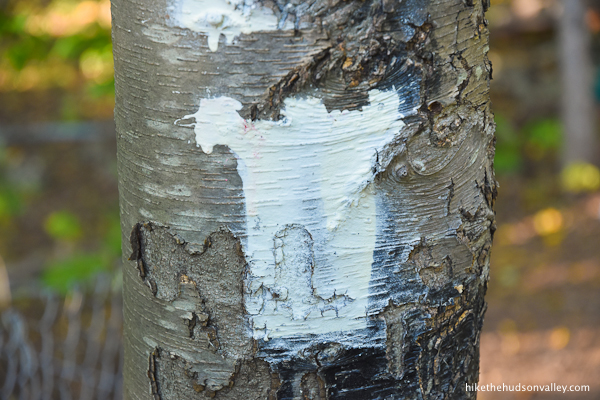
2. Follow those white blazes!
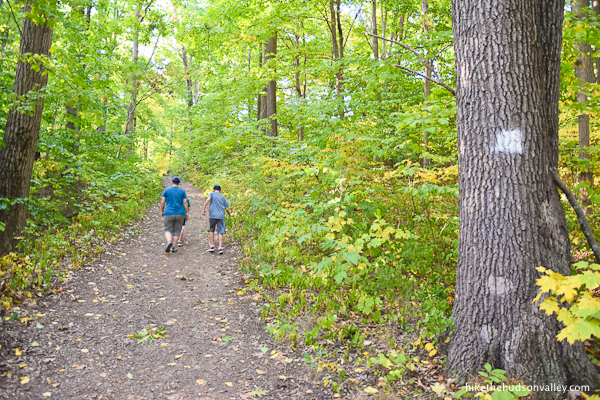
You’ll want to focus your sensory inputs here on your eyes (which are looking at gorgeous woods), rather than your ears (which are hearing trucks roaring by on I-691).

While you’re ignoring those trucks, you can also ignore the unmarked trails you’ll see occasionally joining from the left. You’re in a stay-on-the-White-Trail type situation right now.
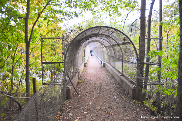
3. About ten minutes from the parking lot, the White Trail turns right to hop up and over I-691. That’s where we’re headed (ignore that unmarked trail that continues straight ahead) – let’s cross that road!
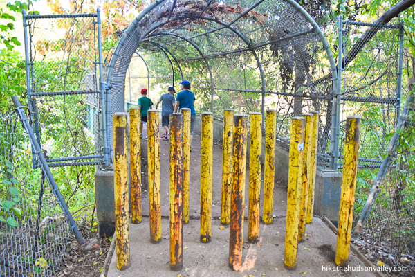
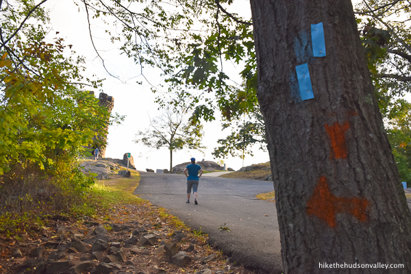
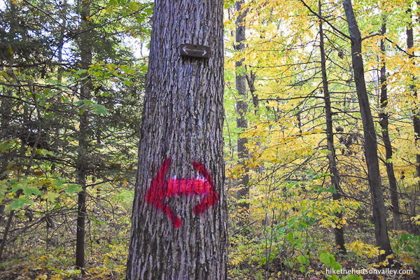
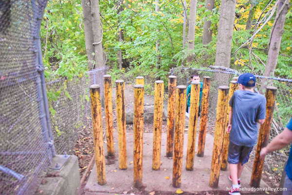
The castle-shaped blaze on the boulder lets you know that you’re on the right track.
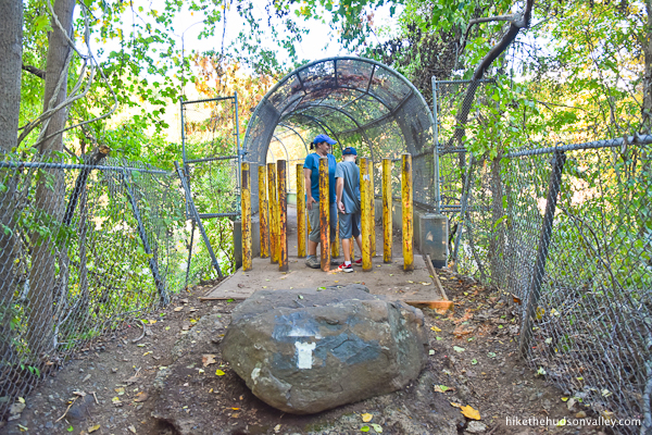
Just behind that boulder, you’ll see several posts meant to keep out vehicles. According to my kids, if any part of you touches any part of a post, you must go back to the beginning and start over (because you just got electrocuted).
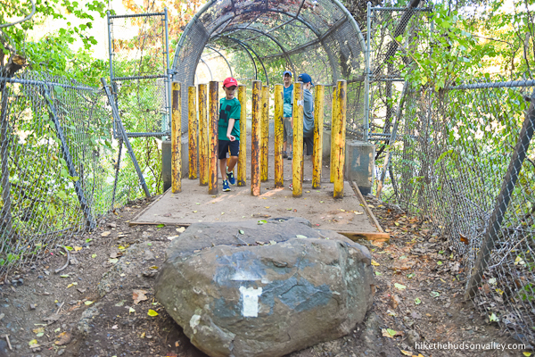
Good luck! Don’t get zapped!
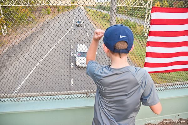
4. Enjoy walking over a busy interstate highway, which is exactly as peaceful and serene as you’d expect. Ahhhh, nature.


One excellent feature of this stretch of trail: Remember the arm motion to ask truckers to honk their horns?

It still works!
And it sounds even better when you’re standing right over the horn when it honks. HOOOOOOOOOOOOOOOONK!!!
Hey, if you have to hike over a highway, might as well make the most of it.
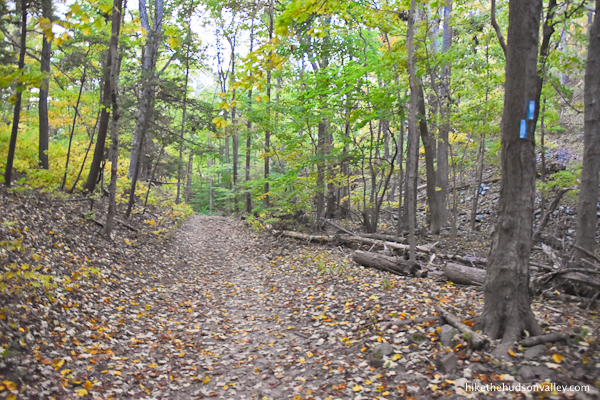
5. After crossing the highway, turn right to head uphill and keep following those white blazes, most of which are now in the shape of cool little castles (nice touch, right?). Just 1.2 miles and 600 vertical feet to go from here!

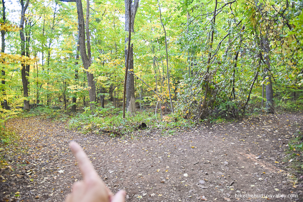
6. Almost immediately, you’ll arrive at what looks like a fork, but isn’t really. The trail splits, but meets with itself again in a little bit. Take your pick! Can’t go wrong.

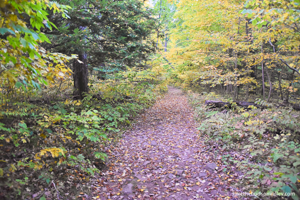
The trail widens as it continues gently climbing.
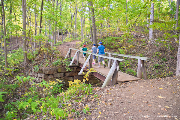
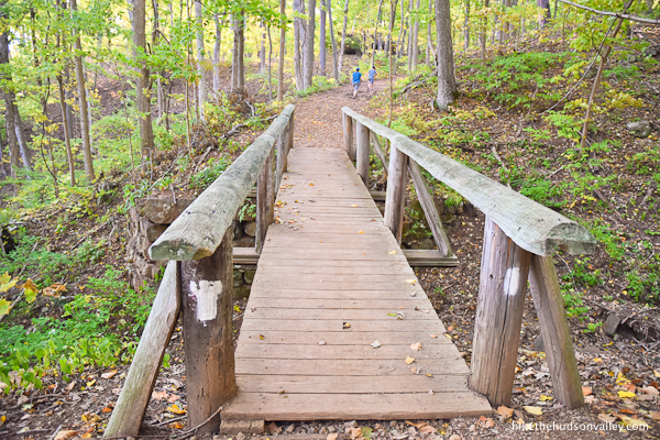
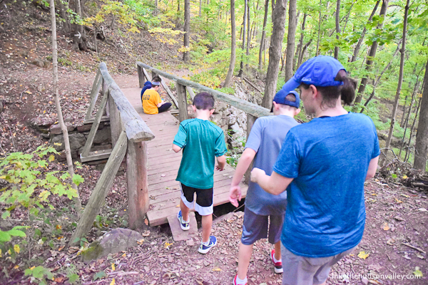
7. Less than ten minutes from the I-691 honk-a-palooza, cross a picturesque little footbridge.

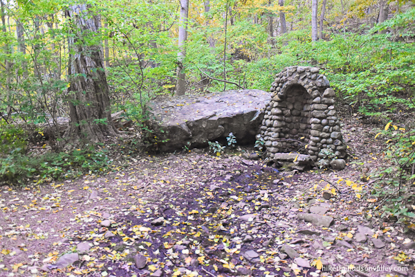
8. Two minutes beyond the bridge, you’ll arrive at the next point of interest, marked by boulders on either side of the trail.
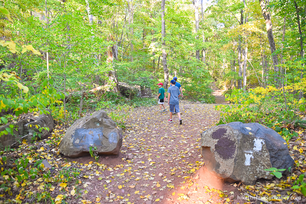
Just beyond those boulders, on the left, you’ll find a stone structure that looks like it contains a little spring.
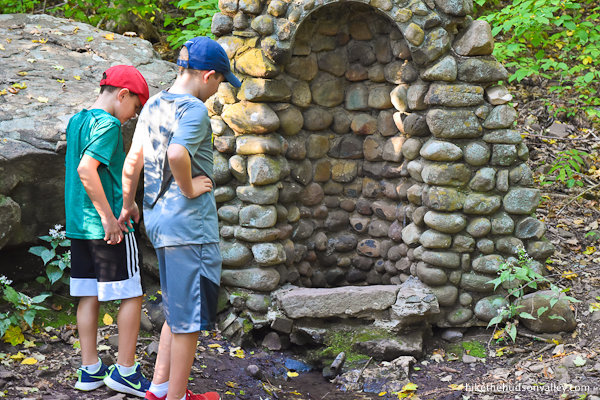
Even though this was likely a useful spring at one time, you should just drink the water in your backpack, unless you’d like to invite the possibility of severe gastrointestinal distress into your life.

Plus, the frogs in there don’t want you drinking their swimming pool.

When you’re done saying “ribbit” to the locals, just keep following those white blazes straight past the spring.
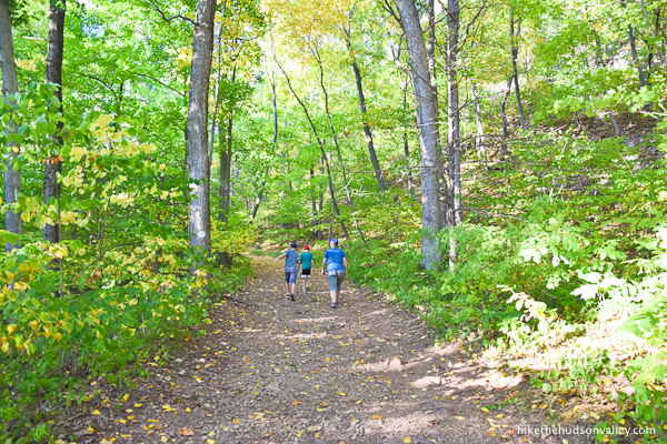
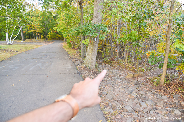
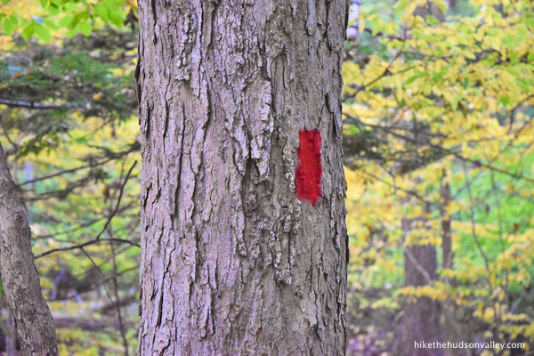
9. In one minute, you’ll arrive at a fork, with an arrow directing you to the right. The Red Trail joins you from the left (though if you notice any red blazes here, you have sharper eyes than me). We’ll take the Red Trail back home later today, but for now, stay to the right to keep following the White Trail.
10. The trail undulates gently for the next .4 miles.
If you see a copperhead in this section, you can hop over it at the last second, like my wife did, or – more preferably — just give him a nice wide berth. (He probably won’t be there anymore by the time you read this.)
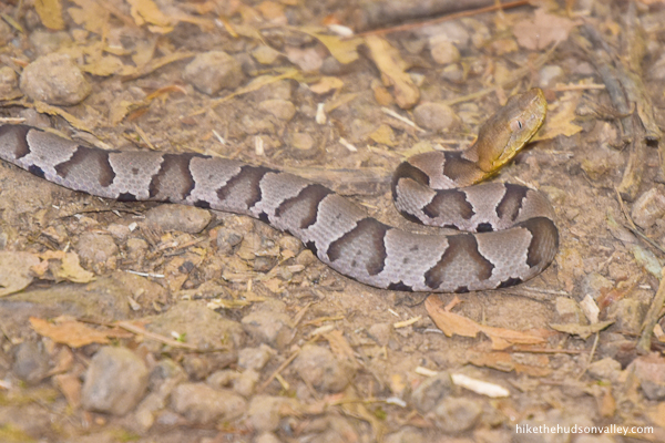
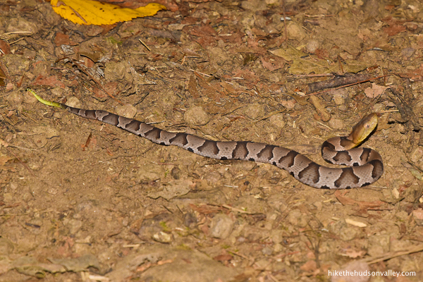
Aren’t you a cute little fella? Also, thanks for not killing any of us.
Just keep following that nice, wide trail, carefully watching where you step.
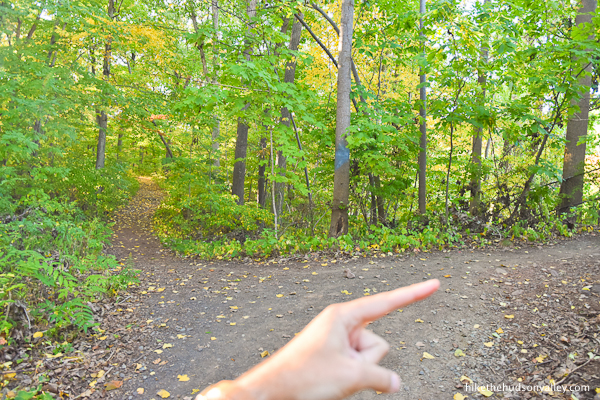
11. About six minutes beyond the spring, you’ll arrive at another (unmarked?) junction, where the Red Trail joins you from the left again. This is the other end of the little loop you’ll take home later. For now, stay right/straight to keep following those white blazes.
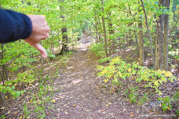
12. In another minute, don’t be lured onto an unmarked trail. Stay to the left to keep following those white blazes.


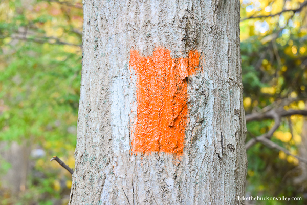
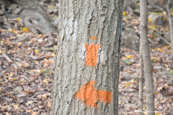
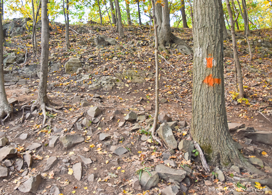
13. In less than five minutes, you’ll arrive at a junction with the Orange Trail. Turn left here to bid adieu to the White Trail, and begin following those orange blazes, which are also helpfully shaped like little castles. We must still be headed the right way!
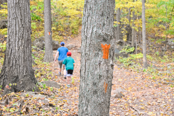
This section of trail must have once been blazed white instead of orange – you’ll occasionally see some of the old blazes peeking out from behind the orange castles.
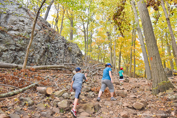
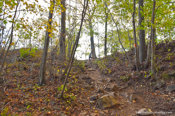
14. Going up! From here, it’s about .35 miles and 323 vertical feet to the castle. You could almost throw a rock and hit the castle from here! (If you threw that rock with a trebuchet.)

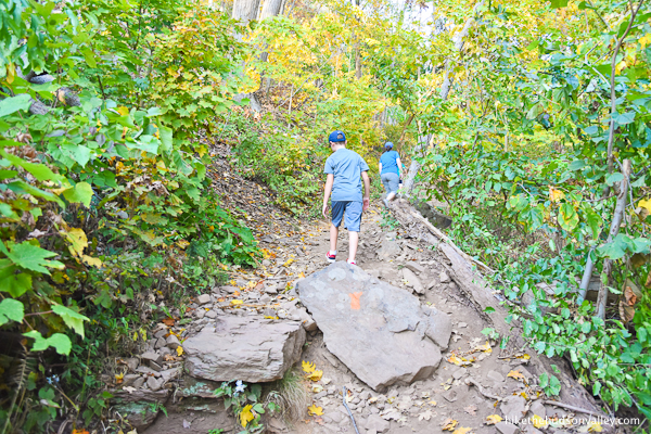
If you enjoy scrabbling over loose rocks on steep inclines, this is the place for you! But seriously, watch your step in this stretch. Careful you don’t surf back down the mountain on any of those rocks.


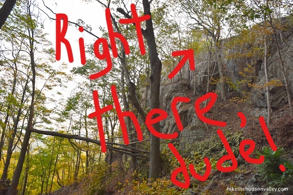
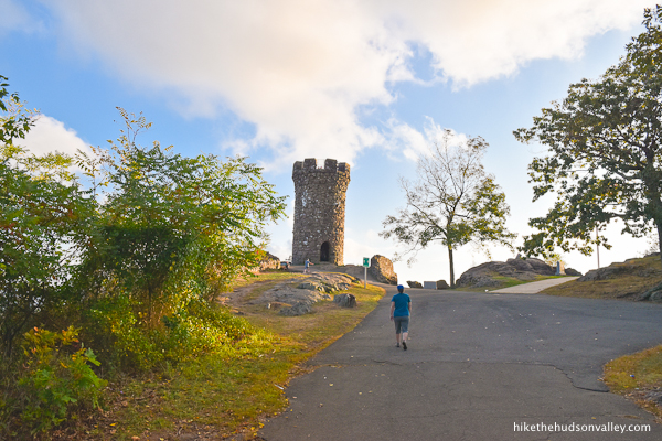
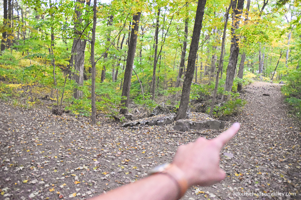
About five minutes from the beginning of your adventure on the Orange Trail, you’ll notice a large cliff looming to your left.
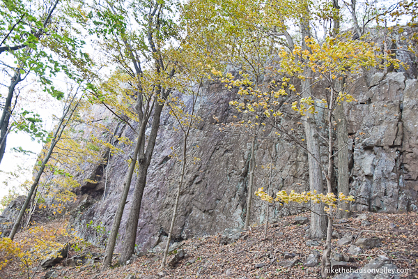
On top of that cliff, through the trees, you can juuuust see the castle up there.
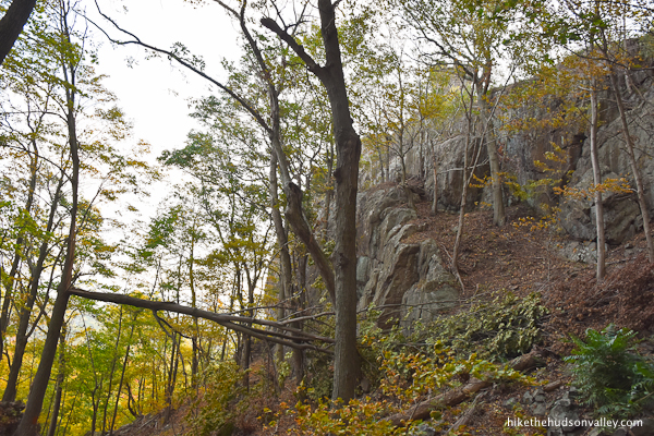
In case you still can’t see it in the picture above, here’s another version of the same image, digitally enhanced with the latest in graphics technology to help you see where the castle is located.
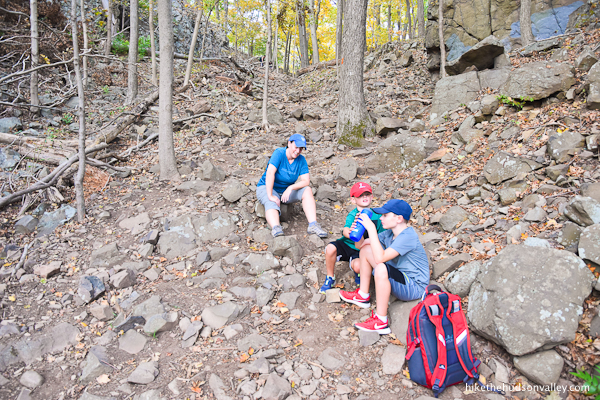
15. Storming castles is hard work! Don’t forget to hydrate.
Keep climbing on the Orange Trail.
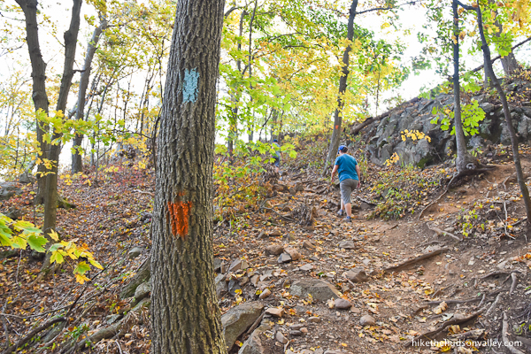
Just a minute beyond the cliff, follow the Orange Trail as it takes a hard left to send you back toward the castle.
You may see some blue blazes as you climb this last rise. Don’t worry about them. We’re only paying attention to the orange ones. (No offense, blue blazes! But you’re not shaped like cute little castles. Rectangles just don’t do it for us anymore.)
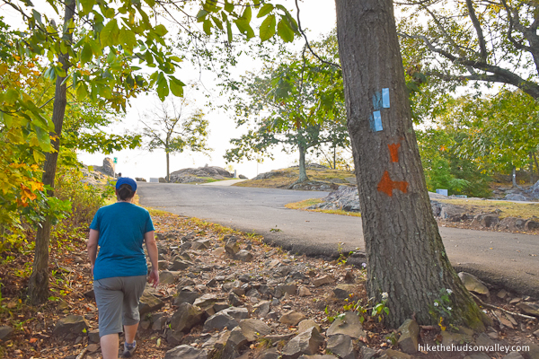
16. Emerge from the woods onto the pavement of Peak Drive Cheaters’ Driveway. Sure, you could have just driven to this spot, but then… well, you could have just driven here, I guess. (But not if you timed your hike so that the gate was closed!)
Anyway, just think of all the character you built during that hike! Good thing you didn’t cheat and miss out on all of that. I can already tell it’s made you a better person.
Turn left onto Cheaters’ Driveway to head toward our destination for the day: Castle Craig!
17. Have fun storming the castle!
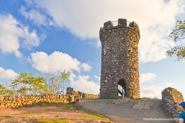
The road takes you right up to the entrance. If the top of the castle is crowded, you can kill a few minutes checking out the view from its base, too. This sure wouldn’t be a bad spot to enjoy the haggis sandwich and/or brie wheel that you packed.
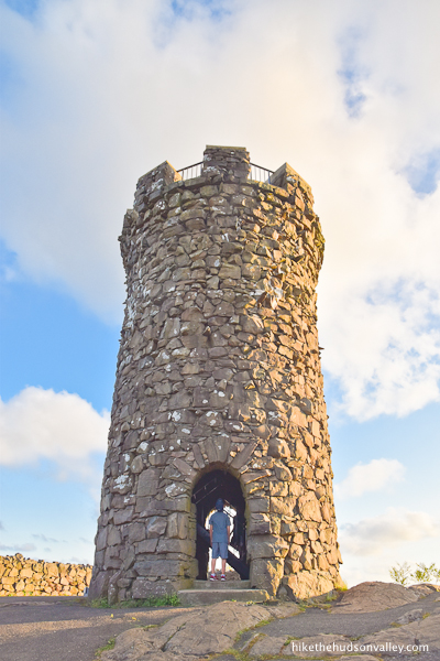
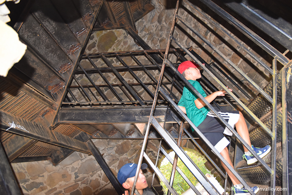
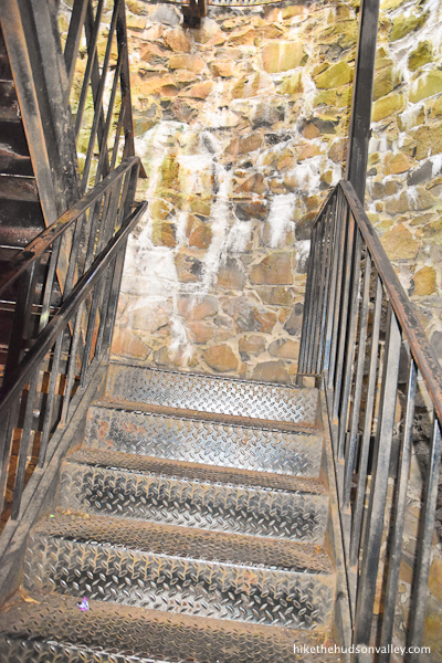
It’s okay if you forgot your siege ladder. Once inside the castle, you’ll find a nice metal staircase to take you to the top.
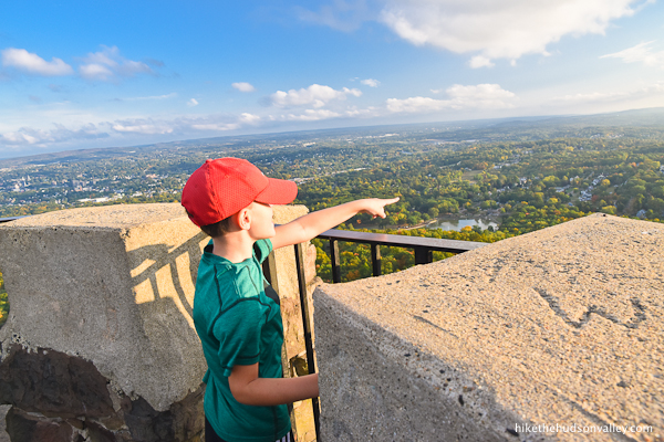
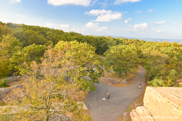
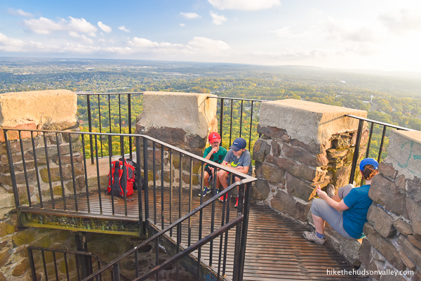
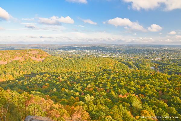
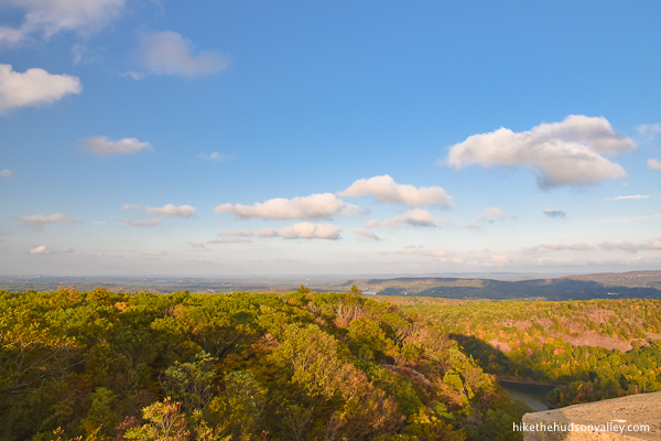
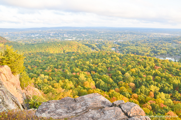
18. From the top of the tower, nothing left to do but check out the crazy view!
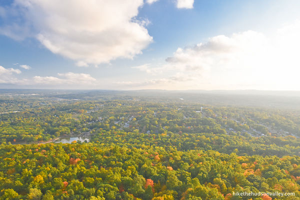


And it is pretty crazy. What a beautiful spot.

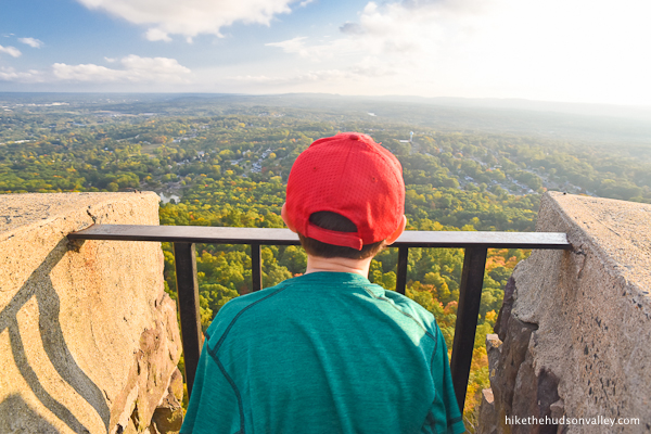
Hello down there, I-691! Hey, I’m doing the thing with my arm, how come nobody’s honking?
When your eyeballs have soaked up as much view as they can hold, head back down the steps.

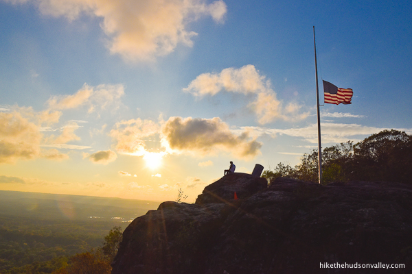
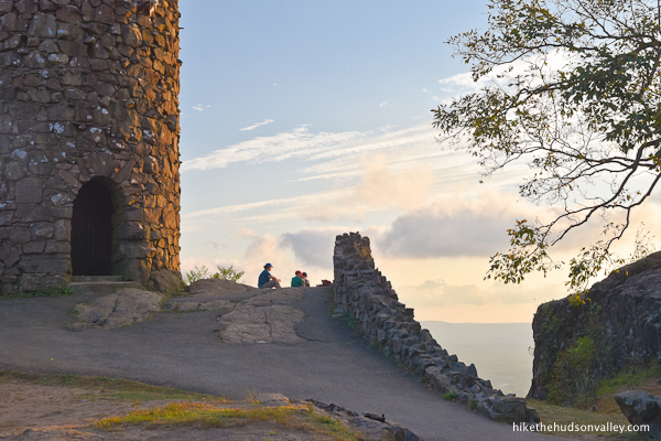
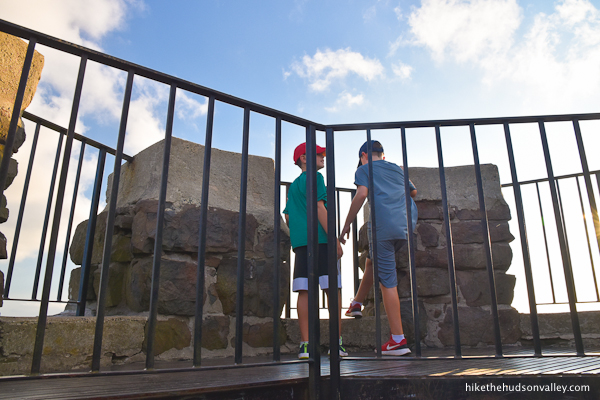
19. From the base of the tower, there’s still some nice stuff to explore. To the right of the tower (when you’re looking out at the view), there’s a rocky bluff with an American flag on it.
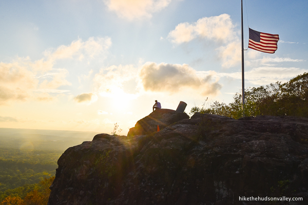
Head over toward that flag, and you’ll find Castle Craig’s historical marker.

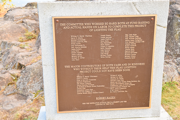
And some call-outs to the good folks who made the lighting of the American flag possible.
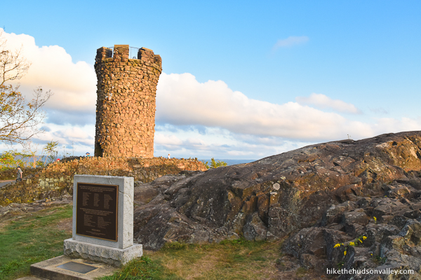
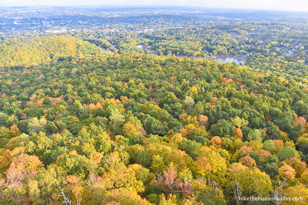
You’ll also get another nice view looking back the castle, and a slightly different vantage point on the insane views from up here.
Get one last look, then we’ll head out when you’re ready.

20. When you’re done storming the castle and marinating your eyeballs in those views, head a few yards back down Cheaters’ Driveway, then turn right onto the Orange Trail.
21. Take that hard right turn at the bottom of your first descent to stay on the Orange Trail.
Carefully pick your way down the rocky terrain. No shame in using your hands when you need to!
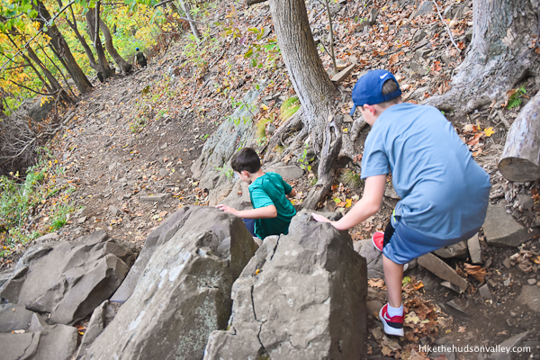
And careful not to surf down the hill on those loose rocks. (Sorry, I know you’re not my kid. But I have to say it anyway.)
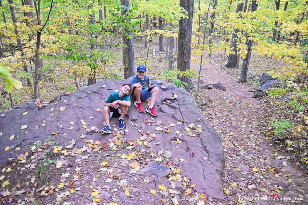
22. At the bottom of the hill, just beyond a flat boulder that makes a nice spot to wait for your doddering old father, take a right turn onto the White Trail, retracing your steps from earlier in the day.
In about two minutes, you’ll arrive at an unmarked junction. The White Trail continues to your left, and you COULD follow it back the way you came. It makes a nice little loop, though, if you take a right onto the (unmarked for now) Red Trail instead. Let’s do it!
23. In less than a minute, you’ll start seeing some red blazes.
Phew! We’re not lost anymore.
The trail here is flat and easy to follow, though it could probably use another blaze or two.
You may notice some light blue blazes heading off to your right. Just keep staying straight and following the red blazes when you can find them.
24. After less than ten minutes on the Red Trail, you’ll emerge at the end of the loop, where the Red Trail ends into the White Trail. Recognize this spot? Stay straight/right to hop back on the White Trail. (Don’t go left on the White Trail, or you’ll wind up back at the castle again.)
25. In less than a minute, you’ll arrive back at the spring-like frog habitat.
Go straight between the boulders here to stay on the White Trail.
26. In another minute, arrive back at the picturesque wooden bridge. (If there are teenagers sitting on the bridge when you pass, don’t worry, they’re not collecting tolls — they won’t even look up from their phones when you go by.) Turn right after the bridge to continue following the White Trail downhill.
27. In another five minutes, you’re back at I-691. You’ll know you’re getting close by the sound of motor vehicles squishing any serenity you might have been experiencing.
Might as well roll with it! Who’s up for some more honking?
HOOOOOOOOOOONK! HONK! HOOOOOOOOOOONK! Oh, that was a good one! Thanks for putting so much elbow into it, trucker person!
When the thrill wears off and/or your ears can’t take it anymore, continue across the pedestrian bridge.
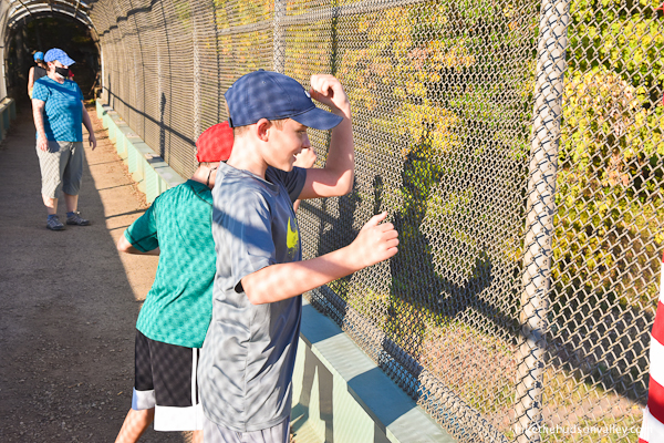
28. Turn left after the electrocution pillars. Careful not to get zapped!
29. After the bridge, turn left to keep following the White Trail.

(And don’t get bucked off onto any of the unmarked trails in this section!)
20. About 12 minutes after the bridge, you’ll arrive back in the Hubbard Park parking lot.
You did it! Congratulations on conquering Castle Craig, however briefly. Hope you had a great time out there. Now, time to celebrate with some haggis (and/or brie)!
Directions
Directions to the trailhead: From the Hudson Valley, head east on I-84. You’re heading waaaay out, past Danbury, then through Waterbury, until you take Exit 27 for I-691 East towards Meriden (this exit is about 70 miles east of the intersection of the Taconic Parkway and I-84). Stay on I-691 E for about 3 miles, then take Exit 4 for W Main Street. Take a right onto W Main Street off the exit. Proceed for about .7 miles, then take a left into the entrance for Hubbard Park at Mirror Lake Drive.
Here’s a Google Streetview image of that turn — the sign for Hubbard Park is beyond the turn, so go slow here, or you’ll have to hang a U-turn and come back (like I did). (If traffic is heavy, you may want to do that anyway.)
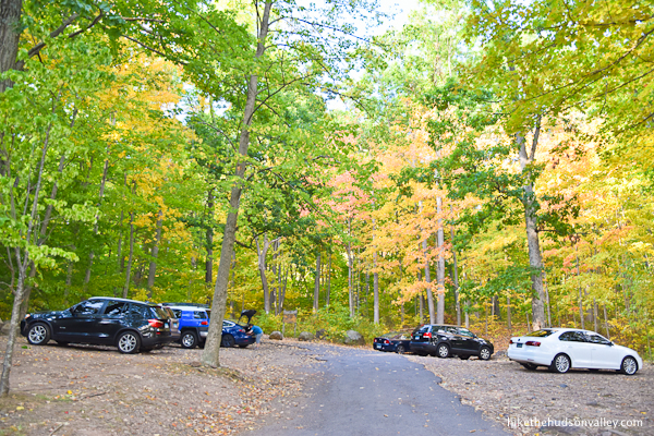
Once you’ve turned into Hubbard Park, with the lake on your right, drive partway around the lake until you see the short driveway to the hiker’s parking lot on your left.
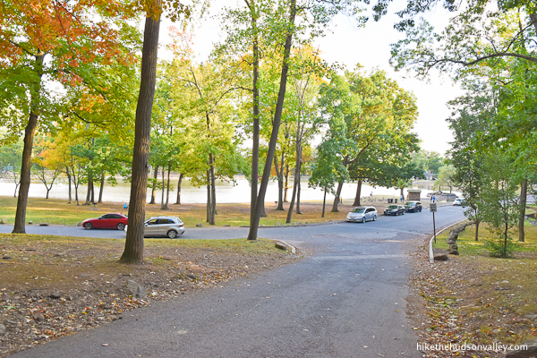
Here’s the view looking back at the lake from the parking lot:
Park in the lot (or find a spot around the lake if the lot is full), climb out, and let the adventure begin!
Sorta nearby address for your GPS: Putting “Mirror Lake Drive, Meriden, CT” will take you to the right spot (then you’ll need to look for the hiker’s parking lot as described in the paragraphs above). Putting “Hubbard Park, West Main Street, Meriden CT” into Google Maps on your phone will get you close, but won’t take you to the exact turn onto Mirror Lake Drive (at least as of this writing in 2021).
GPS coordinates of parking area: 41.55044, -72.83538 (Clicking will open in Google Maps or the Apple Maps app, depending on your browser/device.)
Resources & Interactives
Super-cool Google Earth flyover of hike route:
<
Google Terrain Map of hike route:
Alltrails recording of hike (click here to open in Alltrails app or Alltrails.com, depending on your device):
Related resources: If you’re looking for actual facts and/or useful information, visit these resources:
- The official Hubbard Park homepage
- The free online trail map for this hike and surrounding trails
- The informative Castle Craig Wikipedia page
- The varied reviews (from both cheaters/drivers and hikers) at the Castle Craig TripAdvisor page
- A nice trail guide with an alternate loop (that’s slightly longer and offers more views) from Scenes From The Trail
Want to support trails in the Hudson Valley? Here’s one great way: Visit the New York-New Jersey Trail Conference homepage and click on Volunteer, Donate, or Shop! (Then you can volunteer, donate, or shop, depending on your mood.)
Did you know that there is a book written about hubbard park in meriden . There is pictures that at one time there was plans to develope the area with a golf course and hotels up where the castle is today.and all around the resevoir also.im glad that never happened.and hope it forever stays a psrk and undeveloped.but who knows money talks.
I lived in Meriden for a couple years as a wee lad, there are probably pictures of me dressed in a silly outfit with my parents in their even sillier early 70s outfits. I don’t remember it of course, so I’ll have to visit someday. The trick is getting my family to hike up without finding out there’s a road. They’re cheaters, for which I am ashamed…
Ha! If you visit when the Cheaters’ Driveway is closed, you’d at least have a plausible excuse for making them build all that character by hiking up. Good luck, Jeff!
Thanks for the valuable info Bob!
When dose it open for u to drive up there cuz I went yesterday and it was closed to drive up I wonder y ???
Hi, Jessica! That’s a bummer – sorry you didn’t have better luck yesterday. Here’s the info I have posted in the “Background” section above:
“There’s a gate at the entrance road to Castle Craig that is locked from Nov 1–May 1. (Hikers park at Hubbard Park, so that gate isn’t a problem for us.) Even on dates when Peak Drive (aka Cheaters’ Driveway) is open, the gate is only open from 10am-5pm. ”
If your visit was within 10am-5pm, I’m not sure what was going on. Otherwise, if you show up during that time, you should be all set. Or you could hike there following the trail guide above and visit whenever it suits you, as long as the sun is out.
Hope that helps, and you have a better visit next time!
Yes if you hike hubbard park .do not rely on all trails map. Because the city went and put up an orange blaze which it is not on all trails map.and of course there is no signage telling you orange trail is the trail ti the final step of the way from the white trail. I hike up there daily and have to tell peapole how to get to the top.also the city refuses to put garbage cans up there,and there is garbage all over the place,its an environmental danger to the animals. And broken glass which is dangerous,for children and adults and its disgusting.no excuse for not having a garbage can.
Thank you for the local intel, Bob! I was wondering about those orange blazes — the Hubbard Park map shows that last section leading to the castle as White Trail, but it is most certainly Orange Trail now. The background you provided helps explain how that happened – thanks! (Whatever color they are, the fact that they’re shaped like little castles at least gives us a clue that we’re headed the right way.) And I will never understand how people who appreciate nature enough to visit it also sometimes choose to defile it. So sad. I picked up a couple pieces of litter while I was there – hope that made your daily stroll a little more pleasant 🙂 Many more happy adventures to you, Bob – thanks for dropping by here!