Background
If you find this free trail guide useful, please provide payment by picking up at least one piece of litter on your hike. Cha-ching! Thanks for being awesome! (And here’s a quick primer on Leave No Trace, too, to help us keep the trails nice and fresh for each other.)
**FIVE-ALARM ATOMIC-WEDGIE WARNING!!!! Posted November 2021** The fire tower has been fenced off and CLOSED, perhaps permanently. And we thoughts the wasps were bad! I’ve tried calling the Harriman State Park office for more info, but haven’t been able to contact a human yet. This is a major bummer. If you have more information, please post it in the comments below, and I will update this message if I can scrounge up more details. (And thank you to Matt Mauriello for his helpful comment with the bad news!)
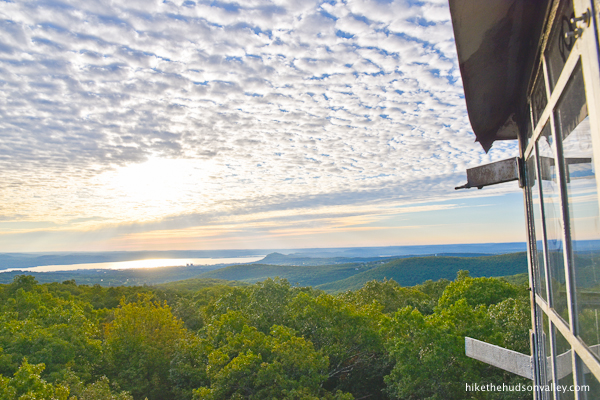
Background you can feel free to skip: As you stand in the cabin of the fire tower on Jackie Jones Mountain at Harriman State Park, gazing out over the NYC skyline on one side and Lake Welch on the other, you should take a moment to feel sorry for the all the people who hiked this area for the several decades prior to 2018, before this fire tower was accessible to the public.
Just think of all the skyline those people didn’t get to see! And all the other views they missed out on! So sad.


(Of course, they’d never heard of Covid-19, either, so they did have some things going for them.)
Here’s a quick bit of history on this tower, from the NY-NJ Trail Conference guide for this hike:
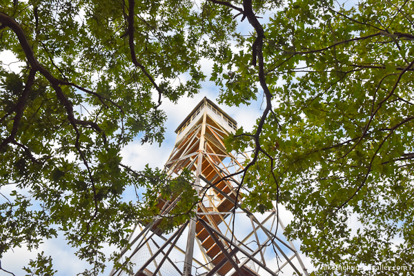
“Built in 1928, the 60-foot-high tower was restored in 2018 by volunteers of the New York State Chapter of the Forest Fire Lookout Association and Team Rubicon.”
Thank you, New York State Chapter of the Forest Fire Lookout Association! And thank you, Team Rubicon! You dudes are super awesome. (And you can check out this great post by Scenesfromthetrail.com from 2016 to see the tower in its pre-restoration, dilapidated state, to give you a greater appreciation for how fantastic it looks now.)
While we’re feeling sorry for all the pre-2018 hikers who couldn’t climb Jackie Jones Fire Tower, it seems worth mentioning the crazy number of recent new hiking destinations that we now have available to us in the Hudson Valley.
When I first moved here in 2000 (am I a local yet?), so many hikes featured on this site didn’t exist yet. High Banks Preserve, Falling Waters Preserve, High Falls Conservation Area, Red Mountain, Franny Reese State Park, and Peach Hill Park didn’t exist (at least not in their current publicly accessible forms). The fire towers at Mt. Beacon and Ferncliff Forest were in disrepair and not safe to climb. The Walkway Over the Hudson was a rusty old trestle that hadn’t been used in decades. The amazing boardwalk at the Great Swamp didn’t exist. Our awesome system of rail trails wasn’t a thing. (Also, this list is nowhere near comprehensive, which makes this area even more awesome.)
Is it normal for so many fantastic new natural destinations to appear in such a short time? It feels extraordinary to me. In any event, these things don’t just happen, and we all owe thanks to all the amazing people and organizations that continually make the Hudson Valley a better place to live and visit. Thanks, awesome people and organized groups of people!
Okay, what were we talking about again? Ah, yes, the Jackie Jones Fire Tower!
The hike to the tower is about 2.8 miles roundtrip, with gentle-to-moderate inclines most of the way.

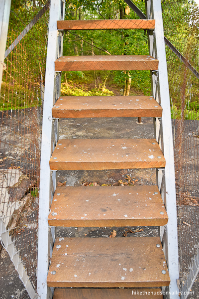
This is a perfect outing for kids, if you happen to have some offspring that you’d like to drag into the outdoors with you. The only caveat is that you will see zero views if you don’t climb the tower, so your wee adventurers would need to be willing to climb those nice, sturdy, newly refurbished steps.
Once you climb those steps, that view is one of the nicest around. You can choose to look at the city or the country, depending on whether you have a city mouse or country mouse vibe going that day.
Another point of interest on this hike is the ruins of the ORAK estate that you’ll pass near the beginning of your stroll.

Here’s some history on the estate from Scenic Hudson:
“Constructed in 1923, the mansion belonged to George Buchanan, a VP of the Corn Products Refining Company. Its name spells backward the gooey sweetener that made his fortune — Karo syrup, a prime ingredient in pecan pie.”

What happened to this place? It’s only a hundred years old, and there’s barely anything left. The Parthenon is much older, and in much better shape. Perhaps we all bear some culpability here, for not eating enough pecan pies.

Beyond the ruins, you’ll find some nice stretches of ferny trail, where you can just stroll, relax, and feel a little guilty for not eating more pecan pie.
While I’ve written this hike up as a 2.8-mile up-and-back affair, you can make it a 4.7-mile roundtrip if you’re interested in going beyond the tower to check out Big Hill Shelter as well. (You can find some great info on the Harriman shelters, including Big Hill Shelter, from MyHarriman.com: Harriman State Park Lean-tos.)

If you’re just in it for the views, I’d recommend turning around and heading home after the fire tower. The shelter offers some very nice views as well, but they’re a smaller version of the same views you had from the tower. By the time you get to the shelter. your retinas are already all spoiled.
But if you’re a crazy hiking goon and want to add some mileage while checking out a cool (and popular!) camping destination, I’ll include the jaunt to Big Hill with optional steps in the write-up below.
Whether you decide to hike the shorter version or the longer version of this hike, the important thing is that you do one of them. Having access to the Jackie Jones Fire Tower is one the major benefits of living in the post-2018 world. That, and Baby Yoda.
Give it a visit when you can, climb the tower, and enjoy one of the best views in the Hudson Valley. This is the way.
Trail Guide
Bonus unsolicited advice: Don't depend on having cell service in the woods - it can be spotty out there! Download this trail guide to your phone before you head out. (It's easy to do on iPhone and Android.) May your connection to nature be strong, even when your connection to the internet is weak.
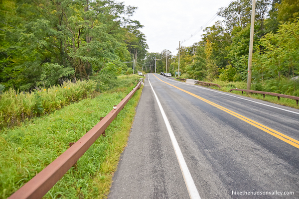
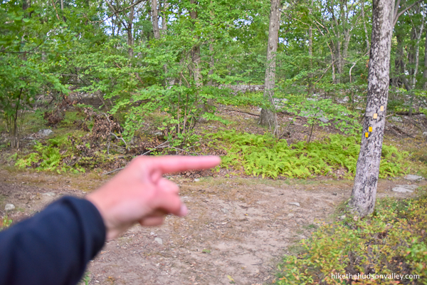
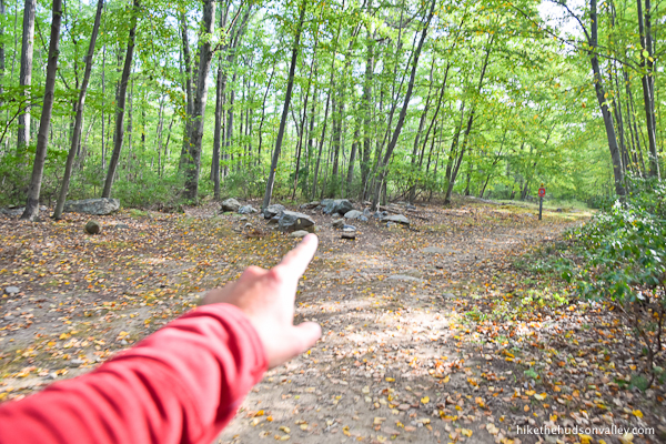
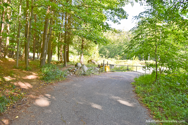
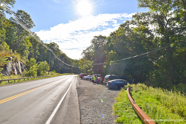
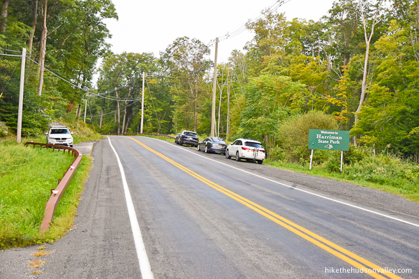
1. From the parking pulloff on Kanawauke Road (County Route 106) (see “Directions to the trailhead” below), walk west along the road (without crossing the street), toward the green “Welcome to Harriman State Park” sign and the little bridge over the boisterous Minisceongo Creek (which is marked by concrete barriers between the guard rails).


2. Just past the creek, you’ll see the not-particularly-inviting trailhead on your left, marked by a gate that would be meant to keep you out, if you were a car.
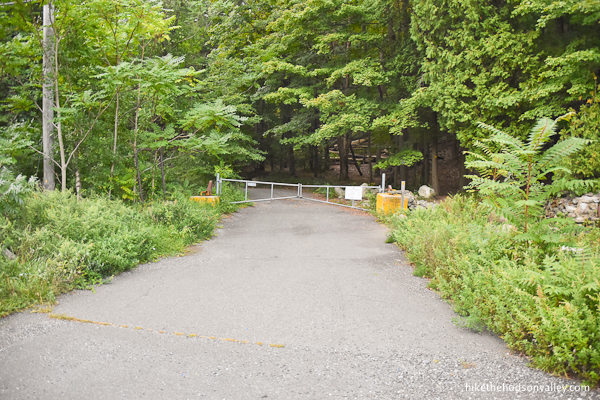
Walk up closer to the gate and you’ll see a much friendlier entrance for hikers on the right.
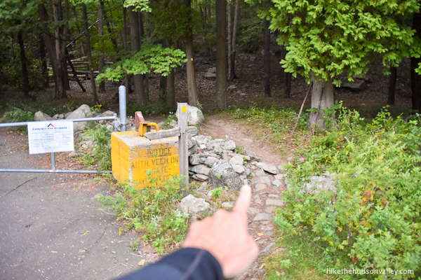
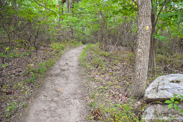
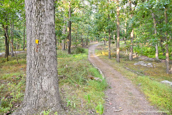
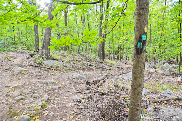
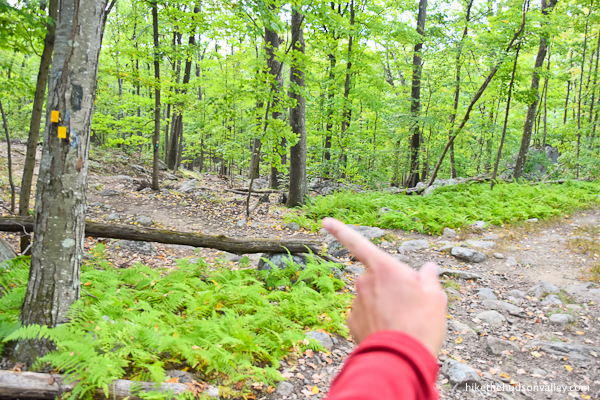
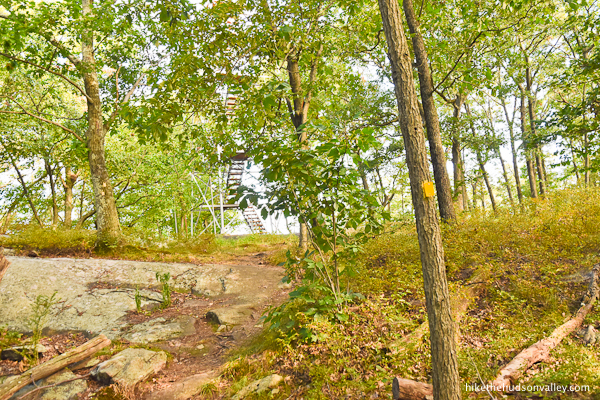
Here, you’ll pick up the yellow blazes of the Suffern-Bear Mountain Trail (heretofore referred to as the Yellow Trail).
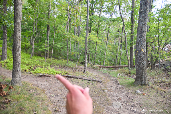
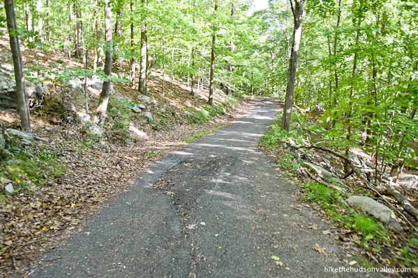
3. On the other side of the gate, simply stroll along the road, getting those nagging thoughts of, “Am I trespassing right now?” out of your head. You’ll see several yellow blazes along the road as you stroll, which shout, “Dude, you’re cool! This is where you’re supposed to be!” from the trees.

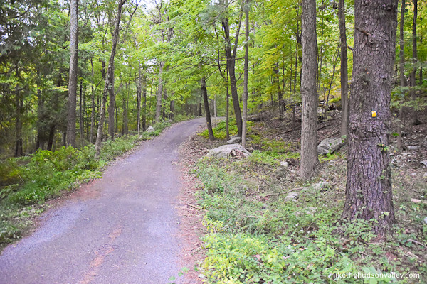
Indeed, this is exactly where you are supposed to be.
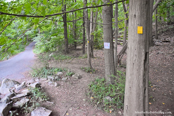
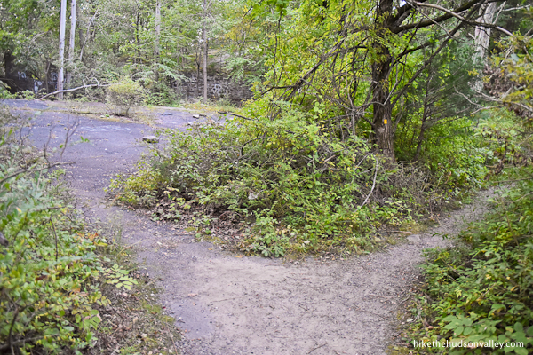
4. Just 3-4 minutes after the gate, you’ll come to a fork. Take the left option to follow the Yellow Trail as you bid adieu to the road.

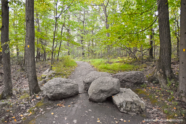
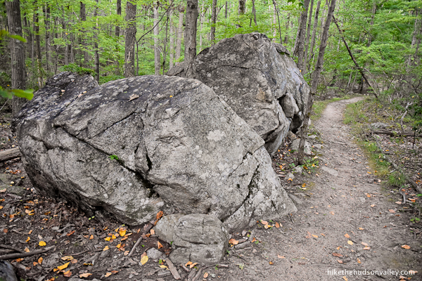
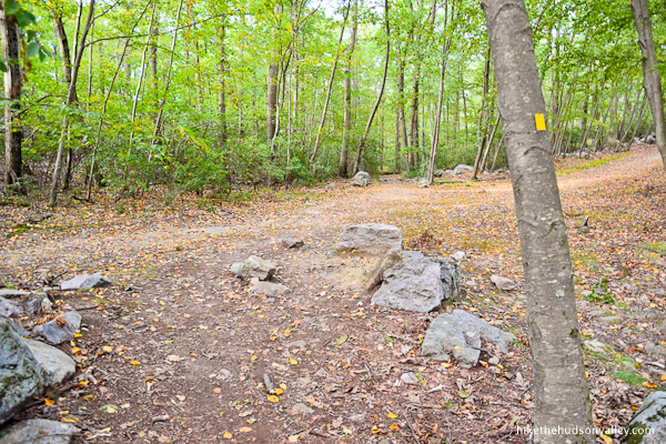
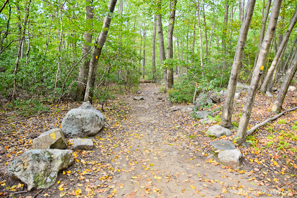
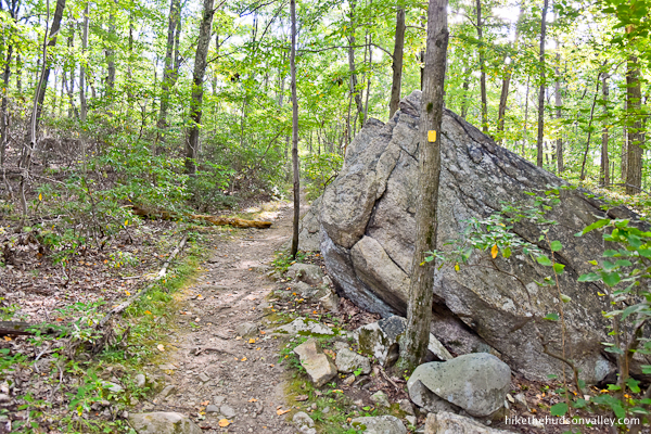
Some boulders ensure that you aren’t trying to cheat by sneaking a motor vehicle in here, just in case that gate didn’t do the trick. Thanks for keeping out the cheaters, boulders!
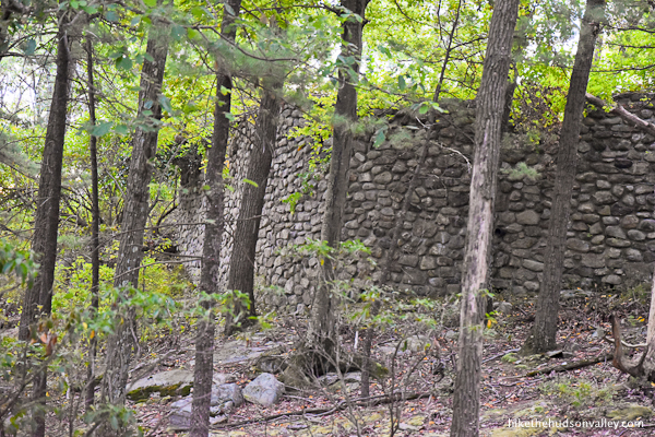
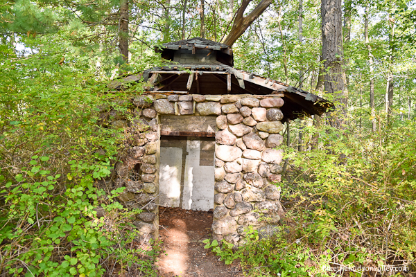
5. Keep following those yellow blazes, and in just a moment, they’ll lead you to your first signs of ruins for the day (assuming you didn’t drive past any vacant malls on the way here).
The trail brings you right past a small outbuilding, which was once part of the ORAK estate. In its heyday, this building served as the gate house where guests were handed pecan pies, which they had to consume, in their entirety, before arriving at the main house.
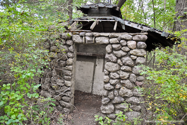
Actually, I have no idea what this building was used for, but I will note, as a homeowner, that this is what happens to a house if you stop paying attention to it for like four months.
6. Just beyond the gate house, there’s an umarked fork where you can check out a little more ruination, on your left. Take a look if you’d like – the ruins are just a few feet off the trail.
Those windows look a little drafty, right?
When you’re done scoping out the ruins (and reflecting on how the heck you make syrup out of corn, anyway), continue straight along the Yellow Trail.
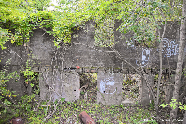
7. Off to your left, hey, more ruins!
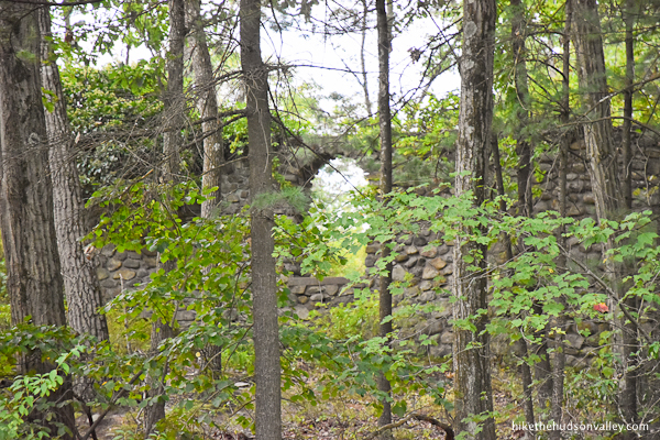
To me, this was the most impressive part of ruins, where there’s a substantial stone wall with an open archway. Still, there’s no denying: this place is a serious fixer-upper.
8. The trail curls to the left, uphill from the ruins.
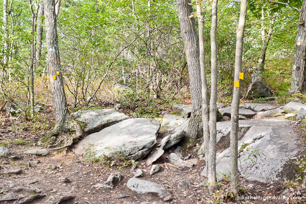
In just a moment, you’ll come to a sharp right turn in the trail, marked with pairs of yellow blazes.
At this spot, you might also be tempted by an unmarked trail heading to your left, back toward the ruins.

I scoped it out, just to see if you’re missing anything amazing by skipping it. You aren’t. (Plenty of thorns, though.)
Keep following those yellow blazes as they turn right, away from the ruins.
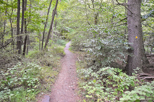
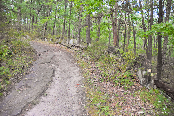
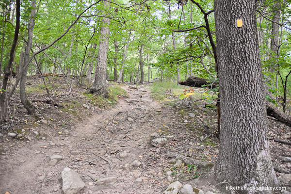
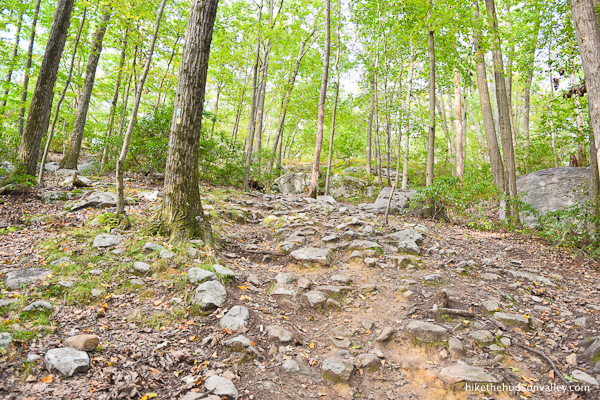
9. After the ruins, the trail becomes less of an old road, and more of a proper trail. Sweet! Less than a mile to the tower from here. Let’s do it!
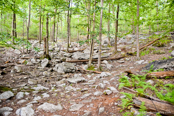
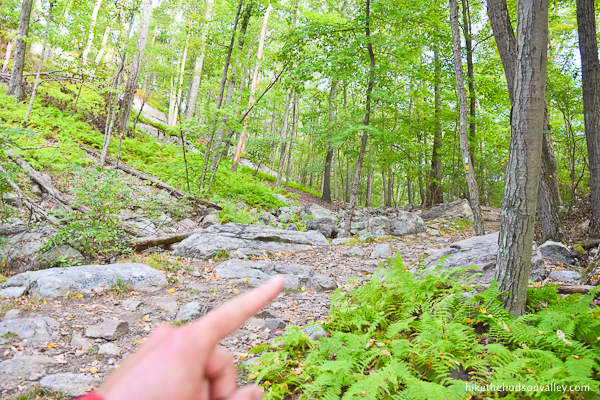
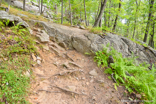
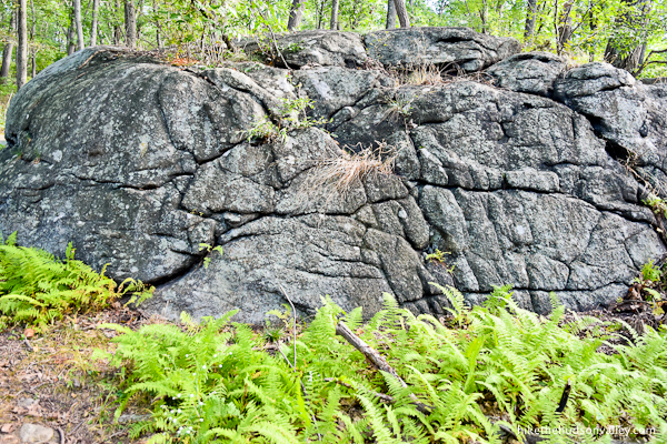
The trail passes some interesting rock formations and continues gently ascending.
Less than ten minutes beyond ORAK, the Yellow Trail is joined from the left by an unmarked trail.
Take a hard right to continue on the Yellow Trail.
10. Immediately after that hard right, follow the double-blazed advice to take a hard left, remaining on the Yellow Trail.
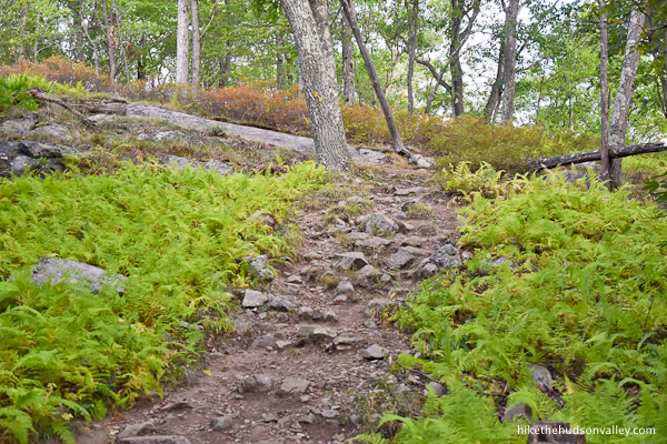
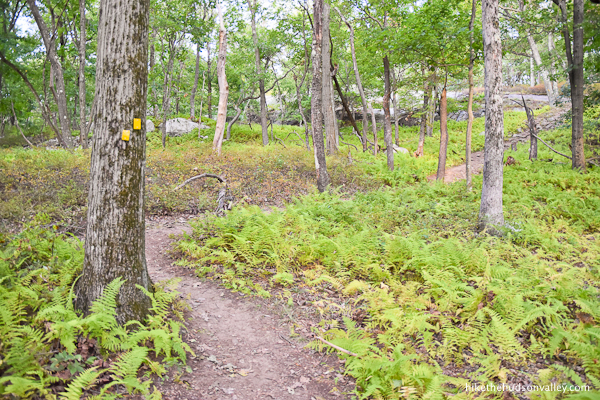
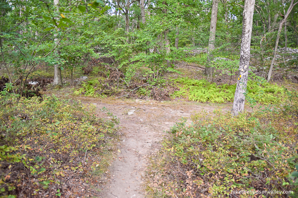
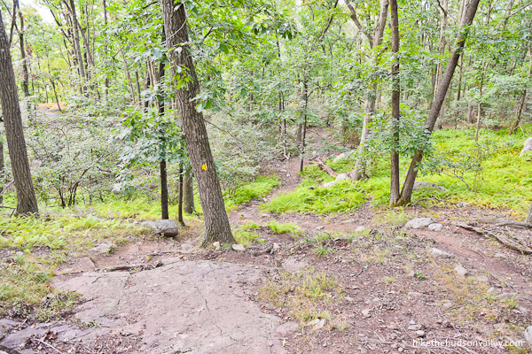
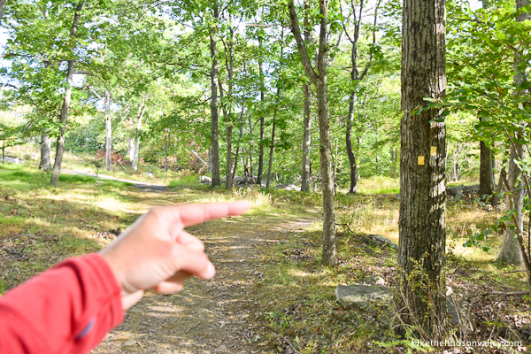
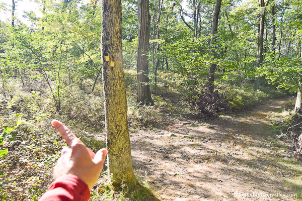
11. Follow the yellow blazes through some ferny goodness.
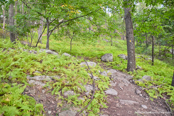

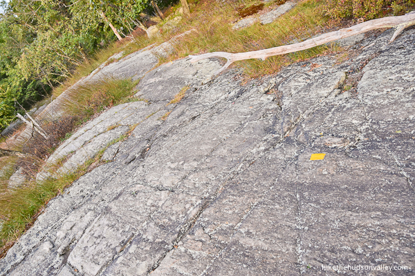
As the trail surface becomes smooth rock, be sure to keep a sharp eye out for painted blazes under your feet.
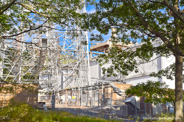
You may notice a communications tower looming overhead, which lets you know that you’re getting awfully close to the Jackie Jones Fire Tower, which is just a hop-and-a-skip further.

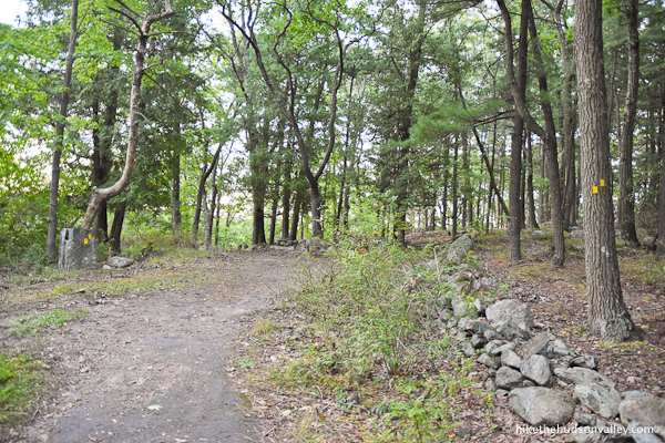
12. As you approach the communications tower, you’ll emerge onto a woods road, where you’ll take a left to continue following the yellow blazes.

On your right, you’ll see a large facility adjoining the communications tower. Who knew all this was up here? (I know what you’re thinking. No, this is definitely NOT a secret Russian complex like the one from Stranger Things. I mean, probably not.)
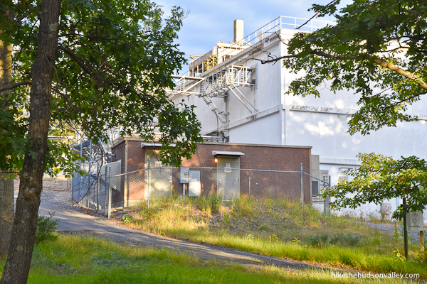
From this complex, it’s only about five minutes to the fire tower. Just keep strolling past, being careful not to get sucked into the Upside-Down.
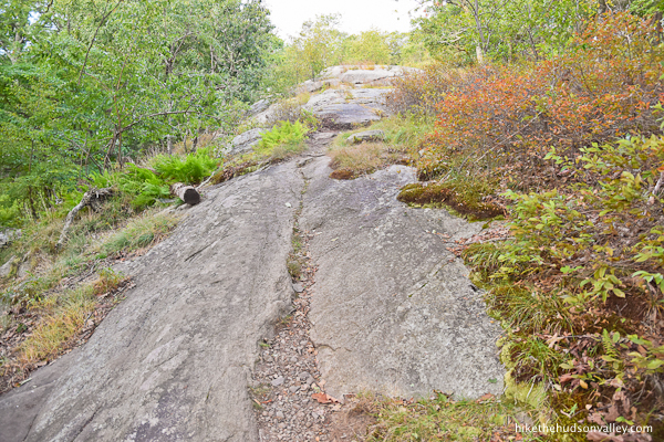
13. The Yellow Trail here is wide and easy to follow.
Keep chugging along, and the trail traverses some more flat rocks.
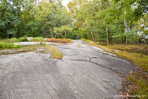
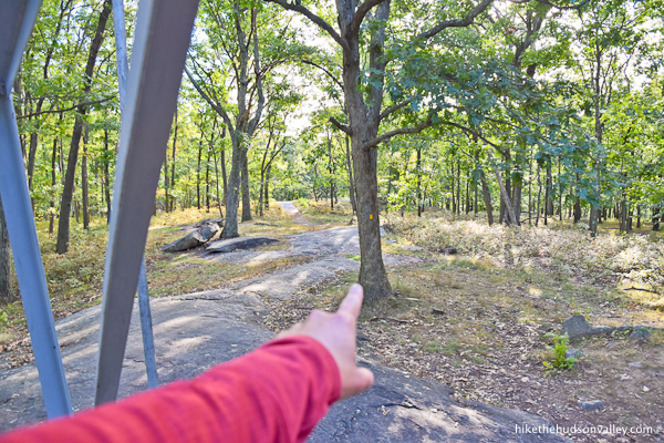
In just a couple more minutes, at the end of a rocky clearing, is that a tower you see straight ahead?
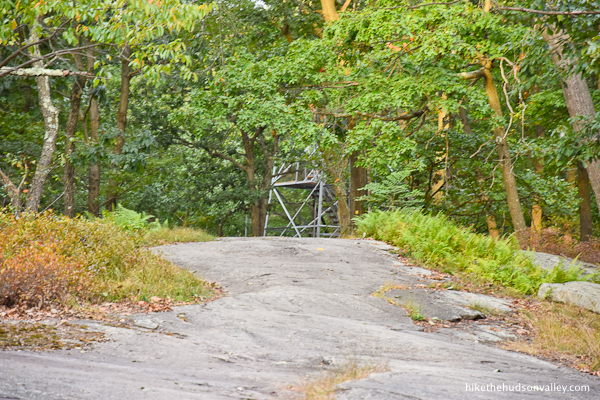
Indeed it is!

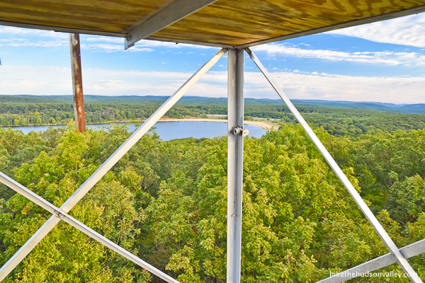
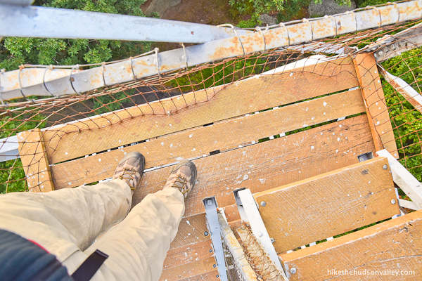
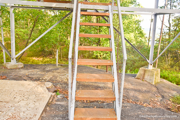
14. Climb that tower!

On my visit to the tower, the door at the bottom of the cabin was open, and you could venture all the way up.

If it’s locked when you visit (as it apparently sometimes can be), have no fear! The view is still quite nice from the last platform before the cabin, where there’s enough room for you and a very close friend or two.
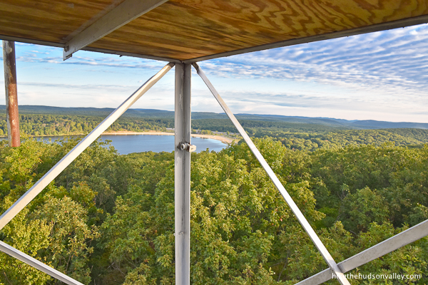
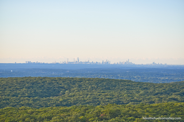
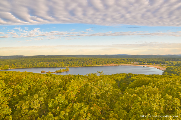
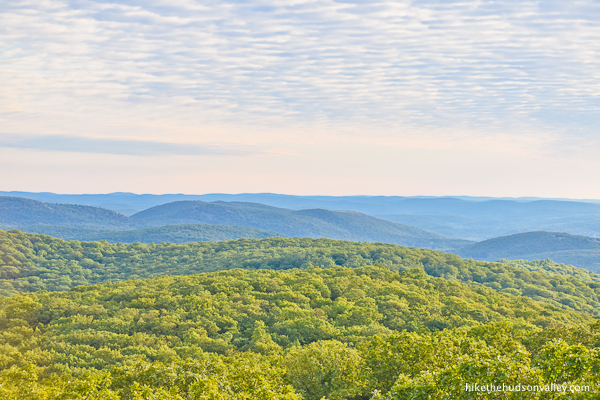
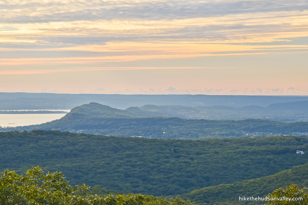
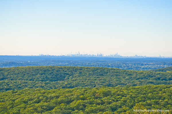
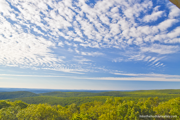
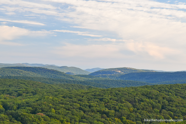
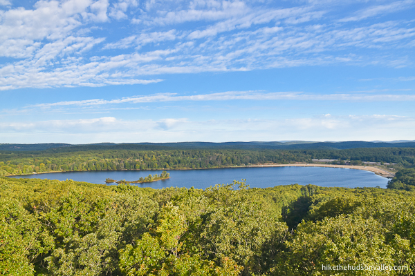
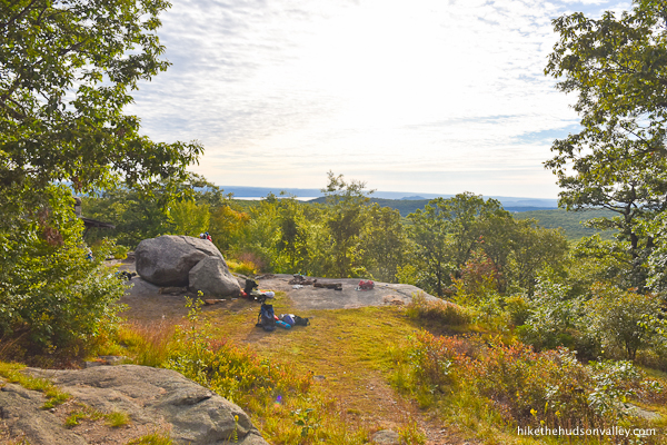
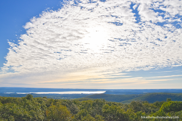
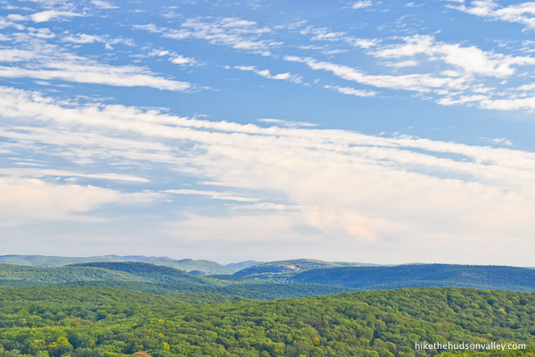
If you can climb all the way up inside the cabin, all the better! Take in that view. Lake Welch smiles back at you from one side.
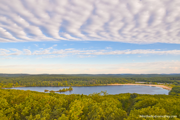
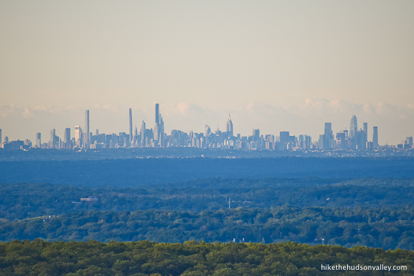
While the Big Apple smiles back at you (while also possibly flipping you the bird) from the other side.
You’ll also see that tower we just strolled past, marking the definitely-not-a-top-secret-Russian-Stranger-Things facility, with nary a demogorgon in sight.

If you turn your attention north, you’ll see the rocky bluff marking the top of Bear Mountain. If you really squint, you can juuuust make out the Perkins Memorial Tower atop Bear Mountain.
In case you can’t find the tower, here’s a digitally enhanced image to help you see it:

While I never want to dwell on the negative, one thing you might notice about the tower is the unfortunate plethora of reminders that some people can’t be trusted with art supplies.
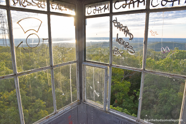
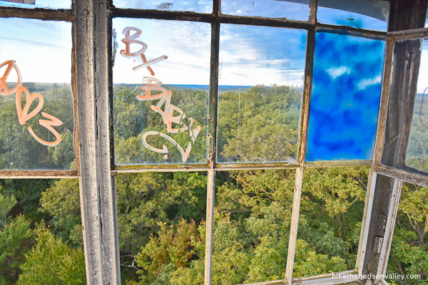
Just above the stairs, you might notice a leading contender for the Hudson Valley’s Most Ironic Graffiti Award.

Just use those knocked-out windows to peer beyond the tower and focus on those views, rather than on the shortcomings of your fellow citizens. (Or focus on the awesome work of your other fellow citizens who made this tower accessible in the first place. Yes, let’s focus on that.)

When you’re done marinating your eyeballs in those views, carefully head back down the steps.
15. Decision time! If you’d like to head back home from here, simply retrace your steps along the Yellow Trail back to your car. You can hop down to Step 17 below if you’d like to keep reading my blathering as you go.
If you’d like to add 1.9 miles and about 500 vertical feet to your day, you can continue deeper into the woods to check out Big Hill Shelter, which I’ll add as an optional step below. (I assume most people will want to head home from here, but it’s good to have options in life.)
16. Optional step: Visit Big Hill Shelter, making this hike a 4.7-mile roundtrip extravaganza. The fire tower hike’s not enough for you, you beast? Okay, let’s do this thing!
16a. From the bottom step of the tower, continue straight/right on the Yellow Trail (opposite the way you came in), heading downhill.

16b. Over the next half-mile, you’ll descend 250 feet (along with some short climbs thrown in, just to keep things interesting). Try not to think about how you’ll have to climb back up these hills on the way back.


Look at all these pretty rocks you wouldn’t have seen if you’d turned around at the tower!
16c. About thirteen minutes after the tower, the Yellow Trail crosses an unmarked woods road, complete with signage warning you not to dig in this area, due to a buried fiber optic cable. (Hope that doesn’t mess up your plans for the day.)
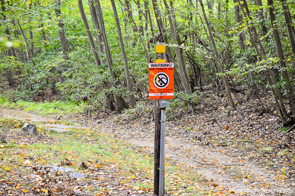
Continue straight across that unmarked road and keep following those yellow blazes on the other side.
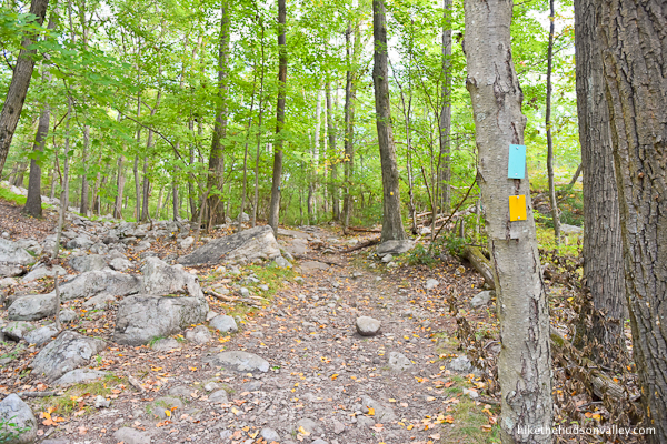
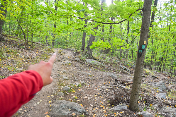
16d. In about three more minutes, you’ll arrive at an intersection with the teal-blazed Long Path.
Turn right here to continue on the Yellow Trail, which now also shares teal co-branding with the Long Path.
16e. Climb! (If anyone in your hiking party complains about the ascent, please remind them that the name “Big Hill” should have been a pretty good hint about what was coming.) Over the next .4 miles, you’ll climb about 175 feet.
Just keep following those yellow blazes (and the teal ones) as they guide you up the hill.

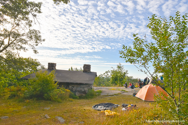
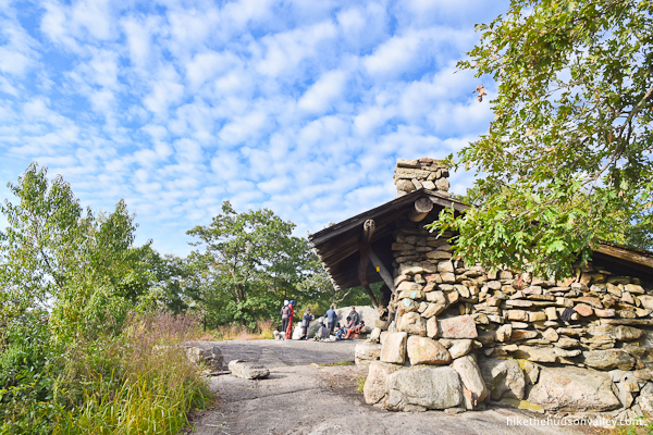
16f. Less than ten minutes after joining the Long Path, the trail leads you directly to Big Hill Shelter.
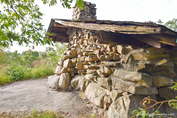
I visited early on a Sunday morning, and the surrounding area was abuzz with tent campers who were just waking up.

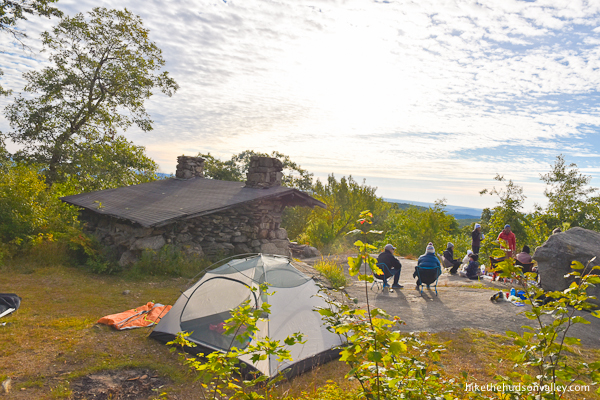
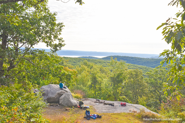
Just beyond the shelter, you can find some pleasant views.

(Too bad you’re spoiled from the views from the fire tower, or these views would look even nicer, right?)
When you’re done exploring, say goodbye to the shelter and head back the way you came.
16g. It takes about 4 or 5 minutes to get back down the hill to the Long Path intersection, where you’ll bid adieu to the Long Path (and its pretty teal blazes) and turn left onto the Yellow Trail.
Be sure to follow the yellow blazes to the left when the Long Path splits off to the right.
16h. In another three minutes, head straight across the unmarked road, once again doing your best to refrain from digging.
16i. Enjoy hoofing it back to the tower from here!

Try not to grumble too much when you have to climb uphill again. (This step was optional, after all!)
Look! More rocks you’d have missed out on if you hadn’t done this step!
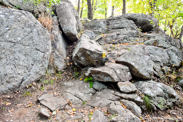
And ferns, too! And more rocks!
Ooooh, and look, a fire tower!
Wait, this is the same one we already climbed. Oh, we’re back! Hooray!
Might as well climb it again, right? Something might look a little different now.
Yup, still gorgeous up here. And maybe a little different.
When you’re done checking out the awesome view (again), head back down. Aren’t you glad you did all this optional hiking? Yes, indeed! (Now play it cool for the people on the next step. They might not have done the optional step. Tell them that it wasn’t that great, so they don’t feel bad.)
17. Okay, time to head home! From the bottom step of the tower, pick up the yellow blaze on the closest tree to your left to begin retracing your steps home.
Follow those yellow blazes! In just a few minutes, you’ll arrive back at the demogorgon’s house.
Just beyond that facility (assuming you didn’t get sucked into the Upside-Down, because if you did, getting home is going to be more difficult), be sure to look out for the two yellow blazes that tell you to turn right. Listen to them! Turn right here to stay on the Yellow Trail.
18. In about three minutes, now listen to the two yellow blazes that tell you to turn left to stay on the Yellow Trail.
19. Enjoy some scenic rocks on the next stretch.
In less than ten minutes, you’ll arrive back at the ORAK ruins. Turn left to stay on the trail.

20. Hi again, ruins! Sorry we didn’t eat more pecan pie! Maybe you’d still be a mansion.

21. In a few more minutes, the trail pops you back out onto the paved driveway, where you’ll turn right to head downhill, back toward Kanawauke Road.
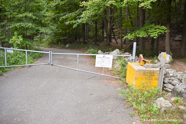
22. Hello there, gate! Thanks for keeping out the cars!
When you get to the road, turn right to return to your car.
That’s it! Hope you enjoyed your stroll to the Jackie Jones Fire Tower (and possibly beyond). Now who’s got a hankering for some pecan pie?
Directions
Directions to the trailhead: From the Bear Mountain Bridge headed west on 202, head into the traffic circle and take the second exit for Route 6 W toward Central Valley. In about 2.5 miles, hop on the Palisades Parkway headed south. Follow the Palisades Parkway for about 6 miles to Exit 15 for CR 106/Gate Hill Road. At the stop sign, turn left onto Gate Hill Road. In just over a mile, turn right at the stop sign (where Gate Hill Road ends and Kanawauke Road begins, though you’re still on CR 106). Almost immediately after you make that turn, look for the nice, long parking pulloff on the left side of Kanawauke Road/CR 106.
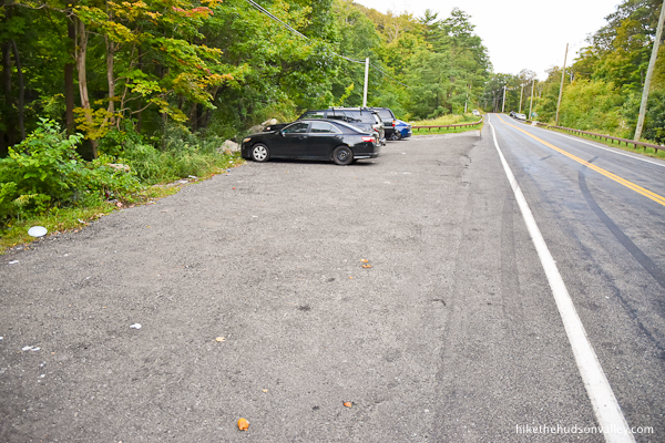
If you can’t find any spots in this pulloff, there are some more spots up ahead (beyond the trailhead), near the “Welcome to Harriman State Park” sign.
Winter warning: Please be aware that portions of Kanawauke Road/CR 106 (further west from this parking area) close during the winter. Google Maps does seem to be aware of these closures and will plan your route accordingly. You can visit the NY-NJ Trail Conference’s Seasonal Road Closures page for more details.
Sorta nearby address for your GPS: Simply putting “Jackie Jones parking” into Google Maps on your phone will, as of this writing, put you in the right place, bringing you right to the trailhead. (See the paragraph above for a description and photo of the parking pulloff, which is just a short distance — perhaps 100 yards — east on Kanawauke Road from the trailhead.)
GPS coordinates of parking area: 41.22975, -74.06025 (Clicking will open in Google Maps or the Apple Maps app, depending on your browser/device.)
Resources & Interactives
Super-cool Google Earth flyover of hike route:
Google Terrain Map of hike route:
Alltrails recording of hike (click here to open in Alltrails app or Alltrails.com, depending on your device):
Related resources: If you’re looking for actual facts and/or useful information, visit these resources:
- Another trail guide for this hike from the always-awesome New York-New Jersey Trail Conference: ORAK Ruins, Jackie Jones Fire Tower and Big Hill Shelter
- Two nice trail guides for this hike from Scenesfromthetrail.com, with one posted before the tower renovation and one posted after
- Another nice trail guide for a longer route from njhiking.com
- Some history on the ruins from Scenic Hudson’s ORAK Mansion Ruins page
- Information on the awesome groups that restored the tower at the Forest Fire Lookout Association and Team Rubicon homepages
Want to support trails in the Hudson Valley? Here’s one great way: Visit the New York-New Jersey Trail Conference homepage and click on Volunteer, Donate, or Shop! (Then you can volunteer, donate, or shop, depending on your mood.)
Hole in the fence still exists. No wasps. A few boards are starting to deteriorate but otherwise the climb up is safe. Decent view
Well myself and fellow hiker did the hike about 20 years ago , and the description was spot on. We both went to the top of the tower . It was great , we continued on to the leanto as pictured , but the trail continues , I dont remember exactly the route , but of course it led back down the mountain . I dont remember where we parked , but it was a great hike , just follow the marked trails and your map. You need energy of course .
Another great scenic hike is Popolopen Creek which is near Bear Mountain State Park , restaurant . That trail is also on the trail map , you start from the parking lot at the lodge , walk past the zoo , cross the traffic circle , be careful , you see a metal gate eventually , there is a bridge over a gorge , stay on your side , but follow the trail along the creek which is down below , and there is something called ” hellhole” where people swim and jump into the water. It is not safe, but the trail continues along eventually going down hill to the creek itself , and when I was there , you crossed on a very sturdy aluminum bridge . No idea if it still exists , but the trail goes over the creek and eventually goes up hill back to the road. IT IS VERY SCENIC . There is a very strenuous hlke to the top of a mountain right there also , which we did. Very scenic on top , but strenuous and steep. Just make your way back to Bear Mountain and if the restaurant is open , enjoy!
I did this hike today 6/7/23, and the fire tower remains closed. However someone made a hole in the fence that is surrounding it.
Oh wow — thanks for the pic and the update, Susan! I hope the situation here will allow for the fence to be removed entirely someday.
Unfortunately it appears that the tower is closed again. I went today and the base of the tower is fenced off and the gate was locked. There was also a sign on the gate saying “authorized personnel only.” You still can get a view of the NYC skyline at the Big Hill Shelter.
Yes, looks like a very permanent fence, I wonder what the plans are?
Was disappointed to finally take my kids to the tower and find it closed 🙁
Matt, Julian — thank you so much for your helpful comments here! (I linked down here from the warning I posted at the top of this trail guide as a result of your comments, but didn’t thank you in the comments as well, a problem that I’m seeking to rectify now 🙂 From what I’ve been able to gather, the fencing is a result of persistent vandalism issues with this tower. Really sad. Hopefully, this will get to a better outcome at some point — such a shame to have to remove/restrict access to such an awesome spot. Really appreciate you both sounding the alarm, and hopefully helping others to avoid hiking out here to find a disappointing surprise.
the trees at Big Hill are starting to get a little big to the point there might not be decent views in spring and summer in not so many years from now
I’m just dropping a comment here to record for posterity that the wasps and caution tape are now GONE from the fire tower, and it’s once again safe to climb. I’ve removed the warning at the top of the Background section above, but just wanted to allay the fears of anyone who jumped down to the comments. You’ll see a lot of wasp talk below, but that information is now (thankfully) no longer relevant. Happy hiking, everyone! Enjoy your wasp-free strolling! (Now can somebody do something about the mosquitos, too?)
I was thinking about doing this hike in the very near future, but with the fire tower apparently closed (unless that has since changed?), is the NYC skyline view still visible without climbing up the tower? If it isn’t, I think that I might just postpone until the Winter. Thanks.
Hello, Dan! The wasps here sure seem to be a persistent problem. Hopefully the coming cold weather will solve the problem naturally. I’m afraid you can’t see squat without climbing the tower, so your plan of waiting until winter sounds like a good one. (If the tower opens again sooner, I hope someone will drop a comment here to let us know!) Happy adventuring to you!
Thanks for the response! Much appreciated.
Would echo William’s experience here. Went today (Sep 4, 2021). Had the same bites from wasps/bees..dont climb up – the tape is there to protect us all.
Guys, just went here today. Do not, I repeat do not go up the tower. They have caution tape for a reason. I stupidly did not heed my wife’s wishes to listen to the tape. I climb uo stairs seem fine, caution to the wind. Just as I was nearing the top. ATTACK! Swam of WASPS or bees, not sure. I ran down with a whole hive chasing me. At first, I carried on, but I grew increasing paranoid that I might be allergic, so I ended up running back to car, and stranding my wife (who somehow made it back first). Good for a laugh, as I drink my beer now, but probably not worth it
William, thanks so much for sharing this cautionary tale here! I’ve updated the top of this trail guide (in the “Background” section) with a warning and link down to the comments (from you and the anonymous person above who had a similar experience). I hope your stories help to keep others from making the same mistake – many thanks to you! Here’s wishing you much less excitement on your future adventures!
Are they reclosing the fire towers due to the uptick in Covid cases? That’s what they did last summer and people just ripped the tape down at some of them.
Guys, just went here today. Do not, I repeat do not go up the tower. They have caution tape for a reason. I stupidly did not heed my wife’s wishes to listen to the tape. I climb uo stairs seem fine, caution to the wind. Just as I was nearing the top. ATTACK! Swam of WASPS or bees, not sure. I ran down with a whole hive chasing me. At first, I carried on, but I grew increasing paranoid that I might be allergic, so I ended up running back to car, and stranding my wife (who somehow made it back first). Good for a laugh, as I drink my beer now, but probably not worth it.
Heads up, I just reached the tower and it’s closed off with caution tape!
Thanks for the heads-up, Denis! I can’t find any information about that closure anywhere. Wonder what’s going on, and how long it will last? I posted on the “Hiking the Hudson Valley and Beyond” Facebook page to see if anyone had further information, and the only response so far noted that the tower was open last week. I’ll post more info if I can find anything else out. Thanks for sharing this here!
Great, sweet, short hike close to NYC. Easy to do! We went last Sunday, a few people were around. The ruins were a positive draw for the kids.