Background
If you find this free trail guide useful, please provide payment by picking up at least one piece of litter on your hike. Cha-ching! Thanks for being awesome! (And here’s a quick primer on Leave No Trace, too, to help us keep the trails nice and fresh for each other.)
Background you can feel free to skip: If you’re anything like me, the main reason you haven’t visited Red Mountain in Sharon, CT, is that you didn’t know that Red Mountain in Sharon, CT exists. But it does exist, and that’s great news for all of us!
Fortunately, not knowing that Red Mountain exists is a problem that can easily be remedied. For me, this problem was fixed by a Facebook comment from friend-of-the-site and super-cool-hiking-person, Tracy Rakin.

I had also never heard of it! But it was wonderful, you say? I, too, enjoy wonderful things! This sounded like a place worth checking out.
A quick search for Red Mountain turned up the informative Mary Moore Preserve homepage maintained by the Sharon Land Trust, which included a handy-dandy trail map.
I showed up at the trailhead early on a Sunday morning, expecting to do the up-and-back shown on that map, adding the short spur to the Chinkapin Oak and then visiting the Moore Lookout.
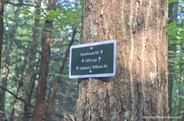
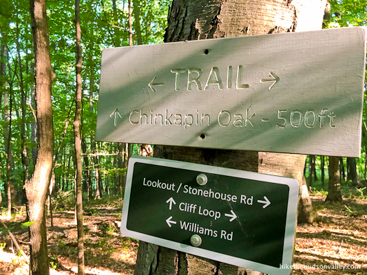
Imagine my surprise, then, when I encountered the trail sign that pointed toward the Cliff Loop.
“Cliff Loop? Sounds cool! According to the map, though, it doesn’t exist,” I said. I whipped out my iPhone for some quick on-trail research, and found this draft map from an April 2020 blog post on the Sharon Land Trust site titled “Mary Moore Loop Trail progress, 4/2/20.”
That post showed future plans to create the Cliff Loop. People of the future, I have great news! The Cliff Loop is complete, and you can walk on it! (And thanks to the Sharon Land Trust and the volunteers who did all that backbreaking manual labor so that the rest of us can have such wonderful trails to visit!)
It’s obvious as you walk along these trails that tremendous planning, expertise, and care have been put into building them. I felt so fortunate to have shown up at just the right time to check them out.

It’s worth noting that significant portions of this hike tread through (beautiful!) grassy areas that need to be mowed to keep them comfortably accessible to hikers. They were all in great shape during my visit, but you should be prepared for some grassy trekking out there.
Otherwise, if you’re a person who enjoys meadows, trails, views, and big giant trees, then you’ll be glad to know that Red Mountain exists.
Thank you to the Sharon Land Trust for creating and maintaining such a wonderful hiking destination. And thanks to Tracy Rakin for the fantastic recommendation!
Trail Guide
Bonus unsolicited advice: Don't depend on having cell service in the woods - it can be spotty out there! Download this trail guide to your phone before you head out. (It's easy to do on iPhone and Android.) May your connection to nature be strong, even when your connection to the internet is weak.
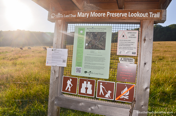
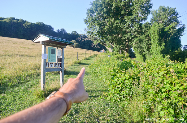
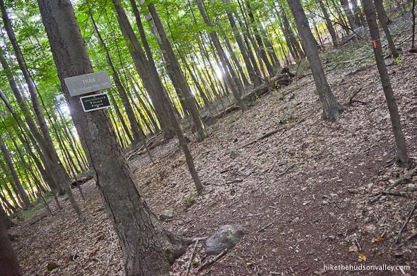
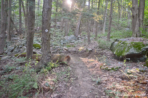
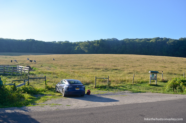
1. From the parking pull-off (see “Directions to the trailhead” below), head over to check out the kiosk. Might as well learn something while we’re here.
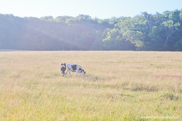
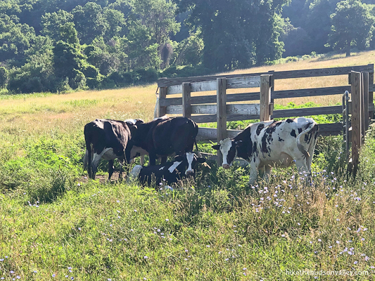
Just behind the kiosk, you might see some locals out in the pasture. Give them a friendly moo before heading on.
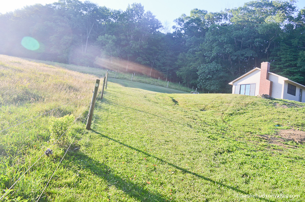
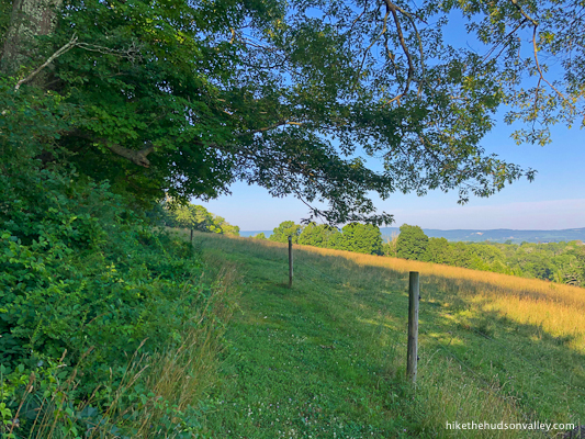
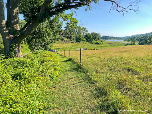
2. Facing the kiosk, turn right to follow the fence line uphill, beside the pasture.
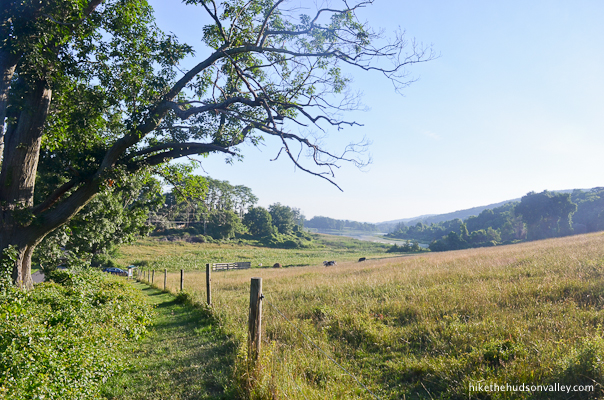
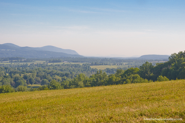
As you climb, don’t forget to look behind you at the expanding view. Such a pleasant spot.
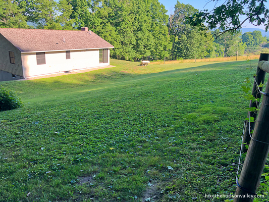
3. About five minutes from the parking lot, you’ll come to a sharp left bend in the fence. I felt a little tresspassy at this spot, with a building (still undergoing construction during my visit in July 2020) straight ahead.
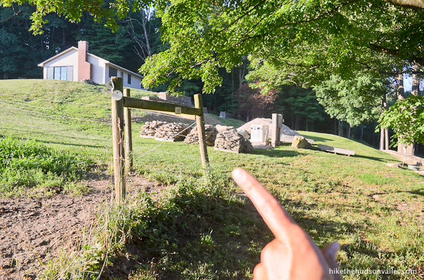
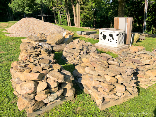
You know how you can tell the occupants of that building are cool, though? They decorated their utility box with spots to make it look like a cow.
Clearly, anyone associated with that building is awesome. (And I’m guessing that the building has something to do with the Sharon Land Trust? Visitors of the future – or anyone who knows something about this – please let us know in the comments!)
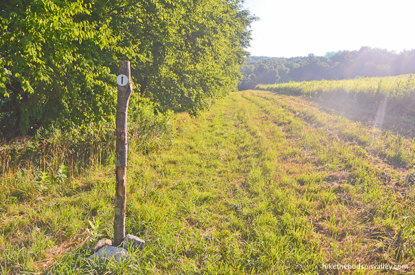
In any event, just keep following the fence line. The white trail markers let you know that yes, indeed, you are supposed to be here.

4. In the corner of the backyard, the fence takes another turn to the left, following the tree line.
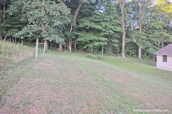
Keep following that fence! Don’t let it get away!

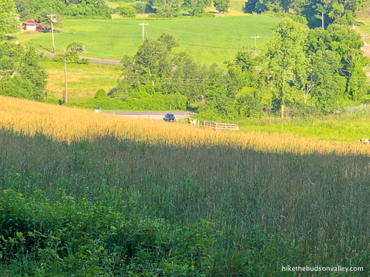
5. Along the top of the pasture, the views just keep getting nicer as you go. We’ve barely even started this hike, and we already have views! Hardly seems fair.
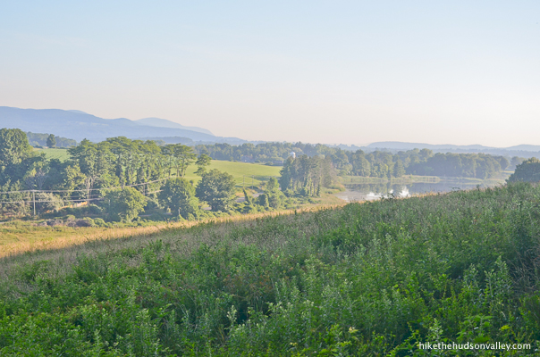

Just keep following those white blazes (and the fence to which they’re attached).
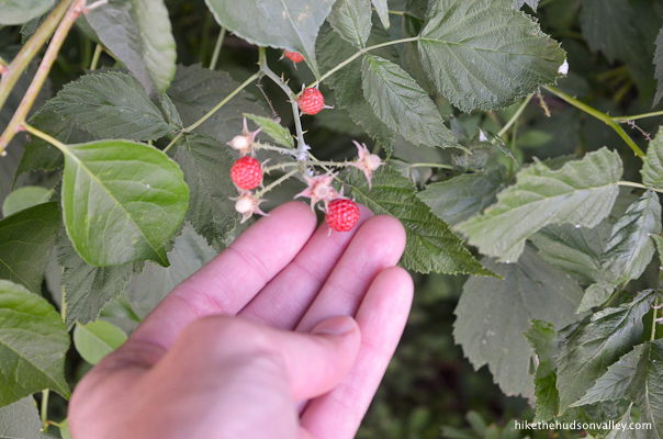
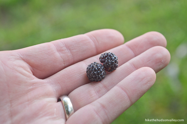
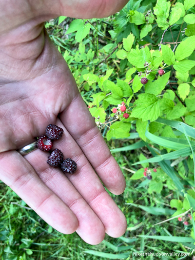
If you’re here in July, you just might find some wild raspberries off to your right. I am NOT suggesting you eat wild berries. I mean, I did, but YOU shouldn’t, unless you have at LEAST achieved your O.W.L. in herbology. Possibly even your N.E.W.T. (If you’re not a Harry Potter fan, please disregard those references. And either way, please never eat anything wild that you’re not 100% positive about, unless you enjoy severe gastrointestinal distress and/or death. But still, raspberries!)
6. At the end of the pasture, say goodbye to the fence as the trail takes a hard right into the woods.
Just before entering the woods, take one last look at that view, and wave to your car down in the parking lot. (It’s still there, right? Phew!)
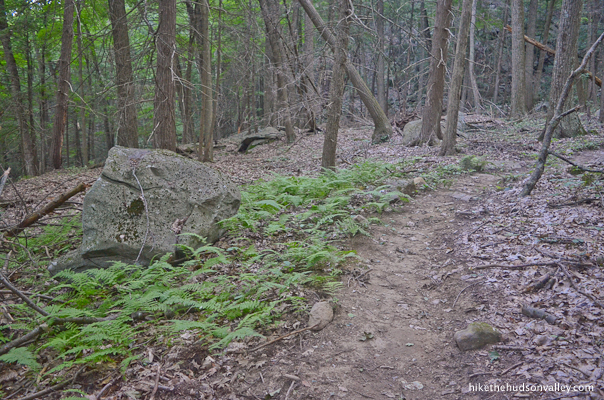
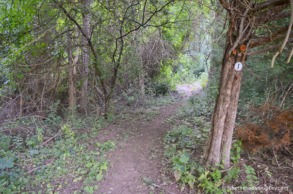
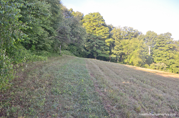
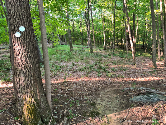
7. Pass through a little break in a stone wall as you enter a beautiful wooded situation. The white blazes continue to guide the way.


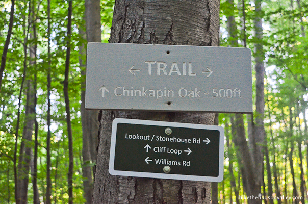
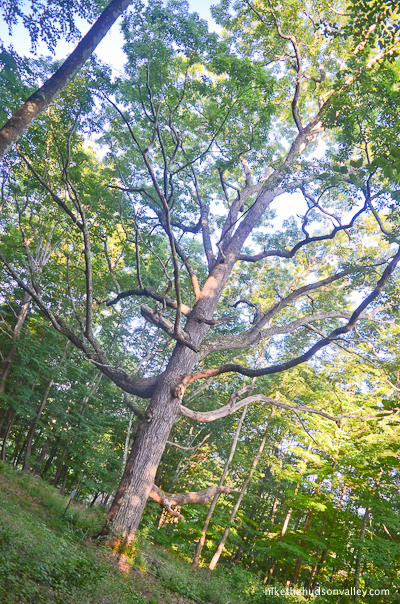
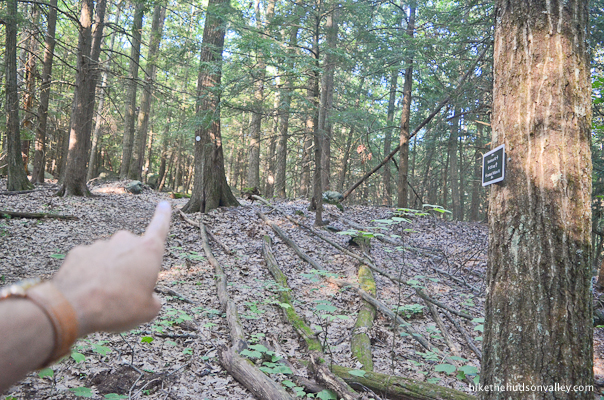
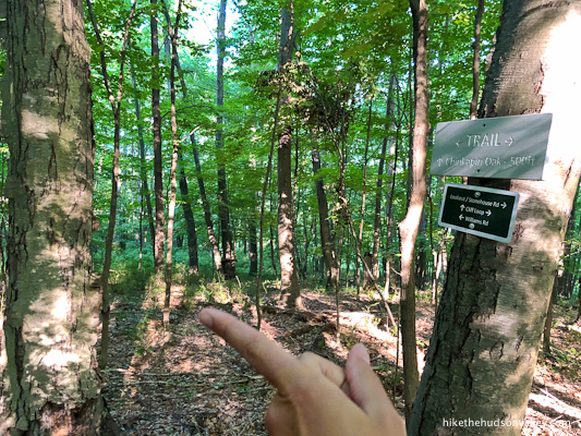
8. In just a minute, you’ll arrive at a well-marked junction. Here, you’ll turn left toward Chinkapin Oak and Cliff Loop. (We might not know what a Chinkapin Oak is, but we’re jonesing to see one, right?)

9. Perhaps two minutes after the fork, you’ll arrive at the Chinkapin Oak. Can you guess which tree it is? Hint: you don’t need a hint.
“Oy! Are you an ent? Can you wake up and carry me around in your branches?” you can ask it.

It probably won’t answer you, unless you’re a hobbit. Still, what a majestic tree. In case you’re curious where its name comes from, Chinkapin is a species of white oak with smallish leaves, not the name of this particular tree. This particular tree deserves a name, though, don’t you think? Let’s call her Charlene.
10. When you’re done communing with Charlene, it’s time to continue along the Cliff Loop. Turn your back to the oak and head straight into the meadow (it would be a right turn into the meadow from the trail that brought you to Charlene).

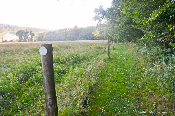
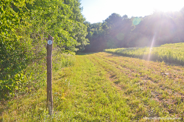
11. You’ll find signposts with white blazes as you make your way across the bottom of another beautiful meadow.


On my visit, this stretch was freshly mowed. Mown? Somebody had recently cut it, is my point. I could see it being a hairy traversal in very tall grass. Hopefully, that’s not the case for you right now!
Later in the loop, we’ll check out the view from the top of this meadow. For now, enjoy the pleasant grassy stroll along the bottom edge, letting the treeline and those well-placed posts guide your way.

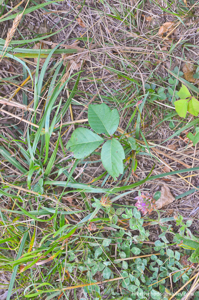
If you’re finding the meadow so beautiful that you’re having difficulty fighting the urge to roll around in it, you might want to check for poison ivy first. I noticed it in a few places. (Yes, I have my O.W.L. in herbology.)
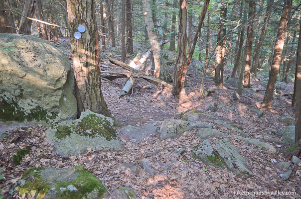
12. In the back corner of the meadow, keep a sharp eye out for the cave-like entrance and white blaze that invite you to be enveloped by the woods once again.
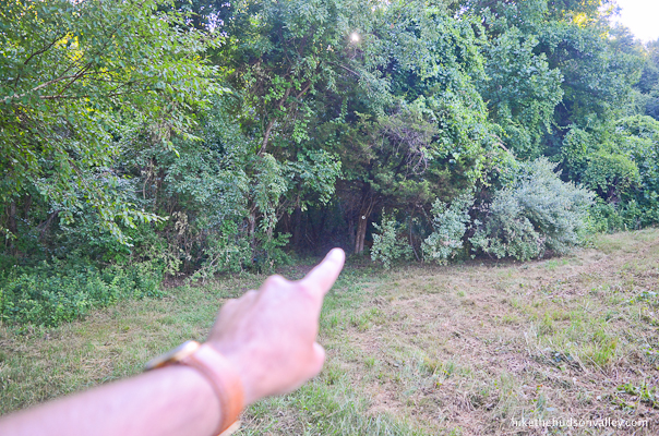
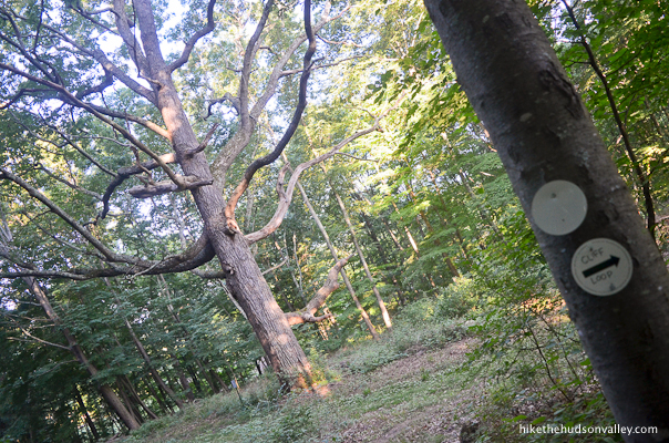
Some of the blazes in the woods even have helpful little arrows on them. Nice touch.
13. About one minute after leaving the meadow, you’ll find another hulking, beautiful specimen of a tree, proudly wearing a trail blaze. This one is a maple, if I’m not mistaken.
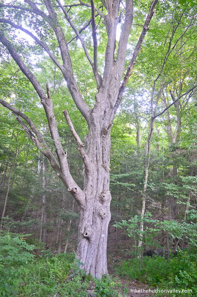
It isn’t marked on the map, but this tree deserves a name too, right? Let’s call him Mike the Maple.
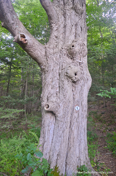
“Oy, Mike, are YOU an ent? Please wake up and carry me! Also, have you met Charlene?” you might ask him. They’re not exactly each other’s type, but they’d make a cute giant couple, wouldn’t they? Like Hagrid and Madame Maxime! (Sorry, I can’t decide whether to go with Lord of the Rings or Harry Potter references, so I’m afraid enduring them both is your burden to carry, and yours alone, Mr. Frodo. Quick, to the next step before it gets worse! Fly, you fools!)
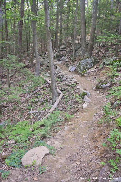
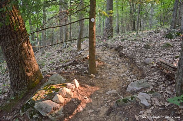
14. Just beyond Mike the Maple, you’ll find the new trails that have been lovingly and carefully constructed.
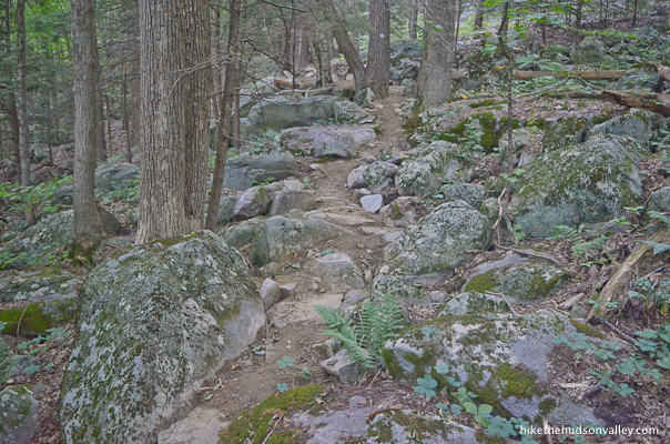
This trail section contains your steepest ascents of the day, but they’re not too ferocious. On your way to the next trail junction in .5 miles, you’ll ascend about 214 feet.

While this trail is part of the “Cliff Loop,” you might find yourself hard-pressed to locate the eponymous cliffs. You may notice some interesting rock formations uphill through the trees when the trail takes a hard right turn away from them – as far as I could tell, this is the closest you’re going to get to any cliffs on the Cliff Loop.

Or maybe the loop is named after somebody named Cliff? If so, thanks for whatever part you played in this whole deal, Cliff! And if not, well, this loop is awesome anyway, even without actual cliffs. Plus, we can all agree that Cliff is a great name, for humans AND loops.
15. About .5 pleasant miles and 13 minutes or so after passing Mike the Maple, you’ll arrive at a trail junction, where you’ll turn right and follow the signs to continue along the Cliff Loop.
16. Just keep following those white blazes as you wind through the woods, taking care to follow the sharp bends in the trail that have been helpfully marked with two blazes. (And if you think those two blazes sort of make it look like the tree is looking at something very interesting or alarming in the sky, nobody would disagree with you.)

17. About ten minutes from the last trail junction, you’ll emerge back into your favorite meadow, where you’ll veer left to hug the upper treeline this time. Hello there, views!
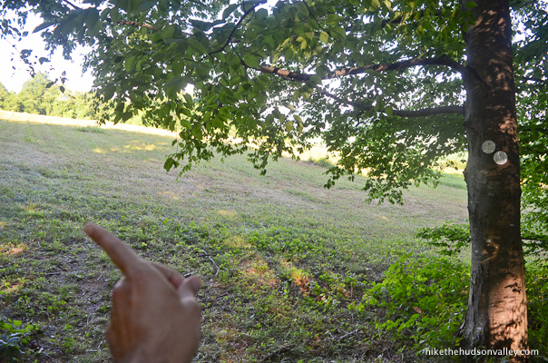
You’ll find more helpful posts with white blazes tucked in close to the trees. Follow those blazes as you stay close to the trees.
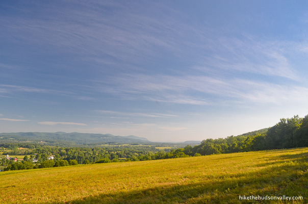
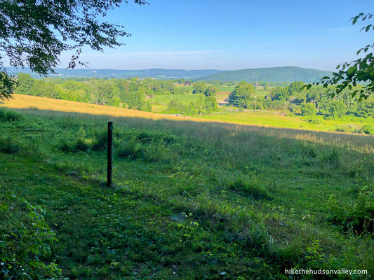
As you walk across the meadow, the view to your right and behind you keeps growing.
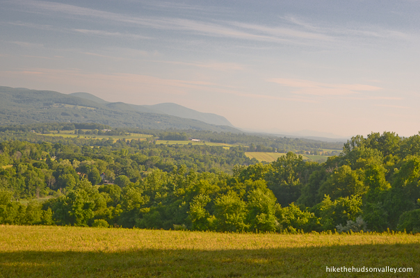
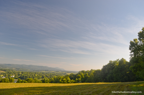
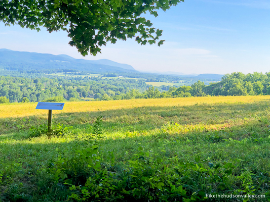
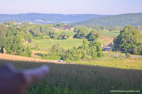
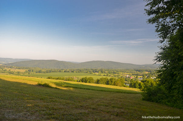
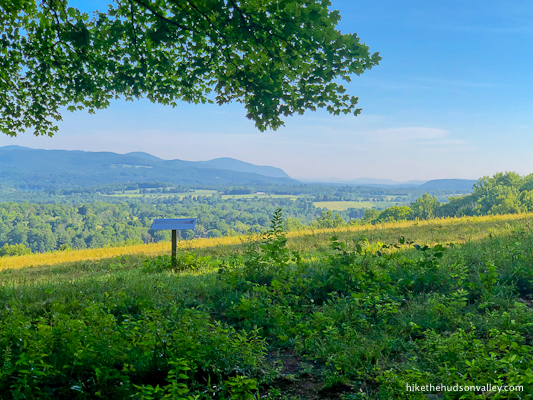
18. On the far side of the meadow, you’ll find a podium-like sign with helpful information about the Mary Moore Preserve and the sprawling view in front of you. This is the money spot!
Take a look at the sign, or use it as a podium to deliver an impromptu speech if there’s anything you need to get off your chest.
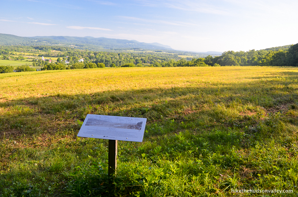

Once your speech reaches its thrilling conclusion, don’t forget to look up from the sign to gaze across the meadow at that view. Duuuude.
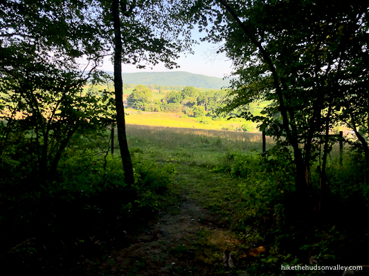
19. When you’re done marinating your eyeballs in the view, continue straight past the podium into the woods. Then take one last look back. Bye, awesome view! Hope to see you again soon.
Let’s keep following those white blazes. They haven’t steered us wrong yet, have they?
20. In just a few minutes, you’ll arrive back at the junction from earlier today, completing the Cliff Loop. We love you so much, Cliff Loop, that we don’t even care that we didn’t notice any cliffs on you. Thanks for being awesome!
Take a left to follow the arrow toward Williams Rd, which is where your car will be waiting for you, unless the cows have taken it for a joyride (which shouldn’t happen unless you live in a Far Side cartoon).

21. A few minutes after that junction, you’ll arrive back out onto the original meadow with the views that seemed awesome before you saw those other views today.
“Hello, old buddy!” you’ll say to the fence as you veer left to follow it again.
Phew! Car’s still there.
22. Follow the fence all the way back to your car.
Be sure not to eat anything poisonous along the way.
Wave to any people in the building, and tell them thanks for letting us walk through their backyard.
Moo to the utility box.

Follow the fence back down the hill.
Say hello to the welcoming committee!
High fives all around. (Aim a high five back up the trail in honor of the Sharon Land Trust, too.) Thanks for the great new trails, awesome people! Now, who’s hungry for some pizza? Let’s go find some! (If you don’t think you’ve earned pizza today, just remember that you had lots of chances of turning back, only you didn’t. You kept going, because you were holding on to something. That there is some good pizza in this world, and it’s worth fighting for.)
Directions
Directions to the trailhead: From the Taconic Parkway headed north from the Poughkeepsie area, take the exit for 44 East. Follow Route 44 for about 15 miles as it winds through beautiful countryside toward the town of Amenia. At the stoplight in Amenia, when Route 44 turns left, stay straight through the light and the road underneath you becomes Rt 343 for some reason. Follow 343 for about 10 minutes into Sharon, CT, where you’ll make a left turn onto Rt. 41, headed north. In 1.7 miles, turn right onto Williams Road. The pulloff for the trailhead is immediately ahead on your left.
Pull in, climb out, and let the adventure begin!
Sorta nearby address for your GPS: Simply putting the street name into Google Maps will put you very close to the trailhead:
Williams Road
Sharon CT
Google Maps will drop the pin a little further down Williams Road than you need to go. Just look for the parking area on your left immediately after you turn onto Williams Road from Rt 41, and you’ll be all set.
GPS coordinates of parking area: 41.890934, -73.453307 (Clicking will open in Google Maps or the Apple Maps app, depending on your browser/device.)
Resources & Interactives
Super-cool Google Earth flyover of hike route: (Caveat: The crazy ridge shown at 1:00 in the video is a Google Earth glitch, not an actual landform you will find on this hike. Sorry to disappoint anyone who expected to find a giant rectangular prism out there!)
Google Terrain Map of hike route:
Related resources: If you’re looking for actual facts and/or useful information, visit these resources:
- The official Mary Moore Preserve homepage from the Sharon Land Trust
- The nice free trail map from the Sharon Land Trust (which, as of this writing in October 2020, does not show the Cliff Loop that has recently been added)
- The nice blog post from the Sharon Land Trust, “Mary Moore Loop Trail progress, 4/2/2020“, which includes this handy-dandy draft map that reflects the trails as you will currently find them
- A great write-up on this preserve, detailing a longer hike through it, from the Hartford Courant: “A place in the Berkshires to see the foliage change“
Want to support trails in the Hudson Valley? Here’s one great way: Visit the New York-New Jersey Trail Conference homepage and click on Volunteer, Donate, or Shop! (Then you can volunteer, donate, or shop, depending on your mood.)
I did the hike yesterday. Beautiful area, the grass in the meadow was short and easy to move through. Heavy rain hit on the return, but the trail was not slippery.
The cows were near the parking area when I started, during the rain they moved to the center of the field.
Nice little gem of a hike. Took it yester 10/9/20 and was not disappointed. I’d categorize it a a gentle hill with some amazing Autumn vistas. And, my (lease at this section) dog was fascinated by the cows.
Glad you had a great day out there, Chris! Please tell your dog that I was kind of fascinated by the cows, too 🙂