Background
If you find this free trail guide useful, please provide payment by picking up at least one piece of litter on your hike. Cha-ching! Thanks for being awesome! (And here’s a quick primer on Leave No Trace, too, to help us keep the trails nice and fresh for each other.)
Background you can feel free to skip: For the first several years I lived in the Hudson Valley, I thought the Catskills, Shawangunks and Hudson Highlands were the only real mountains in town. What a great discovery, then, to find that the Taconic Mountains had been hiding to our northeast the entire time.
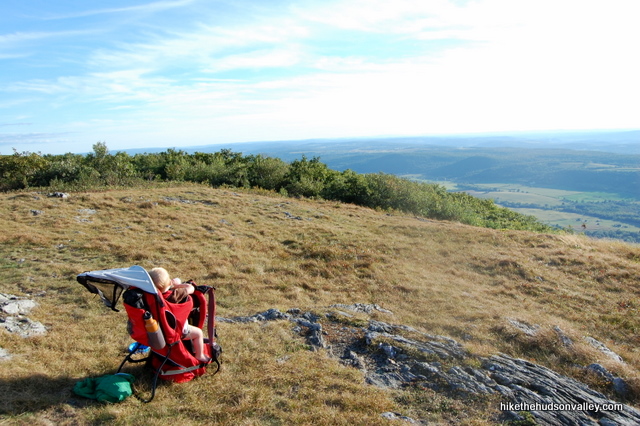
These mountains are the real deal, and their trails feel like they’re leading you deep into the New England wilderness. Since you’re likely to spend time in New York, Connecticut and Massachusetts as you meander about these mountains, I suppose that’s actually the case.
On the day I visited Brace Mountain, toting my son on my back, a nice older couple on the way down stopped and chatted me up. “Oh, there’s nobody else with you?” they asked, checking down the trail behind me.
“No, it’s just me, the baby and the pooch today,” I said.
They exchanged glances.
“Do you have a cell phone?” they asked.
“I do,” I said, and they looked relieved. As I continued on, I understood their concern. This is a tough trail, probably the toughest I’ve done with a baby on my back, and it should only be attempted if you’re looking for a serious hike.
As it turned out, that couple had just given up on making it to the summit, turning around maybe 25 minutes before the top. I can see why someone might do that. The climb up Brace fakes you out multiple times, letting you think you’re near the top only to plunge you back into the woods for another rolling stretch of climbs and descents.
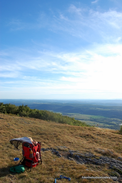
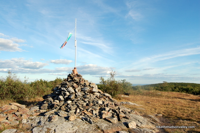
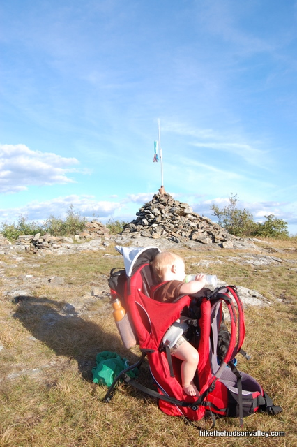
The payoff, though, is well worth all the burned calories. The view from Brace Mountain is incredible, and when you’re lounging about in the grass at the top, it seems like you’re a world away from your normal life. Which you are, unless your normal life has awesome wrap-around views and a huge rock cairn marking its summit.
Plus, if you want to gain some of those calories back, there’s a gas station on the drive up there, out in the middle of nowhere on Route 22, north of Millerton (I believe it’s a Citgo, and the store attached to it is called Ameri-Store or something patriotic like that), that is the only place I know of in the Hudson Valley that serves as a reliable source of Zagnut candy bars, the greatest and rarest confection on Earth. (When I tell people that Zagnuts are like Butterfinger bars, but with toasted coconut instead of chocolate on the outside, they don’t look that excited. But there’s just something about the fact that you hardly ever see Zagnuts anywhere that makes them taste so much better. Finding a Zagnut is an event, like catching a leprechaun. I like a candy bar that plays hard-to-get.)
It’s probably safer if you wait to reward yourself with a Zagnut until after the hike. If you ate one while taking in the awesome view on Brace Mountain, the sheer scale of awesomeness intake all at once might ruin your brain for any future awesome life experiences, especially ones that don’t involve toasted coconut.
Trail Guide
Bonus unsolicited advice: Don't depend on having cell service in the woods - it can be spotty out there! Download this trail guide to your phone before you head out. (It's easy to do on iPhone and Android.) May your connection to nature be strong, even when your connection to the internet is weak.
1. There are many ways to get to the top of Brace Mountain, and several of them are very nicely documented on BerkshireHiking.com’s Brace Mountain page. The hike I’ll describe below assumes you want to hike Brace via the Mt. Frissel Trail, since it’s the easiest (and “easiest” is an extremely relative term here) way to get up there. If you want to try any of the other ways, check out the BerkshireHiking page – and see some of their other excellent hikes as well, while you’re at it. That site is a great resource.
2. There are a couple of parking spots directly in front of the first red blaze of the Mt. Frissell Trail on the west side of the road, or there’s a small lot just a few yards south on Mt. Washington Road (aka East St) on the east side of the road. From that small lot, look for the red blazes across the street. If you’re standing in the parking area facing the road, the red-blazed Mt. Frissell Trail begins across the street and to your right. When you find it, go ahead and hop on it, plunging into the woods.
3. The trail begins as a flat stroll, but that won’t last for long. Soon, a gradual incline gives way to a steep ascent up some rocky, tricky terrain. It’s not quite classifiable as a rock scramble (my 40-lb dog had no trouble with it), but you will likely need to use your hands a bit.
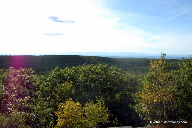
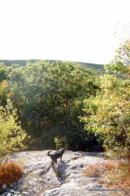
4. You’re now climbing Round Mountain, which doesn’t have an open summit, but it will present quite a speed bump on your way to Brace Mountain. So will Mount Frissell, actually, which you’ll also climb along the way. Just keep climbing, and you will occasionally pop out onto some rocky stretches with nice views. The trail rises and falls, taking you into the woods and back out again.
5. It took me 65 minutes from the parking area to make it to the concrete NY/Mass border marker. I felt like I was truckin’ to get there that fast, but I had a baby on my back, so it’s hard to judge how long it should take someone who’s not lugging their offspring all over the place.
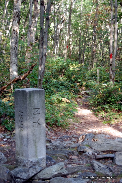
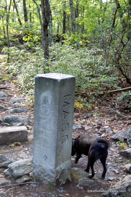
6. After you cross into New York, it’s an easy ten-minute stroll to the intersection with the South Taconic Trail, where a nice view is already opening up in front of you. The sign here points you towards Brace Mountain, and tells you that you only have .4 miles left to go. Wahoo! Take a left here to head south on the South Taconic Trail.
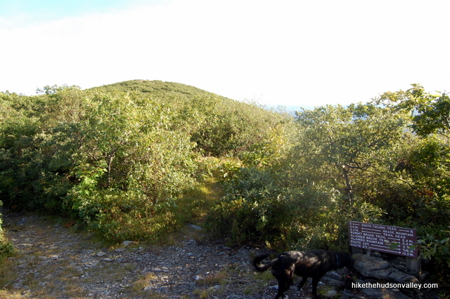
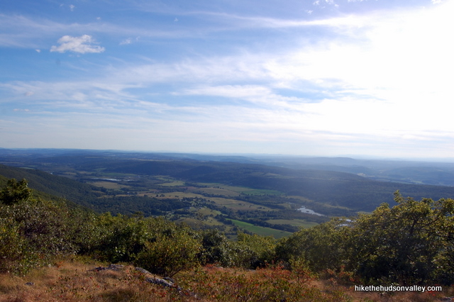
You’re coming down the homestretch now. Well, up the homestretch.
7. In about ten minutes, you’ll stroll out into what must be one of the nicest viewpoints in the Hudson Valley, or anywhere else. At 2,311 feet, you’re standing on the highest point in Dutchess County, so you’ve got that going for you, too.
Take your time and enjoy the meadow-like summit, with views in all directions. You’ve earned a break. If you brought a Zagnut with you, you might want to eat it with your eyes closed, just to make sure your brain doesn’t explode.
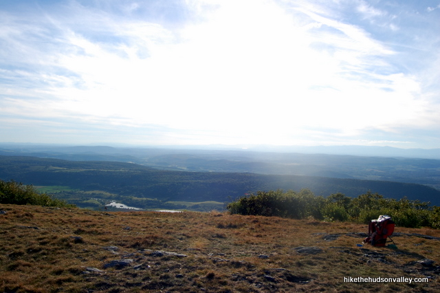
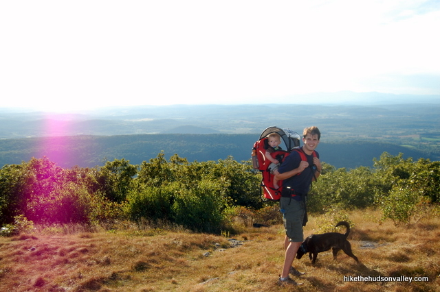
8. When you’re done relaxing, head back down the way you came. And up, and down, and up, and back down again. I hope you saved a Zagnut to eat in the car.
Directions
Directions to the trailhead: From Millerton, NY, head north on Route 22 for 12 miles. Turn right onto NY 344 (Old Rt. 22), and follow signs to stay on 344, which turns into Falls Road as you enter Massachusetts. Turn right onto West Road when Falls Road dead-ends into it. West Road merges into East Street in 2.1 miles. Continue on gravelly old East Street for 2.7 miles, and be on the lookout for a large white sign on your left that says “Mt. Washington Road” at the top. This sign stands at the MA/CT border, and the small pulloff is on your right in just a moment, right in front of a red-blazed tree. If the spots at this tree (the trailhead) are taken, there’s another small area just ahead on the left. If those spots are taken, too, you can carefully make your own spot on the side of the road.
You can also get directions by checking out the Brace Mountain entry on the HiketheHudsonValley.com Google map.
Sorta nearby address for your GPS: The intersection of East Street and Garrett Farms Road in Mt. Washington, MA is about 2.6 miles north of the East Street trailhead (there’s hardly anything else out there, but that’ll get you close). My old-ish Garmin Nuvi lets me put in an intersection as a destination, so hopefully yours does, too. Just head south for 2.6 miles on East Street and you’ll be there in a few minutes.
GPS coordinates of parking area: 42.05012, -73.46694 (Clicking will open in Google Maps or the Apple Maps app, depending on your browser/device.)
Resources & Interactives
Related resources: If you’re looking for actual facts and/or useful information, there’s a surprising wealth of information on the Brace Mountain Wikipedia page. Otherwise, you can read some more nice write-ups and check out alternate routes on these pages:
- BerkshireHiking.com’s Brace Mountain page
- New York-New Jersey Trail Conference’s Brace Mountain page
More Brace Mountain pictures from the hike’s Picasa album:
Want to support trails in the Hudson Valley? Here’s one great way: Visit the New York-New Jersey Trail Conference homepage and click on Volunteer, Donate, or Shop! (Then you can volunteer, donate, or shop, depending on your mood.)

Great hike! Exhausting in the best way possible. Lots and lots of ups and downs. Most of the trails are very narrow on the eastern 2/3, so you’re in the bushes a lot. I’d recommend long pants. Nice to be able to say I hiked in 3 states in one day!
We did this today and it was spectacular — and treacherous. The wet and occasionally icy leaves on the descent are brutal. I was glad we started early in the day, because the hike took much, much longer than anticipated. Careful out there, friends!
Thanks for the heads-up, Sarah! Glad you made it back safely. With the recent snow, too, this hike shouldn’t be attempted without micro-spikes and trekking poles. Hope you got some nice pictures – bet it was a beautiful time to be out there!
Hi, nice article above. I miss toting my kids in the pack, now they’ll in college +. Anyway, I made an attempt at Mt. Alander 3 weeks ago for a 1-night over backpack trip. I went to stage out of Mt. Wash. SF, but was turned around by all the ‘rona warning signs and a threat of $300 fine sign.
So I found the Quarry Hill Rd. Trailhead and plan to make loop w/e after next. Adding Brace Mt. onto my hike looks brutal – I probably expect a “Tuckermans Ravine” punishment lol. I’m going to summit Brace, then circumnavigate clockwise to Mt. Alander, to meet Frissell trail, then left turn back over Brace and to car. Can I expect to find running stream water on this loop. I’d rather not boil snow for drinking water.
I’ll try to post up a picture of loop after I sign in. Nice website. Thanks, Noel.
Comment took elevations, not route, so here it is.
Hi, Noel! Sounds like quite a route you have planned! You can find more detail on the Quarry Hill climb up Brace on my other Brace Mountain trail guide: https://hikethehudsonvalley.com/hikes/brace-mountain-ii-south-taconic-trailhead/. (The camping restrictions will be the same from this trailhead as with Mt. Washington, though, as it’s not allowed in these mountains except at the cabin on Mt. Alander.) You’ll see some evidence of running water in Step 6 of that trail guide, but I don’t remember seeing any other water sources higher up. Hope that helps — happy adventuring to you!
Another highlight along this trail is a marker at the CT/MA border, about 5 min before the NY/MA border marker. This one is a little harder to see, but there is a cairn next to it. As an added bonus there i also saw an army ammo box next to the cairn with a hiker’s log book inside.
Thank you, Wayne! Appreciate the tip! Sounds like you found a geocache there, too — I just recently wrote a blog post about that very topic. Thanks for the heads-up about the CT/MA marker as well! Will have to keep my eyes peeled for it next time.
Has anyone tried doing this hike but returning via Brace Mountain Road (downhill) to Mt. Washington Road in CT – see dotted line in middle of map attached. Would save me having to slog back over Frisell.
Sorry map image here….
Did this route today and I think this is the best way to get to Brace if you have 2 cars. We parked one at the trailhead for Frissell and the other a mile south on West St. at the end of Brace Mountsin Road, which is used by paragliders to get up to Brace easily and directly. Hike back down Brace Mountain Rd. is easy if a bit rocky. Great views on the way up to Frissell, as well as just past it, with Lake Riga in the distance. The CT state High Point is cool, as is the Tri-State marker. Tons of paragliders today at Brace. Fun fun fun hike. Would definitely do it again.
We hiked hip Quarry Hill today. Very aggressive trail for about a hallf mile plus stretch with may a thousand feet or so of elevation gain?
We went much too late in the day on a very hot,very humid day. Once I took off my sweat clogged shirt, my body temp started to return to normal and I finished the hike ok.
Recommend cooler season, or very early hiking. Truly the heat made us all miserable going up.
Brace Mountain NY Trailhead
89 Quarry Hill Rd, Millerton, NY 12546
https://goo.gl/maps/ua7YassUxpo
This description and directions were SO clear. The GPS coordinates were a big help and well as all of the pictures. When I finished I walked across the street and hiked a bit of the AT. I didn’t know of this gem either and I have been to Bash Bish many times. I am so happy you covered this. Thanks for the info!
You made my day, Gabrielle — thanks so much! Glad you had a great day out there, and got a chance to do some extra credit on the AT, too. 🙂
Hiked it yesterday, June 24, 2016 with my 9 yr-old boy and 11 yr-old (athletic) daughter. There are several key points to look for–and problems with directions you might find on the web. First–you’re going to take a right turn onto a gravel road called West St, that will lead you to East St. where you will go right and drive past a State Park building on your right and keep driving for a while past it before you’ll see the state border marker and white painted sign. The trailhead is opposite the state border marker. Second–you are climbing three mountains: Round Mountain (2296 elev.) Mount Frissell (2453) and Brace (2311.) You’ll see your first cairn (pile of rocks people make as a memento/marker) when you get atop Round Mountain. The high peak you see at this point is Frissell. Keep following red far down again and then up higher than ever to Frissell. At the (wooded) top of Frissell, the path will seem to go in 2 directions. To the left is the trail to the highest point in CT and in to Brace, and to the right (just a few steps) is the marker for the Frissell summit. From Frissell, you will see Brace and its windsock marker, a short hike away. We had a grand time. The little one got a little tired and bummed when a cairn fell on him, but we ceremoniously wrapped his bruises with an ace bandage and by the third leg of the trip he was back in front blazing the trail for us all. I was happy we brought our own walking sticks, as there wasn’t a lot of straight wood to be found there, and we sure used them–very rocky hike! Bring at least a liter of water per person, as the tales of waterfalls/natural springs are mere legends, perhaps of days following a heavy rain. Good shoes that lace across the front (preferably over the ankle) are a must and the difference between a twisted ankle and a sprained one.
Would I be able to hike these mountains alone and be safe?
Hi Kierra,
I definitely can’t make any guarantees about anyone’s safety, in the woods or otherwise. Pretty much every hiking safety guide will list “don’t hike alone” as a top recommendation. Hiking alone (with a pooch) is one of my favorite things to do, though I do prepare as much as possible to mitigate the risks, and always make sure a loved one knows where I am and when to expect me home. I also keep a phone with me on the off chance there will be a signal out there (often, there is not). Here’s a nice guide from the DEC on hiking safety: http://www.dec.ny.gov/outdoor/28708.html. Hope that helps!
Many happy adventures to you!
Mike
Address for trailhead parking: 398 Mt Washington Rd Salisbury, 06068
Did this hike today. It wasn’t as hard as I thought it was going to be. Actually, climbing Mt. Frissell was the most challenging part. You need to really keep an eye out for the red blazes. Many are old and barely visible. The view from the top of Brace was magnificent. Definitely worth the trip up!
Excellent, Ed! Glad to hear everything went according to plan. And thanks for posting those awesome paraglider pictures to the forum!
I was thinking about going to hike here this weekend, do you or anyone else know how conditions are and if it would be worth trying?
Hi Mark – Sounds like quite an adventure! I haven’t been lately, but it will most definitely be quite snowy up there still. Another hiker asked about climbing Mt. Beacon in the winter, and I think the response I gave him applies here, too:
“I’m afraid I won’t be much help on this one – I’ve never been up there in the snow before. I can’t promise that it’d be safe. Beautiful, most definitely, but you’ll have to prepare responsibly and make good decisions for yourself. (Sorry to be lame, but without knowing people’s abilities and experience, I’m really hesitant to make blanket recommendations about hiking in potentially dangerous conditions.) Whatever you decide to do, and whenever you get there, I hope you enjoy it and take lots of pictures!”
If you decide to go, I hope it’s a great trip! But you’ll want to be well-prepared for some hairy conditions out there – this trail is steep in spots and challenging even on a sunny summer afternoon.
I have never went this way up Brace Before. The route I normally choose is on the NY side, off of Quarry Hill Road. Nice to try for some different angles
The Quarry Hill (South Taconic Trail) route will probably be my next write-up. Hope you like this way, too! Both great hikes.