Background
If you find this free trail guide useful, please provide payment by picking up at least one piece of litter on your hike. Cha-ching! Thanks for being awesome! (And here’s a quick primer on Leave No Trace, too, to help us keep the trails nice and fresh for each other.)
Background you can feel free to skip: I hadn’t heard of Franny Reese State Park until late 2010, when I picked up a brochure from a different Scenic Hudson hike. Like nearby Peach Hill Park, this is another gem that Scenic Hudson snapped up in recent years so that you wouldn’t have to join a condo association to explore some of our area’s most beautiful places.
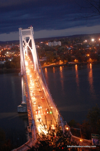
The views here aren’t huge, but the overlook onto the river, the Mid-Hudson Bridge and the Walkway over the Hudson is worth a stop for sure. You can see the overlook as you’re driving west across the bridge, and it’s nice to be able to say, “Hey, I’ve been up there.” Also, when you’re looking down on the bridge from the overlook, it’s nice to be able to say, “I’m really glad I’m on a beautiful stroll instead of crawling along in traffic.”
The trails wind through some picturesque woods, and as you venture further from the bridge, you’ll feel like you’ve gotten much further away from civilization than you actually have.
I visited Franny Reese at dusk in November, so cut the place some slack if the photos below aren’t jaw-dropping. I only saw a couple other people out there that day, but I imagine this park draws some decent crowds in better weather, since it’s so close to Poughkeepsie and Highland.
If you’ve ever stared across the river from Poughkeepsie, admiring the beautiful hills and woodland on the other side, then you’ve seen Franny Reese State Park. For a nice outdoor escape right in the thick of things, you’d have a hard time finding a better spot to burn an afternoon.
Trail Guide
Bonus unsolicited advice: Don't depend on having cell service in the woods - it can be spotty out there! Download this trail guide to your phone before you head out. (It's easy to do on iPhone and Android.) May your connection to nature be strong, even when your connection to the internet is weak.
1. Like all of the excellent Scenic Hudson parks, this hike has a great website with a wonderful trail map included. They also have brochures and maps available near the parking lot (under the bridge). That’s really all you need, but I’ll provide a quick run-through anyway, on the off chance someone in the universe might find it useful.
2. From the parking area at Johnson-Iorio Park, walk towards the Mid-Hudson Bridge and head down the stairs that take you underneath.
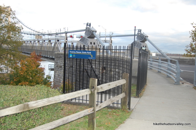
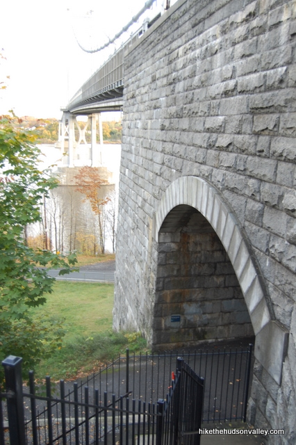
3. At the bottom of the stairs, take a right to go under the bridge. Please be aware that this area is a sensitive habitat for the endangered eastern spotted bridge troll.
4. Under the bridge, you’ll find a nice display with maps and brochures on your right. If you don’t already have a map, you can grab one here. Then just keep heading straight past the sign welcoming you into the park.
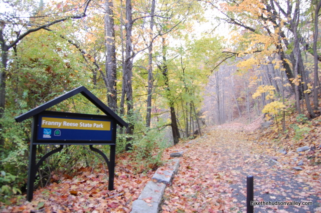
5. Head steadily uphill on the Yellow Trail that connects the park’s two parking areas (the other one is off of Macks Lane, but if you park there, you miss out on the walk under the Mid-Hudson Bridge). After less than half a mile, you’ll want to turn right onto the Blue Trail, which is marked with a wooden “OVERLOOK” sign.
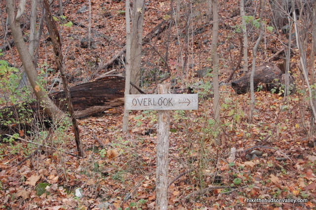
6. Head up the stairs to the overlook and take in the view. The Mid-Hudson Bridge is straight ahead, and the Walkway over the Hudson stretches across the river to your left.
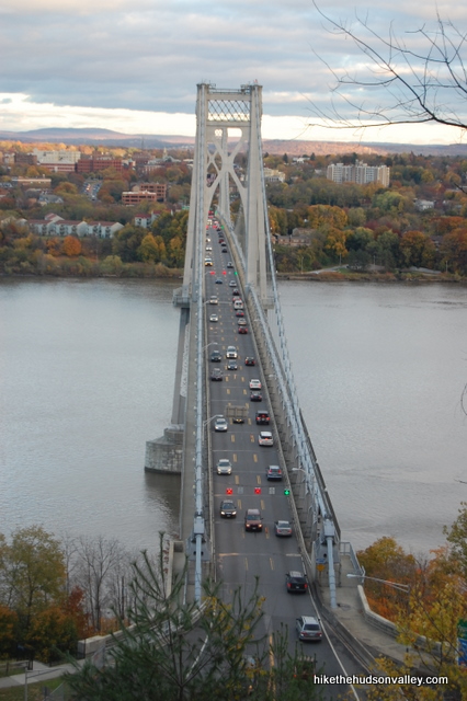
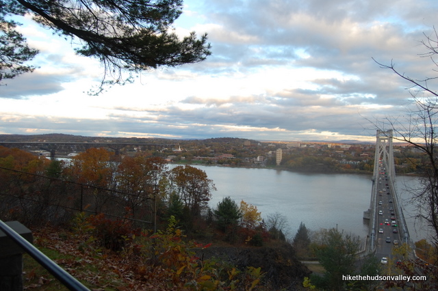
7. Continue along the Blue Trail for a few more minutes until it dead-ends back into the Yellow Trail. Turn left on the Yellow/White Trail (they run parallel for a moment), then take an almost immediate right turn onto the White Trail when it splits off.
8. You’re now on the loop that heads all the way around the park. Just keep heading straight for almost a mile through some nice woods, with a residential area occasionally visible off to your right.
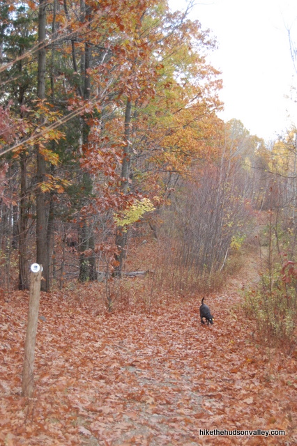
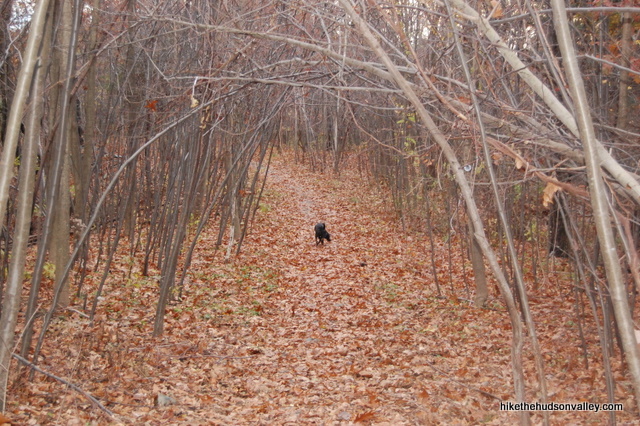
You’ll pass one cutoff trail that turns left off of the White Trail, but since you came all the way out to see some Franny Reese, why not go ahead and do the whole loop?
9. At the far end of the loop, as the White Trail turns left 180 degrees and starts heading back, I could see how some people might accidentally keep wandering straight on an unmarked trail that leads who-knows-where. Keep your eyes peeled for the double-white marker that indicates a left turn to head back toward the parking lot. If you were deep in conversation or thought, you’d probably walk right past this turn and not notice until you hit the river or Hogwart’s or something.
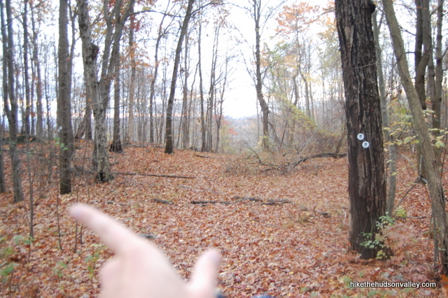
10. This return stretch on the White Trail has three official Scenic Overlooks starred on the Scenic Hudson map. As my dad would say, this appears to be the work of the Chamber of Commerce. As the New York-New Jersey Trail Conference write-up on Franny Reese would say, “…the three ‘scenic overlooks’ that the map shows along it do not exist and views can be limited by abundant trees.” I had my hopes up for some nice money spots, but you’d do well to temper your expectations for more of a pleasant through-the-trees view of the river the entire way back.
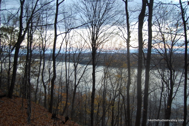
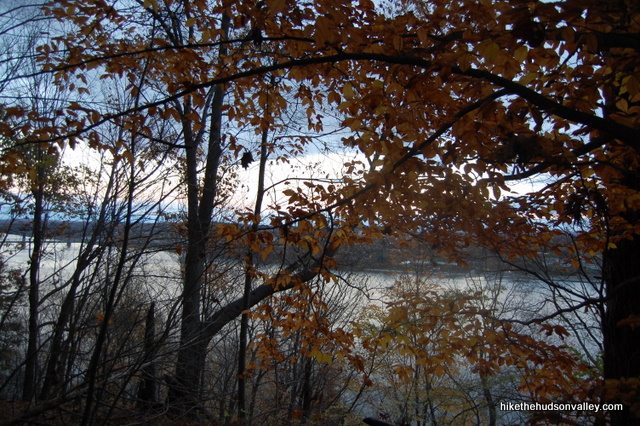
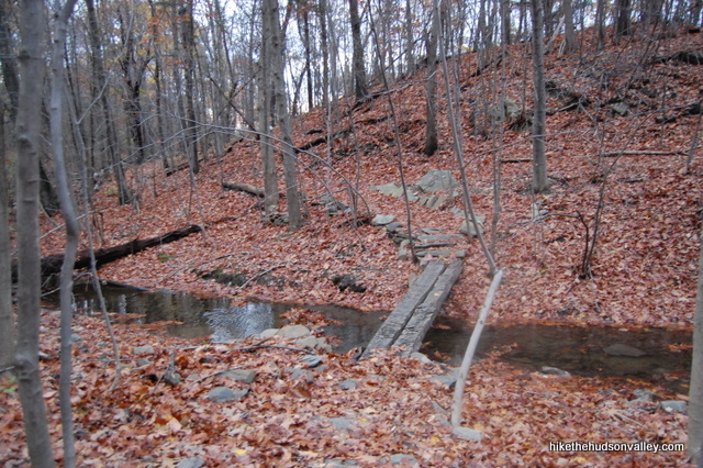
11. Keep wandering back on the White Trail, observing the cutoff trail (that all the wimps took) rejoining you from the left. The way back features a little log bridge and some nice stone walls.
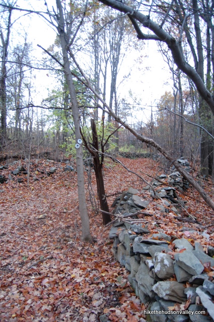
12. Towards the end of the White Trail, you’ll pass some old ruins on either side of the trail. If you’re here at dusk, and thinking about that time you watched Blair Witch, you won’t need the signs to remind you to keep out.
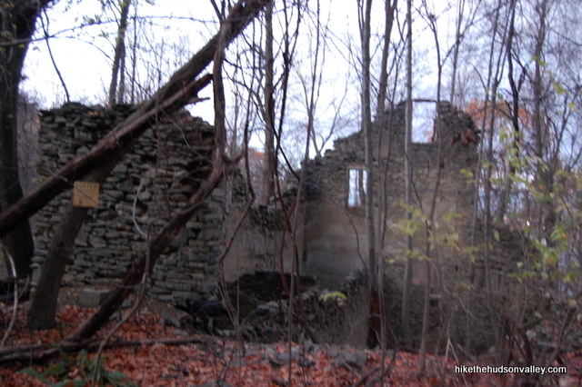
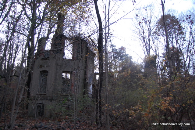
13. After the last of the ruins on your left, the White Trail dead-ends into the Yellow Trail. Take a right on the Yellow Trail to head back to your car. In a few minutes, you can sneak one last peek up the Blue Trail (on your left) to say goodbye to the Mid-Hudson Bridge, if you’d like.
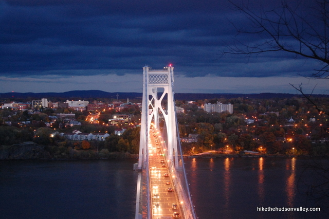
14. Retrace your steps back to the bridge. High-five any eastern spotted bridge trolls you happen to see under there, climb the stairs on your left and head back to your car. And if you live on the east side of the river, say hello to the Mid-Hudson Bridge again in just a minute.
Directions
Directions to the trailhead: Heading west on the Mid-Hudson Bridge, take the first exit for Route 9W North in Highland. From 9W, take the first right turn at the stoplight for Haviland Road. Follow Haviland Road all the way back to the base of the Mid-Hudson Bridge and the parking area for Johnson-Iorio Park (it’s a dead end). Park here and let the rocking and rolling commence.
You can also get directions by checking out the Franny Reese State Park entry on the HiketheHudsonValley.com Google map.
Sorta nearby address for your GPS: The intersection of Haviland Road and Rt 9W in Highland, NY will get you very close (the parking area is less than a mile east – towards the river – down Haviland Road). My old-ish Garmin Nuvi lets me put in an intersection as a destination, so hopefully yours does, too.
GPS coordinates of parking area: 41.70435, -73.9517 (Clicking will open in Google Maps or the Apple Maps app, depending on your browser/device.)
Resources & Interactives
Related resources: If you’re looking for actual facts and/or useful information, visit the Scenic Hudson Franny Reese State Park page. (And if you’re a Scenic Hudson person, thanks for all the awesome parks, dudes!)
You can also find more hike write-ups that detail some longer hikes (tying in the Walkway over the Hudson) from this New York-New Jersey Trail Conference page.
More Franny Reese pictures from the hike’s Picasa album:
Want to support trails in the Hudson Valley? Here’s one great way: Visit the New York-New Jersey Trail Conference homepage and click on Volunteer, Donate, or Shop! (Then you can volunteer, donate, or shop, depending on your mood.)

Pingback: A Hudson Valley Hike at Franny Reese State Park - From Inwood Out
Cute guide – thanks. This park entrance is not easy to find. Google Maps are not reliable.
* For new comers – Trails are a series of switchbacks on the river bluffs. Steep hiking, both up & down. Not an “easy” hike. Not terribly scenic.
* The listed parking area to north of bridge is limited to 8 cars or so. Starting there leads to 30 feet of steep steps going down – the “under bridge” area is underwhelming (even with the troll) & the steep hike up the Yellow Trail is exhausting. The first overlook is a pleasant view of town waterfront apartment buildings across the river.
* Near the overlook a deer trail leads to 2 small foundations; possibly remains of a still house (bootlegging) as some plumbing remains. Also some deer!
* We did not continue to the full “loop” but if we come back we would use the 2 parking lots to the south mentioned in passing (without directions.)
* Overall, from NYC not the most fulfilling of destinations.
Did this this past weekend and it was really really pretty, does anyone know what that ruin used to be? It looked like it used to be someones house a long time ago, I was curious if there were any pictures floating around of what the original structure looked like 🙂
I see you have taken a picture in late evening. Was it really hard to climb down after dark?
I wanted to go up there and take some pictures around dusk and then return and was wondering if it is completely dark, it will be risky.
Shouldn’t be too risky – the overlook is very close to the trailhead, and some careful stepping (and a good flashlight or headlamp) should get you back to your car without any drama. Happy snapping!
Nicely written, thanks. Your narrative amplifies the trail map in a most useful way. Our group of eight will take this trail soon!
theres also a kinda hidden parking lot for this place off 9w behind Riteade. Some great geocaches are stashed here!