Background
If you find this free trail guide useful, please provide payment by picking up at least one piece of litter on your hike. Cha-ching! Thanks for being awesome! (And here’s a quick primer on Leave No Trace, too, to help us keep the trails nice and fresh for each other.)
Pooch proclivity: No doggies allowed. Boooo! (But pooches aren’t the biggest fans of fire towers, anyway.)
Background you can feel free to skip: If you approach Pine Plains from the south on Rt 82, you can see your destination looming on the hill to your left: a big ol’ fire tower, beckoning you to come check it out.
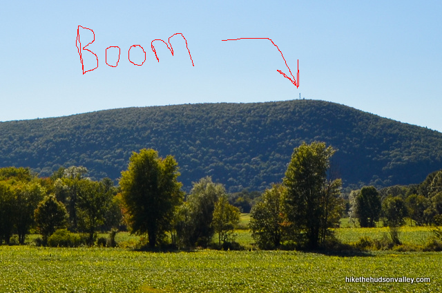
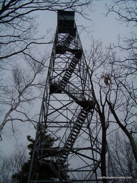
Whoever built this tower must have been compensating for something; it stands about 30 feet taller than your average fire tower. “Surely, I’m at the top now,” you’ll think, only to round the corner and see another flight of stairs.
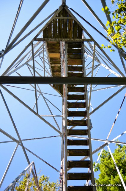
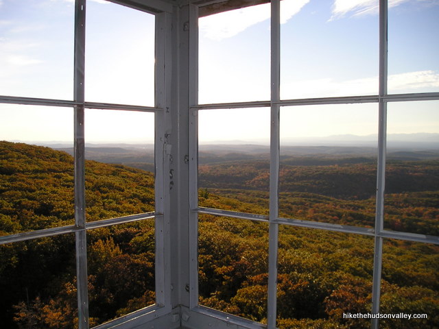
Nothing is more annoying than getting to the last step on a fire tower only to find the hatch above you locked. The tower on Stissing Mountain will never do that to you – it’s always open to explore, all the way up. The gorgeous views up there quickly make you forget all about the creaking and swaying. Almost.
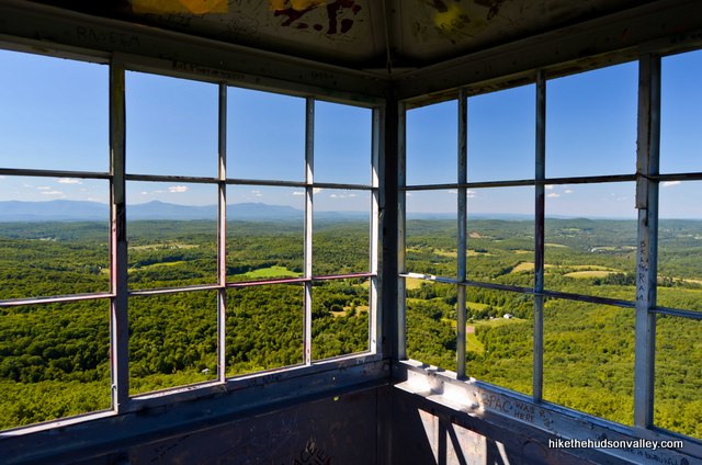
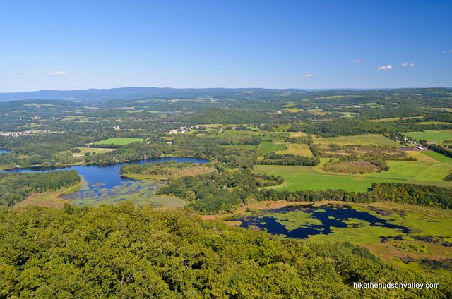
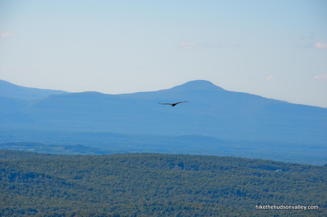
When I used to live a little bit further north, this was my go-to place to bring out-of-town visitors who really liked to hike. Walking at a good clip, it takes about 45 minutes to get from car to tower, a relatively short hike for such awesome views. My friends were never disappointed at this hike, and you won’t be, either.
The difficulty rating for this hike is a 6, which, according to the Scientific Hike Difficulty Rating Scale, means you are entitled to eat at least three slices of pizza afterwards. That scale doesn’t take into account the USA Deli, though, which is just a short distance from the trailhead, and which serves the largest slices of pizza I’ve ever seen. If you wanted to, you could easily wear a slice as a cape and fly around the room. If you can eat three of those slices, you deserve to have your picture hung on a wall somewhere.
Our hiking group used to do this hike every summer, and we’d always go to the USA Deli afterwards. The owners were always so friendly to us, even though we couldn’t always understand each other (there are newspaper clippings on the wall about the family coming here from Kosovo). They also have that 28” pie that is bigger than a wagon wheel.


One year, the owner went into his garden out back, picked some fresh watermelon and sliced it up for us. Very nice people.

I’m always glad to see that they’re still in business in what seems like a pretty remote location. I haven’t been back in a little while, but if someone went there and ate some gigantic pizza based on this recommendation, it would warm the cockles of my heart (if hearts have cockles). And it would also be the perfect way to reward yourself after a calorie-burning afternoon at Stissing Mountain.
**UPDATE October 2018** USA Deli went out of business in 2014. Bummer! Seriously, that makes me sad. Sorry to everyone who has been hoping for awesome gigantic pizza and watermelon after their hikes for the past four years! Feel free to drop some other local recommendations in the comments below.
**UPDATE August 2020** People of 2018, I have fantastic news from the future! (Except for the pandemic, but let’s not get into that now — you’ll find out about it soon enough.) There’s now a farm stand where USA Deli used to be, run by the son (Bez) of the father (Paul) who gave us that delicious watermelon so many years ago! See this Facebook post from Pine Plains, NY to see more details. Even if you don’t climb Mt. Stissing, you should definitely visit this place. They are such wonderful people and the produce is apparently just as delicious now as it was back then. There, something good happened in 2020 after all!
Trail Guide
Bonus unsolicited advice: Don't depend on having cell service in the woods - it can be spotty out there! Download this trail guide to your phone before you head out. (It's easy to do on iPhone and Android.) May your connection to nature be strong, even when your connection to the internet is weak.
1. From the parking area, head across the street, towards the “Thompson Pond Nature Preserve Sign”, following the trail that starts just beside it. (**UPDATE June 2019** Looks like that sign is no longer there, and there’s a new FOSL (Friends of Stissing Landmarks) sign a little further along the trail. Thanks to Matthew’s helpful comment and photo below for keeping us up-to-date!)
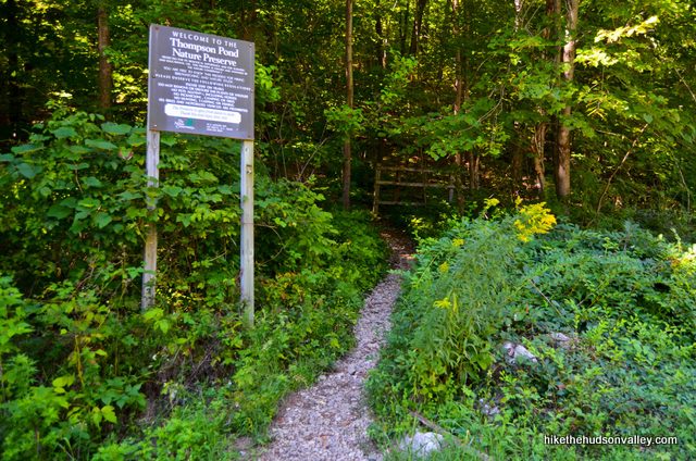
2. Head through the open fence, past the blue trail marker and start making your way up the hill. Don’t worry, this is the steepest section – it’s not all like this. But man, this part is steep.
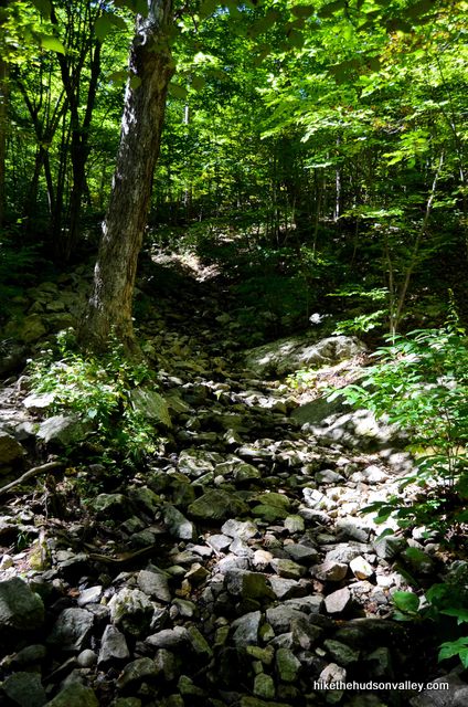
You’ll also come to a fork shortly after you begin climbing — really, more of a “fauxrk,” since it’s not really a fork. Both trail sections meet up again in a moment. I chose left, and it worked out just fine. I won’t be offended if you go right, though.
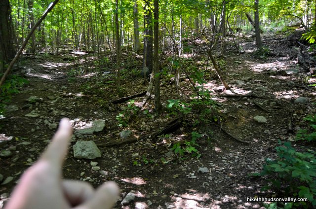
3. After ten minutes or so of vigorous climbing, the trail will T into an old woods road. Make a left to continue, and enjoy the more leisurely incline of this section. If it’s been very wet out recently, you might have to do some rock-hopping to keep your feet dry here.
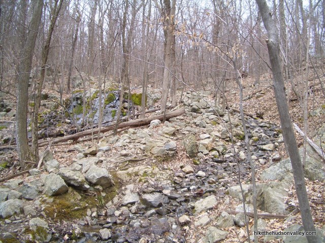
In general, though, this trail is very dry and nicely maintained (though without blazes, an interesting choice, right?), so don’t let a little damp section get you down.
4. About halfway up the hill, you’ll come to a fork in the trail, marked by a big pile of rocks (or cairn, if you’re fancy) at the base of a tree.
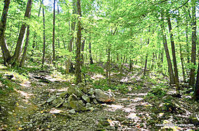
Whichever direction you choose, you’ll come down the other way, so this is where the loop starts. I always go right, just because the incline is a little friendlier this way. I’ll assume you’re doing the same.
5. Just keep chugging and sticking to the trail, reminding yourself that at a casual pace, it usually only takes about an hour to get to the tower. You could chant “an hour to the tower” over and over again in your head, if that would help pass the time. (Really, it usually only takes about 45 minutes, but that doesn’t rhyme with tower.)
Check out some of the cool rock formations as you continue climbing.
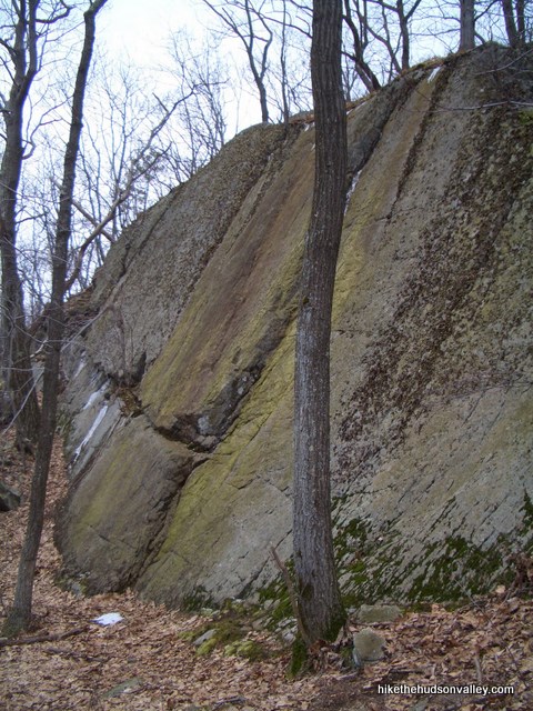
5.5. **UPDATE** On my most recent visit to Mt. Stissing (September 2013), a new (unofficial?) trail marker (a trail marker on Mt. Stissing? Get out!) had materialized in the middle of the trail, near the top. It was a wooden arrow pointing to the left, followed by some metallic disc trail markers.
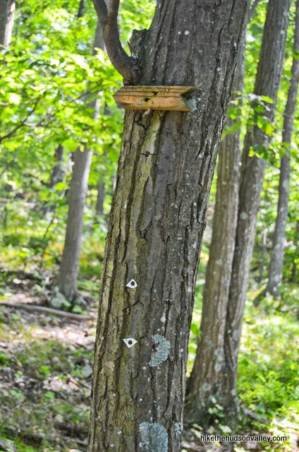
“What the heck, why not?” I thought, and followed the trail left. This turned out to be a shortcut to the tower (five minutes or so), and I’d probably go this way again next time, too, if those markers are still there. You can also go straight past the first marker and arrive at the tower without a problem, too, which is the way I always used to go. Your choice – can’t go wrong! Just wanted to mention it here so those markers don’t surprise/confuse anyone.
**UPDATE June 2019** Those discs have apparently now been painted orange to make them easier to see. Thanks for clueing us in with your comment below, Jessica!
6. Just when you think it’s never going to materialize, you see this bad boy staring back at you:
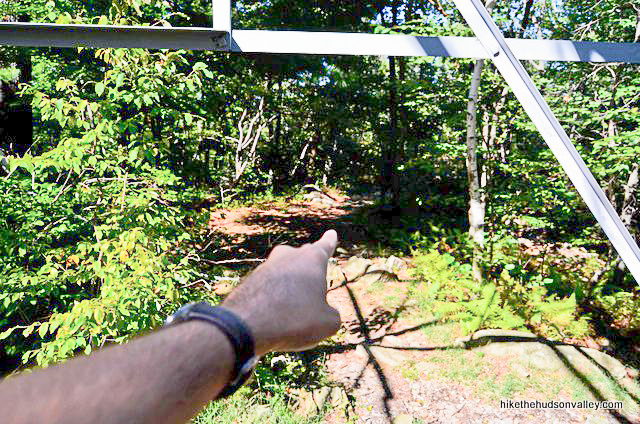
7. When you enter the clearing at the base of the tower, take special note of which trail you came in on. It’s easy to get turned around when you come back down later. If you turned right at the beginning of the loop trail, you should see your return trail heading off to the left of the tower.
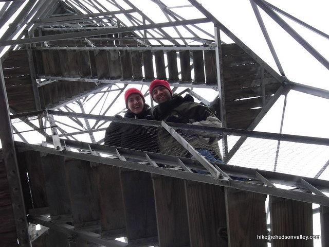
8. Give it a climb! And watch your step. You can’t see squat if you don’t climb the tower, so hopefully you’re game.
9. At the top, take some pictures. Revel in the awesome view. And feel free to pretend that you don’t even notice the swaying.
10. After you’ve had your thrills, carefully descend and head down the hill on the return trail. If you went the same way I did, you’ll pass the remains of an old ranger station, then you’ll descend steeply.
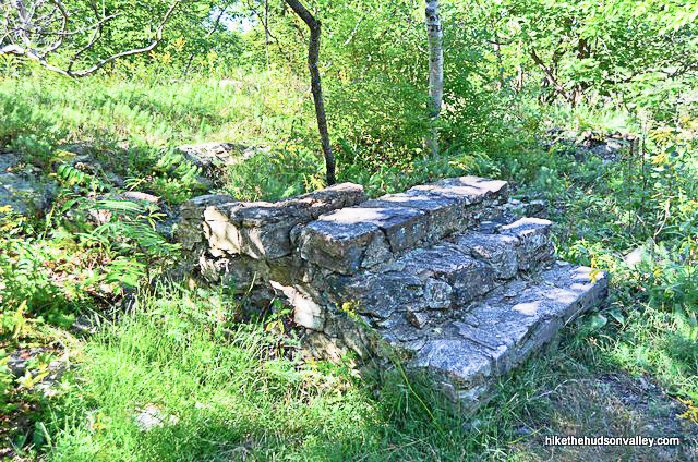
11. About halfway down (15 careful-stepping minutes or so from the ranger station ruins), you’ll rejoin the original trail at the big pile of rocks, where your loop started earlier today. It’s all retracing your steps from here.
12. Remember at the beginning of the hike, when you made a left after that steep stretch dead-ended into that old woods road? Be careful not to miss that turn on your way back (it’s a right turn this time). There are usually some branches lying across the trail to help steer you in the right direction, but keep an eye out. I’ve had friends walk straight past the turnoff without realizing it.
13. Take that right turn and head down the steep stretch until you reach your car. Hungry for some gigantic pizza now? (**UPDATE March 2019** Sorry if you are hungry for gigantic pizza, since the USA Deli went out of business in 2014. I bet you could still find some regular-sized pizza somewhere, though! You’ve earned it!)
Directions
Directions to the trailhead: From Poughkeepsie, take 44 East through Pleasant Valley to 82 North. Follow 82 all the way up to Pine Plains. As soon as you start entering the town of Pine Plains, keep on eye out on the left for Lake Road. You’ll take Lake Road and follow it for just shy of two miles. After passing some marshland, you’ll come to a sharp bend to the right, where a Thompson Pond Preserve sign is on the left (this is parking for a nice nature loop around Thompson Pond – no views there, though, so I’m skipping it in this writeup. You should check it out sometime, if you have the inkling.) Your parking area is on the right in another couple hundred yards. You can see the trail heading up the hill to the left, beside another Thompson Pond Preserve sign.
You can also get directions by checking out the Stissing Mountain entry on the HiketheHudsonValley.com Google map.
Sorta nearby address for your GPS: The Pine Plains Fire Dept is at the corner of Lake Road and Rt 82. Its address is:
7 Lake Road
Pine Plains, NY 12567
If you’re coming from the east on Rt. 199, you’d do better to plug in the address of the USA Deli, which is on Rt. 199, just before the right turn you need to take onto Lake Road. Its address is:
2704 New York 199 West
Pine Plains, NY 12567
GPS coordinates of parking area: 41.96989, -73.68218 (Clicking will open in Google Maps or the Apple Maps app, depending on your browser/device.)
Resources & Interactives
Super-cool Google Earth flyover of hike route:
Google Terrain Map of hike route:
Related resources: If you’re looking for actual facts and/or useful information, see the Nature Conservancy’s Thompson Pond/Stissing Mountain page.
More Stissing Mountain pictures from the hike’s Picasa album: (with a special thanks to Jeff Bisti for digging up some ancient pictures from our old hiking group):
Was this trail guide useful to you? Please leave a comment!
Want to support trails in the Hudson Valley? Here’s one great way: Visit the New York-New Jersey Trail Conference homepage and click on Volunteer, Donate, or Shop! (Then you can volunteer, donate, or shop, depending on your mood.)



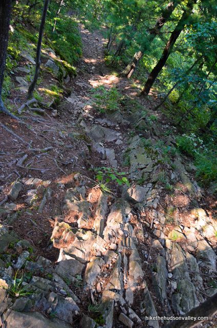
This was such a fun hike! The trails are now clearly marked with orange for a shorter, steeper route and blue for a longer, less steep route. I consider myself a pretty capable hiker (did the Mohonk Labyrinth and Lemon Squeeze without breaking a sweat and ascended Bear Mountain’s seemingly endless stone staircase without getting winded) but the orange trail was challenging. I had to stop to catch my breath several times and I’m someone who prefers to trudge on rather than ever stop. It wasn’t a particularly hot day but I was drenched in sweat. It’s STEEP.
Getting to the top and climbing that blessed tower to escape the insects and forest humidity, to enjoy the gorgeous view and be cooled off with the most pleasant breeze, was something I’ll never forget.
Thanks so much for the trip report, Elisheva! I need to get back out here and refresh this trail guide with some pictures of the new(ish?) blazing. Glad you enjoyed the hike! And your photo special effects are better than mine! 🙂 Thanks for sharing here!
I hiked the trail yesterday (going clockwise, so I did the steeper part of the loop first). As beautiful as October is, I tend to forget how annoying it is when the slippery leaves cover up the small rocks. 😛 But the view was totally worth it. As I was climbing the tower, I thought, “Hmm, this feels taller than the tower on Hunter Mountain. But I’m tired so I’m probably just imagining it.” I wasn’t imagining it! Great little hike in a very pretty area.
Amazing views up in the fire tower today. I am a older hiker and kind of new hiker. I have been working my way up with your hikes, started out doing mostly 3 rated hikes and am working my way up, I am great full for your rating system of these trails. Thanks so much for all your info.
That’s so nice to hear, Pete! Thank you so much, and I wish you all the best as you keep working your way up. If you’ve already knocked out Mt. Stissing, you’re getting pretty high up the list! Enjoy exploring the rest!
BTW there is no Thompson Pond Nature Preserve sigh at the trailhead. There is a Stissing Fire Tower sign just a bit further in next to the small wooden fence, but the Nature Preserve sign is gone, maybe a victim of weather. Still, you can’t miss the trailhead.
Matthew, thanks so much for this update! I’ve updated the trail guide above with a link down to this comment and photo. Much appreciated!
Beautiful Friday up at Stissing Mountain fire tower. Short, steep and rocky going up but well worth it!
Did this hike yesterday 3/3/19. Followed your trail guide, they spray painted the silver disks orange to help make it easier once you get closer to the top. Breathtaking view. The way down we followed your suggestion, was all snow and ice, definitely a lot steeper than coming up. Slid down most of the way but was such a great adrenaline rush! Haha. All your guides have been super useful! Thanks!
Thanks for the heads-up about the new color for the trail markers. Jessica! I’ve added an update to the trail guide above, with a link down to your comment. Much appreciated! Glad you made it home safely from your adrenaline-fueled slide down Mt. Stissing, too!
Did this hike today – great views from the top of the tower. The fact that it was made of wood was a bit off putting – but made it to the top and enjoyed the views! Thanks for the guide.
Took the path to the right at the fork – but after that, we had to guess at least 3 times as to which path to follow. A good tip to add might be that once you fork to the right, every time after that, go to the left so you continue up the mountain.
Also, I imagine that if you went to the left at the fork, this hike goes from a difficulty of 6 to 8+ pretty quickly. That way is mighty steep.
Just a tip for anyone wanting to do this hike since there really aren’t any trail markers and you can get confused as to which path to take. You can download a free trail map to the tower from here (http://www.co.dutchess.ny.us/CountyGov/Departments/DPW-Parks/tmsthompsonpondstissingmnt.pdf). What’s also great about this map is that it is Geo tagged (I think that’s the right word). Meaning that if you download a free app to your phone or tablet called PDF Maps (http://www.avenza.com/pdf-maps) and import that trail map into it, it will use the GPS on your phone and show you exactly where you are on that trail map. My wife and I did this hike yesterday and while the directions here are good, seeing exactly where we were on the map made us feel a little more comfortable that we were on the right path and not getting ourselves lost. Hope you guys find this helpful.
Took four 8 & 9-year-old girls up this trail last weekend. Went left at the rocks. Girls worked very hard, but got their reward at the Fire Tower (both climbing up and down it 3 or 4 times and the candy we had packed for them). They came home happy and exhausted… Success!!!
Lots of walking sticks await at the trail entrance. Take one. Especially with the leaves on the ground, getting good footholds is a challenge on some of the steeper sections (up and down). Every one in our group slipped and fell at least once. Remember to leave your walking stick where you found it on the way out.
Don’t know the specific rules, but we saw several people with dogs on leash. Look for the marker up by the fire tower about a dog who must have loved climbing this trail. This is not a trail for a small dog or an old arthritic one, and it would not be safe for you to be carrying it.
Thank you for the responses. We ended up going today and not brining the pup. We did see a lot of people ignoring the sign which we would not do, and most were even off leash. Enjoyed the hike and tower as well as stopped briefly to check out Thompson Pond and also the Dover Stone Church before both of those. Have enjoyed so many great hikes from this site 🙂
Thank you!
Is it posaible just the pond is no dogs allowed but stissing mnt hike is ok? I havent been yet so am wondering.
Hi Kim,
I’m afraid that if you look at Jon’s picture below (http://hikethehudsonvalley.com/wp-content/comment-image/1774.jpg), which is of the sign posted at the trailhead to climb Mt. Stissing, it’s pretty clear that dogs are not allowed. Sigh.
It’s the entire preserve, which includes the pond and mountain: link to visitation guidelines.
Just did this hike this morning and it was more challenging than I expected. The climb, while short, is really steep and rocky. The trail was very easy to follow, but again, Steep! There were several times that I was fully winded (We were traveling at a pace that got us to the top in 30 minutes) and wondering what I had gotten myself into — we also went left at the fork, which may have led to a steeper path up.
With that being said, the view from the top of the tower was just simply awe-inspiring. It helped that the leaves were in a pretty solid state of change as well. Luckily since we arrived fairly early, we were able to hang out in the tower for a while, we didn’t even see anyone until about half way down the trail back to the car.
While this trail is short, it’s challenging because of how steep it is. Keep that in mind if you’re not looking for a steep challenge.
Where did the name “Stissing” come from?
Hi Wendy – good question! I’m afraid a Google of “where did stissing mountain get its name” brings you to the page we’re on right now, which is not very helpful at all, since I have no idea.
Here’s the closest I could find to an explanation (source: http://www.rootsweb.ancestry.com/~nylnphs/V2/sm.htm):
It is not generally known how Stissing Mountain attained its present name, although it is undoubtedly of Indian origin. One possible explanation has it that the peak originally bore the name of “Teesink” after a particular tribe, or that of its chieftain, which inhabited the region at the time. This was later changed to “Stissink,” and eventually “Stissing.”
Hope that helps!
What a fantastic view from the Firetower! My only complaint is that I wish the trails were better marked by the Preserve. I spent a lot of my journey up wondering if I had wandered off the trail. I kept coming across junctions that sort of looked like other trails and I ended up guessing in spots. I think the recent storms washed the trail out in some spots and there were several trees that had fallen across the path. I am so glad that I had your directions close at hand. Thank you!
Hi, Krista, sorry I let this comment slip past! I completely agree. While you can generally pick your way up the trail by taking some educated guesses, some blazes would really help. It’s on my to-do list to come back to this guide and add a few more pictures and pointers to help. Glad this guide was useful for you anyway!
I agree! We hiked this last July and spent about 45 minutes hiking the wrong trails. We took the scenic route for sure! The view from the fire tower was well worth it though 😉
I think it’s ok to bring dogs, I always bring mine and always run into other people with dogs.
John, thanks for the comment! I just went back to the official Nature Conservancy Thompson Pond/Mt. Stissing site (link in the “Related resources” section above), where I SWEAR there used to be a big statement on how/why doggies weren’t allowed here. I can’t find any such statement now, and I’ve updated the trail guide accordingly. That’s great news – many thanks. And my pooch thanks you, too
The Nature Conservancy’s NY visitation guide does have this to say however:
“With a few exceptions, pets, horses, bikes and motorized vehicles, which can disrupt damage wildlife, are not permitted.”
Link here.
Actually, to add to my first comment, dogs are clearly NOT allowed. There are signs at the trailhead and Posted signs at the boundaries that flatly say “no pets”. So those that brought dogs either didn’t read the signs or ignored them, but the policy is pretty clear. I love to bring my dog on hikes, but there are many, many other local spots that aren’t protected ecological preserves where she is welcome.
Jon,
Thanks so much for the information. I sent an email earlier today to the contact given on the page you linked to above, asking for clarity on the dog situation here, but you just provided all the clarity we need. I’ve amended the section of the trail guide above accordingly, back to its original warning about dogs not being allowed here. Much appreciated!
Mike