Background
If you find this free trail guide useful, please provide payment by picking up at least one piece of litter on your hike. Cha-ching! Thanks for being awesome! (And here’s a quick primer on Leave No Trace, too, to help us keep the trails nice and fresh for each other.)
Background you can feel free to skip: No matter how many hikes you’ve done in the area, it’s unlikely that you’ve ever done one quite like Rand’s View. Most of the hike is standard enough, following the Appalachian Trail over moderate inclines. You’ll climb past the decent view atop Mt. Prospect, which might serve as its own a destination on a normal hike. But then you come down the other side of the mountain and emerge from dense woods into this crazy, enormous meadow that seems like it shoudn’t exist at all.
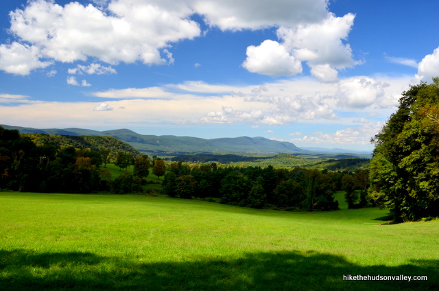
The low grass stretches on and on, leading to a panoramic view of the Berkshires beyond. A perfect place to enjoy a romp, a picnic or both.
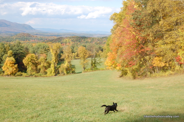

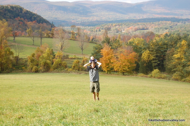
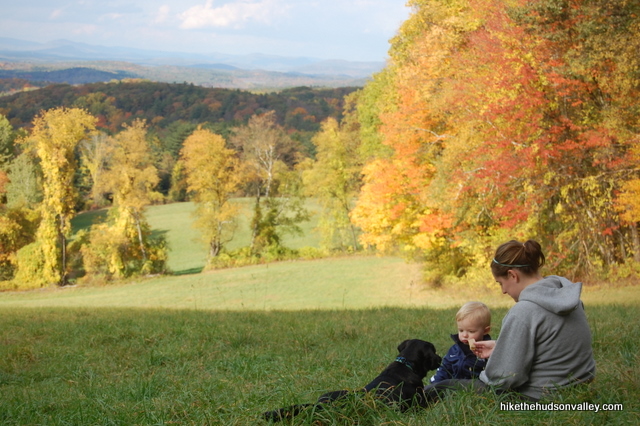
I’ve been here twice: once on a glorious fall day right at the peak of foliage, and once during a perfect late-summer weekend afternoon. There were a few other hikers along the trail, but nowhere near the gobs there should have been, and we had Rand’s View all to ourselves both times. It wouldn’t really matter if there were dozens of other hikers here, though – there’s plenty of room to spread out and take it all in.
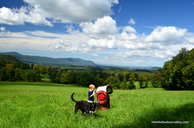
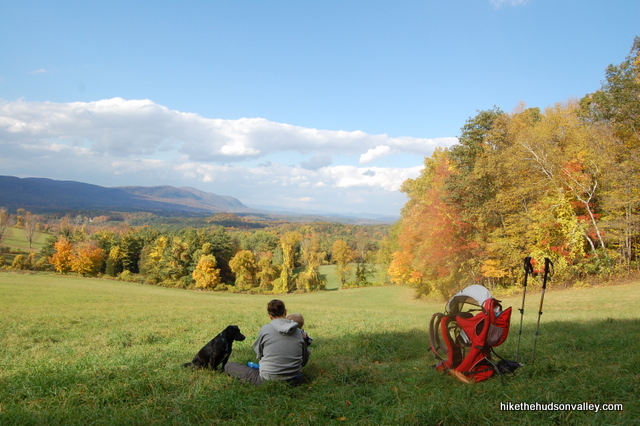
Why does this place exist? I don’t know. I’d love to hear a good reason why this meadow is here – it doesn’t look like a hay field, but if nobody’s mowing it, shouldn’t it be a forest by now? And shouldn’t you have to go to Switzerland to find meadows with views like this?
Whatever the reason for its existence, we’re lucky that Rand’s View is in our backyards, and if you’ve never visited, I recommend putting this one at the top of your list.
**UPDATE October 2018** For those hiking with their four-legged friends, please see Jade’s cautionary comment below about porcupines in the area. Let’s keep those snouts out there quill-free!
Trail Guide
Bonus unsolicited advice: Don't depend on having cell service in the woods - it can be spotty out there! Download this trail guide to your phone before you head out. (It's easy to do on iPhone and Android.) May your connection to nature be strong, even when your connection to the internet is weak.
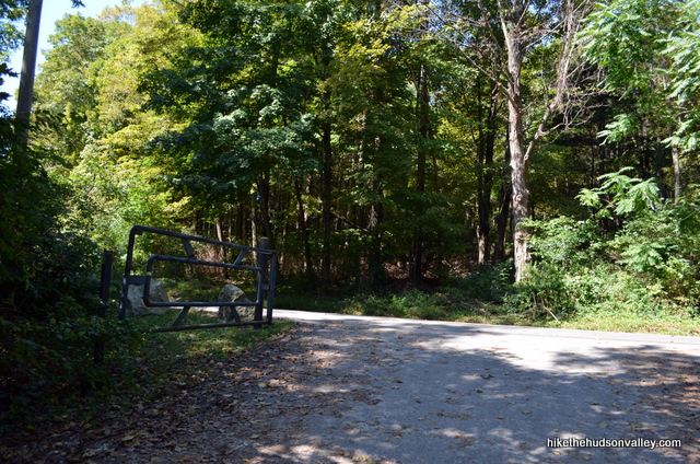
1. From the parking area, turn to face Housatonic River Road, with your back to the river. Turn left onto the road, then take a right turn in just a moment onto the white-blazed Appalachian Trail. You won’t see any signage marking the trail, but it’s very well-worn, and you can see a white blaze on a tree just a short way off the road.
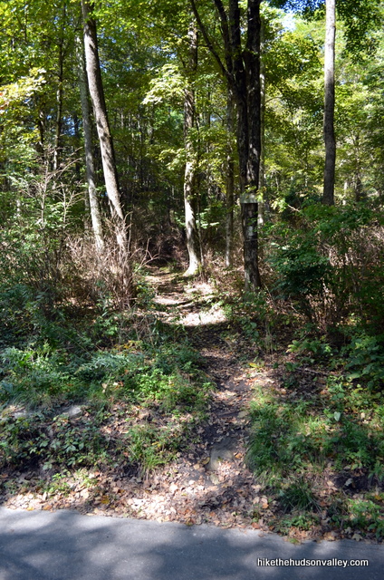
2. In a couple minutes, just past a box with trail maps, emerge into a small clearing. Follow the trail until in plunges back into the woods, but just before you enter, turn around to see the small view behind you. Nothing earth-shattering, but it gives you an idea of the surrounding landscape.
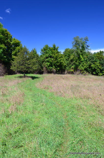
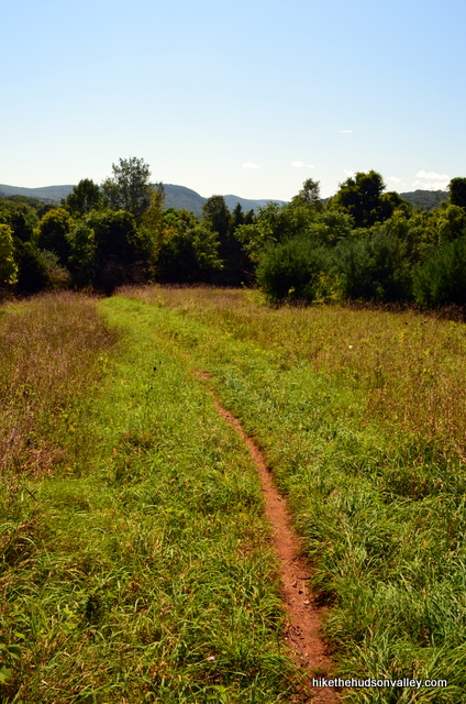
3. Keep on truckin’! To get to the top of Mt.Prospect, you’ll climb 969 total feet from the parking area over 1.8 miles. It took me about an hour. It’s never extremely steep, but you’ll know you’re climbing a mountain for sure.
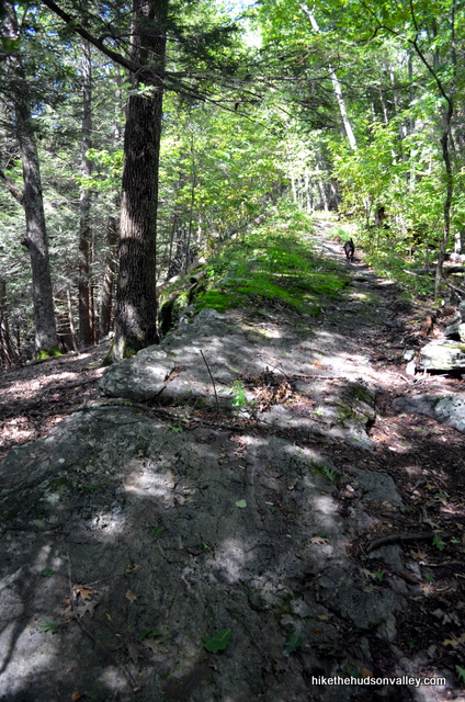
Just keep following the white blazes of the Appalachian Trail until you reach the summit. You’ll know you’re at the summit when you come to a rocky little clearing with a beautiful, if somewhat narrow, view off to your right. Stop to take a breather and soak it all in.
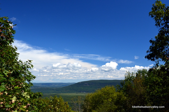
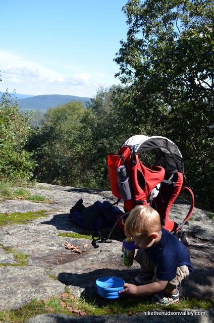
4. From the summit, it took me another dawdling 30 minutes to get to Rand’s View, heading downhill the whole way (try not to think about the way back). This side of the mountain is much smaller – it’s .7 miles to the junction with the side trail that leads to the Limestone Shelter, dropping 200 feet in elevation. (And as Erik noted in his comment below, it’s a pretty easy stroll once you pass the summit – perhaps thinking about the way back isn’t so scary after all.)
Take a right here to continue downhill on the white-blazed Appalachian Trail, and Rand’s View is just around the corner.
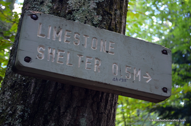
5. From the Limestone Shelter junction, it’s just another .1 miles to Rand’s View. Keep heading downhill and you’ll burst out of the woods into the coolest meadow this side of The Sound of Music. Plunk down and enjoy it.
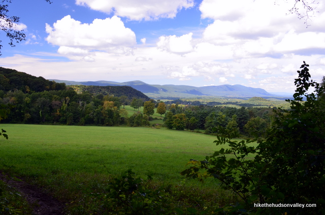
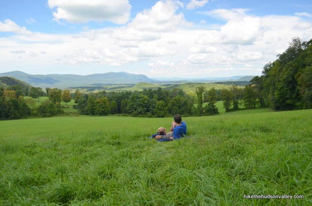
If there’s a better place to visit during fall foliage season, I’m not immediately thinking of it.
6. When you’re done taking it all in, head back the way you came. Climb back to the Limestone Shelter trail junction, where you’ll hang a left to follow the sign toward Prospect Mountain (.5 miles).
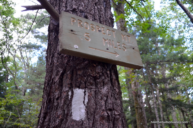
Then just keep following those white blazes all the way back to Housatonic River Road, where your wheels await. The return trip took me 1 hour and 15 minutes. When you get back to your car, rest your weary legs and start daydreaming about your next visit here.
Directions
Directions to the trailhead: From Poughkeepsie, head east on Route 44 all the way through the town of Millerton. 2.1 miles after the center of Millerton (still on Route 44), turn right onto CT 112 E (Interlaken Road), which becomes Lime Rock Road. 4.8 miles after leaving Rt 44, turn left onto Salmon Kill Road. In .6 miles, veer right onto Brinton Hill Road, which is a tiny, windy affair. In 1.1 miles, Brinton Hill Road dead-ends into Dugway Road, where you’ll turn left. Head straight, and Dugway Road becomes Housatonic River Road in .3 miles. Follow Housatonic River Road about another half-mile to the gated, dirt parking area on your right, just above the falls and dam on the Housatonic River.
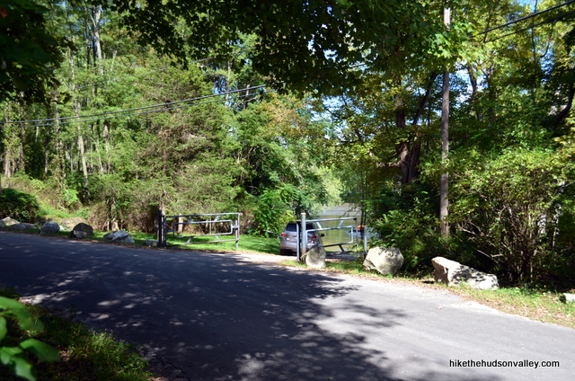
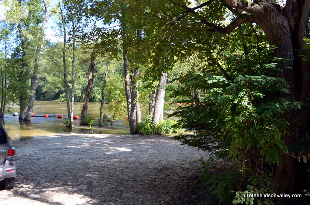
Hop out of your car, carefully take a gander at the top of the falls, then let the adventure begin!
You can also get directions by checking out the Rand’s View entry on the HiketheHudsonValley.com Google map.
Sorta nearby address for your GPS: The intersection of Housatonic River Road and Sugar Hill Road in Falls Village, CT is just a couple hundred yards south of the trailhead parking lot. My old-ish Garmin Nuvi lets me put in an intersection as a destination, so hopefully yours does, too.
GPS coordinates of parking area: 41.96369, -73.37222 (Clicking will open in Google Maps or the Apple Maps app, depending on your browser/device.)
Resources & Interactives
Super-cool Google Earth flyover of hike route:
Google Terrain Map of hike route:
Related resources: If you’re looking for actual facts and/or useful information, visit these resources:
- The excellent Rand’s View write-up at Berkshirehiking.com
- Another write-up with some good tidbits at litchfieldhills.com
- Maps and trail descriptions for a longer stretch of AT at cnyhiking.com
More Rand’s View pictures from the hike’s Picasa album:Was this trail guide useful to you? Please leave a comment!
Want to support trails in the Hudson Valley? Here’s one great way: Visit the New York-New Jersey Trail Conference homepage and click on Volunteer, Donate, or Shop! (Then you can volunteer, donate, or shop, depending on your mood.)

Thank you for sharing this I appreciate this a lot
Thanks for such a wonderful write-up.
This wonderful place has been part of my life for almost 45 years.
We mow it and care for it and are so happy about the pleasure that it gives to so many people.
Peter
Wow, so nice to hear from you, Peter! You deserve to be a celebrity with local hikers – I hope you know how much your work is appreciated. Thank you so much for all that you do. Really appreciate all your work to give us all such a special place to explore and experience.
Terrific out and back hike. It took us 3 hours for the 5.4 miles from the Falls Village Recreation area parking, across the street from trailhead. Easy to follow trail with the white blazes. The earth was packed and comfortable, which was terrific since I only had my sneakers. A moderately hard uphill climb. Not too rocky. First good view was at Mount Prospect, which was not far from the destination, the meadow at Rand’s View. The meadow did not disappoint. We had a gorgeous day. Few clouds and not too hot. A late-afternoon Sunday holiday weekend hike and we met with only about a dozen hikers along the way, including a couple of through-hikers.
We attempted this hike a few days ago, but got distracted by the raging waterfall and ran out of time as thunderstorms were rolling in. We’ll go back soon. It wasn’t a total loss though. the Great Falls are….well…great. I had to drag my son, who isn’t all that fond of being outside, away from the river’s edge. He was even curious about what used to be located here and why there was a dam. At the North end of the parking lot is a small kiosk with a few pictures and information. Upon returning home I found this super informative talk about the Ames Iron Works…I love this stuff.
https://youtu.be/L9DKmVaOqFU
Also if you miss the hike and the View you can see a similar view near the intersection of rt. 7 and rt. 112 South of the trailhead. There’s even a picturesque barn as a bonus.
I did this hike yesterday, and even with the wind, it was relaxing and gorgeous! One note: the “box with trail maps” you note in step 2 isn’t there anymore. The trail is very obvious, but no box to be seen 🙂
Wow!! This was such a peaceful and beautiful spot, especially when a lot of trails have been so busy with everyone trying to get outdoors because of Covid. Thoroughly enjoyed the trail with two great views and more solitude than other trails in the area.
just fyi this is closed, as of when I tried to go on monday 8/17 🙁
Thank you, Virginia! I’ve added Rand’s View to the site’s closure list. I assume this is due to the recent tropical storm, and hope it will be open again soon. Really appreciate the heads-up!
Do you know of this hike has been reopened? Thank you
Our first hike of the season yesterday to Prospect Mt and Rand’s View was a good one. A little bit of ice and mud on the trail with a large snow/ice flat at the edge of Rand’s View. We marked it at just over 5.25mi under 3 hours, including a walk down to the bottom of the falls. Thanks for the write up. It was helpful to navigate. We had a little trouble with the directions but got there and asked directions from a friendly resident.
We stopped along the way in Kent at the Cornwall Country Market (http://www.cornwallcountrymarket.com/) where they had some things to do in the area and maps including CT portion of AT and the general area. I’ve scanned one of the maps which has the location of “The Great Falls” which is immediately to the left of “Falls Village”. The trail head is across the street from the lot at The Great Falls.
Thanks for the helpful info, Linda! If there’s anything I can do to improve the instructions to help other folks not get lost in the same way you did, please let me know! In case it’s helpful, for those with smartphones, you can click the GPS coordinates in the “Directions to the trailhead” section above, which will open Google Maps or Apple Maps (depending on your device) and drop a pin right on the parking lot. Hope that helps!
We never made it to the meadow. Shortly after the summit our pup had an encounter with a porcupine and we had to rush back down the mountain to get to the nearest animal hospital since we were a long ways from home. After we spoke with some locals who said there are a lot in that area and they are seeing more and more. The vet said they see dogs with quills on a regular basis. I recommend keeping your dog on a leash on this trail if he tends to roam and gets curious around critters. Really enjoyed the trail up until that that unfortunate event and our boy is as good as new 🙂
So sorry to hear about this experience, Jade – that must have been terrifying for all of you. I’ve updated the trail guide above (in the “Background” section) with a link down to your comment. Hope that helps other avoid the same fate. Thank you!
Hello everyone,
We are thinking of taking our 14-month-old on this hike, we have the proper equipment (backpack to carry a child like the one in the hiking photos) and are ourselves, experienced hikers. I’d to know your thoughts and if we should bring our little Miles.
Thank you,
Rashaad, so sorry I missed this comment when you left it originally! I’ve come from the future to say, yes indeed, if you all are experienced and have the proper equipment, this hike should be just fine with a child carrier. I’d also strongly recommend trekking poles for anyone carrying a kid on their back, to help make sure you never lose your balance. Of course, Miles is probably in college by now, so that advice might not be so helpful to you anymore :-). I hope you all had a great adventure out there if you decided to give it a go!
what trail map did you use? I prefer to bring a physical map in case my phone dies(and it usually does since it is two years old)
I use my Appalachian Trail MA/CT map, but it maybe on the NY NJ Conference South Taconic Trails Map. You can call them and order it direct, or get the AT on from the Appalachian Trail Conservancy.
Hi Sam,
Great question! Always a good idea to have a paper map on you. The NY-NJ Trail Conference South Taconic Trail map cuts off JUUUUST above Rand’s View, so I don’t think it will be much help to you (but it has a ton of other awesome hikes on it). I didn’t have a paper map with me for this one, just the write-up from Berkshirehiking.com (linked above in the “Related Resources” section). The old brochure I grabbed near the trailhead did have a map very similar (if not identical) to this one that I just dug up online: http://www.ct-amc.org/trails/images/CTATmapbrochureB.pdf. That should help give you a rough idea of the lay of the land out there. Hope that helps!
Did this hike for the first time with a friend today, and it was wonderful. We drove up from NYC for the day and had zero trouble finding parking by the dam in Falls Village (though by the time we left around 3pm, the lot was full with people using the park across from the trailhead for holiday gatherings). The ascent up Mt. Prospect was just strenuous enough to feel I earned my snacks at the top! But the valley in Rand’s View is truly a showstopper. We only encountered maybe 10 other hikers total today; otherwise it was a super peaceful trek. When we stopped in Rand’s View to have some snacks, it felt like we were in Europe or something. Just spectacular.
As always, your directions/tips were super thorough and made the whole experience a breeze. Thank you! Can’t wait to do this one again sometime.
Is there any place to take a dip at that waterfall (legally or illegally?) is the water utterly polluted? Looks a bit brownish.
Hi! \
Thank you for such a detailed description of this hike. I am totally sold on it, and cannot wait to go next weekend. Do you by any chance know if we are allowed to camp anywhere around that area or the parking lot where we leave our car? We are looking for primitive camping for just 1 night. Thanks so much in advance!
Sasha
You can either stay at the Limestone Shelter (side trail about .1 mile south of Rand’s View itself) or there’s probably room to pitch a tent near the shelter as well. I can’t say what this shelter is like but there may or may not be water and the privy is probably just a seat surrounded by bushes (as most privies are on the CT AT). If you do a Google search for the Limestone Shelter, you might be able to find more info or pick up the CT/MA AT trail guide at EMS or someplace.
Yes there’s water, a spring 150′ from the shelter. Also an outhouse w 4 walls and a door. 2 or 3 tent platforms nearby, and a bear box for your food.
Is the bear box new? The CT AMC’s Appalachian Trail Committee hadn’t been supplying them to the shelters unless they decided to start this year.
There is no camping allowed anywhere but at the official Appalachian Trail shelter and campsite which is Limestone Springs. There is a shelter which this time of year is usually per the honor system for AT thru hikers and the campsite has 3_4 tent platforms and a mouldering privy (add finely raked little chopped up leaves after going #1&2) . It is peak thru hiker and summer backpacking season so expect to be sharing the overnight site, and PLEASE don’t create more impact by camping somewhere not directly associated withthe site. trail Rands View os part o the Appalachian National Scenic Trail and is managed differently on each state. In VT the Trail is either on land the National Park Service purchased, or easements of varioussizes with state and private landowners (this at designated sites rule). Please look at the State By State info on www
AppalachianTrail.org for more and familiaroze yourself with Leave No Trace principles. Happy Trails!
As long as they are cutting hay and not trees, then that’s a right of their easement.
Just a note on the field: we went up in late June, and there was a tractor and a couple of cars there, making hay! And we got 3.4 for the distance each way.
Thanks for the update, Maya! Sounds like everyone else’s device thinks this is a 6+ mile hike. Apologies that my GPS had to be the one to give the lowball estimate.
It was nearly 60 degrees and it’s the middle of December… How could I not go for a hike?
Rand’s view was a perfect medium effort hike for two great payoff points. After the hike, me and the LADY were both commenting how this should be a once a season destination (as in 4 times a year) — it would be awesome to see this place in the spring as it’s blooming, in the fall as the leaves are turning, and perhaps even in the winter. Such a cool view, and a unique view for the hudson valley. — Made me wonder if you could camp in that field?
The only warning I’d give to anyone is do not use the GPS coordinates on google maps. Just keep an eye out for Millerton, and make sure you don’t pass 112. Follow the directions given above and you’ll be at the trail head in a few minutes.
If it’s wet and you have a UL Chair — Bring it!
Hi, Dave! Glad you had a great trip out here, thanks for all your nice comments as you explore the Hudson Valley. Good question on the camping — my gut tells me no, but I don’t know that for sure. I also wanted to follow up on your comment about the GPS coordinates. Did you run into a problem with the coordinates I provided above? If so, please let me know so that I can update the guide accordingly. Thank you!
Did this hike today, the foliage was absolutely stunning! There was no box at the beginning, however someone did mark the trail with an arrow on the street! Quite helpful.
Going to try and plan a two day hike around this place, it looks too beautiful. Thanks for the information, I use your website all the time to plan day hikes in the area!
Sounds like a great trip! Thanks for the kind words, Kiki, and happy adventuring!
I got 4.9 miles up and back on my phone GPS app. That may be low, but there is no way this was 6 miles. I finished the entire hike in 1 hour 42 minutes. Gorgeous view at Rand’s. Will do this one again in the fall!
Lovely hike with my sweetie this weekend. The trail itself is very nice: mostly soft underfoot but not eroded, substantially shaded from sun and rain but with plenty of room for the air to move, and with lots of subtle variety. Without hurrying, we were going substantially faster than your timings (our return from RV was one hour flat), so we plowed ahead all the way to Billy’s View, 0.8 miles ahead, maybe 20-25 minutes each way. Billy’s View was very obstructed — I think it would be much better after the leaves are down — and more obviously populated than Rand’s View, but we were happy for the extra distance. Also, along the way (maybe 10 minutes from RV), we passed a neat series of rock formations punctuated by a boulder that looks sort of like a study for Stonehenge.
Sounds like you made it to the Giant’s Thumb. A really strange formation: it doesn’t look real but I guess it must be!
My dad and I saw a bear just down the hill at Billy’s View in June. It looked at us for a second or two and then ambled off downhill.
I hiked the trail from the water fall at Falls Village to Rands View and back today 7/3/13 with my 12, and 10 year old sons. It was a great hike, and well worth taking. The grass in the meadows were about a foot long, but that only added even more beauty, and naturalness to the area. No minus points from us.
Did this hike on May 19th in the rain, not many views could be seen that day but the meadow certainly was breathtaking in the mist! Got some great photographs and had a great day! Thanks for all the info, you have the best guides around.
This website shows 5.3 miles.
http://www.everytrail.com/view_trip.php?trip_id=1459471&code=32e49e6258fd2878f8d036bbb684a3f1
Great hike- took it on this past Sunday, 09/02/2012. Gorgeous the whole way. Your review was spot on, except for when you mention the summit to the view- sure it’s downhill, but barely. We were anticipating a worse descent and return, but it’s nothing. Overall, GREAT hike. Definitely going to do it again when the leaves change.
Stellar hike! We found the Mt. Prospect overlook as stunning as Rand’s View. Rand’s was a bit of a let-down, as the grass was about a foot high and too tall to romp in. Also, some discrepancy on the hike length — our GPS assured us we’d hiked 6.4 miles up and back. Will have to try it again in the future with a 3rd tiebreaker GPS app.
Thanks for the report, and glad you had a good day there! That’s odd about the distance — my GPS definitely said 5.3, and this other site (http://www.cnyhiking.com/ATinCT-CT41.htm) says 3.6 each way, which would be 7.2 total. The average of those three distances is 6.3, which is pretty close to your number. I’d win if we were playing by Price is Right rules, though!
If anyone has a tie-breaking estimate on the distance here, please share it. I could believe 6.4, but 7.2 sounds way too high.
This hike distance is even disputed in the guidebooks. AMC CT folks are aware of it. I like the hike from Route 44, but can see the merit of starting and ending in an area with more parking options and water.