Background
If you find this free trail guide useful, please provide payment by picking up at least one piece of litter on your hike. Cha-ching! Thanks for being awesome! (And here’s a quick primer on Leave No Trace, too, to help us keep the trails nice and fresh for each other.)
Background you can feel free to skip: I’d always thought that hiking the entire loop around Bull Hill seemed like overkill – the best views occur relatively early in the loop, so why not just turn around and go home after you hit those highlights?

That question turns out to have multiple answers: The very interesting Cornish Estate ruins, a few more nice views, and several more miles of very pleasant trails.

In my first Bull Hill trail guide, I recommended turning around after the best view on this hike (heretofore referred to as “the money spot”). For most people, doing that 3.6-mile up/back version of this hike is probably still your best option. But if you have enough gas in the tank to do the entire loop (which adds another 2.3 miles and 172 vertical feet), you’ll be rewarded pretty handsomely for burning those extra calories.
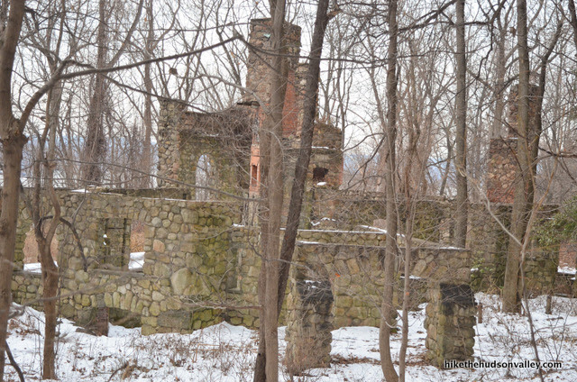
The sprawling ruins of Northgate, the Cornish Estate, serve as the most unique reward for doing the whole loop. You’ll find several interesting buildings here that you can explore, though there are no guarantees that something won’t collapse on you, so please exercise caution and ogle from a safe distance.
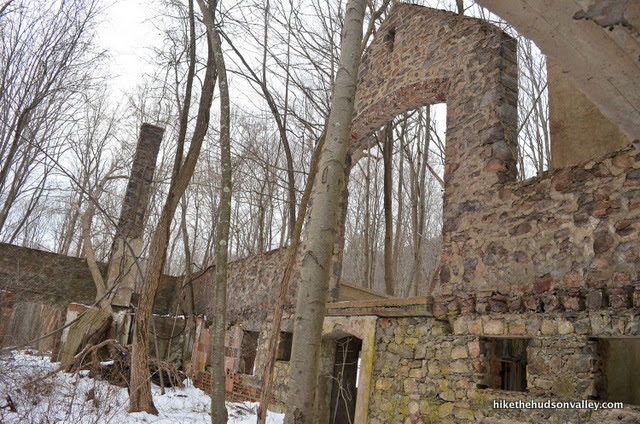
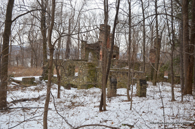
The estate, built sometime around 1907, was once the home of Edward Joel Cornish, who devoted his life to genetically engineering tiny, succulent chickens. For decades, the estate served as the world’s largest free-range sanctuary for the little hens that came to bear Cornish’s name. Some locals still speak in hushed tones about the evening that an experiment went horribly wrong, unleashing a gigantic rooster that stomped and pecked the estate into its current condition.
Actually, Mr. Cornish was president of the National Lead Company. He purchased the estate in 1917 and lived there until his death in 1938. The estate burned down in 1958. The ruins here are truly impressive – they must have been amazing in their heyday (you can see a nice historical photo of the mansion in this entertaining blog post).
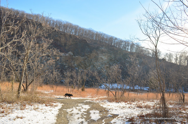
I decided to tackle this hike on a not-too-painfully cold day in December, when I had a vacation day to burn and the dog didn’t have anything better to do but hang out with me.
Perhaps there was a better way we could have spent that day, but probably not. If you’re looking for a challenging hike with beautiful views and several points of interest along the way, Bull Hill is the hike for you.
(Also, please forgive me for getting some re-use out of my original Bull Hill trail guide below – since I’ve already written up some of this hike, I’ll be plagiarizing myself in this trail guide for much of the first bit, switching over to original content once the routes diverge.)
Trail Guide
Bonus unsolicited advice: Don't depend on having cell service in the woods - it can be spotty out there! Download this trail guide to your phone before you head out. (It's easy to do on iPhone and Android.) May your connection to nature be strong, even when your connection to the internet is weak.
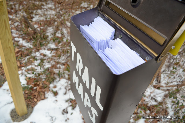
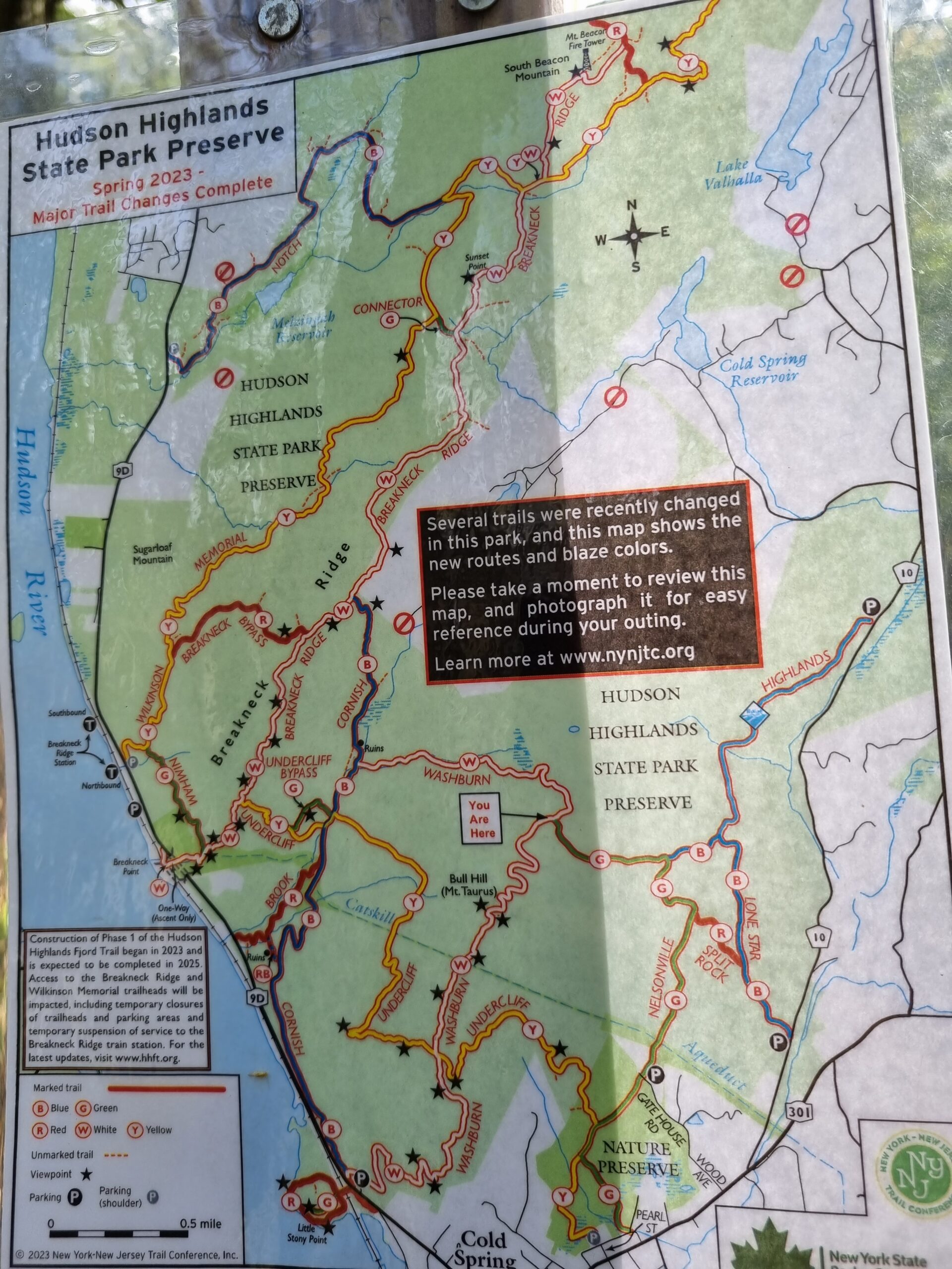
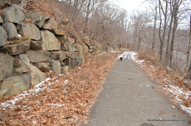
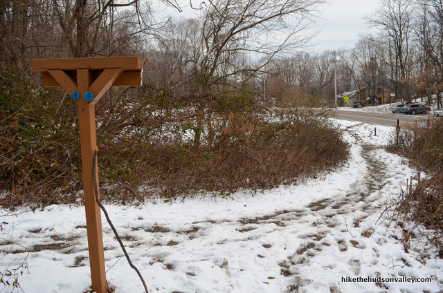
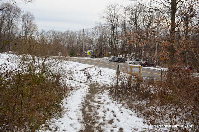
1. From the Bull Hill parking lot (see “Directions to the trailhead below”), begin your ascent on the white-blazed Washburn Trail. Check out the trail map box before you begin. If you’re the planning type, you could also print out a Hudson Highlands trail map before you come here. (If you snag a map from the box, it’s good karma to put it back at the end of the hike.)
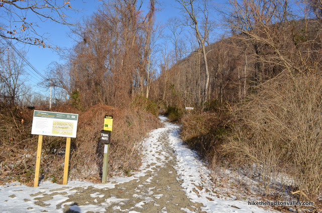
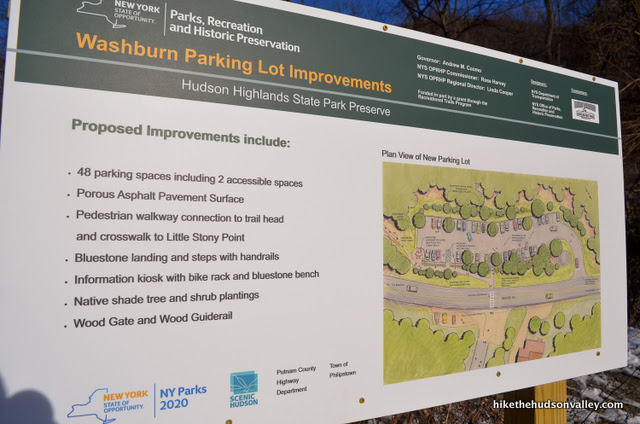
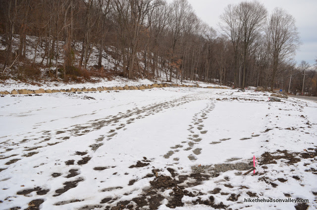
The parking lot was under construction during my most recent visit in December 2016 (I parked across the street at Little Stony Point). If construction is complete when you visit, enjoy the awesome new parking lot, person of the future!
2. You’ll immediately come to a well-marked junction with the blue-blazed Cornish Trail, which is where our loop begins (and ends). Stay right on the White (Washburn) Trail.

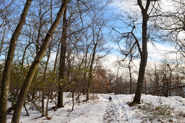
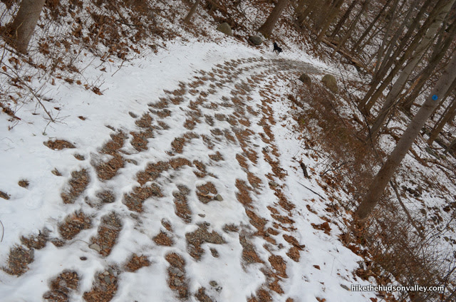
3. Ascend through a deciduous forest for about ten minutes as you approach an old abandoned quarry. It’s about .4 miles and 150 vertical feet from the parking lot to the quarry.

4. Emerge into the old quarry and take a look around. The low grasses and small trees make this place feel like a savanna. I always expect to see gazelles hopping around in here, but so far, my search for the elusive Bull Hill gazelle has yielded only disappointment. Good thing it’s such a cool place otherwise.


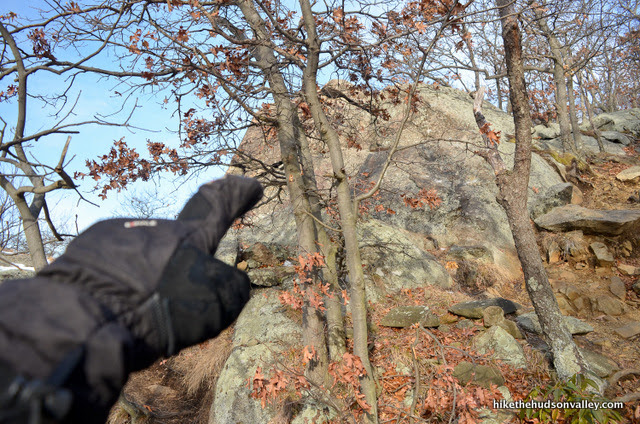
Right at the entrance to the quarry, the trail takes a hard right (almost a U-turn), while an unmarked trail heads into the quarry. Turn right here to continue ascending on the White Trail.


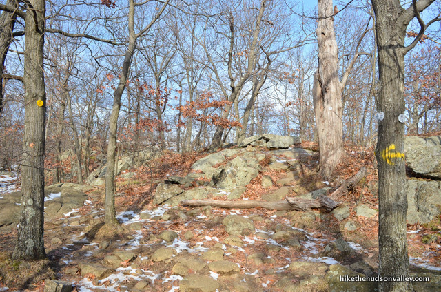
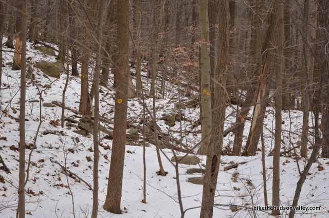
5. Now the serious climbing begins. Our next point of interest is Table Rocks, at which we’ll arrive in another .3 miles and 297 vertical feet. It took me about ten minutes to get there. (It can be easy to lose track of the trail markers in this section – the correct trail isn’t always obvious, as the White Trail has been rerouted here and it’s easy to step off onto an old unmarked section of trail. You’ll want to very carefully play a game of “Find the Next White Blaze” as you ascend.)
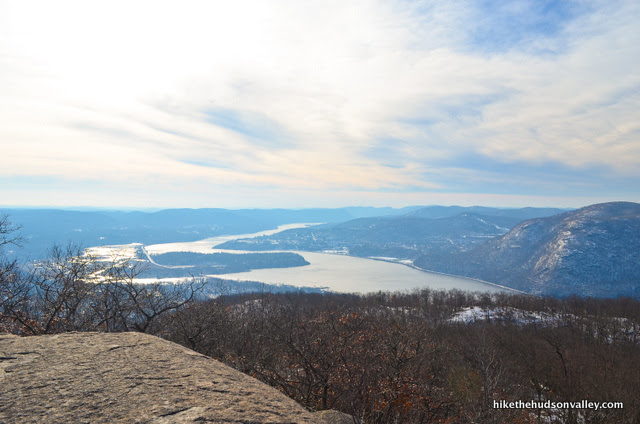
As you ascend, keep an eye on your right for the rocky outcropping that affords a very nice view of Cold Spring, West Point and the river valley beyond. If you’re feeling lazy, nobody would blame you if you decided to make this your final destination. Table Rocks would qualify as a grand finale anywhere else.


6. From Table Rocks, we’ll continue climbing around the quarry, eventually heading past it and up the hill beyond. It’s .6 miles and nearly 600 vertical feet to our next milestone: the junction with the yellow-blazed Undercliff Trail. Happy climbing! Keep following those white blazes, and we’ll see you at the junction with the Yellow Trail.
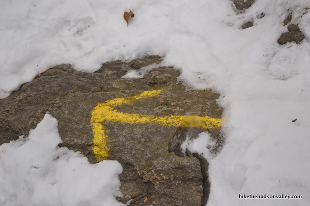
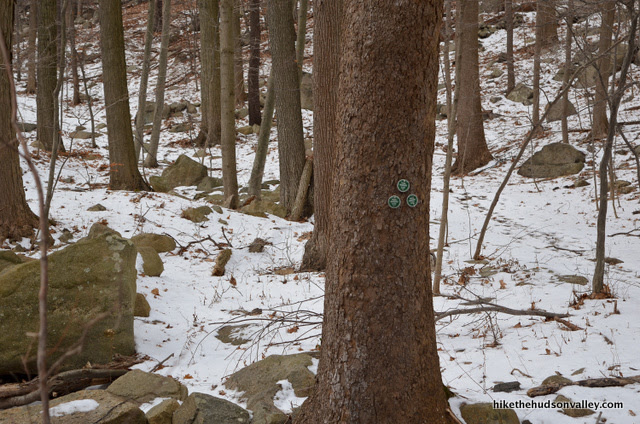
7. When you arrive at the White Trail and Yellow Trail junction, you’ll find it marked with blazes and spray-painted arrows.

We’re going to continue straight on the White Trail here, but it would be trail-guiding malfeasance not to mention the nice views that you COULD see if you wandered to your left down the Yellow Trail for about .3 miles.


Since we’re already tackling such a large hike today, we’re officially skipping that extra jaunt, but you COULD turn left here, keep following the yellow blazes until you come to a rocky viewpoint that lets you look up the river to the north, then turn around and come back to this Yellow/White junction (if you do this extra bit, and you find the Yellow Trail bending hard to the right, heading back towards Bull Hill and away from the river, you’re going too far). You COULD do that, but you could also save those calories for the continued climbing ahead. Whatever you choose to do, no judgement from me! Do your thing (or don’t), and let’s go to the next step.
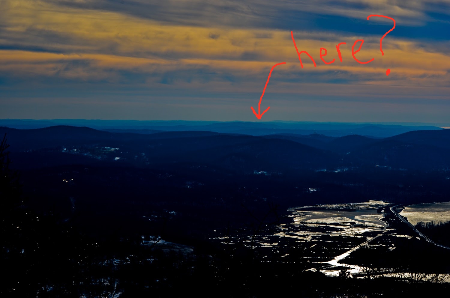
8. From the White/Yellow junction, head uphill on the White Trail. The best viewpoint on Bull Hill is .21 miles and 180 vertical feet from here.

***IMPORTANT UDPATE POSTED MARCH 2020***
The following two steps (9 and 10) detail how to visit an unmarked, off-trail viewpoint that I have been calling the “money spot” for many years. Evan Thompson, Hudson Highlands State Park manager, reached out to me recently to ask me to amend these instructions — people have been getting lost trying to find this spot. Besides, it’s generally bad practice to wander off-trail, or to encourage others to do so, and I *think* this is the only trail guide on this entire site where I do tell people to go off-trail, since it seemed to be a travesty to climb Bull Hill and miss the awesome view at the top.
Fortunately, I got this awesome update from Evan a few days after we started emailing each other:
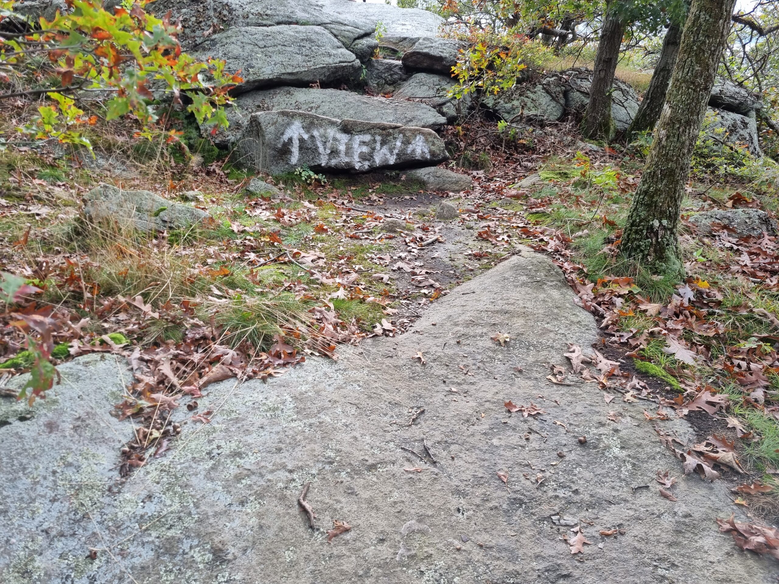
“There is [another] view right off the trail to the south at that location that: has a wider and better view, can accommodate more people and is safer. For now, we spray painted, “view” on a rock that leads to the new $$$$$ spot.
So, if you could update your article to reflect this information, that would be great. And we’ll leave the old spot to the fence lizards and rattlesnakes.”
Please look for the NEW AND IMPROVED MONEY SPOT on your next Bull Hill hike! I need to get back out here to visit it for myself. I’ll get this trail guide updated as soon as possible with the new details and pictures. In the meantime, I’ve put Steps 9 and 10 in strikethrough — please disregard them, and keep a sharp eye out for the painted sign to the new Money Spot!
And a special thanks to Evan Thompson for helping us all find the new Money Spot, and keeping us from wandering around lost in the woods! (After visiting the awesome new spot, you can resume the trail guide at Step 11 below.)
9. READ THIS STEP CAREFULLY OR YOU’LL MISS THE WHOLE POINT OF CLIMBING BULL HILL! The trail doesn’t take you to the best viewpoint on Bull Hill if you aren’t looking for it. You have to wander about 30 feet or so off the White Trail to get there.
It’ll take just shy of ten minutes to reach the viewpoint from the White/Yellow junction at a casual pace. Keep a lookout on your left for some boulders that you can’t see past. That’s where the action is.

On my most recent trip here, I hadn’t been to Bull Hill in a few years, and I walked right past the viewpoint.
I had to circle back to find it, after much cussing and befuddlement. I’ve also watched several other hikers walk past this spot without stopping, not realizing that the most money spot on Bull Hill was just a few feet away. I wonder how many people come here and don’t know that they just walked right past one of the best viewpoints in the Hudson Valley. My point: keep a close eye out here or you’ll miss the spot altogether.
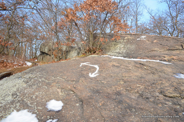
One hint that you’re getting close: you’ll see a white arrow painted on a rock in the middle of the trail. From here, it’s just a couple more minutes up the hill – you can almost see your destination through the trees.


When you get to the boulders on your left just a minute after that arrow, climb up on top. Get ready to plop down and enjoy the sweet fruit of your labor, and feel super awesome that you found a spot that so many people stroll right past.
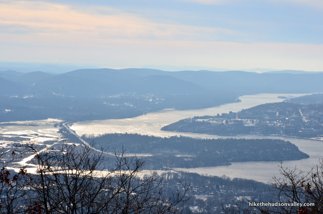
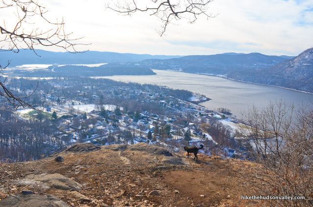
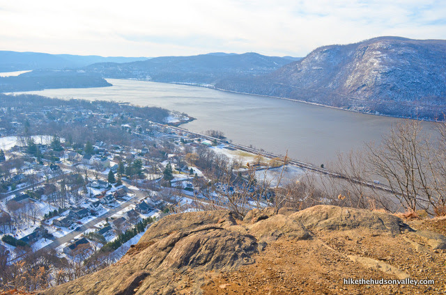
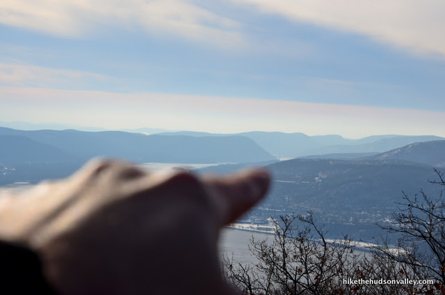
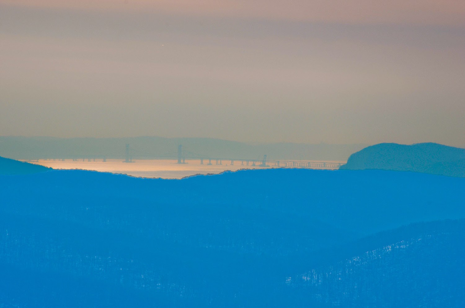
10. Look south to see the Hudson winding its way towards New York City, where the shad enter the river from the sea and dead mobsters enter from various bridges. This is one of my favorite views in the Hudson Valley.


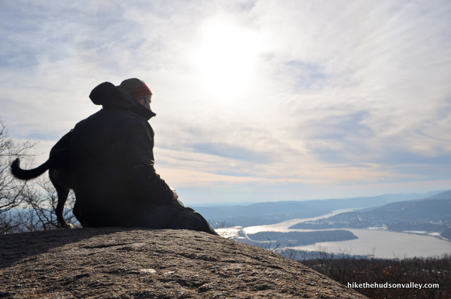
Straight across the river, the western Hudson Highlands smile back at you.


What an amazing place. This is the best view on this hike, so kick back, relax, and feel sorry for everyone who’s at work right now.
11. Once you’re done cashing in the view at the money spot, return to the White Trail and turn left to keep hoofing it in the direction you were heading.
You’ve come 1.6 miles so far, only 4.3 to go! (If it’s any consolation, those 1.6 miles were by far the toughest on this hike.) You’ve also climbed almost 1,300 feet, with only about another 100 or so vertical feet until the true summit of Bull Hill. Woo hoo! Let’s do this thing.
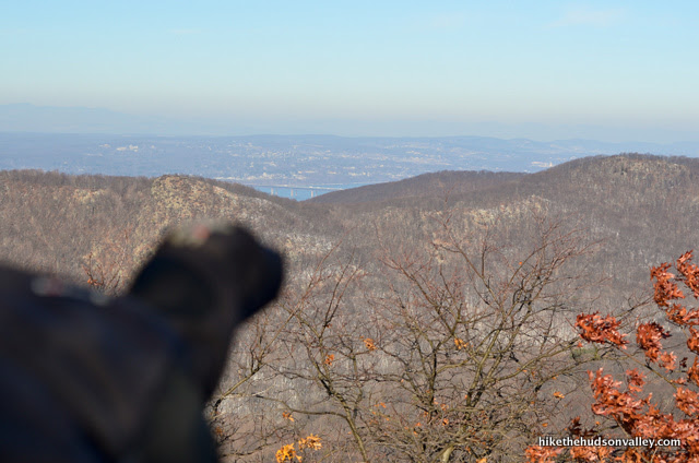
12. Next landmark to watch for: In less than ten minutes from the money spot, you’ll climb a little rock face with a curved arrow indicating a left turn.
Look just beyond that arrow to see *NYC painted on the rock.

Stand right on that asterisk and turn around. You won’t EXACTLY feel like you’re in Times Square, but on a clear day, if you squint (and/or have a serious zoom lens), you juuuuuust might be able to make out the NYC skyline on the horizon. (In the second image, I tried darkening things and cranking up the contrast to make the buildings stand out, and I THINK I see some buildings, but I definitely have a headache now.)
Do you feel a part of it, New York, New York?
With a little less squinting, you can see two Hudson River bridges from this spot. See ‘em?
There’s the eastern side of the Bear Mountain Bridge.
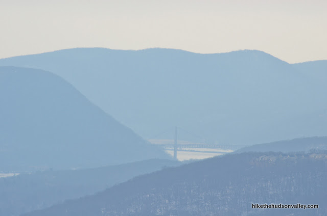
And the Tappan Zee.
When you’re done squinting and zooming, just keep chugging along on the White Trail.
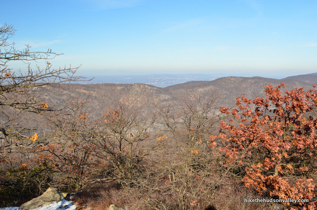
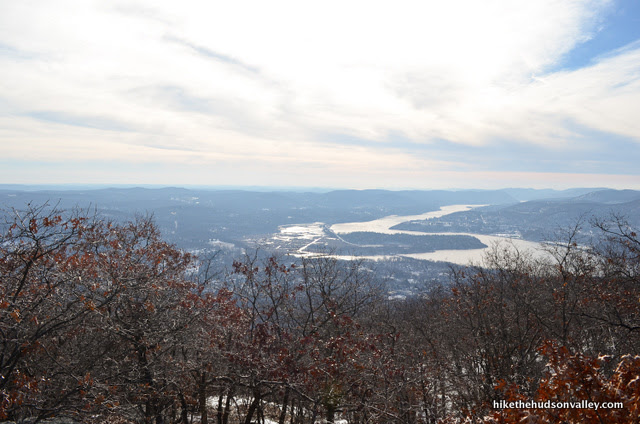
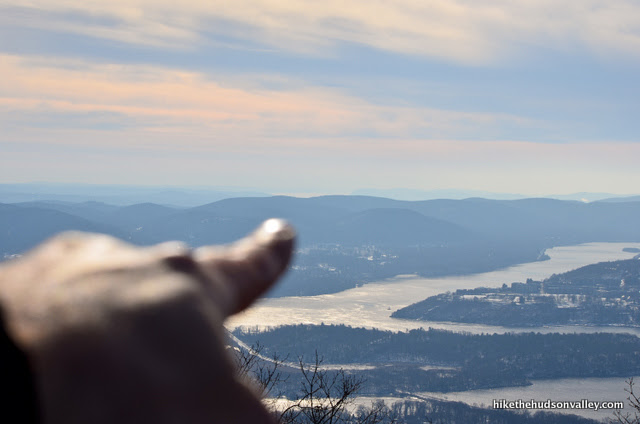
13. In less than ten minutes from the *NYC view, another view opens up to your left, this time looking north. If this isn’t the summit of Bull Hill, it’s very, very close. In any event, it’s all downhill from here. w00t!
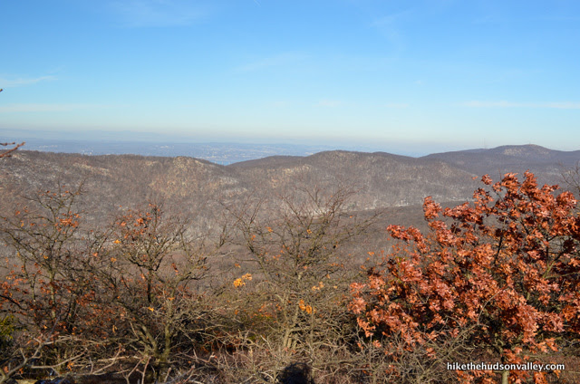
Hey! Another bridge! This time, the Newburgh-Beacon Bridge. You’re well on your way to collecting the whole set.
This is pretty much your last view for the day. Take it all in, then keep rocking and rolling on the White Trail.
**UPDATE NOVEMBER 2023** The blazes from this point forward have changed recently at Bull Hill, making the route much simpler to follow. The White (Washburn) Trail now extends further, and you simply follow it until it dead ends, then take a left onto the Blue (Cornish) Trail to return to your car. My pictures of the next section were out-of-date as a result, but fortunately, awesome hiker AG (he asked me to only use his initials so that he can keep doing good for strangers without having his identity revealed, like Batman) wrote to me with updated text and photos. I’ve updated the trail guide below accordingly, removing some of my pictures and updating the text to match the blazes you’ll find now throughout the rest of the loop. AG also generously gave me permission to use his photos below. We should be all up-to-date now — thanks so much, AG! We all owe you one.
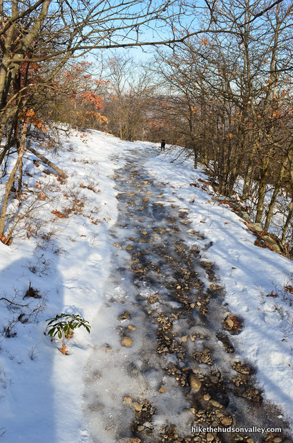
14. From the view at Bull Hill’s summit, it’s .6 miles downhill through some switchbacks to get to the next trail junction, when the Green (Nelsonville) Trail joins from the right. Took me just under twenty minutes to get there, treading carefully over some thin ice.
15. When the Green Trail joins from the right, you’ll find a helpful trail map posted at the junction.
Turn left/straight here to stay on the White Trail.
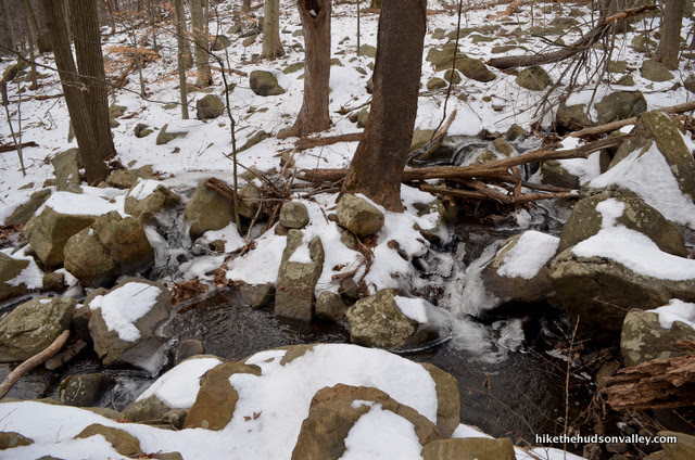
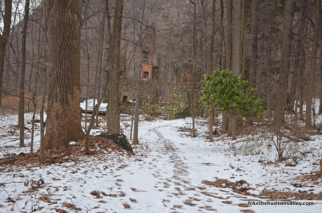
16. It’s about one mile to the Cornish Estate ruins from here (took me just under 30 minutes). After ten minutes or so, the White Trail takes a sharp left turn marked with double blazes. Otherwise, not much to note besides beautiful woods and streams – just keep rocking and rolling, following the white blazes.
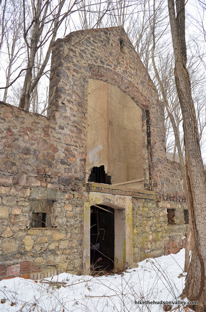
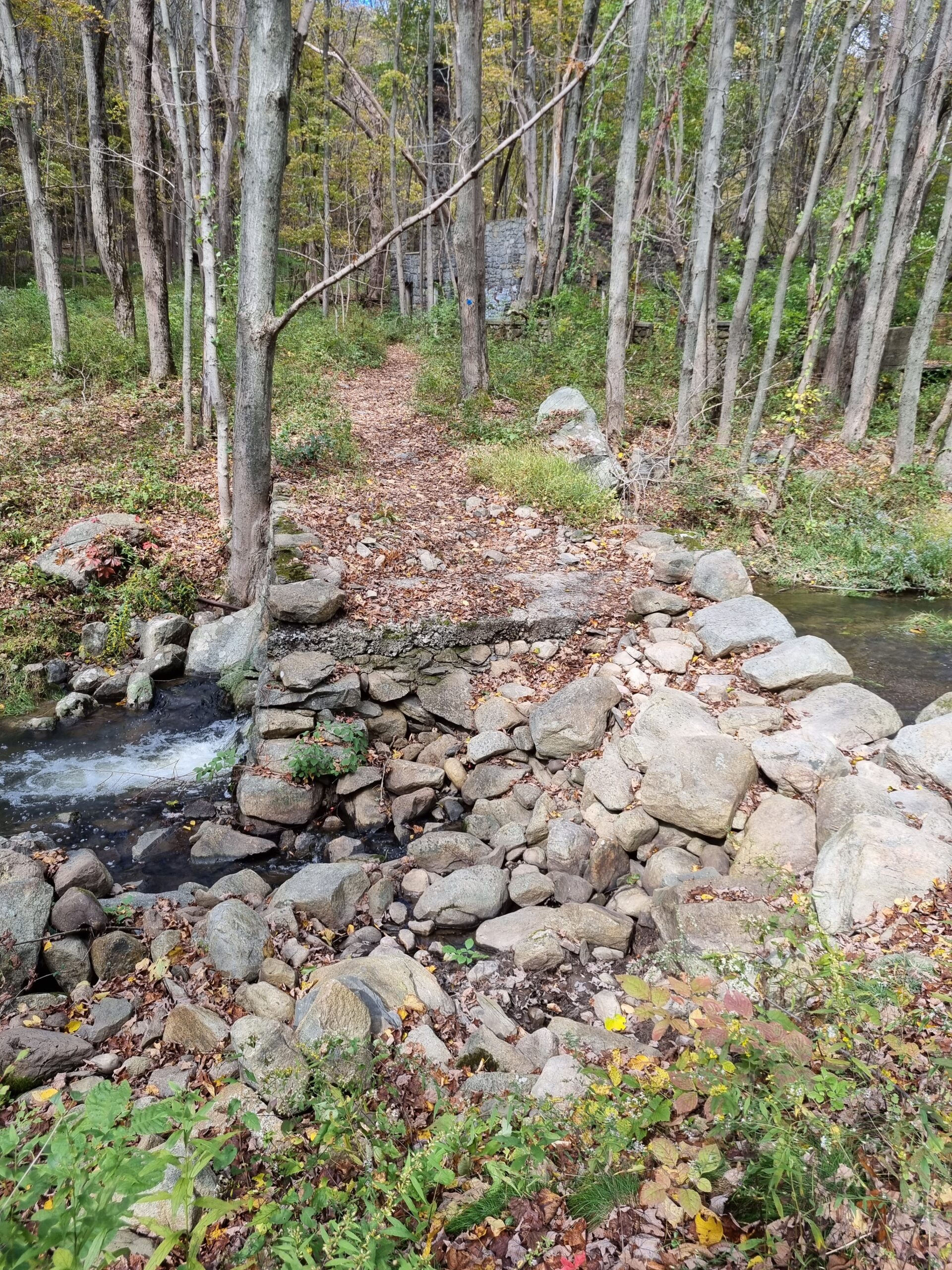
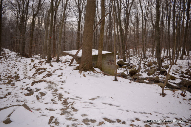
17. You’ll know you’ve reached the Cornish Estate ruins when you arrive at a stream crossing where the White Trail ends, and the Blue Trail heads downstream to your left (but don’t turn left here just yet).
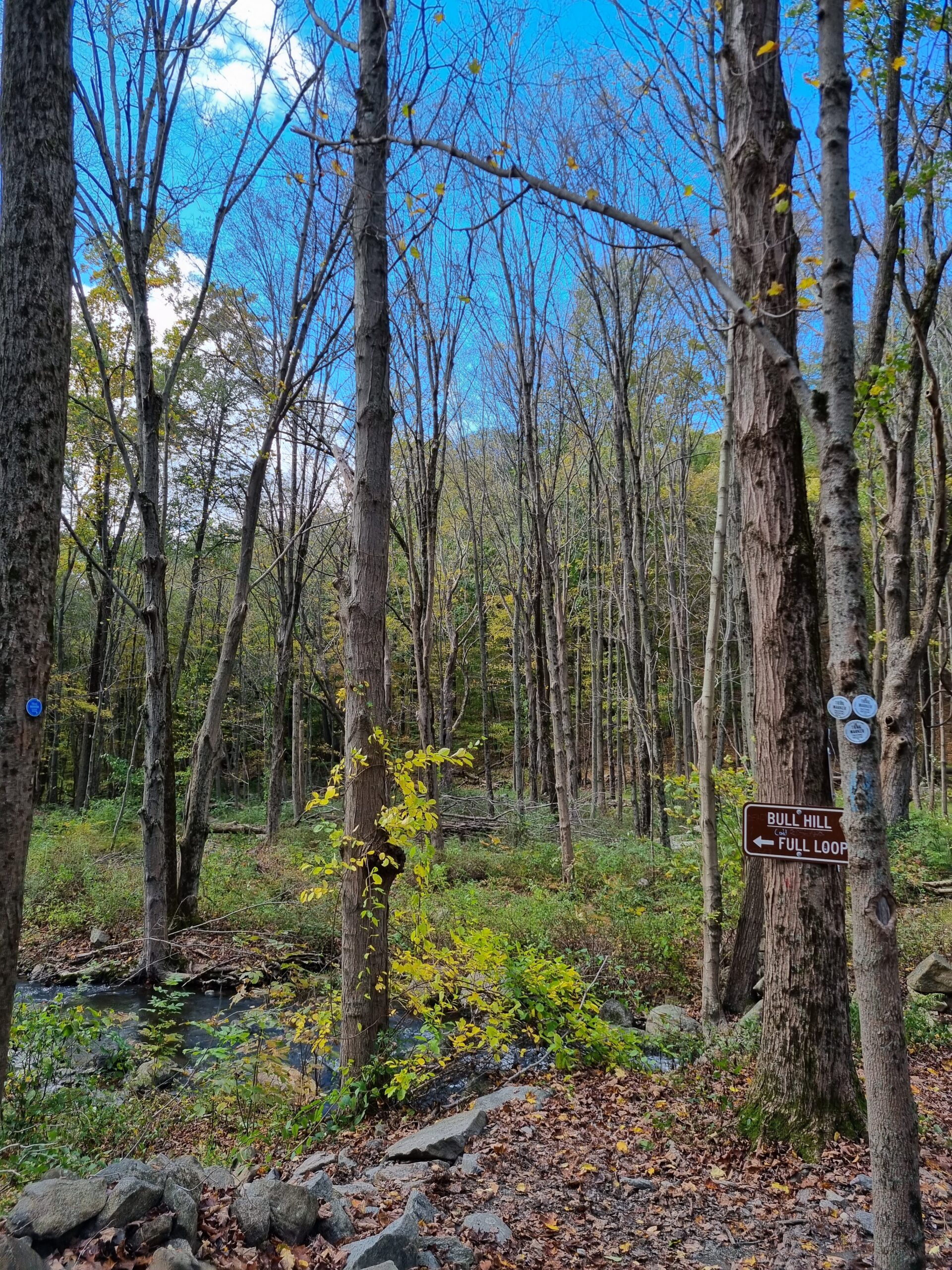
You’ll come back to this spot later, after you’ve checked out the ruins. You can pick your way across the stream here, then turn right to visit the ruins, but I recommend you head upstream through a break in a stone wall, following the blue blazes upstream for just a minute. Those blazes will lead you to an intact bridge across from the ruins, which makes crossing the stream much easier.
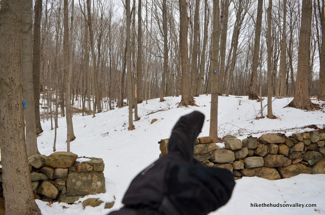
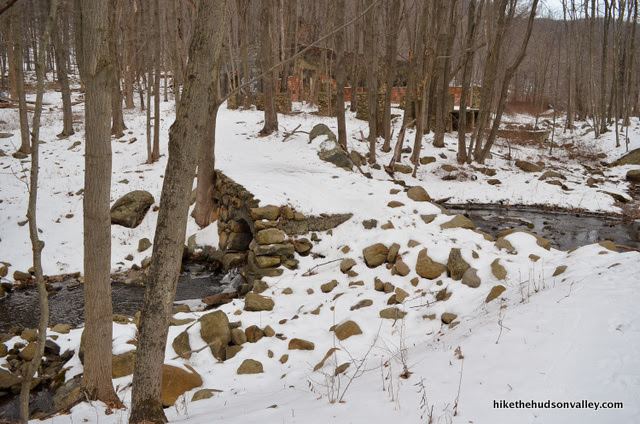
Hop across that bridge (or what’s left of it) and check things out!
**UPDATE November 2023** Time hasn’t been especially kind to this bridge, but it’s still there! Kind of!
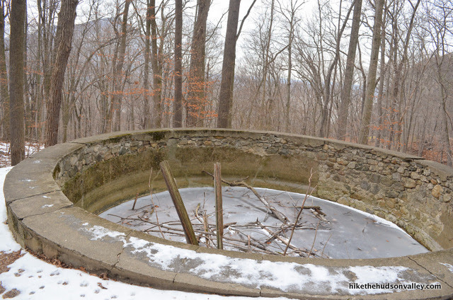
18. Interesting place, right? Carefully poke about – I strongly recommend that you do NOT enter any of the buildings, especially not the ones with ceilings or roofs still somewhat intact. This area was apparently part of an elaborate cattle barn operation, where Mr. Cornish kept some fancy cows.
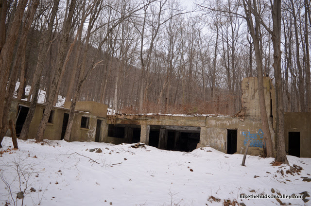
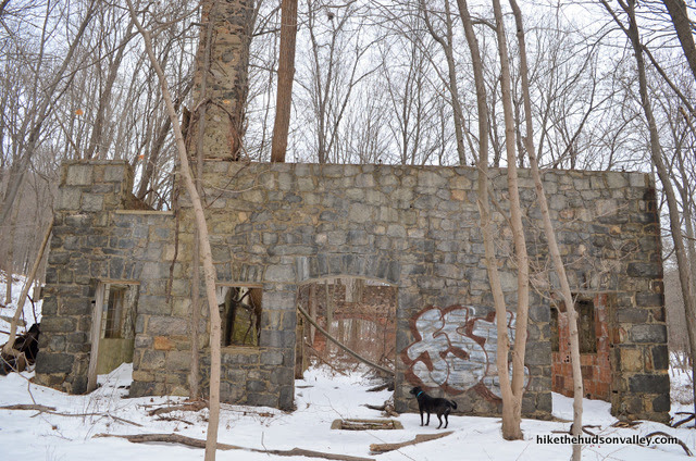
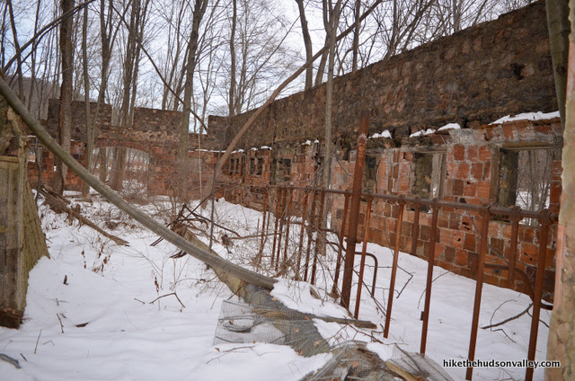
These facilities must have been awesome in their day. As any homeowner can attest, though, this is what happens when you stop maintaining a house for, like, six months.

19. When you’re done NOT getting killed by falling concrete and/or the Blair Witch, return to the Blue/White junction. A helpful sign tells you to head downstream to follow the Bull Hill Full Loop, which is exactly what we’re doing here.
Hop on the Blue (Cornish) Trail and enjoy some creekside strolling.
20. In .3 miles, you’ll see the Yellow (Undercliff) Trail splitting off to your left.
Keep heading straight on the Blue Trail.
21. Immediately thereafter, you’ll see a picturesque bridge spanning the creek, where the Yellow Trail crosses the bridge to the right.
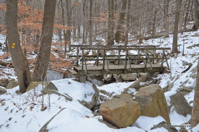
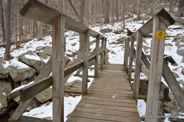
While you should NOT cross the bridge, it’s a nice spot to hang out for a minute and enjoy the cascade that flows underneath.
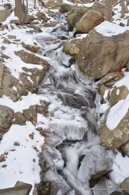
When you’re done enjoying the bridge, continue downstream on the Blue Trail.
22. In a couple of minutes, you’ll pass another a concrete outbuilding, where a green-blazed trail splits off to your right. If you notice that trail, just ignore it and keep following those blue blazes.
23. In just a few more minutes, you’ll arrive at a very well-marked fork, where you can choose between following the Red Trail to the right (toward “Tunnel”) – don’t do this – or take the left fork toward Cold Spring and the Washburn Trail. DING DING DING! That’s the winner! Winner, winner, tiny little Cornish chicken dinner!
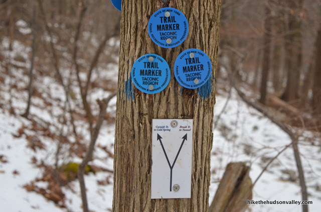
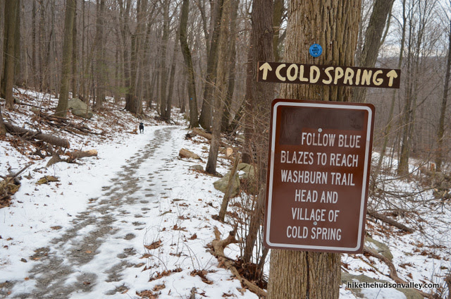
Take the left fork here to follow the blue-blazed Cornish Trail toward Cold Spring.
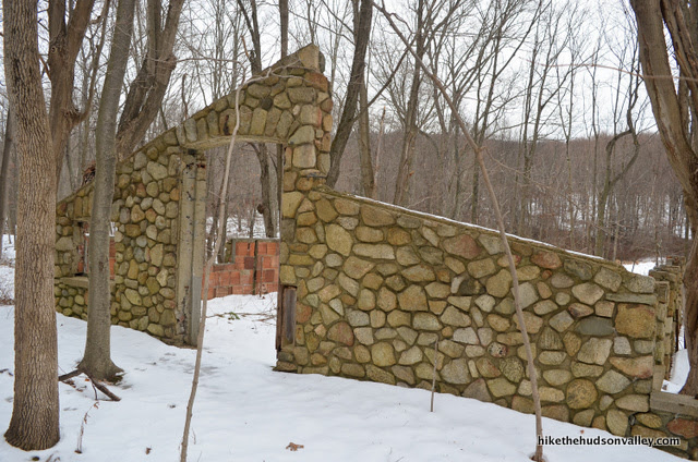
24. The trail widens and becomes smoother through this section. You’ll see more traces of the sprawling Cornish estate as you go, too. (The Olde Cornish Hot Tub was looking a little chilly when we strolled past.)
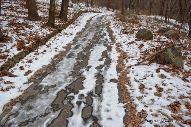
Shortly after the hot tub, the trail becomes a paved path.
In another moment, you’ll see perhaps the most impressive ruins of the day to your right. An old driveway joins the Blue Trail, giving you easy access to the ruins, if you’d like to get a closer look. (I was all ruined-out by this point, but you should feel free to ruin it up, if you aren’t already ruined for ruins.)
25. From those estate ruins, you’re about one mile from the end of the hike. Just keep hoofing down the hill, enjoying the stroll and the sights as you descend closer and closer to Route 9D, which reminds you what civilization sounds like. (VRROOOOOM, is what it sounds like. Just relive your memories from earlier in the day and try to tune it out.)
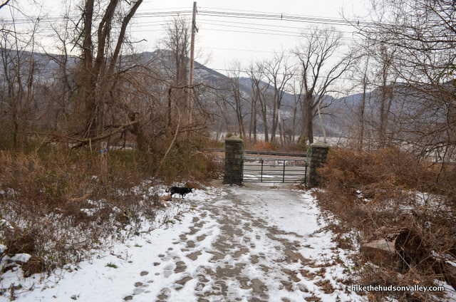
When the Blue Trail dumps you off at a gate that opens onto 9D, turn left just before the gate to continue toward the parking lot.
In just five more minutes, voila!
Hello again, nice new parking lot! Thanks for letting our cars hang out here while we had better things to do.
Congratulations on busting out the entire loop! I hope you enjoyed your day at Bull Hill, and can create an opportunity to eat at least four slices of pizza tonight. Or perhaps a few Cornish hens?
Directions
Directions to the trailhead: From Beacon, head south on Route 9D. In less than five miles, you’ll pass under a tunnel at the trailhead to Breakneck Ridge. About one mile after that tunnel, you’ll see the well-marked parking area for Little Stony Point on your right. Park in the spacious lot directly across the street, on your left heading south. If you enter the village of Cold Spring, you’ve gone just a few hundred yards too far.
You can also get directions by checking out the Bull Hill (Mt. Taurus) II: Full Loop entry on the HiketheHudsonValley.com Google map.
Sorta nearby address for your GPS: The intersection of Fair St and Route 9D in Cold Spring, NY is directly south of the Bull Hill parking area (the parking area is immediately north of that intersection, on the east side of Route 9D).
GPS coordinates of parking area: 41.42659, -73.96534 (Clicking will open in Google Maps or the Apple Maps app, depending on your browser/device.)
Resources & Interactives
Super-cool Google Earth flyover of hike route:
Google Terrain Map of hike route:
Related resources: If you’re looking for actual facts and/or useful information, visit these resources:
- The informative Bull Hill Wikipedia page that gives an interesting explanation for how this mountain got its name
- The official NYS Parks map for this area
- A nice write-up for this same hike on the New York-New Jersey Trail Conference Bull Hill page (pretty sure that 4.8-mile estimate is a lowball, though)
- This same hike detailed on Localhikes.com, with plenty of user reviews
- This dude’s page where he posts a nice 12-minute video of his Bull Hill hike. If he planted the camera by himself in all those places, he must have walked 20 miles that day. Also, he missed the money spot, just like I warned about in Step 11! The trail should really take you directly there. Oh well, you’ll feel cooler when you find it now, like those nightclubs in LA with no signs.
- A nice write-up for this same loop on NYCdayhiking.com
- Another nice write-up for this loop, on which they also appear to have missed the money spot.
- People seem to dig making videos of this hike. Here’s another one. Watching now to see if they find the money spot. Watching….watching…They missed it! “There’s nothing going on on this hike.” Unless you know where the awesome money spot is! It really should be marked. I strolled right past it the first time, too.
- Blammo! Jeremiah didn’t miss the money spot! Check out his very cool video of a beautiful winter hike at Bull Hill, complete with panorama of the money spot beginning at about 2:18.
- An informative write-up on Northgate, the Cornish Estate ruins, from Hudson Valley Magazine
- More good info on the ruins from Atlas Obscura
- Not ruined for ruins yet? Find more pics and information on the Cornish ruins from Untapped Cities.
- More ruin info? Seriously? Okay, okay, there’s the Northgate entry from HudsonValleyRuins.org, and this blog post with some cool pics and stories. I believe we’ve sufficiently covered the topic now.
Want to support trails in the Hudson Valley? Here’s one great way: Visit the New York-New Jersey Trail Conference homepage and click on Volunteer, Donate, or Shop! (Then you can volunteer, donate, or shop, depending on your mood.)
Did this loop yesterday but extended the mileage by a mile and elevation gain by about 500 feet …. Instead of completing the loop on the Cornish trail I branched back on the undercliff trail and then back down the Washburn trail to the quarry. This meant I got views to end the hike rather than ruins. The Cornish trail has a lot of rubble and run off from the recent storms and I wasn’t enjoying having to pick my way along loose rubble and a washed out trail.
Overall it is a really nice trail great views on and over Bull Hill and then a really tranquil section down the back of the mountain
Did the full loop on Sat 4/17 – It was a bit challenging on the uphill, very peaceful and tranquil downhill. Overall an awesome and fun trial. As usual, the trail directions were spot on. I almost missed the “new” money spot (#8) as the writing “VIEW” on the rock was covered up by 2 logs. It looked like it was purposely done – not sure why someone would do that. Great views. I did this trail in the summer last year, so was surprised by how full the streams were this time. It added another level of serenity hearing the water and seeing all the various streams merge. The trail was much muddier than I remembered it but nothing too deep. Also, they have made changes to the trail after passing the quarry, added steps, and taken it away from the quarry edge at some parts. Full loop took 4 hours with stops for lots of pics.
This is the new link to the NYS Parks Dept Hudson Highlands Trail Map North, if anyone was interested.:
https://parks.ny.gov/documents/parks/HudsonHighlandsTrailMapNorth.pdf
Why are #s 9 and 10 crossed out? Read the whole thing so apologies if I missed the explanation! Thanks for these write-ups, I’m dying to get out and hiking again during the pandemic, but don’t want to travel from the city area on the weekend just to hit crowds or half-closed parking lots. Will have to take a day off mid-week.
Hi, Christine! The update in italics directly above Steps 9 & 10 is meant to describe why those steps are crossed out – namely, that the park manager reached out to me to provide a better, safer alternative for a “money spot” on Bull Hill. I’ll take another look tonight and clarify that section, so nobody gets surprised by the new alternative to Steps 9 & 10. A weekday visit is probably a great idea – it has been quite crowded on weekends in that area. Good luck when you visit – hope you have a great trip!
Hey Mike, did this hike today. Your website is great! Trail markings and turns all so accurate. Can’t believe I’ve lived in the Hudson valley my whole life and just discovering these awesome hikes thanks to your site! So many cool places to go, look forward to experiencing all the hikes you have listed here. Thank you
That’s so wonderful to hear, George! Thanks so much for the kind words, and happy exploring!
I hadn’t been here for a couple years, but made the trip today. Firstly I almost missed the parking lot because there’s a new entrance 50 yards or so closer to Cold Spring. As someone mentioned it’s now paved, there’s a ramp down to a crosswalk to get to the Little Stony Point trail too. But wait! Porta Potties, new ones. A nice info kiosk, new clearer signs. Is that all? No! A neat little park office across the street. The Cornish Estate has some informational signs and the trail connecting the parking lot to the Cornish trail has been greatly improved. It’s like our little Bull Hill is all grown up now.
5/24/19 they are doing some major trail work just above the quarry. Stop and say thanks if you can as you huff and puff your way past.
I think they may have rerouted he white trail to hit the money spot. I found it with no problem right off the white trail with a little footpath to the boulders.
Absolutely love this site, guys! It helped inspire my passion for hiking (I think I did a hike in the HV on every weekend between July and September last year).
What are the conditions of the trails now?(specifically Bull Hill). I know this year has given us the most bizarre weather possible, so I wanted to make sure my buddies and I were adequately prepared for hiking. Is there still a lot of snow?
Hey Michael, adding a +1 to your love for this site! I did this hike yesterday and all the snow has melted. Be prepared for a slightly mushy/wet trail for the last half (especially the Blue Trail portion), but it was still an awesome hike. Have a great time!
I usually do the “Money Spot” and return hike, but I went this weekend and midway decided what the heck and did this full loop. Though I wish I knew you had posted this guide (I’d only ever read the other Bull Hill guide) as it was way longer than expected. Anyway, the biggest question I was left with, which may be incredibly stupid, was at your point 23. I was quite tempted to go towards the “Tunnel” but 2 people I met on the trail advised against it. What is this “Tunnel”? Is it an actual Tunnel? Is that just a clever name for a path? A fancy way of saying connector to Breakneck?
Oh, I realize now that this probably means that tunnel when you’re driving towards the start of the Breakneck Trail. Glad I had this convo with myself.
Hey, Chris! That’s right – those people gave you good advice. It’s just the tunnel on Rt 9D, at the Breakneck trailhead. Hope you enjoyed the trek – congrats on busting out the whole loop!
Thanks for being such a fantastic resource over the years!
If you’ve ever wondered who Breakneck and Bull Hill got their names, one of our DJs investigated: https://youtu.be/eUwy1q40fjI
After climbing Bull Hill the old fashioned way a couple of times, I decided I had enough gas left in the tank to keep going and did this loop. The hard part is getting up Bull Hill, after that it’s all downhill and the last part is even paved. That means you won’t have to worry about tripping over any roots or rocks when you’re losing steam. I wouldn’t rate this any harder than Bull by itself, the remaining distance tacked on is a rather pleasant stroll. Plus you have the cool Cornish Estate and Farm ruins to distract you.
The last time I was on this trail there was a little surprise not long before you get to the Farm ruins. I don’t want to spoil the surprise, as it works better visually if you just happen upon it.
This is one of my favorite places to hike, just because you have so many options. I have several penciled in to try. One is that when you get to the bridge in step 21 you could hang a right on the yellow trail and head over towards Breakneck Ridge. Another is that you could hang a left on the yellow trail and climb BACK to the top of Bull Hill. You’ll end up at the junction in step 7 where you can go back down the white trail to the quarry. I have not done either of these…yet
If you want to get to the top of Bull Hill from the South East side, you can park in Phillipstown/Nelsonville on Secor St. and follow the Nelsonville footpath to the summit. As I recall you come out at the Yellow/White junction in step 7. I went back down the same way, but there a number of other loops. This climb is less steep than the traditional route and much less traveled. I described to someone as the backstage area for Bull Hill. I half expected to see bears relaxing with a beer before their next shift on the mountain nodding to me as I walked by.
I just noticed that on the Google Terrain Map above the Nelsonville footpath is designated by a white dotted line that does indeed join at the yellow/white junction in step 7.
I’ve done most of the configurations you described in your comment, Jeff. And here’s what I found (just my opinion, mind you):
1. The Nelsonville trail to the junction of the yellow and white trails is not really worth doing. It’s a gradual ascent with not much to see. And the day I went it was super-buggy. Never did it again.
2. I hiked the entire loop once and didn’t think it was worth the effort. Not much to see.
3. Once I went up Washburn (white trail) to the money spot and then doubled back, turned right on the yellow trail and actually crossed the bridge and went up Breakneck on the yellow trail. There were one or two scenic points but given that by the time you reach the Breakneck trail, there’s just one scenic view, I didn’t find it worth the effort. But on balance, it was more rewarding than 1 or 2 (previously mentioned).
4. What I usually do now (and what I find best) is to climb to the “money spot,” from Stony Point, do a little bushwacking in the money spot area, and then double back and rather than descending the way I came when I meet up with the yellow trail, I turn right and continue north toward Breakneck. There are two very nice views – one of Breakneck itself before you enter the woods and descend gradually – going by the stream and ruins.
Just my two cents here. YMMV but this is what worked for me.