Background
If you find this free trail guide useful, please provide payment by picking up at least one piece of litter on your hike. Cha-ching! Thanks for being awesome! (And here’s a quick primer on Leave No Trace, too, to help us keep the trails nice and fresh for each other.)
Pooch proclivity: Dogs are allowed here, but I didn’t bring mine, and that was definitely the right call for us. As much as I love hiking with her, besides the very rocky trail that would have been rough on her lil’ tootsies, there are several very steep spots where she would have needed to be carried up or down.
If your dog doesn’t have horns and hooves, and is not an actual, literal mountain goat, you might be well-advised to leave her at home for this one. (Or at least scope it out for yourself the first time you come here, and bring her next time if you think she can handle it.)
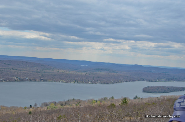
Background you can feel free to skip: This trail guide is titled Surprise Lake II (via Greenwood Lake overlook) to keep it consistent with my previous Surprise Lake (via Bearfort Ridge) trail guide, but giving Surprise Lake main billing on this hike is kind of like making an awesome Batman movie and calling it “Commissioner Gordon Returns.” The main event here is not Surprise Lake at all, but the expansive overlook of Greenwood Lake from a wide-open, rocky perch.
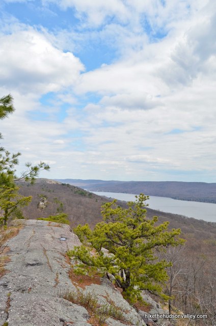
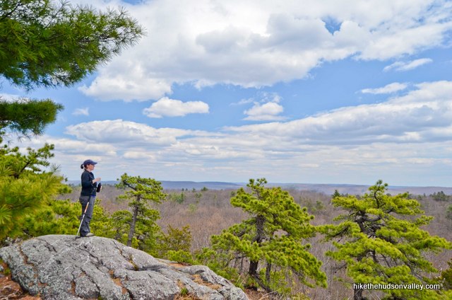
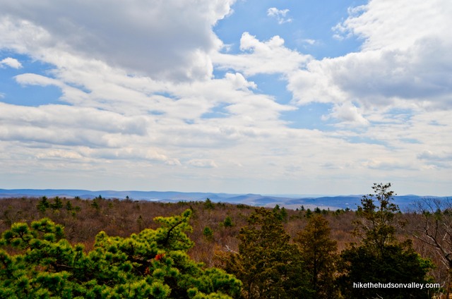
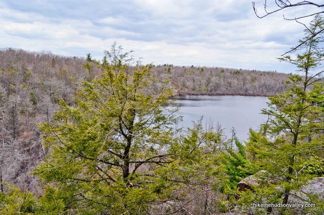
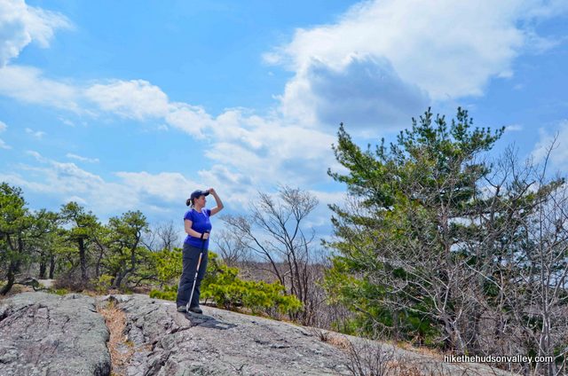
Here’s a panorama from the money spot:

What an awesome place. If this view had just completed an eBay transaction with me, here’s the feedback I would give it: A+++++. VERY TRUSTED VIEW!! WOULD VIEW FROM AGAIN!!!!!
My wife and I burned a day of vacation to come here on an early spring Friday, and it really did feel like we escaped for a one-day, zero-night vacation. After coming off the trail, you can bum around the Village of Greenwood Lake (a very short drive away), or take a scenic drive around the lake’s edge. (Greenwood Lake is nine miles long and within easy striking distance from most points in the Hudson Valley. If you’ve never been, it’s worth a visit just to see the lake and surrounding areas.)
The hike documented below is the one I meant to take the first time I came here. A friendly reader commented that I should check out Surprise Lake, and her description sounded intriguing (thanks, Megan!). As I found out after I completed my first Surprise Lake hike, though, there are two loops that visit Surprise Lake (with a fair amount of overlap between the two), and, without realizing I’d made a choice, I’d chosen the less awesome one. Situation rectified!
Surprise Lake hikes are like the Tobey Maguire Spider-Man movies – the first one is perfectly acceptable, but the second one is where you’ll find most of the awesomeness. (And we won’t bother with a third one, since we all know how that turned out.)
This hike starts with a steep climb up to the Greenwood Lake overlook (you could turn around at the overlook, if you wanted, making this hike a 1.7-mile out-and-back venture instead of a 4-mile loop, but you’d be missing out on some nice trails, sights and small rock scrambles beyond the overlook).

I recommend you do the whole loop at least once, but the Greenwood Lake overlook is most definitely the primary money spot on this hike.
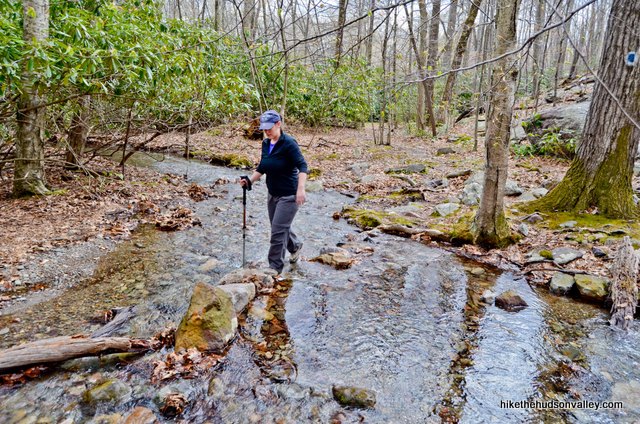
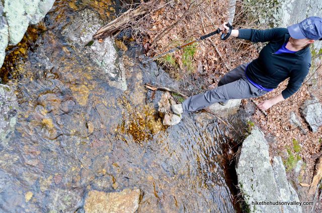
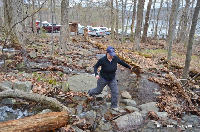
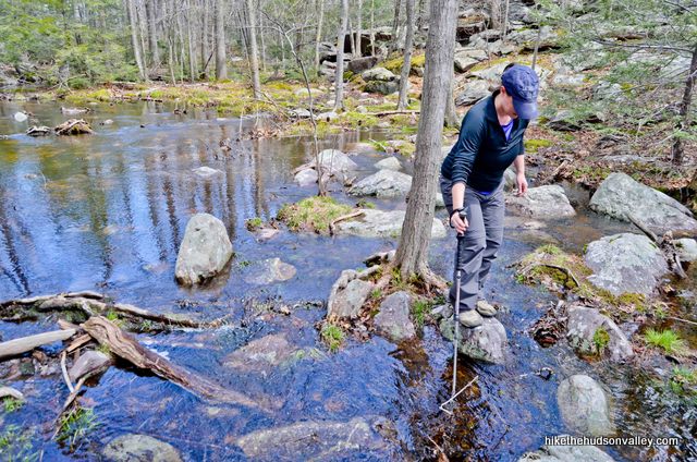
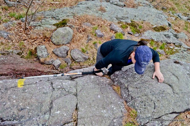
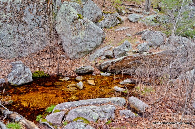
One more note: We visited this spot after several days of drenching rainfall, and we were VERY glad to have some hiking poles (one each) to help us balance across several stream crossings and other wet places. It’s not critical to have them, and the trail was much wetter than usual during our visit, but man, they were nice to have that day.
Before we get to the trail guide, did we hit all the relevant information you need to plan your hike here? Batman. eBay. Spider-Man. Hiking poles. Check, check, check, check.
Okay, let’s get to it!
Trail Guide
Bonus unsolicited advice: Don't depend on having cell service in the woods - it can be spotty out there! Download this trail guide to your phone before you head out. (It's easy to do on iPhone and Android.) May your connection to nature be strong, even when your connection to the internet is weak.
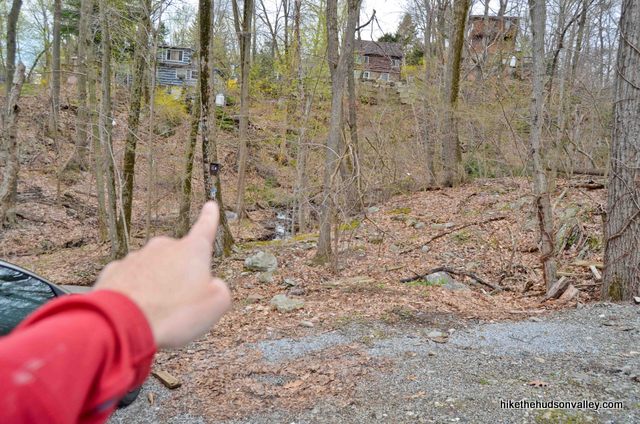
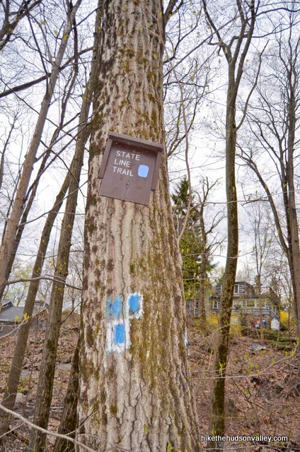
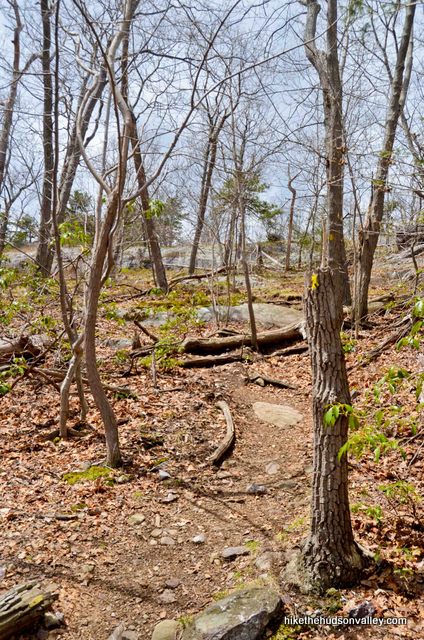
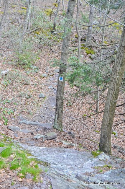
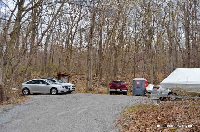
1. From the parking lot at the Greenwood Lake Marina (see “Directions to the trailhead” below), you’ll find some blue-and-white-blazes on the left side of the driveway (assuming you’re heading away from the lake, uphill). This is the official start of the trail, with a small State Line Trail sign in the woods just beyond.
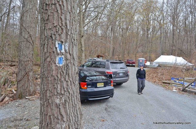
You can also start your trek just behind the kiosk at the top of the parking lot – you can pick up the blazes here, too, though this doesn’t appear to be the official way to do it.
However you choose to get started, pick up the scent of those blue-and-white markers and start heading uphill. Onward and upward!
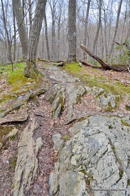
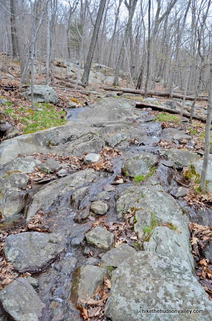
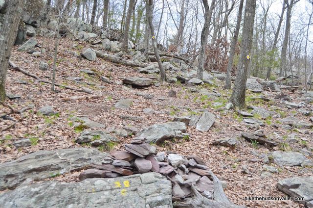
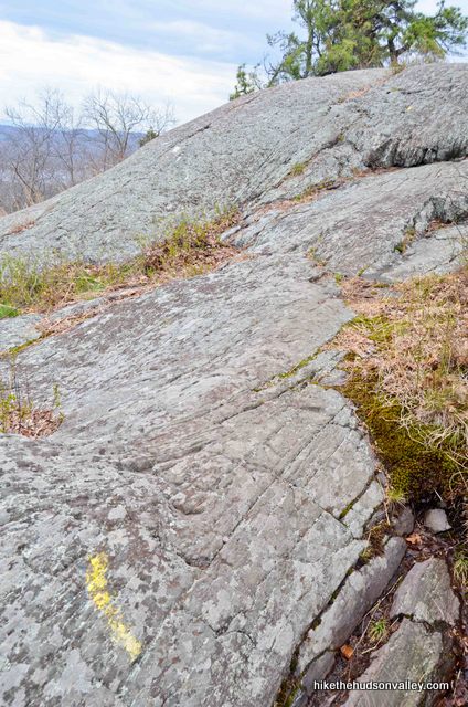
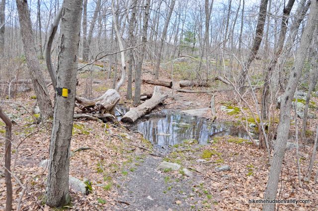
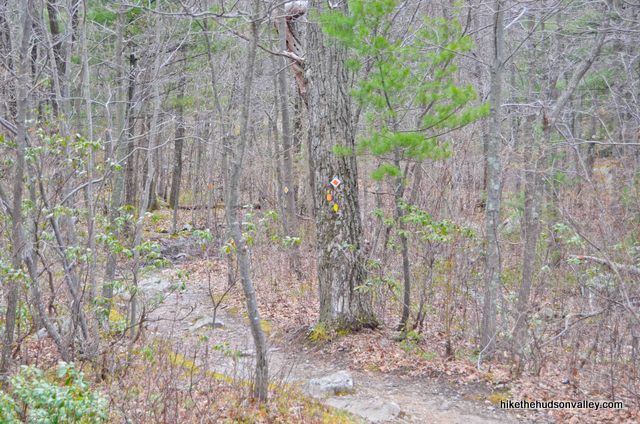
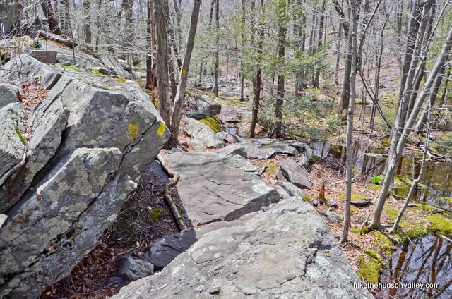
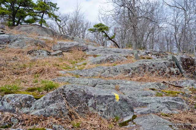
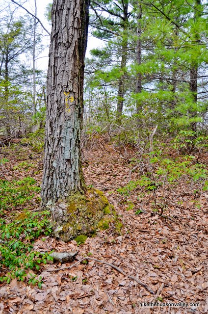
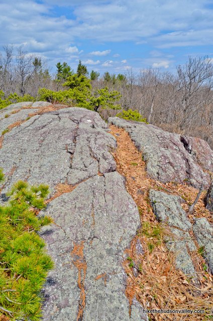
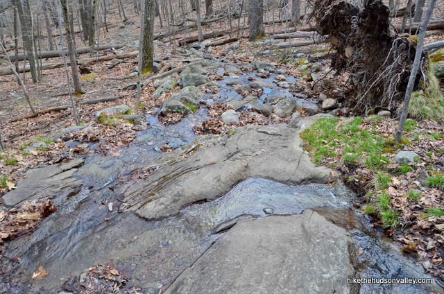
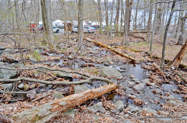
2. You’ll be on the State Line Trail for the next .7 miles, during which you’ll ascend 511 feet. You may have to skip on some rocks over a few wet places, but the trail here is otherwise pleasant and well-marked. Just keep following those ample blue-and-white blazes and don’t get lured onto any unmarked trails.
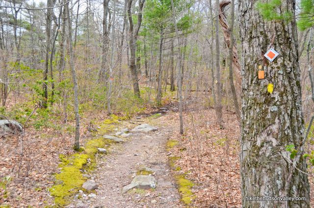
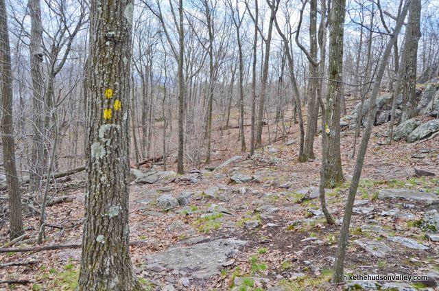
Your next point of interest is the junction with the yellow-blazed Ernest Walters Trail (heretofore referred to as the Yellow Trail). It took us just over thirty minutes to get there from the parking lot.
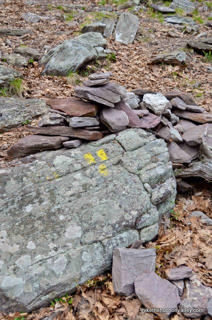
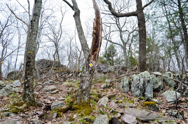
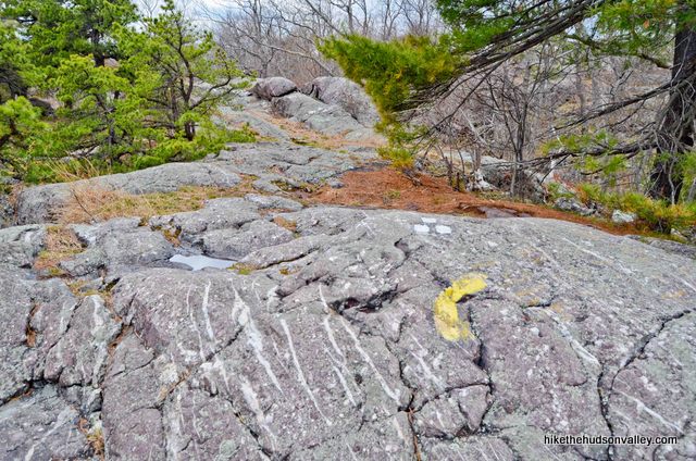
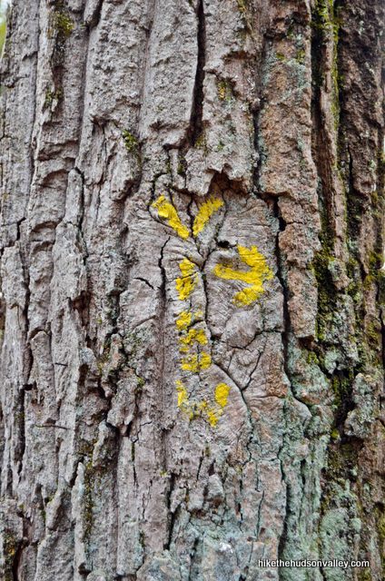
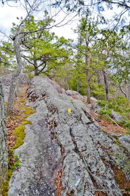
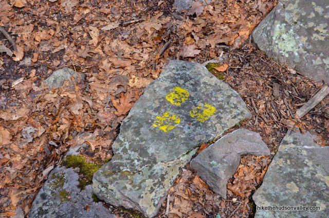
3. As you climb, keep an eye out for the Yellow Trail junction, which is well-marked but not so obvious that you couldn’t stroll right past it if you weren’t paying attention. You’ll find three yellow blazes on a large rock in the middle of the trail (UPDATE December 2017: An alert local hiker noted that the three yellow blazes here were not quite as pictured below, and are now one-blaze-on-top, two-on-the-bottom, marking the beginning of the Yellow Trail, rather than the end. Perhaps the person who blazed this trail had a philosophical awakening about what is really the beginning, and what is the end. In any event, look for three yellow blazes here and you’ll be all set. Thanks for the heads-up, Harvey!) and several yellow blazes veering off to your left. Turn left here to follow those yellow blazes uphill, bidding adieu (for now) to the State Line Trail, as its blue-and-white blazes continue climbing straight ahead to your right.
This is the start of your loop for the day – the next time you visit this spot, you’ll be coming down the State Line Trail with tired legs and, if all goes according to plan, a brain brimming with awesome new memories.
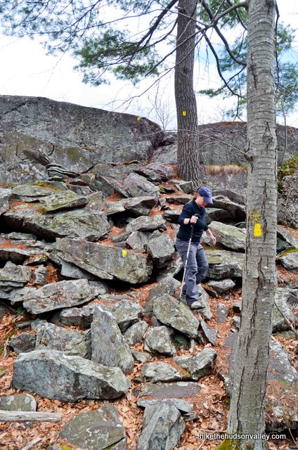
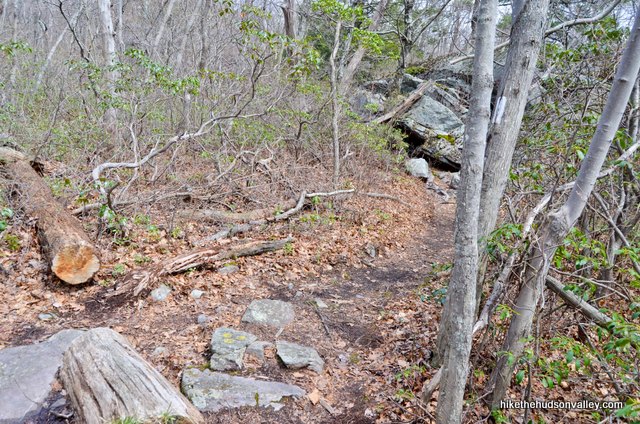
4. Continue following the Yellow Trail uphill. Like, really uphill.
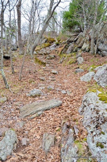
From the beginning of the Yellow Trail, it’s just .15 miles and 140 vertical feet to the money spot, and you’ll start getting some smaller views in about five minutes. w00t!
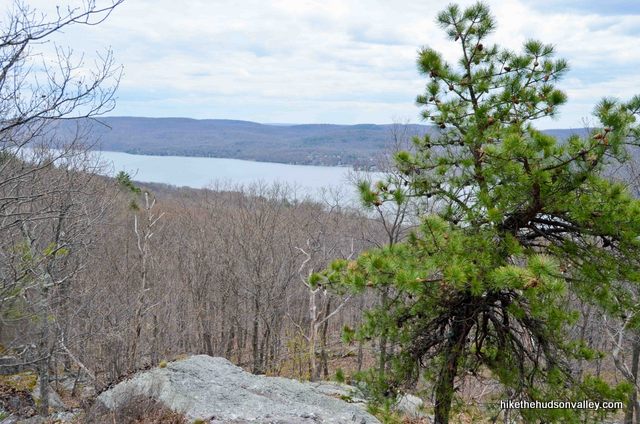
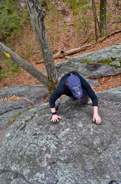
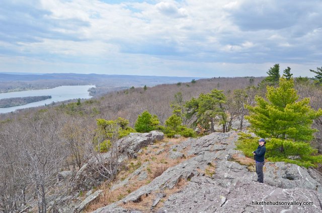
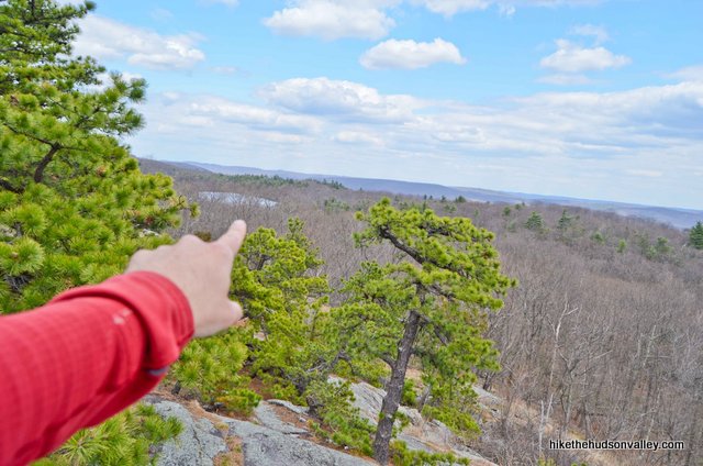
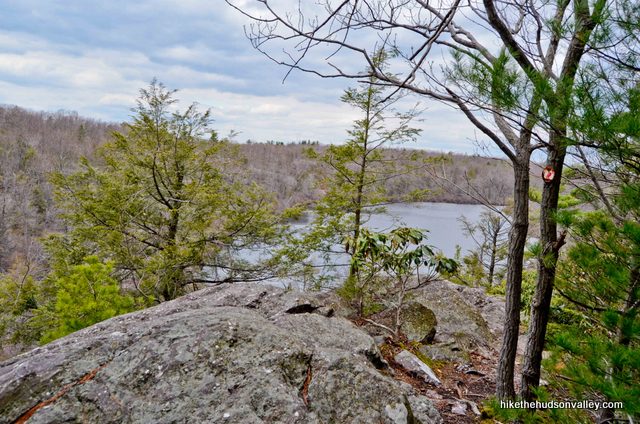
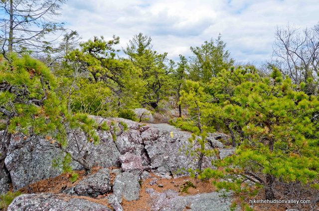
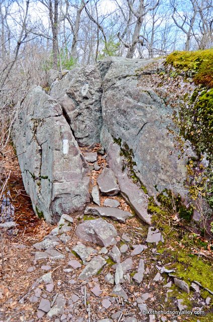
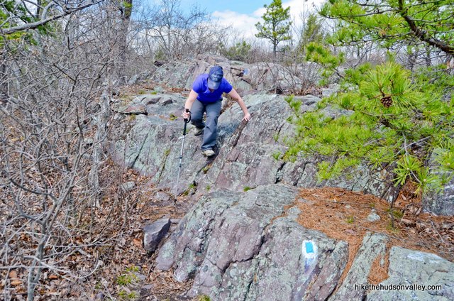
5. Keep climbing past the initial appetizer views and follow those yellow blazes up, up, up the solid rock face to the main course. The views just keep getting better as you go.
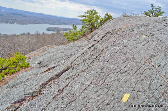
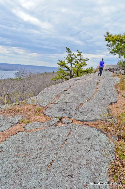
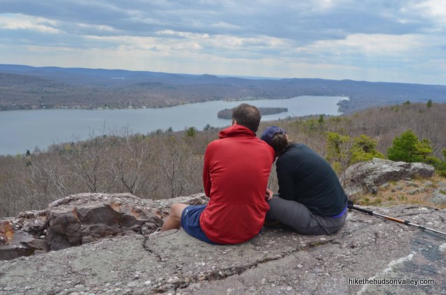
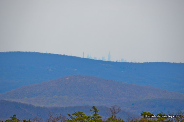
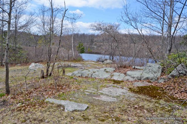
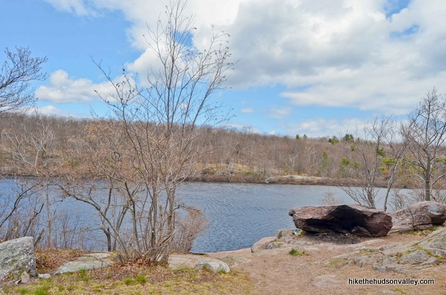
And then, at the top of the ridge, boom, the money spot.

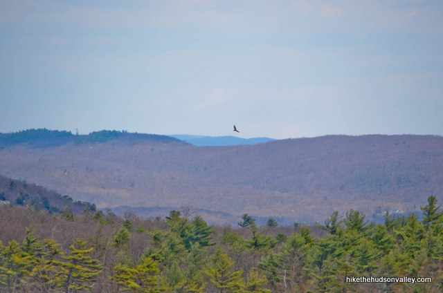
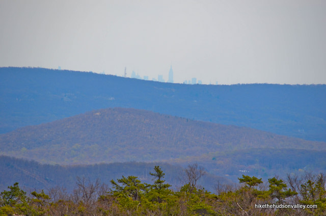
Take your time. Grab a seat. Soak it in. Try to pick out some NYC skyscrapers on the horizon.
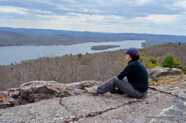
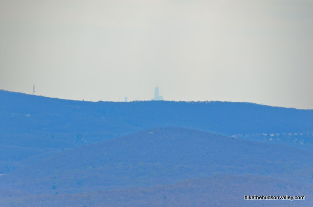
New York City is such an awesome place. But today, you picked the right side of the horizon to be on, didn’t you?
When you’re ready to rock, let’s continue rolling along on the Yellow Trail.
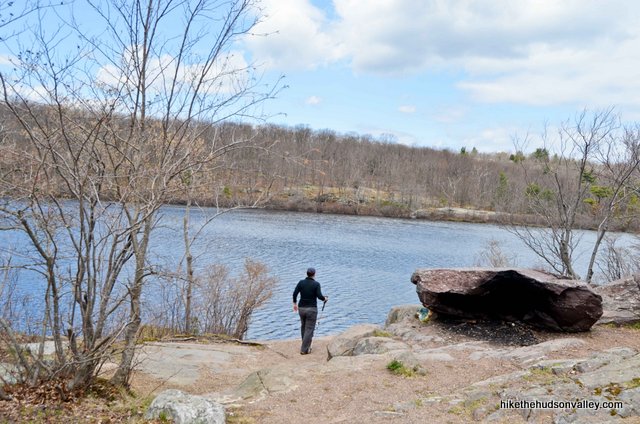
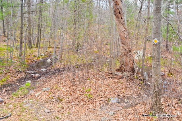
6. From the overlook, you’re just about .3 miles (took us ten minutes) from Surprise Lake. The Yellow Trail follows the ridge for a few more minutes, then takes a right turn to plunge into the woods.
Shortly thereafter, you’ll emerge into a small clearing right in front of Surprise Lake.
(As mentioned in my first Surprise Lake trail guide, there’s a local – and fictional — tradition you should be aware of: The first person in your hiking party to spot Surprise Lake has to jump out at everyone else and yell, “SURPRISE!!!”. Let’s make that a real thing.)
On your left, notice the Yellow Trail and orange-blazed Quail Trail green-blazed Bearfort Ridge Loop Trail heading off into the woods.
**UPDATE January 2020** After some recent re-blazing by the NY-NJ Trail Conference, the Quail Trail is no longer blazed orange (it is now green), and it is also no longer called the Quail Trail (it is now part of the Bearfort Ridge Loop Trail). This trail guide is otherwise unaffected by the new blazing, except for the next couple of steps, where all instances of the word “Orange” are crossed out and replaced with the word “Green.” Sorry for the mental gymnastics you’ll have to do when the picture shows an orange blaze, but the description calls it green. Once you get to Step 8, everything is back to normal again. Thanks for hanging in there in the meantime!
We’ll be going that way in a few minutes, but for now, walk up to the shore of Surprise Lake and soak it in.


That’s soak it in, not soak in it — Surprise Lake is apparently a popular swimming hole, though the examiner.com article “Swimming hole hikes in North Jersey” lists this place as one of “numerous backcountry waters that are popular among hikers who are willing to risk a fine.” So, you know, sounds like you’re not supposed to do that. (Also, this nice blog post shows pictures of a snapping turtle in Surprise Lake, if that gives you any encouragement to stay on the straight-and-narrow.)
7. When you’re done checking out the gorgeous lake (and not swimming in it), return to the clearing behind you, and turn to your right to hop on the Yellow/Orange Yellow/Green Trail.
In just a few yards, the Yellow and Orange Green Trails diverge, and you’ll turn right to stick with our old buddy, Yellow Trail. Goodbye, Orange Green Trail! We hardly knew ye.
8. What’s French, has two thumbs, and is about to walk through a rhododendron tunnel? (This is the part where you point at yourself with both thumbs and say, “Moi!”) Rhododendron tunnel, here we come!
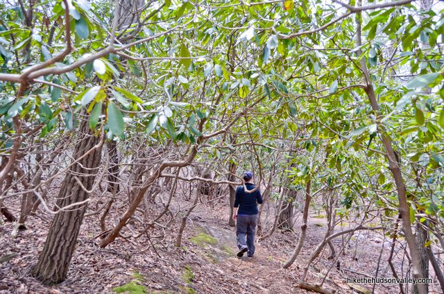
Is this your first rhododendron tunnel? Hey, mine too! The tunnel just keeps on going and going. What a cool place.
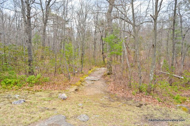
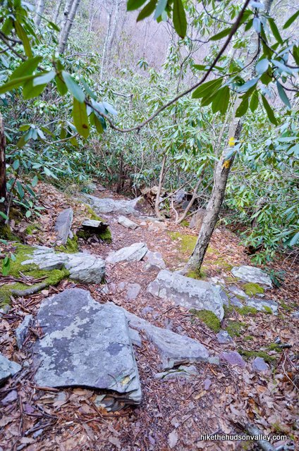
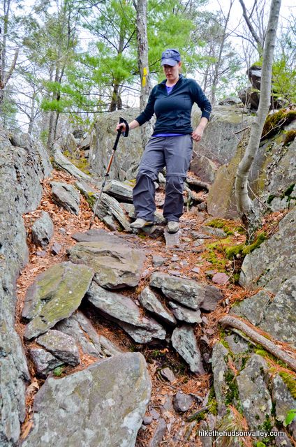
Keep following the Yellow Trail as it meanders past the rhododendron tunnel and over some rocky patches, perhaps also asking you to hop on some rocks over wet areas, depending on the conditions when you visit.
The trail then steeply ascends 200 vertical feet to your next overlook.
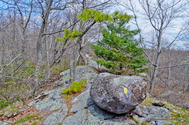
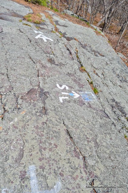
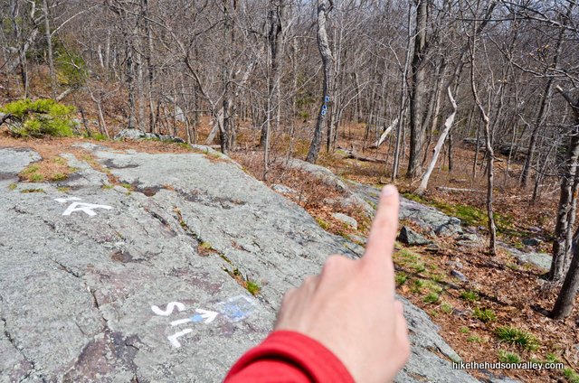
You’ve reached the overlook when you crest the ridge and arrive at one curved, yellow, banana-looking blaze and three white blazes in the middle of the trail.
9. When you reach the banana blaze and three blazes marking the end of the White Trail, check out the view behind you. This overlook isn’t as impressive as the Greenwood Lake overlook, but it’s still a certified money spot.
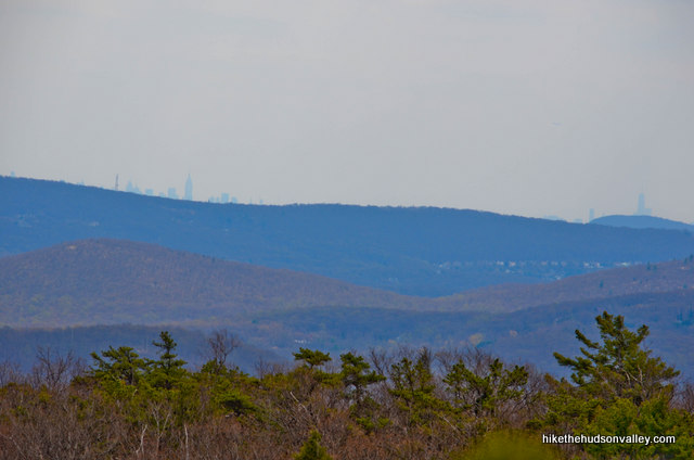
To your left, you can juuust see Surprise Lake through the trees (at least you can when the leaves are down). This spot also gives you an even better gander at some NYC skyscrapers on the horizon.
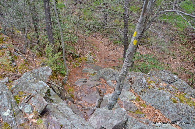
When you’re done checking out the view, continue the way you were heading on the Yellow Trail. Steel yourself – some serious ups and downs ahead.
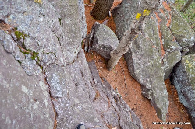
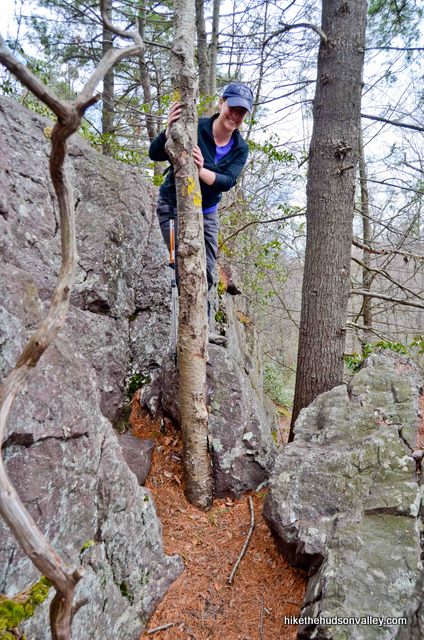
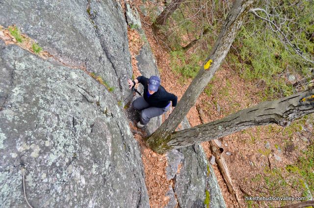
10. In case you’re saying to yourself, “Where are those rock scrambles this dude was talking about?”, you’re about to find out. The top of this ridge is arranged like three parallel speed bumps – it’s pretty quick when you’re walking lengthwise along one of the bumps, but it’s seriously slow going when you’re heading across them the bumpy way, like you’re about to do.
Happy bumping!
Your next point of interest is coming up in about five minutes, at the bottom of a bump, where you’ll find a tree with a very faded (faded as of our last visit on 5/2/2014) yellow arrow pointing to the right and the barely legible word “VIEW.” (**UPDATE June 2017** Thanks to Elia’s helpful comment below, sounds like there’s a fresh blaze on this tree, and the old paint underneath is even less visible. Keep a close watch out for it!)
The Yellow Trail heads left here (which is the way we’ll go in just a moment), but you can visit a very short spur trail to your right to visit a pleasant overlook of West Pond first, which is your only real chance to get a good look at it.
Go right here to check out the small view over West Pond in just a few feet. Purty!
When you’re done checking it out, head back to the tree with the faded marker and turn right to continue along on the Yellow Trail.
11. Your next junction is coming up in .8 miles, when the Yellow Trail dead-ends into the white-blazed Appalachian Trail. It took us about 30 minutes to get there from the West Pond overlook.
Along the way on the Yellow Trail, you’ll find some steep and slow-going spots.
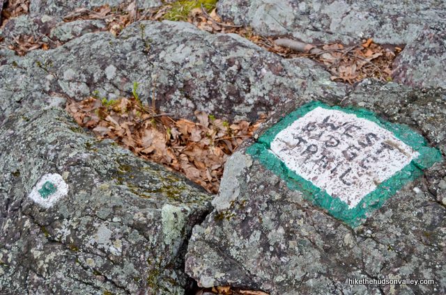
Shortly after the West Pond overlook, when the Yellow Trail takes a hard bend to the right, you may notice the white-and-green-blazed West Ridge Trail joining you from the left. Just ignore it and keep following the yellow blazes across the beautiful and rocky terrain, with West Pond occasionally (and barely) visible through the trees on your right.
This section also features some very nice pitch pines, and it never gets skimpy with the rocks.
When you get to the T-intersection where the Yellow Trail ends, you’ll find three blazes in the middle of the trail.
12. From the end of the Yellow Trail, turn right on the white-blazed Appalachian Trail (heretofore referred to as the White Trail). If you weren’t paying attention, it’s possible you’d turn that way without even noticing the Yellow Trail had ended.
In just a moment, the White Trail greets you with a quick scramble.
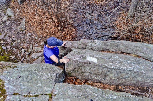
Keep following those white blazes for about fifteen minutes across more rough, beautiful terrain.
13. Your jaunt on the Appalachian Trail ends at a well-marked junction, painted on a rock face, where the State Line Trail (hello again, old friend!) departs to the right. Turn right here to follow those familiar blue-and-white blazes.
14. Navigationally, you’re done with this hike! Hooray! You still have to walk the remaining 1.15 miles down the blue-and-white-blazed State Line Trail to your car, though, during which you’ll descend 768 feet. Don’t forget about that part!
In about twenty minutes, you may notice three yellow blazes marking the junction from earlier in the day, where you turned up the Yellow Trail to check out the money spot. Remember that, way back when your feet didn’t hurt?
This time, though, you can ignore the yellow blazes and keep on chuggin’ downhill on the State Line Trail. From here, you’re retracing your steps all the way back to your car, perhaps hopping over a stream or two along the way.
After about thirty minutes or so, ahoy, there, parking lot! Hello again, car! Thanks for bringing us to this awesome hike and waiting for us while we busted it out. We hope you enjoyed chatting with the boats while we were gone.
My wife and I had to scurry back home, but not before stopping at Mango’s in Greenwood Lake (104 Windermere Ave.) for some quick Mexican food (it’s mostly a takeout joint, but they have some tables). We did not regret that choice one bit, though there are plenty of other grub options in Greenwood Lake if you’re looking for something different. (It’s important to retroactively carbo-load after an awesome hike like this. And even if it’s not, it’s important to stuff down Mexican takeout whenever life gives you that opportunity.)
Whatever you decide to do from here, I hope you enjoyed the adventure! Tonight, you’ve earned the right to kick up your (probably aching) feet and relax. You could watch a movie! Spider-Man 2, perhaps?
Directions
Directions to the trailhead: From Newburgh headed south on I-87, take exit 16 for NY Rt. 17 (near the Harriman toll booths), then merge onto 17 West. After 2.5 miles, take exit 130 for NY 208 South, then turn left onto NY 208 South. You’ll only be on 208 South (Main St) for about half a mile, then you’ll turn right onto Schunemunk Road (also labeled 208 S) for a few hundred yards. When Schunemunk Road dead-ends into NY 17M, turn left onto NY 17M East. In one half-mile, turn right onto Lakes Road (aka Rt 5), and enjoy not having to make any more turns for the next 9 miles.
Toward the end of that 9-mile stretch, Lakes Road becomes Mountain Lakes Lane, then NY-17A East, then Windermere Ave, all without you having to make any turns. From the center of the town of Greenwood Lake, turn right onto NY 210 South (Jersey Ave). This road runs along the length of Greenwood Lake, giving you nice views as you go.
Continue on NY 210 South (Jersey Ave) for 3.5 miles. After you cross into New Jersey, this road changes its name to Lakeside Rd, and your destination is juuuust on the New Jersey side, at the Greenwood Lake Marina (538 Lakeside Rd), immediately after you pass Lake Shore Rd on your left. Drive slow here – it’s easy to blast right past the marina and have to figure out how to get turned around on this small, windy, busy road (I may speak from experience here).
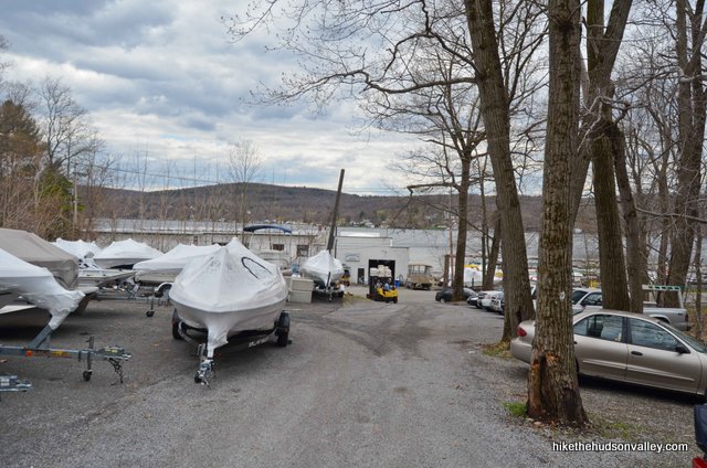
The marina is on the lake side of the street (which, you know, makes sense), and the parking lot is on the opposite (west) side of Lakeside Rd. Turn into the parking lot for the Greenwood Lake Marina and drive to the back of the lot, up the hill, and park by the kiosk.
Important note on parking: Parking here is VERY tight. We visited on an off-season Friday afternoon, and we got the last available spot. Here’s the view from the parking lot, looking back down at the marina:
Figuring that the situation can get hairy here in peak times, I called the Greenwood Lake Marina to discuss the parking advice I should give, and had a nice conversation with the very helpful manager. Here’s what she told me:
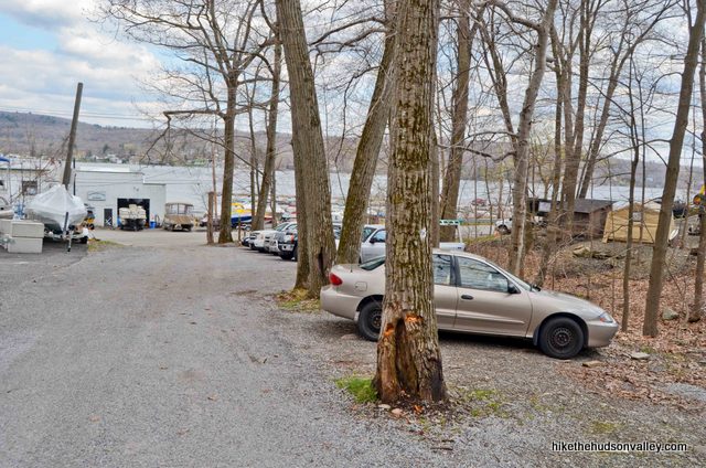
- Once you turn into the parking lot from Lakeside Rd, the first two lots (on your right) are marina parking only. Do not park in these lots.
- The top of the driveway (the third lot) is for hikers – everything up there is fair game, and you can park blocking in the boats up there. They won’t need access to them.
- The lot is always full on nice weekends. Like, always. There is no overflow parking for this hike. It’s strongly recommended to visit at an off-peak time. And please carpool as much as you can – don’t bring three cars for three hikers, which would deprive other hikers of a great day and be really bad for your karma. (And if you can’t get a spot here, you can always do the other Surprise Lake hike, with the trailhead just a few miles down the road. A strong Plan B.)
- As you drive up the parking lot, it’s marina land to your right, state land to your left. There’s an easement-type situation going on here, in case you’re wondering.
Thanks for all the great information, Greenwood Lake Marina! And thank you to everyone for being so gracious and harmonious in a crowded location, which is crowded because it’s awesome.
You can also get directions by checking out the Surprise Lake II (via Greenwood Lake overlook) entry on the HiketheHudsonValley.com Google map.
Sorta nearby address for your GPS: The Greenwood Lake Marina is directly across the street from the parking area for the trailhead – you’ll actually park at the top of the marina’s parking lot (which is on the opposite side of the street from the marina itself). Its address is:
538 Lakeside Rd
Hewitt, NJ 07421
Hop out and let the adventure begin! (And please see the Important note on parking above for more information on the parking situation here.)
GPS coordinates of parking area: 41.18592, -74.33213 (Clicking will open in Google Maps or the Apple Maps app, depending on your browser/device.)
Resources & Interactives
Super-cool Google Earth flyover of hike route:
Google Terrain Map of hike route:
Related resources: If you’re looking for actual facts and/or useful information, visit these resources:
- An excellent write-up for the exact same hike from the always-awesome New York-New Jersey Trail Conference
- My other Surprise Lake trail guide, visiting the lake from the other direction (though if you’re only going to do one Surprise Lake hike, I’d highly recommend you choose the one documented above)
- A nice online trail map from the New York-New Jersey Trail Conference
- Greenwood Lake’s homepage, for some other sights you might want to see while you’re here
More Surprise Lake II (via Greenwood Lake overlook) pictures from the hike’s Flickr album:
Was this trail guide useful to you? Please leave a comment!
Want to support trails in the Hudson Valley? Here’s one great way: Visit the New York-New Jersey Trail Conference homepage and click on Volunteer, Donate, or Shop! (Then you can volunteer, donate, or shop, depending on your mood.)
Trail guide was amazing and we really enjoyed the hike. The details and pictures were great and made everything very easy. Thanks
Joe, that’s great to hear! Thanks so much for taking the time to leave such a nice comment. Happy adventures to you!
I can’t see how to comment regularly so just going to reply to top one. Hiked this today. There’s a new update on the Blue/White State Line trail and they changed it. Just wanted to let you know. Also, found that this hike took <2.5 hours even with not moving super fast, and it wasn't as challenging as I thought it might be. But still a great hike and a great guide.
Accidentally did this loop in reverse on Saturday and it was great! From this direction, I wouldn’t give this trail a difficulty rating of 9 in terms of stamina, but it was definitely an 8 or 9 in terms of trickiness, which is the best kind of 9 IMO.
The trail was mostly dry, with just a bit of mud in the low spots. I arrived at 8:30am and got the last spot in the lot — next time, I’d head out a bit earlier.
Hello! I did this hike about a year and a half ago, and loved it, so I am thinking of coming back. The problem is, I now have an 8-month old puppy. She loves hikes and climbing, but I do think that the whole hike would be a bit much for her. What I am planning on doing is going up the State Line trail to the AT, then heading across the border into NY, and turning around at Prospect Rock. Do you think this would be feasible? Also, I am going to be coming on a weekend, and I won’t be arriving until about 10:00, although I could change this to be earlier. Do you think there will be enough parking? Thank you so much!
Best,
JBK
Hi, JBK! That looks like a perfectly fine route from the trail map, though I’ve never headed up that way to Prospect Rock. Would love to hear your opinion on whether it deserves that star on the map if you decide to check it out! That view over Greenwood Lake is so nice, I’d have a hard time passing that up, being so close to it. You could just go to that view and then turn around, too. Good to have options in life 🙂 As far as parking, I’m going to guess it is still quite crowded, even in January. (Folks are doing a lot more winter hiking this year, since there’s not much else to do these days.) I could be wrong, but I would think the earlier, the better, to make sure you get a spot. Good luck!
Completed this hike last Saturday and your trail guide was amazing!!! Thank you!! There’s new trail restoration program going on. Trail mark clouds have changed a bit. After leaving surprise lake shore the orange trail mark has changed into pink now. Wish I could post a pic here to show the difference. We had a good time today. Thx again!
Trail mark “colors “
Hi Mike,
Follow your writeups, they have been SO helpful in getting me into new and different hikes! Thanks you!
Now the question:
Was thinking of trying this hike this weekend but a little concerned about parking + COVID reduction. Have you experienced or heard of anyone who has tried to do this hike recently (with the parking reductions?)
If I have done the Schunemunk hike, this seems approachable? Would you agree?
Thank you again for all your time and work making this guides!
Lindsey, I’m so glad to hear that this site has been useful! (And I’m so sorry for not replying sooner to your questions!) I hope you had a wonderful hike if you gave this one a try. If you conquered Schunemunk, this one shouldn’t have posed any special problems for you. Would love to hear how it went – hope you had a great hike!
Just completed this hike and your trail guide was amazing!!! Thank you!! Parking was fine, we started at 7:30 on a Saturday and things were getting busy when we got back at 10:30. We bumped face to face into a black bear at the top of the overlook! What a way to start the day! But truly- such a wonderful guide. Felt like a friend was hiking with us every step of the way! 🙂
lara, I can’t tell you how much this comment made my day. But I can try: a lot! That’s how much. I’ve still never seen a bear on a hike around here — you’ve got one up on me. I don’t suppose you needed any more coffee after that! So glad you had a wonderful and memorable day out there. Thanks for taking the time to leave such a nice comment – it is very much appreciated!
Hi Mike!
I live in NYC, and I will be taking this hike tomorrow. We will be arriving at about 8:30 AM. Do you think there will be enough parking? Also, are the rock scramble(s) super hard? Just wondering.
Thanks!
Jova42R
Hey there, Jova! I would expect that early morning on a Monday would be no problem, though I can’t guarantee it. (I’d be really surprised if you had any issues.) And no, the scrambles are not very difficult, but I wanted to make sure folks were aware of them in case they’re either seeking or avoiding scrambles. Hope you have a wonderful day out there!
I’m the reader who originally recommended this hike. We’ve since moved to TN and I’m seriously bummed that I can’t find great trail blogs like yours in my area. Plenty for the Smokies, but those are well over an hour away. So I’m just reading your write ups and feeling nostalgic. Thanks for such amazing trail reviews!
Megan, I owe you a giant thanks for the tip about this hike, and for my accidental addition of the other Surprise Lake route (which is also a winner). Sorry to hear you’re not in the area anymore, but hope you’re enjoying TN! Here’s hoping you find a go-to source for information for hikes down there, and hopefully one with a better joke success rate 🙂 Thanks so much for getting back in touch, and here’s wishing you many awesome adventures in your new home!
Thankyou brought back great memories. Use to hitch hike from west orange to surprise lake when I was 15 ,50 years ago. Has not changed did low impact camping. Did swim in the lake hope it was leagal back then.
Hiked this today (10/20)! Scenery as described 🙂 Looking forward to coming back and trying some of the other trails in this park. Even the drive is beautiful. I’ll note that the marking for the end of the Yellow Trail when it hits the White Trail is basically gone but the White Trail blazes are very obvious, so it’s not a big deal.
Re parking: We got there around noon (Saturday) and had no trouble parking, a few cars on the side but only one in the lot. When we left it had filled up a bit but there were still a few spots left. We ran into a few groups but were alone most of the time.
I might suggest doing this backward – this is an excellent itinerary but a little front-loaded on the views and the last mile felt a little like a slippery, rocky slog by comparison. Boyfriend and I were split on whether the scrambles would have been easier in the other direction, but just a thought for anyone considering this.
Pingback: Surprise Lake! – Adventure Advisors
Great write-up. We did this loop yesterday and loved it. One more suggestion: if you’re into geography you can blow past the turn-off onto the blue-blazed state line trail (near the end) and continue ahead just a few minutes to the marker where the Appalachian Trail crosses from NJ into NY. Our boys say it’s definitely worth it and we have a picture of them standing next to each other but in different states to prove it. (Just turn around and go back to the blue blazes to go down to the parking lot. Or go a bit further for another viewpoint first, which we didn’t do.)
Also note that this trailhead is accessible via the NJ Transit 197 bus from the Port Authority. It’s a great place to start an overnight backpacking trip on the Appalachian Trail 🙂 Northbound you might reach Harriman train station in 2 days.
Helpful info, Steve – thank you for sharing it here!
I actually live on greenwood lake but usually only hike the hudson highlands. Well, i finally did this hike because of your enthusiastic review of it and i was not disappointed !! From the money spot i could see my house on the water AND the NY skyscrapers !! Awesome. Since i planned to only go to the money spot i brought my Chihuahua. Well…. unwisely i to did not heed your warnings and thought i would do the whole loop and retreat if it got too tough. 67 years old and i went down those ledges w chihuahua in one arm and the other available to climb. U guessed it. When i went down that first steep ledge i changed my mind and decided to go back. Could not climb it !! So with no choice we went forward. It was not as.dangerous after that but light was fading fast and we were running now in the easy sections to get out. Great hike! Loved it !! I’ll b more careful in the future :). Oh, to others, no dogs unless it has horns and split hooves !!.
Boy did we break a sweat on this one today! So well worth it, especially on such a beautiful day! Really doubted the 9 out of 10 rating until those rock scrambles were staring me in the face. This hike was challenging and rewarding and we will definitely be back. Mike, we’d be nowhere without your write-ups – thank you so much for this website and for all of your hard work and dedication.
Thank you so much, Anastasiya! Thanks for sharing this pic, too – glad you had a great day out there!
Hi! We are interested in doing this hike on this coming Sunday morning. Will there be a parking issue at that time?
So sorry I didn’t get back to you sooner, Avi. If you get a chance to let us know how it went with the parking situation, that could be very helpful for others who may want to hit this hike on a summer weekend. Thanks!
We got there before 10 am and the parking was fine. By the time we left the lot was pretty full. We really enjoyed the hike and the directions were very helpful!
Glad to hear it all went well – thanks for the info!
If it wasn’t for your step-by-step instructions, we surely would have been lost! A great hike on a beautiful day. I don’t know if I would have rated it a 9 in difficulty, though 🙂
Thanks for all your help!
What a fun hike! Thank you for this well written and documented hike. We hiked on a perfect day for it, temps in the low 70’s, a slight breeze. Beautiful. We enjoyed the money spot view of Greenwood Lake for a while. On step 10, after the bumps, we came to a tree that probably did have “View” written on it at one point, it was straight ahead. But it appeared to have been overwritten with a yellow left turn blaze. We could still see a faint V and the arrow pointing to the right, and were rewarded with a very nice view of West Pond when we followed that path. It was quite purdy! Thanks for the hiking poles recommendation. They definitely came in handy. We would definitely do this hike again. Thanks again for the great guide!
Thanks so much, Elia, so glad to see your comment! I also updated Step 10 above with your information about the very faint “View” writing on the tree — very much appreciated!
We returned to do this awesome hike again, and it was great. Cooler temps, but we were prepared. I took a picture of the tree with the faded “View” marking about which I’d originally commented. Trying to attach to this reply for you. Thanks again for such a great guide!
I did this hike on Friday 4/14 following your guide. Just wanted to reach out and say thanks. Perfect directions / description. Great views, challenging hike and differing terrain. Did not see another person for the 3 hours. Can’t wait to try it again when the leaves come in and it’s warm enough to not swim in the lake.
Awesome, Neal! Many thanks on the kind words for the trail guide, and glad you had a great day out there!