Background
If you find this free trail guide useful, please provide payment by picking up at least one piece of litter on your hike. Cha-ching! Thanks for being awesome! (And here’s a quick primer on Leave No Trace, too, to help us keep the trails nice and fresh for each other.)
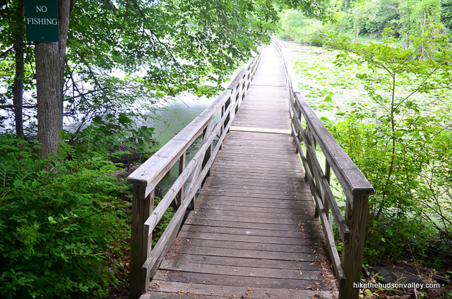
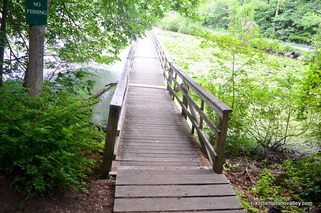
**MEGA-UBER-ATOMIC-WEDGIE UPDATE posted October 2021!!!** The trail system at Teatown has changed dramatically since I wrote this trail guide. The Twin Lakes Trail that was brand-new when I wrote this guide in 2015 didn’t survive very long — it got merged into the new Three Lakes Loop. (The trails with more lakes are always swallowing up the little guys, right?) As a result, a large chunk of the trail guide below (Steps 6-10) is no longer accessible. While the Three Lakes Loop shares much of the route of the old Twin Lakes Trail, it would be more confusing than it’s worth to try to amend the trail guide below without doing a complete re-write. Some good news, though: Steps 18-32, which visit the Lakeside Loop (including the sweet floating bridge shown in the banner image above) are still perfectly valid. So you can use the guide below for steps 18-32 if you’d like, then use the very nice Teatown hiking trails map on Teatown’s hiking page to plan more adventures. (Special thanks to Sasanka for her helpful comment below about these changes — thanks, Sasanka!) Happy hiking, and enjoy the new trails, all!
Background you can feel free to skip: “Can you help fill in the blank? The best local hike not yet documented on Hike the Hudson Valley is ____________.”
I posted that question to this site’s Facebook page in the summer of 2015, and cool local hiker dude Jeff Kent suggested Teatown Lake Reservation. He also provided a link to their snazzy web site, teatown.org.
A quick visit to that page shows you that this isn’t your average nature preserve. They have summer camps, a ton of events, and an active social media presence. This is clearly a place that cares about the outdoors and the surrounding community, and is doing a ton of cool things to bring them both together.
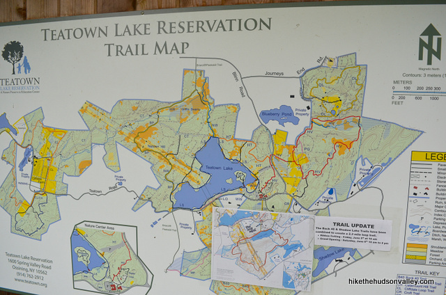
Teatown also features almost 15 miles of hiking trails, and you can plot your own course using their Hiking Trails page and trail map. The route I chose below incorporates two loops in a rough figure-eight pattern, checking out the new Twin Lakes loop (which opened in 2015 as a link between existing trails) and the Teatown Lake loop, which hits the floating bridge/boardwalk that is Teatown’s trademark.

This hike doesn’t feature any mind-blowing vistas, but the property here is clearly well-loved, and you’ll find more than enough goodness all around this place to keep those retinas occupied.

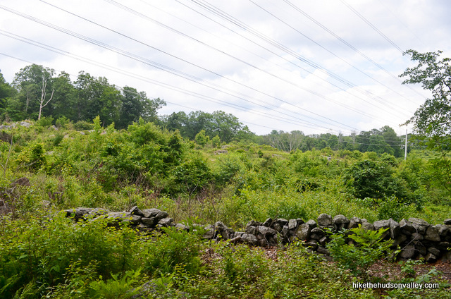
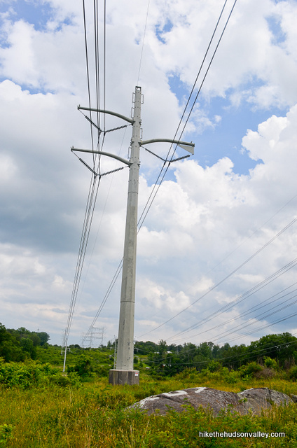
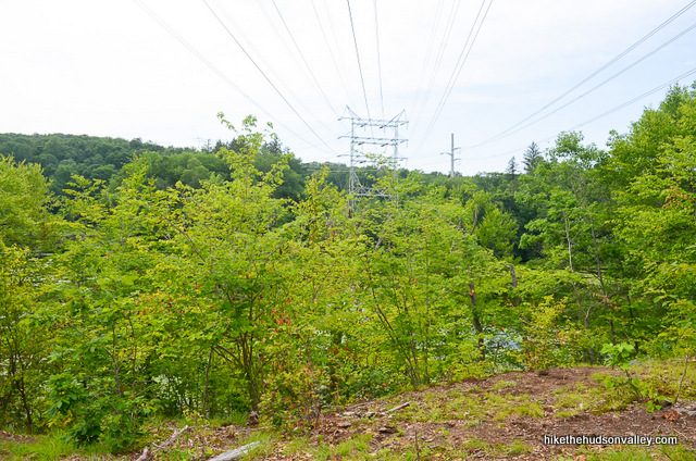
Amidst all the awesomeness, one minor bummer: The big fat power lines that run overhead in several otherwise pristine-looking places.
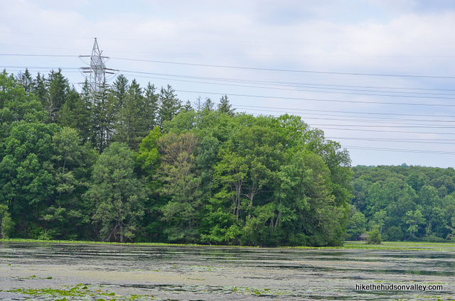
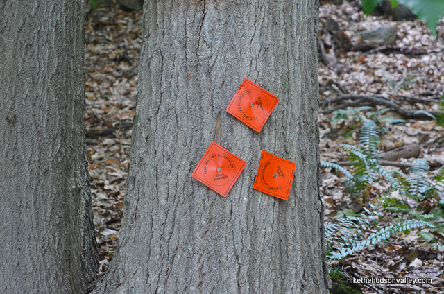
As if reading our minds, Teatown offers some nice educational signage that addresses this very issue.
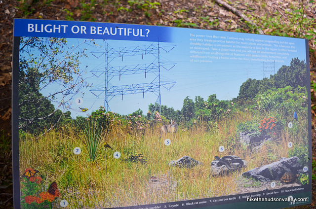
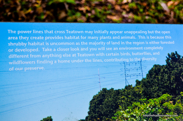
The sign reads: “BLIGHT OR BEAUTIFUL? The power lines that cross Teatown may initially appear unappealing but the open area they create provides habitat for many plants and animals. This is because the shrubby habitat is uncommon as the majority of land in the region is either forested or developed. Take a closer look and you will see an environment completely different from anything else at Teatown with certain birds, butterflies, and wildflowers finding a home under the lines, contributing to the diversity of our preserve.”
So we’re going to take a glass-is-half-full approach to the power line situation. It’s habitat – w00t!
Otherwise, if you’ve never been, or even if you have, I recommend a day of exploring the trails at Teatown. You will likely find that this place is, indeed, your cup of tea. It won’t be oolong before you come back. You can’t matcha this place. You’ll be glad Jeff Kent sencha. It is steeped in awesomeness. You’ll want to brew this one again. (Horrible tea puns welcome in the comments – bonus points if you can do something with “herbal.” I tried really hard, couldn’t do it.)
And if you have an awesome day here like I did, be sure to thank Jeff Kent in the comments below. Thanks for the recommendation, Jeff!

Note: The trail guide below can easily be broken into two smaller loops, if you’re into the whole brevity thing:
- If you’d prefer to visit more remote areas of Teatown while ogling some nice lakes, do the Twin Lakes Loop, Steps 1 – 17 below. Total distance: 2.4 miles, elevation gain of 369 ft.
- If you’d like to venture around what is surely the most popular/iconic trail at Teatown while hitting the very cool floating bridge, do the Lakeside Loop, Steps 18 – 32 below. Total distance: 1.8 miles, elevation gain of 173 ft.
I recommend doing the whole thing, but it’s good to have options in life. (UPDATE October 2021: Now I just recommend doing the second option, since it still exists. But I bet the new Three Lakes Loop is nice, too!)
Trail Guide
Bonus unsolicited advice: Don't depend on having cell service in the woods - it can be spotty out there! Download this trail guide to your phone before you head out. (It's easy to do on iPhone and Android.) May your connection to nature be strong, even when your connection to the internet is weak.
Please see the **MEGA-UBER-ATOMIC-WEDGIE UPDATE posted October 2021!!!** in the background section above, if you haven’t already read it. CliffsNotes version: The trails here have changed dramatically since this guide was written!
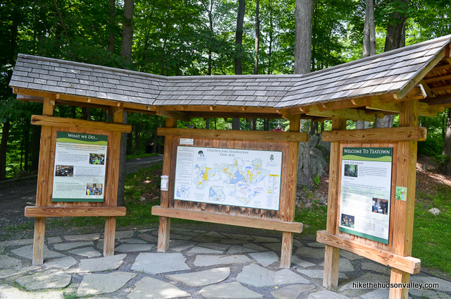
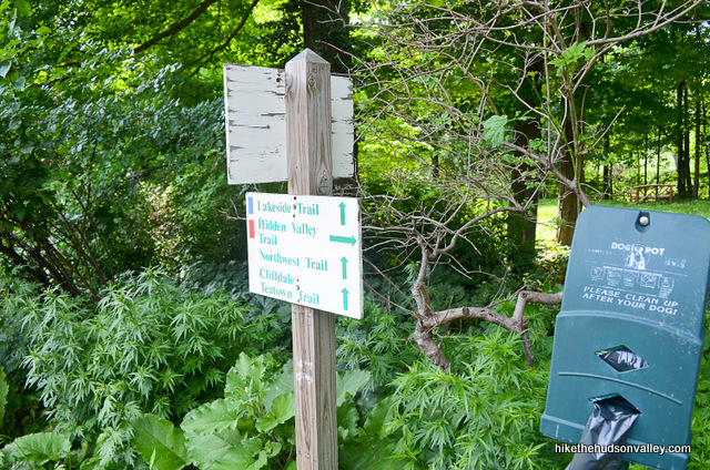
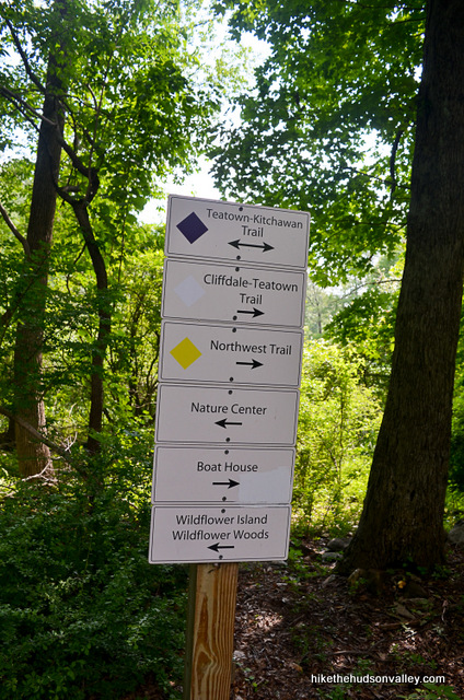
1. Say thanks to Teatown for the awesome trail map, and for the awesome updated subset of that map that shows the new (as of 2015) Twin Lakes Trail we’ll be visiting today. Thanks, Teatown! (You may wish to print these out, or pull them up on your newfangled internet device.)
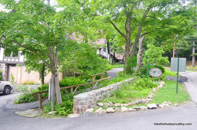
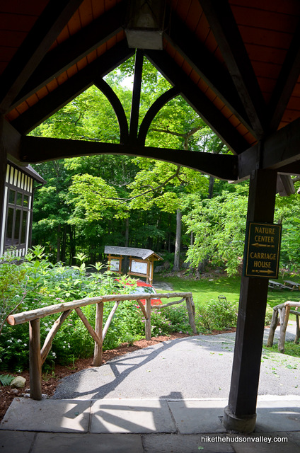
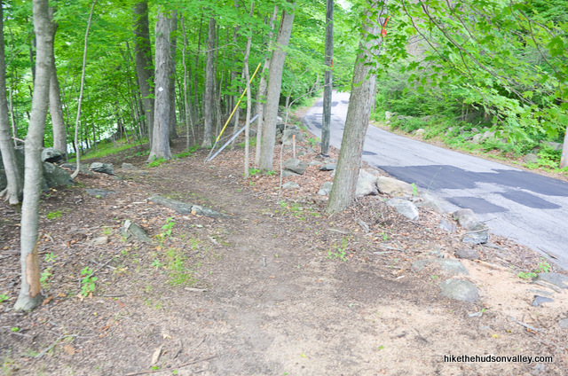
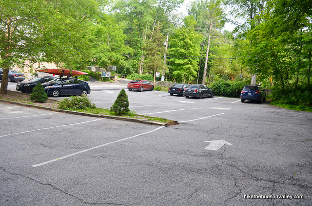
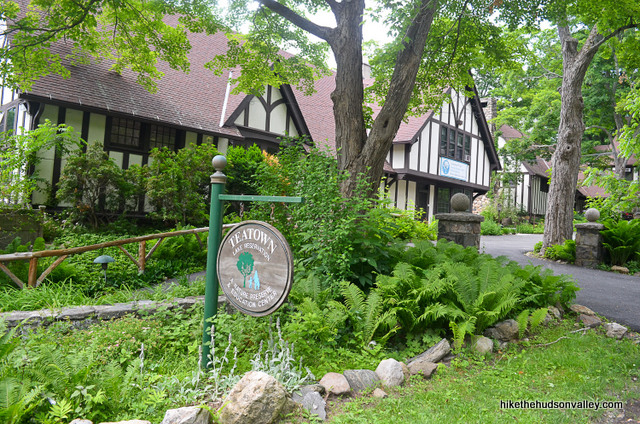
2. From the parking lot (see “Directions to the trailhead” below), walk up to Spring Valley Road and turn left. Cross the street right in front of the Nature Center, heading through the gate in the stone wall on the far side of the street to begin the hike.
Why did you just cross the road? To hike on the other side! (Maybe I should implement a paid version of this site that lets you hide the jokes.)
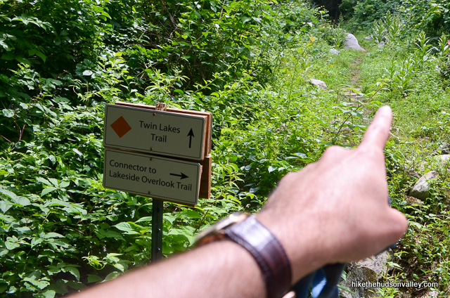
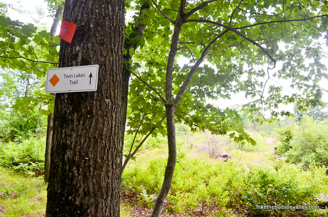
3. Once safely on the other side of the street, hop over to the kiosk at the trailhead to the orange-blazed Twin Lakes Trail, just to the left of the pond, where you can scope out a map of Teatown Lake Reservation.
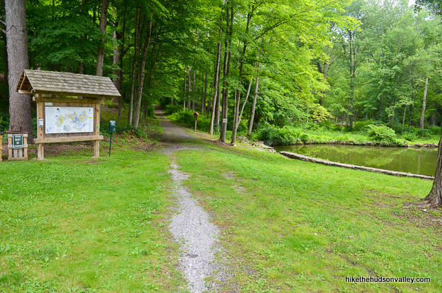
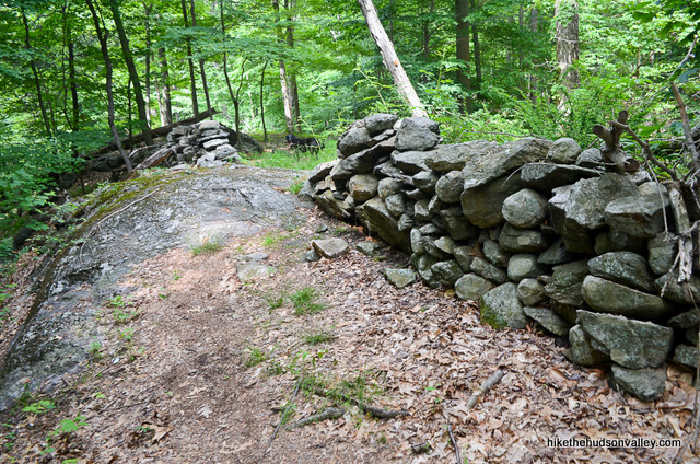
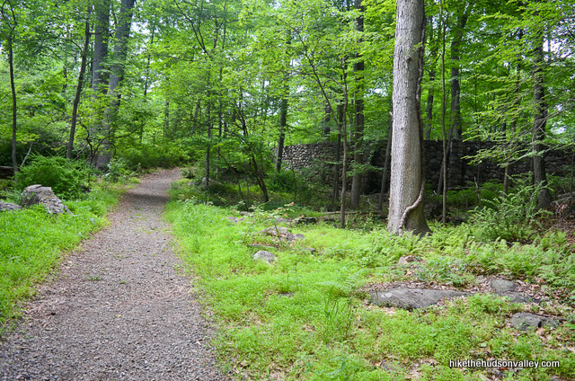
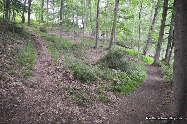
4. Follow the Orange Trail (with a smattering of yellow blazes mixed in, which you can ignore) for about three minutes to your first fork of the day, where the larger (unmarked) trail goes left along a stone wall, and you’ll turn right to keep following those orange blazes.
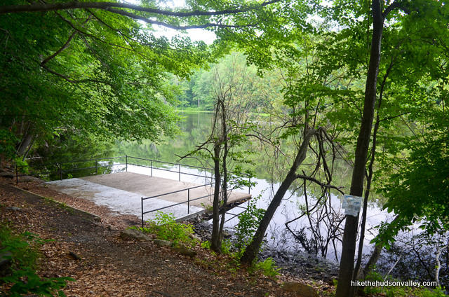
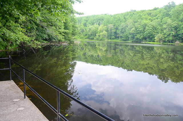
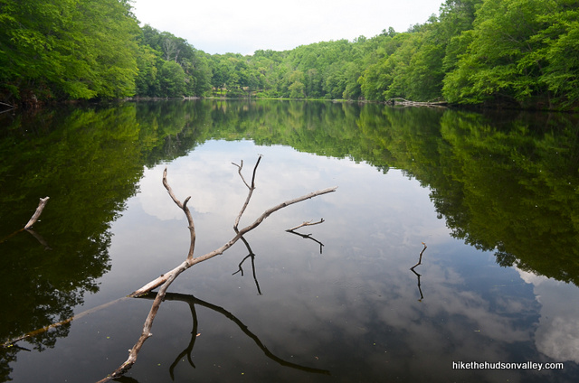
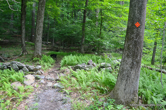
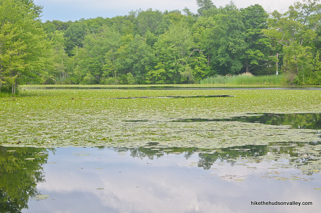
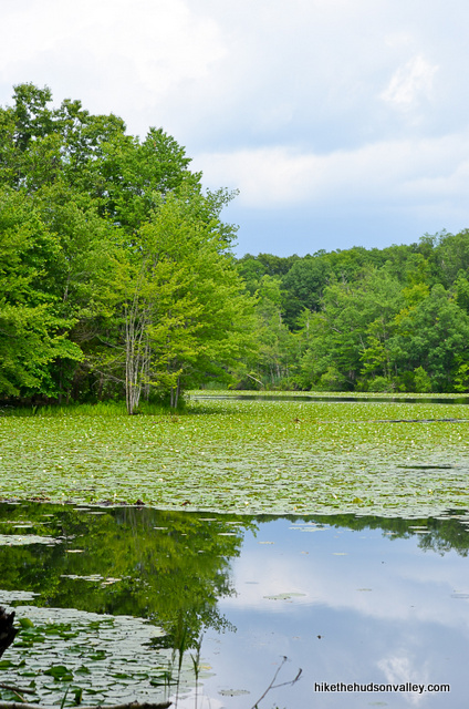
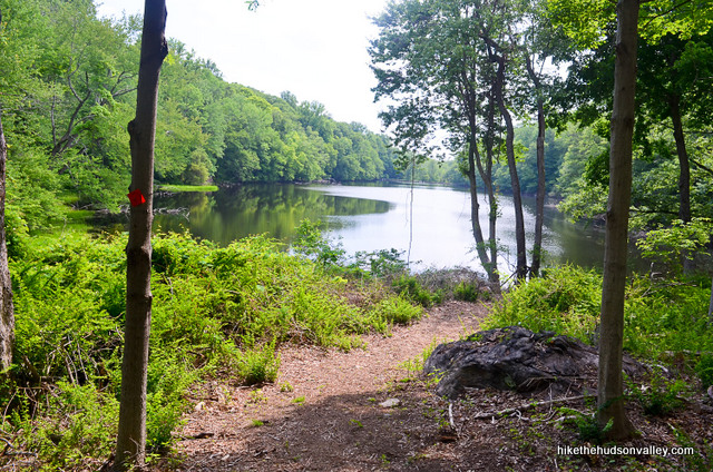
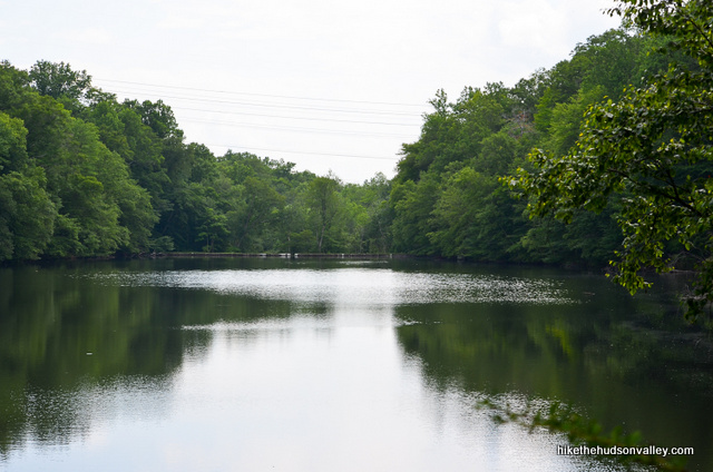
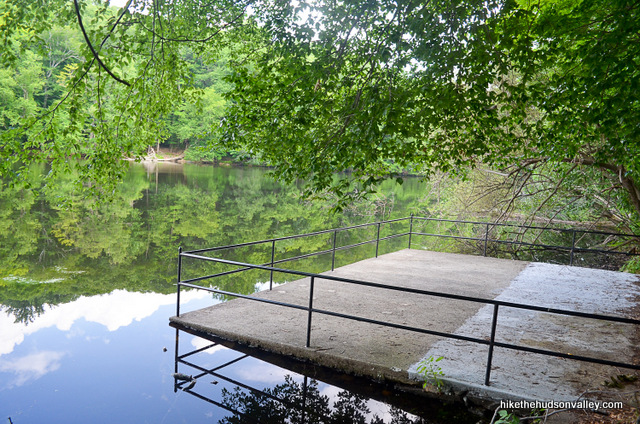
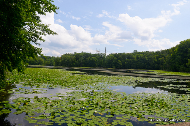
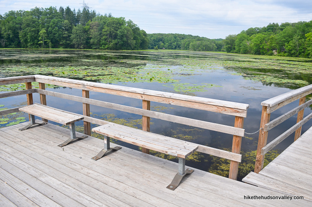
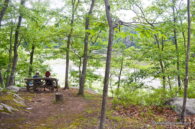
5. Head downhill for another minute, then boom! The trail drops you at the shore of Vernay Lake, your first of three lakes for the day. Bop on over to the concrete platform to gaze over the water and practice your bullfrog calls.
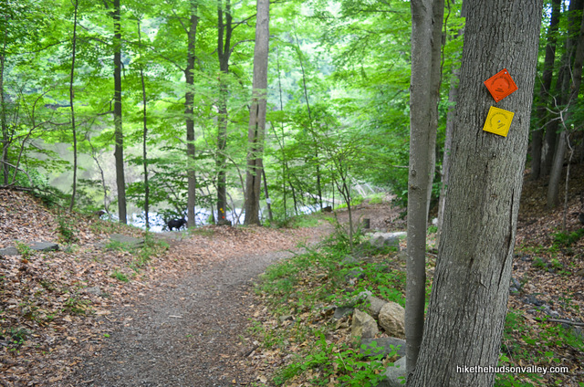
6. Staring at the lake from the platform, turn to your right and notice the three blazes marking the official beginning of the Twin Lakes Trail (the previous orange blazes were just appetizers).
Follow those orange blazes as they hug the shoreline while you keep Vernay Lake on your left. (You’ll follow these blazes for the next 2.1 miles, and they’ll return you to the concrete platform – it took me almost exactly one hour to complete the loop. If you’d like to skip my blathering and just follow the orange blazes – which is probably what I’d do – feel free to jump to Step 16 below.)
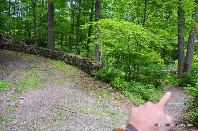
7. You’re still reading? Why? I mean, awesome! In a few moments, you can venture onto the concrete wall that dams one end of the lake. If you play chicken with your friend on this dam (not recommended), definitely try to fall toward the grass side.
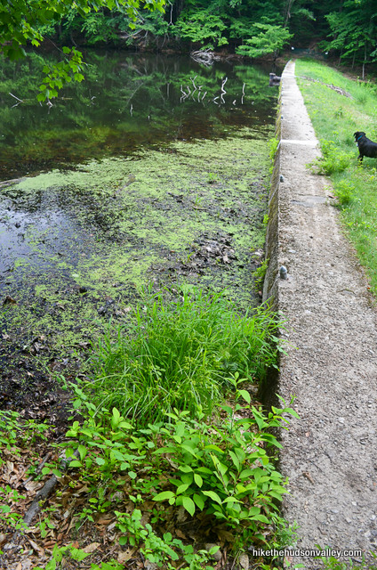
Don’t cross the dam all the way, though – come back and follow those orange blazes into the woods as they head away from the lake. BFN, Vernay Lake! Catch you on your flip side in an hour or so.
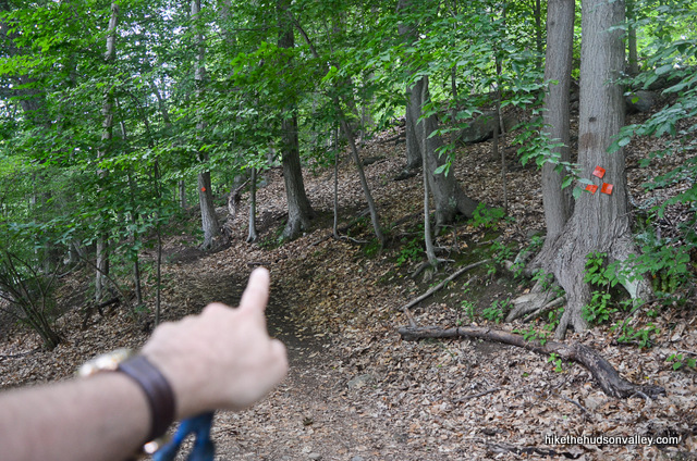
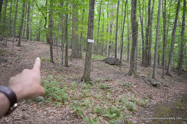
8. In just a moment, arrive at a well-marked junction, where you’ll follow the signs/blazes to stay on the orange-blazed Twin Lakes Trail. Don’t forget to stop and say hi to the locals.

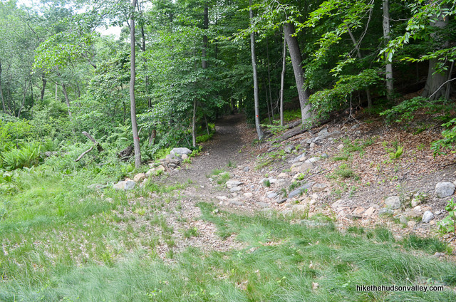
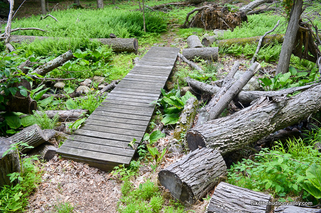
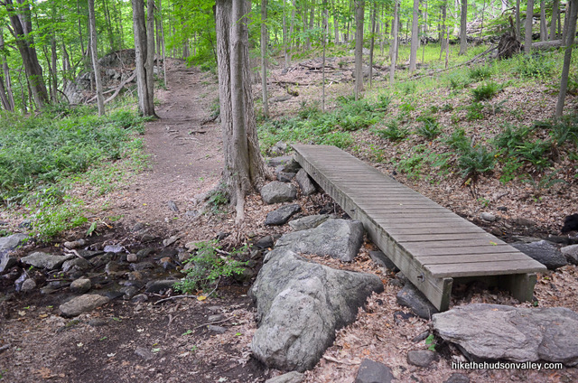
9. You’ll pass over some nifty trailwork in the next section. Thanks for all the nice little bridges, Teatown!
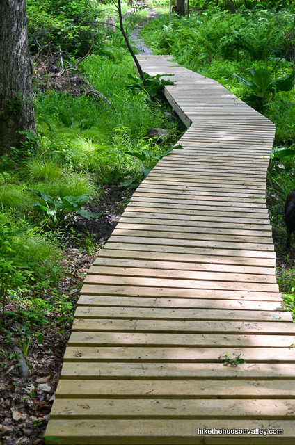
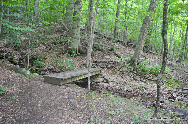
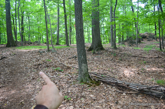
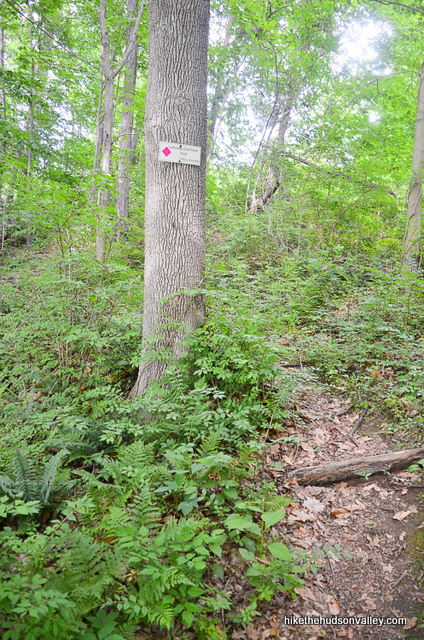
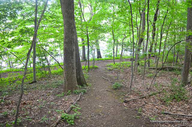
Enjoy the ferns, woods, and plentiful orange blazes.
 About fifteen minutes into the loop, you’ll come upon a fork with the Waterfall Trail departing to the right. If you take a gander at the Teatown map, you’ll see that it’s not a trivial distance to the waterfall (it’s at least a mile, one way). It’s a small waterfall, which you can verify from a quick Google image search (here’s one result that gives you a good look at them.) I’m sure it’s a pleasant stroll down there, but I chose to skip it. If that’s how you’re going to roll, too, then stay left at the fork to continue on the orange-blazed Twin Lakes Trail.
10. After that fork, you’ll have about ten more minutes of romping through some righteous woods.
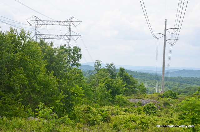
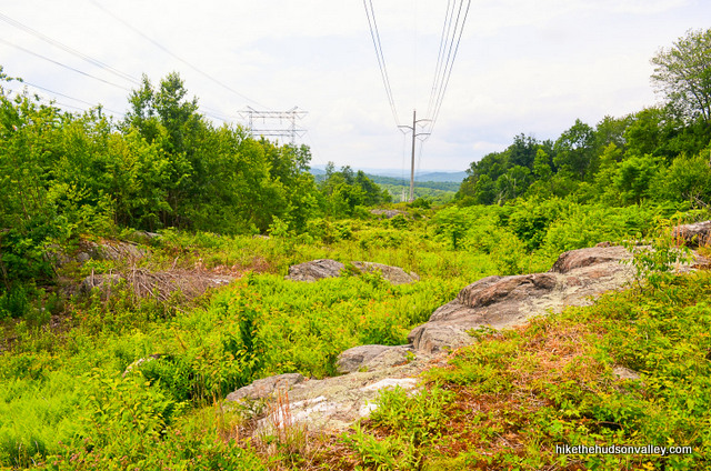
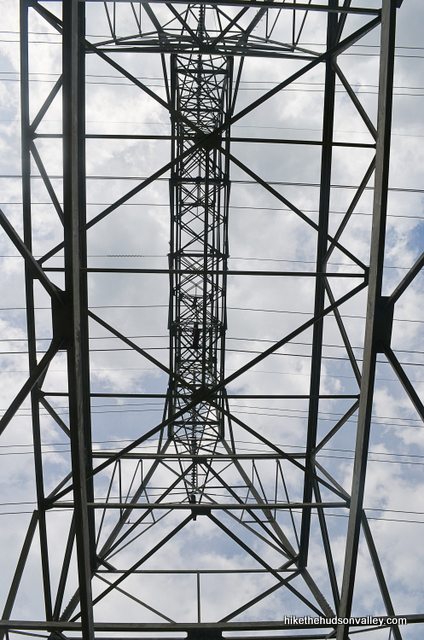
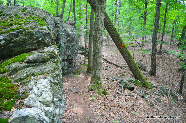
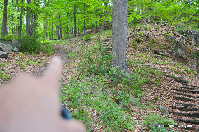
11. After that romp, you’ll emerge into the cut-out for some gigantic honking power lines and towers. The trail takes you right under one of those bad boys.
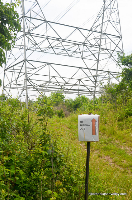
“Hey, you know, it’s pretty here, still,” I thought.
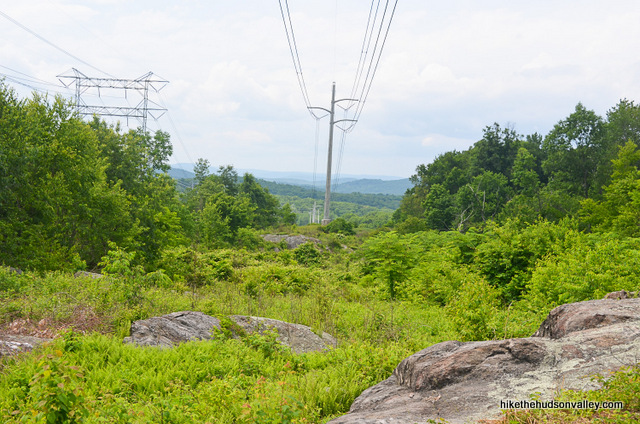
And then I realized, with a mild sense of disappointment, that I was most likely standing on what had been described on the Teatown Hiking Trails page as “an overlook to the Hudson Highlands from the highest point at Teatown.” I would characterize that description as technically true, but you know, not, like, the COMPLETE picture of what you’ll find here.
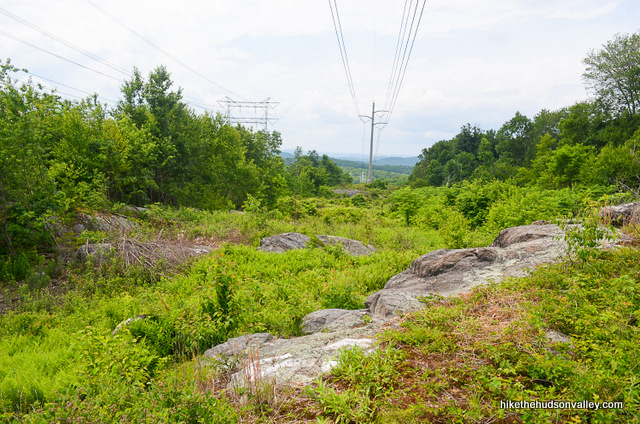
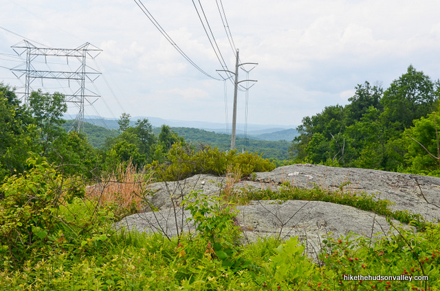
To me, this spot is about 90% power line, 10% overlook. But it’s still a nice spot, and I do, in general, enjoy electricity. Also, if not for the power lines, there’d be no view here at all. Thanks, power lines! Stop here for a bit if you’d like – otherwise, let’s keep motoring.
12. From the power-line/overlook situation, keep following the signs and blazes for the Twin Lakes trail, and enjoy some more nice scenery.
The other twin of “Twin Lakes” fame is coming up in about ten minutes from the power lines.
**UPDATE June 27 2016**
12.5. New Route as of Spring/Summer 2016. From Jeff Kent’s comment below: “As you exit the power lines and go back into the woods for a bit, there’s a slight route change marked by a ‘New Route’ sign. The trail used to dump you at the canoe/bench end of the dam on shadow lake. Now it shoots you over to the opposite side of the dam first and you have to walk across it to get to the canoe/bench. From there the trail continues as previously scheduled.” Thank you for keeping us up-to-date, Jeff!
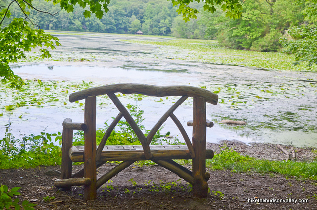
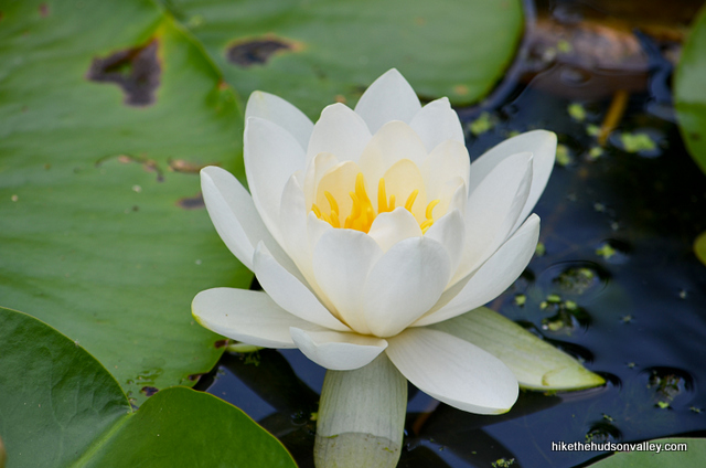
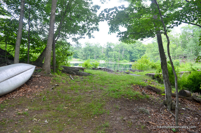
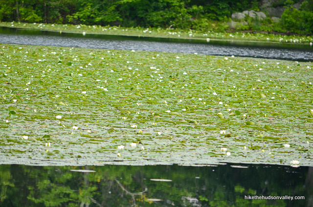
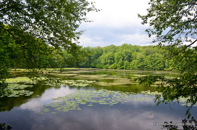
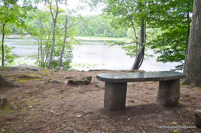
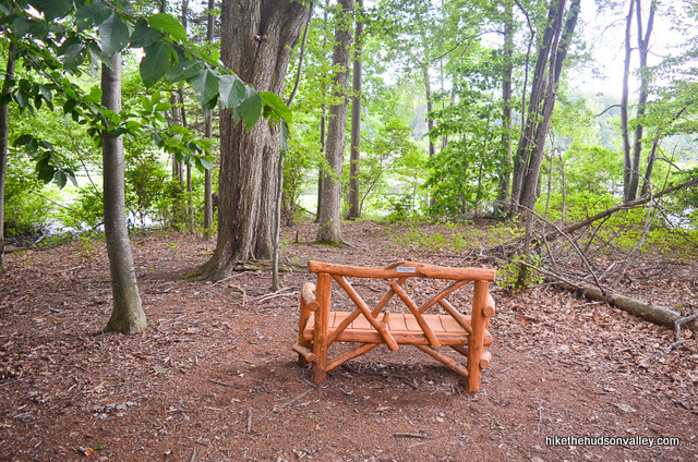
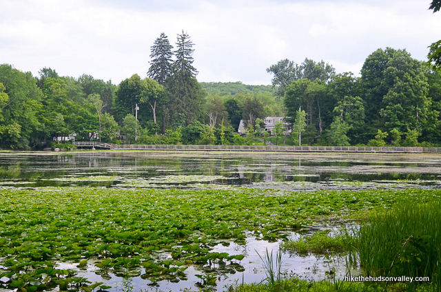
13. Arrive at the shore of Shadow Lake, where you’ll find a nice bench overlooking a serious Kermitload of lily pads.
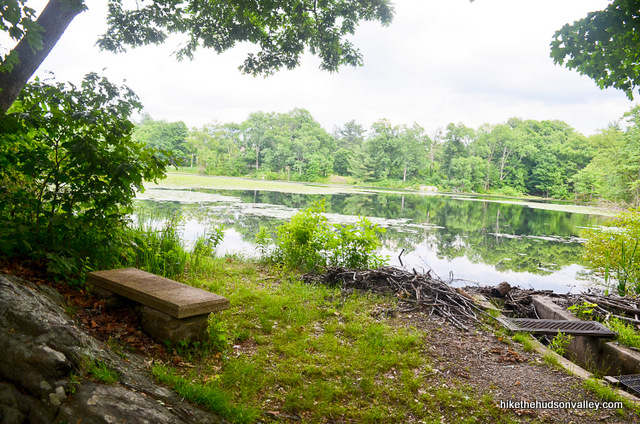
Gaze out over the water for a moment, being careful that none of your friends push you in while you’re distracted.
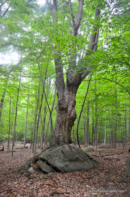
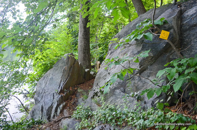
14. Once you’re done ogling the lake, pick up the orange blazes again behind you, being careful not to join the unmarked trail (blocked with a pile of sticks as of my last visit in 2015) that could lure an unsuspecting hiker. Continue on the Orange Trail as it drops beside an interesting rock formation.
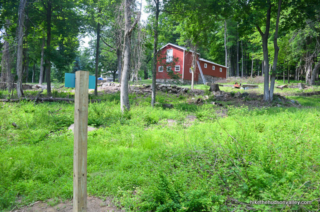
In another few minutes, the trail takes you back to sort-of-civilization, with some buildings visible just off the trail. (If you are Bear Grylls and you’re filming Man vs. Wild, congratulations on reaching the end of the episode!)
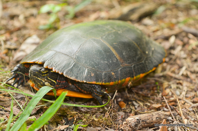
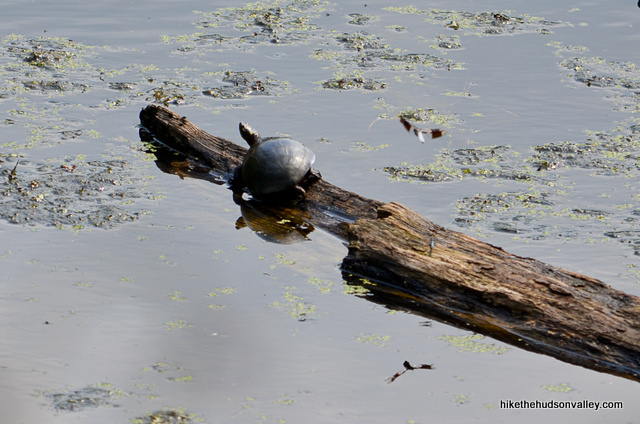
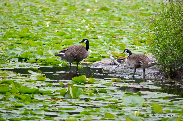
Hey! Hello again, Vernay Lake. Howdy there, copious amounts of turtles.
15. Wrap around Vernay Lake along a nice stretch of shoreline trail – you’ll notice some yellow blazes here that you can cheerfully disregard.
16. In another moment, you’ll arrive back at the concrete platform, completing the Twin Lakes loop. Far out! Took me exactly one hour from platform-to-platform-again, but you probably knocked it out much quicker, you animal.
 Let’s head back toward the car for one more loop today.
17. Retrace your steps back up the little hill, toward the Nature Center and your car – you’ll see several yellow blazes along the way.
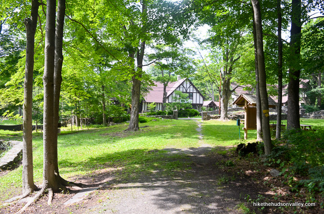
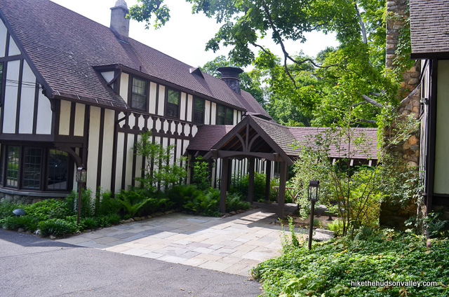
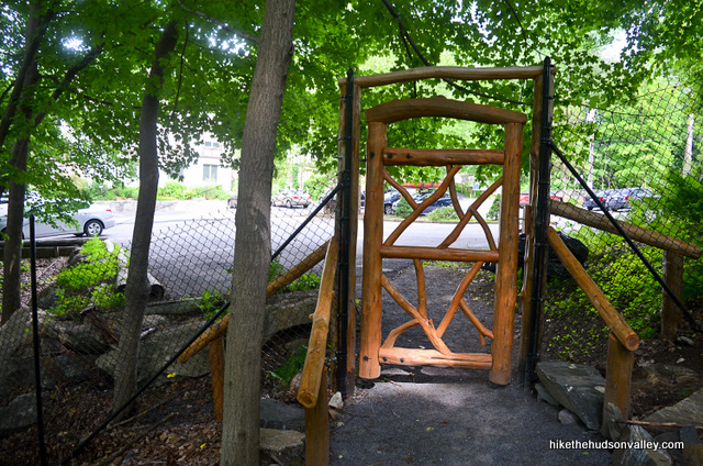
18. When you cross the street this time, head toward the Nature Center, looking for the little breezeway in the center of the building. Walk through that breezeway to pop out behind the building.
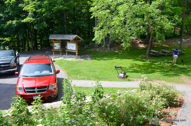
19. Walk past the small parking lot to check out the kiosk on the far side. See if you can learn something there.
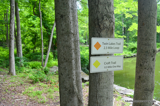
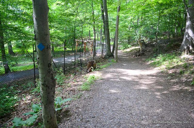
20. From here, head downhill, following signs for the blue-blazed Lakeside Trail.
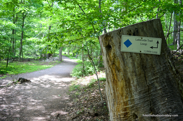
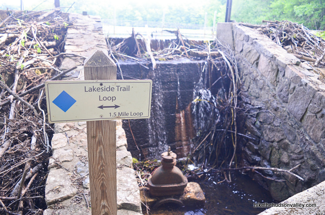
21. As you approach the bottom of the hill, you’ll see a sign for the Lakeside Trail Loop, 1.5 miles roundtrip.
Feel free to tackle the loop without me – no offense taken! But just in case you want to keep hanging out, I’ll just keep prattling on as if anyone will ever read the next 1,000 words.
22. You’re still here! Awesome!
You can choose right or left to start heading around the blue-blazed Lakeside Trail Loop. Really, there’s no wrong answer here, except left. Left is wrong. WRONG! Not really, but to follow along with the instructions below, go right/straight toward the lake, rather than making a U-turn to your left.
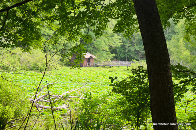
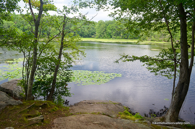
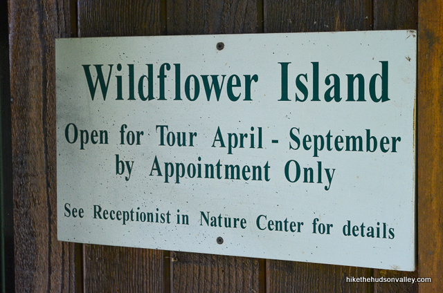
23. As you venture closer to the lake, you’ll see plenty of signage. You can also get a glimpse of Wildflower Island through the trees, which is inaccessible to schlubs like you and me (more on that later).
For now, just follow those blue blazes.
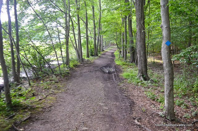
24. As you work your way around the lake, you’ll see plenty of pleasant sights, and plenty of signs and blue blazes to keep you on the Lakeside Trail Loop. Ignore all other signs and blazes.

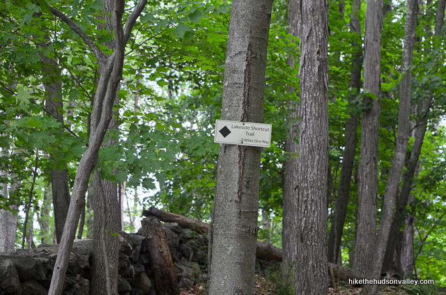
About ten minutes into the loop, you’ll have an option to take the black-blazed Lakeside Shortcut Trail, in case you’d like to lop off a few minutes. Boo to that, I say. Some of the nicest shoreline stretches are coming in a moment. Stay left at the fork to continue on the blue-blazed Lakeside Loop Trail.
25. Good thing you didn’t take that shortcut!
What a nice stretch.
In a few more minutes, after you see the boardwalk approaching straight ahead, you’ll notice the Lakeside Shortcut Trail rejoining you from the right, behind you. Be sure to give anyone who took that trail a superior glance and a quiet tsk-tsk.
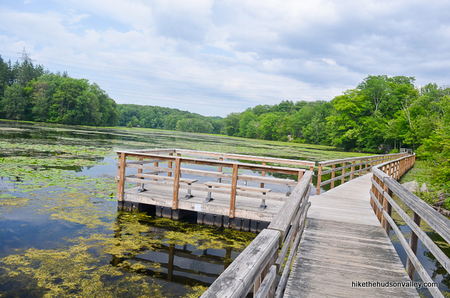
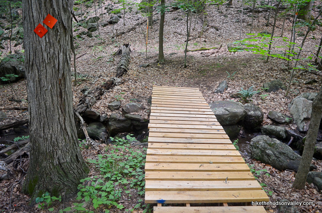
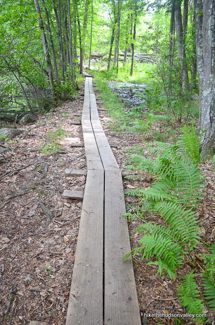
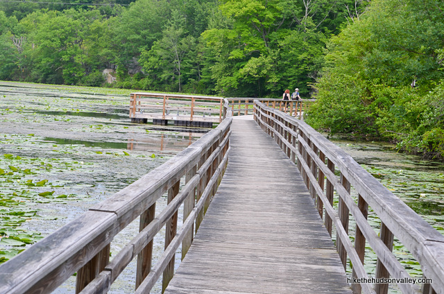
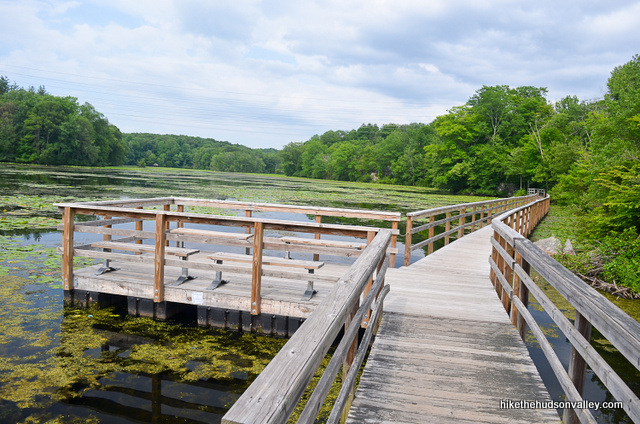
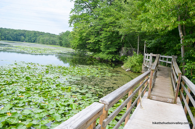
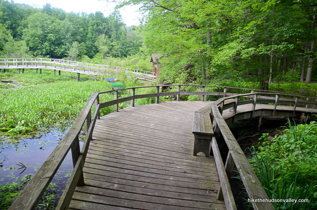
26. Pass some more nice trailwork, then boom. You’re at the boardwalk! Hey. where are all the cheese fries?
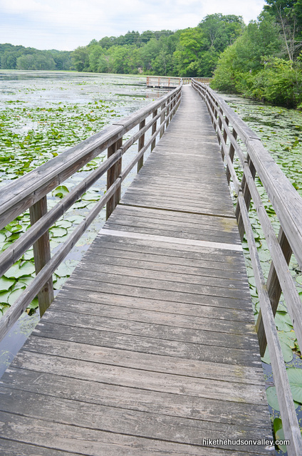
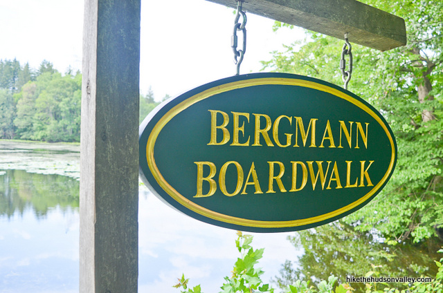
27. This is the main event! Take your time and enjoy it.
When you get to the end, you’ll find that this place is called Bergmann Boardwalk. (Google won’t tell me why it’s named that, but it’s a safe bet somebody named Bergmann did something awesome.)
28. In another two minutes, reach a fork with this sign: “Lakeside Overlook Trail – .2 miles one way.” I’m a sucker for an overlook, so I took the right turn here. The trails meet up again a little further down, so take your pick – the entire foray is less than five minutes.
If you take the Lakeside Overlook Trail, you’ll ascend a small rise to a pleasant bench overlooking the lake. (If there are cuddling teenagers on the bench, you may want to quietly continue walking, like I did.)
Cross under your favorite power lines, skirt the edge of a road (without crossing it), and follow the trail back downhill, where it rejoins the Lakeside Loop.
Turn right to continue on the Lakeside Loop.
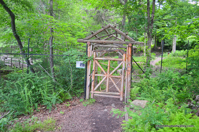
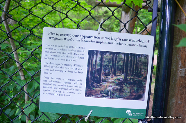
29. In just a couple more minutes, arrive at another door and go through. On my visit in 2015, they were building Wildflower Woods here. Sounds cool! If it exists by the time you visit, enjoy the Wildflower Woods, Person of the Future!
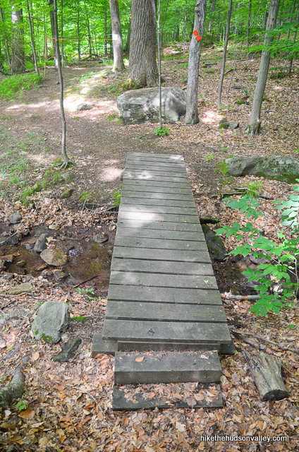
30. Stroll over one last little footbridge for the day.
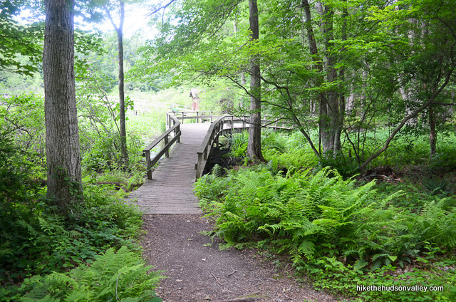
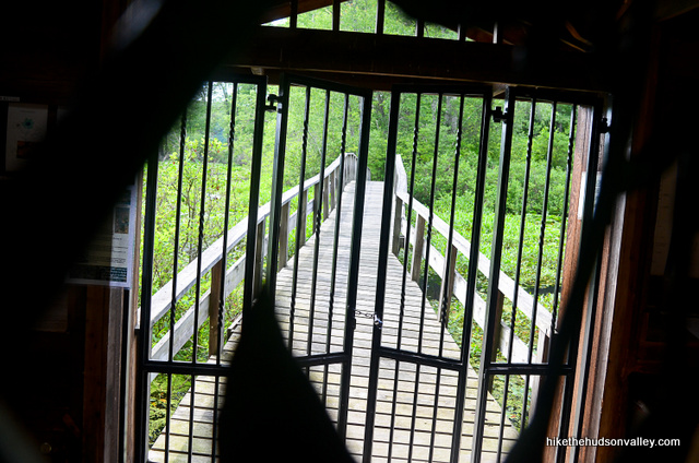
Directly afterwards, you’ll probably notice the building and bridge leading out to the enticing Wildflower Island on your left.
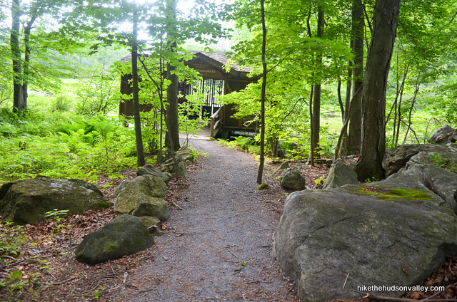
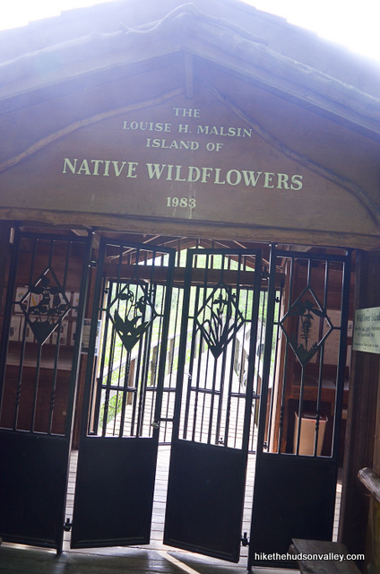
You can stroll up to the building if you’d like, but that’s as close as you’re going to get to the island today, unless you’ve made an appointment in the Nature Center, or you’re the person with the combination to that lock.
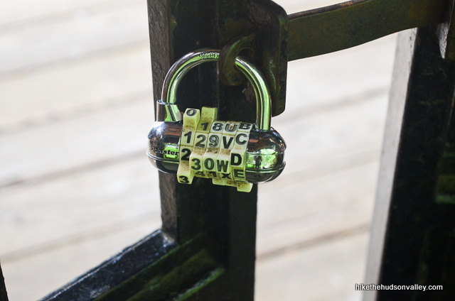
You can’t even try 1-2-3-4-5 as the combination because there are letters mixed in there, too. You win this time, Master Lock!
31. Once you’re done squinting through the bars, turn around and climb the stone steps up the hill to return to the parking lot. You’ll find a door at the top of the steps that leads right out into the lot.
32. Hello there, parking lot!
Thanks for the good times, Teatown! What an awesome place – thanks to everyone here for their hard work to make this such a great hiking destination. And thanks again to Jeff Kent for the recommendation. If you successfully completed this hike and enjoyed it, please send Jeff a nice turtle and/or lily pad. Or drop a friendly comment below. Thanks, Jeff – your lily pad is in the mail!
Directions
Directions to the trailhead: From the Taconic State Parkway headed south from I-84, drive through Fahnestock State Park, and keep heading south for another 22 miles until you reach the exit for NY-134 W in Yorktown. Take this exit, merging onto NY-134 W toward Ossining. Almost immediately, turn right onto Illington Road, but don’t turn all the way onto Illington — take the soft right onto Grants Lane. Another way of saying it — turn right onto Illington for about five feet, then take an immediate left onto Grants Lane. (I know that sounded confusing, and it is the first time – I totally biffed this turn. Here’s a Google Maps photo of the intersection – Grants Lane is the soft right.) In a few moments, when Grants Lane dead-ends, turn right onto Spring Valley Road. Proceed for less than one mile, just past the round, wooden Teatown Reservation Sign and Nature Center on your right, and park in the lot adjacent to the Nature Center (follow signs to overflow parking if necessary).

Pull in, hop out, and let the adventure begin!
You can also get directions by checking out the Teatown Lake Reservation entry on the HiketheHudsonValley.com Google map.
Sorta nearby address for your GPS: This hike has its own address. w00t!
1600 Spring Valley Rd #1
Ossining, NY 10562
GPS coordinates of parking area: 41.21119, -73.82718 (Clicking will open in Google Maps or the Apple Maps app, depending on your browser/device.)
Resources & Interactives
Super-cool Google Earth flyover of hike route:
Google Terrain Map of hike route:
Related resources: If you’re looking for actual facts and/or useful information, visit these resources:
- The very informative official page for Teatown: teatown.org
- The official Teatown Hiking Trails page
- Some nice Teatown trail maps for the hike described above and many more
- A great write-up from the (now-somewhat-defunct) forum, on a different Teatown route from hiker extraordinaire Jeff Kent
- The very informative Teatown Wikipedia page
- The TripAdvisor page for Teatown, which gives it five stars (as of this writing) and calls it the #1 thing to do in Ossining
- A nice Teatown overview page from the always-awesome New York-New Jersey Trail Conference
- The Yelp reviews for Teatown, which also give this place a five-star rating
More Teatown Lake Reservation pictures from the hike’s Flickr album:
Was this trail guide useful to you? Please leave a comment!
Want to support trails in the Hudson Valley? Here’s one great way: Visit the New York-New Jersey Trail Conference homepage and click on Volunteer, Donate, or Shop! (Then you can volunteer, donate, or shop, depending on your mood.)
The twin lakes trail does not exist anymore. Basically your picture in step 8 is overgrown and closed. So basically steps 6-12 doesn’t work.
I would say follow the new orange trail (at step 6, go to left side if you are facing the Vernay lake keeping lake on right) from the trail map after you park, then turn back after you get to shadow lake. This way you can follow steps 13 on
Sasanka, thank you so much for alerting us all to these changes! I’ve added a “MEGA-UBER-ATOMIC-WEDGIE UPDATE” to the top of the trail guide, letting folks know that my route around the Twin Lakes Loop is no longer an option. Really appreciate the heads-up!
great for a warm sunday afternoon! i had originally set out to croton gorge, but that was PACKED, so I came here. Theres multiple trails with different levels of hardness. My 50 year old mother an i are both out of shape, but on the blue trail we didnt have an issue. There was also 2 or three other trails. There wasnt too many people and it was very nice!
“Herbal keep you on the trail if you know him.”…. That’s all I’ve got. Thanks for this great website and the awesome updates.
LOL! Thanks so much for the kind words, Katrina! I’d totally forgotten about the tea puns, too. Back when I wrote this trail guide, I’d thought that doing a pun with “herbal” was impossible, but now I’m ginsenging a different tune.
CHEAPSKATE ALERT!
“To help manage increased visitation to our preserve during peak periods, Teatown will charge $5 to non-members for parking on weekends and holidays beginning October 1, 2017. We appreciate our members, who will always park for free. Thank you for your understanding and support!”
Jeff, a belated thank-you for posting this here. I just updated the trail guide with a new Cheapskate Alert above. Much appreciated!
I know I know, you’re sick of me posting updates here. Get over it. If you’ve been here before and love the Hidden Valley trail across Blinn Rd., note that it has been significantly re routed and now goes straight up into the picnic area before branching left and right. The biggest changes are to the right, in fact that whole section until you get to the valley floor is new. There are many new blazes and signposts so those familiar with the old trail can find their way.
Oh and in even better news, all the roads leading to Teatown have been freshly paved! No more dodging huge potholes around blind corners hoping you don’t hit a car head on in the process. Thanks Yorktown/Ossining taxpayers.
I’ll never get sick of the updates, Jeff — thanks so much for keeping us all up-to-date!
More route and blazing changes changes were made at Teatown this fall. Please be sure to check the new map before heading out.
http://www.teatown.org/sites/116/images/TTMapPrint-_November_2016.pdf
http://www.teatown.org/sites/116/images/TRAIL_UPDATES.pdf
Does Jeff or anyone else have instructions for how to make it over to Croton Gorge Park from the trails described here?
Yes…
Follow the Lakeside (Blue) trail along the East side of the lake. When you get to the dam peel off to the right onto the Northwest trail (yellow). It crosses a couple bridges…after the second bridge go straight onto the Briarcliff/Peekskill (green) trail. This crosses Blinn Rd. and initially follows Bailey brook. The trail here is not well marked and the first time I tried this I stayed next to the brook and followed my Google map until I came out on the road. On the way back I saw the error of my ways…sort of. The green trail does NOT follow the brook, at a point it goes uphill to the left and comes out on Croton Lake Rd directly across from Croton Dam Rd. Follow that to the dam.
I’ll try to find my map that shows where I went. (Teatown map link.)
Thank you! Thank you! So excited!
here’s my round trip hike from Teatown to the dam…see the little triangle at the top…the trail is the left side of the triangle…the stuff to the right was a bush whack…I hope that makes sense.
New Route as of Spring/Summer 2016
Step 12.5…as you exit the power lines and go back into the woods for a bit, there’s a slight route change marked by a ‘New Route’ sign. The trail used to dump you at the canoe/bench end of the dam on shadow lake. Now it shoots you over to the opposite side of the dam first and you have to walk across it to get to the canoe/bench. From there the trail continues as previously scheduled.
Just updated the guide with a new step 12.5, copying your comment. Thanks so much, Jeff!
“In a few moments, when Grants Lane dead-ends, turn right onto Spring Valley Road.”
While stopped here you may notice a barn/house directly in front of you that has some fire damage. This is KISS guitarist Ace Frehley’s house…or was…he still technically owns it, but hasn’t been paying his taxes and/or mortgage so the town isn’t very happy.
Sounds like he should be doing less rock and roll all night and more paying the mortgage every day.
This Jeff Kent guy sounds awesome! But seriously…the lake loops are purty, but the more rugged terrain is across Blinn Rd. on the Hidden Valley (insert salad dressing joke here) and Overlook trails. Still no dramatic vistas, but there is a pretty cool cliff top view of an old glacial valley. Seems odd that you can SEE a hidden valley, no?
This is my local go to hiking spot as it’s 8 miles from my house and I can bring my dog. It gets busy on the weekends and there’s a summer camp so if you like singing/screaming kids there’s that. In addition to the Lakes Loop and the aforementioned HV/OL trails there’s a connector trail over to the Cliffdale Farm which has two loops of its own AND if you don’t mind a tiny bit of bushwacking you can get over to the Croton Gorge Park from the Peekskill/Briarcliff trail.
He really IS that awesome! Thanks for all the great info, Jeff – really appreciate it!