Background
If you find this free trail guide useful, please provide payment by picking up at least one piece of litter on your hike. Cha-ching! Thanks for being awesome! (And here’s a quick primer on Leave No Trace, too, to help us keep the trails nice and fresh for each other.)
Background you can feel free to skip: Ninham Mountain inspired me, perhaps more than any other hike, to create Hikethehudsonvalley.com. I’d stumbled across some brief online descriptions of a fire tower at Ninham Mountain, and found some directions to the parking lot. A new fire tower? Cool! I couldn’t wait to check it out.
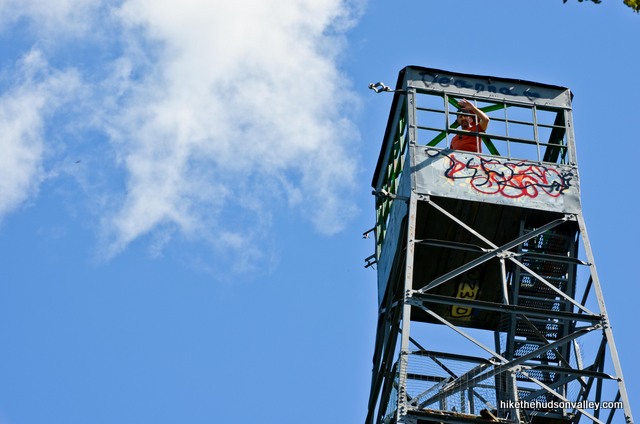
On my first visit here, I wandered around in the woods for a few hours, lost, exploring every trail I could find in the hopes of stumbling upon a fire tower. In the end, after many miles and hours, I eventually found a fellow hiker who pointed me in the right direction, which was up the big gravel road heading out from the parking lot. Seems obvious now, but without good directions, how was I to know? At least I got a nice picture of my dog romping around out on those other trails.

The Ninham Mountain fire tower is extremely easy to find – you simply stroll up the gravel road for 15 minutes and BOOM! Fire tower! But without someone to tell you that, you could end up aimlessly wandering around the vast trail system (apparently popular with mountain bikers) for hours, like a doofus, like me.
In any event, this is a pleasant stroll. No frills, no fuss – just a short walk to a tower with a very nice view. And hopefully, you won’t have to depend on the kindness of strangers to find it.
(Also, a quick note on the name of this place: Different sources call this place Nimham Mountain and Ninham Mountain. The sign posted at the entrance says Ninham Mountain Multiple Use Area, so I’m rolling with that, even though the historical marker right next to it says Mount Nimham. Online sources seem to use the words interchangeably. You say Nimham, I say Ninham. Nimham. Ninham. Ninham, Nimham. Let’s just climb the tower.)
Trail Guide
Bonus unsolicited advice: Don't depend on having cell service in the woods - it can be spotty out there! Download this trail guide to your phone before you head out. (It's easy to do on iPhone and Android.) May your connection to nature be strong, even when your connection to the internet is weak.
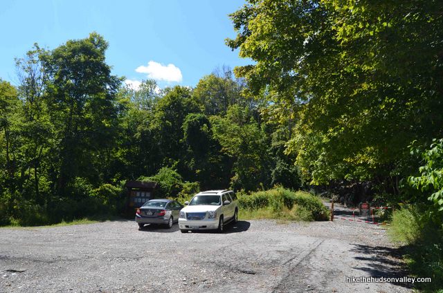
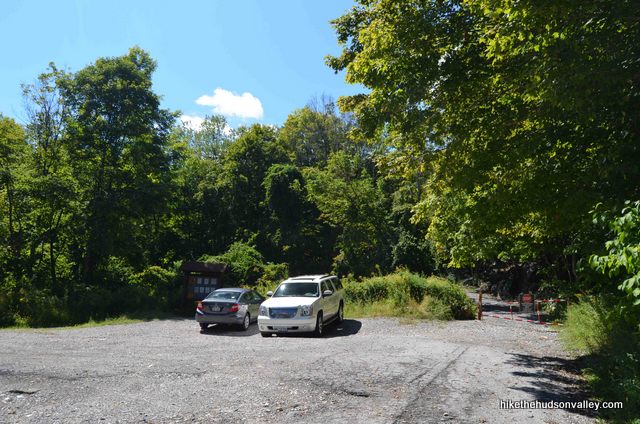
1. From the parking area (see “Directions to the trailhead” below), head around the gate to the right of the kiosk and go uphill on the gravel road. There’s juuuuust enough room to squeeze a stroller around the gate, if you should happen to find yourself hiking with a baby.

2. That’s pretty much it. Just keep strolling up the gravel road.
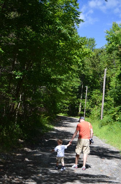
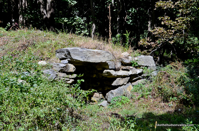
Keep an eye out for some cool old stone chambers as you go. (And for some interesting – completely not crazy – explanations for what these chambers are, visit the comment section of this YouTube video from NY UFO Roundtable. Oh, and see the New York Times article, “A Hike Into the Mystic, Or Just a Walk in the Woods?” for further discussion on the topic. This area is apparently rife with paranormal activity – who knew?)
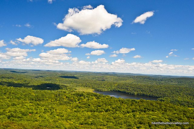
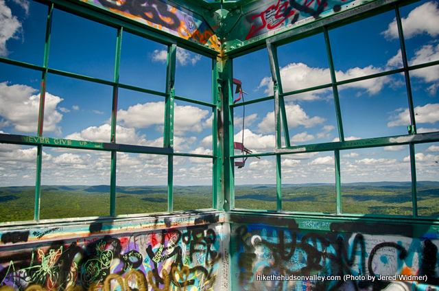
3. It took us about 30 minutes to reach the top, walking at toddler speed (you could probably do it in 10 or 15 at normal-person speed). Just as another road joins from the left, you’ll see the tower straight ahead. It might not feel like you’re on top of a mountain, but the 360-degree view up on that tower suggests that indeed, you are.
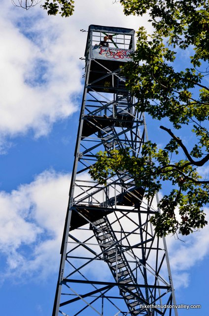
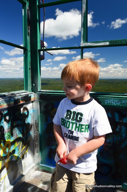
If you have any hesitation about climbing the tower, my three-year-old son wanted me to tell you: You can do it! Also, he wants more juice.
4. Take your time and soak it in. The Catskills are visible way off in the distance, with vast expanses of forest stretching in every direction. I’d love to catch a nice sunset up here. One of these days.
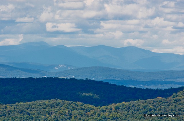

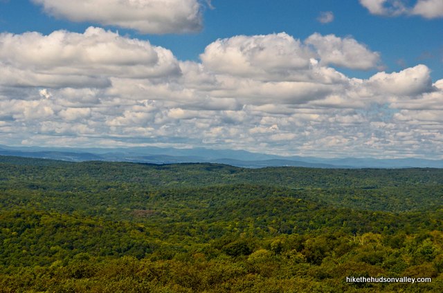
5. That’s it! When you’re done, head back down the way you came.
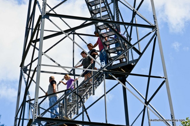
Note: There’s a red-blazed (or unmarked, depending on who you ask) trail that runs parallel to the road if you’re feeling adventurous and want to try a different way down. To access that trail – according to the people I talked to – at the bottom of the tower, facing the road you came in on, turn left to follow the gravel road past a couple of buildings. Apparently, you can pick up the trail there and take it back down to the parking lot. I’ve never tried it (strollers don’t do trails very well), but if you check it out, good luck, and enjoy!
For a quick hike to nice view, this place is tough to beat, right?
Directions
Directions to the trailhead:
From the Taconic Parkway heading south from Poughkeepsie, take the exit for Route 52. Turn right to hop on 52 East for 5.3 miles. Turn right onto White Pond Road for 2.8 miles (after 1.5 miles, you’ll have to veer right to stay on White Pond Road). Turn left onto County Rd 42 (Farmers Mills Rd). In less than a mile, turn right onto Gypsy Trail Road, which becomes more trail than road. After about 2.5 miles, you’ll see the sign on the right for Ninham Mountain Multiple Use Area, next to the historical marker for Mount Nimham.
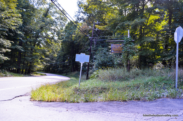
Turn here onto Mt. Nimham Ct and head uphill on the gravel road as far as you can go (about half a mile). Arrive in a nice wide parking lot and let the adventure begin!
You can also get directions by checking out the Ninham Mountain fire tower entry on the HiketheHudsonValley.com Google map.
Sorta nearby address for your GPS: The intersection of Gypsy Trail Rd and Mt. Nimham Ct in Kent, NY will put you right at the entrance.
GPS coordinates of parking area: 41.4543, -73.7215 (Clicking will open in Google Maps or the Apple Maps app, depending on your browser/device.)
Resources & Interactives
Super-cool Google Earth flyover of hike route:
Google Terrain Map of hike route:
Related resources: If you’re looking for actual facts and/or useful information, visit these resources:
- The official DEC map for NimhamMountainStateForest, with several other trails to explore
- The New York-New Jersey Trail Conference Ninham Mountain page
- A nice overview for this and other hikes on the Oblong Land Conservancy hiking page
- A nice Youtube video showing the view from the top of the tower and the experience of walking down the stairs (Warning: If you’re not a Creed fan, be sure to press mute first)
- Some excellent historical information on this and other hikes on the Kent Conservation Advisory Committee’s hikes page
- An entertaining article from the New York Times about the origins of the stone chambers along the trail, and some other local landmarks: “A Hike Into the Mystic, or Just a Walk in the Woods?”
- A nice trail guide for this same hike from the Poughkeepsie Journal: “Ninham’s great views make it tower of power“
More Ninham Mountain fire tower pictures from the hike’s Flickr album:
Was this trail guide useful to you? Please leave a comment!
Want to support trails in the Hudson Valley? Here’s one great way: Visit the New York-New Jersey Trail Conference homepage and click on Volunteer, Donate, or Shop! (Then you can volunteer, donate, or shop, depending on your mood.)

I am glad to see this article. When i was a child, My father actually worked there inside the tower, it was enclosed with glass windows. We actually lived there a couple of summers, as there used to be a cabin right there below the cabin. One of my fondest memories was playing with my siblings there. I remember a trail that would would take you down behind the Mountain and wound up in a camp for kids. And boy do I remember climbing the tower on those windy days and feeling it rock back and forth. Not sure if its still there, but part way up the road on the right was another cabin, we used to “camp” there. Thanks for the memories. Sad to see all that Graffiti all over it.
Ray, thanks so much for sharing these memories and history here! Sounds like an amazing set of experiences you had. It is indeed sad to see the graffiti, but it is still a wonderful place to visit. Really appreciate you dropping by, thank you!
My husband found your website and couldn’t believe how precise your information was. We have been looking for trails across the country so we can expand our passion further North. We are indeed avid trail seekers in the NE part of Texas and have explored from Texas through Missouri and Kansas. We’re definitely going to expand our opportunities now. Keep up the great website. We love it!
I’m fairly certain it’s “Nimham” not “Ninham.” The mountain and nearby NYS Multiple Use Area are named after Daniel Nimham, a Revolutionary War combat vet.
Christopher, thanks for sharing your thoughts here! I discussed this topic in more detail in my more recent “Breakneck Ridge: Short Loop” trail guide (https://hikethehudsonvalley.com/hikes/breakneck-ridge-short-loop/), which traverses the new Nimham Trail there. Here’s the relevant snippet from that trail guide:
*****
The spellings “Ninham” and “Nimham” are often used interchangeably. (I also encountered this issue when writing the trail guide for Ninham Mountain, 40 minutes east of Breakneck in Kent, NY.)
The NYS Parks press release for the opening of the trail calls it the “Ninham Trail.” This lengthier article from NYS Parks also says “Ninham Trail,” and offers this context on its namesake:
“…Daniel Ninham, who was the last chief of the Wappinger tribe that once lived in the rocky Hudson Highlands of Westchester, Dutchess, and Putnam counties. (His last name has also been spelled Nimham, based on the historical record, but the preferred spelling is Ninham.)”
While I would rather use the preferred spelling of “Ninham,” I have used “Nimham” in this trail guide to match the trail signage, which uniformly uses “Nimham.” (You’re more likely to be looking at the trail signs than online articles while you’re hiking, so that felt like the right tiebreaker to use.)
*****
So it looks like everyone is right (and wrong?) when using either spelling 🙂
Is this currently open?
Hi, Priya! Thank you for asking — due to your question, I found information that indicates that that the trails are open, but the tower is indeed closed due to the COVID-19 crisis. I’ve updated this page accordingly: https://hikethehudsonvalley.com/hudson-valley-trail-closures-and-parking-restrictions-due-to-covid-19/. Appreciate you helping to keep information here accurate!
Yes !!
Hi, Daniela! This tower had been reported as closed. Have you been there recently? Was there tape blocking the stairs, or any signage about a closure? Really appreciate your help to get accurate information here!
Went a couple of days ago, looked like there had been tape there prior but no signs of closure and multiple people there! Not completely sure if someone removed the tape or if it’s actually open. Probably best to wait until official opening!
I went yesterday and there are still signs at the parking lot and base of the tower saying the tower is closed but nothing blocking the tower stairs so I went up.
Had a nice walk up to top this afternoon. Much windier on top of tower.
Glad you a good visit up there, CS!
We finally went back another day and went up the right path to the Fire tower, abd what a great experience it was, went up the fire tower abd what a view, it was spectacular, the view!!!!!
Did this hike a few weeks ago. I walked up the road to the tower (a bit buggy), but on the way back took the trail that runs through the woods back to the parking spot. Some amazing views from the top.
The local teens do favor this place for pot smoking…fyi…we couldn’t even go up in the tower because they were all stoned up there and wouldn’t come down.
Hey, I’m doing the hike this weekend and was wondering what towers or antennas are next to the fire tower. I noticed a few and were wondering if they’re safe to look at up close, thanks!
They are cell phone towers. It’s up to you whether or not you think they’re safe to be close to
my Husbans and I got lost today there because hw wanted to take the right fork where you come to the fork in road OMG don’t ever too rocky and we got lost and to walk terryfying terrain, We are so so gladd to have it out it was getting so dark in there, Thank God We made itt home safe and we were coming a cab was ther and toook us to where was on the other, now we will go back and walk on the gravel!!!!!
Were so glad to get out of there as it was getting so dark Thank God we did and a there was a cab that was driving on the road we stopped it and it took us to where our car was on the other side whew, Thank God!!! We even called the cops wow!!!!! Now next time we will just goon the straight road,lol !!! My Husband happens to be to be adventerous and saidd that he would take that path that was dangerous silly him!!!! He didn’t know it was going to be dangerous!!!!! Thought we were’t going to make it back home and we would have to sleep in the woods oh our cell phones died too,lol, wow what a day!!!!!! When my phone was working i had called cops a number of times then when it died we had to fend for ourselves wow!!!!
Sorry you ended up with more adventure than you bargained for, Lisa! Glad you made it back home safely. Hopefully this situation won’t be encountered by anyone following the above instructions — please let me know if there are any changes or warnings I could add to make sure the same fate doesn’t befall anyone else. (Sounds like just sticking to the instructions as they’re written should do the trick, but please let me know if that’s not the case.)
Join them
Great directions on this hike ! The Firetower was very high and had excellent views. My friend and I got confused about the location of hawk rock, since we believed it was close to the tower only to find it was 15 miles away in another part of Kent.
In addition to the article about Phil Imbrogno and the stone chambers of Putnam county, I would like to include another about how he has been exposed for lying about his past and credentials. Because of this, the claim that the stone chambers are ancient could have been fabricated on his part.
See Saucers, Lies and Audio Tape on NotaGhost.com
Regardless of this, the stone chambers and hawk rock are still beautiful and worthy of a visit.
Thank you for this awesome site. We took the kids (6,4 &3) to the Ninham fire tower…Although I didn’t go all the way to the top (it was a bit windy and the tower was shaking a bit too much for me, I did go up 2 1/2 flights of stairs), my kids went up with my friend. (I would NOT recommend letting young children to go up there alone).
Your directions were awesome! I was a bit nervous as to how long it would take to get to the tower, but your estimate for the round trip was right on the money!
I will definitely keep your site in mind for our next trip to anywhere! Thank you again for getting this former city girl up and moving! The views were amazing!
Thanks so much, Lori Ann!
Hiked this today with an 8 and 6 year old plus their mom who had never hiked. My boyfriend and I have hiked many ADK and Catskill Fire towers….we wanted to introduce my nephews and their mom to an easy one. This was the best choice ever! They complained a little on the way up but when they got to the tower they climbed it twice! We also brought my small dog who had no intention of climbing the tower….the stairs hurt her feet. We saw a small snake on our way up and the kids were in awe. We also pulled into the first Ninham lot and because we had your pictures and site we knew to go further. Your gps address worked well. Thanks for posting on this tower.
Keep your eyes peeled as you walk up the gravel road to the tower. Last week I was here with my kids and we saw a baby ring snake. It was only 4-5 inches long and thinner than a pencil. It kept trying to hide under our shoes so we had to be careful not to crush it. Ring snakes are black with a prominent yellow ring just behind their head. They allso develop a red belly as they mature.
Moved to the area recently and am always on the lookout for nice walks/hikes in the area. Just discovered your web site and have already seen many hikes I want to try, but today decided on this one as it was close by with a fire tower! (Love a great view.) Your directions were clear and easy to follow, not that this hike was at all complicated. I appreciate your efforts and will be checking the site frequently for hiking ideas.
Thanks for the detailed directions on how to get to this one; don’t think we would have made it without them! My daughter (age 7) and I enjoyed the short hike to the tower, up it, and back.
me and my family went there today.. We thought that it was a little hill and then straight…. we were wrong we dont know if we went the wrong way or not but that was the longest walk ever! Beautiful views but if u are over weight and cant walk up hills its not for u!
I went up with my 9 year old son today. Had a little trouble finding it from the South, and ended up in the wrong Ninham parking lot (there are two). My son was expecting the tower to be right by the parking lot so he was none too pleased about the walk in the 90 degree plus heat. Once up the tower he was torn between being awed and terrified. On the way down the road he said his legs were numb and his stomach hurt, but he said it with a huge smile and later said it was the best day of his life. A great Father/Son bonding experience. Next time we’ll take the rest of the family…maybe we’ll wait til the fall when it’s cooler.
So glad that story had a happy ending! (If there’s anything I should change in the trail guide that might have led to a better experience in finding or getting to the tower, please let me know.) My buddy complained at me, too, when we came up here on a hot day and had to trudge up the road. Come to think of it, I’m going to change the difficulty rating from a 2 to a 3. The whining shouldn’t start until at least 3, right?
I don’t think you need to change the directions, except to maybe point out that you’re coming from the Poughkeepsie area and may not have explored other routes.
Hearing Creed is far scarier than climbing any fire tower…thanks for the warning!